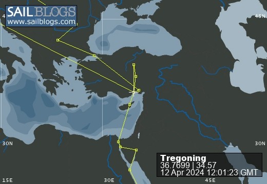
Tregoning
22 July 2023 | Chez Gail, near the New York Café, Budapest, Hungary
17 July 2023 | Piata Uniri Cozy Inn, Bucharest, Romania
14 July 2023 | Hotel Favorit, Sofia, Bulgaria
11 July 2023 | Halkali Train Station, Istanbul, Türkiye
10 July 2023 | Yükselhan Hotel, Adana, Türkiye
08 July 2023 | Berth 14/15 B-dock, Mersin Marina, Mersin, Türkiye
19 June 2023 | Berth 14/15 B-dock, Mersin Marina, Mersin, Türkiye
23 May 2023 | Berth 14/15 B-dock, Mersin Marina, Mersin, Türkiye
21 May 2023 | Fuel/Q dock, Mersin Marina, Mersin, Türkiye
20 May 2023 | Fuel/Q dock, Mersin Marina, Mersin, Türkiye
17 May 2023 | Anchored 0.5 nm off the coast at Boğaz Northern Cyprus
14 May 2023 | Ismailia Yacht Club, Ismailia, Suez Canal, Egypt
13 May 2023 | Ismailia Yacht Club, Ismailia, Suez Canal, Egypt
12 May 2023 | Suez Yacht Club, Port Suez, Egypt
07 May 2023 | Suez Yacht Club, Port Suez, Egypt
03 May 2023 | Ayla Marina, Aqaba, Jordan
21 April 2023 | Ayla Marina, Aqaba, Jordan
17 April 2023 | Anchored in Soma Bay, Red Sea, Egypt
12 April 2023 | Anchored in Soma Bay, Red Sea, Egypt
07 April 2023 | Anchored at Siyal Island, Sudan
US to Japan to Türkiye update
12 April 2024 | We are back aboard Tregoning in Mersin Marina, Mersin, Türkiye
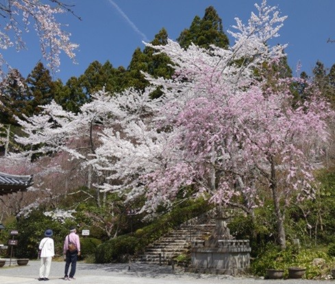
Alison Stocker | Photo- Cherry blossoms of varying shades at Sanzen-In Temple, Ohara - Kyoto, Japan
Phew! We are back aboard Tregoning after a fabulous trip to Japan visiting Kaoru and Joe. We crammed so much into six days that it will take me a while to untangle it all and write coherently about it for the blog. So, this is just an update to say that our travels went fairly well…other than such chaos in the Immigration Hall in Tokyo that we missed our connecting flight and then the last bus from Osaka to Kyoto. But a night in a hotel after our series of 3-, 13-, and 1-hour flights was not a bad thing. It stole a night from the company of Kaoru and Joe but we would not have been fit for much anyway.
Initial forecasts were that prime cherry blossoms in Kyoto would be over by the time we arrived, so Kaoru had booked us a night in the mountains where flowering would be a little later. A cold March delayed the opening of the blossoms such that we hit the absolute peak in Kyoto, and it truly was a sight to behold. There were many beautiful trees in isolated places and long avenues of them beside roads or waterways. It was hard to stop taking more and more photographs.
As planned, we met with Jennie and her daughters for an afternoon and evening which was great fun. Like us, they were thrilled to have Kaoru’s expertise in ordering a delightful range of dishes from a popular restaurant. Trying authentic Japanese cuisine was quite a theme throughout our visit from an excellent sushi restaurant to an unusual breakfast with raw egg (tried and rejected), tofu, and fish in a traditional-style inn with hot-springs. In addition to visiting many temples and shrines, Kaoru organized tickets for us to attend a dance performance by Kyoto’s geisha and maiko (geisha-in-training)…oh, yes, despite our short stay, we received a marvelous dose of Japanese culture.
Finally, after another 13-hour flight, we were back in Türkiye, and it did not take long to reach Mersin from Istanbul. As expected Tregoning was very dusty and I have spent the last two mornings washing down the decks, Bimini, and cockpit while Randall installed the many new items that we brought with us from the US. Inevitably, there are a few issues that will need to be addressed before we leave the marina, so we have plenty of boat-work to keep us busy for the next few weeks. Despite that, it feels very good to finally unpack our bags and sleep in our own bed. We have had a wonderful time on our flying trip around the world, but we are ready to start sailing again...hopefully very soon.
Springtime blossoms in Japan
05 April 2024 | We are in Kyoto, Japan: Tregoning is in Mersin Marina, Mersin, Türkiye
Alison Stocker | Photo: Cherry blossoms and tourists along the Philosopher’s Walk, Kyoto, Japan

As the "designated worrier" aboard Tregoning, it is my job to anticipate everything that can go wrong, a role at which I am quite skilled. As foreshadowed in my post from Toronto Airport, I was concerned that we might miss our connecting flight in Tokyo due to delays in Customs explaining that the strange collection of boat parts in our luggage was not going to remain in Japan. Well, I got the consequent correct but not the cause.
Our more than 13-hour daytime flight from Toronto to Tokyo gave us plenty of opportunities to enjoy the airline's movies (including happily watching Barbie for a second time). We also had some spectacular views as we flew over northern Canada and the North Slope Basin of Alaksa. Flying over the Bering Strait, we crossed the International Dateline, cutting short Tuesday (2nd April) and thrusting us well into Wednesday.

Flying over the North Slope Basin of Alaska
We landed about on time at Haneda Airport in Tokyo, but there was a significant delay before we could leave the plane. After a long walk we reached the Arrivals Hall to find absolute chaos, not what we had expected in Japan at all. Initially there was no apparent line to reach the immigration desks, but after following the slow shuffle of the crowd from several incoming flights, we found ourselves in a long, long, single-file line, weaving back and forth across the hall.
When we eventually reached the Immigration desk, we were checked in quickly and efficiently. However, we already knew that we had little chance of making our connection. Collecting our bags we approached the Customs officer and x-ray machine anticipating a long explanation. Instead, we were waved straight through. Thankful that the process was not as complicated as I had feared, it had taken us over two hours to get through the arrival procedures, and we still had to re-check our bags and take a bus to another terminal to get our 6 pm flight to Osaka.
We had plenty of company with other exhausted travelers as we queued at the "All Nippon Airways" re-check desk but amazingly, the ANA representative was able to find us seats on their 7:15 pm flight. The shuttle bus delivered us to the correct terminal, the line at security was surprisingly small, and we made it to the gate of our revised flight with a few minutes to spare. We both napped soundly on the 70-minute flight knowing that in the dark we would not get to see Mount Fuji as Jennie and her daughters had done on their train ride from Tokyo to Kyoto a few days earlier.

Jennie's photo of Mount Fuji seen from the train from Tokyo to Kyoto (alas, it was dark when we flew past)
Things were looking promising but by the time we got our luggage at Osaka Airport, the last bus to Kyoto had already left. We had no energy left to work out the train schedule or drag our luggage through the necessary changes. Talking to Kaoru, she suggested that we could take a taxi all the way from Osaka to her condo but it would have been expensive and tiring. Instead, we were able to get a tiny but neat room in the Osaka Airport hotel where we quickly showered and collapsed into bed. We were sorry to miss a night with our marvelous hosts Kaoru and Joe, but we were probably better company once we were rested than if we had arrived totally exhausted.

Our excellent and generous hosts, Joe and Kaoru
We caught the 8:20 am bus to Kyoto after a good breakfast in Le Pan café of the airport (complete with boiled eggs from which the top was neatly removed by a Eierschalensollbruchstellenverursacher (see https://en.wiktionary.org/wiki/Eierschalensollbruchstellenverursacher where the lower ball is lifted up and dropped a couple of times...it sometimes does not take much to impress us). Kaoru kindly met us in her car and drove us through the city to her condo. Here, we were fascinated by the parking garage.

Kaoru backing her car into the parking garage below her condo
We were initially confused when Kaoru said that there were nine pens for eight cars (one space is empty to allow the eight pens to be moved around), but there are three pens below the ground level that cannot be seen in this photo. The driver requests which pen is to be vacated/filled and the machine finds the best way to shuffle the pens and the single space to get the required car to the exit/entry position shown at the left. This may not be unusual to big city residents but was new to us...as I said, it often does not take much to impress us. Land space is obviously of great value in most of Japan and public transportation is highly developed and well-used.
Spread over 3,000 km (almost 1,900 miles) along the Pacific coast of continental Asia, the five main islands of Japan, Hokkaido, Honshu, Kyushu, Shikoku, and Okinawa, plus another 14,120 "remote islands", form a total land area of 364,546 km2 (140,752 sq mi). This a about 1.5 times the land area of Great Britain and slightly smaller than California. With a population of just over 125 million, Japan is much more densely populated than Britain (67 million) and California (39 million).
Since most of the land is ruggedly mountainous and 66% is covered with forest, the population is concentrated around the coast, mostly in large cities. Only 20% of the land area is suitable for agriculture, which is highly intensive and fills most of the non-mountainous, non-urban areas. Agriculture only accounts for about 1% of the nation's gross domestic product. Industry contributes almost 30% of GPD while almost 70% is provided by the service sector including a large proportion related to international trade to provide natural resources to support industry. Kyoto is not highly industrialized, but does have the headquarters of the well-known video gaming company, Nintendo.

In urban areas, some intensively managed, small-scale farming or gardening plots remain
Located on the Pacific Ring of Fire, Japan is prone to frequent earthquakes, tsunamis, and volcanic activity as the Pacific tectonic plate subducts beneath the continental North American plate and the latter collides with the Eurasian plate. Although also prone to typhoons, the risk of earthquakes is probably why most utility wiring is kept above ground, rather than protected from wind in hard-to-repair underground ducts. Through-roads, in Kyoto are wide but most of the local streets seemed to be quite narrow and apartments blocks and houses were crowded together with minimal yards or gardens.

A very busy tourist road (leading to a popular temple) typical of narrow, local streets with a profusion of utility wires between poles overhead
Japanese life appears to be a fascinating mixture of traditional and highly modern practices. In a dense population, discretion and cleanliness are highly valued. Removal of shoes on entry to homes or anywhere with a raised floor, e.g., in traditional restaurants or hotels, is common. It does not take long to notice the high complexity of many Japanese toilets both public and private. Options for various types of bidets, some with driers, and water-sounds or music to cover "bodily noises", can make a trip to the bathroom quite an adventure. The fondness of many for electronics and gimmicks can result in some interesting experiences, such as a hotel with a self-check-in desk that is overseen by motion-activated dinosaur robot "hosts".

Guests are expected to check themselves in on computer terminals while these animatronic dinosaurs move and roar in the background
To aid visitors, most directions on streets, in airports, and in train stations are given in English versions as well as Japanese characters. Of course, Google Maps in the user's own language simplifies travel enormously. While Google Translate can be useful, especially for reading labels, many people in Kyoto speak some English. The occupation of Japan by Allied forces between 1945 and 1952, probably contributed to the integration of English into many Japanese activities. Of course, we were so well looked after by Kaoru, that Randall and I hardly needed to worry about trying to communicate in Japanese or understand signs. Traveling on their own in Tokyo and then getting to Kyoto and Osaka, Jennie and her daughters were much more adventurous in that regard than we were.
As mentioned before, the coincidence of their visit with ours was largely because we were all trying to catch the cherry blossom season in Kyoto. Given the warm winter, Kaoru had suggested that the season may have been over in Kyoto by early April and so had booked us for a night in a hotel in Yoshino. This small town is south of Kyoto but high enough in the Kii Mountains that its thousands of cherry trees bloom significantly later than in the city.

Cherry blossoms in Kyoto showing buds and variations in flower color
However, March was unusually cold, which delayed the cherry blossoms in Kyoto. So, to our great delight, the peak of blooming was exactly when we were there...we were SO LUCKY! We could see the blossoms thicken on the trees for the first few days of our visit, and peaking just before we left, some wind and rain scattered many of the petals in white carpets on the ground. Kyoto has many cherry trees planted along roads, waterways, around important buildings, and growing wild on the hillsides. As we looked at a cherry tree on the side of the wooded hill across the street from Kaoru and Joe's condo, it started a real obsession with the blossoms wherever we went.

A cherry tree densely covered in bright white blossoms
Unlike Jennie and her daughters, we did not spend any time visiting the nation's current capital city, Tokyo, but concentrated our short stay in Japan in Kyoto. Both near the coast of Japan's largest island of Honshu, Tokyo is east, but not much further north, than Kyoto. The city of Kyoto has a population of 1.46 million and the Greater Kyoto metro area had about 3.8 million inhabitants. This is considerably smaller than the metropolitan area of Tokyo with over 37 million residents.
Archeological evidence suggests that the area of Kyoto was settled in the Paleolithic period, prior to 12,000 years ago. However, little has been recorded of human activity in the region prior to the 6th century. The growing community had various names until it became the site of the imperial court, or capital of Japan in 794 AD when it became widely known as Kyoto or "capital city". When established as the capital the expanding city was planned on a grid system according to traditional Chinese feng shui principles, following the models of two ancient Chinese capitals. The seat of the emperor was moved to the city of Edo in 1868, at which time, that city became known as Tokyo "eastern capital". Given its importance from 794 to 1868, Kyoto is sometime referred to as the thousand-year capital.
Considered the cultural capital of Japan, Kyoto was spared from large-scale bombing and destruction during World War II. With more than 1,600 Buddhist temples, 400 Shinto shrines, palaces, and gardens, 14 of which are designated collectively as the Historic Monuments of Ancient Kyoto UNESCO World Heritage Site, Kyoto is a popular tourist destination. Like us, many tourists timed their visits to coincide with the cherry blossoms.
After dropping off our bags, viewing their condo, and meeting Pia the cat,
Kaoru and Joe took us into the city to the Nishiki Market. Cold groundwater in this area was used to keep fish and meats fresh in an area close to the Kyoto Imperial Palace, with the sale of fish starting as early as 782. An official market was established in 1615 and this has continued to the present day.

Inside the Nishiki Market with many small stalls specializing in particular kinds of food
Known as "Kyoto's kitchen" and popular with tourists, there are about 130 small shops in the Nishiki Market selling food items such as fish, fruit, vegetables, tofu, and dry foods, many of which are ready to eat. Most stores specialize in particular types of food and these include many items not commonly seen outside Japan. We were intrigued by the half-shell sea urchins and fish-on-a-stick, and slightly horrified by the sparrows-on-a-stick. Instead of trying any of these, we bought a bag of lovely roasted chestnuts.

Typical store in Nishiki market with fish on a stick (center front) and sparrows on a stick to their right
We had lunch at a small restaurant nearby, most of us selecting a boiled cod soup while Randall was more adventurous with a tray of small dishes, pickled vegetables, meats, etc., served with a bowl of rice, a very popular style of eating in Japan. Afterwards we stopped at the Konkai Komyo-ji Temple not very far south of Kaoru and Joe's condo. Founded in 1175, this Buddhist temple was destroyed by war or fire but subsequently rebuilt several times. The colossal two-story ceremonial gate at the entrance to the temple complex was built in 1860, and leads to many buildings, a cemetery, ponds, and gardens. We soon came to recognize that multiple, curved roofs are a common feature of Japanese temples.

The large, two story ceremonial gate at Konkai Komyo-ji Temple
Konkai Komyo-ji Temple is one of eight chief temples in Japan belonging to the Pure Land sect of Buddhism. Not referring to the sites of the temples, the Pure Land lies far beyond the sinking sun and adherents of the sect pray that they might reborn in the Pure Land. This is the largest sect of Japanese Buddhism with 22 million believers. There were not many visitors while we were at Konkai Komyo-ji as this temple is not on the typical tourist trail, but there were several young couples in traditional dress, having photographs taken under the cherry trees.
At this point, we needed to clarify the difference between shrines and temples. The former are generally Shinto and the latter are typically Buddhist but both are often located on the same site, usually starting as a Shinto shrine with a Buddhist temple added later. Shinto was the earlier, endemic religion of Japan with Buddhism gradually arriving from India, via the Silk Road through China and Korea. Officially Buddhism was introduced to Japan in the mid-sixth century (around 550) when King Seong of Baekje (now western South Korea) sent a mission to Emperor Kinmei that included an image of the Buddha, ritual banners, and sutras (writings).
Unlike Western religions which focus on exclusivity, in Japan it is considered acceptable to practice different religious traditions simultaneously. Thus, many people adopt both Shinto and Buddhist rituals and beliefs, these being the by far the most popular religions in Japan. While plenty of Japanese claim no religious affiliation, of those that do about 1% are Christians, 4 - 6% other religions, and at least 70% identify as Shintoists and 67% as Buddhists, with about 40% overlap of these two religions.
Part of the reason for that overlap is that Shinto is often regarded more as a way of life than a religion. Shinto has no single founder or canonical text (both present in Buddhism) and focuses on rituals and adapting to the pragmatic requirements of life rather than doctrine. The doctrine of Buddhism might be summarized as the belief that human life is a cycle of suffering and rebirth, but it is possible to escape this cycle forever, if a transcendent state of enlightenment (nirvana) is achieved.

One of many beautiful buildings in the Konkai Komyo-ji Temple complex
Kami are the objects of Shinto veneration which are spirits and deities that can be of mythological, spiritual, or natural phenomena, including the spirits of venerated dead people, forces of nature, and elements of the landscape, and which can have both good and evil characteristics. "Kannagara" is the way of the Kami, a law of natural order with "wa" being the benign harmony inherent in all things. Disruption of wa is bad whereas contributing to wa, such as subordination of the individual to the larger social unit, is regarded as good.
While humans are regarded in Shinto as fundamentally having purity or "harae", this has to be maintained by the avoidance of pollution by impurity or "kegare". Temporary states of impurity can be reversed by ritual purification and this is incorporated into many aspects of Japanese culture, including the emphasis on bathing. Flowing water is often available for ritual purification on approaching a shrine.
Once we left the Konkai Komyo-ji temple, Kaoru took me to visit her office. Part of the Kyoto University campus is literally just around the corner from her condo and her office is just a few hundred yards inside the campus boundary. Kyoto University is a national research university with law and medical schools, that was founded 1897, making it the second oldest university in Japan after Gakushūin University, a private college in Tokyo. Kyoto University has around 22,500 students and an 11% acceptance rate which compares with a total enrollment of almost 61,000 and 23% acceptance rate at the University of Florida.
That evening, we had dinner at a tiny local restaurant that Kaoru had booked for us. A reservation was essential as there were just two tables each with low stools for four, and some taller stools at a bar. We let Kaoru order the house special menu of tempura vegetables and shrimp, along with many small side dishes, including some very delicate and fancy carvings of vegetables.

Vegetable side-dish: sweet-potato on right is carved and stained to look like a pinnate leaf; items on the left were intricately carved potatoes as a lantern and a dragon - it seemed a shame to eat such works of art
After a good night's sleep on the comfortable futon in the condo, we were ready for our second day of Japanese culture...specifically more temples and interesting food. The starting point was a visit to Kyoto's temple that is most popular with tourists, Kiyomizu-dera Temple, a UNESCO World Heritage Site. We tried to beat the crowds but it was already busy by the time we got there, as many people were attracted, like us, to the description that it appears to float in the cherry blossoms and trees.
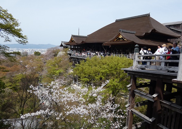
The main hall of Kiyomizu-dera Temple, appearing to float above the trees with the city of Kyoto in the distance
Like many of the old temples in Kyoto, Kiyomizu-dera is on the edge of the city with wooded hillside owned by the Temple behind it. These steep hillsides are protected so that views of the temples with woodlands behind them are not spoiled.

Wooded hillside with blooming cherry trees, uphill from Kiyomizu-dera Temple
Belonging to the Buddhist Kita-Hosso sect, the Kiyomizu-dera temple is located on the foothills of Mount Otowa, in the Higashiyama Mountain range that borders eastern Kyoto. The temple was founded in 778 AD (16 years before the city became the capital of Japan) when a Buddhist priest from the nearby capital city, Nara, claimed to have a vision that directed him to the site of Otowa Spring. This spring gave rise to the temple's name which means "Pure Water Monastery".
The spring still flows and is divided into three streams, each of which is associated with a particular type of good fortune: health, longevity, and exam success. Many visitors choose to sample the water because of these supposed magical properties although it is considered greedy to sample more than one stream. Thus, the appropriate stream should be chosen for the desired type of good luck.

Visitors sampling water from the three branches of the spring at Kiyomizu-dera Temple
Many of the buildings and pagodas at Kiyomizu-dera Temple are painted orange, or more appropriately "saffron". This is a significant color in Buddhism indicating illumination or the highest state of perfection and many monks wear saffron robes.

Okunu-in Hall at Kiyomizu-dera Temple with statue of Buddha inside
The bright paintwork suggested recent renovations, and we found a few dougongs that had yet to be restored. Rather than effigies of the manatee-like marine mammal found around Australia and the Southwestern Pacific (dugongs), dougongs are a structural element in traditional, timber-framed Chinese architecture. With layers of interlocking wooden brackets, they form a stable connection and vertical transfer of weight between the larger surface of a horizontal beam and the top of a column. One of the earliest examples of modern mortise and tenon joints, using precisely cut notches and grooves to allow for a tight fit, dougongs reduce the strain on horizontal beams and provide elasticity which allows buildings to withstand earthquakes better. As seen here, many layers of blocks may be included along with highly ornate painting.

Example of restored and non-restored dougongs on Okunu-in Hall
The two most eye-catching saffron buildings in the temple complex are the three-story pagodas. Common to Southeast Asia, pagodas are tiered towers with multiple eaves. Typically Buddhist, they were derived from stupas, which were dome-shaped buildings used for meditation and to store relics in ancient India. Although the oldest and tallest pagodas were typically made of wood, they were susceptible to lightning strikes and other sources of fire, so many of the oldest surviving pagodas are made of brick or stone.

Koyasunoto Pagoda, one of the three-story pagodas at Kiyomizu-dera Temple
While often used to protect and preserve Buddhist relics and artifacts, pagodas are auspicious symbols of the path to heightened awareness and perception. According to one source, the Koyasunoto Pagoda which is separated from the main temple complex, is dedicated to Koyasu Kannon, a goddess who grants safe delivery of children, so it is often visited by pregnant women.

Randall's picture of the Koyasunoto pagoda with cherry blossoms
The temple's other pagoda, Sanjunoto Pagoda, is part of the main complex of buildings and at 31 m (102 feet) is one of the tallest of such structures in Japan. It was added to the site in 1633, during the Kiyomizu-dera reconstruction three years after a massive fire destroyed the temples and main hall.

Looking north from the Koyasunoto pagoda to the main Kiyomizu-dera Temple complex with the Sanjunoto Pagoda on the left and the main hall and stage (Butai) on the right
The original main hall, which was reassembled from an emperor's palace, was added to the temple in 798, a few years after Emperor Kammu moved the nation's capital from Nara. Rebuilt in 1633, the main hall and its wide veranda, or Butai, is perched over a steep cliff. Huge tree trunks were used as support posts and not a single nail was used in the construction of the entire structure. Such large halls and verandas were added to many popular sites during the Edo period (1606 to 1868) to accommodate large numbers of pilgrims. This platform has a floor of 410 cypress board supported by 168 pillars of 12-m (40 feet) tall keyaki (Japanese Zelkova a native tree often used for bonsai). Reassuringly, these posts were restored in 2017.
This Butai is referenced in the popular Japanese expression "to jump off the stage at Kiyomizu" which equates to the English "to take the plunge". This refers to an Edo-period tradition that suggested that if one were to survive the 13-m (43-foot) jump from the stage either (depending upon the source) one's wish would be granted, or as a monk one would gain spiritual merit. Of the 234 jumps recorded an astonishing 85% survived (perhaps saved by the trees below), but in 1872 the potentially suicidal practice was prohibited.
Despite the crowds, we enjoyed a lovely morning completing a loop of the temple complex before returning to the car via the narrow approach street which is famous for ceramics. The small stores had windows full of fine china...and signs saying No Photographs! We also passed several stores renting out kimonos and yukatas. These are very popular at this time of year for young adults or tourists to have their photographs taken with the cherry blossoms. Kaoru explained how she can tell from a distance if young women in kimonos are Japanese or other Asians. Japanese women intuitively know to take small steps, while Koreans, for example, will try to walk normally and find the kimono very constricting of their paces.

Two young women, probably tourists in rented kimonos, striding in a rather un-traditional manner up the street toward the Kiyomizu-dera Temple
After lunch we left Joe at the condo, while Kaoru, Randall and I walked east to Ginkaku-ji Temple (Temple of the Silver Pavilion) another UNESCO World Heritage site. Two of the main features of this site are the Silver Pavilion and the Zen Garden including precisely raked and shaped areas of coarse white sand. Unsurprisingly, there are many signs asking visitors "Please do NOT touch - Ginsyadan sand layer".

The sand garden at Ginkaku-ji with the carefully formed pile said to symbolize Mount Fuji, a.k.a. Kogetsudai (Moon-Viewing Mound) and Ginshadan (Sea of Silver Sand) in front of the Silver Pavilion
Plans for a retirement villa and gardens were initiated in 1460 by Shogun Ashikaga Yoshimasa. It was similar to the design of the golden pavilion, Kinkaku-ji (in northwestern Kyoto), which had been commissioned by the Shogun's grandfather. It is alleged that it was planned for this pavilion to be covered with silver foil, but this is unlikely since the popular nickname dates from a later period.
Ashikaga Yoshimasa became a Zen Buddhist monk in 1485, acquiring the name Jisho-ji. After his death in 1490, the villa and gardens became a Buddhist temple complex and was also renamed Jisho-ji. The temple is today associated with the Shokoku-ji branch of Rinzai Zen and just over 5 million Japanese identify themselves as Zen Buddhists.

Moss-covered garden within the Ginkaku-ji Temple complex - Kaoru spotted several small ardisia (coralberry) plants scattered through the area (an invasive species in Florida on which we have both conducted research)
Now for a few words on emperors and shoguns.
Mythology suggests that the first Japanese emperor, Emperor Jimmu, was a descendant of the Shinto Sun Goddess Amaterasu, and was enthroned in the year 660 BC. Modern research suggests that verifiable emperors did not appear until 539 AD with Emperor Kinmei. The duties as an emperor, and thus head priest of the Shinto religion, are passed only to male children. With a line of about 100 emperors, the Japanese Imperial House is the oldest continuous hereditary monarchy (lifetime heads of state) in the world. The Japanese Emperor is also the world's only remaining head of state with the title of emperor. The powers of these emperors have varied over time between actual imperial rulers and a largely symbolic, ceremonial role. The current Constitution of Japan defines the emperor as "the symbol of the State and of the unity of the people".
Shogun, by contrast, was the title of the military ruler of Japan during most of the period spanning from 1185 to 1868. Nominally appointed by an Emperor, the shogun was usually the de facto ruler of the country although their relative roles strengthened and weakened many times. The office of shogun was hereditary, but over the course of the history of Japan, several different clans held the position. While emperors lived in their Imperial Palaces in the nation's capital, shoguns might have had castles in the capital but often lived or moved around elsewhere in Japan depending upon military advantage. Although the current head of Japanese government is titled Prime Minister, a retired prime minister who still has power and influence behind the scenes may be referred to as a "shadow shogun".

View over Giinkaku-ji Temple towards Kyoto - Kaoru and Joe's apartment is just to the right of the wooded hill in the middle distance
We enjoyed walking around the gardens where much of the ground was covered with a variety of mosses. We also followed a trail to a freshwater spring and up to view point looking west over the city. Once we had left the Ginkaku-ji complex, Randall and Kaoru walked home while I waited outside the temple at the north end of the Philosopher's Walk. Here I was due to meet Jennie and her three daughters, Sarah, Josie (my goddaughter who now lives in Melbourne, Australia), and Claire, who, apart from Josie, were visiting from near London, UK.

Meeting under the cherry blossoms: L to R - Jennie, Claire, Josie and Sarah
Running a little late (this was not entirely surprising...), they had caught a taxi rather than waiting for the bus from Arashiyama, where they had been excited to see and feed Japanese macaques. Within the Monkey Park, the humans are kept in cages and hold appropriate food through the bars to feed the wild monkeys.
Once reunited, we enjoyed the impressive cherry blossoms along the Philosopher's Walk and associated irrigation canal that carries water from the large freshwater lake in the neighboring mountains, Lake Biwa. The Walk, first opened in 1890 and extended in 1912, was named because two 20th-century Japanese philosophers and Kyoto University professors were thought to have used it for daily exercise.

More cherry blossoms along the Philosopher's Walk
At the end of the Walk, Sara, Josie, and Claire took a bus back to their rented apartment while Jennie and I continued walking past the massive Sammon Gate of the Nanzen-ji temple and through Maruyama Park. This park has many cherry trees and huge numbers of people were having picnics underneath or having photos taken of themselves dressed in kimonos and yukatas.

Young Japanese people dressed in traditional kimonos and yukatas and posing for photographs under cherry trees in Maruyama Park
Yakking the whole way, Jennie and I then headed south along the bank of the Kamo River to finally cut west to their apartment. A short walk early in the evening brought us to a restaurant at the main railway station where Kaoru had booked a table, knowing that it would be close to their apartment. Amazingly, we got there precisely on time and it was Kaoru, Joe, and Randall who were late, having been delayed by traffic.

Us, Kaoru and Joe, Jennie's family, and her random new Japanese friends as we are about to say farewell after dinner
We had a wonderful meal with Kaoru ordering a wide selection of mostly vegetarian dishes for everyone to try. It was great fun as I sat with Sarah, Josie, and Claire and Jennie had a chance to ask Kaoru plenty of questions about Japan. We were only sorry that Jennie and the girls would be leaving for Osaka the next day so they could not spend more time with us and our wonderful hosts. Just before we were about to leave, in her marvelously friendly way, Jennie struck up a conversation about sustainability and reducing disposable waste in hospitals, etc., with a local young woman who was there with her mother. They were both excited about the prospect of communicating on this topic further. Jennie has clearly not understood the concept of retirement at all!
It all made a chaotic and amusing leave-taking as we said goodbye multiple times to Jennie's family and headed our separate ways again. Our plan for the next day was to visit Nara and learn about the capital of Japan before Kyoto and Tokyo.
Our more than 13-hour daytime flight from Toronto to Tokyo gave us plenty of opportunities to enjoy the airline's movies (including happily watching Barbie for a second time). We also had some spectacular views as we flew over northern Canada and the North Slope Basin of Alaksa. Flying over the Bering Strait, we crossed the International Dateline, cutting short Tuesday (2nd April) and thrusting us well into Wednesday.
Flying over the North Slope Basin of Alaska
We landed about on time at Haneda Airport in Tokyo, but there was a significant delay before we could leave the plane. After a long walk we reached the Arrivals Hall to find absolute chaos, not what we had expected in Japan at all. Initially there was no apparent line to reach the immigration desks, but after following the slow shuffle of the crowd from several incoming flights, we found ourselves in a long, long, single-file line, weaving back and forth across the hall.
When we eventually reached the Immigration desk, we were checked in quickly and efficiently. However, we already knew that we had little chance of making our connection. Collecting our bags we approached the Customs officer and x-ray machine anticipating a long explanation. Instead, we were waved straight through. Thankful that the process was not as complicated as I had feared, it had taken us over two hours to get through the arrival procedures, and we still had to re-check our bags and take a bus to another terminal to get our 6 pm flight to Osaka.
We had plenty of company with other exhausted travelers as we queued at the "All Nippon Airways" re-check desk but amazingly, the ANA representative was able to find us seats on their 7:15 pm flight. The shuttle bus delivered us to the correct terminal, the line at security was surprisingly small, and we made it to the gate of our revised flight with a few minutes to spare. We both napped soundly on the 70-minute flight knowing that in the dark we would not get to see Mount Fuji as Jennie and her daughters had done on their train ride from Tokyo to Kyoto a few days earlier.
Jennie's photo of Mount Fuji seen from the train from Tokyo to Kyoto (alas, it was dark when we flew past)
Things were looking promising but by the time we got our luggage at Osaka Airport, the last bus to Kyoto had already left. We had no energy left to work out the train schedule or drag our luggage through the necessary changes. Talking to Kaoru, she suggested that we could take a taxi all the way from Osaka to her condo but it would have been expensive and tiring. Instead, we were able to get a tiny but neat room in the Osaka Airport hotel where we quickly showered and collapsed into bed. We were sorry to miss a night with our marvelous hosts Kaoru and Joe, but we were probably better company once we were rested than if we had arrived totally exhausted.
Our excellent and generous hosts, Joe and Kaoru
We caught the 8:20 am bus to Kyoto after a good breakfast in Le Pan café of the airport (complete with boiled eggs from which the top was neatly removed by a Eierschalensollbruchstellenverursacher (see https://en.wiktionary.org/wiki/Eierschalensollbruchstellenverursacher where the lower ball is lifted up and dropped a couple of times...it sometimes does not take much to impress us). Kaoru kindly met us in her car and drove us through the city to her condo. Here, we were fascinated by the parking garage.
Kaoru backing her car into the parking garage below her condo
We were initially confused when Kaoru said that there were nine pens for eight cars (one space is empty to allow the eight pens to be moved around), but there are three pens below the ground level that cannot be seen in this photo. The driver requests which pen is to be vacated/filled and the machine finds the best way to shuffle the pens and the single space to get the required car to the exit/entry position shown at the left. This may not be unusual to big city residents but was new to us...as I said, it often does not take much to impress us. Land space is obviously of great value in most of Japan and public transportation is highly developed and well-used.
Spread over 3,000 km (almost 1,900 miles) along the Pacific coast of continental Asia, the five main islands of Japan, Hokkaido, Honshu, Kyushu, Shikoku, and Okinawa, plus another 14,120 "remote islands", form a total land area of 364,546 km2 (140,752 sq mi). This a about 1.5 times the land area of Great Britain and slightly smaller than California. With a population of just over 125 million, Japan is much more densely populated than Britain (67 million) and California (39 million).
Since most of the land is ruggedly mountainous and 66% is covered with forest, the population is concentrated around the coast, mostly in large cities. Only 20% of the land area is suitable for agriculture, which is highly intensive and fills most of the non-mountainous, non-urban areas. Agriculture only accounts for about 1% of the nation's gross domestic product. Industry contributes almost 30% of GPD while almost 70% is provided by the service sector including a large proportion related to international trade to provide natural resources to support industry. Kyoto is not highly industrialized, but does have the headquarters of the well-known video gaming company, Nintendo.
In urban areas, some intensively managed, small-scale farming or gardening plots remain
Located on the Pacific Ring of Fire, Japan is prone to frequent earthquakes, tsunamis, and volcanic activity as the Pacific tectonic plate subducts beneath the continental North American plate and the latter collides with the Eurasian plate. Although also prone to typhoons, the risk of earthquakes is probably why most utility wiring is kept above ground, rather than protected from wind in hard-to-repair underground ducts. Through-roads, in Kyoto are wide but most of the local streets seemed to be quite narrow and apartments blocks and houses were crowded together with minimal yards or gardens.
A very busy tourist road (leading to a popular temple) typical of narrow, local streets with a profusion of utility wires between poles overhead
Japanese life appears to be a fascinating mixture of traditional and highly modern practices. In a dense population, discretion and cleanliness are highly valued. Removal of shoes on entry to homes or anywhere with a raised floor, e.g., in traditional restaurants or hotels, is common. It does not take long to notice the high complexity of many Japanese toilets both public and private. Options for various types of bidets, some with driers, and water-sounds or music to cover "bodily noises", can make a trip to the bathroom quite an adventure. The fondness of many for electronics and gimmicks can result in some interesting experiences, such as a hotel with a self-check-in desk that is overseen by motion-activated dinosaur robot "hosts".
Guests are expected to check themselves in on computer terminals while these animatronic dinosaurs move and roar in the background
To aid visitors, most directions on streets, in airports, and in train stations are given in English versions as well as Japanese characters. Of course, Google Maps in the user's own language simplifies travel enormously. While Google Translate can be useful, especially for reading labels, many people in Kyoto speak some English. The occupation of Japan by Allied forces between 1945 and 1952, probably contributed to the integration of English into many Japanese activities. Of course, we were so well looked after by Kaoru, that Randall and I hardly needed to worry about trying to communicate in Japanese or understand signs. Traveling on their own in Tokyo and then getting to Kyoto and Osaka, Jennie and her daughters were much more adventurous in that regard than we were.
As mentioned before, the coincidence of their visit with ours was largely because we were all trying to catch the cherry blossom season in Kyoto. Given the warm winter, Kaoru had suggested that the season may have been over in Kyoto by early April and so had booked us for a night in a hotel in Yoshino. This small town is south of Kyoto but high enough in the Kii Mountains that its thousands of cherry trees bloom significantly later than in the city.
Cherry blossoms in Kyoto showing buds and variations in flower color
However, March was unusually cold, which delayed the cherry blossoms in Kyoto. So, to our great delight, the peak of blooming was exactly when we were there...we were SO LUCKY! We could see the blossoms thicken on the trees for the first few days of our visit, and peaking just before we left, some wind and rain scattered many of the petals in white carpets on the ground. Kyoto has many cherry trees planted along roads, waterways, around important buildings, and growing wild on the hillsides. As we looked at a cherry tree on the side of the wooded hill across the street from Kaoru and Joe's condo, it started a real obsession with the blossoms wherever we went.
A cherry tree densely covered in bright white blossoms
Unlike Jennie and her daughters, we did not spend any time visiting the nation's current capital city, Tokyo, but concentrated our short stay in Japan in Kyoto. Both near the coast of Japan's largest island of Honshu, Tokyo is east, but not much further north, than Kyoto. The city of Kyoto has a population of 1.46 million and the Greater Kyoto metro area had about 3.8 million inhabitants. This is considerably smaller than the metropolitan area of Tokyo with over 37 million residents.
Archeological evidence suggests that the area of Kyoto was settled in the Paleolithic period, prior to 12,000 years ago. However, little has been recorded of human activity in the region prior to the 6th century. The growing community had various names until it became the site of the imperial court, or capital of Japan in 794 AD when it became widely known as Kyoto or "capital city". When established as the capital the expanding city was planned on a grid system according to traditional Chinese feng shui principles, following the models of two ancient Chinese capitals. The seat of the emperor was moved to the city of Edo in 1868, at which time, that city became known as Tokyo "eastern capital". Given its importance from 794 to 1868, Kyoto is sometime referred to as the thousand-year capital.
Considered the cultural capital of Japan, Kyoto was spared from large-scale bombing and destruction during World War II. With more than 1,600 Buddhist temples, 400 Shinto shrines, palaces, and gardens, 14 of which are designated collectively as the Historic Monuments of Ancient Kyoto UNESCO World Heritage Site, Kyoto is a popular tourist destination. Like us, many tourists timed their visits to coincide with the cherry blossoms.
After dropping off our bags, viewing their condo, and meeting Pia the cat,
Kaoru and Joe took us into the city to the Nishiki Market. Cold groundwater in this area was used to keep fish and meats fresh in an area close to the Kyoto Imperial Palace, with the sale of fish starting as early as 782. An official market was established in 1615 and this has continued to the present day.
Inside the Nishiki Market with many small stalls specializing in particular kinds of food
Known as "Kyoto's kitchen" and popular with tourists, there are about 130 small shops in the Nishiki Market selling food items such as fish, fruit, vegetables, tofu, and dry foods, many of which are ready to eat. Most stores specialize in particular types of food and these include many items not commonly seen outside Japan. We were intrigued by the half-shell sea urchins and fish-on-a-stick, and slightly horrified by the sparrows-on-a-stick. Instead of trying any of these, we bought a bag of lovely roasted chestnuts.
Typical store in Nishiki market with fish on a stick (center front) and sparrows on a stick to their right
We had lunch at a small restaurant nearby, most of us selecting a boiled cod soup while Randall was more adventurous with a tray of small dishes, pickled vegetables, meats, etc., served with a bowl of rice, a very popular style of eating in Japan. Afterwards we stopped at the Konkai Komyo-ji Temple not very far south of Kaoru and Joe's condo. Founded in 1175, this Buddhist temple was destroyed by war or fire but subsequently rebuilt several times. The colossal two-story ceremonial gate at the entrance to the temple complex was built in 1860, and leads to many buildings, a cemetery, ponds, and gardens. We soon came to recognize that multiple, curved roofs are a common feature of Japanese temples.
The large, two story ceremonial gate at Konkai Komyo-ji Temple
Konkai Komyo-ji Temple is one of eight chief temples in Japan belonging to the Pure Land sect of Buddhism. Not referring to the sites of the temples, the Pure Land lies far beyond the sinking sun and adherents of the sect pray that they might reborn in the Pure Land. This is the largest sect of Japanese Buddhism with 22 million believers. There were not many visitors while we were at Konkai Komyo-ji as this temple is not on the typical tourist trail, but there were several young couples in traditional dress, having photographs taken under the cherry trees.
At this point, we needed to clarify the difference between shrines and temples. The former are generally Shinto and the latter are typically Buddhist but both are often located on the same site, usually starting as a Shinto shrine with a Buddhist temple added later. Shinto was the earlier, endemic religion of Japan with Buddhism gradually arriving from India, via the Silk Road through China and Korea. Officially Buddhism was introduced to Japan in the mid-sixth century (around 550) when King Seong of Baekje (now western South Korea) sent a mission to Emperor Kinmei that included an image of the Buddha, ritual banners, and sutras (writings).
Unlike Western religions which focus on exclusivity, in Japan it is considered acceptable to practice different religious traditions simultaneously. Thus, many people adopt both Shinto and Buddhist rituals and beliefs, these being the by far the most popular religions in Japan. While plenty of Japanese claim no religious affiliation, of those that do about 1% are Christians, 4 - 6% other religions, and at least 70% identify as Shintoists and 67% as Buddhists, with about 40% overlap of these two religions.
Part of the reason for that overlap is that Shinto is often regarded more as a way of life than a religion. Shinto has no single founder or canonical text (both present in Buddhism) and focuses on rituals and adapting to the pragmatic requirements of life rather than doctrine. The doctrine of Buddhism might be summarized as the belief that human life is a cycle of suffering and rebirth, but it is possible to escape this cycle forever, if a transcendent state of enlightenment (nirvana) is achieved.
One of many beautiful buildings in the Konkai Komyo-ji Temple complex
Kami are the objects of Shinto veneration which are spirits and deities that can be of mythological, spiritual, or natural phenomena, including the spirits of venerated dead people, forces of nature, and elements of the landscape, and which can have both good and evil characteristics. "Kannagara" is the way of the Kami, a law of natural order with "wa" being the benign harmony inherent in all things. Disruption of wa is bad whereas contributing to wa, such as subordination of the individual to the larger social unit, is regarded as good.
While humans are regarded in Shinto as fundamentally having purity or "harae", this has to be maintained by the avoidance of pollution by impurity or "kegare". Temporary states of impurity can be reversed by ritual purification and this is incorporated into many aspects of Japanese culture, including the emphasis on bathing. Flowing water is often available for ritual purification on approaching a shrine.
Once we left the Konkai Komyo-ji temple, Kaoru took me to visit her office. Part of the Kyoto University campus is literally just around the corner from her condo and her office is just a few hundred yards inside the campus boundary. Kyoto University is a national research university with law and medical schools, that was founded 1897, making it the second oldest university in Japan after Gakushūin University, a private college in Tokyo. Kyoto University has around 22,500 students and an 11% acceptance rate which compares with a total enrollment of almost 61,000 and 23% acceptance rate at the University of Florida.
That evening, we had dinner at a tiny local restaurant that Kaoru had booked for us. A reservation was essential as there were just two tables each with low stools for four, and some taller stools at a bar. We let Kaoru order the house special menu of tempura vegetables and shrimp, along with many small side dishes, including some very delicate and fancy carvings of vegetables.
Vegetable side-dish: sweet-potato on right is carved and stained to look like a pinnate leaf; items on the left were intricately carved potatoes as a lantern and a dragon - it seemed a shame to eat such works of art
After a good night's sleep on the comfortable futon in the condo, we were ready for our second day of Japanese culture...specifically more temples and interesting food. The starting point was a visit to Kyoto's temple that is most popular with tourists, Kiyomizu-dera Temple, a UNESCO World Heritage Site. We tried to beat the crowds but it was already busy by the time we got there, as many people were attracted, like us, to the description that it appears to float in the cherry blossoms and trees.
The main hall of Kiyomizu-dera Temple, appearing to float above the trees with the city of Kyoto in the distance
Like many of the old temples in Kyoto, Kiyomizu-dera is on the edge of the city with wooded hillside owned by the Temple behind it. These steep hillsides are protected so that views of the temples with woodlands behind them are not spoiled.
Wooded hillside with blooming cherry trees, uphill from Kiyomizu-dera Temple
Belonging to the Buddhist Kita-Hosso sect, the Kiyomizu-dera temple is located on the foothills of Mount Otowa, in the Higashiyama Mountain range that borders eastern Kyoto. The temple was founded in 778 AD (16 years before the city became the capital of Japan) when a Buddhist priest from the nearby capital city, Nara, claimed to have a vision that directed him to the site of Otowa Spring. This spring gave rise to the temple's name which means "Pure Water Monastery".
The spring still flows and is divided into three streams, each of which is associated with a particular type of good fortune: health, longevity, and exam success. Many visitors choose to sample the water because of these supposed magical properties although it is considered greedy to sample more than one stream. Thus, the appropriate stream should be chosen for the desired type of good luck.
Visitors sampling water from the three branches of the spring at Kiyomizu-dera Temple
Many of the buildings and pagodas at Kiyomizu-dera Temple are painted orange, or more appropriately "saffron". This is a significant color in Buddhism indicating illumination or the highest state of perfection and many monks wear saffron robes.
Okunu-in Hall at Kiyomizu-dera Temple with statue of Buddha inside
The bright paintwork suggested recent renovations, and we found a few dougongs that had yet to be restored. Rather than effigies of the manatee-like marine mammal found around Australia and the Southwestern Pacific (dugongs), dougongs are a structural element in traditional, timber-framed Chinese architecture. With layers of interlocking wooden brackets, they form a stable connection and vertical transfer of weight between the larger surface of a horizontal beam and the top of a column. One of the earliest examples of modern mortise and tenon joints, using precisely cut notches and grooves to allow for a tight fit, dougongs reduce the strain on horizontal beams and provide elasticity which allows buildings to withstand earthquakes better. As seen here, many layers of blocks may be included along with highly ornate painting.
Example of restored and non-restored dougongs on Okunu-in Hall
The two most eye-catching saffron buildings in the temple complex are the three-story pagodas. Common to Southeast Asia, pagodas are tiered towers with multiple eaves. Typically Buddhist, they were derived from stupas, which were dome-shaped buildings used for meditation and to store relics in ancient India. Although the oldest and tallest pagodas were typically made of wood, they were susceptible to lightning strikes and other sources of fire, so many of the oldest surviving pagodas are made of brick or stone.
Koyasunoto Pagoda, one of the three-story pagodas at Kiyomizu-dera Temple
While often used to protect and preserve Buddhist relics and artifacts, pagodas are auspicious symbols of the path to heightened awareness and perception. According to one source, the Koyasunoto Pagoda which is separated from the main temple complex, is dedicated to Koyasu Kannon, a goddess who grants safe delivery of children, so it is often visited by pregnant women.
Randall's picture of the Koyasunoto pagoda with cherry blossoms
The temple's other pagoda, Sanjunoto Pagoda, is part of the main complex of buildings and at 31 m (102 feet) is one of the tallest of such structures in Japan. It was added to the site in 1633, during the Kiyomizu-dera reconstruction three years after a massive fire destroyed the temples and main hall.
Looking north from the Koyasunoto pagoda to the main Kiyomizu-dera Temple complex with the Sanjunoto Pagoda on the left and the main hall and stage (Butai) on the right
The original main hall, which was reassembled from an emperor's palace, was added to the temple in 798, a few years after Emperor Kammu moved the nation's capital from Nara. Rebuilt in 1633, the main hall and its wide veranda, or Butai, is perched over a steep cliff. Huge tree trunks were used as support posts and not a single nail was used in the construction of the entire structure. Such large halls and verandas were added to many popular sites during the Edo period (1606 to 1868) to accommodate large numbers of pilgrims. This platform has a floor of 410 cypress board supported by 168 pillars of 12-m (40 feet) tall keyaki (Japanese Zelkova a native tree often used for bonsai). Reassuringly, these posts were restored in 2017.
This Butai is referenced in the popular Japanese expression "to jump off the stage at Kiyomizu" which equates to the English "to take the plunge". This refers to an Edo-period tradition that suggested that if one were to survive the 13-m (43-foot) jump from the stage either (depending upon the source) one's wish would be granted, or as a monk one would gain spiritual merit. Of the 234 jumps recorded an astonishing 85% survived (perhaps saved by the trees below), but in 1872 the potentially suicidal practice was prohibited.
Despite the crowds, we enjoyed a lovely morning completing a loop of the temple complex before returning to the car via the narrow approach street which is famous for ceramics. The small stores had windows full of fine china...and signs saying No Photographs! We also passed several stores renting out kimonos and yukatas. These are very popular at this time of year for young adults or tourists to have their photographs taken with the cherry blossoms. Kaoru explained how she can tell from a distance if young women in kimonos are Japanese or other Asians. Japanese women intuitively know to take small steps, while Koreans, for example, will try to walk normally and find the kimono very constricting of their paces.
Two young women, probably tourists in rented kimonos, striding in a rather un-traditional manner up the street toward the Kiyomizu-dera Temple
After lunch we left Joe at the condo, while Kaoru, Randall and I walked east to Ginkaku-ji Temple (Temple of the Silver Pavilion) another UNESCO World Heritage site. Two of the main features of this site are the Silver Pavilion and the Zen Garden including precisely raked and shaped areas of coarse white sand. Unsurprisingly, there are many signs asking visitors "Please do NOT touch - Ginsyadan sand layer".
The sand garden at Ginkaku-ji with the carefully formed pile said to symbolize Mount Fuji, a.k.a. Kogetsudai (Moon-Viewing Mound) and Ginshadan (Sea of Silver Sand) in front of the Silver Pavilion
Plans for a retirement villa and gardens were initiated in 1460 by Shogun Ashikaga Yoshimasa. It was similar to the design of the golden pavilion, Kinkaku-ji (in northwestern Kyoto), which had been commissioned by the Shogun's grandfather. It is alleged that it was planned for this pavilion to be covered with silver foil, but this is unlikely since the popular nickname dates from a later period.
Ashikaga Yoshimasa became a Zen Buddhist monk in 1485, acquiring the name Jisho-ji. After his death in 1490, the villa and gardens became a Buddhist temple complex and was also renamed Jisho-ji. The temple is today associated with the Shokoku-ji branch of Rinzai Zen and just over 5 million Japanese identify themselves as Zen Buddhists.
Moss-covered garden within the Ginkaku-ji Temple complex - Kaoru spotted several small ardisia (coralberry) plants scattered through the area (an invasive species in Florida on which we have both conducted research)
Now for a few words on emperors and shoguns.
Mythology suggests that the first Japanese emperor, Emperor Jimmu, was a descendant of the Shinto Sun Goddess Amaterasu, and was enthroned in the year 660 BC. Modern research suggests that verifiable emperors did not appear until 539 AD with Emperor Kinmei. The duties as an emperor, and thus head priest of the Shinto religion, are passed only to male children. With a line of about 100 emperors, the Japanese Imperial House is the oldest continuous hereditary monarchy (lifetime heads of state) in the world. The Japanese Emperor is also the world's only remaining head of state with the title of emperor. The powers of these emperors have varied over time between actual imperial rulers and a largely symbolic, ceremonial role. The current Constitution of Japan defines the emperor as "the symbol of the State and of the unity of the people".
Shogun, by contrast, was the title of the military ruler of Japan during most of the period spanning from 1185 to 1868. Nominally appointed by an Emperor, the shogun was usually the de facto ruler of the country although their relative roles strengthened and weakened many times. The office of shogun was hereditary, but over the course of the history of Japan, several different clans held the position. While emperors lived in their Imperial Palaces in the nation's capital, shoguns might have had castles in the capital but often lived or moved around elsewhere in Japan depending upon military advantage. Although the current head of Japanese government is titled Prime Minister, a retired prime minister who still has power and influence behind the scenes may be referred to as a "shadow shogun".
View over Giinkaku-ji Temple towards Kyoto - Kaoru and Joe's apartment is just to the right of the wooded hill in the middle distance
We enjoyed walking around the gardens where much of the ground was covered with a variety of mosses. We also followed a trail to a freshwater spring and up to view point looking west over the city. Once we had left the Ginkaku-ji complex, Randall and Kaoru walked home while I waited outside the temple at the north end of the Philosopher's Walk. Here I was due to meet Jennie and her three daughters, Sarah, Josie (my goddaughter who now lives in Melbourne, Australia), and Claire, who, apart from Josie, were visiting from near London, UK.
Meeting under the cherry blossoms: L to R - Jennie, Claire, Josie and Sarah
Running a little late (this was not entirely surprising...), they had caught a taxi rather than waiting for the bus from Arashiyama, where they had been excited to see and feed Japanese macaques. Within the Monkey Park, the humans are kept in cages and hold appropriate food through the bars to feed the wild monkeys.
Once reunited, we enjoyed the impressive cherry blossoms along the Philosopher's Walk and associated irrigation canal that carries water from the large freshwater lake in the neighboring mountains, Lake Biwa. The Walk, first opened in 1890 and extended in 1912, was named because two 20th-century Japanese philosophers and Kyoto University professors were thought to have used it for daily exercise.
More cherry blossoms along the Philosopher's Walk
At the end of the Walk, Sara, Josie, and Claire took a bus back to their rented apartment while Jennie and I continued walking past the massive Sammon Gate of the Nanzen-ji temple and through Maruyama Park. This park has many cherry trees and huge numbers of people were having picnics underneath or having photos taken of themselves dressed in kimonos and yukatas.
Young Japanese people dressed in traditional kimonos and yukatas and posing for photographs under cherry trees in Maruyama Park
Yakking the whole way, Jennie and I then headed south along the bank of the Kamo River to finally cut west to their apartment. A short walk early in the evening brought us to a restaurant at the main railway station where Kaoru had booked a table, knowing that it would be close to their apartment. Amazingly, we got there precisely on time and it was Kaoru, Joe, and Randall who were late, having been delayed by traffic.
Us, Kaoru and Joe, Jennie's family, and her random new Japanese friends as we are about to say farewell after dinner
We had a wonderful meal with Kaoru ordering a wide selection of mostly vegetarian dishes for everyone to try. It was great fun as I sat with Sarah, Josie, and Claire and Jennie had a chance to ask Kaoru plenty of questions about Japan. We were only sorry that Jennie and the girls would be leaving for Osaka the next day so they could not spend more time with us and our wonderful hosts. Just before we were about to leave, in her marvelously friendly way, Jennie struck up a conversation about sustainability and reducing disposable waste in hospitals, etc., with a local young woman who was there with her mother. They were both excited about the prospect of communicating on this topic further. Jennie has clearly not understood the concept of retirement at all!
It all made a chaotic and amusing leave-taking as we said goodbye multiple times to Jennie's family and headed our separate ways again. Our plan for the next day was to visit Nara and learn about the capital of Japan before Kyoto and Tokyo.
Springtime colors in Florida
02 April 2024 | We are in Toronto Airport, Canada: Tregoning is in Mersin Marina, Mersin, Türkiye
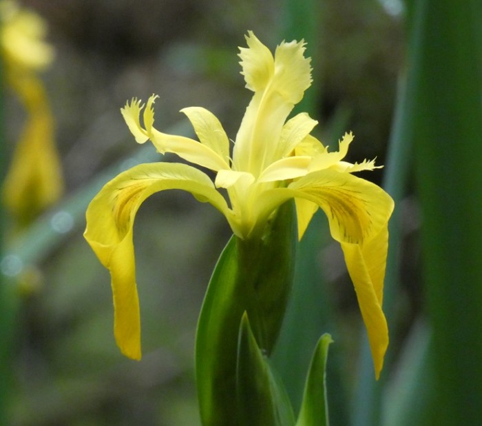
Alison Stocker | Photo: A yellow flag flower seen during a stroll through woods in southeast Gainesville
Well, some of my expectations from the last blog post were fulfilled...others not so much.
We had more medical appointments than anticipated. This was largely due to weekly trips to Randall's dermatologist for the removal of various small skin cancers on his face. The last one was the trickiest being on the side of a nostril and, poor fellow, required a skin-graft and week of wearing large dressing and nostril dilators (plastic tubes up his nose). Needless to say, this was not particularly comfortable nor inclining him to feel very sociable. Still, the doctor was pretty pleased with the result so far and we are instructed to send him photos every week for the next month...of the healing site, not of our "vacation".
The inspections of our various other body systems were all encouraging. Randall was particularly delighted to be told that unless he shows relevant symptoms, he need never go through the discomfort of preparing for a colonoscopy again. Lucky him...
We did get a month's break from long-distance traveling, and that was good. However, with so many appointments and various online tasks in preparation for the coming months, spending March in Gainesville did not seem quite as restful as we had hoped. Still, it is a spectacular time to be in north central Florida and Nancy's lovely home was a perfect place from which to watch the explosion of pink azaleas, dazzling white dogwood trees, and the unfolding of vibrant green leaves on the deciduous trees, all of which occurred over a period of just a few days. Against a rich blue sky, this is one of the world's best displays of springtime. Of course, the associated deluge of pollen is phenomenal, leaving a yellow coating on everything left outside, and plaguing the eyes of noses of hay-fever sufferers.
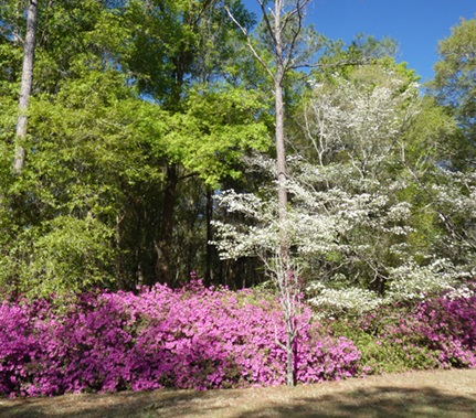
Spring colors in Gainesville: pink azaleas, white dogwoods, and bright green leaves on the deciduous trees
The part of my expectations that seriously fell short was catching up with people that we had not been able to see in November. I managed to squeeze in a few lovely walks, a bit of birding, and delicious meals with some friends in Gainesville, and we spent two nights revisiting Kathy and Dan in Crystal River, but there were many people with whom we failed to connect, partly because it was difficult to plan around the shifting and expanding appointments. We also had to sell our Prius, which made it awkward towards the end, not knowing whether we would have to be available to meet potential buyers. In fact, we had very little interest and were thankful to have a guaranteed purchase by CarMax, even though we almost certainly could have got more money from a private sale had we had more time. Thankfully, Doria and Katie kindly helped provide us with wheels for the days after the car was sold...all part of our complicated dual-continent lives.
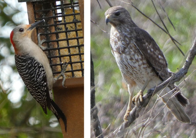
Female red-bellied woodpecker on feeder (to 26 cm or 10 inches: note that the longest tail feathers are used for balance like a third leg) and a juvenile red-shouldered hawk (to 61 cm or 24 inches) in Paynes Prairie
I am writing this as Randall and I are sitting in the international departure lounge at Toronto's Pearson Airport. We left Gainesville yesterday on the RedCoach service, stayed overnight in the Hyatt Regency Hotel at Orlando Airport, and got up soon after 3 am to catch our 6:25 am flight here. We slept most of the way, have a four-hour layover, and then take the 13-hour flight to Tokyo. Assuming that our extra bag with a strange mixture of equipment for the boat does not confuse the Japanese customs officers, we will make our two-hour connection in a different terminal (yikes) to a flight to Osaka, and finally catch a bus from that airport into Kyoto. So far, so good, but it will be a very long and short day for us. A long time before we get to bed at Kaoru and Joe's apartment, and two days (Tuesday and Wednesday) cut short as we cross the international dateline.
We are really thrilled about visiting Japan, particularly as it should be the peak time for cherry blossoms in Kyoto. Neither of us has been to Japan before and although this will be just a short, six-night visit, we very much look forward to seeing some of the beautiful sights and learning a little of Japanese culture. Most especially we are excited about seeing Kaoru and Joe in Kaoru's home country. They have very kindly arranged various activities for our visit including the opportunity to get together with Jennie (visiting from Bushey, London) and her three daughters including Josie visiting from Australia. It will be quite the international gathering, and a fun dose of long-time friends before we move onto Türkiye and reacquainting ourselves with our new friends at Mersin Marina.
We had more medical appointments than anticipated. This was largely due to weekly trips to Randall's dermatologist for the removal of various small skin cancers on his face. The last one was the trickiest being on the side of a nostril and, poor fellow, required a skin-graft and week of wearing large dressing and nostril dilators (plastic tubes up his nose). Needless to say, this was not particularly comfortable nor inclining him to feel very sociable. Still, the doctor was pretty pleased with the result so far and we are instructed to send him photos every week for the next month...of the healing site, not of our "vacation".
The inspections of our various other body systems were all encouraging. Randall was particularly delighted to be told that unless he shows relevant symptoms, he need never go through the discomfort of preparing for a colonoscopy again. Lucky him...
We did get a month's break from long-distance traveling, and that was good. However, with so many appointments and various online tasks in preparation for the coming months, spending March in Gainesville did not seem quite as restful as we had hoped. Still, it is a spectacular time to be in north central Florida and Nancy's lovely home was a perfect place from which to watch the explosion of pink azaleas, dazzling white dogwood trees, and the unfolding of vibrant green leaves on the deciduous trees, all of which occurred over a period of just a few days. Against a rich blue sky, this is one of the world's best displays of springtime. Of course, the associated deluge of pollen is phenomenal, leaving a yellow coating on everything left outside, and plaguing the eyes of noses of hay-fever sufferers.
Spring colors in Gainesville: pink azaleas, white dogwoods, and bright green leaves on the deciduous trees
The part of my expectations that seriously fell short was catching up with people that we had not been able to see in November. I managed to squeeze in a few lovely walks, a bit of birding, and delicious meals with some friends in Gainesville, and we spent two nights revisiting Kathy and Dan in Crystal River, but there were many people with whom we failed to connect, partly because it was difficult to plan around the shifting and expanding appointments. We also had to sell our Prius, which made it awkward towards the end, not knowing whether we would have to be available to meet potential buyers. In fact, we had very little interest and were thankful to have a guaranteed purchase by CarMax, even though we almost certainly could have got more money from a private sale had we had more time. Thankfully, Doria and Katie kindly helped provide us with wheels for the days after the car was sold...all part of our complicated dual-continent lives.
Female red-bellied woodpecker on feeder (to 26 cm or 10 inches: note that the longest tail feathers are used for balance like a third leg) and a juvenile red-shouldered hawk (to 61 cm or 24 inches) in Paynes Prairie
I am writing this as Randall and I are sitting in the international departure lounge at Toronto's Pearson Airport. We left Gainesville yesterday on the RedCoach service, stayed overnight in the Hyatt Regency Hotel at Orlando Airport, and got up soon after 3 am to catch our 6:25 am flight here. We slept most of the way, have a four-hour layover, and then take the 13-hour flight to Tokyo. Assuming that our extra bag with a strange mixture of equipment for the boat does not confuse the Japanese customs officers, we will make our two-hour connection in a different terminal (yikes) to a flight to Osaka, and finally catch a bus from that airport into Kyoto. So far, so good, but it will be a very long and short day for us. A long time before we get to bed at Kaoru and Joe's apartment, and two days (Tuesday and Wednesday) cut short as we cross the international dateline.
We are really thrilled about visiting Japan, particularly as it should be the peak time for cherry blossoms in Kyoto. Neither of us has been to Japan before and although this will be just a short, six-night visit, we very much look forward to seeing some of the beautiful sights and learning a little of Japanese culture. Most especially we are excited about seeing Kaoru and Joe in Kaoru's home country. They have very kindly arranged various activities for our visit including the opportunity to get together with Jennie (visiting from Bushey, London) and her three daughters including Josie visiting from Australia. It will be quite the international gathering, and a fun dose of long-time friends before we move onto Türkiye and reacquainting ourselves with our new friends at Mersin Marina.
Returning eastward
25 February 2024 | We are back in Gainesville, FL: Tregoning is in Mersin Marina, Mersin, Türkiye
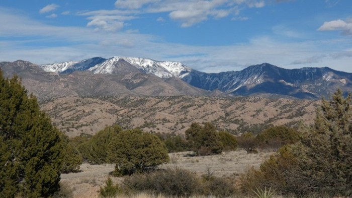
Alison Stocker | Photo: Snow-capped Mogollon Mountains in Gila National Forest, New Mexico
By the time we reached Morro Bay on the evening of Tuesday (12th February), we had only two weeks left before we had to be back in Gainesville. We had to drive the width of the continent and we had many friends and relations still to visit but, in theory at least, it should all be possible if the Prius continued to behave impeccably, and all else went according to plan. Although the weather had improved since we were in San Jose, there were forecasts of another wintery storm system to cross California and potentially follow us eastward. But my more immediate concern was finding sea otters.
After running south along the main street of Morro Bay, on Wednesday morning, I returned along the waterfront looking for my favorite mammals. I saw some across the lagoon among the distant boats but, based on Susan's photograph, I felt sure that I should be able to find some that were closer. Then suddenly I came across the mother lode...literally a group of mothers with pups floating close to shore beside the fishing dock. A small sign on the fence asked people to be quiet because this site was a sea otter nursery and it was so cute to see several mothers floating on their backs with their pups resting or squirming on their tummies. Since I did not have my camera, I returned to the motel hoping that they would still be there when I returned with Randall after showering.
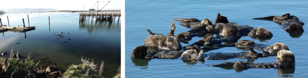
Sea otter nursery by the fishing wharf in Morro Bay with a pile (raft) of otters
Yes! They were still there floating peacefully on this calm morning when were returned. Of course, even though I took plenty of photos and video clips, I could have stayed there watching them for hours. But breakfast called, so we eventually dragged ourselves away, promising to return the following morning for another dose of cuteness.
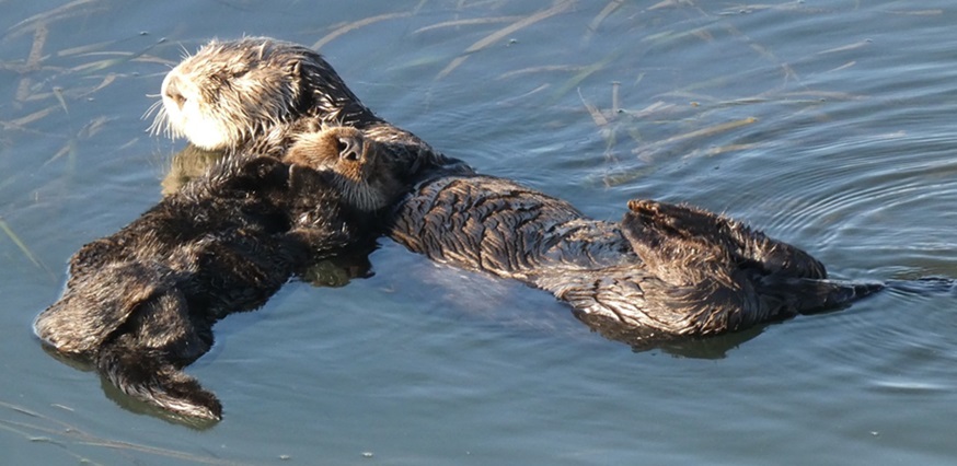
A mother sea otter with her pup resting its head on her chest
Driving inland, we had a delicious lunch with Linda and Randall's cousin Greg at their ranch house made out of straw bales. Plenty of family stories were traded as we ate and watched the birds feeding outside the large windows, including California towhees, curve-billed thrashers, and many California quail. On leaving, we drove through Shandon where we visited the graves of Randall's parents and maternal grandparents. Thanks to the recent rains, the surrounding hills were much greener than they had been on any of my previous visits.
Recent rains had flushed the normally dry hillsides of central California with lush spring grasses, such as these hills in the Diablo Range
On way to Morro Bay from Shandon, we stopped at a nursing facility in Atascadero to visit Randall's cousin Roxanna, who has been seriously ill for the last couple of years. She seemed genuinely touched and happy to see Randall and to meet me. Although her health was poor, her mind was still sharp and many more family stories were exchanged during our very enjoyable conversation. We subsequently heard that she died exactly a week after our visit, making us very thankful that we had been able to see her when we could.
Before leaving Morro Bay on Wednesday, we returned to the sea otter nursery only to find it empty. Empty of otters, that is, there were still sea lions barking on a distant floating dock, common loons, and western `grebes. We continued to Morro Rock at the mouth of the Bay, the northwesternmost of nine named volcanic plugs (although there are actually 23 in total) between San Luis Obispo and Morro Bay. We were hoping to see peregrine falcons on the steep rock face but had to content ourselves with sighting around the Rock of surf scoters, western gulls, bufflehead ducks, and eared grebes. We also saw a few sea otters floating in the kelp beds, not as close to shore as at the nursery, but still a satisfying opportunity to say farewell before we headed further south.
After driving south through San Luis Obispo (where Randall was born) we passed through Santa Barbara (where he got his undergraduate degree at the University of California: Santa Barbara). Looking for former surfing sites of his along the coast, we stopped at Santa Claus Beach, where we walked across the railway tracks to find several long-legged willets wading in the diminutive surf. Given Randall's surfing history in the area, I was intrigued by a sign that said that great white sharks occurred in the area and are protected by state and federal law.
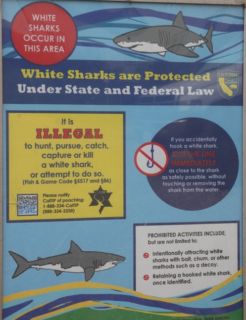
A variation from the warning sign about the predatory dangers of mountain lions seen further north, this sign on a beach near Ventura, CA, is about the protection of great white sharks from people
Arriving at Ventura Marina, we were thrilled to be reunited with Cheryl and Steve, a lovely couple of sailors we had met in Kona, Hawai'i in 2011. We had not seen them for over a decade, but it did not seem that way as we talked about our travels and their amazing global circumnavigation as the support boat with Hokule'a, a Polynesian double-hulled voyaging canoe, sailed and navigated in the tradition ways https://worldwidevoyage.hokulea.com/voyages/our-story/
We had originally intended to stay for the night, but Cheryl was about to have a minor surgical procedure so she was understandably concerned about not catching Covid which would cause this to be postponed. So, we ate outside at a marina restaurant (facing our partners), and then wandered around some nearby ponds looking at the birds. These included gadwall, cinnamon teal, ruddy ducks, mergansers, pied-billed grebes, great blue herons, many black-crowned night herons, and more unusually for the area, a yellow-crowned night heron.
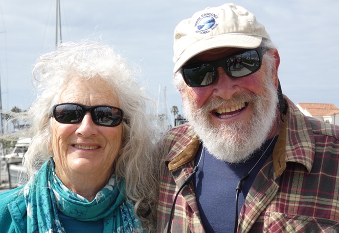
Cheryl and Steve from SV Gershon II at Ventura Marina
(In case you are wondering how I decide of the many people that I mention whose photos to include in the blog, given the nature of the Sailblogs website and its potential for readers who are sailors, I tend more often to include photos of friends we have met cruising.)
On saying goodbye to Cheryl and Steve, we turned eastward, skirting around the north side of Los Angeles. With the afternoon traffic increasing and slowing us down, we finished the day by stopping at motel in Moreno Valley, just east of LA. This afternoon grind reduced the distance to our next motel stop in south Tucson, Arizona, and allowed us time to stop for a couple of hours at the Saguaro West - Tucson Mountain District section of Saguaro National Park. We made a brief stop at the Visitor Center, drove around the Bajada Scenic Loop, and then, as the sun was setting, walked around the Desert Discovery Nature Trail.
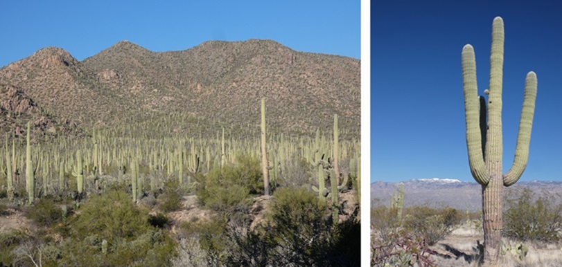
A forest of saguaro cacti and a typically shaped individual in the West Tucson Mountain District of Saguaro National Park
The following morning, we visited the Saguaro East - Rincon Mountain District section of the National Park. We walked along the Freeman Homestead Trail where we did not see a large number of birds, but we did see verdin, phainopepla, curve-billed thrasher, and a gila woodpecker. Many plants looking lusher than usual, such as the bright green leaves of the ocotillo, and there was even a trickle of water in some of the usually dry stream beds. We were sorry not to see or hear cactus- or canyon wrens, but we did hear and not see a new species to us the pyrrhuloxia, a desert-dwelling cardinal. We subsequently followed the Cactus Forest Loop Drive with occasional stops to admire the views of distant snow-capped mountains, adjacent rocky outcrops, or to follow the Desert Ecology Trail.
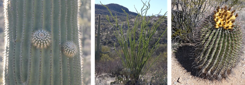
Neophyte branches on a saguaro cactus, an ocotillo that usually looks like a bunch of dead sticks but was covered in bright green leaves after the rains, and a flowering barrel cactus
On our way to the Park, we had passed by an area which appeared to have hundreds of unpainted airplanes packed tightly together. This turned out to be the Historic Aviation Bone Yard, a.k.a. the 309th Aerospace Maintenance and Regeneration Group, which was started at the end of World War II and is now a 2,600-acre (11 km2) facility. With nearly 4,000 miliary and government aircraft, it is the largest aircraft storage and preservation facility in the world, benefitting from a low rate of corrosion in the desert climate. According to Wikipedia, there are four categories of storage for aircraft:
Long Term - aircraft are kept intact in "inviolate" storage for future use with no parts removed; Parts Reclamation - aircraft are picked apart and for spare parts; Flying Hold - aircraft are kept intact with regular running of their engines, lubrication of bearings and servicing of fluids; Excess of DoD needs - aircraft are sold off whole or in parts.
Continuing eastward on Interstate 10, we soon arrived in Willcox, AZ, where we stopped for the night with Randall's cousin, Laurette and her husband Mark. Both flautists and retired school teachers, we wondered if we might get a full concert. That was a bit optimistic but we were very happy to hear Laurette demonstrate her piccolo. Many more family stories were swapped and they asked many, penetrating questions about our aquatic lifestyle...which seemed so distant from their lives surrounded by desert. While we talked, I was excited to watch various birds, including many sparrows and white-winged doves, arrive at their bird feeders. We were especially thrilled to add three new species to our life-lists, the pyrrhuloxia, Gambel's quail, and Bendire's thrasher.
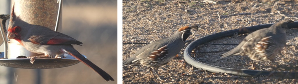
Two new bird species for us at Laurette and Mark's feeders: left - the desert-dwelling cardinal called pyrrhuloxia (to 9 inches or 22 cm) and right - male and female Gambel's quail (to 11 inches or 28 cm)
The following morning, Laurette and Mark drove us to the Crane Observatory by the ponds just south of the Twin Lakes Golf Course. Many of the western populations of sandhill cranes spend the winter in Arizona, New Mexico, and along the Mexican border. We heard a few sandhill cranes on the ground but could not see them unless they were flying overhead. We did see hundreds of American wigeon feeding on the golf course, a trio of snow geese, ruddy ducks, and northern shovelers. It did not take long before Laurette seemed keen to buy a pair of binoculars and start their own birding records.
Having said farewell to Laurette and Mark, we head a little further north, stopping for more birding at Roper Lake State Park. Being the middle of the day, few birds were visible, and there was certainly no sign of the vermillion flycatchers that Randall was keen to see. By a barbecue grill in a campsite, however, we did watch a pair of brown birds that we did not recognize. Happily, we realized that they were Abert's towhees, another new species for us.
Continuing to the northeast, we climbed a twisty road over a low range to arrive in New Mexico at the western edge of the Gila National Forest (pronounced "Hee-la"). Stopping at a viewpoint, we found a plaque to Aldo Leopold (1887-1948) noting that this foresighted forester and wildlife manager had in 1924 established, within the Gila National Forest, the Gila Wilderness - the world's first designated wilderness area. Our northeastward view of the Gila Wilderness included the snow-capped Mogollon Mountains (see introductory photograph). The tallest peak within this range, Whitewater Baldy, is 10,895 ft (3,321 m).
We ended our day's travel in the tiny community of Glenwood in the San Francisco River valley. Somehow Randall had not received the address from our hosts, Roger and Kate, so we had to stop and ask people in the street and at the fish hatchery if they knew Roger. Luckily, it was a small enough community that we were eventually directed to the correct house. Randall and Roger had worked together in Glacier National Park in the 1970s and had not seen each other for several decades. Kate and Roger very kindly allowed us to stay in their newer, hilltop house with a commanding view of the Mogollon Mountains, while they spent the nights in their older house (from which they were slowly moving) down by Whitewater Creek.
Following Kate into a culvert under the road at the start of our walk in Harve Gulch
On Sunday, while Randall and Roger were happy to sit around exchanging stories about their past activities and mutual friends, Kate and I went hiking with their dog Scout in Harve Gulch. As a young man, Roger had been a researcher of raptors in the Gila Wilderness and many other areas, so he knew the wild mountains and their populations of peregrine falcons intimately. He and Randall had played together in a bluegrass band during their time in Montana, so they had both been keen to get out some guitars and jam. That evening, we were joined by their guitar-playing son Kyle and his young family, for a delightful evening of music.
The following morning, I went running up an unpaved road to a small airstrip, just west of the Catwalk Recreation Area. It was a good workout grinding uphill for over 3 km, but pretty nice coming back down. As I ran, I studied the various pawprints in the recently formed mud. Most were probably dogs, foxes, or bobcats. I was a bit concerned about mountain lions (a.k.a. cougars) although Kate had told me that she had run the same route many times. Although deaths are rarely caused by cougars (27 deaths out of 167 attacks in North America in the last 100 years), biologists surmise that people are more likely to be seen as potential prey when they bend over or squat than when they are standing. Runners who have been stalked by a cougar, may be more likely to be attacked if they bend over to pick something up or tie a shoelace. If I was going to be running in this area regularly, I would buy slip-on shoes...
Later that day, we returned to the nearby Catwalk Recreation Area where Kate led Randall and me up the trail to an impressively robust boardwalk attached to the sides of the narrow Whitewater Canyon. Randall and I both noted that compared to the long boardwalk that we had explored in Homa Canyon in Türkiye in October, the supports and fences for this catwalk, which was replaced after extreme floods in 2013, seemed much more solid. Although Kate and I were keen to follow the trail further up the canyon, part of it was submerged under icy cold water. Lacking waterproof footwear, we reluctantly turned around. This was a pity as we would have seen the type of areas where Roger (as a young man) had repelled down cliffs to study peregrine falcon nests.
Kate peering down to the creek in Whitewater Canyon below the catwalk on the Catwalk National Recreation Trail: as a result of the recent rains, following the trail further up the canyon would mean wading through cold water
In the afternoon, we drove a little south of Glenwood to the property, in the floodplain of the San Francico River, where Kyle and his wife Meggie have an organic vegetable farm. Amazingly, in an effort to be sustainable, they are building their house out of home-made adobe bricks and they cultivate the land using horse-drawn equipment rather than tractors. Wondering where they found suitable equipment, the answer, which should have been obvious, was from Amish farmers. That is also where they got their four horses (for excellent pictures see their website at: https://mdexter7.wixsite.com/friscofarm ).
Kyle and Meggie's organic vegetable farm in the floodplain of the San Francisco River which they cultivate using horse-drawn equipment
We left early the next morning, for the long drive to Amarillo, Texas, on a scenic route to Albuquerque through Gila National Forest that Roger had suggested. There were many impressive mesas and cliffs along the route and, as recommended, we stopped at La Ventana Natural Arch in El Malpais National Conservation Area. El Malpais (Spanish for "the badlands") is an extensive area of volcanic features including many layers of lava flow, the oldest dating back about 115,000 years, and the youngest to just 3,900 years ago. Underneath the lava flows, were various layers of sandstone. La Ventana Arch and surrounding bluffs were mostly eroded from Zuni Sandstone which was formed from sand blown across a vast desert to form dunes about 160 million years ago. A thinner sandstone layer near the top was of Dakota Sandstone, laid down about 96 million years ago under the water of the Western Interior Seaway. A series of uplifts and collapses caused massive cracks in the Zuni Sandstone which filled with water. Freeze and thaw cycles would have expanded and contracted those cracks causing fragments to break off and resulting in the 125-feet high, and 165-feet wide arch (38 m by 50 m), the tallest in New Mexico (the Snake Bridge arch is wider).
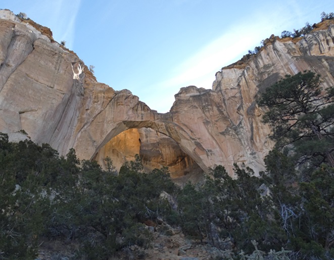
La Ventana Natural Arch - the surrounding cliffs are impressive but sadly one is not allowed close enough to see the sky through the arch
During our long drive across the northern part of Texas to Texarkana, we randomly stopped at the small town of Saint Joseph for lunch at the Chisholm's Chophouse. Arranged in the Spanish style with a large central square, there were several preserved buildings around it, including the Stonewall Saloon, established in 1873 and named for General "Stonewall" Jackson. The town's first permanent building, it had been a saloon and trail drivers' rest stop from days between 1867 to 1884 when cattle were driven from San Antonio, Texas, along the nearby Chisholm Trail, to railheads in Abilene, Kansas. After county prohibition in 1897, the building became offices and a bank.
The Stonewall Saloon in St Jo with hitching posts outside and the neighboring Chisholm's Chophouse
After our night in Texarkana, we stopped to look for birds in a park in the southern part of town. The flashes of the bright red of northern cardinals and the sky blue of blue jays were becoming much more common as we headed east. We also had a good sighting of a red-headed woodpecker, and new to us, several white-throated sparrows.
We crossed the mighty Mississippi River on Greenville Bridge, then headed south through the small town of Rolling Fork. With roofless buildings, snapped-off trees, and piles of debris, it was still very evident that this town had been badly hit by a big tornado in March 2023. With maximum windspeeds estimated at 195 mph (314 kph), the tornado traveled with an average forward speed of 50 miles per hour (80 km/h) for 59.4 miles (95.6 km), killing 17 people and injuring 165 others. Even a year later, it was a very sobering reminder of a dramatic force of nature.
Meanwhile, the current weather was surprisingly fine. This was surprising because the winter storm that had been forecast to sweep across the nation from the Pacific had, thankfully, stayed to the north of our route. We were lucky because there was plenty of snow on the Sierra Mountains in California. By the end of February, these areas had seen winds over 100 mph (160 kph) and more than 7 feet (nearly 3 m) of snow. So much snow fell in February, that it is anticipated that there would be no widespread drought in California for a couple of years.
We soon arrived at the duck-hunting camp, near Satartia in the Mississippi Delta (floodplain), of our friend Kurt, whose camp partner, Eric, was also visiting. Having all been professional colleagues, in the evening we shared plenty of stories from working on projects or attending conferences. The cabin overlooked former catfish ponds in a tract that Kurt is actively managing to increase biodiversity and, of course, to attract waterfowl. He gave us a grand tour of the property but there were surprisingly few ducks, only a couple of mergansers. There were, however, plenty of redwing blackbirds, northern cardinals, swamp sparrows, and blue jays.
Left - Deciduous trees in Mississippi with Kurt's hunting camp to the right: Right - flatwood pines by Week's Bay National Estuarine Research Reserve, AL, visited with Gidget and Joe
Leaving camp the next morning, we headed southeast, stopping in southern Hattiesburg to eat our picnic and look at the Canada geese, ring-necked ducks, and various other waterfowl at Duncan Lake Park. The following two nights were spent as guests of Gidget and Joe near Fairhope, AL. Again, we knew Joe from our professional days, so in addition to trading stories and pictures of our respective travels (they spend the summers hiking and fishing in Wyoming in their camper), we also reminisced about events and friends from various conferences.
Gidget and Joe drove us through the attractive, artsy town of Fairhope, on the east side of Mobile Bay. It was busy on a Saturday morning so we did not stop but enjoyed a good walk with their dog Jensen to Weeks Bay on the Fish River. Watching ospreys diving for fish, pelicans flying in and out of the bay, and eastern bluebirds in the pine flatwoods, started to get us in the mood for returning to Florida the following day. It was a six-hour drive back to Gainesville and the excellent company of Nancy.
We had thoroughly enjoyed our tour around the US and SW Canada seeing so many wonderful people, but we were ready for a bit of a rest from traveling. We have several more medical check-ups and procedures to attend/endure and plenty of supplies to purchase to take back to Tregoning. However, with just over a month before we leave Florida, we are also looking forward to spending more time with our friends here, especially those we had missed seeing in November. Then we will dust off our passports and take-off on our next overseas adventures...
After running south along the main street of Morro Bay, on Wednesday morning, I returned along the waterfront looking for my favorite mammals. I saw some across the lagoon among the distant boats but, based on Susan's photograph, I felt sure that I should be able to find some that were closer. Then suddenly I came across the mother lode...literally a group of mothers with pups floating close to shore beside the fishing dock. A small sign on the fence asked people to be quiet because this site was a sea otter nursery and it was so cute to see several mothers floating on their backs with their pups resting or squirming on their tummies. Since I did not have my camera, I returned to the motel hoping that they would still be there when I returned with Randall after showering.
Sea otter nursery by the fishing wharf in Morro Bay with a pile (raft) of otters
Yes! They were still there floating peacefully on this calm morning when were returned. Of course, even though I took plenty of photos and video clips, I could have stayed there watching them for hours. But breakfast called, so we eventually dragged ourselves away, promising to return the following morning for another dose of cuteness.
A mother sea otter with her pup resting its head on her chest
Driving inland, we had a delicious lunch with Linda and Randall's cousin Greg at their ranch house made out of straw bales. Plenty of family stories were traded as we ate and watched the birds feeding outside the large windows, including California towhees, curve-billed thrashers, and many California quail. On leaving, we drove through Shandon where we visited the graves of Randall's parents and maternal grandparents. Thanks to the recent rains, the surrounding hills were much greener than they had been on any of my previous visits.
Recent rains had flushed the normally dry hillsides of central California with lush spring grasses, such as these hills in the Diablo Range
On way to Morro Bay from Shandon, we stopped at a nursing facility in Atascadero to visit Randall's cousin Roxanna, who has been seriously ill for the last couple of years. She seemed genuinely touched and happy to see Randall and to meet me. Although her health was poor, her mind was still sharp and many more family stories were exchanged during our very enjoyable conversation. We subsequently heard that she died exactly a week after our visit, making us very thankful that we had been able to see her when we could.
Before leaving Morro Bay on Wednesday, we returned to the sea otter nursery only to find it empty. Empty of otters, that is, there were still sea lions barking on a distant floating dock, common loons, and western `grebes. We continued to Morro Rock at the mouth of the Bay, the northwesternmost of nine named volcanic plugs (although there are actually 23 in total) between San Luis Obispo and Morro Bay. We were hoping to see peregrine falcons on the steep rock face but had to content ourselves with sighting around the Rock of surf scoters, western gulls, bufflehead ducks, and eared grebes. We also saw a few sea otters floating in the kelp beds, not as close to shore as at the nursery, but still a satisfying opportunity to say farewell before we headed further south.
After driving south through San Luis Obispo (where Randall was born) we passed through Santa Barbara (where he got his undergraduate degree at the University of California: Santa Barbara). Looking for former surfing sites of his along the coast, we stopped at Santa Claus Beach, where we walked across the railway tracks to find several long-legged willets wading in the diminutive surf. Given Randall's surfing history in the area, I was intrigued by a sign that said that great white sharks occurred in the area and are protected by state and federal law.
A variation from the warning sign about the predatory dangers of mountain lions seen further north, this sign on a beach near Ventura, CA, is about the protection of great white sharks from people
Arriving at Ventura Marina, we were thrilled to be reunited with Cheryl and Steve, a lovely couple of sailors we had met in Kona, Hawai'i in 2011. We had not seen them for over a decade, but it did not seem that way as we talked about our travels and their amazing global circumnavigation as the support boat with Hokule'a, a Polynesian double-hulled voyaging canoe, sailed and navigated in the tradition ways https://worldwidevoyage.hokulea.com/voyages/our-story/
We had originally intended to stay for the night, but Cheryl was about to have a minor surgical procedure so she was understandably concerned about not catching Covid which would cause this to be postponed. So, we ate outside at a marina restaurant (facing our partners), and then wandered around some nearby ponds looking at the birds. These included gadwall, cinnamon teal, ruddy ducks, mergansers, pied-billed grebes, great blue herons, many black-crowned night herons, and more unusually for the area, a yellow-crowned night heron.
Cheryl and Steve from SV Gershon II at Ventura Marina
(In case you are wondering how I decide of the many people that I mention whose photos to include in the blog, given the nature of the Sailblogs website and its potential for readers who are sailors, I tend more often to include photos of friends we have met cruising.)
On saying goodbye to Cheryl and Steve, we turned eastward, skirting around the north side of Los Angeles. With the afternoon traffic increasing and slowing us down, we finished the day by stopping at motel in Moreno Valley, just east of LA. This afternoon grind reduced the distance to our next motel stop in south Tucson, Arizona, and allowed us time to stop for a couple of hours at the Saguaro West - Tucson Mountain District section of Saguaro National Park. We made a brief stop at the Visitor Center, drove around the Bajada Scenic Loop, and then, as the sun was setting, walked around the Desert Discovery Nature Trail.
A forest of saguaro cacti and a typically shaped individual in the West Tucson Mountain District of Saguaro National Park
The following morning, we visited the Saguaro East - Rincon Mountain District section of the National Park. We walked along the Freeman Homestead Trail where we did not see a large number of birds, but we did see verdin, phainopepla, curve-billed thrasher, and a gila woodpecker. Many plants looking lusher than usual, such as the bright green leaves of the ocotillo, and there was even a trickle of water in some of the usually dry stream beds. We were sorry not to see or hear cactus- or canyon wrens, but we did hear and not see a new species to us the pyrrhuloxia, a desert-dwelling cardinal. We subsequently followed the Cactus Forest Loop Drive with occasional stops to admire the views of distant snow-capped mountains, adjacent rocky outcrops, or to follow the Desert Ecology Trail.
Neophyte branches on a saguaro cactus, an ocotillo that usually looks like a bunch of dead sticks but was covered in bright green leaves after the rains, and a flowering barrel cactus
On our way to the Park, we had passed by an area which appeared to have hundreds of unpainted airplanes packed tightly together. This turned out to be the Historic Aviation Bone Yard, a.k.a. the 309th Aerospace Maintenance and Regeneration Group, which was started at the end of World War II and is now a 2,600-acre (11 km2) facility. With nearly 4,000 miliary and government aircraft, it is the largest aircraft storage and preservation facility in the world, benefitting from a low rate of corrosion in the desert climate. According to Wikipedia, there are four categories of storage for aircraft:
Long Term - aircraft are kept intact in "inviolate" storage for future use with no parts removed; Parts Reclamation - aircraft are picked apart and for spare parts; Flying Hold - aircraft are kept intact with regular running of their engines, lubrication of bearings and servicing of fluids; Excess of DoD needs - aircraft are sold off whole or in parts.
Continuing eastward on Interstate 10, we soon arrived in Willcox, AZ, where we stopped for the night with Randall's cousin, Laurette and her husband Mark. Both flautists and retired school teachers, we wondered if we might get a full concert. That was a bit optimistic but we were very happy to hear Laurette demonstrate her piccolo. Many more family stories were swapped and they asked many, penetrating questions about our aquatic lifestyle...which seemed so distant from their lives surrounded by desert. While we talked, I was excited to watch various birds, including many sparrows and white-winged doves, arrive at their bird feeders. We were especially thrilled to add three new species to our life-lists, the pyrrhuloxia, Gambel's quail, and Bendire's thrasher.
Two new bird species for us at Laurette and Mark's feeders: left - the desert-dwelling cardinal called pyrrhuloxia (to 9 inches or 22 cm) and right - male and female Gambel's quail (to 11 inches or 28 cm)
The following morning, Laurette and Mark drove us to the Crane Observatory by the ponds just south of the Twin Lakes Golf Course. Many of the western populations of sandhill cranes spend the winter in Arizona, New Mexico, and along the Mexican border. We heard a few sandhill cranes on the ground but could not see them unless they were flying overhead. We did see hundreds of American wigeon feeding on the golf course, a trio of snow geese, ruddy ducks, and northern shovelers. It did not take long before Laurette seemed keen to buy a pair of binoculars and start their own birding records.
Having said farewell to Laurette and Mark, we head a little further north, stopping for more birding at Roper Lake State Park. Being the middle of the day, few birds were visible, and there was certainly no sign of the vermillion flycatchers that Randall was keen to see. By a barbecue grill in a campsite, however, we did watch a pair of brown birds that we did not recognize. Happily, we realized that they were Abert's towhees, another new species for us.
Continuing to the northeast, we climbed a twisty road over a low range to arrive in New Mexico at the western edge of the Gila National Forest (pronounced "Hee-la"). Stopping at a viewpoint, we found a plaque to Aldo Leopold (1887-1948) noting that this foresighted forester and wildlife manager had in 1924 established, within the Gila National Forest, the Gila Wilderness - the world's first designated wilderness area. Our northeastward view of the Gila Wilderness included the snow-capped Mogollon Mountains (see introductory photograph). The tallest peak within this range, Whitewater Baldy, is 10,895 ft (3,321 m).
We ended our day's travel in the tiny community of Glenwood in the San Francisco River valley. Somehow Randall had not received the address from our hosts, Roger and Kate, so we had to stop and ask people in the street and at the fish hatchery if they knew Roger. Luckily, it was a small enough community that we were eventually directed to the correct house. Randall and Roger had worked together in Glacier National Park in the 1970s and had not seen each other for several decades. Kate and Roger very kindly allowed us to stay in their newer, hilltop house with a commanding view of the Mogollon Mountains, while they spent the nights in their older house (from which they were slowly moving) down by Whitewater Creek.
Following Kate into a culvert under the road at the start of our walk in Harve Gulch
On Sunday, while Randall and Roger were happy to sit around exchanging stories about their past activities and mutual friends, Kate and I went hiking with their dog Scout in Harve Gulch. As a young man, Roger had been a researcher of raptors in the Gila Wilderness and many other areas, so he knew the wild mountains and their populations of peregrine falcons intimately. He and Randall had played together in a bluegrass band during their time in Montana, so they had both been keen to get out some guitars and jam. That evening, we were joined by their guitar-playing son Kyle and his young family, for a delightful evening of music.
The following morning, I went running up an unpaved road to a small airstrip, just west of the Catwalk Recreation Area. It was a good workout grinding uphill for over 3 km, but pretty nice coming back down. As I ran, I studied the various pawprints in the recently formed mud. Most were probably dogs, foxes, or bobcats. I was a bit concerned about mountain lions (a.k.a. cougars) although Kate had told me that she had run the same route many times. Although deaths are rarely caused by cougars (27 deaths out of 167 attacks in North America in the last 100 years), biologists surmise that people are more likely to be seen as potential prey when they bend over or squat than when they are standing. Runners who have been stalked by a cougar, may be more likely to be attacked if they bend over to pick something up or tie a shoelace. If I was going to be running in this area regularly, I would buy slip-on shoes...
Later that day, we returned to the nearby Catwalk Recreation Area where Kate led Randall and me up the trail to an impressively robust boardwalk attached to the sides of the narrow Whitewater Canyon. Randall and I both noted that compared to the long boardwalk that we had explored in Homa Canyon in Türkiye in October, the supports and fences for this catwalk, which was replaced after extreme floods in 2013, seemed much more solid. Although Kate and I were keen to follow the trail further up the canyon, part of it was submerged under icy cold water. Lacking waterproof footwear, we reluctantly turned around. This was a pity as we would have seen the type of areas where Roger (as a young man) had repelled down cliffs to study peregrine falcon nests.
Kate peering down to the creek in Whitewater Canyon below the catwalk on the Catwalk National Recreation Trail: as a result of the recent rains, following the trail further up the canyon would mean wading through cold water
In the afternoon, we drove a little south of Glenwood to the property, in the floodplain of the San Francico River, where Kyle and his wife Meggie have an organic vegetable farm. Amazingly, in an effort to be sustainable, they are building their house out of home-made adobe bricks and they cultivate the land using horse-drawn equipment rather than tractors. Wondering where they found suitable equipment, the answer, which should have been obvious, was from Amish farmers. That is also where they got their four horses (for excellent pictures see their website at: https://mdexter7.wixsite.com/friscofarm ).
Kyle and Meggie's organic vegetable farm in the floodplain of the San Francisco River which they cultivate using horse-drawn equipment
We left early the next morning, for the long drive to Amarillo, Texas, on a scenic route to Albuquerque through Gila National Forest that Roger had suggested. There were many impressive mesas and cliffs along the route and, as recommended, we stopped at La Ventana Natural Arch in El Malpais National Conservation Area. El Malpais (Spanish for "the badlands") is an extensive area of volcanic features including many layers of lava flow, the oldest dating back about 115,000 years, and the youngest to just 3,900 years ago. Underneath the lava flows, were various layers of sandstone. La Ventana Arch and surrounding bluffs were mostly eroded from Zuni Sandstone which was formed from sand blown across a vast desert to form dunes about 160 million years ago. A thinner sandstone layer near the top was of Dakota Sandstone, laid down about 96 million years ago under the water of the Western Interior Seaway. A series of uplifts and collapses caused massive cracks in the Zuni Sandstone which filled with water. Freeze and thaw cycles would have expanded and contracted those cracks causing fragments to break off and resulting in the 125-feet high, and 165-feet wide arch (38 m by 50 m), the tallest in New Mexico (the Snake Bridge arch is wider).
La Ventana Natural Arch - the surrounding cliffs are impressive but sadly one is not allowed close enough to see the sky through the arch
During our long drive across the northern part of Texas to Texarkana, we randomly stopped at the small town of Saint Joseph for lunch at the Chisholm's Chophouse. Arranged in the Spanish style with a large central square, there were several preserved buildings around it, including the Stonewall Saloon, established in 1873 and named for General "Stonewall" Jackson. The town's first permanent building, it had been a saloon and trail drivers' rest stop from days between 1867 to 1884 when cattle were driven from San Antonio, Texas, along the nearby Chisholm Trail, to railheads in Abilene, Kansas. After county prohibition in 1897, the building became offices and a bank.
The Stonewall Saloon in St Jo with hitching posts outside and the neighboring Chisholm's Chophouse
After our night in Texarkana, we stopped to look for birds in a park in the southern part of town. The flashes of the bright red of northern cardinals and the sky blue of blue jays were becoming much more common as we headed east. We also had a good sighting of a red-headed woodpecker, and new to us, several white-throated sparrows.
We crossed the mighty Mississippi River on Greenville Bridge, then headed south through the small town of Rolling Fork. With roofless buildings, snapped-off trees, and piles of debris, it was still very evident that this town had been badly hit by a big tornado in March 2023. With maximum windspeeds estimated at 195 mph (314 kph), the tornado traveled with an average forward speed of 50 miles per hour (80 km/h) for 59.4 miles (95.6 km), killing 17 people and injuring 165 others. Even a year later, it was a very sobering reminder of a dramatic force of nature.
Meanwhile, the current weather was surprisingly fine. This was surprising because the winter storm that had been forecast to sweep across the nation from the Pacific had, thankfully, stayed to the north of our route. We were lucky because there was plenty of snow on the Sierra Mountains in California. By the end of February, these areas had seen winds over 100 mph (160 kph) and more than 7 feet (nearly 3 m) of snow. So much snow fell in February, that it is anticipated that there would be no widespread drought in California for a couple of years.
We soon arrived at the duck-hunting camp, near Satartia in the Mississippi Delta (floodplain), of our friend Kurt, whose camp partner, Eric, was also visiting. Having all been professional colleagues, in the evening we shared plenty of stories from working on projects or attending conferences. The cabin overlooked former catfish ponds in a tract that Kurt is actively managing to increase biodiversity and, of course, to attract waterfowl. He gave us a grand tour of the property but there were surprisingly few ducks, only a couple of mergansers. There were, however, plenty of redwing blackbirds, northern cardinals, swamp sparrows, and blue jays.
Left - Deciduous trees in Mississippi with Kurt's hunting camp to the right: Right - flatwood pines by Week's Bay National Estuarine Research Reserve, AL, visited with Gidget and Joe
Leaving camp the next morning, we headed southeast, stopping in southern Hattiesburg to eat our picnic and look at the Canada geese, ring-necked ducks, and various other waterfowl at Duncan Lake Park. The following two nights were spent as guests of Gidget and Joe near Fairhope, AL. Again, we knew Joe from our professional days, so in addition to trading stories and pictures of our respective travels (they spend the summers hiking and fishing in Wyoming in their camper), we also reminisced about events and friends from various conferences.
Gidget and Joe drove us through the attractive, artsy town of Fairhope, on the east side of Mobile Bay. It was busy on a Saturday morning so we did not stop but enjoyed a good walk with their dog Jensen to Weeks Bay on the Fish River. Watching ospreys diving for fish, pelicans flying in and out of the bay, and eastern bluebirds in the pine flatwoods, started to get us in the mood for returning to Florida the following day. It was a six-hour drive back to Gainesville and the excellent company of Nancy.
We had thoroughly enjoyed our tour around the US and SW Canada seeing so many wonderful people, but we were ready for a bit of a rest from traveling. We have several more medical check-ups and procedures to attend/endure and plenty of supplies to purchase to take back to Tregoning. However, with just over a month before we leave Florida, we are also looking forward to spending more time with our friends here, especially those we had missed seeing in November. Then we will dust off our passports and take-off on our next overseas adventures...
Still on the road…
18 February 2024 | We are in Glenwood, New Mexico: Tregoning is in Mersin Marina, Mersin, Türkiye
Alison Stocker | Saguaro cacti at dusk in Saguaro National Park, Arizona
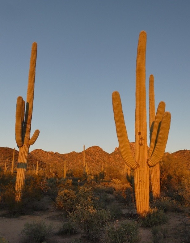
It has been a month since our last post and plenty has happened during that time. But that makes it hard to find time to write the blog, so this is just a quick update to show that we are still going strong, and our climate has changed a bit. More details of our excellent stays in Seattle, Olympia (WA), San Jose, Jackson, Morro Bay (CA), Willcox (AZ), and now Glenwood (NM) will follow eventually.
In addition to seeing many family members and friends, we have enjoyed spectacular scenery from snow-capped mountains to the Pacific Ocean to the Sonoran Desert. We have also experienced the gamut of weather conditions from the snow in Vancouver, to atmospheric rivers dumping rain on California, to frost melting to midday warmth in the desert. We will stay here in New Mexico for a couple more nights then head further east to Vicksburg, MS, and Fairhope, AL, before returning to Florida in about a week’s time. We truly appreciate the generous hospitality of all of our hosts and hope that we added something enjoyable to their winter.
In addition to seeing many family members and friends, we have enjoyed spectacular scenery from snow-capped mountains to the Pacific Ocean to the Sonoran Desert. We have also experienced the gamut of weather conditions from the snow in Vancouver, to atmospheric rivers dumping rain on California, to frost melting to midday warmth in the desert. We will stay here in New Mexico for a couple more nights then head further east to Vicksburg, MS, and Fairhope, AL, before returning to Florida in about a week’s time. We truly appreciate the generous hospitality of all of our hosts and hope that we added something enjoyable to their winter.
The southern swing
12 February 2024 | We are in Morro Bay, California: Tregoning is in Mersin Marina, Mersin, Türkiye
Alison Stocker | Photo: A northern harrier (to 20 in / 52 cm) flying over wetlands in San Francisco Bay
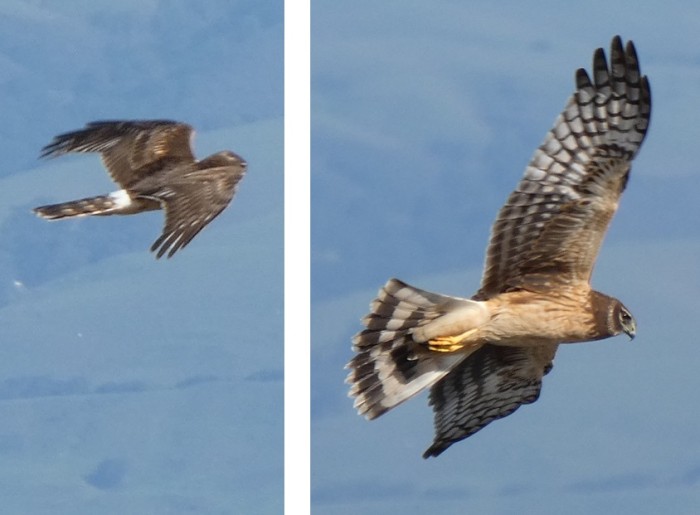
In Vancouver, we had reached the most north-western point of our trip around the continent, and the snowy weather had seemed to acknowledge this. Now it was time to start heading south towards springtime. Having carefully dug ruts in the snow to allow the Prius to escape without becoming its own snowplow, we cautiously eased out of the residential roads leading from Debra and Rob's house on Friday (19th January). Once on the main streets, the route was clear with only a little fog as we crossed the low pass just south of Bellingham.
Not only were there a few sun-breaks (as the locals call them) once we reached Seattle, but the clouds were high enough that we could actually see Mount Rainier from Karen and Mike's lovely house overlooking Lake Washington. This was shocking because when we arrived in Seattle to start our sabbaticals in March 2005, it was weeks before we saw the volcano's summit. Rainier was coyly veiled for the rest of our week-long stay in Seattle, but that one evening's glimpse was spectacular.
Mount Rainier seen beyond Lake Washington from Karen and Mike's house
Our viewing of Rainier also benefitted from the third-floor extension that Karen and Mike had added to their house since our last visit in 2016. This provided excellent views and a delightful, self-contained guest area that was very comfortable. It was wonderful to see plenty of Karen and Mike because they both worked at home for part of our visit. We were especially appreciative that they were so patient with our frequent changes of both arrival and departure dates.
The latter was because we were waiting to see when Michael might be able to return home to Olympia from his medical-rehabilitation facility in Tacoma. We visited him there several times from Seattle and it was very encouraging that he was making great progress in walking around and remembering things. When he eventually received a discharge date, we arranged with Jan that we would come home with her the night before to help prepare the house, and so that I could go with her to help get him home. In the meantime, we took a bit of time to enjoy revisiting some of our Seattle haunts from our sabbatical when we lived on our previous sailboat with our golden retriever, Roxy. Thus, we stopped by Pike Street Market, the Chittenden Locks, Shilshole Marina, and UW campus. We also had a fun dinner with Crysta, a former colleague at UF, who is working hard to finish her PhD from the University of Portland.
Michael was finally allowed home, exactly a month after his medivac departure early on Boxing Day. I think that we were helpful to him and Jan during our five-day stay in Olympia, especially as he still had to use a walker to get back-and-forth to the car for his various medical appointments. It was also fun for us to see some of his family as they came to visit him at home. There was one midnight trip to the Emergency Room, but the problem was resolved quickly and we were all thankful that he could return home right away. So, it was not quite the visit that we had anticipated back in November, but we were all relaxed and thankful that it looked as though Michael was going to make a substantial recovery, although the final status might not be known for several months. It also made us realize how very lucky he was to have a such an ideal partner in Jan who was so devoted and had the stamina to keep on top of his treatments and needs. Well done both of you!
By Tuesday (30th January), Randall was anxious for us to leave Olympia and continue south to Martha's in San Jose. His angst was not because we had any special commitments in California, but because the weather forecasts were again looking dodgy. This time, instead of snow, it was an "Atmospheric River" bringing large amounts of rain across the Pacific to the West Coast. Our goal was to try to beat the worst of the rain to San Jose because flooding, landslides, and nasty driving conditions were predicted for several days.
On the way, we had an excellent view of the snow-covered volcanic cone of Mount Shasta as we pulled into Yreka for the night. It was hidden by the next morning and by the time we crossed the Golden Gate Bridge it was steadily raining. We had taken that route to San Jose both to see the Bridge and to visit with Vandy and Eric (formerly of SV Scoots, now SV Awildian which is in Montenegro) who were staying in a hotel near San Mateo. Like our experience in 2016, they had come to the US from their boat for about six weeks, but were now looking at being on this side of the Atlantic for many months. This was due to an unexpected medical condition of Eric's that was going to require many tests and possible treatment. Having discussed this via WhatsApp, we were very pleased to see them both looking remarkably well and cheerful, and we chatted for a couple of hours before we continued on to San Jose. We would see them again after the weekend when we hoped that the weather would be better for birding.
In fact, the rain diminished for the next two days, so we took Martha to the Don Edwards National Wildlife Refuge on the east side of southern San Francisco Bay, and she patiently wandered round with us while we paused to identify birds. These included Anna's hummingbird, song sparrow, black phoebe, greater yellowlegs, northern shovelers, green wing teal, and American wigeon. The following day, we tried to go to Castle Rock State Park up in the Coastal Range, SW of San Jose but the road was closed. So, we stopped at Sanborn, a Santa Clara County Park where we could walk around a forest of coastal redwoods. There were not as many birds as we had expected (it was midday), but we did peer into a pond that had a large population of California newts. This was particularly fascinating because I was not sure that I had ever seen newts other than in a fish tank before.
Looking rather prehistoric or alien, endemic California newts (to 8 inches or 20 cm) seen in a pond at Sanborn County Park
Just before the rain returned over the weekend, I participated in the Parkrun at Byxbee Park near Palo Alto, while Randall did some birding. He showed me his best finds after my run which included Say's phoebe, greater scaup, common goldeneye, and many other waterfowl. The rain finally eased again on Thursday when we met Vandy and Eric for birding at Baylands Nature Preserve, adjacent to the Byxbee Park. Vandy knew this area and its wildlife well because she had been a volunteer at the Preserve when they lived near Redwood City before they started cruising. In fact, they had shown us their old house the day before when we met for lunch but deemed it too wet to enjoy walking through the wetlands.
Our bird sightings at Baylands Nature Preserve were extensive, including a huge population of marbled godwits, many American avocets, black-necked stilts, Savannah sparrows, northern shovelers, green-winged teal, redwing blackbirds, and a few Clark's- and western grebes, and northern harriers (see introductory photograph). New to Randall and me were ruddy- and canvasback ducks, and a white-tailed kite, the latter hovering by the road and spotted by Vandy as we were driving out of the Preserve.
Song sparrow (to 7 inches or 18 cm) and American avocet (to 18 inches or 46 cm)
After lunch, we drove up Page Mill Road to Los Trancos Mid-Peninsula Regional Open Space Preserve. Randall and Eric stayed in the car talking about music and boat equipment while Vandy and I hiked around, mostly admiring the views and trees as there were very few birds. Vandy showed me various indicators, including bent trees, shallow pools, and disjointed sections of fence, of the huge earthquake on the San Andreas Fault in 1989 that was centered near Loma Prieta, the highest peak in the Santa Cruz Mountains.
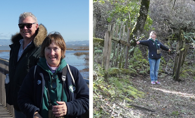
Eric and Vandy at Baylands Nature Preserve; Vandy illustrating how far apart the 1989 earthquake moved sections of a fence that straddled the San Andreas Fault
Vandy used to bring fieldtrips of students up to this Open Space, and often birded and walked there on her own. She was aware of, but not put off by, the known presence in the area of mountain lions (a.k.a. cougars, pumas, and more than 40 other English names, making it the animal with the most names in the world). She had seen signs of them, such as their kill, but knew not to be there when they are most active, at dawn and dusk.
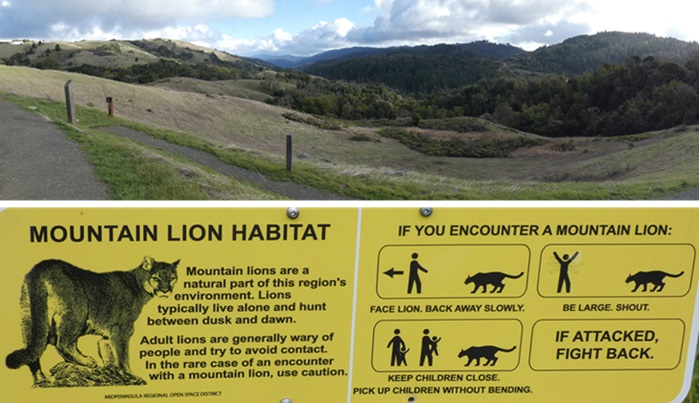
View southeast at Los Trancos with Mt Loma Prieta in far center, and warning sign about mountain lions
Having said a fond farewell to Vandy and Eric, (who we hope to see in Montenegro next winter, if not before), the following day we drove with Martha along part of Skyline Boulevard. This state route winds along the top of ridges through the same Coastal Range where we had been the previous day. It passed through various Open Space Preserves and had several impressive viewing points over San Francisco Bay and the Pacific Ocean. One of our stops was to see the Methuselah Tree, a huge coastal redwood with an estimated age of 1,860 years. Its height had been 225 ft (69 m) before the top broke off in a storm in 1954 leaving its current height of 137 ft (42 m), and the trunk's diameter at its base is 14 ft (4.3 m). While its size and age for a redwood merit the Methuselah name, it should not be confused with the world's potentially oldest living organism, a bristlecone pine in Eastern California called Methuselah that is estimated to be 4,854 years old. But wait! In 2023, according to National Geographic, a Patagonian cypress was identified in Chile that may be 500 years older. Either way, both trees would have been well established by the time the ancient Egyptians built the pyramids at Giza.
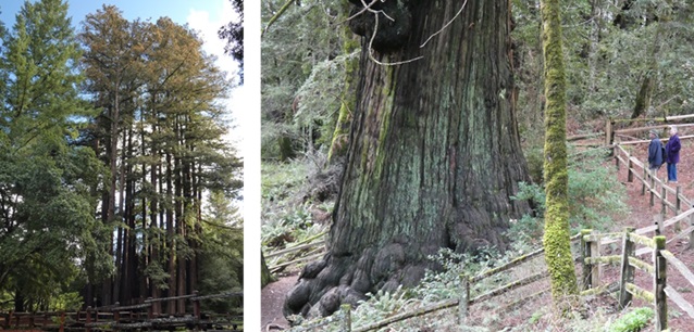
Grove of coastal redwood trees in Sanborn Park; Randall and Martha by base of the Methuselah coastal redwood tree
After having lunch in Half Moon Bay, we drove south along the coastal road to Santa Cruz where be briefly visited the downtown area. On way, we stopped to admire the Pacific Coast and at the base of the cliff I noticed what looked like five penguins (no species of which occur in California) or puffins (which are very unlikely to be walking on sand). Finally, I realized that they were surf scoter ducks actually in the surf. They waddled towards the incoming waves then bent down to feed in the stirred water until they were pushed back into beach, only to start the cycle again.
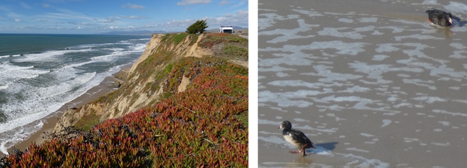
A cliff on the coastal road between Half Moon Bay and Santa Cruz with surf scoter ducks (to 20 inches or 50 cm) feeding in the surf at the base
The next day, we drove from San Jose to Jackson, CA, via the Diablo Range. The steep, twisty road rising out of San Jose had sweeping views over the city and southern San Francisco Bay. We stopped at Joseph D. Grant County Park which we had visited before with Martha but this time we were looking for birds. We had some good sightings including yellow-rumped warblers, golden crowned sparrows, western bluebirds, California scrub jays, chestnut-backed chickadees, bald eagles, red-tailed hawks, northern flickers, a California towhee, and two species that were new to us: Nuttall's woodpecker and oak titmouse.
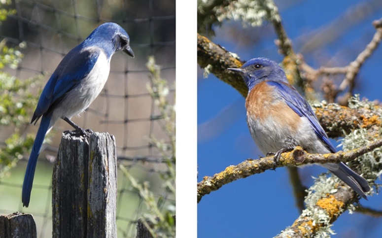
California scrub jay (to 11 inches or 29 cm) and western bluebird (to 7.5 inches or 19 cm)
Later, beyond the Park, we paused to watch a covey of California quail scamper and flutter across the road. These are one of Randall's favorite birds.
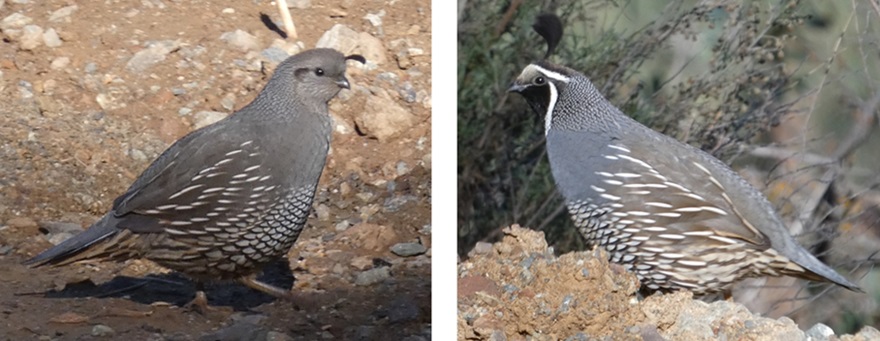
California quail (to 10 inches or 25 cm) with their curiously curving topknots; female left, male right
Further on, we topped the 4,200-foot (1,280 m) summit of Mount Hamilton with its remnants of snow, by stopping briefly at the historic Lick Observatory, the world's first permanently occupied mountaintop observatory which started observations in 1888. We had taken a tour of the observatory with Martha in 2016 https://www.sailblogs.com/member/tregoning/411434. It was amazing that the observatory was still there because a huge fire in August 2020, which burned more than 2,000 square miles (5,180 km2) of California in just 10 days, came very close to destroying it. Remarkably firefighters were able to save all but one residential building despite the fire passing very close to the summit.
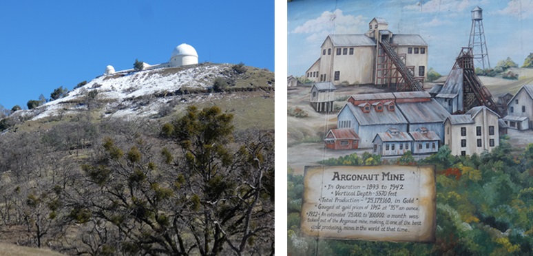
Lick Observatory atop Mount Hamilton with burned trees just below it, and a mural about Argonaut Mine in Jackson, CA
We spent a couple of nights staying with Randall's cousin Court and his wife Ellen in Jackson, just southeast of Sacramento in the foothills of the Sierra mountains. This was an historic gold mining town and after a lovely country-lane walk, Court drove me around the town to see the remains of a couple of old gold mines. The Argonaut Mine was in production from 1893 to 1942 during which time more than $25 million worth of gold (based on 1942 gold prices) were extracted. In 1922, with $75,000 to $100,000 of gold being extracted a month, it was one of the world's most productive mines. This was also the site and year of the state's worst gold-mine disaster when 47 miners were trapped and killed during a fire. The nearby Kennedy Mine was active from 1860 to 1942 during which time it produced almost $35 million of gold. When the mine closed, it had the deepest vertical shaft in North America at 5,912 feet (or 1,802 m).
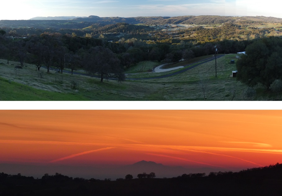
View over the valley of the North Fork Mokelumne River from Ellen and Court's house in early morning and sunset
In addition to visiting Ellen's four horses at their nearby stables, enjoying the fabulous view from their house, and identifying the local birds, most of us watched the American Football Super Bowl. This was between the San Franscisco 49ers (Court's team) and the Kansas City Chiefs. It was an exciting match but had an agonizing end when it went into almost 15 minutes of overtime. This was painful for Ellen who really dislikes the sport and hoped that it would be over at full time, and for Court when Kansas City finally won with a touchdown over San Francisco's field goal.
Leaving Jackson on Monday morning, we recrossed the Diablo Range on a much faster road than we had taken up Mount Hamilton. We drove south on the east side of the Gabilan Range, part of California's Coast Range, until we reached the east entrance to Pinnacles National Park (NP). We ate our picnic lunch at the Peaks View Parking Area admiring the distant and central High Peaks and Pinnacle Rocks which can be reached by foot from separate park entrances on either side of the range. The golden rocks of the pinnacles were "rhyolite breccia, angular fragments ejected from (distant) volcanoes and cemented by ash and mud".
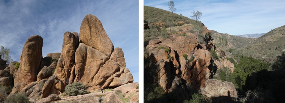
Some of the Pinnacles and rocky canyon cliffs in Pinnacles National Park
Further into the park, after spotting a couple of Stella's jays, we followed the Moses Spring Trail to the modest spring. While Randall retraced his steps, I went on to Bear Gulch Reservoir, returning by the Rim Trail. The landscape and flora were those of a predominantly dry habitat, but the muddy reservoir, full streams, and noisy waterfalls displayed the effects of the recent rains. Despite fabulous views of the various pinnacles and canyons, we had no views of California condors, the main reason that we come to this Park. Gainesville friend Katie had recommended the Park as a likely place to see condors because it is one of the release sites for the condor captive breeding program. Instead, we did see a few bees on the white flowers of the native manzanita shrubs. It is claimed that Pinnacles NP contains more than 500 species of bees, giving it some of the highest bee diversity anywhere on earth. There are over 20,000 bee species in the world of which 4,000 are native to the USA. I had no idea.
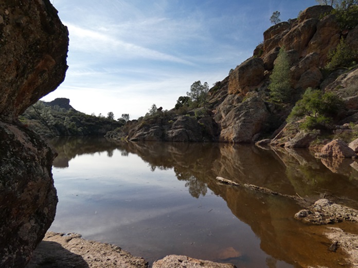
Bear Gulch Reservoir in Pinnacles National Park
As we were leaving the park, we stopped once more at the place where we had lunch to peer at the distant Pinnacles with our binoculars. By this time, there were many more birds soaring above the peaks and while they were too distant to be absolutely certain that some of them were condors as opposed to the much more common turkey vultures, we managed to persuade ourselves that some might be some of North America's largest land bird. (I put them on my "possible sightings" page of my life-time bird spreadsheet.) Thinking that there might only be three or four condors regularly in the Park, we were not absolutely convinced.
However, as we left, we learned from the Park Ranger at the gate that about 30 condors used the Park, making our optimistic identifications much more likely. Given that by 1987 the global population of California condors had fallen to just 27 individuals, which were (controversially) all taken into captivity, this size of population in one of only six release sites for captive-bred birds is very encouraging. However, as long as some birds still die from lead-poisoning after ingesting carrion containing lead shot (the condor's strong digestive juices make them more susceptible to such lead than other scavengers), collisions with power lines, and lately avian 'flu, the world population of around 560 birds is not out of danger yet.
After heading south from Pinnacles NP, we turned west to cross the Gabilan Range then followed the Salinas Valley to Atascadero where we met Randall's cousin Eloise and her daughter Petra for dinner. It was lovely to see them both look so well and many family stories were traded until it was time for us to continue southwest to our motel in Morro Bay. We had chosen to stay there because we had fond memories of staying in the Bay's sheltered lagoon in Tregoning in October 2013. Also, Susan, another friend from Gainesville, had been there recently and had shared excellent photos of sea otters. Having not seen any along the coast so far on this trip, it was our last chance to see them...and I do LOVE sea otters.
Not only were there a few sun-breaks (as the locals call them) once we reached Seattle, but the clouds were high enough that we could actually see Mount Rainier from Karen and Mike's lovely house overlooking Lake Washington. This was shocking because when we arrived in Seattle to start our sabbaticals in March 2005, it was weeks before we saw the volcano's summit. Rainier was coyly veiled for the rest of our week-long stay in Seattle, but that one evening's glimpse was spectacular.
Mount Rainier seen beyond Lake Washington from Karen and Mike's house
Our viewing of Rainier also benefitted from the third-floor extension that Karen and Mike had added to their house since our last visit in 2016. This provided excellent views and a delightful, self-contained guest area that was very comfortable. It was wonderful to see plenty of Karen and Mike because they both worked at home for part of our visit. We were especially appreciative that they were so patient with our frequent changes of both arrival and departure dates.
The latter was because we were waiting to see when Michael might be able to return home to Olympia from his medical-rehabilitation facility in Tacoma. We visited him there several times from Seattle and it was very encouraging that he was making great progress in walking around and remembering things. When he eventually received a discharge date, we arranged with Jan that we would come home with her the night before to help prepare the house, and so that I could go with her to help get him home. In the meantime, we took a bit of time to enjoy revisiting some of our Seattle haunts from our sabbatical when we lived on our previous sailboat with our golden retriever, Roxy. Thus, we stopped by Pike Street Market, the Chittenden Locks, Shilshole Marina, and UW campus. We also had a fun dinner with Crysta, a former colleague at UF, who is working hard to finish her PhD from the University of Portland.
Michael was finally allowed home, exactly a month after his medivac departure early on Boxing Day. I think that we were helpful to him and Jan during our five-day stay in Olympia, especially as he still had to use a walker to get back-and-forth to the car for his various medical appointments. It was also fun for us to see some of his family as they came to visit him at home. There was one midnight trip to the Emergency Room, but the problem was resolved quickly and we were all thankful that he could return home right away. So, it was not quite the visit that we had anticipated back in November, but we were all relaxed and thankful that it looked as though Michael was going to make a substantial recovery, although the final status might not be known for several months. It also made us realize how very lucky he was to have a such an ideal partner in Jan who was so devoted and had the stamina to keep on top of his treatments and needs. Well done both of you!
By Tuesday (30th January), Randall was anxious for us to leave Olympia and continue south to Martha's in San Jose. His angst was not because we had any special commitments in California, but because the weather forecasts were again looking dodgy. This time, instead of snow, it was an "Atmospheric River" bringing large amounts of rain across the Pacific to the West Coast. Our goal was to try to beat the worst of the rain to San Jose because flooding, landslides, and nasty driving conditions were predicted for several days.
On the way, we had an excellent view of the snow-covered volcanic cone of Mount Shasta as we pulled into Yreka for the night. It was hidden by the next morning and by the time we crossed the Golden Gate Bridge it was steadily raining. We had taken that route to San Jose both to see the Bridge and to visit with Vandy and Eric (formerly of SV Scoots, now SV Awildian which is in Montenegro) who were staying in a hotel near San Mateo. Like our experience in 2016, they had come to the US from their boat for about six weeks, but were now looking at being on this side of the Atlantic for many months. This was due to an unexpected medical condition of Eric's that was going to require many tests and possible treatment. Having discussed this via WhatsApp, we were very pleased to see them both looking remarkably well and cheerful, and we chatted for a couple of hours before we continued on to San Jose. We would see them again after the weekend when we hoped that the weather would be better for birding.
In fact, the rain diminished for the next two days, so we took Martha to the Don Edwards National Wildlife Refuge on the east side of southern San Francisco Bay, and she patiently wandered round with us while we paused to identify birds. These included Anna's hummingbird, song sparrow, black phoebe, greater yellowlegs, northern shovelers, green wing teal, and American wigeon. The following day, we tried to go to Castle Rock State Park up in the Coastal Range, SW of San Jose but the road was closed. So, we stopped at Sanborn, a Santa Clara County Park where we could walk around a forest of coastal redwoods. There were not as many birds as we had expected (it was midday), but we did peer into a pond that had a large population of California newts. This was particularly fascinating because I was not sure that I had ever seen newts other than in a fish tank before.
Looking rather prehistoric or alien, endemic California newts (to 8 inches or 20 cm) seen in a pond at Sanborn County Park
Just before the rain returned over the weekend, I participated in the Parkrun at Byxbee Park near Palo Alto, while Randall did some birding. He showed me his best finds after my run which included Say's phoebe, greater scaup, common goldeneye, and many other waterfowl. The rain finally eased again on Thursday when we met Vandy and Eric for birding at Baylands Nature Preserve, adjacent to the Byxbee Park. Vandy knew this area and its wildlife well because she had been a volunteer at the Preserve when they lived near Redwood City before they started cruising. In fact, they had shown us their old house the day before when we met for lunch but deemed it too wet to enjoy walking through the wetlands.
Our bird sightings at Baylands Nature Preserve were extensive, including a huge population of marbled godwits, many American avocets, black-necked stilts, Savannah sparrows, northern shovelers, green-winged teal, redwing blackbirds, and a few Clark's- and western grebes, and northern harriers (see introductory photograph). New to Randall and me were ruddy- and canvasback ducks, and a white-tailed kite, the latter hovering by the road and spotted by Vandy as we were driving out of the Preserve.
Song sparrow (to 7 inches or 18 cm) and American avocet (to 18 inches or 46 cm)
After lunch, we drove up Page Mill Road to Los Trancos Mid-Peninsula Regional Open Space Preserve. Randall and Eric stayed in the car talking about music and boat equipment while Vandy and I hiked around, mostly admiring the views and trees as there were very few birds. Vandy showed me various indicators, including bent trees, shallow pools, and disjointed sections of fence, of the huge earthquake on the San Andreas Fault in 1989 that was centered near Loma Prieta, the highest peak in the Santa Cruz Mountains.
Eric and Vandy at Baylands Nature Preserve; Vandy illustrating how far apart the 1989 earthquake moved sections of a fence that straddled the San Andreas Fault
Vandy used to bring fieldtrips of students up to this Open Space, and often birded and walked there on her own. She was aware of, but not put off by, the known presence in the area of mountain lions (a.k.a. cougars, pumas, and more than 40 other English names, making it the animal with the most names in the world). She had seen signs of them, such as their kill, but knew not to be there when they are most active, at dawn and dusk.
View southeast at Los Trancos with Mt Loma Prieta in far center, and warning sign about mountain lions
Having said a fond farewell to Vandy and Eric, (who we hope to see in Montenegro next winter, if not before), the following day we drove with Martha along part of Skyline Boulevard. This state route winds along the top of ridges through the same Coastal Range where we had been the previous day. It passed through various Open Space Preserves and had several impressive viewing points over San Francisco Bay and the Pacific Ocean. One of our stops was to see the Methuselah Tree, a huge coastal redwood with an estimated age of 1,860 years. Its height had been 225 ft (69 m) before the top broke off in a storm in 1954 leaving its current height of 137 ft (42 m), and the trunk's diameter at its base is 14 ft (4.3 m). While its size and age for a redwood merit the Methuselah name, it should not be confused with the world's potentially oldest living organism, a bristlecone pine in Eastern California called Methuselah that is estimated to be 4,854 years old. But wait! In 2023, according to National Geographic, a Patagonian cypress was identified in Chile that may be 500 years older. Either way, both trees would have been well established by the time the ancient Egyptians built the pyramids at Giza.
Grove of coastal redwood trees in Sanborn Park; Randall and Martha by base of the Methuselah coastal redwood tree
After having lunch in Half Moon Bay, we drove south along the coastal road to Santa Cruz where be briefly visited the downtown area. On way, we stopped to admire the Pacific Coast and at the base of the cliff I noticed what looked like five penguins (no species of which occur in California) or puffins (which are very unlikely to be walking on sand). Finally, I realized that they were surf scoter ducks actually in the surf. They waddled towards the incoming waves then bent down to feed in the stirred water until they were pushed back into beach, only to start the cycle again.
A cliff on the coastal road between Half Moon Bay and Santa Cruz with surf scoter ducks (to 20 inches or 50 cm) feeding in the surf at the base
The next day, we drove from San Jose to Jackson, CA, via the Diablo Range. The steep, twisty road rising out of San Jose had sweeping views over the city and southern San Francisco Bay. We stopped at Joseph D. Grant County Park which we had visited before with Martha but this time we were looking for birds. We had some good sightings including yellow-rumped warblers, golden crowned sparrows, western bluebirds, California scrub jays, chestnut-backed chickadees, bald eagles, red-tailed hawks, northern flickers, a California towhee, and two species that were new to us: Nuttall's woodpecker and oak titmouse.
California scrub jay (to 11 inches or 29 cm) and western bluebird (to 7.5 inches or 19 cm)
Later, beyond the Park, we paused to watch a covey of California quail scamper and flutter across the road. These are one of Randall's favorite birds.
California quail (to 10 inches or 25 cm) with their curiously curving topknots; female left, male right
Further on, we topped the 4,200-foot (1,280 m) summit of Mount Hamilton with its remnants of snow, by stopping briefly at the historic Lick Observatory, the world's first permanently occupied mountaintop observatory which started observations in 1888. We had taken a tour of the observatory with Martha in 2016 https://www.sailblogs.com/member/tregoning/411434. It was amazing that the observatory was still there because a huge fire in August 2020, which burned more than 2,000 square miles (5,180 km2) of California in just 10 days, came very close to destroying it. Remarkably firefighters were able to save all but one residential building despite the fire passing very close to the summit.
Lick Observatory atop Mount Hamilton with burned trees just below it, and a mural about Argonaut Mine in Jackson, CA
We spent a couple of nights staying with Randall's cousin Court and his wife Ellen in Jackson, just southeast of Sacramento in the foothills of the Sierra mountains. This was an historic gold mining town and after a lovely country-lane walk, Court drove me around the town to see the remains of a couple of old gold mines. The Argonaut Mine was in production from 1893 to 1942 during which time more than $25 million worth of gold (based on 1942 gold prices) were extracted. In 1922, with $75,000 to $100,000 of gold being extracted a month, it was one of the world's most productive mines. This was also the site and year of the state's worst gold-mine disaster when 47 miners were trapped and killed during a fire. The nearby Kennedy Mine was active from 1860 to 1942 during which time it produced almost $35 million of gold. When the mine closed, it had the deepest vertical shaft in North America at 5,912 feet (or 1,802 m).
View over the valley of the North Fork Mokelumne River from Ellen and Court's house in early morning and sunset
In addition to visiting Ellen's four horses at their nearby stables, enjoying the fabulous view from their house, and identifying the local birds, most of us watched the American Football Super Bowl. This was between the San Franscisco 49ers (Court's team) and the Kansas City Chiefs. It was an exciting match but had an agonizing end when it went into almost 15 minutes of overtime. This was painful for Ellen who really dislikes the sport and hoped that it would be over at full time, and for Court when Kansas City finally won with a touchdown over San Francisco's field goal.
Leaving Jackson on Monday morning, we recrossed the Diablo Range on a much faster road than we had taken up Mount Hamilton. We drove south on the east side of the Gabilan Range, part of California's Coast Range, until we reached the east entrance to Pinnacles National Park (NP). We ate our picnic lunch at the Peaks View Parking Area admiring the distant and central High Peaks and Pinnacle Rocks which can be reached by foot from separate park entrances on either side of the range. The golden rocks of the pinnacles were "rhyolite breccia, angular fragments ejected from (distant) volcanoes and cemented by ash and mud".
Some of the Pinnacles and rocky canyon cliffs in Pinnacles National Park
Further into the park, after spotting a couple of Stella's jays, we followed the Moses Spring Trail to the modest spring. While Randall retraced his steps, I went on to Bear Gulch Reservoir, returning by the Rim Trail. The landscape and flora were those of a predominantly dry habitat, but the muddy reservoir, full streams, and noisy waterfalls displayed the effects of the recent rains. Despite fabulous views of the various pinnacles and canyons, we had no views of California condors, the main reason that we come to this Park. Gainesville friend Katie had recommended the Park as a likely place to see condors because it is one of the release sites for the condor captive breeding program. Instead, we did see a few bees on the white flowers of the native manzanita shrubs. It is claimed that Pinnacles NP contains more than 500 species of bees, giving it some of the highest bee diversity anywhere on earth. There are over 20,000 bee species in the world of which 4,000 are native to the USA. I had no idea.
Bear Gulch Reservoir in Pinnacles National Park
As we were leaving the park, we stopped once more at the place where we had lunch to peer at the distant Pinnacles with our binoculars. By this time, there were many more birds soaring above the peaks and while they were too distant to be absolutely certain that some of them were condors as opposed to the much more common turkey vultures, we managed to persuade ourselves that some might be some of North America's largest land bird. (I put them on my "possible sightings" page of my life-time bird spreadsheet.) Thinking that there might only be three or four condors regularly in the Park, we were not absolutely convinced.
However, as we left, we learned from the Park Ranger at the gate that about 30 condors used the Park, making our optimistic identifications much more likely. Given that by 1987 the global population of California condors had fallen to just 27 individuals, which were (controversially) all taken into captivity, this size of population in one of only six release sites for captive-bred birds is very encouraging. However, as long as some birds still die from lead-poisoning after ingesting carrion containing lead shot (the condor's strong digestive juices make them more susceptible to such lead than other scavengers), collisions with power lines, and lately avian 'flu, the world population of around 560 birds is not out of danger yet.
After heading south from Pinnacles NP, we turned west to cross the Gabilan Range then followed the Salinas Valley to Atascadero where we met Randall's cousin Eloise and her daughter Petra for dinner. It was lovely to see them both look so well and many family stories were traded until it was time for us to continue southwest to our motel in Morro Bay. We had chosen to stay there because we had fond memories of staying in the Bay's sheltered lagoon in Tregoning in October 2013. Also, Susan, another friend from Gainesville, had been there recently and had shared excellent photos of sea otters. Having not seen any along the coast so far on this trip, it was our last chance to see them...and I do LOVE sea otters.
| Vessel Name: | Tregoning |
| Vessel Make/Model: | Morgan Classic 41 |
| Hailing Port: | Gainesville, FL |
| Crew: | Alison and Randall |
| About: | We cast-off from Fernandina Beach in north Florida on 1st June 2008 and we have been cruising on Tregoning ever since. Before buying Tregoning, both of us had been sailing on smaller boats for many years and had worked around boats and water throughout our careers. |
| Extra: | “Tregoning” (rhymes with “belonging”) and is a Cornish word (meaning “homestead of Cohnan” or “farm by the ash trees”) and was Alison's mother’s middle name. Cornwall is in southwest England and is where Alison grew-up. |
Tregoning's Photos - San Francisco to San Diego


Tregoning
Who: Alison and Randall
Port: Gainesville, FL
Gallery