Catboat Adventures
Sailing from New Jersey to the Florida Keys in an Atlantic City Catboat.
20 May 2006
12 May 2006
30 April 2006
29 April 2006
23 April 2006
10 April 2006
29 March 2006
26 March 2006
21 March 2006
03 March 2006
26 February 2006
17 February 2006
07 February 2006
30 January 2006
15 November 2005
04 November 2005
29 October 2005
15 October 2005
09 October 2005 | Chesapeake Bay
04 October 2005 | HERRING BAY, MD (United States)
Statistical Information
20 May 2006
Bill

This is a summary of the Statistical Information from the Voyage of Fodder's Cat:
Number of Days on the Fodder's Cat = 169
Number of days in transit = 78
Number of "Lay Days" = 91
Number of days anchored = 44
Number of days docked = 125
Number of days docked for repairs (bilge pump, rudder, engine/transmission) = 40
Number of days docked for visiting family = 15
Number of days free dockage = 33
Number of days dockage $20.00 or less = 18
Highest dockage fee = $72.00
Fuel Information:
Total engine hours = 579.9
Total gallons of fuel consumed = 290.0
Average price of fuel = $2.85/g
Total cost of fuel = $822.96
Fuel consumption = 0.50 gallon per hour
Records for Longest day
Longest day (hours traveling): May 9, 2006, 15 hours and 10 minutes
Longest day (mileage): May 9, 2006, 81.0 nautical miles
Total Miles = 2924.5
Average miles per day when moving boat = 37.5
Alligator River Marina to Surf City, NJ
12 May 2006
Bill
Some Weather Observations
On the southbound portion of our trip, the winds came predominately from the south. This limited the amount of sailing we did in the few bodies of water that were deep enough for sailing. The narrow canals and ditches that make up the bulk of the waterway prevented any sailing, even if the wind was in our favor.
The story was similar on the way north. The predominant winds were out of the north. We had hoped to do some sailing on the Chesapeake Bay, but north winds meant that we motored up the bay without even taking the sail cover off.
The howling winds of the Alligator River had become a distant memory, until we reached the Solomon Islands on the western shore of the Chesapeake. The forecast for rain 20 - 25 knots of wind caused us to leave our anchorage in Mill Creek and take a slip at Zahniser's Sailing Center. We stayed for three evenings. The rain and wind didn't materialize as predicted in our location, but several boaters told us the Bay was pretty rough. We were happy we stayed.
The Solomon Islands Revisited
We in the Solomon's and it's raining. The picture is similar to our southbound stop here in that we have to contend yet again with wind and rain. Fortunately, we don't have the cold to contend with, although we fired up the heater in the evenings to take the chill out of the cabin.
We did lots of walking on this stay. Although we had rain, there were periods where we could go for walks. The Calvert Marine Museum piqued our interest when we laid over on the southbound portion of our trip. As we walked passed, the museum was packed with visitors and special displays. They were having a spring celebration of some sort or another. It has a nice collection of Chesapeake work boats, a wonderful art gallery, and a tug boat. The Museum staff operates an old Chesapeake buy boat to take people or a tour of the harbor and the Patuxent River. We were particularly impressed with the screw pile lighthouse. It is open for display and we climbed the ladder leading to the first floor living quarters. All of the rooms are painted in gray and white and looked cozy with period furniture and accessories. This floor had a wraparound deck with views from every quadrant. A rainwater collection system provided the fresh water for the light keeper. Beside the bedroom "chamber pot," an "out house" was perched outside, cantilevered off the deck and over the water below. With only a hole in the seat, the waste fell directly to the sea below. The second floor had a little room from which the light keeper could operate the fog bell by pulling on a chain. Bedrooms and storage rounded out the second floor. The third floor housed the light. A Fresnel lens, used to focus the light was in position.
On one of our excursions, we visited the "TIKI BAR." This establishment has several very large tiki's on the sand beach between some of the buildings that make up this interesting complex. Clearly, patrons of the TIKI BAR know how to party!
While tied up at Zahniser's Sailing Center, we were surprised to have a visit from Steve Flesner and his wife. Anna Marie was in the laundry room, so I gave Steve a tour of the boat. Steve is a member of the Chesapeake Catboat Association and happened to see our boat tied up to the docks. He just had to stop by to say hi!. He took several pictures and we chatted for awhile before he departed. The very next day, he sent out an e-mail to all of the CCA members telling them of his "find," and a bit about our Atlantic City Catboat. He was gracious enough to e-mail me a copy and a directory of CCA members.
Shortly after his visit, Butler Symthe stopped by. I know Butler by name as he owns a Menger 23 a boat I used to admire. We had a most pleasant conversation with Butler for an hour or so before he took his leave.
Recall that during Steve Flesner's visit Anna Marie was in the laundry facilities. During the course of the trip, she has met many interesting people while doing the laundry. Today was no exception. She met Nancy who, with her husband David, arrived in "Windrider," their home built 37' catamaran. David retired when he was 57. It took them nine years to build the boat. They keep the boat in Castleton-on-Hudson, not far from their Massachusetts home. They sailed to the keys and the Dry Tortugas and did some of the west coast of Florida before making the turn for home. Anna Marie and I were invited to look at their boat and we became fast friends.
We departed the Solomon's on the same day, about ten minutes behind them. It only took an hour or so before they were beyond the horizon. Their boat can get up and go, even when under auxiliary power. They planed stop at Tolchester on the eastern shore of the Bay. We are still amused by the fact that we spend time with people along the way, only to go our separate ways and are always pleasantly surprised when we meet up with them a few days later. On these occasions, it is always great to compare notes and share experiences.
A Triumph! Tuesday, May 9, 2006 Was A Record Setting Day
Since we spent three days in the Solomon's we opted to put in a long day and make up some distance. The forecast was for 10 to 15 knots out of the NNE with 1' to 2' seas. Upon entering the Bay, we were greeted by 15 - 20 knots and 2' - 3' seas. Matters were also complicated by a foul current. Conditions weren't ideal for the long day we had planned, but they weren't horrible. We pressed on making about 4.5 knots.
As the day wore on, conditions improved; the current turned in our favor and the seas calmed so much so that by the time we were abeam of Bloody Point Light, the seas were calm. The wind remained on the nose, but was only blowing around 5 - 10 knots.
Abeam of Tolchester, we saw the tall mast of the catamaran that was home to our new friends. We were making good progress and had a couple of hours of daylight left so, on we went.
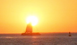
We continued to be pushed by a favorable current and were making 6+ knots. We followed the Elk Neck Channel in the twilight and took yet another photo of a spectacular sunset. It is 730 in the bubble with only the front panel open and the evening is clear and calm.
At 2110 hours, we had the anchor down in Cabin John Creek. We entered the creek in the dark, with only the light of the moon guiding our way. We anchored in 5 � feet of water between the shores of the creek. We have gone 81.0 nm in 15:10 (15.17 hours). Both the time traveled and distance traveled record have been shattered (for this boat)! This was a long and most rewarding day. We're both OK with the time spent traveling today and extremely happy with the distance. Even though we spent much of the day fighting a foul current, we averaged a very respectable 5.3 knots.
Our progress today has put us in a position to complete the Delaware Bay Wednesday, May 10. This was important to us because after tomorrow, the forecast for the Delaware Bay and the coastal waters from Sandy Hook to Cape May was for rain and breezy conditions for the next week.
Our plan is to do the entire Delaware Bay tomorrow (another long day). We'll leave Cape May before first light on Thursday in an effort to beat the in-coming cold front.
It was amusing to note that Cabin John Creek is located on roughly the same latitude as the SCYC which is only 83 miles to the east as the crow flies. To get there, we have the Delaware Bay and the Atlantic Ocean from Cape May to Atlantic City to negotiate.
Triumph and Travail
It's Wednesday, May 10. There is a chill in the air so it's on with sweatshirts and winter jackets. We were up at 0600 and on our way to the fuel dock on the Bohemia River. This wasn't going to be an early day for two important reasons. First, this was the last fuel dock directly on our route until Cape May, and the Bohemia Bay Yacht Harbor didn't open for business until 0800. Secondly, a favorable current at Reedy Point (the Delaware Bay end of the C&D Canal) wouldn't occur until 1135.
We departed the fuel dock at 0800 and had a chilly but pleasant ride through the C&D Canal. We were passed by friends David and Nancy aboard "Windrider." We entered the Delaware River at the appropriate time and were met with the predicted favorable current. For the next five hours, our speed didn't drop below 6.5 knots and much of the time was spent over 7 knots.
The seas were calm, we were making good progress and the temperature was up to the mid 60's. By 1300 hours, we had covered 30.2 nm in 5 hours for an average of 6+ knots. The mighty Delaware Bay was being very kind to us and we were grateful.
At 1600, we were still making 6.2 knots but the wind almost instantly pricked up to 20+ knots. Almost instantly, the seas built to 3' with the occasional 4 footer thrown in for good measure.
At 1700 hours, conditions remained the same. Our progress has been reduced by 1/3rd and we are making slow progress. These last two hours haven't been pleasant. These last two hours have not been pleasant and we still have at least one hour before reaching the Cape May Canal.
By 1800 hours, the wind has backed about 15 to 20 degrees and we were in the lea of the land. The winds continued to blow, but the seas were significantly calmer.
Joyfully, we reached the Cape May Canal at 1900 hours. The waters are calm and, although we have a foul current, we only have about 20 minutes to go until we tie up to the docks at the Miss Chris Marina.
In only ten minutes, our reverie was broken when I notice heard water squirting from the engine. Somehow, the bilge below the engine was filling up with water. Could it be that we're only a day from completing our voyage and... we're sinking?
Anna Marie hooked up the emergency bilge pumpas I tried to maintain course while investigating the source of the water. It appeared that the new Yanmar engine was pumping water into the boat. Water was shooting out of a hole where the exhaust manifold mates to the engine block. This appearance was reinforced by the fact that the amount of water entering the boat seemed to be in direct proportion to the RPM's - lower RPM's = less water being pumped in and vice-versa. It appeared that stopping the engine stopped the water intrusion. Unfortunately, stopping the engine meant a loss of steerage in the narrow canal. I tried throttling up for steerage and backing off as soon as I had steerage.
Meanwhile, Anna Marie called for emergency assistance from Tow Boat/US. She told them we were taking on water and to bring pumps. The Coast Guard monitored the call and reported that two boats were underway. They would provide assistance within five minutes. Within five minutes, the Coast Guard arrived on the scene. She also received verification that TowBoat/US was underway.
As promised, the Coast Guard arrived within 5 minutes. They tied up to our port side and sent a Coast Guardsman aboard to evaluate the situation. He saw the water being pumped into the boat. He asked his mates for the tool and then asked me to shut down the engine. Anna Marie continued to operate the emergency bilge pump. Fortunately, the water level appeared to be receding.
The Coast Guard secured us to their boat until TowBoat/US arrived on the scene.
When I retarted the engine, all was fine! Amazingly, no more water was being pumped into the boat! Neither I nor the "Coastie" had a logical explanation. Anna Marie and I were thankful that the emergency was over, but we had no logical explanation for the water intrusion.
The Coast Guard personel were very professional and competent. They handled their boats well and were extremely helpful and polite. The same can be said for the TowBoat/US guy. We had a pleasant conversation while being towed to the Marina.
It was now after 2100 hours and we were both hungry. We walked across the street to the local bar and enjoyed some fresh scallops.
On Thursday, May 11, we were up at 0700 to move the boat to Utsch's Marina. They are authorized Yanmar mechanics and we were grateful that one mechanic was assigned to look at our engine immediately. After a thorough check, the mechanic said that the water did not come from the engine at all. It seems that there is a hole in the flywheel housing, and when the water reached the level of the flywheel, water, propelled by the flywheel itself, was shooting water through the hole! Thankfully, the engine was not the source of the water and it was not damaged by the intrusion of salt water. As a precautionary measure, I rinsed the engine with fresh water.
Before departing Cape May, we wanted to find the source of the water! Between us and the mechanic, we eliminated all possibilities except siphoning through the bilge pumps. In rough conditions and operating under higher RPM's, we concluded that the bilge hoses siphon the water into the boat, despite the new loops in each. The solution is to install check valves or vented loops.
We spent the rest of the day working on that project. We took time to visit David and Nancy of "Windrider." They docked at the South Jersey Marina, only a short walk from Utsch's. We made plans for dinner at the Lobster House and later that evening, we enjoyed a great meal and a couple of hours of delightful conversation. We made lose plans to meet Nancy and David for lunch tomorrow.
When we arrived in Cape May, bad weather was forecast for the next week. On Friday, May 12, the actual weather was much better than the predicted weather. The unexpected weather encouraged our friends to leave on this day and our phone call regarding lunch was taken by them while in the Atlantic off Townsend's Inlet.
We continued our project to install vented loops in the bilge hoses. While in the bilge, I replaced to starboard side scupper "T" fitting and the thru hull.
It is a bit ironic that only a couple of days after the unwanted water intrusion, I was now flooding the bilge to check the bile pump connections for leaks. After a couple of hours in the bilge, I was out and everything was working properly.
Triumph! The Last Day of Our Voyage
The Weather
The forecast for Saturday, May 13, 2006, was different than expected. Based on the weather forecasts on Wednesday and Thursday, we were prepared to stay at Utsch's Marina until next Thursday. On Friday, May 12, 2006, the forecast for Saturday called for 2' to 3' seas in 5 - 10 knots of wind out of the Southeast. The afternoon would bring a chance of showers and 1 to 3 mile visibility in patch fog. An early start might allow us to get in Absecon Inlet before the showers and fog. We even thought that sailing might be in the offing for this last day!
At wake up time (0430), conditions were calm and chilly. The eastern horizon had a glow that was the forerunner of a beautiful sunrise. We were headed for home filled with melancholy over the imminent conclusion of our cruise. The weather forecast and the early morning conditions gave us hopes for good weather and a great conclusion for our voyage.
The weather prediction was accurate to a point. When we motored out the marina and Cold Springs Inlet, we were greeter by NE winds @ 10 knots. No sailing, but there is no chop in the ocean; just long 4' rollers.
The Final 65 Miles
We were up at 0430. We wanted to get a good start and hoped to beat the afternoon chance of showers. We're up for what may be the last day of our trip!
By 0505, we had slipped our lines from Utsch's Marina in Cape My, NJ. Even though I'm not feeling well, we motored out of the marina and Cold Spring Inlet. We were very contented with the ocean conditions. Although there would be no sailing due to the NE wind @ 10 knots, we should have an easy time of motoring. Our progress was slowed by a foul current, but we were doing a respectable 5.2 knots.
At 0540, we exited the Cold Spring Inlet and entered the "Big Pond." We were happily motoring along, but I still had a major headache and a lethargic feeling. We had breakfast on the move and, because of the cold; Anna Marie made me a cup of soup. I've enjoyed the cup-o-chicken soup on chilly mornings in the past and this morning was really chilly. But I thought the soup would be just what the doctor ordered. Today's soup was almost uneatable. It tasted horrible and I couldn't finish it and had a couple of crackers instead. Not long afterwards, I began to feel overheated on this chilly morning. Within five minutes, in an effort to cool off, I removed my winter jacket, sweatshirt, and long sleeved shirt. Just minutes earlier, I was cold!
It's 1015 and what's this? FOG! FOG! FOG! Visibility is less than one mile and the wind has pricked up to 20 knots! Within � hour, we are in the soup! The chop is incredible and undisciplined. In less than an hour the chop makes holding our course difficult to near impossible. The GPS suggest we still have one hour to the Absecon Inlet sea buoy and our course fluctuates from 0 to 90 degrees. It is really rough going. To make matters worse, Anna Marie has to take the helm while I hang out over the side. I'm nauseous and feeling overheated. In five minutes, the overwhelming feeling of being overheated began to subside and I was back at the helm, feeling better and determined to get in the inlet. Was it Mal de Mar or a bad batch of chicken soup? Whatever the case, Anna Marie did a great job while at the helm. She was rightly proud of her contribution on this day. I am proud of her contribution during the entire trip. We enjoyed great teamwork!
Right on schedule, we found the Absecon Inlet sea buoy at 1200, the fog was still with us and visibility was still less than � mile. As we turned in from the sea buoy, another sailboat hailed us on the radio and inquired about the conditions. We reported that the conditions were exactly as they were at the sea buoy. The captain thanked us for the info and continued south. After fighting a foul current, we finally make it safely in the inlet where visibility increased to a mile or two.
The trip in the ditch from Atlantic City to Great Bay was most pleasant. We were protected from the 20 knot winds but progress was slowed by the foul current we'd been fighting most of the day.
As we approach the Little Egg Harbor Inlet, we re-entered the fog that has been hanging over the ocean. Once again, we navigated from buoy to buoy using compass courses plotted from the chart. As we approached Holgate, the fog limited visibility to about � mile. Our navigation in the fog was spot on as we found all of the marks without touching bottom. About 1 hour later, visibility improved and we could see clearly as we entered our home waters in Manahawkin Bay. We finished our cruise with a pleasant last few miles to the Surf City Yacht Club.
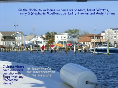
At 1740 we arrived back at the Surf City Yacht Club. We're home; the "Trip" is over! Waiting to greet us on the Surf City Docks were Mom, and club friends Newt, Terry and Stephanie , Joe, Letty and Andy.
We concluded the trip by recalling the lyrics of Jimmy Buffett (A Lovely Cruise):
We're sorry it's ending,
It's sad but it's true,
It's been a lovely cruise!
We had a great trip and met many very nice people. Still, we missed the grandchildren very much.
On the southbound portion of our trip, the winds came predominately from the south. This limited the amount of sailing we did in the few bodies of water that were deep enough for sailing. The narrow canals and ditches that make up the bulk of the waterway prevented any sailing, even if the wind was in our favor.
The story was similar on the way north. The predominant winds were out of the north. We had hoped to do some sailing on the Chesapeake Bay, but north winds meant that we motored up the bay without even taking the sail cover off.
The howling winds of the Alligator River had become a distant memory, until we reached the Solomon Islands on the western shore of the Chesapeake. The forecast for rain 20 - 25 knots of wind caused us to leave our anchorage in Mill Creek and take a slip at Zahniser's Sailing Center. We stayed for three evenings. The rain and wind didn't materialize as predicted in our location, but several boaters told us the Bay was pretty rough. We were happy we stayed.
The Solomon Islands Revisited
We in the Solomon's and it's raining. The picture is similar to our southbound stop here in that we have to contend yet again with wind and rain. Fortunately, we don't have the cold to contend with, although we fired up the heater in the evenings to take the chill out of the cabin.
We did lots of walking on this stay. Although we had rain, there were periods where we could go for walks. The Calvert Marine Museum piqued our interest when we laid over on the southbound portion of our trip. As we walked passed, the museum was packed with visitors and special displays. They were having a spring celebration of some sort or another. It has a nice collection of Chesapeake work boats, a wonderful art gallery, and a tug boat. The Museum staff operates an old Chesapeake buy boat to take people or a tour of the harbor and the Patuxent River. We were particularly impressed with the screw pile lighthouse. It is open for display and we climbed the ladder leading to the first floor living quarters. All of the rooms are painted in gray and white and looked cozy with period furniture and accessories. This floor had a wraparound deck with views from every quadrant. A rainwater collection system provided the fresh water for the light keeper. Beside the bedroom "chamber pot," an "out house" was perched outside, cantilevered off the deck and over the water below. With only a hole in the seat, the waste fell directly to the sea below. The second floor had a little room from which the light keeper could operate the fog bell by pulling on a chain. Bedrooms and storage rounded out the second floor. The third floor housed the light. A Fresnel lens, used to focus the light was in position.
On one of our excursions, we visited the "TIKI BAR." This establishment has several very large tiki's on the sand beach between some of the buildings that make up this interesting complex. Clearly, patrons of the TIKI BAR know how to party!
While tied up at Zahniser's Sailing Center, we were surprised to have a visit from Steve Flesner and his wife. Anna Marie was in the laundry room, so I gave Steve a tour of the boat. Steve is a member of the Chesapeake Catboat Association and happened to see our boat tied up to the docks. He just had to stop by to say hi!. He took several pictures and we chatted for awhile before he departed. The very next day, he sent out an e-mail to all of the CCA members telling them of his "find," and a bit about our Atlantic City Catboat. He was gracious enough to e-mail me a copy and a directory of CCA members.
Shortly after his visit, Butler Symthe stopped by. I know Butler by name as he owns a Menger 23 a boat I used to admire. We had a most pleasant conversation with Butler for an hour or so before he took his leave.
Recall that during Steve Flesner's visit Anna Marie was in the laundry facilities. During the course of the trip, she has met many interesting people while doing the laundry. Today was no exception. She met Nancy who, with her husband David, arrived in "Windrider," their home built 37' catamaran. David retired when he was 57. It took them nine years to build the boat. They keep the boat in Castleton-on-Hudson, not far from their Massachusetts home. They sailed to the keys and the Dry Tortugas and did some of the west coast of Florida before making the turn for home. Anna Marie and I were invited to look at their boat and we became fast friends.
We departed the Solomon's on the same day, about ten minutes behind them. It only took an hour or so before they were beyond the horizon. Their boat can get up and go, even when under auxiliary power. They planed stop at Tolchester on the eastern shore of the Bay. We are still amused by the fact that we spend time with people along the way, only to go our separate ways and are always pleasantly surprised when we meet up with them a few days later. On these occasions, it is always great to compare notes and share experiences.
A Triumph! Tuesday, May 9, 2006 Was A Record Setting Day
Since we spent three days in the Solomon's we opted to put in a long day and make up some distance. The forecast was for 10 to 15 knots out of the NNE with 1' to 2' seas. Upon entering the Bay, we were greeted by 15 - 20 knots and 2' - 3' seas. Matters were also complicated by a foul current. Conditions weren't ideal for the long day we had planned, but they weren't horrible. We pressed on making about 4.5 knots.
As the day wore on, conditions improved; the current turned in our favor and the seas calmed so much so that by the time we were abeam of Bloody Point Light, the seas were calm. The wind remained on the nose, but was only blowing around 5 - 10 knots.
Abeam of Tolchester, we saw the tall mast of the catamaran that was home to our new friends. We were making good progress and had a couple of hours of daylight left so, on we went.
We continued to be pushed by a favorable current and were making 6+ knots. We followed the Elk Neck Channel in the twilight and took yet another photo of a spectacular sunset. It is 730 in the bubble with only the front panel open and the evening is clear and calm.
At 2110 hours, we had the anchor down in Cabin John Creek. We entered the creek in the dark, with only the light of the moon guiding our way. We anchored in 5 � feet of water between the shores of the creek. We have gone 81.0 nm in 15:10 (15.17 hours). Both the time traveled and distance traveled record have been shattered (for this boat)! This was a long and most rewarding day. We're both OK with the time spent traveling today and extremely happy with the distance. Even though we spent much of the day fighting a foul current, we averaged a very respectable 5.3 knots.
Our progress today has put us in a position to complete the Delaware Bay Wednesday, May 10. This was important to us because after tomorrow, the forecast for the Delaware Bay and the coastal waters from Sandy Hook to Cape May was for rain and breezy conditions for the next week.
Our plan is to do the entire Delaware Bay tomorrow (another long day). We'll leave Cape May before first light on Thursday in an effort to beat the in-coming cold front.
It was amusing to note that Cabin John Creek is located on roughly the same latitude as the SCYC which is only 83 miles to the east as the crow flies. To get there, we have the Delaware Bay and the Atlantic Ocean from Cape May to Atlantic City to negotiate.
Triumph and Travail
It's Wednesday, May 10. There is a chill in the air so it's on with sweatshirts and winter jackets. We were up at 0600 and on our way to the fuel dock on the Bohemia River. This wasn't going to be an early day for two important reasons. First, this was the last fuel dock directly on our route until Cape May, and the Bohemia Bay Yacht Harbor didn't open for business until 0800. Secondly, a favorable current at Reedy Point (the Delaware Bay end of the C&D Canal) wouldn't occur until 1135.
We departed the fuel dock at 0800 and had a chilly but pleasant ride through the C&D Canal. We were passed by friends David and Nancy aboard "Windrider." We entered the Delaware River at the appropriate time and were met with the predicted favorable current. For the next five hours, our speed didn't drop below 6.5 knots and much of the time was spent over 7 knots.
The seas were calm, we were making good progress and the temperature was up to the mid 60's. By 1300 hours, we had covered 30.2 nm in 5 hours for an average of 6+ knots. The mighty Delaware Bay was being very kind to us and we were grateful.
At 1600, we were still making 6.2 knots but the wind almost instantly pricked up to 20+ knots. Almost instantly, the seas built to 3' with the occasional 4 footer thrown in for good measure.
At 1700 hours, conditions remained the same. Our progress has been reduced by 1/3rd and we are making slow progress. These last two hours haven't been pleasant. These last two hours have not been pleasant and we still have at least one hour before reaching the Cape May Canal.
By 1800 hours, the wind has backed about 15 to 20 degrees and we were in the lea of the land. The winds continued to blow, but the seas were significantly calmer.
Joyfully, we reached the Cape May Canal at 1900 hours. The waters are calm and, although we have a foul current, we only have about 20 minutes to go until we tie up to the docks at the Miss Chris Marina.
In only ten minutes, our reverie was broken when I notice heard water squirting from the engine. Somehow, the bilge below the engine was filling up with water. Could it be that we're only a day from completing our voyage and... we're sinking?
Anna Marie hooked up the emergency bilge pumpas I tried to maintain course while investigating the source of the water. It appeared that the new Yanmar engine was pumping water into the boat. Water was shooting out of a hole where the exhaust manifold mates to the engine block. This appearance was reinforced by the fact that the amount of water entering the boat seemed to be in direct proportion to the RPM's - lower RPM's = less water being pumped in and vice-versa. It appeared that stopping the engine stopped the water intrusion. Unfortunately, stopping the engine meant a loss of steerage in the narrow canal. I tried throttling up for steerage and backing off as soon as I had steerage.
Meanwhile, Anna Marie called for emergency assistance from Tow Boat/US. She told them we were taking on water and to bring pumps. The Coast Guard monitored the call and reported that two boats were underway. They would provide assistance within five minutes. Within five minutes, the Coast Guard arrived on the scene. She also received verification that TowBoat/US was underway.
As promised, the Coast Guard arrived within 5 minutes. They tied up to our port side and sent a Coast Guardsman aboard to evaluate the situation. He saw the water being pumped into the boat. He asked his mates for the tool and then asked me to shut down the engine. Anna Marie continued to operate the emergency bilge pump. Fortunately, the water level appeared to be receding.
The Coast Guard secured us to their boat until TowBoat/US arrived on the scene.
When I retarted the engine, all was fine! Amazingly, no more water was being pumped into the boat! Neither I nor the "Coastie" had a logical explanation. Anna Marie and I were thankful that the emergency was over, but we had no logical explanation for the water intrusion.
The Coast Guard personel were very professional and competent. They handled their boats well and were extremely helpful and polite. The same can be said for the TowBoat/US guy. We had a pleasant conversation while being towed to the Marina.
It was now after 2100 hours and we were both hungry. We walked across the street to the local bar and enjoyed some fresh scallops.
On Thursday, May 11, we were up at 0700 to move the boat to Utsch's Marina. They are authorized Yanmar mechanics and we were grateful that one mechanic was assigned to look at our engine immediately. After a thorough check, the mechanic said that the water did not come from the engine at all. It seems that there is a hole in the flywheel housing, and when the water reached the level of the flywheel, water, propelled by the flywheel itself, was shooting water through the hole! Thankfully, the engine was not the source of the water and it was not damaged by the intrusion of salt water. As a precautionary measure, I rinsed the engine with fresh water.
Before departing Cape May, we wanted to find the source of the water! Between us and the mechanic, we eliminated all possibilities except siphoning through the bilge pumps. In rough conditions and operating under higher RPM's, we concluded that the bilge hoses siphon the water into the boat, despite the new loops in each. The solution is to install check valves or vented loops.
We spent the rest of the day working on that project. We took time to visit David and Nancy of "Windrider." They docked at the South Jersey Marina, only a short walk from Utsch's. We made plans for dinner at the Lobster House and later that evening, we enjoyed a great meal and a couple of hours of delightful conversation. We made lose plans to meet Nancy and David for lunch tomorrow.
When we arrived in Cape May, bad weather was forecast for the next week. On Friday, May 12, the actual weather was much better than the predicted weather. The unexpected weather encouraged our friends to leave on this day and our phone call regarding lunch was taken by them while in the Atlantic off Townsend's Inlet.
We continued our project to install vented loops in the bilge hoses. While in the bilge, I replaced to starboard side scupper "T" fitting and the thru hull.
It is a bit ironic that only a couple of days after the unwanted water intrusion, I was now flooding the bilge to check the bile pump connections for leaks. After a couple of hours in the bilge, I was out and everything was working properly.
Triumph! The Last Day of Our Voyage
The Weather
The forecast for Saturday, May 13, 2006, was different than expected. Based on the weather forecasts on Wednesday and Thursday, we were prepared to stay at Utsch's Marina until next Thursday. On Friday, May 12, 2006, the forecast for Saturday called for 2' to 3' seas in 5 - 10 knots of wind out of the Southeast. The afternoon would bring a chance of showers and 1 to 3 mile visibility in patch fog. An early start might allow us to get in Absecon Inlet before the showers and fog. We even thought that sailing might be in the offing for this last day!
At wake up time (0430), conditions were calm and chilly. The eastern horizon had a glow that was the forerunner of a beautiful sunrise. We were headed for home filled with melancholy over the imminent conclusion of our cruise. The weather forecast and the early morning conditions gave us hopes for good weather and a great conclusion for our voyage.
The weather prediction was accurate to a point. When we motored out the marina and Cold Springs Inlet, we were greeter by NE winds @ 10 knots. No sailing, but there is no chop in the ocean; just long 4' rollers.
The Final 65 Miles
We were up at 0430. We wanted to get a good start and hoped to beat the afternoon chance of showers. We're up for what may be the last day of our trip!
By 0505, we had slipped our lines from Utsch's Marina in Cape My, NJ. Even though I'm not feeling well, we motored out of the marina and Cold Spring Inlet. We were very contented with the ocean conditions. Although there would be no sailing due to the NE wind @ 10 knots, we should have an easy time of motoring. Our progress was slowed by a foul current, but we were doing a respectable 5.2 knots.
At 0540, we exited the Cold Spring Inlet and entered the "Big Pond." We were happily motoring along, but I still had a major headache and a lethargic feeling. We had breakfast on the move and, because of the cold; Anna Marie made me a cup of soup. I've enjoyed the cup-o-chicken soup on chilly mornings in the past and this morning was really chilly. But I thought the soup would be just what the doctor ordered. Today's soup was almost uneatable. It tasted horrible and I couldn't finish it and had a couple of crackers instead. Not long afterwards, I began to feel overheated on this chilly morning. Within five minutes, in an effort to cool off, I removed my winter jacket, sweatshirt, and long sleeved shirt. Just minutes earlier, I was cold!
It's 1015 and what's this? FOG! FOG! FOG! Visibility is less than one mile and the wind has pricked up to 20 knots! Within � hour, we are in the soup! The chop is incredible and undisciplined. In less than an hour the chop makes holding our course difficult to near impossible. The GPS suggest we still have one hour to the Absecon Inlet sea buoy and our course fluctuates from 0 to 90 degrees. It is really rough going. To make matters worse, Anna Marie has to take the helm while I hang out over the side. I'm nauseous and feeling overheated. In five minutes, the overwhelming feeling of being overheated began to subside and I was back at the helm, feeling better and determined to get in the inlet. Was it Mal de Mar or a bad batch of chicken soup? Whatever the case, Anna Marie did a great job while at the helm. She was rightly proud of her contribution on this day. I am proud of her contribution during the entire trip. We enjoyed great teamwork!
Right on schedule, we found the Absecon Inlet sea buoy at 1200, the fog was still with us and visibility was still less than � mile. As we turned in from the sea buoy, another sailboat hailed us on the radio and inquired about the conditions. We reported that the conditions were exactly as they were at the sea buoy. The captain thanked us for the info and continued south. After fighting a foul current, we finally make it safely in the inlet where visibility increased to a mile or two.
The trip in the ditch from Atlantic City to Great Bay was most pleasant. We were protected from the 20 knot winds but progress was slowed by the foul current we'd been fighting most of the day.
As we approach the Little Egg Harbor Inlet, we re-entered the fog that has been hanging over the ocean. Once again, we navigated from buoy to buoy using compass courses plotted from the chart. As we approached Holgate, the fog limited visibility to about � mile. Our navigation in the fog was spot on as we found all of the marks without touching bottom. About 1 hour later, visibility improved and we could see clearly as we entered our home waters in Manahawkin Bay. We finished our cruise with a pleasant last few miles to the Surf City Yacht Club.
At 1740 we arrived back at the Surf City Yacht Club. We're home; the "Trip" is over! Waiting to greet us on the Surf City Docks were Mom, and club friends Newt, Terry and Stephanie , Joe, Letty and Andy.
We concluded the trip by recalling the lyrics of Jimmy Buffett (A Lovely Cruise):
We're sorry it's ending,
It's sad but it's true,
It's been a lovely cruise!
We had a great trip and met many very nice people. Still, we missed the grandchildren very much.
Stories from the Aligator River Marina
30 April 2006
Bill
THE ALLIGATOR BITES - The Rest of the Story
Good news - we can report that our heart rates have slowed down some since our April 28 experiences on the Alligator River. We told you what happened to us. Now, the rest of the story:
The winds blew strong for about five days from April 25 to April 30. Out in the ocean, there were high seas and rip currents along the shore - ten foot waves in the surf and 28 foot waves in the Gulf Stream. The rivers and bays (sounds) were bad as well. The worst days seemed to be April 28 and 29. On those days, there following stories unfolded for all to hear on the VHF radio.
First, a 32' sailboat "Maryah" became disabled in the Alligator River. Winds were at 32 knots and the boat was helpless. She had lost power and steerage. Calls to Sea Tow (a boat towing service) went unanswered and cell phone service was unavailable. Fortunately, a trawler stood by the distressed vessel and urgent messages were relayed up the river from boat to boat until one had a working cell. Sea Tow was contacted. They launched the rescue boat using the ramp in the at our (Alligator River) marina. Several hours later, the boat was towed in to the marina and the two sailors aboard were safe after a harrowing experience.
Meanwhile, out in the ocean, one could hear a conversation between a sailor and the Coast Guard. The sailor was solo on his boat, but had no power and was taking on water. He asked the Coast Guard for assistance. The Coast Guard asked the captain if he was prepared to abandon his boat. He said no, with some assistance, he felt that he could get the boat running again. The Coast Guard told the gentleman that they would not send a boat out in this weather unless he was prepared to abandon his vessel. He reluctantly agreed. (One sailor in our group happened to have his insurance policy on board and discovered that the insurance was null and void should the vessel be abandoned).
During another distress call, a couple reported that their 43' Silverton Motor Yacht had just sunk near mile marker 75 in the Albemarle Sound. They were able to get in their dinghy with only a hand held VHF radio. They reported that they were clinging to a buoy in the sound and that they were cold and tired and were not sure how long they could hang on. The Coast Guard was able to rescue the people and put them ashore in our marina. The only things the couple had were the clothes on their backs and that VHF radio. Boaters in the marina gave them some clothes and took up a collection to give them a little money. The sheriff picked them up and took them to a motel. Apparently, the Silverton was banging into the waves and after reaching the crest of one large wave, the boat pounded and shuttered. The bow split open and in seconds, the boat was on the bottom.
On the morning of May 1, the winds continued to blow but not as strong. All of the boaters left the marina and anchorages where they waited out the blow. As they traveled northward, we could hear reports of the eerie sight of the Silverton, resting on the bottom with its pilothouse above water, as they traveled the Albemarle Sound on their way to the Virginia Cut.
We were up early on May 1 and headed of out the marina at 0620. At about 0735, we reached the Albemarle Sound and were greeted by 20 knot winds and 3 foot seas. Were we had been doing a respectable 5 knots in the river; in the Sound, we were barely making 3 knots. This would make for a long passage in rough water. We turned around and went back to the marina. At 1115, we departed for the second time that day and found that the winds had dropped to 5 - 10 knots and the seas were about 2 feet. As we crossed, the seas flattened out and we had a great day. We arrived in Elizabeth City at 1700, joining some friends who had left the marina earlier in the day.
And now you know the rest of the story!
To the Aligator River Marina
29 April 2006
Bill
OUR OLFACTORY SENSES WERE CONFUSED
In the last issue we reported that we were getting so close to home that "we could almost smell the Jersey Shore!" Turns out that it wasn't the Jersey Shore we smelled. I think our olfactory senses were deceived by the seashore community of Surf City, North Carolina! At the time, we were still about 600 miles from the real Surf City in NJ.
Skeptics among you may question why I would label Surf City, NJ as the real "Surf City." After all there are Surf Cities all over the country. The reason is simple. After a particularly fun filled vacation to the fabulous NJ shore community the pop duo of the sixties, Jan and Dean, wrote, recorded and had a number 1 hit with their song, "Surf City." From then on, Surf City, NJ became the real Surf City! At least that's the way I remember it!
OUR VISIT WITH PRETTY MARJE AND FAMILY!
It's always fun to meet new people and make new friends. We were excited this particular day. Our plan was to travel a short distance (14 nm) on the waterway. We had reservations for a slip in Dudley Marina in Cedar Point, near Swansboro NC. Directly across the waterway is Emerald Isle, the long time home of parents of our friends from SCYC. We were excited to meet Willis' & Lucille's family.
We coordinated our arrival with Willis's sister Marjorie. She exuded energy over the phone and we knew right a way that it would be a wonderful visit. Marje met us on the fuel dock and was genuinely excited to meet us. The feeling was mutual. She exuded as much energy in person as she did on the phone. She certainly seemed to be a person who celebrates life to the fullest. She happily accepted our offer to "sail" with for the short ride to our slip. We gave her a tour of the boat and discovered that she has yet to see Lucille & Willis' boat. Their "Calico Cat" is an Atlantic City Catboat (hull number 110) just like ours. Coincidently, ours is hull number 109!
On the ride to her parent's house, we were saddened to learn that her (and Willis's) father (Bud) had passed away in late January. I couldn't help but think that it would have been our honor to have met him and except for our southbound navigational error (we passed Emerald Isle without even knowing it), we would have. Our condolences are offered to the entire family.
We enjoyed great conversation with Marje and her mother (Roma). Unfortunately, Marje's husband BR had to work. Other than exchanging pleasantries, we weren't able to spend time with him.
While explaining how we came up with the name for our boat, "Fodder's Cat," she explained how she was given the moniker, "Pretty Marje." She is, now and forever, Pretty Marje in our book too! After lunch, we checked out the family's pier that juts out into Bogue Sound. We watched Harrier jets do touch and go practice across the sound. We followed this with a trip to the beach followed by a stroll on the fishing pier. We were a bit surprised when Marje asked us to follow her lead and wave our arms high in the air. Before we could ask aloud why we were doing this, she explained that the pier had a web cam and we were in fact waving to her little sister Lois. A quick call on the cell phone to sister Lois had her checking us out on the web cam... Way Kewel!
Back home we enjoyed showers and a sumptuous dinner featuring a delicious leg of lamb, mint jelly and the best gravy ever made. We shared stories of our adventure and Roma shared stories of her motorhome travels and experiences. We had delightful conversation for hours. Soon, it was past Mom's bedtime and she bid us a fond farewell and a safe voyage home. Sadly it was also time for us to return to the boat to prepare for tomorrow's departure and then hit the sack. The day had gone by much too quickly!
Pretty Marje walked us down the dock at Dudley's Marina where we exchanged fond farewells. We had a terrific time and promised to return on our next voyage south!
THE ALLIGATOR BITES!
On April 28, we navigated the Neuse River in 20 knots of wind gusting to 25. The river was lumpy but not too bad. We were grateful for the few miles of protection we enjoyed in the canal that joins the Neuse and Pungo Rivers. We exited the canal into the wide open waters of the Pungo River where we experienced winds of 20 knots accompanied by gusts to 25 again. The trip wasn't too bad. Navigating in the higher wind strengths require more concentration and attention to the marks. One is also required to maintain a stern grip on the wheel. Senses are heightened and casual conversation is less frequent.
On this day, we were glad to make the Alligator-Pungo Canal and the refuge from the wind that it offered. We also wanted to make as much progress as possible toward the Alligator River which we would navigate tomorrow. Our hope was to get to Elizabeth City. The weather forecast for April 29 called for cool temperatures, lots of sunshine and high winds. The forecast said the winds would start out at 10 - 15 knots (we go out in winds of that strength all the time). During the course of the day, the winds would build to 20 to 25 knots and later in the afternoon, to 25 - 30 knots (we do not venture out in winds of that strength). Our little catboat doesn't have the waterline length to made traveling in 25 knot winds very comfortable.
The forecast "encouraged" us to travel deep into the Alligator-Pungo Canal. We anchored about 7 miles from the east end of the canal in the little Fairfield Canal. The Fairfield Canal runs north and south and bisects the A-P Canal at the Fairfield High Rise Bridge. The Fairfield canal is little, probably about 50 - 60 feet wide. Considering our boat's 24 foot length, the five feet for the rudder and the three feet for the bow sprit, we could only set out about 20 feet of anchor rode before we "touched" the far bank. We were snuggled about 100 feet into the Fairfield Canal. Our anchorage was well protected from the 20 knot winds that were blowing overhead. The eastern bank is a cypress swamp (not many cypress tress left, but other wetland trees gave good protection). The western bank probably was a cypress swamp at one time, but apparently was the staging area for the construction of the bridge. There are all sorts of grasses and low lying trees and the bridge itself offers some protection from the wind. We were and have been in north winds for several days, so we were thankful that the trees on the eastern bank offered great protection. The wind was howling when we arrived, but it was blowing over the tree tops. Down on the water, we experienced vary calm conditions. We slept soundly in a motionless boat on calm water, although we could hear the howling winds. Sometime in the wee early hours, the winds stopped blowing. Sadly, this cessation was temporary.
At 0520 on April 29, we happily awoke. The wind forecast hadn't changed. Our hope and intent was to beat the stronger winds, thus the early rise time. We completed our chores in record time and planned to enjoy breakfast while underway. We believed that making Elizabeth City was out of the question so we would try to make the Alligator River Marina. Only 30 miles from Elizabeth City, the marina would make a good spot to wait for the wind to calm and give us an easy day to make Elizabeth City. If the wind prevented us from making the marina, there were several anchorages along the way. If need be, we could seek refuge at the closest one.
By 0545, the anchor was up! We exited the little Fairfield Canal and re-entered the Alligator-Pungo Canal. The Alligator-Pungo doesn't run north and south as one might think, but rather east and west. We departed the anchorage in calm conditions and a relatively glassy water surface. Because of the cool (48o) temperature, the water had a swirling gray mist over it. The sun rose bright and clear, we were motoring along at about 6 knots. It was a lovely scene.
At 0600, the wind began to blow at 7 knots. We were still on the protected waters of the Allligator-Pungo Canal. We remained hopeful that we could make the Alligator River Marina at MM 81 before the wind pipes up to the 25 to 30 knots predicted for the afternoon.
At 0705, we exited the Alligator-Pugo Canal and entered the protected portion of the Alligator River. Along this stretch, we passed four boats anchored at the Tuckahoe Point anchorage and six more at the Deep Point anchorage that we used on the way south. Like the old Tortoise, our "speed" is slow and methodical. Our speed is not in measured miles per hour but miles per day. Given enough hours, we can catch anybody. The wind picked up to 15 to 20 knots. We were riding very comfortably and continued to be hopeful of making our destination before things turned snotty.
At about 0800, the river turns northward. It is wide open and the fetch runs all the way from Elizabeth City. The wind strength increased to 20 - 25 knots and the short, steep chop was building. We were still handling the conditions well as we carefully weighed our options. We were prepared to go to the nearest anchorage if the forecasted high winds materialized sooner than predicted. At 2500 RPM's, we were making slow progress, about 4.5 knots occasionally slowed to 3.5 knots by the chop.
Around 1000 hours, the winds increased to 25 - 30 knots with gusts to 32. This wasn't supposed to happen until later in the afternoon. Our little catboat wasn't made for these conditions. I goosed the throttle to 3000 RPMs. She dug in and our speed increased to 5.5 knots. After awhile, the chop, influenced by the increased winds, became steeper and our speed slowed into the 4 knot range and less than four when pounding in the chop. Spray was flying everywhere and the boat was bouncing unmercifully. We were only 1 hour from our chosen destination and about 20 - 25 minutes to the closest anchorage. We decided to plug on because the forecast predicted high winds through Monday. It is very likely that wherever we stopped today would be our home for a while. We usually don't stay on the hook for more than a couple of days because we have no way of recharging the batteries other than running the motor. We also reckoned that if we were tied up in a slip for a few days, we would be able to go for walks and do some things. The anchorages along the way are remote and, even if we inflated the dinghy, there would be no place to go in it. We also had to reckon with the fact that the route to the anchorage would put our beam to the sea. This would cause us to roll horribly for at least 30 minutes until we got into the quiet of the anchorage.
We made the difficult choice to plug on for the hour or so it would take to get to the marina. We were actually doing very well for such a small boat. Our speed was slow, but respectable. We were bobbing around like a cork, but the motion wasn't horrible. We took a lot of spray, some of it completely over the dodger. Every other wave splashed the dodger windshield with gallons of spray. The spray reduced visibility to almost nothing, until it could run off the window. The temperature was falling and visibility became restricted not only by the spray but by condensation that formed on the inside of the window. Anna Marie had to wipe the condensation off frequently so I could see where we were going. This was going to be a long hour.
The hour could have been longer than we thought. Before reaching our destination, we had to pass through a swing bridge that doesn't open if the winds exceed 35 knots. Since we were experiencing gusts to 32 knots, we became concerned that it might get shut down by the wind. We held our collective breath for that last hour and only breathed a huge sigh of relief when we passed through the swing bridge at 1100 hours. We put our beam to the wind and seas and traveled the last 1000 yards into the marina where we nestled up to the fuel dock. We were inside the marina, safe and sound. Our plan was to top off the fuel tank and motor over to a slip.
The fuel dock was perpendicular to the wind, now at 30 knots, we were effectively pinned to a lee dock. Anna Marie held the bow while I powered forward to get the stern out. Several other boaters came to help. They took Anna Marie's place while she hopped on board. Once I got the stern out, I powered out in reverse. The wind was strong but we were slowly making progress. We were able to get off and calmly pulled into a slip that faced the wind. Tying up was a piece of cake and we were "home" in no time.
We spent the rest of the afternoon helping other boats tie up. Several had intended to cross the Albemarle Sound, only to retreat back to this marina. One sailor had to be "rescued" by Sea Tow. It seems he lost power during the blow. Sea Tow towed him ten miles to this marina.
Several boats took on water. One relatively new Catalina 38 had a soaked interior. Cushions, clothes and various other items were laid out in the sunshine in hopes that they would dry by the evening.
The wind continues to blow at 30 knots and promises to do so for two more days. We are rocking in the slip, but I believe the motion rocked us to a sound sleep last night. The weather forecast indicates that the winds will be 25 - 30 knots through Monday evening. It looks like we'll be staying here until Tuesday!
DISTANCE TO HOME
At this juncture, we're only 81 miles from the Chesapeake Bay and about 400 miles from home. It won't be long until we are home!
Myrtle Beach to Carolina State Park Marina
23 April 2006
Bill
Our adventure continues after an enjoyable stay in Myrtle Beach, SC. We had great fun on the beach, in the pool (the water was a bit chilly) and doing "touristy" things. The grandkids were great fun no matter what we were doing.
We are underway again and can almost smell the Jersey shore! We are docked at Carolina Beach State Park Marina which is located at mile marker 297 on the ICW. That means we only have 297 miles to Hospital Point in Norfolk, VA which is only a stone's throw (OK - it's a rather long stone's throw) to the Chesapeake Bay, not that we're in a hurry mind you.
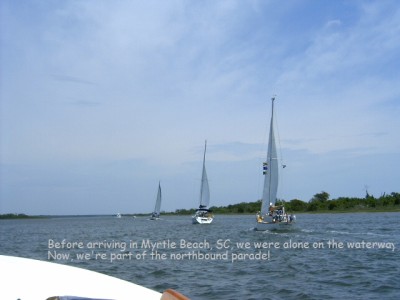
Our travel today marked a milestone of sorts. We were among 8 sailboats waiting for passage through the Sunset Beach Pontoon Swing Bridge (MM 337). This is the first time that we've been in a parade of north bound vessels. We haven't been cruising with other boats since the south bound leg before the holidays. Although we were near the back of the pack today, we did manage to pass two boats and managed to stay within a mile of the boat in front of us.
As we were north bound on the Cape Fear River, a naval warship was heading south, escorted by two Coast Guard boats. We pinched our way to the edge of the channel and after passing us, the CG boat complete with machine guns, turned and positioned itself between us and the warship, matching us stride for stride, until we were well clear. This was similar to our south bound encounter with a nuclear submarine. It is yet another reminder that times have changed.
While on the Cape Fear River, we remembered fondly the prognostication from one of our fellow sailors on the trip south. This person assured us that the weather would get warmer once we got south of the Cape Fear River. This prognostication was spot on. We only hope that the reverse isn't true.
Anna Marie completes her 58th trip around the sun tomorrow. We'll make it a special occasion by taking a long nature walk in this park before we leave.
We are underway again and can almost smell the Jersey shore! We are docked at Carolina Beach State Park Marina which is located at mile marker 297 on the ICW. That means we only have 297 miles to Hospital Point in Norfolk, VA which is only a stone's throw (OK - it's a rather long stone's throw) to the Chesapeake Bay, not that we're in a hurry mind you.
Our travel today marked a milestone of sorts. We were among 8 sailboats waiting for passage through the Sunset Beach Pontoon Swing Bridge (MM 337). This is the first time that we've been in a parade of north bound vessels. We haven't been cruising with other boats since the south bound leg before the holidays. Although we were near the back of the pack today, we did manage to pass two boats and managed to stay within a mile of the boat in front of us.
As we were north bound on the Cape Fear River, a naval warship was heading south, escorted by two Coast Guard boats. We pinched our way to the edge of the channel and after passing us, the CG boat complete with machine guns, turned and positioned itself between us and the warship, matching us stride for stride, until we were well clear. This was similar to our south bound encounter with a nuclear submarine. It is yet another reminder that times have changed.
While on the Cape Fear River, we remembered fondly the prognostication from one of our fellow sailors on the trip south. This person assured us that the weather would get warmer once we got south of the Cape Fear River. This prognostication was spot on. We only hope that the reverse isn't true.
Anna Marie completes her 58th trip around the sun tomorrow. We'll make it a special occasion by taking a long nature walk in this park before we leave.
Vero Beach, FL to Myrtle Beach, SC
10 April 2006
Bill
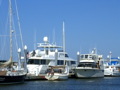
In our attempt to get to Myrtle Beach for Easter, we have put in longer days on the water. On the 30th of March we put the anchor down in Titusville, FL. We covered the 64 nautical miles from Vero Beach in 11 � hours. Right after the anchor was set we had dinner, worked on our logs, and hit the sack.
On the 31st we stopped at the Seven Seas Marina in Daytona Beach. At 80 cents per foot, the marina has the most reasonable docking fee that we have experienced. But, that's not the only reason we stopped there. The marina is only about two blocks from the famed beach at Daytona Beach. Once tied up and after completing our chores, we took a long walk on the beach. It was a warm day and there were many folks enjoying everything that beach has to offer. Some cruised by in cars, others rode bicycles, others rented golf carts as a means of conveyance along the beach, still others, like us, walked and there were lots of people enjoying the surf. Life guards were on duty and the "rip current" flags were flying. There were quite a few "red" bodies (haven't they heard about the invention of sunscreen?).
From Daytona Beach, we blitzed by St. Augustine. Actually, blitzed may not accurately describe our passage through the oldest US city. As it happens, they are building another bridge adjacent to the Bridge of Lions Bascule Bridge. A tug and barge had taken up a position in the waters under the opening span of the bridge. A crane was lifting steel for the new bridge. We circled for over an hour and one-half, waiting for the bridge to open. When it finally did, we went through and on to an anchorage behind Pine Island. We used this anchorage on our way south. Pine Island has a nesting pair of Bald Eagles that we saw on our way south. We were please to see the bald eagles were still there.
On the day, we traveled 63 nm in 12 hours. It was another long but fulfilling day.
From Pine Island, we went all the way to Cumberland Island, Georgia, We did a total of 40 nm in 9 � hours. We were hoping to stop at Palm Cove Marina in Jacksonville, FL to meet with Captain Dan Parker, who did a lot of terrific work on the boat while we were home. Alas, our scheduled didn't permit us to stop, but we are indebted to Captain Dan for the service he provided. We have a much better and a much nicer boat because of his efforts. Thank you Captain Dan! We haven't forgotten about our dinner invitation and expect to see you in Jacksonville in the not too distant future.
From the anchorage at Cumberland Island, GA, we had a short day to Jekyll Island, GA. On the day, we traveled 25 nm in 4 � hours. Once there, we borrowed marina bikes and toured the grounds of the Jekyll Island Club. We also purchased the fixin's for a "Low Country Boil," and dined in style on the boat that evening.
On April 4, we departed Jekyll Island Harbor Marina for points north. Our chosen anchorage was 51 nm away and we made it there in 9.7 hours. We shared the "Cattle Pen Creek anchorage with two other boats. To date, we seem to be cruising north with power boats and trawlers. They always pass us sometime during the day, and we seem to catch most of them at the anchorage. The two boats in this anchorage had passed us hours before on the ICW. We haven't encountered any north bound sailboats yet. We suppose they are still in the islands.
Our next anchorage was in Bull Creek, across the ICW from Daufuskie Island on the Western shore and about 5 miles South of Hilton Head. We were in South Carolina and getting very close to our destination (Myrtle Beach). About 1500 feet from our anchorage, a forest/marsh fire was slowly dying out. The winds kept fanning the flames and we watched several trees be consumed by the blaze. Fortunately, the wind blew the smoke away from the anchorage. This is the third fire we've seen on our trip.
Several tour boats came up the creek, we suppose to view the fire or the sunset. Our money was on the sunset which was spectacular. In the morning, we could still see several orange "hot spots" at the fire scene as we motored out of the anchorage.
It's April 6, 2006, and we're on our way to Beaufort, SC. We have a reservation for a slip at Lady's Island Marina. Today will be a relatively short day as we only have 27 miles to cover. The trip through Callibogue and Port Royal Sounds was uneventful. The winds were light and the experience was much different. On the trip south, we had a foul current and 15-20 knot winds on the nose. It was a very slow trip compared to today's crossings.
After tying up at the marina, we walked to the historic town of Beaufort. It boasts many antebellum houses and has a nice array of shops and restaurants. After doing some window shopping, we walked back across the Lady's Island Swing Bridge to the marina. All told, we probably walked about 2 � miles on the day. Once across the bridge, we stopped at the local health food store for some fresh, organic fruits and vegetables.
Friends from Mariner's Marina in Barnegat, BJ moved to Beaufort in 2000. We were please the were able to meet us for dinner. We met at the boat and after quick greetings, they whisked us off the Barbara Jean's Restaurant for some southern cooking.
After bidding farewell to our hosts, we walked to the local cinema where we saw the movie "Failure to Launch." It was funny in spots but I wouldn't call it a great movie, perhaps mildly entertaining would be an apt description.
The next day, we motored all the way to Charlestown, SC. We covered 62 nm in just under 12 hours. Two factors entered into our decision to put in such a long day. First, we are trying to get to Myrtle Beach for Easter week (actually, we want to get there sometime during the week before Easter). Secondly, and more importantly, a cold front is predicted to go through the area sometime on Saturday, Saturday night and into Sunday morning. The forecast for strong winds and small craft warnings made us want to be securely tied up to a dock when the front passed. We chose to tie up in Charleston because, although strong winds (25 - 35 knots), rain and thunderstorms are predicted, both Saturday and Sunday promise to have some sunshine. Being tied up in Charlestown will allow us to walk the waterfront and parks that make it such a picturesque town.
Saturday morning began bright and windy (15 - 20 knots) with small craft warnings posted. None-the-less, boats participating in Charlestown Race Week headed out for a day of competitive sailing. We walked from about 1000 to 1600, stopping for coffee, lunch and the IMAX 3-D movie "Deep Sea." We continue to enjoy and be amazed by 3-D movies!
We arrived back at the boat a 1600 where we tidied up for the impending storm. At 1630, the skies darkened and a torrential downpour ensued. We were snug in our bubble watching the large boats and mega yachts on the outside of the dock rock and roll with the wind. There were sustained winds of 35 knots with higher gusts. We were happy to be on an inside dock but the strong winds had our little boat dancing right along with the big boys on the outside.
When we went to bed, the wind was still a sustained 30 knots. At about 0300, the winds had subsided to about 20 knots and the dance was all but over. We awoke to an angry looking sky, but by 0800, it was clear and sunny. The wind was still blowing 20 knots, but there were times when it dropped to 10 knots. The forecast for the rest of the day was for North East winds of 10 - 20 knots. Anna Marie and I began to debate whether we should stay another day of leave. The wind forecast for the next day was for 10 - 15 knots out of the Northeast. After careful consideration, we decided to slip our lines and depart Charlestown. We were on the move by 1200. The trip to our anchorage in Five Fathom Creek was uneventful. As predicted, the winds diminished to 5 - 10 knots by the early evening. We were securely anchored and finishing dinner when another sailboat (Tartan 30 "Celeste"), which we passed in Charleston Harbor, arrived at the anchorage a full hour after us! Do we ever like our new Yanmar! This may be the first time since the trip began that we beat another boat to an anchorage.
Today, we arrived at Osprey Marina, just outside of Myrtle Beach. We'll be here for 10 days, while we visit with Sandi, Matt and Joshie. On Saturday, April 14, Shelley, Greg, Geoffrey, Claire and Madison will be in from NJ to make a full Easter family reunion for the first time since Christmas. Only Mom will be absent as she is still in Texas visiting my sister. We will miss her at the gathering, but look forward to seeing her at home in NJ when we arrive sometime in May.
| Vessel Name: | Fodders Cat |
| Vessel Make/Model: | Atlantic City 24 Catboat |
| Hailing Port: | West Creek, NJ |
| Crew: | Bill and Anna Marie |
Gallery not available
Fodders Cat
Who: Bill and Anna Marie
Port: West Creek, NJ