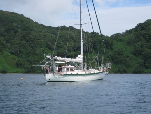
Cruising Active Transport
We circumnavigated between 2008 and 2014. After sailing to Alaska we ended up in Seattle for four years.
19 September 2018
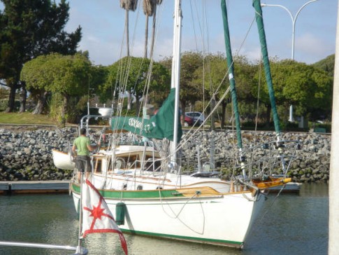
08 August 2018 | Marina del Rey
23 July 2018 | Marina del Rey
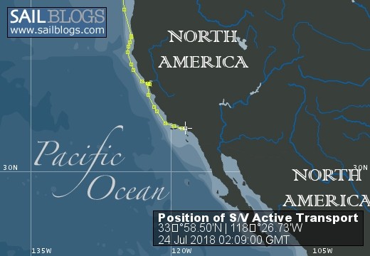
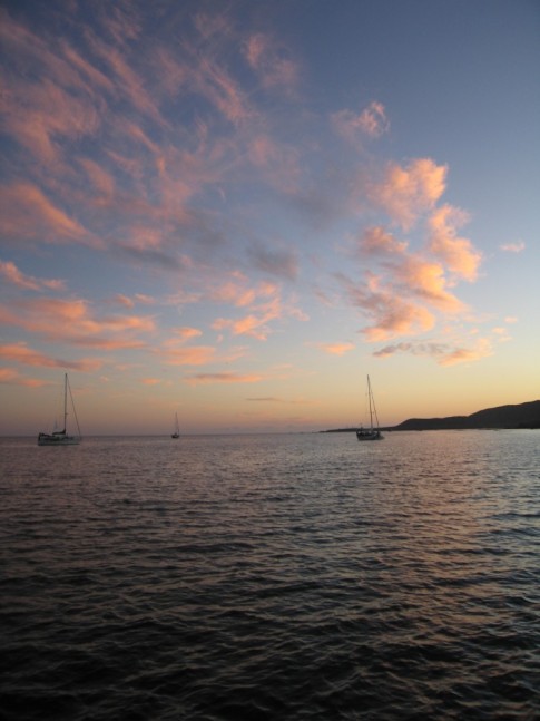
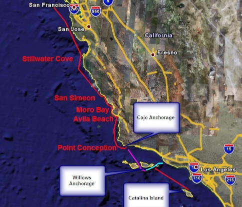
22 July 2018 | 25 miles west of Cambria
21 July 2018 | Crossing Monterey Bay
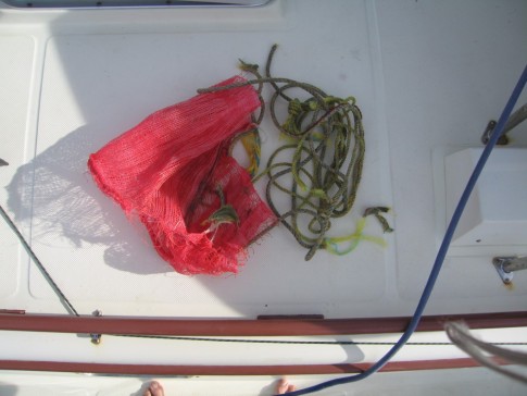
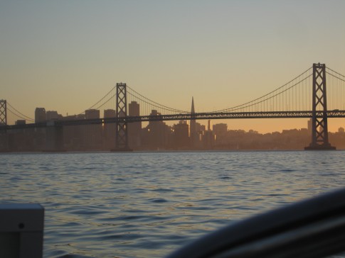
21 July 2018 | South of the Golden Gate
16 July 2018
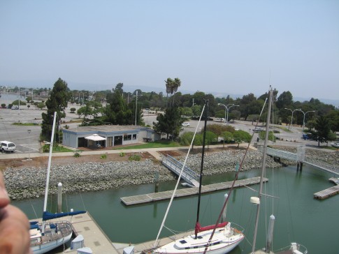
14 July 2018 | Grand Marina
14 July 2018 | San Francisco Bay
13 July 2018 | Point Arena
12 July 2018 | Thirty Miles NW of Humbolt Bay, CA
11 July 2018 | Crescent City
10 July 2018 | Neah Bay
09 July 2018 | Thirty five miles WNW of Reedsport, Oregon
08 July 2018 | Forty Miles West of Columbia River Entrance
07 July 2018 | Neah Bay
06 July 2018 | Neah Bay Marina
05 July 2018 | Neah Bay Marina
04 July 2018
03 July 2018 | Port Angeles City Floats
A Second Trip Through the Canal
27 July 2013 | Panam
John
We met some folks on an Australian boat named Alessandra who were getting ready to go through the canal. After our year in Australia we anticipate the Aussies will be friendly and easy to get along with so we volunteered to serve as line handlers for their transit of the canal. It had been 5 years since we had been through on another boat that did the south to north transit and we figured the experience would serve us well when we take Active Transport through in October.
The skipper, Andrew, was doing his third transit of the canal. He has been in the business of buying boats out of the charter trade in the west indies and sailing them to Australia where he can get a lot more for them.
His second in command was a young woman named Jo who claimed to be Tasmanian but lacked evidence of the neck scars that are supposed to be identifying. She grew up sailing on the Derwent near Hobart and had just completed her yacht master training in Gibraltar.
We are not the only people who found Australia expensive (but worth it). She said the program she went through cost her $10,000 in Gibraltar but would have been $20,000 in Australia and she would not have been able to live on the boats in Australia. In the Gibraltar program she got to cruise the coast of Portugal while living on the boat. Not bad.
The third member of the crew was an American named John from Philadelphia. He was a vegetarian which was going to make provisioning for a Pacific crossing an interesting challenge. He also liked to complain a lot which is always an attractive characteristic in a shipmate. I'm skeptical about how that sort of interpersonal approach to things will work with Aussies.
Alessandra was transiting from the Caribbean to the Pacific. Most of us think of that as traveling from East to West but in the Panama canal parlance that is a trip from North to South. Look it up on google earth. The canal runs almost directly North South.
When a yacht transits the canal it must have an adviser on board, as opposed to a pilot which is required for the big ships. Advisers are canal employees who take on the adviser role as a source of extra income. Some have boating experience and others don't. They are trained in the proper procedures for taking a yacht through the canal and with the proper communication protocols but don't always have the seaman like skills you might expect. We got some of both types on our transit and I would actually say that the less seaman like guy did a better job of instructing everyone regarding what to expect.
The Canal has a daily operating schedule that starts with the northbound traffic in the morning and the southbound traffic is run through in the afternoon. The choke point is the Galliard cut which is a long straight part of the canal that cuts through the continental divide. Its a little too narrow to allow two panamax ships to pass in the cut. Technically there is enough room but the pilots refuse to do it. They think it's too risky.
So the strategy is to get all the north bound traffic into Gatun lake and then start sending the southbound traffic through. That works fine for big ships that can steam along a 10 or more knots but yachts cant go fast enough to get out the other end before dark. The canal authority requires southbound yachts to spend the night in the Lake and finish the transit the next day.
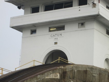
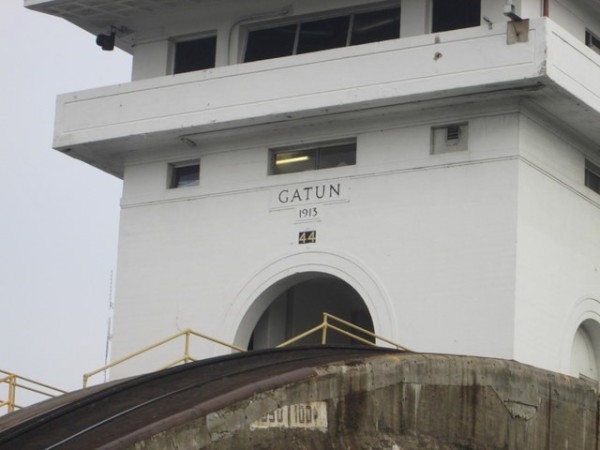
So we got started in the middle of the afternoon, went through the 3 Gatun locks that took us up the 85 feet to the level of the lake and then tied off to a mooring buoy for the night.
We got started again the following morning and were in the Pacific ocean by mid afternoon.
Our adviser for the first day was a guy named Ricardo and he brought along a trainee named Narciso (sp?). Narciso was on his last training transit and would be a qualified adviser at the end of the day.
Ricardo must have been an accountant or some similar type of employee because he did not have any of the instincts about how to manage lines that come with experience. But he did a very good job of explaining what was going to happen. That was probably because he learned it so recently that he realized that everyone was not born with the knowledge. At one point he really scared me when he started to cleat a line with a load on it He put his thumb on the inside of the line against the cleat. Nothing happened but it sure could have been a problem.
Richardo did get some dirty looks from the shore side line handlers. He was not shy about telling them what to do. From my perspective I thought that showed that he was a strong advocate for the safety of the yacht and they guys on shore resented being told what to do. Too bad.
Ricardo did have a great system to tying us to the mooring buoy. I continue to learn from everyone I sail with. As with most things in life, attitude goes a long way toward making up for any shortcomings any of us have and Ricardo has a great attitude.
We were surprised that there were no mosquitoes on the lake. We were expecting an onslaught with all the fresh water around.
The next morning the pilot boat, with our next adviser, showed up an hour late. Why they were late was never made clear but it was no big deal since we had plenty of time to get through the canal before dark.
From our mooring near the lake side of the Gatun locks it was almost a five hour motor across the lake and through the Galliard cut before we entered the locks that were going to take us down to the Pacific ocean.
When Shawn and I went through the canal in 2009 they were dynamiting the sides of the Galliard cut to widen it. The dynamite barge was not there this time but there were several dredges at work which I assume was a continuation of the same project.
The canal authority is building new locks to allow larger ships through the canal and the cut would have been an even worse bottleneck when the bigger ships started coming through. So the widening project is a critical part of their long term strategy to increase throughput. It's impressive what careful planning people do when they are thinking about projects that require cutting trenches through a continent.
We learned a lot on this second trip through the canal.
The first time we were fascinated tourists viewing one of the engineering wonders of the world. This time we were old pros and more observant of the details.
The locking up process is a lot more demanding on the line handlers on the yacht. The water rushing in from below, as the lock fills, pushes the yacht around a lot and the fin keel Benateau we were on did like to dance. The line handlers on the yacht must continually haul in on the lines as the boat rises and that requires that the 4 line handlers coordinate their efforts. The line handlers in the cockpit usually put their lines around the sheet winches and have a significant mechanical advantage over those of the foredeck. If the skipper does not pay attention the handlers in the back can pull control away from those in the front and the boat will end up misaligned as it rises.
There are three lock chambers in the Gatun lock so within an hour and a half we were lifted three times until we were 85 feet above sea level and could motor out into the lake. It was really strange to look back at the Caribbean sea several stories below us.
Ricardo was on top of the entire process. He was the most attentive adviser Shawn and I have experienced on our two transits and a really good choice to train new advisers.
Locking down is easy by comparison. The water drains from the lock much more gently than it enters on the up side. All the line handlers have to do is let the lines out slowly as the level of the water falls. Its a very mellow process.
Our adviser for that part of the transit was Alejandro who is qualified as a tug boat captain. He is soon to be through the qualification process to drive tugs in the canal. So he had a lot of hours on boats, to his credit, and tended to be a bit more blasé about things. Like many of us who have spent a lot of time on boats he probably forgot that everyone did not learn all this line handling stuff in kindergarten.
About halfway across the lake Alejandro asked if it was OK if he took off his jeans and just wore shorts. It was hotter than hell and it really seemed silly for him to be wearing jeans in the first place. But Panama still has a lot of customs that date from another age. We were cautioned to wear long pants and collared shits if we have to visit government offices and that some business will not accept customers in shorts. Alejandro did not, however, abandon the long sleeve jersey of the Panamanian soccer team that had just kicked Mexico's butt.
I experienced this same strange formality tradition at the DHL office in Peru. I had to get my cab driver to take me to a mall to buy long pants or they would not let me in the DHL compound near the Lima airport. They were admitting lots of guys with three day old beards and terminal BO but those guys were wearing long pants. Go figure.
I could not help but think that when Alejandro's generation is in charge the long pants thing will fall by the wayside pretty quickly. Maybe compulsory Panamanian soccer jerseys will be required instead.
One thing we did notice on this trip through is that the maintenance on the locks seems to be slipping. It 's possible that we did not notice those sorts of details on our way through the first time , but I don's think so.
We were told that the new locks were supposed to come on line this year and that the plan is to close the old locks for a couple of years for maintenance work. Now the new locks are scheduled to open next year. Projects of that magnitude are always full of surprises. They seem to be doing a better job of staying on schedule for the new locks than Caltrans is doing on the new bay bridge. If the plan was to shut down the old locks this year it would make sense to defer maintenance until the big rework could be done but with the delay in the new locks the maintenance issue looks like more of a problem.
The metal surfaces on the gates for the locks were in need of paint.. Buildings around the locks needed paint, or at least cleaning. We saw breaks in the concrete walls of the lock chambers where water entered when the level was high and poured back out when the level fell. We had the impression that there was a lot of erosion going on behind those 100 year old walls.
The first time we went through the canal the maintenance seemed to be first rate. That was 5 years ago.
Ill close with some observations about the cost of yachts transiting the canal. Ill probably hear a lot of crap from other cruisers about this but I think the cost of taking a yacht through the Panama canal is incredibly cheap.
The toll for taking a yacht of less than 50 feet through the canal is $800. There are a few other fees (measurement and security related) that drive the cost up to a little over $1000.
For this $1000 the yacht owner gets a full man day of the services of an adviser, several hours of the services of 4 on shore line handlers per lock (12 people) and the use of the incredibly expensive equipment that controls the gates and the inflow and outflow of water in the chambers. It takes four trips by pilot boats to deliver and retrieve the advisers for a North to South transit.
The ship that shared the Gatun locks with us probably paid somewhere near $100,000 to get through the canal and we rode in the same locks for $1000.
On top of that is the volume of water need to operate the locks. We went through all of the three down locks by ourselves. There was not ship in the lock with us. If there is a ship in the lock the ship displaces a lot of water. A yacht displaces next to nothing. So it takes a lot more water to get a yacht through the canal than a big ship.
They put us through the locks alone because the ship we were supposed lock down with was late. I'm sure the canal operators did not want to have to deal with amateur yachties after dark. So they got us on our way and our of their hair. who could blame them.
This time of year the lake that provides the water to operate the locks is full. Its the rainy season. If they did not use the water to lock us through by ourselves the water would have spilled over the Gatun dam and into the Caribbean. In the dry season I doubt they would be o quick to lock a yacht through on its own.
If you look at the value of a canal transit for a yacht the bargain is even more obvious. It would cost a yacht our size tens of thousands of dollars to sail down the east coast of South America, cross through the absolutely worst oceans on the planet to get around Cape Horn and then spend months getting back up the west coast of south America.
Im not sure how the Canal marketing folks come up with the pricing structure for pleasure boats but I think the market would tolerate a much steeper toll for yachts. We will spend more for the diesel fuel to get us from Panama to Mexico than it will cost us to get through the canal! And we are not even the 50 foot boat that would pay the same toll.
People are taking million dollar yachts through the canal and paying $800 in toll. That's wrong, especially in light of the risks the canal must deal with if there is any mishap that is the canal's fault.
The canal represents the largest component of the GNP of Panama. Subsidizing pleasure boating does not seem like something the canal authority should be doing.
If they doubled the tolls I suspect they would see little, if any, decrease in yacht traffic through the canal.
I sure as hell would not think about the Cape Horn option unless the toll was at least $20k.
If they doubled the toll and traffic fell by 50% they would be ahead because they would need half as many advisers, half as many shore side line handlers and half as many pilot boat runs.
A large percentage of the cruising community operates on the assumption that if they buy a few hamburgers in a country they are contributing to the economy and should not be expected to cover the administrative costs of their presence. From my point of view that is a lot like mooching. I dont like to be gouged on fees and avoid places that have a reputation for doing that, but we have been places where it was embarrassing to realize that we were not paying our fair share of what it costs a government to deal with foreign yachts.
Expecting a third world country to subsidize the costs of a yachting hobby just seems wrong to me.
I know that American built the canal but when when did we made a deal , with Panama, for a 99 year lease. I suspect the US got its money out of the investment over the years it operated the canal and we turned it over, as agreed, at the end of the lease.
Now the canal belongs to Panama and it is their asset to manage. The revenue it generates is essential to the prosperity of the country.
In terms of the tolls they get from commercial shipping I suppose the yacht transit business is noise level but they should at least break even on it. That can't be the case at the current fee structure.
Boy am I going to get some hate mail for this blog post.
The last time we were in Panama I wrote something negative about the quality of the beer here and got all sorts of hate mail.
After a year in Australia Panamanian beer at $12 a case seems much more attractive than it did after the few months in Mexico that preceded our last visit to Panama. I'm willing to rethink my comments on Panamanian beer but someone will have to convince me that the cost of transiting the canal is not embarrassingly cheap.
I posted pics of this canal passage to an album in our gallery
The skipper, Andrew, was doing his third transit of the canal. He has been in the business of buying boats out of the charter trade in the west indies and sailing them to Australia where he can get a lot more for them.
His second in command was a young woman named Jo who claimed to be Tasmanian but lacked evidence of the neck scars that are supposed to be identifying. She grew up sailing on the Derwent near Hobart and had just completed her yacht master training in Gibraltar.
We are not the only people who found Australia expensive (but worth it). She said the program she went through cost her $10,000 in Gibraltar but would have been $20,000 in Australia and she would not have been able to live on the boats in Australia. In the Gibraltar program she got to cruise the coast of Portugal while living on the boat. Not bad.
The third member of the crew was an American named John from Philadelphia. He was a vegetarian which was going to make provisioning for a Pacific crossing an interesting challenge. He also liked to complain a lot which is always an attractive characteristic in a shipmate. I'm skeptical about how that sort of interpersonal approach to things will work with Aussies.
Alessandra was transiting from the Caribbean to the Pacific. Most of us think of that as traveling from East to West but in the Panama canal parlance that is a trip from North to South. Look it up on google earth. The canal runs almost directly North South.
When a yacht transits the canal it must have an adviser on board, as opposed to a pilot which is required for the big ships. Advisers are canal employees who take on the adviser role as a source of extra income. Some have boating experience and others don't. They are trained in the proper procedures for taking a yacht through the canal and with the proper communication protocols but don't always have the seaman like skills you might expect. We got some of both types on our transit and I would actually say that the less seaman like guy did a better job of instructing everyone regarding what to expect.
The Canal has a daily operating schedule that starts with the northbound traffic in the morning and the southbound traffic is run through in the afternoon. The choke point is the Galliard cut which is a long straight part of the canal that cuts through the continental divide. Its a little too narrow to allow two panamax ships to pass in the cut. Technically there is enough room but the pilots refuse to do it. They think it's too risky.
So the strategy is to get all the north bound traffic into Gatun lake and then start sending the southbound traffic through. That works fine for big ships that can steam along a 10 or more knots but yachts cant go fast enough to get out the other end before dark. The canal authority requires southbound yachts to spend the night in the Lake and finish the transit the next day.
So we got started in the middle of the afternoon, went through the 3 Gatun locks that took us up the 85 feet to the level of the lake and then tied off to a mooring buoy for the night.
We got started again the following morning and were in the Pacific ocean by mid afternoon.
Our adviser for the first day was a guy named Ricardo and he brought along a trainee named Narciso (sp?). Narciso was on his last training transit and would be a qualified adviser at the end of the day.
Ricardo must have been an accountant or some similar type of employee because he did not have any of the instincts about how to manage lines that come with experience. But he did a very good job of explaining what was going to happen. That was probably because he learned it so recently that he realized that everyone was not born with the knowledge. At one point he really scared me when he started to cleat a line with a load on it He put his thumb on the inside of the line against the cleat. Nothing happened but it sure could have been a problem.
Richardo did get some dirty looks from the shore side line handlers. He was not shy about telling them what to do. From my perspective I thought that showed that he was a strong advocate for the safety of the yacht and they guys on shore resented being told what to do. Too bad.
Ricardo did have a great system to tying us to the mooring buoy. I continue to learn from everyone I sail with. As with most things in life, attitude goes a long way toward making up for any shortcomings any of us have and Ricardo has a great attitude.
We were surprised that there were no mosquitoes on the lake. We were expecting an onslaught with all the fresh water around.
The next morning the pilot boat, with our next adviser, showed up an hour late. Why they were late was never made clear but it was no big deal since we had plenty of time to get through the canal before dark.
From our mooring near the lake side of the Gatun locks it was almost a five hour motor across the lake and through the Galliard cut before we entered the locks that were going to take us down to the Pacific ocean.
When Shawn and I went through the canal in 2009 they were dynamiting the sides of the Galliard cut to widen it. The dynamite barge was not there this time but there were several dredges at work which I assume was a continuation of the same project.
The canal authority is building new locks to allow larger ships through the canal and the cut would have been an even worse bottleneck when the bigger ships started coming through. So the widening project is a critical part of their long term strategy to increase throughput. It's impressive what careful planning people do when they are thinking about projects that require cutting trenches through a continent.
We learned a lot on this second trip through the canal.
The first time we were fascinated tourists viewing one of the engineering wonders of the world. This time we were old pros and more observant of the details.
The locking up process is a lot more demanding on the line handlers on the yacht. The water rushing in from below, as the lock fills, pushes the yacht around a lot and the fin keel Benateau we were on did like to dance. The line handlers on the yacht must continually haul in on the lines as the boat rises and that requires that the 4 line handlers coordinate their efforts. The line handlers in the cockpit usually put their lines around the sheet winches and have a significant mechanical advantage over those of the foredeck. If the skipper does not pay attention the handlers in the back can pull control away from those in the front and the boat will end up misaligned as it rises.
There are three lock chambers in the Gatun lock so within an hour and a half we were lifted three times until we were 85 feet above sea level and could motor out into the lake. It was really strange to look back at the Caribbean sea several stories below us.
Ricardo was on top of the entire process. He was the most attentive adviser Shawn and I have experienced on our two transits and a really good choice to train new advisers.
Locking down is easy by comparison. The water drains from the lock much more gently than it enters on the up side. All the line handlers have to do is let the lines out slowly as the level of the water falls. Its a very mellow process.
Our adviser for that part of the transit was Alejandro who is qualified as a tug boat captain. He is soon to be through the qualification process to drive tugs in the canal. So he had a lot of hours on boats, to his credit, and tended to be a bit more blasé about things. Like many of us who have spent a lot of time on boats he probably forgot that everyone did not learn all this line handling stuff in kindergarten.
About halfway across the lake Alejandro asked if it was OK if he took off his jeans and just wore shorts. It was hotter than hell and it really seemed silly for him to be wearing jeans in the first place. But Panama still has a lot of customs that date from another age. We were cautioned to wear long pants and collared shits if we have to visit government offices and that some business will not accept customers in shorts. Alejandro did not, however, abandon the long sleeve jersey of the Panamanian soccer team that had just kicked Mexico's butt.
I experienced this same strange formality tradition at the DHL office in Peru. I had to get my cab driver to take me to a mall to buy long pants or they would not let me in the DHL compound near the Lima airport. They were admitting lots of guys with three day old beards and terminal BO but those guys were wearing long pants. Go figure.
I could not help but think that when Alejandro's generation is in charge the long pants thing will fall by the wayside pretty quickly. Maybe compulsory Panamanian soccer jerseys will be required instead.
One thing we did notice on this trip through is that the maintenance on the locks seems to be slipping. It 's possible that we did not notice those sorts of details on our way through the first time , but I don's think so.
We were told that the new locks were supposed to come on line this year and that the plan is to close the old locks for a couple of years for maintenance work. Now the new locks are scheduled to open next year. Projects of that magnitude are always full of surprises. They seem to be doing a better job of staying on schedule for the new locks than Caltrans is doing on the new bay bridge. If the plan was to shut down the old locks this year it would make sense to defer maintenance until the big rework could be done but with the delay in the new locks the maintenance issue looks like more of a problem.
The metal surfaces on the gates for the locks were in need of paint.. Buildings around the locks needed paint, or at least cleaning. We saw breaks in the concrete walls of the lock chambers where water entered when the level was high and poured back out when the level fell. We had the impression that there was a lot of erosion going on behind those 100 year old walls.
The first time we went through the canal the maintenance seemed to be first rate. That was 5 years ago.
Ill close with some observations about the cost of yachts transiting the canal. Ill probably hear a lot of crap from other cruisers about this but I think the cost of taking a yacht through the Panama canal is incredibly cheap.
The toll for taking a yacht of less than 50 feet through the canal is $800. There are a few other fees (measurement and security related) that drive the cost up to a little over $1000.
For this $1000 the yacht owner gets a full man day of the services of an adviser, several hours of the services of 4 on shore line handlers per lock (12 people) and the use of the incredibly expensive equipment that controls the gates and the inflow and outflow of water in the chambers. It takes four trips by pilot boats to deliver and retrieve the advisers for a North to South transit.
The ship that shared the Gatun locks with us probably paid somewhere near $100,000 to get through the canal and we rode in the same locks for $1000.
On top of that is the volume of water need to operate the locks. We went through all of the three down locks by ourselves. There was not ship in the lock with us. If there is a ship in the lock the ship displaces a lot of water. A yacht displaces next to nothing. So it takes a lot more water to get a yacht through the canal than a big ship.
They put us through the locks alone because the ship we were supposed lock down with was late. I'm sure the canal operators did not want to have to deal with amateur yachties after dark. So they got us on our way and our of their hair. who could blame them.
This time of year the lake that provides the water to operate the locks is full. Its the rainy season. If they did not use the water to lock us through by ourselves the water would have spilled over the Gatun dam and into the Caribbean. In the dry season I doubt they would be o quick to lock a yacht through on its own.
If you look at the value of a canal transit for a yacht the bargain is even more obvious. It would cost a yacht our size tens of thousands of dollars to sail down the east coast of South America, cross through the absolutely worst oceans on the planet to get around Cape Horn and then spend months getting back up the west coast of south America.
Im not sure how the Canal marketing folks come up with the pricing structure for pleasure boats but I think the market would tolerate a much steeper toll for yachts. We will spend more for the diesel fuel to get us from Panama to Mexico than it will cost us to get through the canal! And we are not even the 50 foot boat that would pay the same toll.
People are taking million dollar yachts through the canal and paying $800 in toll. That's wrong, especially in light of the risks the canal must deal with if there is any mishap that is the canal's fault.
The canal represents the largest component of the GNP of Panama. Subsidizing pleasure boating does not seem like something the canal authority should be doing.
If they doubled the tolls I suspect they would see little, if any, decrease in yacht traffic through the canal.
I sure as hell would not think about the Cape Horn option unless the toll was at least $20k.
If they doubled the toll and traffic fell by 50% they would be ahead because they would need half as many advisers, half as many shore side line handlers and half as many pilot boat runs.
A large percentage of the cruising community operates on the assumption that if they buy a few hamburgers in a country they are contributing to the economy and should not be expected to cover the administrative costs of their presence. From my point of view that is a lot like mooching. I dont like to be gouged on fees and avoid places that have a reputation for doing that, but we have been places where it was embarrassing to realize that we were not paying our fair share of what it costs a government to deal with foreign yachts.
Expecting a third world country to subsidize the costs of a yachting hobby just seems wrong to me.
I know that American built the canal but when when did we made a deal , with Panama, for a 99 year lease. I suspect the US got its money out of the investment over the years it operated the canal and we turned it over, as agreed, at the end of the lease.
Now the canal belongs to Panama and it is their asset to manage. The revenue it generates is essential to the prosperity of the country.
In terms of the tolls they get from commercial shipping I suppose the yacht transit business is noise level but they should at least break even on it. That can't be the case at the current fee structure.
Boy am I going to get some hate mail for this blog post.
The last time we were in Panama I wrote something negative about the quality of the beer here and got all sorts of hate mail.
After a year in Australia Panamanian beer at $12 a case seems much more attractive than it did after the few months in Mexico that preceded our last visit to Panama. I'm willing to rethink my comments on Panamanian beer but someone will have to convince me that the cost of transiting the canal is not embarrassingly cheap.
I posted pics of this canal passage to an album in our gallery
Comments
| Vessel Name: | Active Transport |
| Vessel Make/Model: | Tayana 37 PH |
| Hailing Port: | Seattle, Washington |
| Crew: | John and Shawn |
| About: | |
| Extra: |
Active Transport's Photos - Cruising Active Transport (Main)
 |
Over the past couple of years we have been slowly adapting to life tied up in a marina full time and doing a lot of boat maintenance that we deferred during the last couple of years our our cruising adventure.
We wore a lot of stuff out.
One piece of gear that had served us well but was overdue for retirement was our Force 10 three burner stove.
This galley has some photos that show the process of getting the old stove out of the boat and getting the new one in.
4 Photos
Created 9 July 2017
|
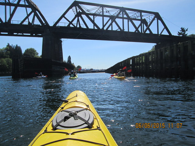 |
As part of our research before buying Kayaks we decided to take a guided kayak tour up through the Hiram M. Chittenden Locks (AKA, the Ballard Locks) that allow boats to pass between salty Puget Sound and the freshwater canal and lakes that are 20 feet higher, at mid tide.
There is a company that rents kayaks and conducts a variety of tours out our our marina. The company is called Ballark Kayaks (http://www.ballardkayak.com/). We were very pleased with the condition of equipment and the competence of our guide.
11 Photos
Created 6 June 2015
|
 |
These are a few pics we took during the weekend we spent at Blake Island.
8 Photos
Created 6 June 2015
|
 |
Whittier Alaska is probably the strangest place we have ever visited. It only exists because the army set it up as a deep water port during WWII. Population is only 273 and everyone in town lives in the same building.
12 Photos
Created 2 August 2014
|
 |
After more than 6000 hours on our engine our raw water pump gave up the ghost. This album contains photos that show what happened to our pump and what had to be done to fix the problem.
11 Photos
Created 12 July 2014
|
 |
Our old raymarine radar died in the Indian Ocean and we got this far without replacing it. But Alaska and the inside passage to Seattle have a reputation for foggy weather so we thought it would be a good idea to replace the old radar before we headed north. The choices were greater than we had the last time we bought radar and one of the choices was a new technology called broadband radar. That is what we went for and we are pleased with the decision.
The broad band radar puts out less energy than a cell phone and consumes a lot less power than older type radars. It also requires no warm up whereas our old radar took 90 seconds to warm up before it could be used.
3 Photos
Created 15 June 2014
|
 |
We spent a few days anchored i Hanalei Bay while we got the boat and our attitudes prepared for the sail to Alaska
4 Photos
Created 15 June 2014
|
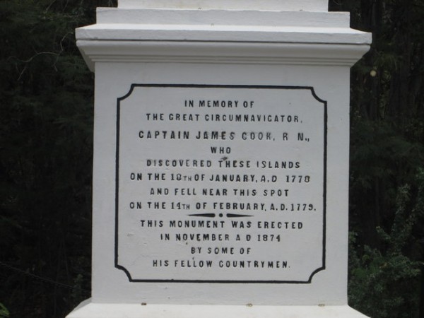 |
Captain James Cook, the famous British explorer, was killed here when an attempt to kidnap the local king did not work out as planned. A monument now marks the spot.
7 Photos
Created 5 May 2014
|
 |
Radio Bay is a small harbor adjacent to the larger ship terminal here in Hilo. It is a secure harbor where the coast guard keeps its local boat and where visiting yachts are allowed to tie up while clearing customs and resting up from the passage that brought them here.
5 Photos
Created 2 May 2014
|
 |
This album contains photos that were taken on our passage from La Paz to Hilo. We were unable to upload any of them while at sea
19 Photos
Created 27 April 2014
|
 |
In the Pedro Miguel and Miraflores locks we rafted up to a tourist boat named Pacific Queen. One of the passengers on the Pacific Queen took the photos in this album and she sent them to us when she saw Brian's video show up on youtube.
31 Photos
Created 19 March 2014
|
 |
We got a lot of photos during our whale watching adventure in Bahia Magdalena. The ones in this album were taken by John. I uploaded the photos that Brian took into another album.
18 Photos
Created 14 March 2014
|
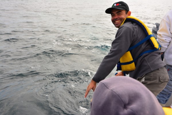 |
Our friends Brian and Claudia are much more experienced, skilled, and well equipped photographers than we are and they took a total of 460 still photos during the course of our day on the water in Bahia Magdalena. I selected the photos in this album from the collection.
39 Photos
Created 14 March 2014
|
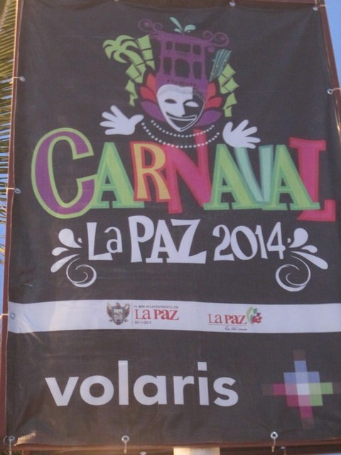 |
La Paz has a carnival celebration every year and we were fortunate enough to be here for it this year. It starts about a week before Ash Wednesday and ends with a parade on Fat Tuesday.
27 Photos
Created 3 March 2014
|
 |
We took a two day side trip to Guadalajara. It took us a day to get there and a day to get back so it was a total of 4 days.
The photos in this gallery are not in any particular order. They are just intended to provide a flavor of the place and give me a place to make a few comments that were not easy to fit into the blog entries about Guadalajara.
15 Photos
Created 28 February 2014
|
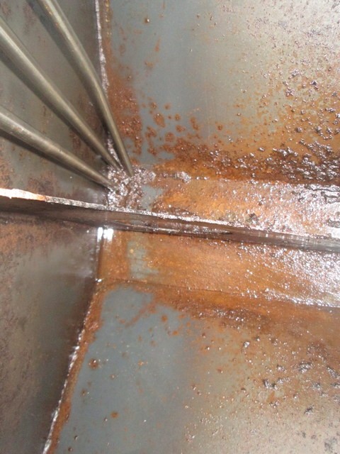 |
We pulled the inspection plate off the fuel tank this morning so the guys from Active Yacht Maintenance could clean the tank. It had not been cleaned since we left the states five and a half years ago
7 Photos
Created 10 February 2014
|
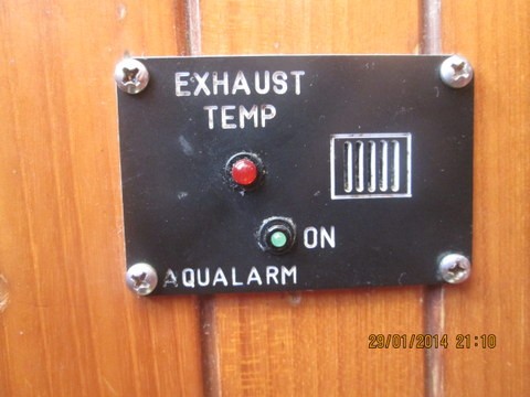 |
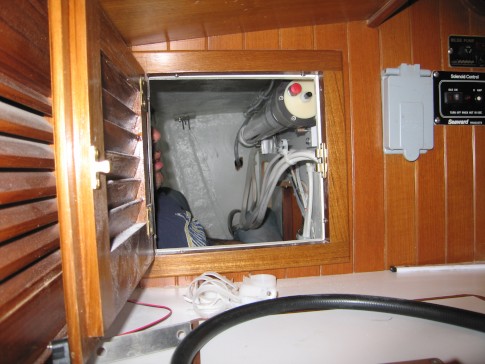
We Installed an Aqualarm Exhaust Gas Temperature Sensor on our diesel exhaust hose to try to prevent repeats of muffler damage we had suffered when cooling water flow was interrupted and hot exhaust gas melted part of our muffler. Malfunction, of this device when it was re installed following our recent engine service , caused me to look into the way it was manufactured in detail. I was not impressed.
5 Photos
Created 29 January 2014
|
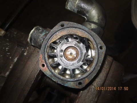 |
One of the wear parts on a diesel engine is the rubber impeller used in the pump that pulls sea water in and pushing it through the engine for cooling. Impellers wear out and sometimes (on our engine for example) are difficult to replace.
The speed seal is a replacement cover for the water pump that makes access easier and also extends impeller life by eliminating a major cause of wear.
7 Photos
Created 19 January 2014
|
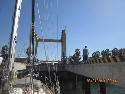 |
Our engine was overdue for a lot of maintenance so we had it pulled out of the boat. this album will hold the photos of the process.
44 Photos
Created 11 January 2014
|
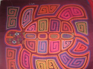 |
Molas are the most well known of the Kuna people's hand crafts. They were originally made as part of a woman's clothing and had abstract designs. With the tourist pressure the molas are now available with representations of various sea and land animals. The are also available as ready to stuff throw pillows, beer can coolers and purses. The more work intensive reverse applique designs are not used to on the tourist oriented products. That is probably because the mola makers realized early on that the quality of the work did not impact the price and the more eleborate techniques require a lot more work.
I noticed that there are some shadows across some of the photos. I was in a hurry when I was taking them as there was a squall approaching. I think that until they start passing our Nobel prizes for mola photography I'm gonna cut myself some slack on this issue.
9 Photos
Created 3 October 2013
|
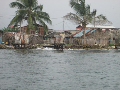 |
Nargana Town is a modern Guna village that has abandoned traditional ways and has electricity, televisions, beer and rum.
4 Photos
Created 25 September 2013
|
 |
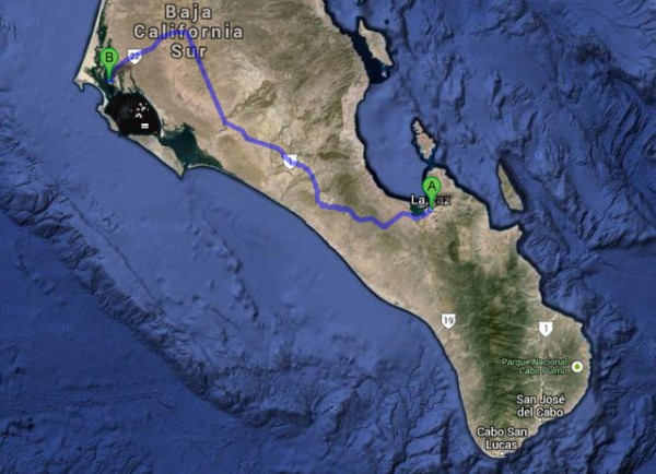
We went through the canal as line handlers on another yacht when we visited Panama almost 5 years ago. We decided to do it again since the north to south transit is a bit different than the one from the pacific to the caribbean because you have to spend the night in the lake after going through the Gatun locks
31 Photos
Created 28 July 2013
|
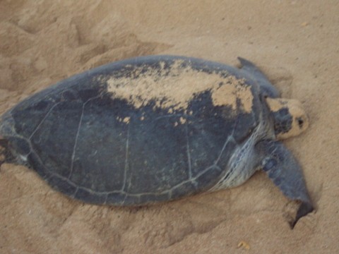 |
The people on St Helena say "we may live on a rock but on Ascension they live on a cinder". That seems like a pretty good description of the Island of Ascension but the green turtle nesting site made it a very special place to visit.
27 Photos
Created 2 June 2013
|
 |
St. Helena is an Island in the South Atlantic that is a convenient stopping point on the way from South Africa to the West Indies. It was discovered by the Portuguese, and, because it was a valuable re-provisioning stop, was kept a secret for a couple of hundred years. It is so remote that the British decided to use it to imprison Napoleon so he could not pull off as escape, like he did at Elba, and return to Europe and start some more wars.
19 Photos
Created 2 June 2013
|
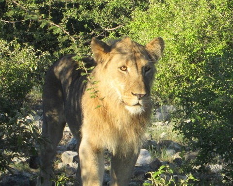 |
Etosha is a game reserve and national park in Namibia. It is located about 200 km from the coast. The park includes a large salt plain and the terrain around the salt plain is dry and the vegetation sparse. This makes it a lot easier to see the animals than the lush jungles near Richard's Bay in South Africa.
20 Photos
Created 18 May 2013
|
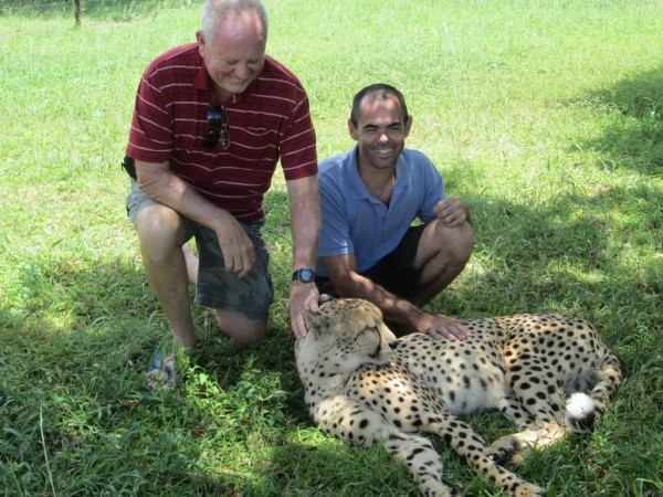 |
The Emdoneni Lodge is an upscale wilderness hotel that also operates a rehabilitation center for animals that need help. They specialize in the smaller African cats like Cheetahs, Caracals, African wildcats and Servals.
23 Photos
Created 19 January 2013
|
 |
The iMfolozi Game Reserve was established in the mid nineties. It is 24,000 hectares in size (about 60,000 acres) .
The Reserve is less than a 2 hour drive from Richards Bay and is accessed via a few paved and unpaved roads.
The number of vehicles allowed access to the park is limited to 120 per day.
Our friend Anne de Robillard hthe drive north.as been to the Reserve many times and carefully evaluated the weather for the day of our visit before having us turn out at 4 AM for the start of the drive north.
As it turns out we were the second vehicle in line at the gate. She did not say anything but I think Anne was a bit miffed about being second. Some of the visitors blow through the park so fast that they scare all the game and the vehicles that follow them dont get to see as much if you follow them. As it turned out the vehicle that was first in line was a professionaly run tour operation that was careful about speed and noise. At one of the stops the drive shared spotting tips with us.
30 Photos
Created 12 January 2013
|
 |
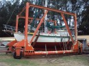
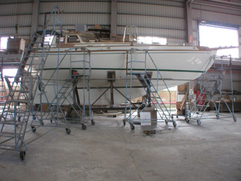
We were due to haul the boat and paint the bottom. Since we had some time to kill here, while we want for our batteries to arrive, we decided to go ahead and get the haul out taken care of.
There are two ways to get hauled here. The preferable one is on the club owned dolly that is less scary for the owner and cheaper but we could not get scheduled to get hauled that way so we used the travel lift that is operated by the yard.
5 Photos
Created 5 December 2012
|
 |
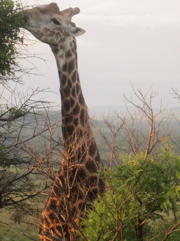
We got to do a day trip with the deRobert family to the iSimanglasiso game park that is less than a two hour drive from the Zululand Yacht Club. We got to see Cape Buffalo, Rebok, Kudu, Guinea fowl, hippos, a rino, dung beetles, and lots of of iconic vistas of the African grasslands.
23 Photos
Created 5 December 2012
|
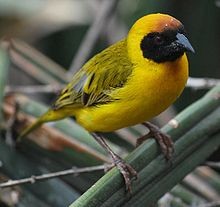 |
There is a tree at the Zululand Yacht Club that has been selected by a flock of Southern Masked Weaver Birds for nesting. This album contains photos of the birds and their nests.
21 Photos
Created 29 November 2012
|
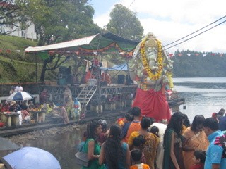 |
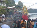
The photos in this album are from our tour of Mauritius on the holiday known as Ganesh Chaturthi. We visited one of the major temples on the island and also witnessed a traditional ceremony where statues of Ganesh are submerged in the ocean and left of dissovle
24 Photos
Created 23 September 2012
|
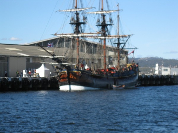 |
Hobart is the capital of Tasmania and the largest city. Large is a strong word to use for Hobart. It was originally called "Hobart Town" and that seems to fit.
7 Photos
Created 26 March 2012
|
 |
Sarah Island has had several names. The one that seems to have stuck is Sarah Island which was named in honor of Sarah Birch who was the wife of the man who financed James Kelly's expedition to explore Macquarie Harbour. Sara was the daughter of convicts who met in Australia and was born on Norfolk Island. The family later moved to Tasmania where they became wealthy.
I have not found any mention of any response that Sarah might have had to the island, that had been named in her honor, being turned into one of the most horrific prisons in Australian history.
7 Photos
Created 9 March 2012
|
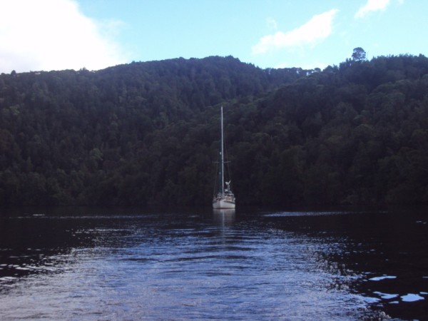 |
The Gordon River empties into the south end of Macquarie Harbour and is navigable by keel sailboats for about 20 miles upstream.
There are no nautical charts of the river but a local yachtman has generated a set of "mud maps" that show where the problematic places are. It was a bit creepy to be motoring along at 4 kts over what looked like dry land on the chart but there was plenty of water all the way up to Warne's landing where we spent the night.
9 Photos
Created 9 March 2012
|
 |
Deal Island is located in the middle of the Bass Straight and is the northern most of Tasmania's parks. It is a pristine environment with lots of wild life, an historic lighthouse (highest in the southern hemisphere) and comfortable anchorages.
We enjoyed the gracious hospitality of David and Mary Nicholson who are the current volunteer caretakers on the island.
31 Photos
Created 27 February 2012
|
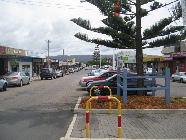 |
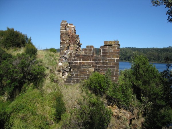
This album contains a variety of pictures we took while visiting Eden, a delightful little town on the south east corner of Australia.
6 Photos
Created 10 February 2012
|
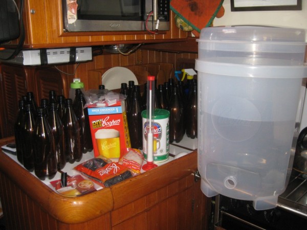 |
This album contains photos of various stages in the brewing process for making beer on board.
2 Photos
Created 17 January 2012
|
 |
We are anchored in Camden Haven waiting for weather to move south. This beautiful little estuary is made up of many little villages that are mostly retirement communities.
7 Photos
Created 14 December 2011
|
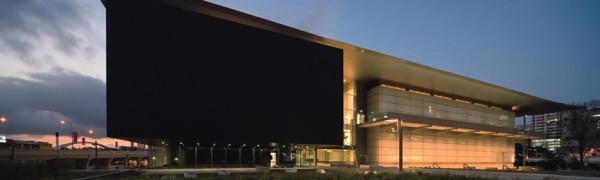 |
The Gallery of Modern Art is on of the important buildings that sits on the South Bank of the Brisbane river in the city's cultural center. It is a beautiful building with a superbly displayed collection.
11 Photos
Created 25 November 2011
|
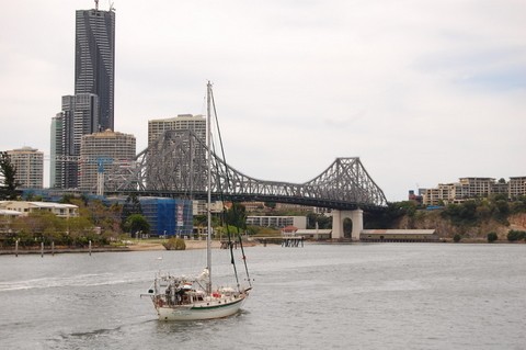 |
We have the loan of a mooring in the Brisbane river right across from the Central Business District and are enjoying this very nice city by using it extensive ferry service (high speed catamarans) and bicycle rental service.
12 Photos
Created 18 November 2011
|
 |
Most of Magnetic Island is a National Park so there are lots of hiking trails. We decided to take the hike that goes out to some WWII fortifications.
19 Photos
Created 4 October 2011
|
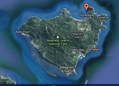 |
Magnetic Island is a few miles off the Queensland Coast of Australia in the vicinity of Townsville. It is a suburb of Townsville with excellent ferry service, beautiful beaches, and a friendly beach community atmosphere.
20 Photos
Created 3 October 2011
|
 |
 |
One of the things you can do as a tourist in Puno is take a tour where you spend the night with a native family on Amantani Island in the Lake. It was an interesting experience.
23 Photos
Created 8 January 2010
|
 |
We had to take a "ferry" across to San Cristobol island to start our tour on the motor yacht Galaxy. Timing required that we go over to the island a day ahead of when we joined the boat. The ferry ride was quite an experience. The ferry consisted of a 25 foot power boat with three 200 hp outboards on back. They packed about 30 people on it and west as fast as the prevailing swell would allow. It was a rough trip with lots of passengers getting a little green around the gills. Before we boarded the ferry we had to submit out bags for agricultural quarantine inspection. Despite the restrictions on taking fruits and vegitables between the islands one local resident spent the whole trip across eating fruit he had in his backpack. I guess only gringo fruits and vegetables are a problem.
15 Photos
Created 8 January 2010
|
 |
Many of the environments in the Galapagos are protected and require you to be in the presence of a licensed guide when you visit them. The hiking trail to Turtle Bay is an exception. This trail runs from Puerto Ayora to a beach location a mile or so from town. Along the way we saw a lot of Darwin's finches, lizards, and native plant life. At the beach at the end of the train we saw the marine Iguanas in their native habitat.
21 Photos
Created 8 January 2010
|
 |
 |
 |
This island is also called Barrington Island and is the only island with the specific species of land iguana that is shown in our photos.
7 Photos
Created 8 January 2010
|
 |
We decided to break up our trip from Panama to the Galapagos by stopping over a Cocos Island which is about 300 miles off shore and is part of Costa Rica.
This is the island that was the model for the movie Jurassic Park and I think a lot of the aerial scenes were shot here.
As you will see from our photos, this is a really beautiful spot.
The Island and it surrounding waters are a Coasta Rican national park. There are rangers stationed on the island along with a contingent of the Costa Rican Coast Guard.
14 Photos
Created 7 January 2010
|
 |
The first time we crossed the equator seemed like a big deal so we celebrated as best we could. This album contails some pics of our bleary eyed early morning celebrations. As it turned out our tour of the Galapagos (on a power yacht) took us back and forth across the equator a couple of more times in the next couple of weeks. The northern most islands of the Galapagos are in the northern hemisphere.
5 Photos
Created 7 January 2010
|
|
|
|
|
|
 |
One of the natural wonders of Peru is Colca Canyon. Colca Canyon is in the Andes. It is deeper than the Grand Canyon but a lot more narrow. It is a stunningly beautiful place and the sides of the canyon are almost completely covered with terraces that were build by pre Inca civilizations and are still farmed today.
We took an overnight tour to the Canyon that Cost us all of $20 each for bus transportation, hotel and breakfast. We had perfect weather for the trip.
61 Photos
Created 22 October 2009
|
|
|
|
this is a place holder for our pics of La Punta Callao. Pics will be added soon
No Photos
Created 22 October 2009
|
 |
this is a place holder for our easter island pics...will add them soon
28 Photos
Created 22 October 2009
|
 |
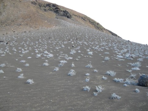
Our northern most Island on our Tour was Genovesa which is above the equator. It was about a 7 hour motor trip and they did it at nigh. Genovesa is interesting because its climate is quite a bit different that the more southern islands. The marina Iguanas are small, the vegetation has a hard life and there seemed to be more predator birds that other places
34 Photos
Created 13 July 2009
|
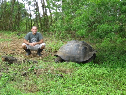 |
At the suggestion of Antonio, our Galapagos agent, we took a pass on the organized tours of the highlands and got a cab driver to take us up there instead. We visited a farm that has areas where you can see the giant tortoises in the wild and we got quite a few good pictures. We also walked through a quarter mile long lava tube.
14 Photos
Created 10 July 2009
|
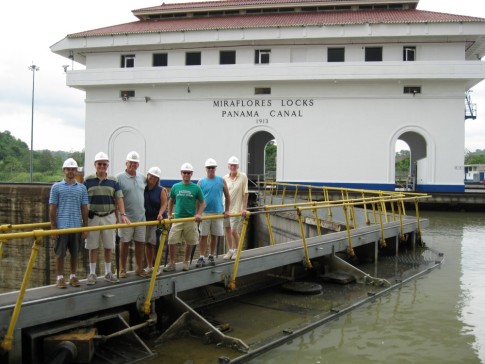 |
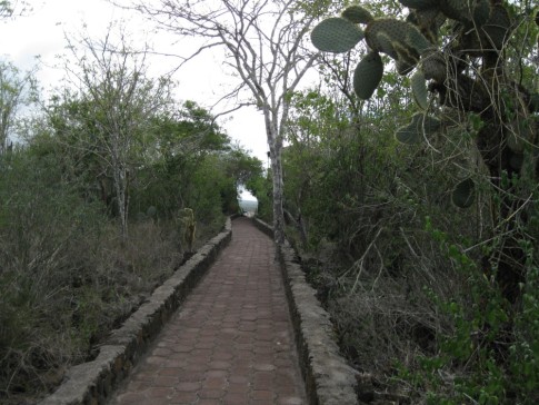
There is a nice visitor center at the Miraflores locks with museums, a theater, some restaurants, and observation decks from which you can watch the ships pass through the locks. But we were lucky and got a very special VIP tour thanks to our friend Captain Jim Guy from the yacht Ocean Dance. Jim arranged for his friend Paul Reid to give us essentially the same VIP tour that Hilary Clinton got when she visited the locks as first lady. We got to walk across the closed gates and tour the control room and under the locks where all the machinery is located. This album contains pictures from that exceptional experience.
30 Photos
Created 6 June 2009
|
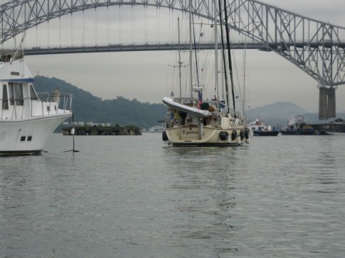 |
While we were in Panama waiting for equipment to arrive from the US we volunteered to be line handlers for another sailboat that was transiting the Canal. We got to ride through the canal and return to Active Transport in the same day. We got a lot of pictures of the adventure. We also uploaded an album of pictures from a special tour of the Miraflores locks that we got thanks to our friend Captain Jim Guy.
22 Photos
Created 6 June 2009
|
 |
Chichenitza is the Mayan ruin that most people get so see. It's close to Cancun and receives between 10,000 and 15,000 visitors a day. That is not too surprising when you think that one cruise ship can dump 2000 people on the shore. One of the consequences of the popularity of the site is that it is plagued with the largest assortment of junk vendors of any place we have been in Mexico. They offer the same crap all over the site with the sides of the walkways lined with displays of the same carvings, chess sets, masks, blankets, etc. It is easy to get the idea that all of vendors are owned by the same outfit and buys in bulk in China.
14 Photos
Created 3 May 2009
|
 |
Uxmal was our second Mayan site. It was significantly different from Palenque in that it is not located in a jungle and did not suffer the same level of breakup that was caused by plant growth at Palanque. Uxmal is off the beaten path and that has two effects. One is that the number of visitors they get each day is around 450 (compared with 10 to 15 thousand per day at Chichenitza). The second impact of the remote location is that the tee shirts are cheaper than at most of the sites. John got so caught up in a tee shirt buying frenzy that he ended up with a tee shirt that says Uxmal but had a picture of the top of Pakal's tomb at Palenque.
10 Photos
Created 3 May 2009
|
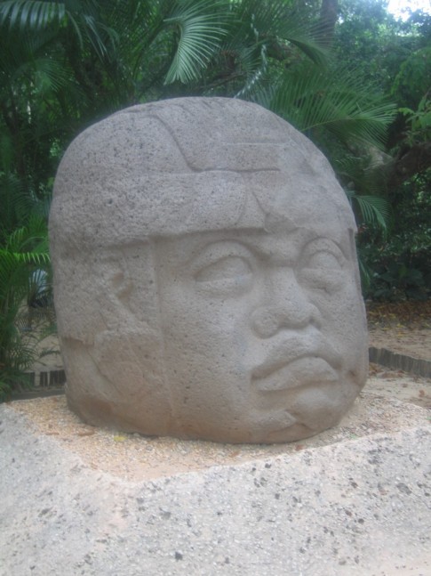 |
Several years ago Pemex (mexico's national oil company) starting drilling in a swamp near the Gulf of Mexico. They discovered some very significant sculptures attributed to the Olmec culture which is considered the mother culture of all the mesoamerican civilizations. Since the site where they discovered these relics was very remote (and probably because they wanted to keep drilling) the moved them to Venta park in Villahermosa.
8 Photos
Created 3 May 2009
|
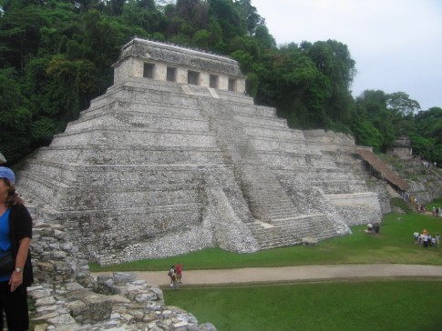 |
Palenque was the first of the Mayan sites that we visited. Like many of the sites its current name is not Mayan but Spanish.
We had been prepared for our visit here by our visit to the Anthropology museum in Mexico city where they have many of the artifacts from the tomb of Palak which was discovered here in Palenque. But nothing could adequately prepare you for the stunning impact of turning a corner in the jungle and seeing this city rising out of the overgrowth.
21 Photos
Created 3 May 2009
|
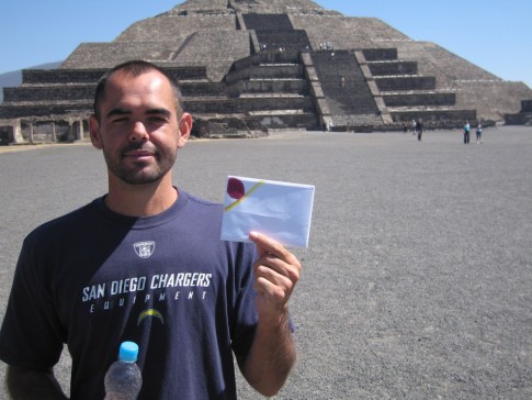 |
Teotihuacan is a short bus ride outside of Mexico City. Nobody knows who built the pyramids and other buildings found here but it was long abandoned by the builders when it was taken over the the Aztecs.
7 Photos | 1 Sub-Album
Created 22 April 2009
|
 |
The vast majority of the equipment we have installed on the boat has worked out fine but there have been a handful of products that were shoddily made or poorly designed so that they either did not perform as expected or hold up for very long. We will add the most egregious examples to this gallery.
1 Photo
Created 25 March 2009
|
 |
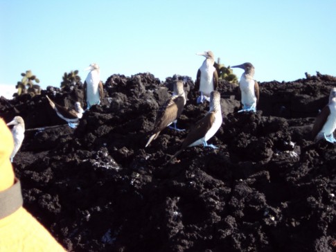
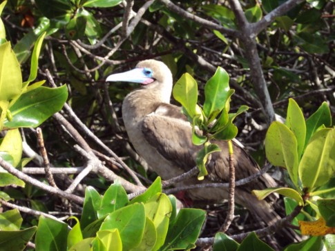
Isla Isabela is a Mexican National Park that is set aside because of the rookeries for Frigate birds and Boobys. The timing for our visit was very good since it was the breeding season for both kinds of birds.
21 Photos
Created 25 March 2009
|
 |
Several of the students at our spanish school (Se Habla La Paz) got together to attend las luchas libres or mexican wrestling matches at club deportivo Corona.
The photos and video clips in this gallery give a pretty good idea of what it was like.
1 Photo
Created 17 January 2009
|
 |
We picked up some junk on our prop while motoring from Puerto Escondido to San Evaristo. The pics in this album provide a few details
3 Photos
Created 9 January 2009
|
 |
Mulege located about 40 miles south of Santa Rosalia on Highway 1. The town dates back to the beginning of the 18th century where its fresh water river was an obvious attractant to explorers and exploiters alike (conquistadors and missionaries). Since there is no safe anchorage within walking distance of Mulege we decided to take a bus down while we were this close.
17 Photos | 1 Sub-Album
Created 22 December 2008
|
 |
Santa Rosalia is as far north as we are going in the Sea of Cortes. It is a little over halfway up the sea.
Santa Rosalia was built as part of the deal that the French mining company, called Boleo, made with the Mexican Government in the latter half of the nineteenth century.
The copper smelting plant is now closed but takes up as much space as the downtown area. There are still some well preserved buildings from the French time here and a lot of train relics around town.
17 Photos
Created 21 December 2008
|
 |
Photos taken during our trip ashore in the remote coastal town of Bahia Tortugas.
6 Photos | 1 Sub-Album
Created 26 November 2008
|
 |
Photos from this leg of our trip
12 Photos
Created 25 November 2008
|
 |
While we were in southern California and had access to a mooring at the marine lab we were able to have several friend visit us for short cruises to the island. This album contains pics of some of those cruises
11 Photos
Created 26 October 2008
|
 |
The photos in this album show details of our visit to the USC marine lab on Catalina Island.
3 Photos
Created 17 October 2008
|
 |
This album contains pictures of anchorages, coastline details and people. These photos were taken during our sail down the coast toward Southern California
19 Photos
Created 17 October 2008
|
 |
This album contains photos from the party we had prior to our departure.
12 Photos
Created 15 September 2008
|
 |
Pictures from our first few days at sea.
6 Photos
Created 15 September 2008
|
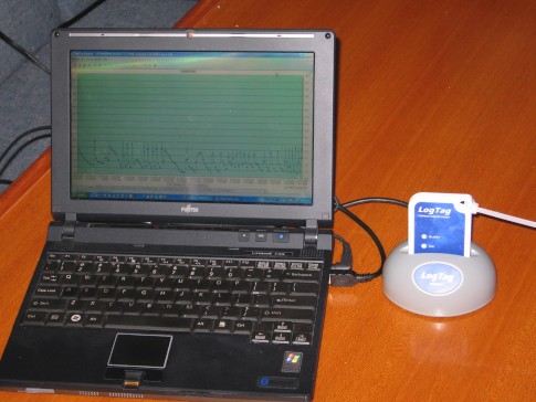 |
We wanted to characterize the performance of our refrigerator/freezer so we would spot any problems early. We found this clever device on line that allows us to get a detailed record of the temperature inside the freezer and graph it conveniently.
3 Photos
Created 21 July 2008
|
 |
We decided to replace our running backstays. The ones the builder provided were too short. This meant another trip up the mast for Shawn. This time he took the camera with him.
2 Photos
Created 11 July 2008
|
 |
Well, it does not really "make" water. What it does is turn sea water into fresh water.
9 Photos
Created 11 July 2008
|
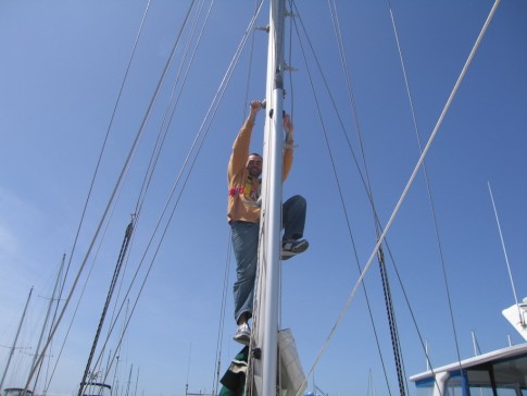 |
Someone on board needs to be willing and able to climb the mast when the need arises . Since we had a couple of tasks that needed to be taken care of before we shove off, Shawn volunteered to
3 Photos
Created 21 April 2008
|
 |
This album contains a collection of photos of some of the small details that we think have worked out well for us. Many of the ideas are not original with us. As a matter of fact, some of the better ones were stolen (borrowed) from what we have seen on other boats or read about.
13 Photos
Created 2 April 2008
|
 |
This album will be used to accumulate pictures of the various solutions we are using to reduce power consumption by converting old fashioned incandescent lights to more efficient technologies
3 Photos
Created 31 March 2008
|
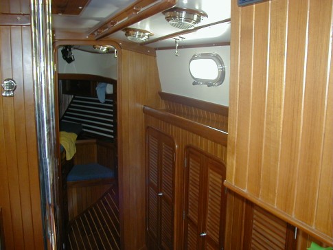 |
The photos in this album show the boat shortly after it was commissioned. I will post another album after we have finished our modifications and are ready to shove off.
8 Photos
Created 26 March 2008
|
 |
The yard provided pictures of the boat at various stages of construction and I have assembled a few of them here to show the process.
7 Photos
Created 26 March 2008
|
 |
This album contains some pics of the modifications we made to the lockers that run along each side of the pilot house.
4 Photos
Created 5 March 2008
|
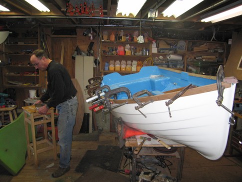 |
These pics show what we did to bring our 30 year old dingy back to life and a couple of enhancements we made that make this a serviceable tender for Active Transport
6 Photos
Created 20 February 2008
|
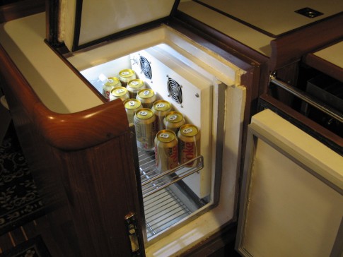 |
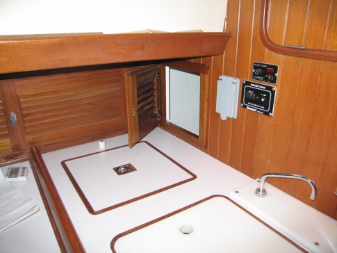
These photos show various stages of the construction of the refrigerator box on Active Transport.
9 Photos
Created 1 February 2008
|
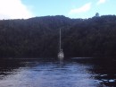
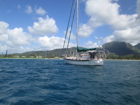
On the hook in Tomales Bay
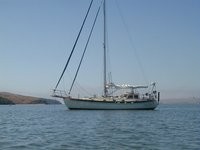
Who: John and Shawn
Port: Seattle, Washington
Gallery