
Aluna

06 November 2010 | Spain
05 November 2010 | Bay of Biscay
03 November 2010 | Bay of Biscay
19 October 2010 | La Rochelle
17 October 0210 | La Rochelle
Kuna Yala Paradise
10 March 2014 | Holandes Cays, San Blas
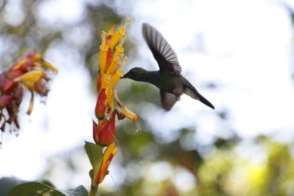
We anchored near the most popular area in the Kuna Yala, what is known as "the swimming pool" near the BBQ Island. The number of boats there surprised us, we counted well over 30 boats while approaching the chain of islands. Islands near the mainland you can have to yourself, the water might be not as clear and the islands perhaps mangrove and bug infested. But in the more attractive spots, you find a number of sailors hanging out for years or waiting for the right time to cross the Panama canal. There is also some Tourism on a small scale, we found eco-lodges in the Lemon Cays, with toilets over the waters edge on stilts and a small generator for lights. They even serve cold beer, which is forbidden for the Kuna´s to consume.
We found a beautiful spot behind one of the islands, what a difference to noisy, dusty and windy Santa Marta! The Chief of the Holandes Cays came paddling in his dugout to our boat, we invited him on board. We even got a welcome present, Avocados from the island, there are also breadfruit, plantains and of course lots of coconuts available. We paid happily our contribution of $10.- (anchoring fee for one month) and could exchange a few niceties, since the Chief spoke more English than we speak Spanish. All the discomfort of the last 24 hours were forgotten, we jumped in the water and snorkeled the reef, saw the biggest swarm of little fish ever, it must have been millions, we were enveloped in a huge cloud of sardine sized school of fish for many minutes. From a distance the school of fish looked like a huge hump back whale. My only hope was that there was no shark at the end of the line, in fact there were 5 big cravelles chasing them.
We found a beautiful spot behind one of the islands, what a difference to noisy, dusty and windy Santa Marta! The Chief of the Holandes Cays came paddling in his dugout to our boat, we invited him on board. We even got a welcome present, Avocados from the island, there are also breadfruit, plantains and of course lots of coconuts available. We paid happily our contribution of $10.- (anchoring fee for one month) and could exchange a few niceties, since the Chief spoke more English than we speak Spanish. All the discomfort of the last 24 hours were forgotten, we jumped in the water and snorkeled the reef, saw the biggest swarm of little fish ever, it must have been millions, we were enveloped in a huge cloud of sardine sized school of fish for many minutes. From a distance the school of fish looked like a huge hump back whale. My only hope was that there was no shark at the end of the line, in fact there were 5 big cravelles chasing them.
Cartagena
27 February 2014 | Columbia
Following a quiet and dark night at anchor (Marina turned their generator off at midnight) in Puerto Velero we upped the hook and headed straight for Cartagena. Again we had head winds for the firsts 3 hours and then a comfortable 10-15kts set in from aft until we reached Cartagena. We approached the harbour through the northern Bocca Grande entrance .
Thia entrance is an interesting feature in that even though it is 500m wide the navigable 3.5m deep channel in the middle is only 50m wide. Over 200 years ago the Spanish built an underwater barrier across the entire entrance forcing the English and French invaders to use a heavily fortified entrance further south. England only penetrated this southern entrance once with 180 ships and at a cost of 8000 lives ! At that time Cartagena was the centre for gold for South America.
We anchored opposite the Club Nautico in 12m of water opposite the old city, on one side a very busy container terminal and on the other a city skyline like Manhattan.
Apart from catching a Jack Cravelle fish and air in the diesel fuel lines we had a wonderful trip. Several boats we met in Categena who came from Santa Marta were not so lucky. Just before the Rio Magdalena they were completely pooped broadside with large random waves coming on board and flooding their cockpit.
Sailing from Santa Marta to Carthagena
24 February 2014 | Carthagena
Against the advice of recent cruising articles to visit Cartagena by bus from Santa Marta, we sailed there. Despite paying an additional US70 for an agent to clear us in, this was the better option as we could stay as long as we wished.
The notorious stretch of water between Santa Marta and Cartagena could also be done in two daylight passages and anchoring overnight at Puerto Velero (Punta Hermoso). This 114NM stretch can be one of the most dangerous in the Caribbean. You can encounter 40kt winds, unpredictable downwind seas, the crossing of the Magdalena river estuary and pirates at Puerto Velero.
Since the last reported case of piracy was 2012 we ruled this risk out as long as we anchored close to the new marina at Punta Velero. Rainfall was low this time of year, so debris ladened river flow was also a low risk. Our only concern was the wind, so we were lucky when a very calm weather window opened.
We set off from Santa Marta at 0600 with 5 kts head winds forecast to change soon in our favour. The wind didn't change until much later. We had to motor but, the consolation was, we had relatively calm seas. We only noticed crossing the Rio Magdalena because the sea changed colour from blue to dirty brown. At midday the wind finaly changed and blew from behind at 15-20kts (forecast 15kts).
At 1600 we approached Puerto Velero. Here we had to be very careful and navigate by eye only. Not easy in murky water. Only Google Earth showed a realistic map of the land spit that protruded 2NM out from the coast. There are no water depths on Google! . Navionics, Garmin and CMap charts all showed a spit half this size. Only later did we obtain an official Columbian chart that appeared accurate. By the time we got to the marina the wind was gusting 25kts and there was no way we were going to try a med mooring without help, so we anchored in 5m of water to the west of the dock in very calm water.
Tayrona National Park
06 February 2014 | Santa Marta, Columbia
Tayrona National Park, also known as the Five Bays is not the best place to anchor, at this time of the year. Two boats we met who tried to anchor here both experienced 60 Kts of katabatic wind. We went there with the chicken bus from Calle 11, Carrera 11, Santa Marta. From the park entrance we got a second bus to Cañaveral and then walked 90 minutes to the beach at Arrecifes. Too dangerous to swim. Over 100 people have already drowned here. It is 'dry jungle forest'. Most people stayed overnight in tents or in hammocks. Eveline was worried about the bugs so we walked back.
The same bus will also take you to the lovely beach at Paloma or to the Waterfalls, both worth a visit, as is Minca.
The same bus will also take you to the lovely beach at Paloma or to the Waterfalls, both worth a visit, as is Minca.
Windy, dusty, busy Santa Marta
13 January 2014 | Santa Marta, Kolumbien

Having decided to take the in-shore route to Santa Marta the next decision was when. On this stretch, with two nights at sea and a high risk of localized gusty winds, we wanted to avoid winds stronger than 25kts. Since the wind always appear to be 5kts stronger than GRIB forecast winds, we waited for maximum forecast winds of around 20kts.
In this part of the world the winds regularly blows 20kts-30kts from January to March and on average every 10-14 days are interrupted by a cold front moving down North America. The influence of the front is never certain so there is some degree of risk that it may not be significant.
We missed one good weather window over Christmas and we had to wait 4 weeks until the next opportunity arose. I planned the timing of the passage so we would sail the two difficult cape stretches in daylight. We sailed from Curacoa to Aruba. Waited here one night at anchor, made a last minute weather check and decided to go. Two other boats anchored with us in Aruba also hoping to make the same passage, decided not to go. The small catamaran 'Paranda' found the crossing from Curacao to Aruba the day before so challenging they decided to stay possibly until October when the wind usually blows less. The other mono hull got advice from a professional weather router and did not go.
We departed at 1600hr and arrived after 44hours later, one hour longer than expected. The wind was so little we had to motor for 20 hours between Los Monjes and shortly before the Carbo Punta Gallinas and shortly after the cape until 25NM before Carbo La Aguja. At the capes we had almost 30kts and orderly but moderate seas.
We had a fantastic trip. We didn't want to acknowledge it until we arrived in Santa Marta just in case we were pooped at the last minute by 40kts winds and huge waves which we discovered several boats experience several days before us.
Dominican Republic to Curacao
14 June 2013 | Curacao, Spanish Water

We arrived in Curacao after a very strenuous 50 hour sail across from Isla Saona on the south east tip of the DR. We knew we would have a boisterous passage with 15kt-20kts easterly winds forecast the entire passage. It turned out a little fresher than expected.
At the start we had 25kt south east winds and 2m waves slamming hard on the nose. Fortunately, after 5 hours the wind moved east and crossing the waves, which got bigger, was more comfortable but this resulted in increased boat speed which translated back to more slamming. We slowed the boat down with a second reef and took it as fast as we could tolerate. On the main leg we averaged a moderate 7kts or though we frequently touched 12kts with sustained gust of 30kts plus. We were taken once by surprise from a quick squall bringing horizontal rain and 41kt winds. The worst came when we reached the last 30NM leg along the lee side of Curacao when we expected flat water and zero wind and a chance to rest before making landfall. Instead we encountered a constant 30kts dead on head wind and a big short sea.
It felt like we had the worst of the weather at night. Since there was no moon and it was pitch black it was impossible to tell the angles we were at. The computer screen tipped over for the first time ever. I am sure if we were on a mono hull it would have been a lethal weapon flying through the air. We didn't feel like eating much the whole way and we didn't get much sleep either.
The entrance to the Spanish Waters harbour where we arrived was a narrow 35m opening in a rocky coast line sheltered from the wind at the foot of a large mountain. What a contrast going from 30kts to 0kts in a few seconds. The tranquillity didn't last long. The anchorage opened up into a large lagoon with many little islands, very flat water but very gusty wind nevertheless, very inviting!
| Vessel Name: | Aluna |
| Vessel Make/Model: | Orana 44 Fountaine Pajot Catamaran |
| Hailing Port: | Travemünde |
| Crew: | Richard & Eveline |
| Social: |
|
Gallery not available
Caribbean
Who: Richard & Eveline
Port: Travemünde
Contents
Favorites
No Links Added Yet