SailBlog
18 September 2009 | Bell Harbor, Seattle, Washington
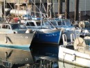
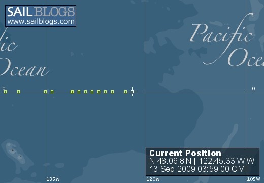
12 September 2009 | N 48.06.8'N:122.45.33 W'W, Port Townsend, San Juans, Washington
11 September 2009 | N 48.31.9'N:122.51.51 W'W, Lopez Island, San Juans, Washington
07 September 2009 | N 49.10.6'N:123.55.86 W'W, Strait of Goergia, British Columbia, Canada
03 September 2009 | N 50.05.9'N:125.01.6 W'W, Gorge Harbour, British Columbia, Canada
02 September 2009 | N 50.047'N:125.11.65 'W, Rebecca Spit, Drew Harbour, British Columbia, Canada
30 August 2009 | N 50.02.05'N:125.14.64 W'W, Johnstone Straight, British Columbia, Canada
28 August 2009 | N 50.52.8'N:126.15.3 W'E, Lagoon Cove, Somewhere in Canada
27 August 2009 | N 50.52.8'N:126.15.3 'W, Kwatsi Bay, Broughton Archipelago, British Columbia, Canada
25 August 2009 | N 50.42.8'N:127.29.3 W'W, Queen Charlotte Sound, Inside Passge, Canada
24 August 2009 | N 51.51.6'N:127.52.1 W'W, Fitzhugh Sound, Inside Passge, Canada
19 August 2009 | N 53.31.66'N:128.20.74 W'W, Jackson Narrows, Inside Passge, Canada
17 August 2009 | N 53.22.23'N:128.54.4 W'W, Bishop Bay Hot Springs, Inside Passge, Canada
16 August 2009 | N 53.19.4'N:129.10.2 W'W, McKay Reach, Inside Passage, North Coast, Canada
12 August 2009 | N 54.33.7'N:130.25.8 W'W, Lax Kw' Alaams
12 August 2009
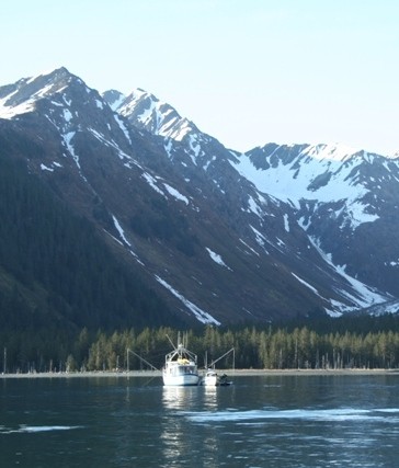
09 August 2009 | N 55.55.5'N:131.49.4 W'W, Behm Canal, Revillagigedo Island, Alaska
07 August 2009 | Naha Bay, Behm Canal, Alaska
07 August 2009 | ANC/FBX/ANC/KTN AK
30 July 2009 | One hour North of Knudson Cove, Alaska
After Incident Analysis
07 June 2009 | Juneau Marine Services
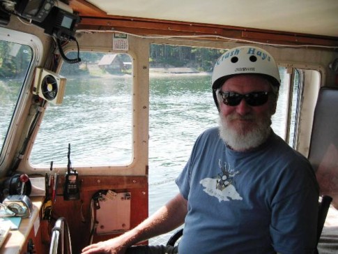
Anne
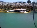
This is a picture of the Lady Anne right after we abandoned ship - she is balanced on the submerged rock - which never did show.
The GPS screen shot of the point of impact has us at 58.23.296N; 136.29.512 W. The rock is charted at 58.23.274N; 136.29.507W, an actual measured distance differential of 44.6 yards. That is about 138 feet off. Wonder how many other rocks out there are in the wrong place?
Rob had plotted a course from where we were to where we wanted to be. A review of the course plot - searching for the rock on the chart - revealed that the chart symbol was "under" the plot line and not visible. I have decided to make it a personal mission to convince Nobeltec that obstacles should always remain in the foreground and plot lines in the background. I also think the VISTA approach might be approporiate - with Vista when you are about to make a move that could result in catastrophe - it annoyingly asks you "Hey stupid, you are about to do something dumb, do you really want to do that" at which point you are constructively aware of the peril you have placed yourself in. I think this type of system would be good for course plotters.
There were no shallow depth contours on the chart to indicate a change in the bottom topography, although there are adjacent depth contours that indicate a similar change.
Had we not been tired from a 26 hour crossing, we might have made different judgment calls regarding the above facts.
And the good ole sun was directly ahead, making it really difficult to view the plotter screen.
A perfect storm of bad facts coming together.
But ultimately, the course decisions were made by us. We have discussed having two sets of eyes review the plot before embarking into new territory. We have also discussed a forward -sounding sonar, for even if we had plotted the course with the rock identified, we still would have hit it because it was in the wrong god-damned place anyway.
Now what?
Itchy Willy the renowned fiberglass artiste showed up today. I swear to god, he kissed the motor. He has a large tattoo on his back that is a huge middle finger with the legend "F**k Everybody. Along with a swastika, some Harley memorabilia and prison tats. Cute little fella. But jolly. And reverent when it comes to boat motors.
He says no sweat. That stuff on the keel is just cosmetic, that bump on the nose is nothin', now that job on the side is a different story. Though it didn't create an actual hole, the fiberglass is crushed for about a twenty-four inch diameter and must be extensively repaired. It is easily accessed from the inside through the engine room, that makes it easier to fix. He thinks a week.
So, we await the insurance adjusters call tomorrow and we get started on the repairs. The weather in Juneau is almost to warm. Living in the sky has few drawbacks as well, foremost being the lack of a useable head. Suffice to say, I have resorted to some creative uses of plastic bags.......
Comments
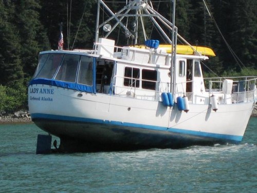
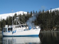
| Vessel Name: | Lady Anne |
| Vessel Make/Model: | Willard 40' Pilot House |
| Hailing Port: | Girdwood, Alaska |
| Crew: | Rob & Anne Hays, and Milo |
| About: | Rob Hays, recently retired after nearly thirty years on the North Slope of Alaka with BP and Anne Hays, polling and survey research business owner and their pal milo, the hearing impaired welsh terrier comprise the usual crew of the Lady Anne. |
| Extra: | This summer's journey will take us from Seward Alaska on or about the 24th of May, weather dependant, to Puget Sound. We intend to spend four months exploring and enjoying the inland passage with a few forays out to the coast. |
Lady Anne's Photos - Main
 |
 |
Our voyage from Prince Rupert South to Port Hardy
10 Photos
Created 24 August 2009
|
 |
A one week journey through some of SE's prettiest!
14 Photos
Created 25 July 2009
|
 |
 |
 |
 |
 |
 |
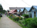
The lovely community of Tenakee Springs, Alaska, pop. 97
4 Photos
Created 21 June 2009
|
 |
Who: Rob & Anne Hays, and Milo
Port: Girdwood, Alaska
Gallery
Favorite Links
No Links Added Yet