
Redirection
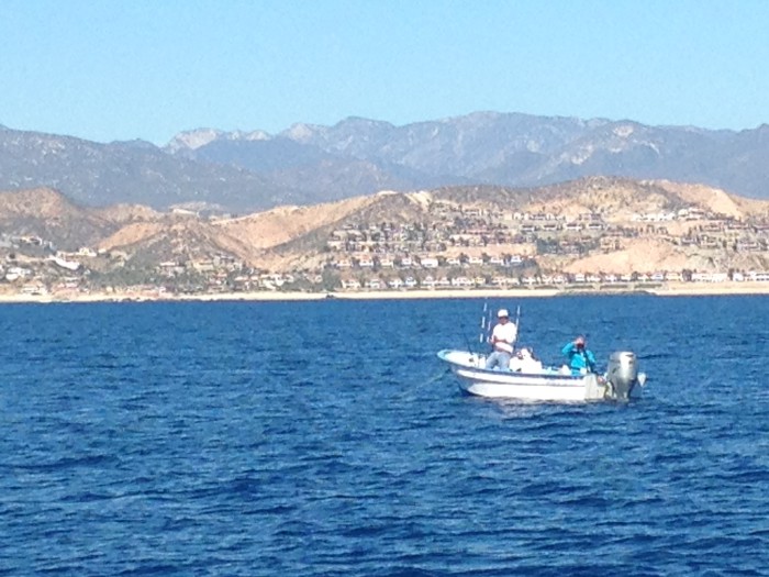
The day before departing Cabo San Lucas, we met Pete (80ish) from Long Beach - definitely a highlight of our few days there. Pete and his buddies had been coming to Cabo once/twice annually since 1978 for sport fishing - now a big industry, much transformed from its early years, when he tells us, there was no marina, no condos, no nothing --- just pure beauty. As our conversation with Pete was wrapping up, he said, "Hold on a minute - I'll be right back." When he returned, he had 5+lbs. of Yellow Fin Tuna in hand - cleaned, filleted, and nicely packaged in zip lock bags. Thank you Pete. We thought of you as we enjoyed several wonderful meals of fresh tuna!
We had planned to explore the east side of Baja (inside the Sea of Cortez) a bit more than we actually did. The weather was fine, beautiful actually, sunshine and water temps of 75 degrees. It turns out, however, that the winds are pretty fierce during the winter and, to head north, towards La Paz; we would have had to head directly into these winds - and the seas - produced by some 900 miles of these winds blowing at 20-30+ knots.
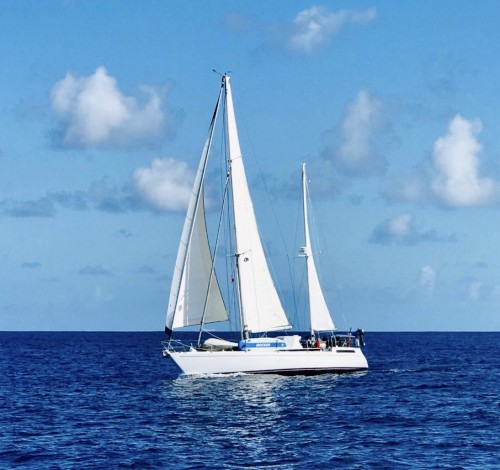
As we headed out of Cabo San Lucas we had no wind, so we made motored our way north. Despite the sound of the engine, the scenery entranced us - including whales, one after the other, breaching, and tails slapping. It was magnificent. As we turned up into the Sea of Cortes, we were quickly pulled out of our trance by increasing winds and seas. With hours to go until we reached our anchorage, we were facing 30-knot winds on the nose. After one day of taking a beating, and with nothing but the same in front of us, we opted to hang tight at Los Frailes, some 45 nautical miles northeast of Cabo San Lucas.
Los Frailes is a bit of a desolate contradiction. A few "luxury homes", a private airstrip, a beautiful beachfront, and a shantytown / fishing village with weathered cars and RVs parked in the sand. The fishing Pangas head out in the morning, come back, then head out again / in again. Pangas, basically elongated fiberglass fishing dorys, powered by large modern silver Honda outboards, that are literally driven hard and fast as they are launched twenty five feet up on the beach directly from the water. Toyota trucks are on the beach to pull them higher on the beach and, later, launch them back into the salt water, tires spinning in the sand. Day after day, they do it all over again.
While we opted not to launch the dingy to go ashore, Susan and I jumped off the boat and swam to shore. It felt so amazing! I crave this tropical climate, and am so looking forward to swimming regularly, and eating well. Staying in Los Frailes was good for us; it was really the first chance we've had to settle into the relaxed energy of voyaging. While at anchor, we chipped away at a long list of small projects that we've been meaning to get around to doing: installing a cockpit table that my Dad made for us, organizing a box of screws and miscellaneous hardware, fashioning new cables for two additional solar panels, cleaning the bilge, etc. All the while, running the watermaker and finding time to and nap a bit.
Given the weather forecasts, and the prevalence of these Northerly winds, it was clear that we could easily get stuck for several days without making any significant movement up the Baja. So, we decided that we'll take what we've had (and its been great), and head to Mazatlan to begin our exploration of the "mainland" Pacific Coast of Mexico before we make our way to French Polynesia. We will have 6-8 weeks to explore tropical Mexico, likely as far south as Manzanillo.
We'll check back soon on our travels in Mazatlan!
Rob and Susan
------------
"In addition to the storms, the scarcity of ports and of good anchorages, the lack of well-traveled sea routes, and other factors unfavorable to navigation, three general conditions, which become increasingly important the father north a vessel goes, make navigation dangerous in the Gulf of California. These special conditions are (1) the unusual tidal range, (2) the absence of swell or breakers to mark isolated dangers, and (3) the velocity of tidal currents." -- Sailing Directions (Enroute) for the West Coasts of Mexico and Central America. Sixth Edition (1991) Defense Mapping Agency Hydraulic /Topographic Center (USA).
We had planned to explore the east side of Baja (inside the Sea of Cortez) a bit more than we actually did. The weather was fine, beautiful actually, sunshine and water temps of 75 degrees. It turns out, however, that the winds are pretty fierce during the winter and, to head north, towards La Paz; we would have had to head directly into these winds - and the seas - produced by some 900 miles of these winds blowing at 20-30+ knots.
As we headed out of Cabo San Lucas we had no wind, so we made motored our way north. Despite the sound of the engine, the scenery entranced us - including whales, one after the other, breaching, and tails slapping. It was magnificent. As we turned up into the Sea of Cortes, we were quickly pulled out of our trance by increasing winds and seas. With hours to go until we reached our anchorage, we were facing 30-knot winds on the nose. After one day of taking a beating, and with nothing but the same in front of us, we opted to hang tight at Los Frailes, some 45 nautical miles northeast of Cabo San Lucas.
Los Frailes is a bit of a desolate contradiction. A few "luxury homes", a private airstrip, a beautiful beachfront, and a shantytown / fishing village with weathered cars and RVs parked in the sand. The fishing Pangas head out in the morning, come back, then head out again / in again. Pangas, basically elongated fiberglass fishing dorys, powered by large modern silver Honda outboards, that are literally driven hard and fast as they are launched twenty five feet up on the beach directly from the water. Toyota trucks are on the beach to pull them higher on the beach and, later, launch them back into the salt water, tires spinning in the sand. Day after day, they do it all over again.
While we opted not to launch the dingy to go ashore, Susan and I jumped off the boat and swam to shore. It felt so amazing! I crave this tropical climate, and am so looking forward to swimming regularly, and eating well. Staying in Los Frailes was good for us; it was really the first chance we've had to settle into the relaxed energy of voyaging. While at anchor, we chipped away at a long list of small projects that we've been meaning to get around to doing: installing a cockpit table that my Dad made for us, organizing a box of screws and miscellaneous hardware, fashioning new cables for two additional solar panels, cleaning the bilge, etc. All the while, running the watermaker and finding time to and nap a bit.
Given the weather forecasts, and the prevalence of these Northerly winds, it was clear that we could easily get stuck for several days without making any significant movement up the Baja. So, we decided that we'll take what we've had (and its been great), and head to Mazatlan to begin our exploration of the "mainland" Pacific Coast of Mexico before we make our way to French Polynesia. We will have 6-8 weeks to explore tropical Mexico, likely as far south as Manzanillo.
We'll check back soon on our travels in Mazatlan!
Rob and Susan
------------
"In addition to the storms, the scarcity of ports and of good anchorages, the lack of well-traveled sea routes, and other factors unfavorable to navigation, three general conditions, which become increasingly important the father north a vessel goes, make navigation dangerous in the Gulf of California. These special conditions are (1) the unusual tidal range, (2) the absence of swell or breakers to mark isolated dangers, and (3) the velocity of tidal currents." -- Sailing Directions (Enroute) for the West Coasts of Mexico and Central America. Sixth Edition (1991) Defense Mapping Agency Hydraulic /Topographic Center (USA).
Profile
Who: Robert Bordner & Susan Mitchell
Port: Seattle
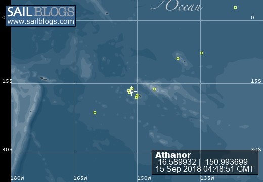
Photo Albums


Comments