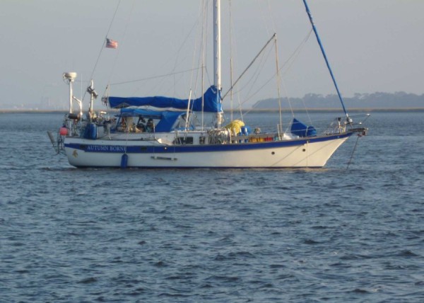
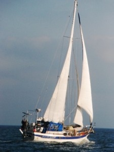
Autumn Borne Cruising
CSY-44 Antigua - Hull 001
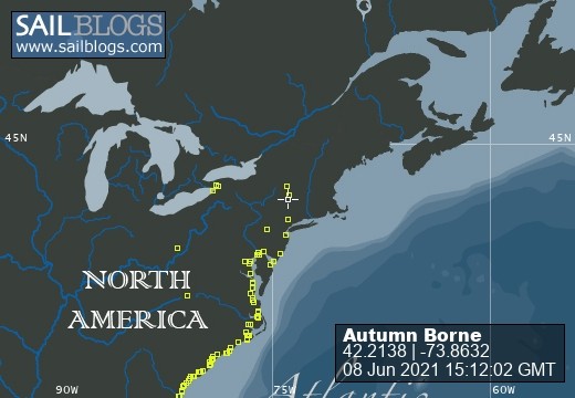
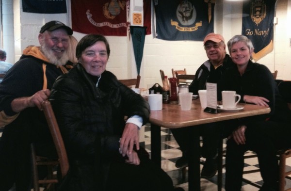
01 January 2024 | Shady Harbor Marina -- Coyman's Landing
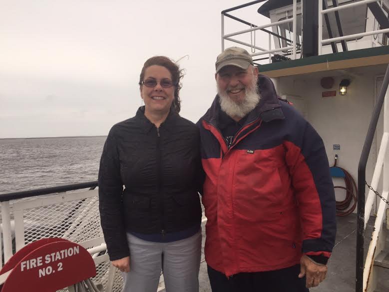
22 November 2022 | Beaufort SC
06 September 2022 | Catskill NY
15 July 2022 | Catskill
02 July 2022 | catskill, NY
19 June 2022 | Catskill NY
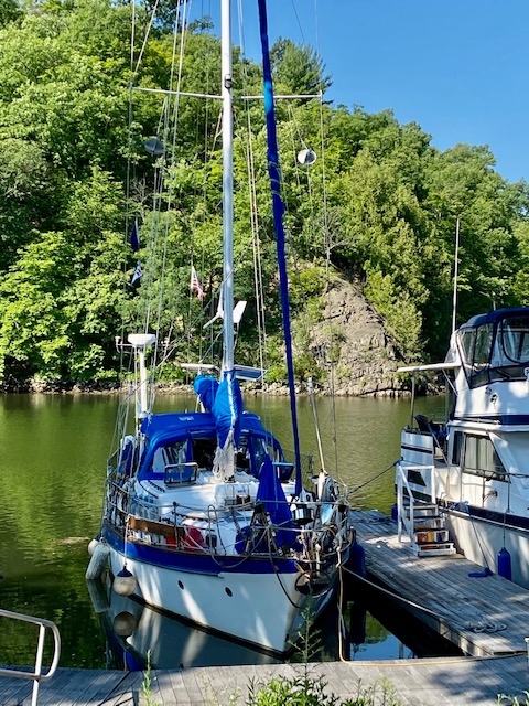
05 June 2022 | Catskill Marina
15 March 2022
14 February 2022
08 February 2022
02 February 2022 | VERO Beach
05 September 2021 | Catskill Marina
22 July 2021 | Catskill NY
18 July 2021
11 July 2021 | Dock at Catskill Marina
24 June 2021 | Catskill Marina
24 June 2021 | Catskill, NY
22 June 2021
22 June 2021
19 June 2021 | CATSKILL
Sunday Monday Tuesday LOGS - beating feet NORTH
19 April 2016 | Belhaven NC
Dean - WARM and sunny
Sunday - 17 April 2016 St. James Plantation to Wrightsville Beach
Departure day from St. James Marina.
We had breakfast with Janet, and Bill Brown (residents at St. James plantation). Then they assisted us off the dock. The slip-ways are wide enough but the wind was a factor in turning the AB... It took perhaps 5 "back & Fills" to turn her toward the exit.
We had been at that Marina a few days less than a month... NICE, but we were ready to "beat FEET" to the north. We had accomplished our automobile trip to the north to see the "grand-Baby", Lillian Rose. And that was wonderful... Expensive, but wonderful! Plus Enterprise double billed us, but I think that's been taken care of NOW. $$$
Our hosts (so to speak) at St. James, THE BROWN's were great... as you probably surmised from previous log posts.... Touring, eating out, eating IN, car ferry rides, open mic nights at the waterfront, etc.
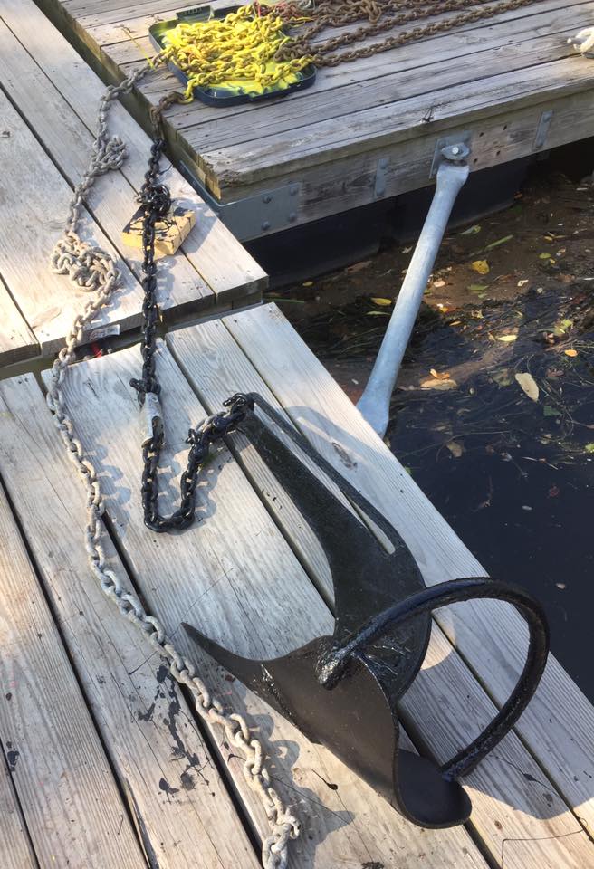
We needed fuel, and a pumpout, so our first stop was the South Harbour Village gas dock (about 3 miles east on the AICW). We loaded on about 70 gallons of diesel (Bow tank). That will be gone by the time we get to the mid-Chesapeake, (maybe the Solomon's or Deltaville), unless we get some really, really good sailing days.
The trip up the Cape Fear River was fight, (against the very end of the ebb tide); but nothing like the trip up "snow's cut"... a ROCK BARGE entered ahead of AB, and two Sailing vessels... Whoaa !!! They were WAY ahead of us.. .and we caught them in a "heart-beat"... why you ask....is AB that FAST.... NO...The Rock barge could only make 1.3 knots against the current in the cut. So once we entered the cut too...we had to literally "mark time" in place at several places (rock walls or shoals on both sides)...
BUT... The good news... we did get to pass the barge and made it all the way to Wrightsville Beach.
Anchored with JUST two other sailing vessels at Wrightsville Beach (unheard of normally)... at
N 34 12.310 W077 78.023
Monday - 18 April - Wrightsville Beach to Beaufort NC
We rose very early on Monday... and made the 0700 hr opening of the bascule bridge. That was the last bridge that we made on time... EVERY other bridge is OUT of sync with the speed of a normal Sailing vessel... i.e. IF the tide is NOT 100% at your stern you cannot possibly make the next bridge Opening. So the end result is the "bridge dance" (backing and filling to keep off the side shoals)... or you slow up SO much while approaching the bridge that you "make the operator mad" that you aren't "BRINGING your boat up to the bridge"... (making HIS job easier).
The approach to the Surf City Bridge is so ridiculous I added about 8 marks on our chart Plotter...as I approached so that if the current increased and handling became a problem I could "run BACK to those marks (where I KNEW the depth was safe).
Anyway... WE decided to skip our normal anchorage at Mile Hammock Bay (Camp Lejeune) and make the run for Beaufort (70 nm away). So in doing that we saved a day. WE actually anchored at the USCG base before sundown (minutes before, but before).
Our "USCG anchorage" (adjacent to CG) is N34 42.151 W 076 41.120 after 70 nm of travel that day.
Tuesday - `19 April 2016 Beaufort NC to Belhaven
Today we slept in a bit... rising just a few minutes after the sunrise... instead of the intended 1 hour before sunrise... So we were a bit late in our departure from the USCG base anchorage at Beaufort (south of Radio Is.). But we did catch the end of the flood tide, going north... so we carried 7 to 8 knots of SOG most of the way toward Cedar Creek. (well, we had sail too)...
I had hopes of just sailing (no motor) the Neuse River (eastbound)... and it started well.. but 20 minutes into the Neuse leg, the wind just quit.... I left all the sail up and It may have helped a bit, but not enough to "just sail". Bummer. I finally took it all down in the Hoboken Canal... (R.E. Mayo).
We did motor/sail the Pamlico, and some of the Pungo.... We finally stopped short of our goal, but this anchorage at Belhaven has (touch wood) CBS TV. (that's important on Tuesday!!! )
Belhaven anchorage at N35 31.809 W 076 37.164 after 60 nm of travel.
Departure day from St. James Marina.
We had breakfast with Janet, and Bill Brown (residents at St. James plantation). Then they assisted us off the dock. The slip-ways are wide enough but the wind was a factor in turning the AB... It took perhaps 5 "back & Fills" to turn her toward the exit.
We had been at that Marina a few days less than a month... NICE, but we were ready to "beat FEET" to the north. We had accomplished our automobile trip to the north to see the "grand-Baby", Lillian Rose. And that was wonderful... Expensive, but wonderful! Plus Enterprise double billed us, but I think that's been taken care of NOW. $$$
Our hosts (so to speak) at St. James, THE BROWN's were great... as you probably surmised from previous log posts.... Touring, eating out, eating IN, car ferry rides, open mic nights at the waterfront, etc.
We needed fuel, and a pumpout, so our first stop was the South Harbour Village gas dock (about 3 miles east on the AICW). We loaded on about 70 gallons of diesel (Bow tank). That will be gone by the time we get to the mid-Chesapeake, (maybe the Solomon's or Deltaville), unless we get some really, really good sailing days.
The trip up the Cape Fear River was fight, (against the very end of the ebb tide); but nothing like the trip up "snow's cut"... a ROCK BARGE entered ahead of AB, and two Sailing vessels... Whoaa !!! They were WAY ahead of us.. .and we caught them in a "heart-beat"... why you ask....is AB that FAST.... NO...The Rock barge could only make 1.3 knots against the current in the cut. So once we entered the cut too...we had to literally "mark time" in place at several places (rock walls or shoals on both sides)...
BUT... The good news... we did get to pass the barge and made it all the way to Wrightsville Beach.
Anchored with JUST two other sailing vessels at Wrightsville Beach (unheard of normally)... at
N 34 12.310 W077 78.023
Monday - 18 April - Wrightsville Beach to Beaufort NC
We rose very early on Monday... and made the 0700 hr opening of the bascule bridge. That was the last bridge that we made on time... EVERY other bridge is OUT of sync with the speed of a normal Sailing vessel... i.e. IF the tide is NOT 100% at your stern you cannot possibly make the next bridge Opening. So the end result is the "bridge dance" (backing and filling to keep off the side shoals)... or you slow up SO much while approaching the bridge that you "make the operator mad" that you aren't "BRINGING your boat up to the bridge"... (making HIS job easier).
The approach to the Surf City Bridge is so ridiculous I added about 8 marks on our chart Plotter...as I approached so that if the current increased and handling became a problem I could "run BACK to those marks (where I KNEW the depth was safe).
Anyway... WE decided to skip our normal anchorage at Mile Hammock Bay (Camp Lejeune) and make the run for Beaufort (70 nm away). So in doing that we saved a day. WE actually anchored at the USCG base before sundown (minutes before, but before).
Our "USCG anchorage" (adjacent to CG) is N34 42.151 W 076 41.120 after 70 nm of travel that day.
Tuesday - `19 April 2016 Beaufort NC to Belhaven
Today we slept in a bit... rising just a few minutes after the sunrise... instead of the intended 1 hour before sunrise... So we were a bit late in our departure from the USCG base anchorage at Beaufort (south of Radio Is.). But we did catch the end of the flood tide, going north... so we carried 7 to 8 knots of SOG most of the way toward Cedar Creek. (well, we had sail too)...
I had hopes of just sailing (no motor) the Neuse River (eastbound)... and it started well.. but 20 minutes into the Neuse leg, the wind just quit.... I left all the sail up and It may have helped a bit, but not enough to "just sail". Bummer. I finally took it all down in the Hoboken Canal... (R.E. Mayo).
We did motor/sail the Pamlico, and some of the Pungo.... We finally stopped short of our goal, but this anchorage at Belhaven has (touch wood) CBS TV. (that's important on Tuesday!!! )
Belhaven anchorage at N35 31.809 W 076 37.164 after 60 nm of travel.
Comments
| Vessel Name: | Autumn Borne |
| Vessel Make/Model: | CSY-44-Antigua |
| Hailing Port: | Buffalo, New York |
| Crew: | Dean and Susan Perry |
| About: | Full time cruisers for 14 years, now. We cruise about 3500 nautical miles each season, from the top of the Hudson River (NY) to either the FL keys; the Bahamas; or the west side of FL, for the Winters. |
| Extra: | Our CSY-44-Antigua is hull #001. |
Autumn Borne's Photos - Main
 |
Autumn Borne has new home in 2020 - summer...
14 Photos
Created 25 August 2020
|
 |
Vero Beach 2020 - Limit to this seasons southerly travels... Activities and Projects.
9 Photos
Created 24 February 2020
|
 |
 |
preparation projects on the AB...for trip south
6 Photos
Created 30 September 2018
|
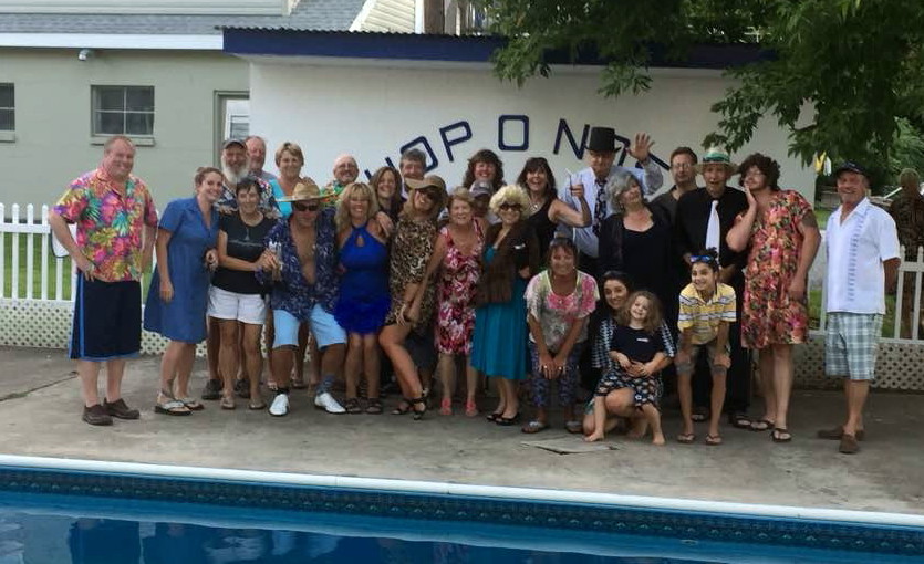 |
Goodwill Date NIGHT at the pool at HOP-O-Nose.
Great Fun with good folks.
spouses buy outfits for the other party.
5 Photos
Created 6 August 2017
|
 |
2017 Trip to the Abacos Islands - BAHAMAS
4 Photos
Created 15 February 2017
|
 |
Wonderful time at St. Marys GA -
8 Photos
Created 1 December 2016
|
 |
Bill and Janet took us to Wilmington NC ( aka "the big city") by car on FRiday...
GREAT TRIP
6 Photos
Created 16 April 2016
|
 |
We were invited for Pasta Night with Mike and Vickie McKinnon, to the new home of Michele and Steve Papile (s/v John Rae). Wonderful day !!
6 Photos
Created 19 February 2016
|
 |
 |
FALL 2015 - Trip South along EAST Coast of USA
8 Photos
Created 15 November 2015
|
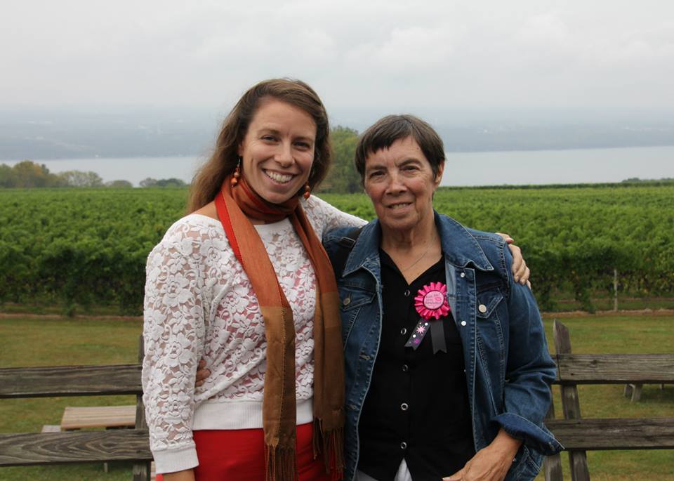 |
Wonderful time at a Finger-Lakes wine tasting tour, organized by our daughter, Ruth.
The tour was followed by a B-day celebration, and dinner at a local restaurant.
Friends, and Relatives gathered from all over NY, and PA. GREAT TIME !!!
7 Photos
Created 18 September 2015
|
 |
After Key West - winter of 2015 spent in Boot Key Harbor, and Marathon FL.
Lot's of friends here...
12 Photos
Created 19 April 2015
|
 |
Vacation from Cruising... Becoming a tourist again.... and a wonderful visit from our kids.
6 Photos
Created 22 February 2015
|
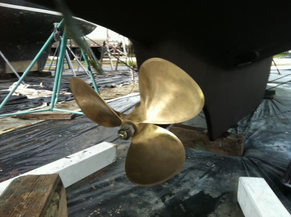 |
AB on the Hard for bottom work, and new paint.
Propeller staightened, and cleaned up by professional prop shop.... two dents, and numerous nicks... and scratches...gone now... plus "pitch" checked and trued...
Cutless bearing removed, and reset...
9 Photos
Created 18 December 2014
|
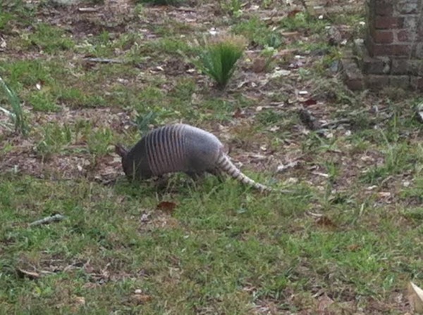 |
Cumberland Island GA - great place to visit... like walking on an alien planet
6 Photos
Created 1 December 2014
|
 |
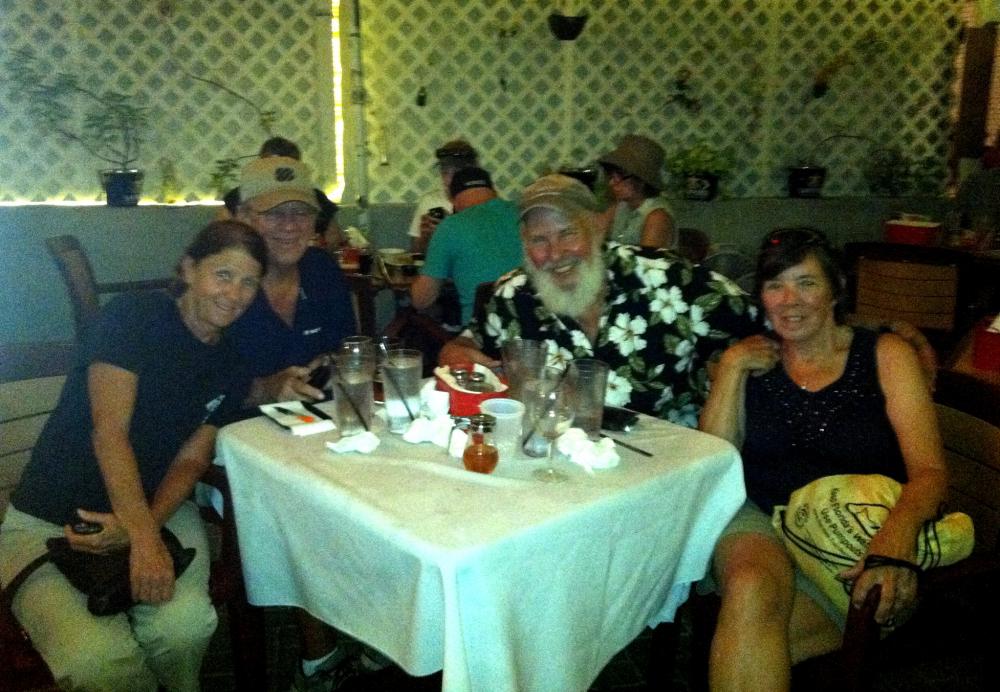
Traveling with Benny and Lisa on the S/V Rhiannon, and then Ilene, and Roger, on the s/v ILENE. Beautiful Beaufort SC until we had to leave before our anchor let GO in a blow and tide... and a wonderful ST. Mary's Thanksgiving.
6 Photos
Created 30 November 2014
|
 |
dinner for 8, cooked by Ondra, and Nelson on Last Boat... eaten by the crews from Autumn Borne, SEEKER, Last Boat, and Endurance.
4 Photos
Created 12 March 2014
|
 |
 |
rented car in Titusville, FL. Drove to Glenville, NY in two days.
Christmas with Ruth, Matt, and the kids (Billie, and Charlie).
5 Photos
Created 25 December 2012
|
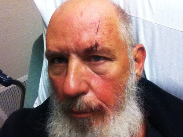 |
Painting the trim at Ruth's house, led to some interesting happenings... Like my first ambulance ride (head wound).
4 Photos
Created 28 September 2012
|
 |
photos from our past, and hopefully from our sixth year 'out'.
4 Photos
Created 16 September 2012
|
Autumn Borne
Who: Dean and Susan Perry
Port: Buffalo, New York