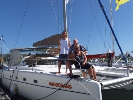
BANGORANG!
15 September 2017 | Tacoma
13 July 2017
12 July 2017
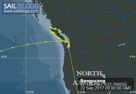
26 June 2017 | West Vancouver Island
24 June 2017 | North Vancouver Island
23 June 2017 | North Vancouver Island
22 June 2017 | North Vancouver Island, BC
21 June 2017 | East Thurlow Island
20 June 2017 | Quadra Island
17 June 2017 | Vancouver Island
15 June 2017 | Comox, BC
12 June 2017 | Nanimo, BC
10 June 2017 | Saltspring Island, BC
09 June 2017 | Victoria, BC
04 June 2017 | Port Townsend
04 June 2017 | Blake Island
03 June 2017 | Tacoma
29 July 2016 | Neah Bay, WA
29 July 2016 | Neah Bay
Baie de Prony - Geocache Bonanza
28 September 2015 | Baie de Prony, New Caledonia
Colin
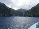
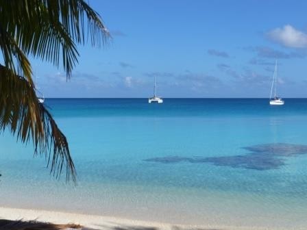
Baie de Prony is a huge bay on the south end of the New Caledonia mainland and is comprised of several smaller bays, inlets and islands. There are many anchorages and places to explore. On the NE side of the bay there is a huge mining operation that has carved up the hillsides and is constantly belching smoke and steam from the ore processing facility. Believe it or not this place is called Mordor…
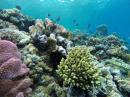
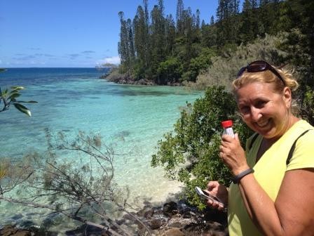
We arrived in Baie de Prony about midday and snuck past Mordor to a lovely little island called Ile Casy, which is also a nature preserve. Here we picked up a mooring placed by the government to keep the yachties from anchoring in the delicate coral that covers the bottom. Out of curiosity I snorkeled the mooring to check it out and to my surprise discovered a sunken sailboat about 35 ft long on the bottom amongst the beautiful coral. Disregarding that, Ile Casy was a beautiful spot. We enjoyed a nice hike all the way round the island and found 5(!) geocaches.
From Ile Casy we moved a few miles over to Prony, which is a restored historic village that in its day had started as a prison and been converted to a logging then mining camp. It was in great shapeand an interesting walk. Scored 2 more geocaches at Prony.
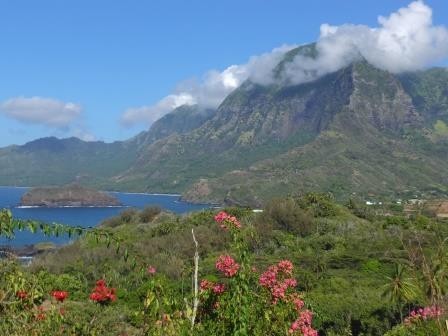
We then moved up into the far head of the bay to Baie de Carenage. This was a very well protected anchorage with many trails and points of interest. There were 2 hot spring baths, one modern (+1 geocache) and one historic. Unfortunately, both were only lukewarm. The historic bath was built of brick on a bank in the middle of the river and used small chimneys to trap the hot water wherever it bubbled out of the rock, and then channel it into the tub. I guess the old time miners enjoyed a good soak too. There were also several waterfalls here, the best of which was about a 40min walk in, but worth it. There was another geocache here too.
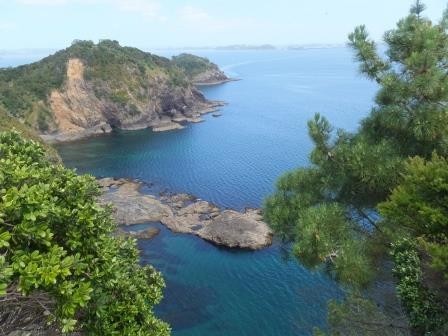
After a few days in Baie de Carenage we moved down to another large inlet called Bonne Anse near the mouth of Baie de Prony. Here we took another mooring in a pretty little bay called Anse Majic. The attraction here was a hike to the lighthouse (185 mt elevation) with a stunning overlook of the southern islands and extensive reefs. Oh, and there was also another geocache to be found… At this point the weather forecast showed 2 days of light NE winds which provided an excellent opportunity to sail the 35 miles SE to Ile de Pins (Pines).
We arrived in Baie de Prony about midday and snuck past Mordor to a lovely little island called Ile Casy, which is also a nature preserve. Here we picked up a mooring placed by the government to keep the yachties from anchoring in the delicate coral that covers the bottom. Out of curiosity I snorkeled the mooring to check it out and to my surprise discovered a sunken sailboat about 35 ft long on the bottom amongst the beautiful coral. Disregarding that, Ile Casy was a beautiful spot. We enjoyed a nice hike all the way round the island and found 5(!) geocaches.
From Ile Casy we moved a few miles over to Prony, which is a restored historic village that in its day had started as a prison and been converted to a logging then mining camp. It was in great shapeand an interesting walk. Scored 2 more geocaches at Prony.
We then moved up into the far head of the bay to Baie de Carenage. This was a very well protected anchorage with many trails and points of interest. There were 2 hot spring baths, one modern (+1 geocache) and one historic. Unfortunately, both were only lukewarm. The historic bath was built of brick on a bank in the middle of the river and used small chimneys to trap the hot water wherever it bubbled out of the rock, and then channel it into the tub. I guess the old time miners enjoyed a good soak too. There were also several waterfalls here, the best of which was about a 40min walk in, but worth it. There was another geocache here too.
After a few days in Baie de Carenage we moved down to another large inlet called Bonne Anse near the mouth of Baie de Prony. Here we took another mooring in a pretty little bay called Anse Majic. The attraction here was a hike to the lighthouse (185 mt elevation) with a stunning overlook of the southern islands and extensive reefs. Oh, and there was also another geocache to be found… At this point the weather forecast showed 2 days of light NE winds which provided an excellent opportunity to sail the 35 miles SE to Ile de Pins (Pines).
Comments
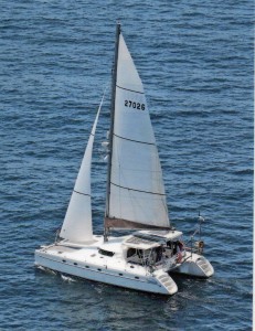
| Vessel Name: | Bangorang |
| Hailing Port: | Ventura, CA |
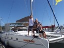
| Crew: | Colin, Wendy and Skid |
| Extra: | Urban Dictionary: Bangorang - The word from the film "Hook" meaning, basically, awesome! |
Bangorang's Photos - Main
 |
 |
 |
 |
 |
 |
 |
 |
 |
 |
 |
 |
 |
 |
 |
A 2 week road trip to Seattle and back on the PCH
18 Photos
Created 5 October 2013
|
 |
 |
 |
 |
 |
 |
 |
Who: Colin, Wendy and Skid
Port: Ventura, CA
Gallery