Beth and Evans
Most recent Blogs
SailBlogs Friends

19 September 2013 | Mills creek
06 August 2013 | smith cove
04 August 2013 | cradle cove
31 July 2013 | Broad cove, Islesboro Island
24 July 2013 | Maple Juice Cove
06 June 2013 | Maple Juice Cove, Maine
02 June 2013 | Onset, cape cod canal
20 May 2013 | Marion
18 May 2013 | Marion
16 May 2013 | Mattapoisett
10 May 2013 | Block ISland
02 May 2013 | Delaware Harbour of Refuge
16 April 2013 | Sassafras River
01 April 2013 | Cypress creek
06 March 2013 | Galesville, MD
20 August 2012 | South River, MD
09 August 2012 | Block Island
06 August 2012 | Shelburne, Nova Scotia
20 July 2012 | Louisburg
18 July 2012 | Lousiburg, Nova Scota
Hawk in the Magellan Straits
01 February 2008 | Caleta Hidden, opposite Cabo Froward, Straits of Magellan, Chile
Buenas! Hawk is lying to her anchor and two stern lines off a rocky beach at the head of a narrow, mile and a half long inlet surrounded by low hills. We are now back in the far south where extreme weather tends to be the norm. We've had winds of gale force and higher since we reached this harbor on Wednesday, and after a twelve hour break tomorrow, another system will arrive with more of the same. For the most part, the strong winds outside our snug haven blow right over us, making a low humming sound that sometimes rises to a growl when a gust whips across the surface of the water. If it hits the boat just right, it causes the heater in the corner across from me to huff and snap, or to rumble in a low purr. The wind has many different voices down here, the most distinctive of which is the freight-train shriek it makes when it hits 50 or 60 knots. We've yet to hear that sound this trip, but when we were in this area in 2002 we would sometimes hear it for several minutes before Hawk got thrown back against her anchor or fetched up against her stern lines. The "Roaring Forties" are supposedly named for this unforgettable sound.
Wednesday, two days ago, was a typical day in Chilean Patagonia, to the extent that any day is typical. We had anchored Tuesday night at Bah�a Mussel, a large bay located on Isla Carlos III right between Paso Tortuoso and Paso Ingles at roughly the midpoint of the Straits of Magellan. The westernmost point of Isla Carlos III is called Cabo Crosstides, and it is the place where the Pacific tide, flooding in from the western entrance to the Magellan, meets the Atlantic tide, flooding in from the east. As is to be expected, tidal currents in this area are quite confused, even more so because high tide on the Atlantic side is three hours earlier than high tide on the Pacific side. Luckily, the currents on either side rarely exceed three knots or so, enough to make life interesting but not dangerous - unless strong winds are opposing one or the other of the currents.
Besides straddling the crossroads where the two currents meet, Isla Carlos III marks the spot where the Straits of Magellan takes a little jog at Paso Tortuoso. From its western entrance, the Magellan runs straight southeast and averages five miles in width to the island, a distance of nearly 90 miles. High mountains border the Magellan for that entire length, many snow-capped and some covered with glaciers. So when strong northwest winds blow, they get funneled and accelerated down the length of the Magellan until they meet their first impediment - Isla Carlos III. The winds roar over the top of the island and back down again into the next section of the Magellan which runs southeast for another 40 miles before turning northeast at Cabo Froward, the most southerly point on the American continent. The island has two harbors that would be bulletproof anywhere else in the world. Here they are considered fair weather anchorages only.
And fair weather was what we had when we arrived on Tuesday night. We anchored at the head of Bah�a Mussel knowing that the forecast called for moderate winds overnight, but it was supposed to die off early Wednesday when we planned to sail to the anchorage where we are now, forty miles further down the Magellan. The wind started to blow as forecast late in the afternoon at around 20 knots. But it built overnight, and by Wednesday morning we had a steady 30 knots with gusts up to 40. The anchorage had good holding in a deep mud bottom, and the island was too low to produce williwaws or rachas, the katabatic wind gusts that accelerate winds of that strength to 60 knots and more. Our anchor was well dug in, and we were perfectly safe.
But the forecast called for even stronger winds over the next three days, and both of us preferred to find a truly secure anchorage where we'd be sheltered from the wind and where we might be able to leave the boat and go ashore. Our only concern was the prospect of wind against tide in the Magellan. The strait was visible from our anchorage, and when we had first gotten up a layer of what appeared to be white mist hung over the frothing white of the water in Paso Ingles. The wind was picking up the water and atomizing it into smoke, which happens in williwaws or in wind against tide conditions. We waited a few hours until the tide had changed in our favor, which was fortunately with the wind, and the channel started looking passable.
So we decided to head out to our next anchorage. Evans motored up on the anchor while I raised it, and then we worked our way out of the harbor. On the chart, the anchorage was a blank space that showed almost no soundings. When traversing these not infrequent "white" areas on the charts, kelp is our guide. Kelp visible on the surface tends to be in depths of 30 feet or less, and there is almost always something shallower than that in the middle of a large kelp patch. As we were working our way out of the anchorage, we strayed a bit too far to the east and found ourselves blocked by two large areas of kelp. We were exposed to the full force of the wind in the channel, and it was blowing at close to 40 knots. We had to turn almost dead upwind and motor around these before we could fall off again and head out into the channel. Once out, we were able to get a sense of how much wind we really had, and we decided to put up the staysail.
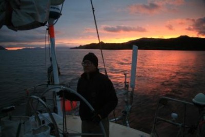
As is often the case after the barometer finishes its drop and starts to rise, the day was sunny and bright, and visibility was nearly unlimited with white-capped peaks rising above rocky ridges in the distance on all sides. The wind had whipped the channel up into a welter of whitecaps and was blowing the crests of the two- to three-foot waves downwind into long, lacy fingers of spindrift. Hawk was racing along under just the staysail, doing 8 to 9 knots with a knot of current and 35 knots and more of wind over the stern.
Shortly after we came out of the anchorage, we saw a freighter coming our way. All crews sailing yachts in the channels are required to monitor channel 16 and to report to lighthouses, freighters, naval patrol vessels - anyone who calls them. As is usually the case, the pilot called us in Spanish, and I spent ten minutes on the radio giving him our name, call sign, port of origin, port of destination, flag, number of people on board and so on. Since the first week in January, this has been our only interaction with other people down here. We have spoken on the radio with three lighthouse keepers, a half dozen pilots on freighters, and two other crews on yachts - neither of whom we managed to share an anchorage with.
It took us just over four hours to make good the 35 miles to our next anchorage. For some time before we reached it, we could see Cabo Froward, the blunt, mesa-like cape that marks the southernmost extent of the American continent - south of this cape to Cape Horn, all of the land masses are islands. From now until we leave the Beagle in eight months or so, we won't touch on the mainland again, at least not with the boat. Yet the islands are large enough to include some of the highest mountains in the Andes which are covered with snowfields and glaciers. The largest island, Isla Grande de Tierra del Fuego, is about half the size of Tasmania or Ireland, yet its population (115,000) is well less than that of a small American city.
As its name suggests, the entrance to Caleta Hidden was all but impossible to see until we were right on top of it. Several small islands and some very large kelp patches lay off a low peninsula that blended into the higher land behind. As we passed the kelp patches, we startled a snoozing sea lion whose flippers were waving in the air. He rolled over and poked his head out of the water when he was just six feet off our beam, did a most comical double-take, and then somersaulted away from us in a flurry of nose, flippers and tail. Peale's dolphins joined us as we reached the entrance and darted ahead of the boat to lead the way in. These handsome dolphins are native to the channels and look very similar to Dusky dolphins with dark gray to black coloration except for gray sides and a wave-shaped gray stripe that runs from their tail to their dorsal fin. One leaped clear out of the water as we entered, apparently delighted to have company.
Just as we came through the entrance, I caught sight of what looked to be a white snowball at the tide line on shore. I grabbed the binoculars and saw a pair of kelp geese, the male an astonishingly bright white color that makes him stand out like a red buoy in this landscape, and the female a mix of brown and black that allows her to blend in completely with her background. Several chicks waddled along after their parents as they scrambled higher up the beach to get away from Hawk. As we motored into the entrance, a pair of steamer ducks took off in a flurry of whitewater. Like the kelp geese, these flightless ducks are found nowhere else in the world. When threatened, they take off across the water pinwheeling their wings and kicking their feet like a windup toy, throwing up a welter of water while they steam off.
Based on the forecast, we had expected the wind to drop during the day, but when we reached the entrance it was still blowing strongly in the Magellan. It was a relief, then, to round the corner and have the wind drop immediately. The bay was bordered by two long, relatively low ridges covered with tussock grass and sparsely dotted with stunted trees. The sides of the inlet closed in about halfway down its length, where we had to pick our way through a narrow channel between an island and a large kelp patch. On the other side of this, the inlet opened again into a large basin a half a mile or so in width with 20 knots of wind blowing down from the head of the harbor. A much smaller basin lay at the head, where a cove was backed by a beach of flat stones with tall trees behind it. The best berth would be backed right up to the beach in that cove with an anchor out off the bow and two lines off our stern tied to the trees ashore. That would orient our stern to the southwest, and the trees would protect us from the wind.
So now the shore line process began. We carry two tall mesh bags - about chest height - with a metal hoop in the mouth so they stay open on their own. Each bag holds a 300-foot polypropylene line. When we're underway, these are secured standing up in front of the binnacle. I had already taken these and placed them out on the sidedeck, laid on their sides, with the mouth open. I had pulled about twenty feet of line out of each bag, taken it through the stern pulpit on the same side and then coiled it and put the loop around the primary winch. I had opened the large blocks attached to the stern quarter through which our stern lines run, but I had not put the lines through the blocks - that would wait until after we had run the line ashore. Now it was time to put the dinghy in the water. Evans motored upwind until we were most of the way across the basin and then put the boat in neutral and let her drift.
We never tow the dinghy in the channels - the winds are just too unpredictable - and we certainly wouldn't tow it in the conditions in the Magellan that day. So our inflatable dinghy was stowed right side up on deck. We attached a halyard to the bridle inside of it, untied it from the deck and, without lifting it from the coachroof positioned it so that the stern was over the sidedeck. Evans got the outboard off its mount at the back of the boat, and he carried it around to the dinghy and secured it. I winched the dinghy off the deck and over the lifelines and Evans eased it over the side of the boat. He secured the painter as tightly as he could to the spring cleat, and I lowered the dinghy into the water. I went back to the cockpit, took the helm and turned us back upwind while Evans dropped down into the dinghy alongside the boat and started the outboard. He left it running and climbed back aboard, and then he took the helm. He started backing toward the head of the cove while I freed the anchor and set up the snubber. Our guide showed that we would need to anchor in about 25-30 feet to have enough scope to reach the shore with the lines. When we were still a ways from where he wanted to drop the anchor, he had me drop 25 feet of chain over the bow.
Judging distance to shore can be very difficult. About the only thing that offers some scale are the trees. But in some anchorages, these grow to only fifteen or twenty feet in height, while in more protected anchorages they may be twice that high. From one anchorage to another, then, your eye can easily be deceived. Evans is very good at telling how far we are and deciding where to drop the anchor. I have learned not to question his judgment, because I am almost always wrong. Evans called to me to start dropping, and though I thought we were much to close, I let the anchor go, calling out the amount of chain as it went over the bow roller - "50 feet, 75 feet, 100 feet, 125 feet." At that point, Evans called to me to come back to the stern. The boat was in reverse and the helm locked. "I want the port line," he said, as he lowered himself over the side and into the dinghy. I grabbed the coiled line off the port winch as he pulled himself to the stern. I tossed the coils into the dinghy and he grabbed it. Then he took off at full throttle toward the shore.
This is the part where I usually get nervous. Most of the safest coves are also the smallest ones, some no more than about twice the width of the boat. If the wind is doing anything but blowing us straight in or straight out of the cove, we have a tendency to drift toward the shore. If we have the boat in reverse, the prop walk can also carry us toward the shore. Evans always picks the line that is slightly upwind to take ashore first, and he gets it tied to something as quickly as possible so that I can use it to hold the boat in position. We have learned that the best way to do this is to run in with the outboard even if Evans has to row the last bit to get through kelp. We have also learned to leave the line out of the block it will later run through, otherwise kinks in the line pull Evans up short and have almost jerked him right out of the dinghy. In the narrowest coves with wind on the beam, we will drop an anchor on short scope at the mouth of the cove and Evans will take our longest line - over 600 feet - in and secure it. I will then winch us in using the primary winches - but that's a lot more work than getting close to the shore and getting the line ashore efficiently. In this harbor I wasn't worried - the beach was a hundred feet wide, and there was nothing for us to hit. All I had to do was to keep the boat reversing into the wind so we didn't bounce forward while I waited for Evans to find a good tree and tie the line to it.
Evans landed the dinghy on the beach, cut the outboard, tossed the dinghy anchor onto the rocks, and took the line ashore. He strode quickly to the back of the beach and started looking for a good tree. He had to toss the line over a high branch, but then he pulled a lot of line through and tied a loop long enough that the bowline that held it was over the edge of the beach, where he could reach it easily when we were leaving. Once he yelled to me that it was secure, I put the line on the primary and started grinding it in, stopping only to put the line through the snatch block and close it when I had some tension on it. Evans pulled himself back to the boat using the line I was winching in, climbed up on board and started letting out more chain while I continued to pull the line in astern. When we started to get close to the kelp line just off the beach, I went below and got our handheld depth sounder. We were about 25 feet off the beach with 12 feet of water at the stern at mid-tide, so we decided we were in a good position. Evans then climbed back in the dinghy and we repeated the process for the second line. There was some more back and forth as we put the snubber on the anchor chain and again made sure our rudder had sufficient depth before the boat was fully secured.
From the time we reach an anchorage until the boat is secured, the sails flaked and covered, the extra line back in each of the bags, and we're able to strip out of our foul weather gear can be anywhere from forty-five minutes to two hours, depending on how many lines we put out and if we have to move any before we're done. In this case, it took about an hour and a half. We had gotten up at 7:00, watched the weather and the tide until 11:00, sailed until 3:00 and went below at 4:30. And we had sailed through some of the most magnificent scenery on the planet and seen some of the most unusual wildlife. Not a bad day.
Here's to a typical day in a most unusual place,
Beth and Evans
s/v Hawk
Wednesday, two days ago, was a typical day in Chilean Patagonia, to the extent that any day is typical. We had anchored Tuesday night at Bah�a Mussel, a large bay located on Isla Carlos III right between Paso Tortuoso and Paso Ingles at roughly the midpoint of the Straits of Magellan. The westernmost point of Isla Carlos III is called Cabo Crosstides, and it is the place where the Pacific tide, flooding in from the western entrance to the Magellan, meets the Atlantic tide, flooding in from the east. As is to be expected, tidal currents in this area are quite confused, even more so because high tide on the Atlantic side is three hours earlier than high tide on the Pacific side. Luckily, the currents on either side rarely exceed three knots or so, enough to make life interesting but not dangerous - unless strong winds are opposing one or the other of the currents.
Besides straddling the crossroads where the two currents meet, Isla Carlos III marks the spot where the Straits of Magellan takes a little jog at Paso Tortuoso. From its western entrance, the Magellan runs straight southeast and averages five miles in width to the island, a distance of nearly 90 miles. High mountains border the Magellan for that entire length, many snow-capped and some covered with glaciers. So when strong northwest winds blow, they get funneled and accelerated down the length of the Magellan until they meet their first impediment - Isla Carlos III. The winds roar over the top of the island and back down again into the next section of the Magellan which runs southeast for another 40 miles before turning northeast at Cabo Froward, the most southerly point on the American continent. The island has two harbors that would be bulletproof anywhere else in the world. Here they are considered fair weather anchorages only.
And fair weather was what we had when we arrived on Tuesday night. We anchored at the head of Bah�a Mussel knowing that the forecast called for moderate winds overnight, but it was supposed to die off early Wednesday when we planned to sail to the anchorage where we are now, forty miles further down the Magellan. The wind started to blow as forecast late in the afternoon at around 20 knots. But it built overnight, and by Wednesday morning we had a steady 30 knots with gusts up to 40. The anchorage had good holding in a deep mud bottom, and the island was too low to produce williwaws or rachas, the katabatic wind gusts that accelerate winds of that strength to 60 knots and more. Our anchor was well dug in, and we were perfectly safe.
But the forecast called for even stronger winds over the next three days, and both of us preferred to find a truly secure anchorage where we'd be sheltered from the wind and where we might be able to leave the boat and go ashore. Our only concern was the prospect of wind against tide in the Magellan. The strait was visible from our anchorage, and when we had first gotten up a layer of what appeared to be white mist hung over the frothing white of the water in Paso Ingles. The wind was picking up the water and atomizing it into smoke, which happens in williwaws or in wind against tide conditions. We waited a few hours until the tide had changed in our favor, which was fortunately with the wind, and the channel started looking passable.
So we decided to head out to our next anchorage. Evans motored up on the anchor while I raised it, and then we worked our way out of the harbor. On the chart, the anchorage was a blank space that showed almost no soundings. When traversing these not infrequent "white" areas on the charts, kelp is our guide. Kelp visible on the surface tends to be in depths of 30 feet or less, and there is almost always something shallower than that in the middle of a large kelp patch. As we were working our way out of the anchorage, we strayed a bit too far to the east and found ourselves blocked by two large areas of kelp. We were exposed to the full force of the wind in the channel, and it was blowing at close to 40 knots. We had to turn almost dead upwind and motor around these before we could fall off again and head out into the channel. Once out, we were able to get a sense of how much wind we really had, and we decided to put up the staysail.
As is often the case after the barometer finishes its drop and starts to rise, the day was sunny and bright, and visibility was nearly unlimited with white-capped peaks rising above rocky ridges in the distance on all sides. The wind had whipped the channel up into a welter of whitecaps and was blowing the crests of the two- to three-foot waves downwind into long, lacy fingers of spindrift. Hawk was racing along under just the staysail, doing 8 to 9 knots with a knot of current and 35 knots and more of wind over the stern.
Shortly after we came out of the anchorage, we saw a freighter coming our way. All crews sailing yachts in the channels are required to monitor channel 16 and to report to lighthouses, freighters, naval patrol vessels - anyone who calls them. As is usually the case, the pilot called us in Spanish, and I spent ten minutes on the radio giving him our name, call sign, port of origin, port of destination, flag, number of people on board and so on. Since the first week in January, this has been our only interaction with other people down here. We have spoken on the radio with three lighthouse keepers, a half dozen pilots on freighters, and two other crews on yachts - neither of whom we managed to share an anchorage with.
It took us just over four hours to make good the 35 miles to our next anchorage. For some time before we reached it, we could see Cabo Froward, the blunt, mesa-like cape that marks the southernmost extent of the American continent - south of this cape to Cape Horn, all of the land masses are islands. From now until we leave the Beagle in eight months or so, we won't touch on the mainland again, at least not with the boat. Yet the islands are large enough to include some of the highest mountains in the Andes which are covered with snowfields and glaciers. The largest island, Isla Grande de Tierra del Fuego, is about half the size of Tasmania or Ireland, yet its population (115,000) is well less than that of a small American city.
As its name suggests, the entrance to Caleta Hidden was all but impossible to see until we were right on top of it. Several small islands and some very large kelp patches lay off a low peninsula that blended into the higher land behind. As we passed the kelp patches, we startled a snoozing sea lion whose flippers were waving in the air. He rolled over and poked his head out of the water when he was just six feet off our beam, did a most comical double-take, and then somersaulted away from us in a flurry of nose, flippers and tail. Peale's dolphins joined us as we reached the entrance and darted ahead of the boat to lead the way in. These handsome dolphins are native to the channels and look very similar to Dusky dolphins with dark gray to black coloration except for gray sides and a wave-shaped gray stripe that runs from their tail to their dorsal fin. One leaped clear out of the water as we entered, apparently delighted to have company.
Just as we came through the entrance, I caught sight of what looked to be a white snowball at the tide line on shore. I grabbed the binoculars and saw a pair of kelp geese, the male an astonishingly bright white color that makes him stand out like a red buoy in this landscape, and the female a mix of brown and black that allows her to blend in completely with her background. Several chicks waddled along after their parents as they scrambled higher up the beach to get away from Hawk. As we motored into the entrance, a pair of steamer ducks took off in a flurry of whitewater. Like the kelp geese, these flightless ducks are found nowhere else in the world. When threatened, they take off across the water pinwheeling their wings and kicking their feet like a windup toy, throwing up a welter of water while they steam off.
Based on the forecast, we had expected the wind to drop during the day, but when we reached the entrance it was still blowing strongly in the Magellan. It was a relief, then, to round the corner and have the wind drop immediately. The bay was bordered by two long, relatively low ridges covered with tussock grass and sparsely dotted with stunted trees. The sides of the inlet closed in about halfway down its length, where we had to pick our way through a narrow channel between an island and a large kelp patch. On the other side of this, the inlet opened again into a large basin a half a mile or so in width with 20 knots of wind blowing down from the head of the harbor. A much smaller basin lay at the head, where a cove was backed by a beach of flat stones with tall trees behind it. The best berth would be backed right up to the beach in that cove with an anchor out off the bow and two lines off our stern tied to the trees ashore. That would orient our stern to the southwest, and the trees would protect us from the wind.
So now the shore line process began. We carry two tall mesh bags - about chest height - with a metal hoop in the mouth so they stay open on their own. Each bag holds a 300-foot polypropylene line. When we're underway, these are secured standing up in front of the binnacle. I had already taken these and placed them out on the sidedeck, laid on their sides, with the mouth open. I had pulled about twenty feet of line out of each bag, taken it through the stern pulpit on the same side and then coiled it and put the loop around the primary winch. I had opened the large blocks attached to the stern quarter through which our stern lines run, but I had not put the lines through the blocks - that would wait until after we had run the line ashore. Now it was time to put the dinghy in the water. Evans motored upwind until we were most of the way across the basin and then put the boat in neutral and let her drift.
We never tow the dinghy in the channels - the winds are just too unpredictable - and we certainly wouldn't tow it in the conditions in the Magellan that day. So our inflatable dinghy was stowed right side up on deck. We attached a halyard to the bridle inside of it, untied it from the deck and, without lifting it from the coachroof positioned it so that the stern was over the sidedeck. Evans got the outboard off its mount at the back of the boat, and he carried it around to the dinghy and secured it. I winched the dinghy off the deck and over the lifelines and Evans eased it over the side of the boat. He secured the painter as tightly as he could to the spring cleat, and I lowered the dinghy into the water. I went back to the cockpit, took the helm and turned us back upwind while Evans dropped down into the dinghy alongside the boat and started the outboard. He left it running and climbed back aboard, and then he took the helm. He started backing toward the head of the cove while I freed the anchor and set up the snubber. Our guide showed that we would need to anchor in about 25-30 feet to have enough scope to reach the shore with the lines. When we were still a ways from where he wanted to drop the anchor, he had me drop 25 feet of chain over the bow.
Judging distance to shore can be very difficult. About the only thing that offers some scale are the trees. But in some anchorages, these grow to only fifteen or twenty feet in height, while in more protected anchorages they may be twice that high. From one anchorage to another, then, your eye can easily be deceived. Evans is very good at telling how far we are and deciding where to drop the anchor. I have learned not to question his judgment, because I am almost always wrong. Evans called to me to start dropping, and though I thought we were much to close, I let the anchor go, calling out the amount of chain as it went over the bow roller - "50 feet, 75 feet, 100 feet, 125 feet." At that point, Evans called to me to come back to the stern. The boat was in reverse and the helm locked. "I want the port line," he said, as he lowered himself over the side and into the dinghy. I grabbed the coiled line off the port winch as he pulled himself to the stern. I tossed the coils into the dinghy and he grabbed it. Then he took off at full throttle toward the shore.
This is the part where I usually get nervous. Most of the safest coves are also the smallest ones, some no more than about twice the width of the boat. If the wind is doing anything but blowing us straight in or straight out of the cove, we have a tendency to drift toward the shore. If we have the boat in reverse, the prop walk can also carry us toward the shore. Evans always picks the line that is slightly upwind to take ashore first, and he gets it tied to something as quickly as possible so that I can use it to hold the boat in position. We have learned that the best way to do this is to run in with the outboard even if Evans has to row the last bit to get through kelp. We have also learned to leave the line out of the block it will later run through, otherwise kinks in the line pull Evans up short and have almost jerked him right out of the dinghy. In the narrowest coves with wind on the beam, we will drop an anchor on short scope at the mouth of the cove and Evans will take our longest line - over 600 feet - in and secure it. I will then winch us in using the primary winches - but that's a lot more work than getting close to the shore and getting the line ashore efficiently. In this harbor I wasn't worried - the beach was a hundred feet wide, and there was nothing for us to hit. All I had to do was to keep the boat reversing into the wind so we didn't bounce forward while I waited for Evans to find a good tree and tie the line to it.
Evans landed the dinghy on the beach, cut the outboard, tossed the dinghy anchor onto the rocks, and took the line ashore. He strode quickly to the back of the beach and started looking for a good tree. He had to toss the line over a high branch, but then he pulled a lot of line through and tied a loop long enough that the bowline that held it was over the edge of the beach, where he could reach it easily when we were leaving. Once he yelled to me that it was secure, I put the line on the primary and started grinding it in, stopping only to put the line through the snatch block and close it when I had some tension on it. Evans pulled himself back to the boat using the line I was winching in, climbed up on board and started letting out more chain while I continued to pull the line in astern. When we started to get close to the kelp line just off the beach, I went below and got our handheld depth sounder. We were about 25 feet off the beach with 12 feet of water at the stern at mid-tide, so we decided we were in a good position. Evans then climbed back in the dinghy and we repeated the process for the second line. There was some more back and forth as we put the snubber on the anchor chain and again made sure our rudder had sufficient depth before the boat was fully secured.
From the time we reach an anchorage until the boat is secured, the sails flaked and covered, the extra line back in each of the bags, and we're able to strip out of our foul weather gear can be anywhere from forty-five minutes to two hours, depending on how many lines we put out and if we have to move any before we're done. In this case, it took about an hour and a half. We had gotten up at 7:00, watched the weather and the tide until 11:00, sailed until 3:00 and went below at 4:30. And we had sailed through some of the most magnificent scenery on the planet and seen some of the most unusual wildlife. Not a bad day.
Here's to a typical day in a most unusual place,
Beth and Evans
s/v Hawk
Comments
| Vessel Name: | Hawk |
Gallery not available
Most recent Blogs
SailBlogs Friends