
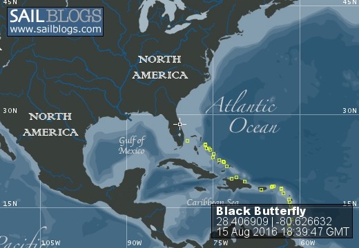
Black Butterfly
15 August 2016 | Cape Canaveral
20 April 2016 | Bimini
17 April 2016 | Governors Habour
06 April 2016
06 April 2016
20 March 2016 | Puerto Bahia Marina Samana
05 March 2016
05 March 2016 | Isla Caja De Muertos
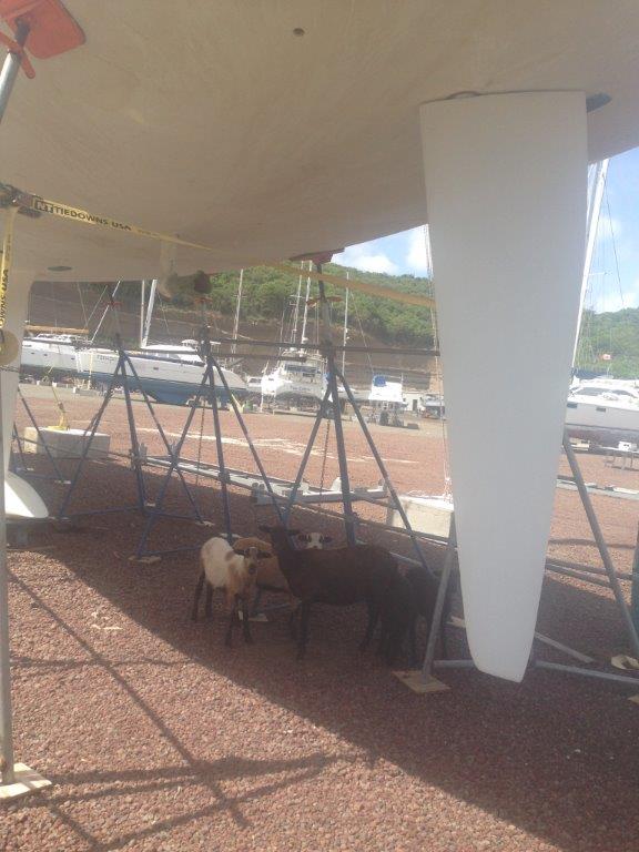
25 November 2015 | Clarkes Court Boatyard, Grenada
01 November 2015 | HALLOWEEN GRENADA HASH HOUSE
26 October 2015 | Grenada
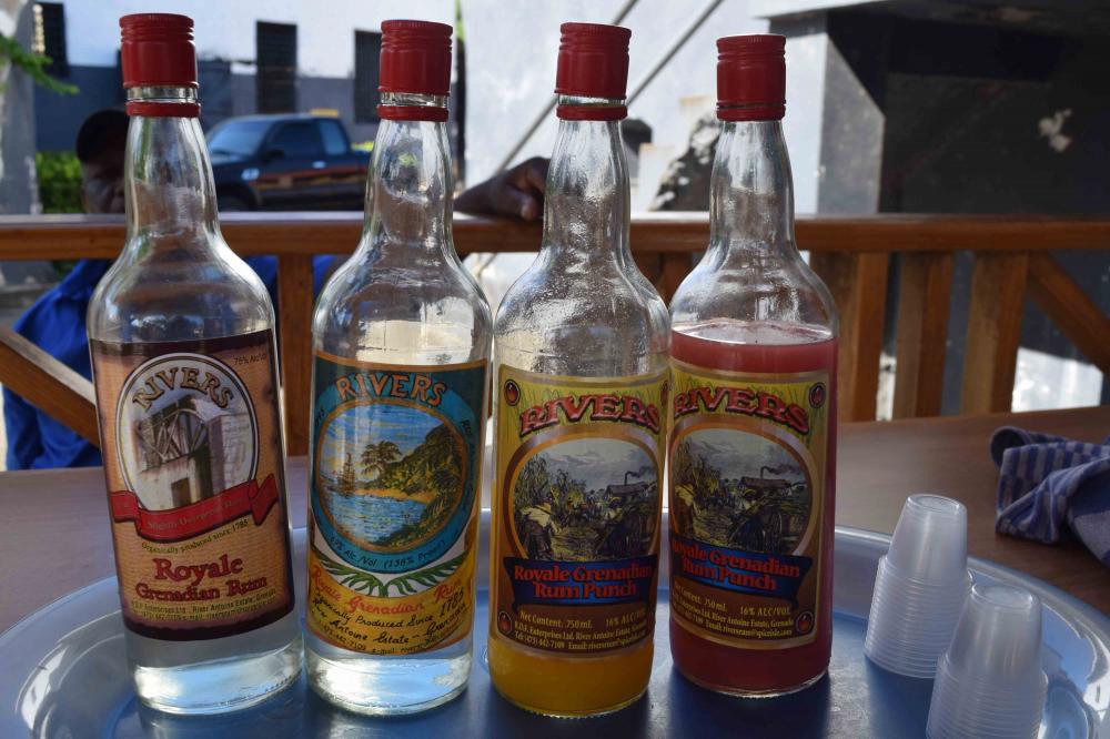
20 October 2015 | Rivers Rum Distillery, Grenada
18 October 2015 | Grenada
17 October 2015 | Grenada
11 October 2015 | Mt Horn near Grenville, Grenada
20 September 2015 | Grenada Hash House Harriers at St Davids
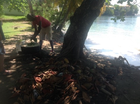
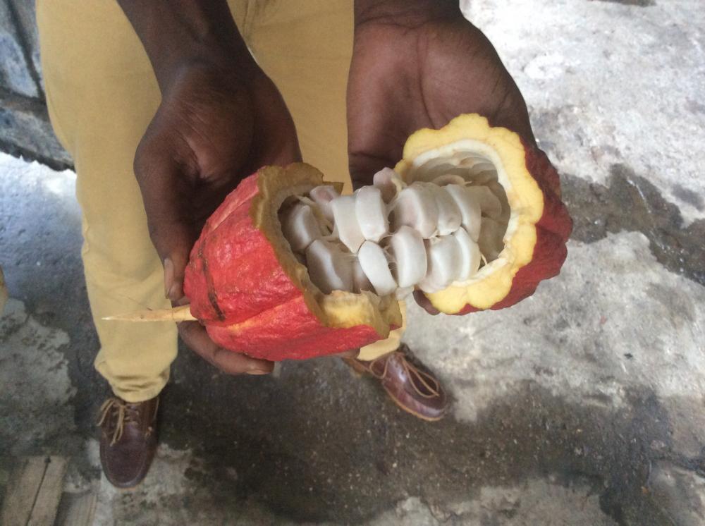
20 September 2015 | Grenada Chocolate Factory
06 September 2015 | Clarkes Court Boatyard, Grenada
21 August 2015 | Grenada
31 July 2015 | Carriacou
Cambiosa to The Bahamas
06 April 2016
A small swell had started to enter the bay of Cambiosa but it was not a major problem, but it did increase during the night and by morning was rolling our boat so much it woke us up with things rolling around. The was no wind so we ended up side on to the swell. We listened to the weather on HF, then packed the boat up and headed the next 65 NM towards Manzanillo(pronounced Manza neo).
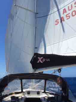
We had an amazing downwind run with the sails "butterflied", we don't goosewing anymore, in 20 - 25 knots wind. We were hoping to get into Mananillo before the forecast 25-30 knot winds forecast for the late afternoon. We almost made it, but not quite, the last 10 NM were in the higher NE winds, we had already put 2 reefs in and we're still surfing along, with Jay recording 12.2 knots. I wasn't going to take the helm!
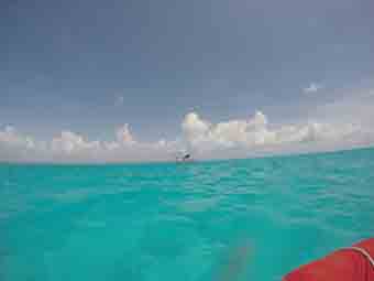
hidden in the swell
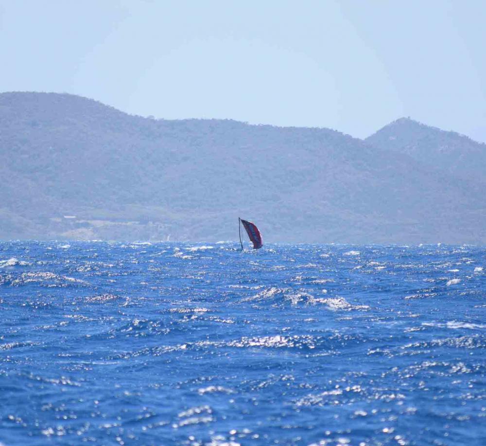
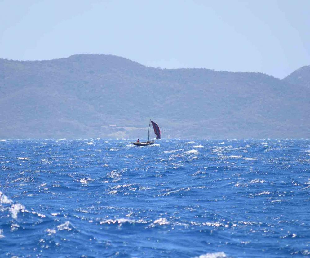
Whilst we sailed along the north coast we saw some small open craft with red/brown sails, and a branch for a mast, they must have been over 6 NM from the coast in 2.5 metre rough seas, crazy!
We sailed through some small islands approaching Cape Manzanillo, we were on the look out for an abandoned Canadian ferry. Can't wait to here that story! Well the book that supposedly had been updated in 2015 was again incorrect... No ferry. We headed towards Manzanillo this was a deep bay that cut the wind in half and totally no swell.
Unfortunately the forecast which we had worsened and we were in for 4 days of strengthening winds 20 -25 with gusts to 30, during the mornings 25-35 in the afternoon into the evening, with the wind funneling through the Bahamas channel. Looks like we are staying in Manzanillo for Easter.
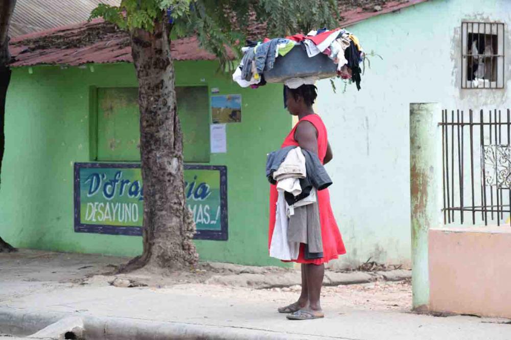
Manzanillo is very different to the other small parts of the DR that we have seen and very different to the other islands of the Caribbean. It is dry and arid. The town is said to be for the workers in the banana plantations, but there is a small container port here also. The whole town is very run down. The trees are green but the ground is rocks and grass is all but dead. You can see the infrastructure was there but there has been no maintenance and most things are crumbling and falling down, including the container wharf.
We had toyed with the idea of going via Cuba to the East coast of the U.S., planned the stops etc but decided that it would be too long a sail, when we could have easier jaunts through the Bahamas. We have lost time already to weather and just want to get up as far north as possible to leave us time for weather issue later in April. We have a deadline of leaving the U.S. at the end April.
It was awfully hard sitting in a fairly protected bay thinking surely we can leave?, but then listening to the weather, no still 30 knots. It finally moderated and we headed off Easter Sunday afternoon, in what we expected to be E/SE 15-20 knots. We had 30 NE. Not what we want so headed back to the protected bay. The next morning was calm as again and we worked out that the wind was coming up in the late pm evening along the cost of DR, so we left straight after breakfast, 8 am. We changed our plans and instead of heading to Great Inagua, the southern most island of the Bahamas, we headed north as quickly as possible trying to get away from the winds funneling through past DR and Cuba in the afternoons. Our destination, the island of Mayaguana (pronounced Maygwana)
We actually had to motor out from Manzanillo as there was no wind! Once we cleared the coast line we had a nice 15-20 knots, from the NE, the wind was supposed to be E/SE but we hoped that was still coming, on a comfortable reach we were off to the Bahamas! The wind did eventually go E with a smattering of SE and gradually increased so that for the most part we were in 20-25 knots. As dark fell we had about 2 hours where the wind was 25-30, by this stage we had dropped the main. We hurtled along at 8-9.5 knots with some nice surfs to 12. We decided to overnight, or what was left of it, at West Caicos, part of the Turks and Caicos, islands not part of the Bahamas to the East, neither of us enjoys a night of little sleep. As we got closer to West Caicos both the swell and wind dropped and we arrived doing 6 knots at 2am, found a dive mooring to attach to along the coast and by 3 am was sound asleep. We left just before 8am as that is when the dive boats were due in.
We arrived as Mayaguana around 2:30pm, and prepared to go from a depth of 300 metres of water to 5 metres in roughly 100 metres distance. Daunting. We followed some tried and tested waypoints in to amazingly light blue crystal clear water. We very quickly got to 3.5 metres and continued into this huge bay, surrounded and protected by reef. We anchored the boat about 2NM into the bay and dropped off the end of the boat for a much deserved swim. The clarity was amazing; the sandy bottom had lots a sea potatoes, a very large sea urchin that lives under the sand, and queen conch and other sea shell life.
From the western entrance we had come through it was a 6 NM dinghy ride to the township and customs, into the wind and fetch. We checked out Maps.me app (thank you Pauline!) and found a round and tracks from further south so we put the bikes in the dinghy and motored 1.5 NM to the beach and rode into town. We got to see the abandoned buildings and airport that the Americans left behind sometime in the 70s. There was supposed to be a capsule that took the first photos of earth from afar and landed not far from the Island but all we found was a derelict monument to the occasion. The ride in of course was also into the wind, but we weren't getting wet! We completed Customs and immigration and bought a SIM card, US$371 poorer after that we had an almost free wheel ride back to the dinghy, with the wind behind us.
We went for a snorkel out near the reef and found a good sized cray fish, but it got the better of me when I had to come up for air and had scuttled away. We decided to stay an extra day and do some more cray hunting. I fashioned a cray catcher out of plastic tubing and a computer security cable I wasn't using, not like I am used to but it should work I hope. Well we found a cray and spent 1/2 - 3/4 hour getting it out......yeh......but the discovered it had eggs! Damn, I got coral scraps for nothing, I put her back where she came from. We wondered off to find another which we did but that also evaded us. Oh well chicken for dinner again.
We moved out of the bay and headed up the west coast so we could get a clear water exit at first light the next morning. The area we were going to was supposed to have plenty of sand but was struggled to find any to anchor in, finally I took the dinghy and scouted around, found a patch about 600 wide and 2 metres long and we maneuvered and dropped the hook there. We recently bought a Rocna anchor and it catches almost every time very quickly and digs in quickly, we have greater confidence with this anchor than we did with the Bruce style.
We headed off the next morning and stopped overnight at a small bay on Acklands Island, a little rolly as with our draft we could not tuck in well but it didn't keep us awake.
After listening to the weather at 0630am we headed to an area on Long Island called Salt Pond, or Clarence town. We stayed here a couple of day finding cray ready for taking the next morning with tanks on. The Northerly that we were expecting came in lighter than expected so instead of crayfishing we headed off to Rum Island 30NM north. There were stronger northerly's coming and Rum Island offered better protection.
I managed to catch a small tuna on the way so was very happy.
Rum Cay as been a good place to be in these 25-30 knot NE /E.
We had an amazing downwind run with the sails "butterflied", we don't goosewing anymore, in 20 - 25 knots wind. We were hoping to get into Mananillo before the forecast 25-30 knot winds forecast for the late afternoon. We almost made it, but not quite, the last 10 NM were in the higher NE winds, we had already put 2 reefs in and we're still surfing along, with Jay recording 12.2 knots. I wasn't going to take the helm!
hidden in the swell
Whilst we sailed along the north coast we saw some small open craft with red/brown sails, and a branch for a mast, they must have been over 6 NM from the coast in 2.5 metre rough seas, crazy!
We sailed through some small islands approaching Cape Manzanillo, we were on the look out for an abandoned Canadian ferry. Can't wait to here that story! Well the book that supposedly had been updated in 2015 was again incorrect... No ferry. We headed towards Manzanillo this was a deep bay that cut the wind in half and totally no swell.
Unfortunately the forecast which we had worsened and we were in for 4 days of strengthening winds 20 -25 with gusts to 30, during the mornings 25-35 in the afternoon into the evening, with the wind funneling through the Bahamas channel. Looks like we are staying in Manzanillo for Easter.
Manzanillo is very different to the other small parts of the DR that we have seen and very different to the other islands of the Caribbean. It is dry and arid. The town is said to be for the workers in the banana plantations, but there is a small container port here also. The whole town is very run down. The trees are green but the ground is rocks and grass is all but dead. You can see the infrastructure was there but there has been no maintenance and most things are crumbling and falling down, including the container wharf.
We had toyed with the idea of going via Cuba to the East coast of the U.S., planned the stops etc but decided that it would be too long a sail, when we could have easier jaunts through the Bahamas. We have lost time already to weather and just want to get up as far north as possible to leave us time for weather issue later in April. We have a deadline of leaving the U.S. at the end April.
It was awfully hard sitting in a fairly protected bay thinking surely we can leave?, but then listening to the weather, no still 30 knots. It finally moderated and we headed off Easter Sunday afternoon, in what we expected to be E/SE 15-20 knots. We had 30 NE. Not what we want so headed back to the protected bay. The next morning was calm as again and we worked out that the wind was coming up in the late pm evening along the cost of DR, so we left straight after breakfast, 8 am. We changed our plans and instead of heading to Great Inagua, the southern most island of the Bahamas, we headed north as quickly as possible trying to get away from the winds funneling through past DR and Cuba in the afternoons. Our destination, the island of Mayaguana (pronounced Maygwana)
We actually had to motor out from Manzanillo as there was no wind! Once we cleared the coast line we had a nice 15-20 knots, from the NE, the wind was supposed to be E/SE but we hoped that was still coming, on a comfortable reach we were off to the Bahamas! The wind did eventually go E with a smattering of SE and gradually increased so that for the most part we were in 20-25 knots. As dark fell we had about 2 hours where the wind was 25-30, by this stage we had dropped the main. We hurtled along at 8-9.5 knots with some nice surfs to 12. We decided to overnight, or what was left of it, at West Caicos, part of the Turks and Caicos, islands not part of the Bahamas to the East, neither of us enjoys a night of little sleep. As we got closer to West Caicos both the swell and wind dropped and we arrived doing 6 knots at 2am, found a dive mooring to attach to along the coast and by 3 am was sound asleep. We left just before 8am as that is when the dive boats were due in.
We arrived as Mayaguana around 2:30pm, and prepared to go from a depth of 300 metres of water to 5 metres in roughly 100 metres distance. Daunting. We followed some tried and tested waypoints in to amazingly light blue crystal clear water. We very quickly got to 3.5 metres and continued into this huge bay, surrounded and protected by reef. We anchored the boat about 2NM into the bay and dropped off the end of the boat for a much deserved swim. The clarity was amazing; the sandy bottom had lots a sea potatoes, a very large sea urchin that lives under the sand, and queen conch and other sea shell life.
From the western entrance we had come through it was a 6 NM dinghy ride to the township and customs, into the wind and fetch. We checked out Maps.me app (thank you Pauline!) and found a round and tracks from further south so we put the bikes in the dinghy and motored 1.5 NM to the beach and rode into town. We got to see the abandoned buildings and airport that the Americans left behind sometime in the 70s. There was supposed to be a capsule that took the first photos of earth from afar and landed not far from the Island but all we found was a derelict monument to the occasion. The ride in of course was also into the wind, but we weren't getting wet! We completed Customs and immigration and bought a SIM card, US$371 poorer after that we had an almost free wheel ride back to the dinghy, with the wind behind us.
We went for a snorkel out near the reef and found a good sized cray fish, but it got the better of me when I had to come up for air and had scuttled away. We decided to stay an extra day and do some more cray hunting. I fashioned a cray catcher out of plastic tubing and a computer security cable I wasn't using, not like I am used to but it should work I hope. Well we found a cray and spent 1/2 - 3/4 hour getting it out......yeh......but the discovered it had eggs! Damn, I got coral scraps for nothing, I put her back where she came from. We wondered off to find another which we did but that also evaded us. Oh well chicken for dinner again.
We moved out of the bay and headed up the west coast so we could get a clear water exit at first light the next morning. The area we were going to was supposed to have plenty of sand but was struggled to find any to anchor in, finally I took the dinghy and scouted around, found a patch about 600 wide and 2 metres long and we maneuvered and dropped the hook there. We recently bought a Rocna anchor and it catches almost every time very quickly and digs in quickly, we have greater confidence with this anchor than we did with the Bruce style.
We headed off the next morning and stopped overnight at a small bay on Acklands Island, a little rolly as with our draft we could not tuck in well but it didn't keep us awake.
After listening to the weather at 0630am we headed to an area on Long Island called Salt Pond, or Clarence town. We stayed here a couple of day finding cray ready for taking the next morning with tanks on. The Northerly that we were expecting came in lighter than expected so instead of crayfishing we headed off to Rum Island 30NM north. There were stronger northerly's coming and Rum Island offered better protection.
I managed to catch a small tuna on the way so was very happy.
Rum Cay as been a good place to be in these 25-30 knot NE /E.
Comments
| Vessel Name: | Black Butterfly |
| Vessel Make/Model: | X-yacht, Xp44 |
| Hailing Port: | Adelaide, South Australia |
| Crew: | Jay Brown, Glenda Neild |
Black Butterfly's Photos - Main
 |
.jpeg) |
1 hour Halloween Hash House Harriers event, Grenada
8 Photos
Created 1 November 2015
|
 |
 |
 |
.jpg) |
St Davids September 19, 2015
3 Photos
Created 20 September 2015
|
.jpg) |
 |
Who: Jay Brown, Glenda Neild
Port: Adelaide, South Australia
Gallery
.jpeg)

.jpg)
Favorites
No Links Added Yet