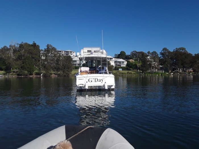
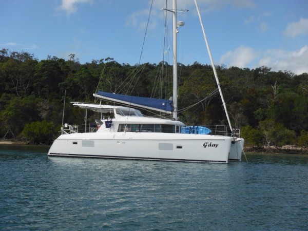
Everyday's a G'day
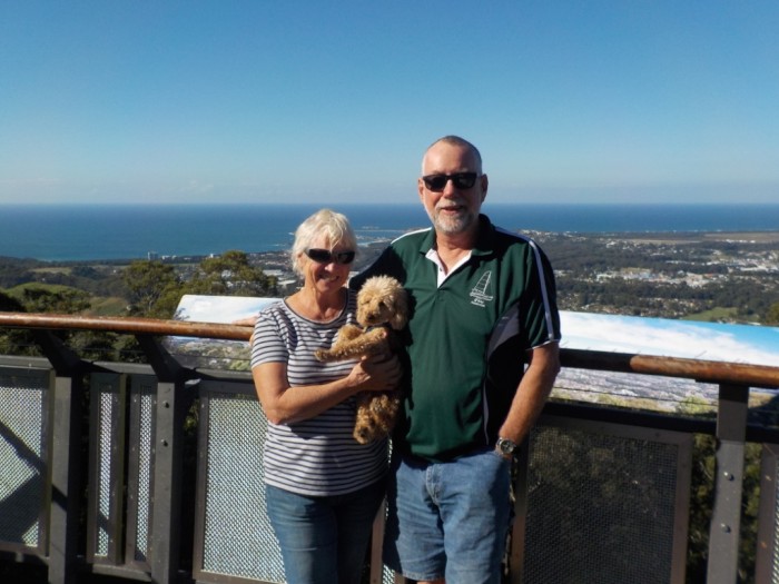
Keith and Lesley Brooker and poodle BJ, sailing from Mooloolaba to Perth by northern route.
02 June 2017
02 June 2017
02 June 2017
02 June 2017
02 June 2017
02 June 2017
02 June 2017
02 June 2017
02 June 2017
02 June 2017
02 June 2017
02 June 2017
02 June 2017
02 June 2017
02 June 2017
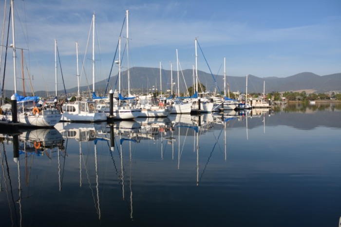
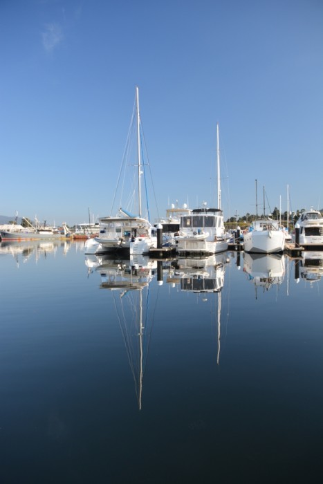
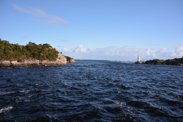
Farewell to Tassie; off back to warm, sunny Queensland
02 June 2017
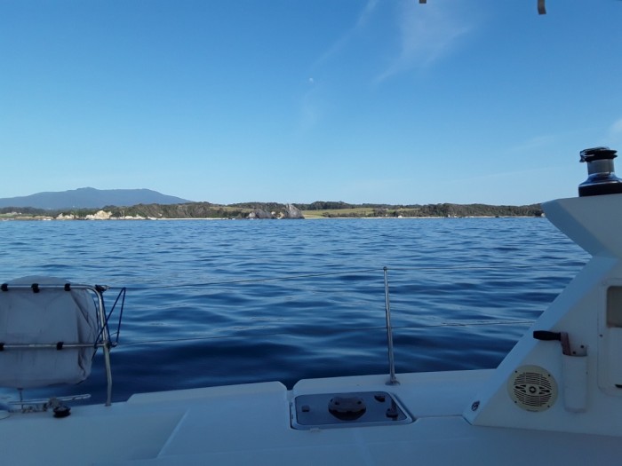
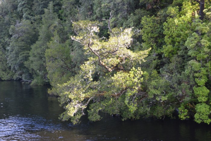
On our first day out of Hobart we pottered down the River Derwent at 4.5kn on a cold, dreary, rainy day. The catamaran, Sundowner, pulled out from Wrest Point just ahead of us, but were soon well ahead. With the sun finally squeezing a few rays between the clouds, we entered our first anchorage at Lime Bay. We had heard Sundowner requesting a bridge opening a couple of hours ahead of us, but we had opted to aim for this anchorage in lieu of not reaching Denison Canal by the afternoon high tide, which provided the alternative to take the high water early the next morning. Timing the tides is critical through this area as there are a number of variables to take into account. Firstly, the bridge is only opened between 8am and 4pm. Secondly, there are shallows just prior to the canal and a further 5nm north at Marion Flats, then a tricky bar to cross from Marion Flats out into Marion Bay. In addition, the tide floods into Blackman Bay from the south at Denison Canal and the north at Marion Flats, and there is a two hour current overrun after high tide. Hence, the aim is to have adequate water at both locations, to time our arrival for when the bridge can be opened, to have a minimal flood current with us as we traverse the narrow, fast-flowing canal, and to have the flood, but close to slack water, as we navigate the Marion Flats bar! During the afternoon we had called the Donnelly Bridge to inform them of our intention to passage the Canal at 8am the following day.
We made an early start for our crossing of Norfolk Bay, planning to reach Dennison Canal with enough time to request the opening of the bridge as close to 8 am as possible in order to coincide with the high tide. This would give us slack high water at the canal, and the two hour current overrun would give us an hour to make the 5nm up to Marion Flats and still have the high water and the delayed flood to cross Marion Flats and the bar. We were sailing across Norfolk Bay with a lovely southerly behind us, but, combined with a following current, were travelling faster than we had anticipated. A local fishing trawler was not far behind us and called the bridge master just before 8am, letting him know there was also a catamaran in front of him. We immediately called the bridge master as well and he requested we slow down so both boats could passage together. This is much easier said than done! We had already furled the sail and had the motors set at just enough revs to give us steerage, but, with both wind and current pushing us along, the trawler was not catching up fast enough and the bridge was approaching rapidly. There is nowhere to pull over in the approach to the bridge and it was a close call as it finally opened when we were Just 50m away. After that heart stopping moment we had a good run across Blackman Bay and through Marian Flats, our timing impeccable as we crossed a benign bar out into Marion Bay. With the southerly wind at 20-30 knots, we had a lovely downwind sail on the genoa, to pick up a public mooring at Shelly Beach, south of Triabunna by early afternoon.
The wind had dropped the following day, so we motor sailed across to Freycinet Peninsula, and anchored in the calm, aqua waters of Wineglass Bay, along with a bevy of Riverina power boats. With a 2- day weather window of light winds generally astern, we weighed anchor at Wineglass Bay at 2 am, along with 'Run for Paradise'. But we soon lost sight of their navigation lights as they headed up the coast, while we were on a direct bearing to Eden. Initially, the fickle winds astern, paired with confused seas, made for an uncomfortably rolly few hours. However, by dawn the wind turned east, filling the genoa more consistently, the swell was behind us and we were making 6kn on one motor and the genoa. The light easterly persisted until early evening, when the winds flipped 180 degrees and it was a race to see if we made it to the protection of the mainland before the westerly wind built to its predicted storm category. As it eventuated, we just beat the strong winds to anchor in the safety of Woodchip Bay by mid morning. In all, it had been an excellent passage across Bass Strait; mostly calm seas, averaging just over 6kn on one motor, as opposed to two on the way south, and using less than half the fuel.
Sunrise on Bass Strait
02 June 2017

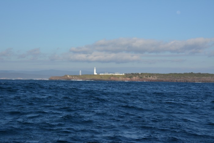
Entering Twofold Bay
02 June 2017
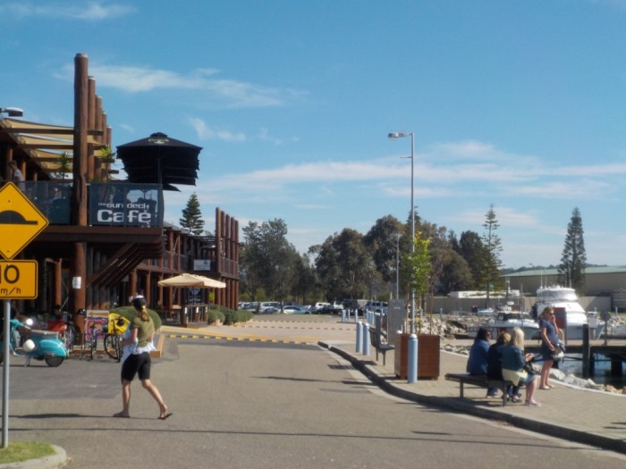
Bermagui should not be missed by yachties
02 June 2017
We did not hang about in Twofold Bay, having had our fill of the shuffle from Eden to Woodchip on our passage south, so we took the advantage of light southerlies the next day to motor sail up to Bermagui Marina. We bypassed this lovely little harbour on our way south as we had good winds to reach Eden, but, as we had no deadline for reaching our home port, we determined to visit many of the places we had sailed past in January. We took a berth in the marina for two nights and were just off for a walk round town when the catamaran, Sundowner, sailed into harbour. We are not sure where they had been or where we had overtaken them, but a short chat with Peter and Chris, before they left harbour, revealed that they were intending to join the down under rally to New Caledonia, scheduled for next month. With all the Easter weekend activities, and constant boat traffic from the slipway opposite us, there was plenty to keep us entertained for our two-day stay.
Picturesque Bermagui
02 June 2017
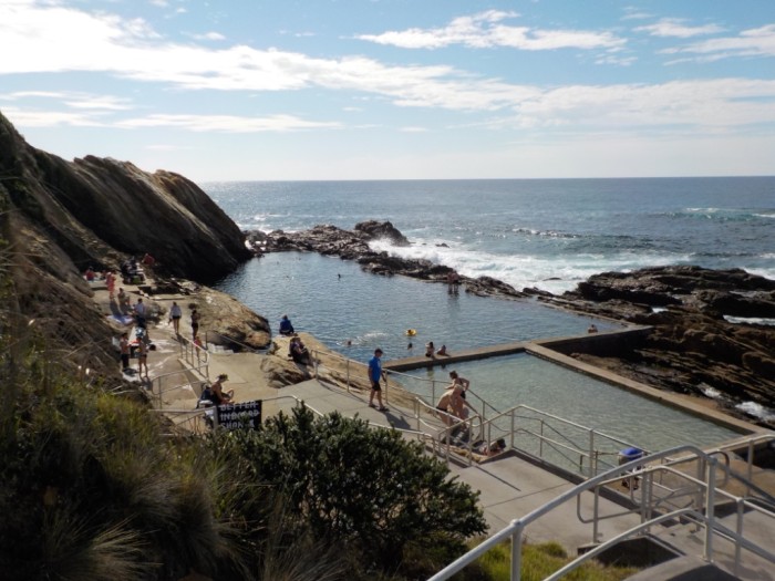
Blue Pool: The natural rock pool at Bermagui
02 June 2017
The locals are not so friendly at Tomakin Bay
02 June 2017
For our next passage to Tomakin Bay, south of Batemans Bay, we had glorious autumn and a spectacular coastline clothed in verdant green pastures. Keith spent a couple of hours sitting on the forward deck, taking in the views as we motor sailed close inshore, picking up a light breeze and the counter current to take us north. The surf onshore was too rough to dinghy in from our anchorage that afternoon, but by morning the swell had subdued enough to go for a walk. Tomakin Bay, boasts a lovely long sandy beach and it was a pleasant walk west to the lookout over the bay and township to the south. Unfortunately, our enjoyment of the location was marred on our return when a huge dog on a lead lurched for BJ as we walked past. His 120kg owner was yanked face first in the sand and the dog wrapped his lead around Keith's legs and grabbed BJ around the waist in his jaws. Keith swore at the dog and. I was relieved to see him scoop BJ into his arms as the dog dropped her. However, the clearly embarrassed owner started abusing Keith and threatened physical violence if he swore at him again! He continued to berate us as we walked away from him down the beach; Illogically shouting that BJ should have been on a lead, as if that would have circumvented the attack. He concluded by yelling that we should go back to Canberra; obviously a local with a bit of a chip on his shoulder!
Anchorage at Tomakin Bay; a pretty place, pity about the locals
02 June 2017
Several short hops while we wait for the weather window north
02 June 2017
In no hurry, and with no winds to take us far, we leisurely motored just 10nm north to Chain Bay in the afternoon, and dinghied ashore to check out Maloney’s Beach Café. Disappointingly, it was closed on Tuesday, but we made up for that by returning for breakfast the following morning. We then moved just2nm west to Square Head; from where we were able to dinghy into the Bateman Bay shops to top up on fresh food. While light winds prevailed in the mornings, the afternoons were dominated by quite strong northerlies, limiting how far we could passage north. So we decided to stay put and enjoy the glorious weather and a long walk around Square Headland. In preparation for the end of the northerlies, we moved back to Chain Bay on April 23rdready to head north the following day and headed back to Maloney’s for lunch. While the French couple who owned the café had a reasonable menu, their coffee was dreadful!
BJ in trouble, hiding behind the bathroom door
02 June 2017

A short stay in Jervis Bay
02 June 2017
Light variable winds of 0-0.5kn had been forecast, so we weighed anchor at first light to allow plenty of time for the 50nm passage to Jervis Bay. However, we had an unexpected decent southerly pushing us along, and picked up a courtesy mooring at Hole in the Wall by 3pm; plenty of time to take BJ for a walk along the beach. I had mistakenly thought the name of the bay referred to the gap between the mainland and the precipitous, offshore island, but Keith pointed out its namesake: an almost insignificant break in the limestone rock adjacent to the anchorage.
Not the hole in the wall
02 June 2017

Rather unimposing hole in the limestone wall
02 June 2017

Looking south along the perpendicular cliffs
02 June 2017
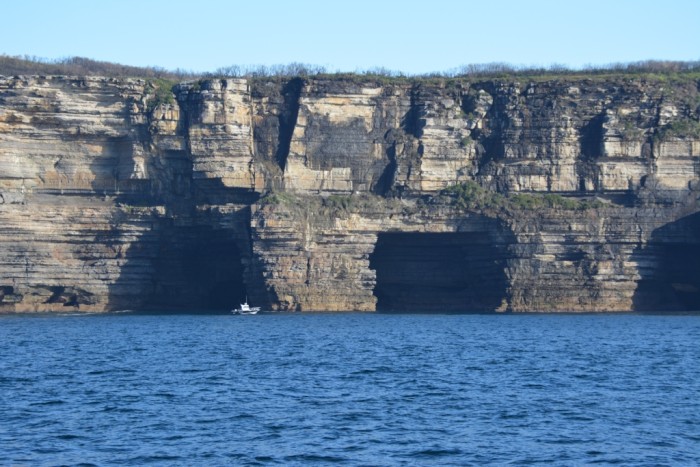
Caves in the cliffs: potential 12 apostles on the east coast in another few millennia?
02 June 2017
Exploring the Crookhaven-Shoalwater Rivers
02 June 2017
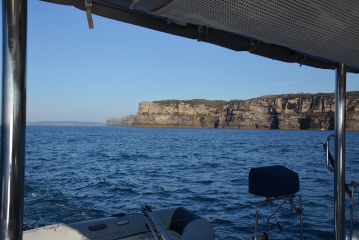
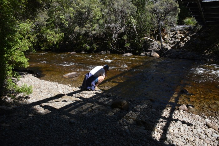
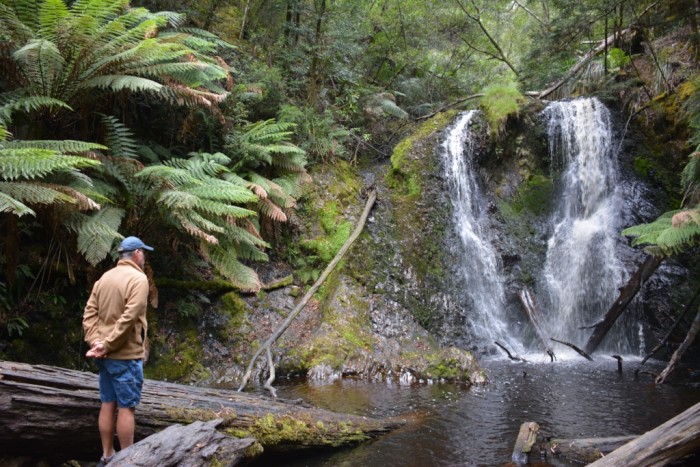
With strong winds predicted for a few days, and over 70nm up to Port Hacking, we opted for the shorter passage to Crookhaven, where we could shelter in the river for a few days. We started off well with enough wind to motor sail with the genoa and we picked up the counter current close to the cliffs north of Jervis Bay. However, as we reached the end of the Cliffs at Beecroft Head, we were suddenly hit by the east coast southern current in full force and our speed was reduced from 6.2kn down to 2kn! It was a slow trek on both motors across Crookhaven Bight to the entrance to the Crookhaven River. Fortunately, we still made it with the flood tide to cross a benign bar and anchor in the river. As for most of the rivers in NSW, the tidal currents are ferocious, so we awaited the tide change before going ashore in Greenwell to reassure ourselves that our anchor would hold once we swung 180 degrees.
We anticipated spending the next few days exploring the extensive river system. A dredged canal links the Crookhaven and Shoalhaven rivers and it is just 8nm upstream to Nowra. Despite overcast conditions the next morning, we donned our spray jackets and dinghied upriver to Shoalhaven. After a long walk, we rewarded ourselves with lunch at acafe overlooking the river. But our meal was interrupted when the threatening clouds finally burst and we had to move inside. While the café was dog friendly, BJ’s presence was restricted to the outside patio and you can imagine her disgust at being left outside. She was tethered to a table, which she could have sheltered under, but perversely, she stood in the downpour looking pathetically at us through the café door; she was drenched by the time we finished! Fortunately, the rain clouds cleared and the sun dried her out on the walk back to the dinghy.
Our river explorations were forestalled by the forecasted arrival of a front the following afternoon, which limited our movements to a morning reconnaissance of Greenwell. A predicted storm warning the following day kept us aboard all day, as we did not want to be away from G’day and risk a repeat of the episode in The Duckpond, back in January, when the anchor let loose in a sudden squall! The storm was preceded by the typical pre-frontal westerlies, and, with a swing to the south, the skies erupted in torrential rain, thunderstorms and squalls. However, by late afternoon the river was eerily calm and, fortuitously, we were not visited by the 45kn winds predicted.
Corellas invaded G’day before the storm
02 June 2017

Corellas move to another boat
02 June 2017

Stayed to the south and the north but skipped Sydney Harbour on this trip
02 June 2017
Stayed south and north but skipped Sydney Harbour on this trip
With the storms having passed, we set off for Port Hacking the following day, but while the wind had abated we had a remnant 2-3m beam swell, which, along with light tail winds, made uncomfortable rolling that consistently took the air out of the screecher. While we averaged less than 5kn that day, a 6:30am start saw us pick up a spare RMYC mooring at Jibbon Beach, Port Hacking, just as the daylight disappeared. We didn't hang about as we were looking forward to spending some time in the protected waters of Pittwater. It was a much kinder conditions the following day, with the wind a little stronger and more on the beam, and the swell all but disappeared. We even turned the motor off for a (very short) while. The sea grass at Barrenjoey Head precludes secure anchoring, but we snagged an RPAYC mooring and dinghied ashore for a walk around Palm Beach. The following morning, we went for a leisurely cruise in G’day, following the western shore of Pittwater and around Scotland Island to the RMYC. There are thousands of boats, of all descriptions, moored in the majority of bays throughout Pittwater, but we noticed that Morning Bay was a potential quiet anchorage, having sparse moorings in the shallows close to shore. We set the anchor in 8m of water but there was ample swing room to lay out adequate chain for a secure night.
With the storms having passed, we set off for Port Hacking the following day, but while the wind had abated we had a remnant 2-3m beam swell, which, along with light tail winds, made uncomfortable rolling that consistently took the air out of the screecher. While we averaged less than 5kn that day, a 6:30am start saw us pick up a spare RMYC mooring at Jibbon Beach, Port Hacking, just as the daylight disappeared. We didn't hang about as we were looking forward to spending some time in the protected waters of Pittwater. It was a much kinder conditions the following day, with the wind a little stronger and more on the beam, and the swell all but disappeared. We even turned the motor off for a (very short) while. The sea grass at Barrenjoey Head precludes secure anchoring, but we snagged an RPAYC mooring and dinghied ashore for a walk around Palm Beach. The following morning, we went for a leisurely cruise in G’day, following the western shore of Pittwater and around Scotland Island to the RMYC. There are thousands of boats, of all descriptions, moored in the majority of bays throughout Pittwater, but we noticed that Morning Bay was a potential quiet anchorage, having sparse moorings in the shallows close to shore. We set the anchor in 8m of water but there was ample swing room to lay out adequate chain for a secure night.
Big breakfast onboard G’day at Pittwater
02 June 2017

Short hop north from Pittwater to Lake Macquarie
02 June 2017
We hadn't taken on diesel since leaving POW Bay Marina, so topped up our fuel and water tanks the next morning at the RMYC and returned to Barrenjoey Head, in preparation for leaving for Port Macquarie in the morning. However, the moorings were all full and the sea grass thwarted many attempts to anchor, so we moved across the entrance of Broken Bay to Iron Ladder Bay for the night. A review of the weather and tides revealed the light winds predicted for the next few days coupled with the early afternoon high tide would not enable us to enter Lake Macquarie on the high tide. So we revised our schedule and motored around Little Box Head the next morning, picking up a courtesy mooring in Hardy's Bay, in Brisbane Waters. It was a fantastic spot, and we enjoyed a couple of days taking long walks from Killcare around Pretty Beach and Wagstaffe to the unusual rock formations at Half Tide Rocks, where white rock seams appeared to infill the ochre sandstone blocks with concrete.
We motored through the shallow channel exiting Brisbane Waters at mid ebb tide, with 0.5m below our keels at the lowest point. While there was very little wind, the remnant swell from yesterday’s strong southerly resulted in a rolly trip up to Lake Macquarie. We requested the Swansea Bridge opening for high tide at 3pm, which gave us a two hour overflow of the flood tide to take us into Lake Macquarie. Although we had been warned about the shallows just before entering the lake, we had no less than 1.2m beneath our keels.
We motored through the shallow channel exiting Brisbane Waters at mid ebb tide, with 0.5m below our keels at the lowest point. While there was very little wind, the remnant swell from yesterday’s strong southerly resulted in a rolly trip up to Lake Macquarie. We requested the Swansea Bridge opening for high tide at 3pm, which gave us a two hour overflow of the flood tide to take us into Lake Macquarie. Although we had been warned about the shallows just before entering the lake, we had no less than 1.2m beneath our keels.
Transiting the Swansea Bridge into Lake Macquarie
02 June 2017
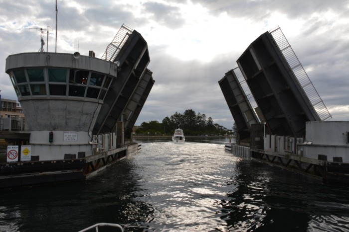
They don’t hang about in closing the bridge
02 June 2017

Lake Macquarie
02 June 2017
We anchored in Belmont Bay, a very short dinghy ride to the shore in time for sundowners. Belmont provided easy reprovisioning the following day, with Coles and Woolworths just a short walk from the jetty; though, not having had a descent provision since we left Hobart, it took two trips with my ‘old ladies’ trolley. The following day we had a lovely, but short sail across the lake to Wangi Wangi. I can understand why a lot of yachties swear by leaning to sail their boat on Lake Macquarie; the lake combines descent winds down the centre with completely calm waters, and myriad bays to drop he anchor. Wangi Wangi sits in a pretty bay, well protected from anything the winds throw at it from the south. There is a lovely long walk from the Workers Social Club on the western shore, around the bay to the hub of the suburb, where we enjoyed a lovely breakfast.
Halcyon anchorage at Belmont, Port Macquarie
02 June 2017
An imposter G’day at Wangi Wangi
02 June 2017
Bridge dramas
02 June 2017
Leaving Lake Macquarie was not as easy as our entry. We timed our passage of the channel at mid flood tide in order to make a bridge opening booking at 5pm and picked up a courtesy mooring with 15 minutes to spare. However, 5pm came and went and, although we heard a garbled request over the loud speaker, we presumed it was instructing pedestrians that the bridge was about to open. By 5:15, the bridge had still not opened and we called Swansea Marine Rescue, who we had booked the opening with, to determine when it would open and were informed that the bridge had been trying to contact us via the loud speaker, stating that we needed to drop the line to the mooring before they would open the bridge. We were rather upset at this since we had timed our passage to coincide with adequate water and light to traverse the bridge and pick up a mooring. In addition, on our entry to the lake, three days earlier, we had asked if there was a protocol regarding when we dropped the mooring line and was told it was up to us, just to be ready to transit the bridge promptly once it opened. We rebooked the bridge for 6pm and dropped our mooring early, sitting in the channel against the flood tide with both motors reved to maintain our position, while the bridge opened and picking up the courtesy mooring in the dark.
With light southerlies and very little swell, we motor sailed on the screecher and picked up a helpful counter current to make good time up to Port Stephens. While it is a lovely area to spend a few days, we had stayed here a few years ago with Georgia Wray, our previous boat and, with so many lovely rivers and bays to visit on the NSW coast, we were limiting our extended stays to new locations. As we left Port Stephens on a seemingly grey drizzly morning the entrance to the port was haloed in a spectacular double rainbow.
We picked up a courtesy mooring in Shoal Bay in mid afternoon, with plenty of time for a long walk ashore, reminiscing over our previous visit. We left Port Stephens the following morning with a destination of Forster-Tuncurry, but were a little dubious about the bar crossing at the entrance and the strong tidal currents in the river. On our previous visit in Georgia Wray we had surfed across the bar on the swell and had a nasty experience with the strong tidal currents. On leaving Fishermans Wharf, where we had been berthed for the night, we released our stern line, intending to pivot on the bow line to move away from the wharf. Suddenly, the current swung our stern through 180 degrees and the taut bow line started to wrench the cleat out of the deck. Not being able to safely reach across to the taut section of rope, I handed a sharp knife to a passerby on the wharf, who had no problem cutting us free. She was waving the knife as we drifted out into the stream, yelling "How do I get it back to you", but I told her to keep it. Anyway, back to our current passage: we had 10-15kn following winds, and sailed all day on the screecher, so decided to take advantage of the good conditions and overnight sail to Coffs Harbour. The winds picked up the next morning resulting in lumpy seas and a reasonable swell invading Coffs Harbour when we arrived in the late morning. Luckily, one of the two courtesy moorings was available on the western side of the jetty in calm, protected water.
Rainbow over the entrance to Port Stephens
02 June 2017

BJ can’t keep her eyes open: sleeping sitting up!
02 June 2017

Keith and BJ catch up on a nanna nap after overnight sail
02 June 2017

Catching up with a good WA friend at Coffs
02 June 2017
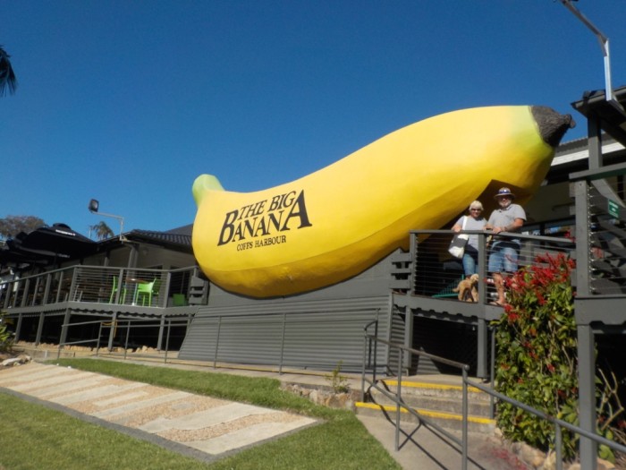
We had planned to stay a couple of days in Coffs as John, a friend from Western Australia, was holidaying in the town. We met up for coffee that afternoon, and he offered to take us for a tour of the surrounds the following day. He first headed north of Coffs, up the zig-zagging Bruxner Park Road, passing banana plantations clinging tenuously to the precipitous slopes, on our way to the cantilevered Forest Sky Pier. It is an amazing structure, suspended out from the ridge with magnificent views over Coffs Harbour and the surrounding countryside. We couldn't resist a coffee stop at the Big Banana before heading south to the seaside town of Sawtell for a walk along the beach.
K L n BJ Coffs Habour from the Forest Sky Pier
02 June 2017
Posing at the Big Banana
02 June 2017
Relaxing days break up our overnight sails
02 June 2017
With almost 60nm to cover from Coffs to Iluka, we dropped our mooring line just before daylight and sailed all day on the genoa. While the swell exceeded that forecast, it was not too uncomfortable, but created some decent rollers at the entrance to the Clarence River, where we surfed across the bar at 10kn. However, the adrenalin rush of the entrance was soon soothed by the serenity of one of the most protected anchorages on the NSW coast, behind the trainer walls that line the river. We had visited Iluka nine years previously onboard Georgia Wray and Keith was still wearing the 'two for $20' Iluka t-shirts he bought at that time, so we headed off to see if the bargain was still available. The eclectic shop on the foreshore was unchanged, as was the price of the t-shirts, so he invested in another couple. On our previous visit we were sheltering from strong winds, which precluded investigating Yamba on the southern shore of the Clarence. So this visit we steered G'day through the meandering, shoaling channel to anchor in the shallow water off the town. Unlike Iluka, which has a new public floating pontoon with ample room for visiting yachties' tenders, the foreshore of Yamba is lined by an unrelenting rock wall. So, with no place to land the tender, we tied up to the shore side of the local ferry's pontoon; in no-ones way, but keeping our fingers crossed they would not object.
For our third night in the Clarence we had moved back to the Iluka anchorage, as we intended to leave early for the passage to Ballina. While it was only 35nm to the north we needed to cross the bar at Iluka around 7am with the start of the flood tide, in order to also cross the bar into Ballina at the end of the same flood. The alternative was another overnight sail to the Gold Coast Seaway. While we were up early to passage north, we reassessed our plans, determining that we risked missing the flood into Ballina if we could not average in excess of 6 knots, and we would also have to cross the Clarence bar with the ebb tide. If we left early we would arrive at the Gold Coast in the middle of the night. So we went for another long walk along the Iluka foreshore and had a leisurely departure at midday, crossing the Clarence bar at high water.
With just enough wind to fill the genoa and a small enough swell for a comfortable night on and off watch, we had a pleasant passage north and transited a benign Gold Coast Seaway, to anchor in Bums Bay for a late breakfast. With the rest of the day to while away, we ventured up the Nerang River in the dinghy, wending our way around the canals adjacent to Surfer's Paradise and stopping for a walk through the oasis in this skyscraper jungle: the delightful gardens of the Mackintosh Island Park. On our return to G'day, Keith mistakenly thought he had reached the end of the 6kn speed limit and was soon informed of his error by the police boat that had been right behind us when he sped up. After a breathalyser test returned a reading of zero and the officer had finished his tirade (albeit with a trace of a grin on his lips), Keith was let off with a warning.
Higgeldy piggledy wharf at Steiglitz on the Broadwater
02 June 2017

Catch up with cruising pals and last leg to Mooloolaba
02 June 2017
We had another leisurely morning the following day as high tide through the Broadwater was not until 3pm and the distance to the shallows is only 12nm. With plenty of time up our sleeves we sailed almost the whole way to Jacobs Well, dropping the anchor a few miles further north, and out of the main channel, at Tabby Tabby Island. We had been looking forward to catching up with Margaret and meeting her son Andrew, and, with Lance also flying back from Hobart on the weekend, it was impeccable timing for spending a couple of days on their pontoon in Birkdale. Once again we jagged a lovely day for sailing and had the screecher flying the full 30nm until we rounded Wellington Point and turned south to transit the lateral markers into Birkdale canals. After a lovely couple of days catching up with the Dukes, and also my Brisbane-based sister, Jeanette, and her husband, Ron, we set off on the last leg of our Tassie trip. Once again Lance (and Margaret) cast off our lines for us as we exited the canals at first light. We had a pleasant sail for most of the 54nm, but every couple of hours Mooloolaba Marine Rescue broadcast a notice to mariners, warning of the shoaling across the entrance to the Mooloolah River. By the time we reached the heads, we were in the company of three other yachts, all arriving to have the flood tide across the bar and to enter the river with good light. The surf of Point Cartwright looked ominous as we approached the entrance and the period between each set of three rollers crossing the entrance was a couple of minutes. However, we judged our transit just after one set had rolled in and were beyond the eastern wall and into the protection of the river before the swell broke behind us. It was an easy park into our marina berth as Keith squared G’day with the berth and the flood tide and southerly wind pushed us gently up to the pontoon.
Last post for the predictable future
02 June 2017
It has taken us six weeks to sail from Hobart to our home port of Mooloolaba and it is now almost three years since we first departed on our sailing adventures. In some ways it seems like yesterday, while in others if feels like we have been living this lifestyle for much longer. We will stay as ‘live aboards’ in the marina for the next few months, reassessing the next phase of our lives. While I am still enamoured with the cruising way of life and my dream of cruising overseas persists, Keith is hankering for some solid ground beneath his feet. The travel bug remains a dominant motivator for us both and, since we have a huge, half empty shed on our block of land and a 3m high roller door, we have the ideal storage for a caravan. That is not really the incentive for buying a caravan, but it is convenient and gives us the option of alternating between land and sea travel
Only seeing one page of the Sailblog?
02 June 2017
If Facebook only links you to the first page of the blog entry I just posted, you can go directly to the site using the following url. It will then show the blog with continuous pages
http://www.sailblogs.com/member/brookersatsea/
http://www.sailblogs.com/member/brookersatsea/
10 weeks in Tasmania
20 April 2017
Impressions of Tasmania
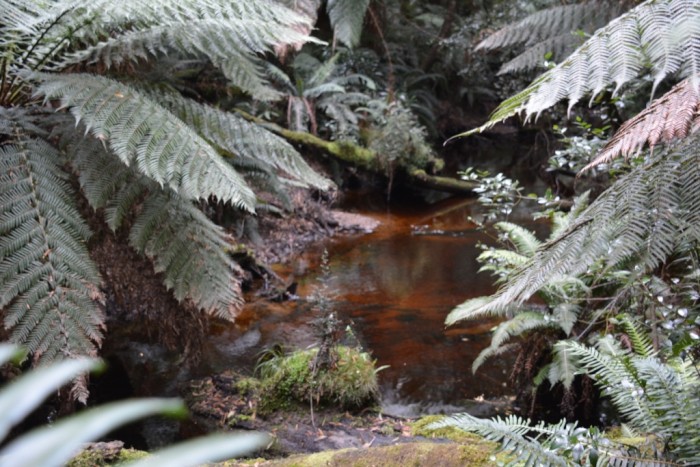
My lasting impressions of Tasmania are of hazy, rugged mountains and rolling green hills, interspersed with brown patches of pasture; seemingly infinite hues of green echoed in the verdant forests; ubiquitous water, whether it be rivers, estuaries, secluded bays, lakes or reservoirs; walks of every conceivable description: steep, narrow, winding tracks traversing Mount Wellington; dark, damp, leaf littered ways in the gloom of the forest; boardwalks across wetlands teeming with foraging wading birds; meandering paths along the blackberry bordered banks of rivers; rutted, rock strewn tracks across windswept heath lands; peaceful strolls along white sandy beaches (admittedly, not many of these, most beaches we visited were shelly or muddy); a majestic air walk through the forest canopy of the Huon valley; bustling along with the crowds at the Wooden Boat Show and quiet saunters through historic streets. Incongruous in this state of natural beauty are the skeletal iron giants that march indomitably across the ridges and through the luscious valleys, carrying the high tension wires from hydro electric plants to the towns and cities.
Tasmanian Industries
The cold, oxygen and plankton rich waters surrounding Tasmania are a boon for fisheries industries, dominated by the hundreds of salmon pens spread amongst the numerous fish farms scattered throughout the D’Entrecasteaux Channel, the Derwent and Huon Rivers and Macquarie Harbour in the west. The rows of black buoys denoting muscle farms fill many of the quiet bays and, although it was not the season while we were there, abalone and scallops are plentiful; nether-the-less, the much acclaimed scallop pie was available (and tasted) in many cafes and bakeries. Although not a native to the island, the introduced Pacific Oyster thrives along the shorelines of many of the muddy bays off D’Entrecastreaux Channel, providing easy pickings for a delicious meal.
The Apple Isle, once the apple orchard of the world, suffered an industry collapse in 1973, when Britain joined the European Common Market depriving Tasmanian of its major customer. In order to preserve the industry in the reduced market, 50% of the apple trees were ripped out over the next two years. More recently, the states iconic fruit has undergone a revival, spawned by the establishment of new markets in Asia and, in part, by a rise in the population of cider. When we arrived in Hobart, cherries, plums and raspberries adorned the shelves of local fruit stores. Along with the famed Tasmanian cheeses, the traditional apples and pears, and, of course, the salmon, they contribute to a healthy export industry.
Prince of Wales Bay Marina
My specific impressions of Hobart are coloured somewhat by our location at POWB Marina, where a persistent, biting wind was channelled down the Derwent River to greet us most days. The dust from local industries and the occasional pervasive odours from the adjacent fertiliser factory and nearby sewage farm were, in part, compensated for by the reasonable berthing rates and the warm, friendly marina staff. The omnipresent Mount Wellington, though located northwest of Hobart, was seemingly geographically labile, the position of our berth in the marina almost convincing us that it was east of the Derwent River.
A very rare day of calm in POWB Marina
20 April 2017
A rare calm day: Reflections of G'day
20 April 2017
Port Arthur: our first tourist trip
20 April 2017
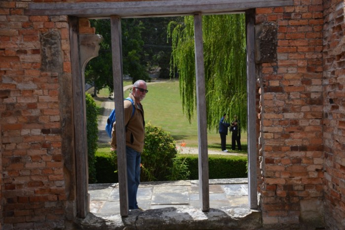
Lance and Margaret had sailed to Tasmania several times before and had spent a winter in POW Marina a few years previous, so they had numerous friends in Hobart. Royce, a boat builder, had purchased a new car for his wife Heather, and had held off selling their old BMW 318, so that Lance and Margaret had transport for the duration of their stay. After they had taken us on a familiarisation tour of Hobart, we hired a little Nissan Pulsar for a month and interspersed days of maintenance on G’day with forays into Hobart and surrounds. Lance and Margaret had kindly offered to dog sit for us when we went to places BJ was not welcome, so we took them up on their offer for a drive down the Forestier and Tasman Peninsulas to Port Arthur. As it eventuated, the only place BJ could not have joined us was in Port Arthur itself, as it was a lovely drive with lots of walks on the way that she would have enjoyed. Still, any visit to Tasmania is not complete without an education on the convict heritage of the island and you could easily spend a day or two exploring the town.
Tessellated pavement
20 April 2017

The tessellated pavement on Forestier Peninsula near Eaglehawk Neck. A unique geological formation comprising polygonal divisions along the bedrock joints of the weathered flat rock surface
Walking the tessellated pavement
20 April 2017

Looking south to Raoul Cliffs
20 April 2017
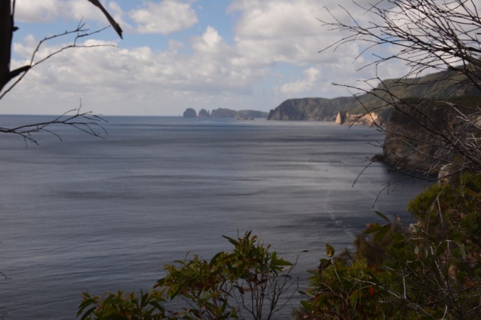
Looking south to the spectacular dolerite cliffs of Cape Raoul. They have been eroded into towering pillars, similar to the organ pipes on Mount Wellington.
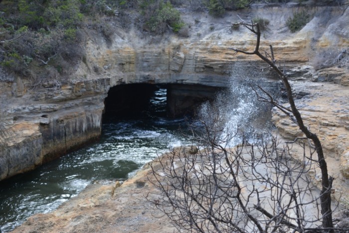
Surge through the blow hole on Forestier Peninsula
20 April 2017
The majestic church ruins at Port Arthur
20 April 2017

View through the church window
20 April 2017
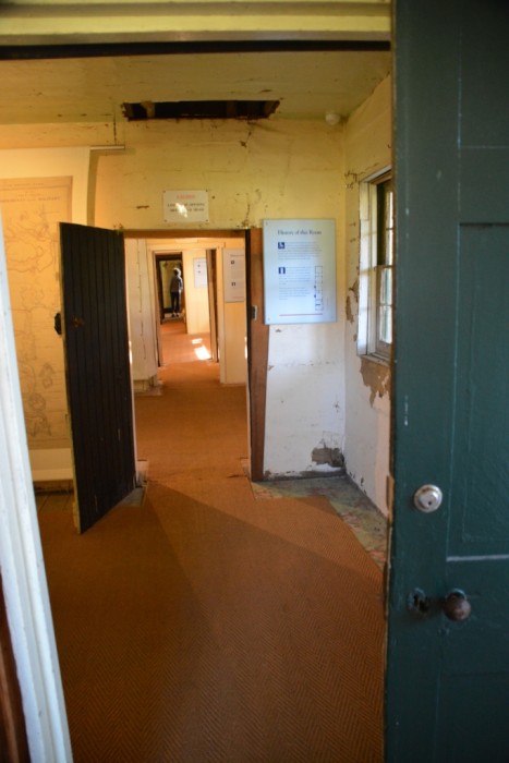
Port Arthur Penitentiary ruins
20 April 2017

Individual cells in the penitentiary
20 April 2017

Superb Fairy Wren
20 April 2017

A Superb Fairy Wren in the grounds of Port Arthur
Officers Quarters at Eaglehawk Neck
20 April 2017
The officers quarters at the guard post at Eaglehawk Neck have been retained to demonstrate the living quarters of the time.
An escaped convict facing up to the guard dog on the dog line.
20 April 2017
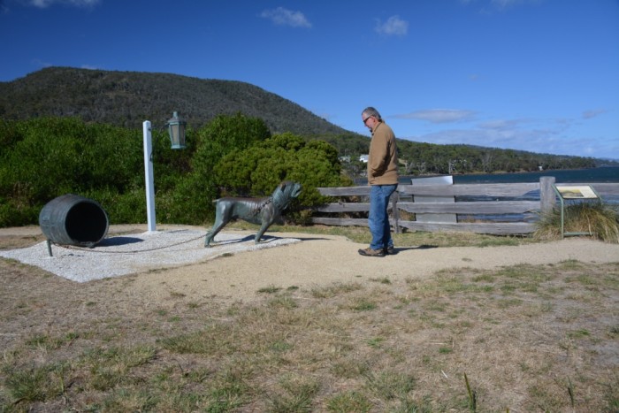
The Tasman peninsula is separated from the Forestier Peninsula by a very narrow isthmus called Eaglehawk Neck. The guard dogs were chained to their kennels in a line along the isthmus, not to attack escaped convicts but to create a ruckus to warn the guards.
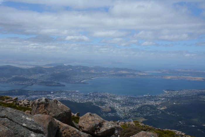
Mount Wellington
20 April 2017
Since Mount Wellington dominates the Hobart skyline, a drive up the winding road to the pinnacle is mandatory for any visitor to the city. When the sun is shining and the summit is not enveloped in cloud, it provides spectacular views of the city and the sweeping Derwent River. However, the first time we drove to the pinnacle, it was a grey overcast day and the wind was bitter. Through the grey haze the view was propitious, but we were not dressed for the conditions and the disagreeable weather soon had us scurrying back to the warmth of the car. We returned a few weeks later on a warm windless, sunny day when we could really appreciate the spectacular scenery and, over the next few weeks, enjoyed many walks on the countless tracks that zig zag across the mountain slopes.
POW Bay
20 April 2017

View of POW Bay and the Bowen Bridge from Mount Wellington - G'day is down there somewhere!
View of Hobart and the River Derwent from Mount Wellington
20 April 2017
Basking skink
20 April 2017
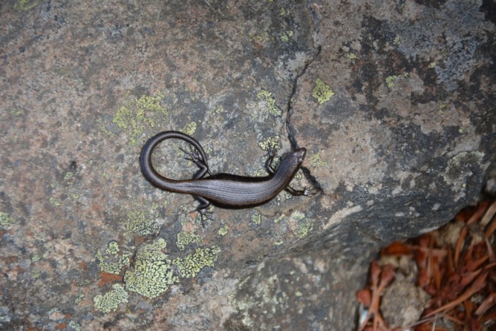
An arctic skink basking on a rock at the summit of Mount Wellington; its black skin aiding the absorption of a little heat
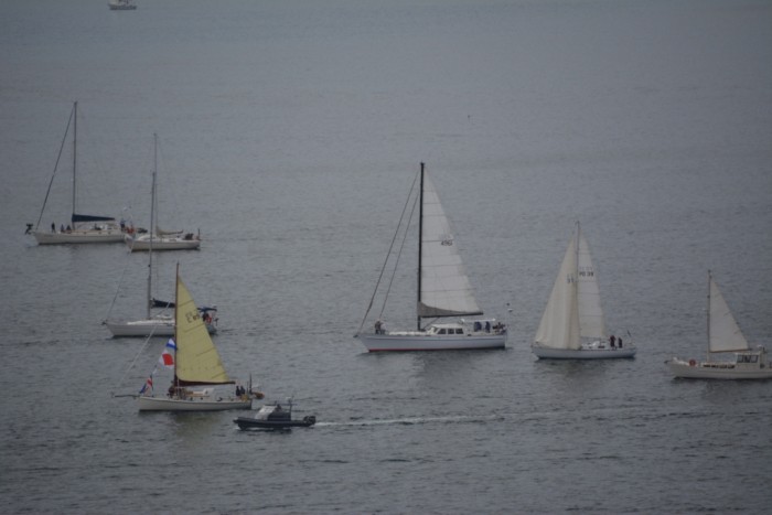
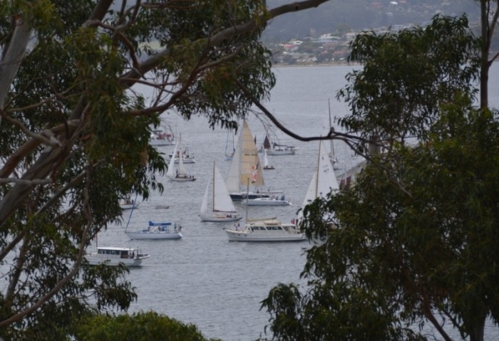
Parade of Sails
20 April 2017
Most of the yachts we had crossed Bass Strait with were timing their arrival for the biennial Hobart Wooden Boat Festival, along with many more boats before and after them. It commenced the day prior to the festival, with The Parade of Sails, for which we had a panoramic view from Alexandra Battery Park, south of Sandy Bay.
The parade of sails
20 April 2017
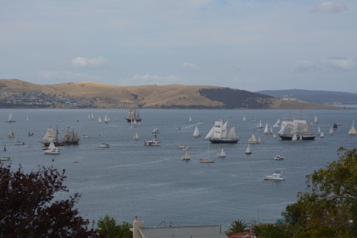
The parade of sails from the hilltop at Battery Park
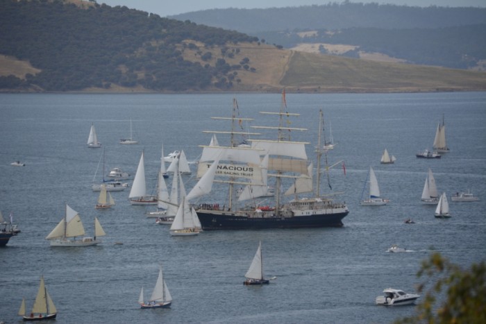
Tenacious with her in-yard furling
20 April 2017
Lance and Margaret on the foredeck of Royces restored wooden boat
20 April 2017
Parade of sails framed by the trees
20 April 2017
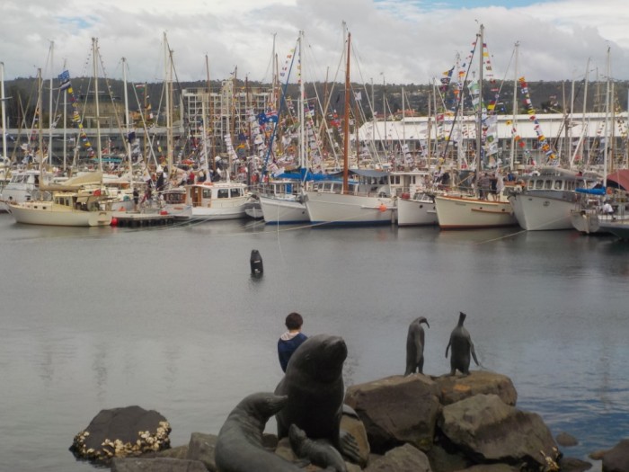
Hobarts Wooden Boat Festival
20 April 2017
The Wooden Boat Festival was a carnival of activity, with boating related displays, lectures and activities, food aplenty, a unique, Dutch, on-the-water busker, and, most importantly, many lovingly restored wooden boats, some of the most impressive over 150 years old!
Wooden boats decked out at Constitution dock
20 April 2017
Vintage outboards
20 April 2017
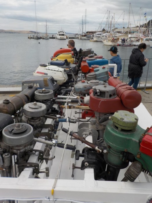
Keith spent much of the time reminiscing over the vintage outboards (especially the seagulls his father had when he was a boy)
Dutch Busker
20 April 2017

This Dutch aquatic busker kept the crowds entertained with his repertoire of music
Ovation of the sea
20 April 2017
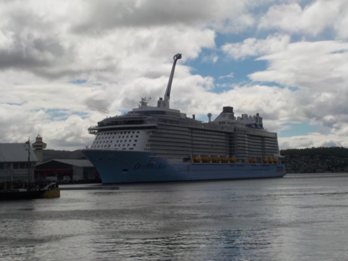
The cruise ship 'Ovation of the sea' was in port for the Wooden Boat Festival and we watched fascinated as she raised her 'spy bubble' high above her top decks.
Bj having a snooze
20 April 2017
It's a long day at the boat show for BJ: all those legs and feet at eye level. So it's time for a ride and a snooze!
Tallships
20 April 2017
Of the numerous tall ships in port, the James Craig was built in 1874 and, after an illustrious career as a cargo ship, rounding Cape Horn 23 times, was beached in Researche Bay in 1932, where she remained for 40 years until being refloated and finally restored over a number of years, to be relaunched in 1996. In contrast, Tenacious, a replica tall ship was launched in 2000,and has been outfitted specifically to facilitate disabled sailing, with wheel chair lifts, ramps, stabilisation points, Braille signage, vibration alerts for the hearing impaired and even “in-yard” furling!
Tenacious
20 April 2017
A tangle of halyards and sheets on the modern tall ship Tenacious
Whirlwind tour of Tassie
20 April 2017
On a drive up to New Norfolk following the River Derwent upstream, we just reached the most interesting scenery when the Mount Field National Park signs specified no dogs! So we sauntered our way back down the valley, stopping to pick a couple of punnets of blackberries. Lance and Margaret contended that we had to venture off and see a bit more of Tasmania, insisting that their upcoming trip down D’Entrecasteaux Channel with their daughter Raelene and husband Jeff, was an ideal time for them to babysit BJ.
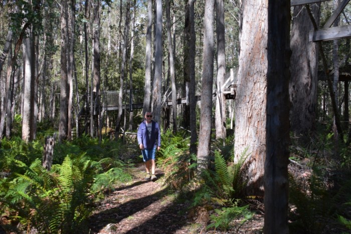
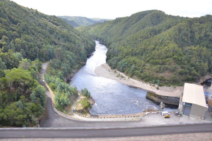
We planned to be away two or three days, but, although the distances are small in Tasmania, there is a lot to see and, with the blessing of Lance and Margaret and assurances that BJ was not missing us, our two days was extended to six. Even so, it was still a bit of a whirlwind tour. Heading northwest from Hobart on our first day, the winding, blackberry-lined country roads initially took us through farming country, then up through more rugged terrain to the hydro town of Tarraleah. Although you cannot tour the hydro plant, the viewing platform over the valley emphasises the scale of the complex, with rows of massive pipelines flowing into the plant from hills to both the north and south. Being a sunny day, we enjoyed a walk through forest to Tarraleah Falls, though it would have been nice if the sign at the start of the path gave some indication of the distance. As we progressed further into the forest the wide track became narrower and narrower, until we were clambering, single file down muddy slopes. What we thought would be a short stroll ended up taking 1½ hours, but the falls at the end were well worth the effort. The outdoor information centre in town was a pleasant way to become acquainted with the history of hydroelectricity in the region and to appreciate the hardships of the people associated with the construction.
We planned to be away two or three days, but, although the distances are small in Tasmania, there is a lot to see and, with the blessing of Lance and Margaret and assurances that BJ was not missing us, our two days was extended to six. Even so, it was still a bit of a whirlwind tour. Heading northwest from Hobart on our first day, the winding, blackberry-lined country roads initially took us through farming country, then up through more rugged terrain to the hydro town of Tarraleah. Although you cannot tour the hydro plant, the viewing platform over the valley emphasises the scale of the complex, with rows of massive pipelines flowing into the plant from hills to both the north and south. Being a sunny day, we enjoyed a walk through forest to Tarraleah Falls, though it would have been nice if the sign at the start of the path gave some indication of the distance. As we progressed further into the forest the wide track became narrower and narrower, until we were clambering, single file down muddy slopes. What we thought would be a short stroll ended up taking 1½ hours, but the falls at the end were well worth the effort. The outdoor information centre in town was a pleasant way to become acquainted with the history of hydroelectricity in the region and to appreciate the hardships of the people associated with the construction.
Tarraleah hydro plant
20 April 2017
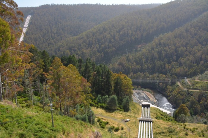
Tarraleah hydro plant: the pipes descend 290m into the turbines at the plant
Turraleah pipelines
20 April 2017
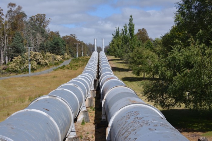
Pipes leading into the Tarraleah hydro station. The two surge towers provide a pressure release for the pipe lines (called penstocks in the industry) preventing a resonance build up that could potentially be catastrophic at the turbines.
Walking the track to Tarraleah Falls
20 April 2017
Valley of arctic tree ferns
20 April 2017
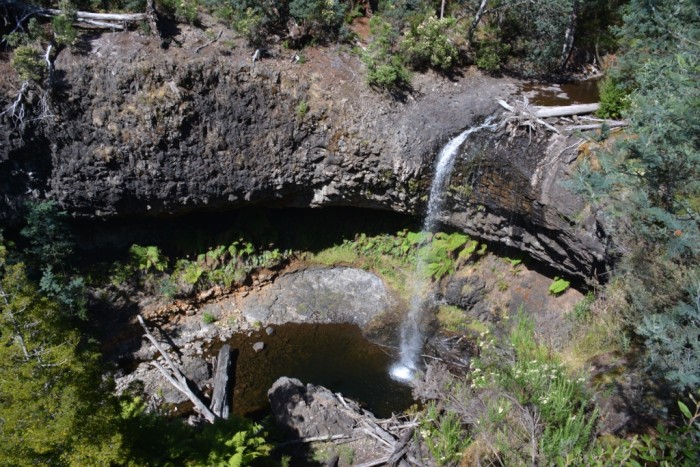
Tarraleah waterfall
20 April 2017
‘The Wall’
20 April 2017
Having worked up an appetite on our walk we stopped at Derwent Bridge for lunch before paying a visit to The Wall in the Wilderness. Affectionately referred to by Tasmanians as just The Wall, it is a 100m sculpture in Huon pine by artist Greg Duncan. The project took him two years to complete and portrays a history of life in the central highlands of Tasmania through incredibly realistic carvings of people, animals and artefacts.
'The Wall'
20 April 2017
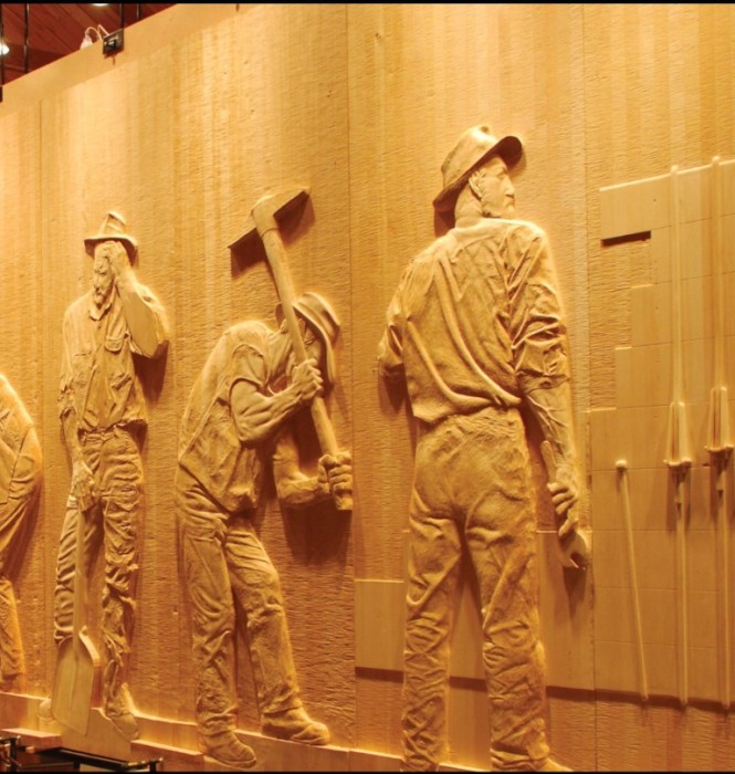
No photography is permitted of the carvings, but the web site depicts some excellent examples of the carving sections
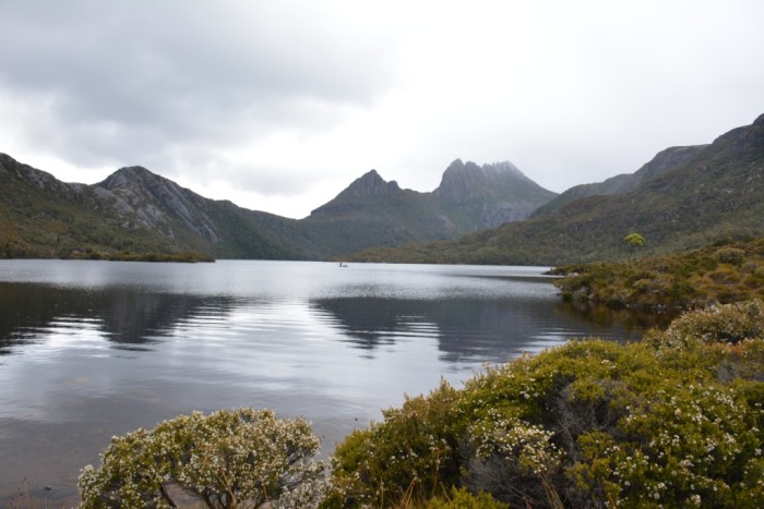
Lake St Clare southern gateway to Cradle Mountain
20 April 2017
Just outside Derwent Bridge lies Lake Saint Clare and the southern ‘walk in’ entrance to Cradle Mountain. The area is renowned for its numerous short trails around the lake, day walks into the hills and longer treks up to Cradle Mountain. The latter were closed when we visited due to predicted snow on the summit and, since it was already mid afternoon, we opted for a short 3km walk through forest to the junction of the Hugel and Cuvier Rivers. I am not suggesting for a second that we would actually have taken the longer track to Cradle Mountain anyway!
Drinking from the stream
20 April 2017
Drinking from the stream: was that the Hugel or the Cuvier River?
Lake St Clare in the foothills of Cradle Mountain
20 April 2017

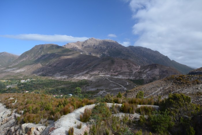
Wild West Queenstown
20 April 2017
Not knowing the area we had pre-booked accommodation for the night at Queenstown, much to Lance and Margaret's dismay, as they stated we had chosen the only industrial town on the west coast. The steep and winding road leading into Queenstown is testament to the long history of mining, initially for gold but more extensively for copper. The rugged mountainous landscape, scoured by immense scars and pock marked with mining pits has been compared to a lunar landscape. Once booked into our motel we went off in search of dinner, but the town centre was deserted and, with the exception of the two hotels, everything was closed. Queenstown claims the title of Tasmania's 'Wild West' town and it was only lacking the tumble weed to reflect the deserted cowboy towns of the US. This was our first indication that the short summer tourist season in western Tasmania was on the decline. So we joined the crowd of motor bikers at one of the hotels for, what turned out to be, an excellent dinner.
Iron blow mining pit
20 April 2017
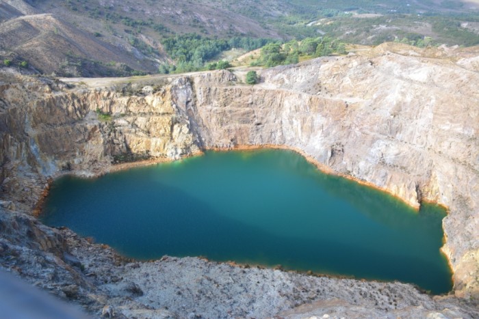
Linda Valley
20 April 2017

View from the cantilevered lookout over Iron Blow down to Linda Valley
Stark Landscape
20 April 2017
The stark mining-ravaged lunar landscape of the hills east of Queenstown
Queenstown
20 April 2017
Queenstown, claimed as Tasmania's Wild West town
A day to fill in Strahan
20 April 2017
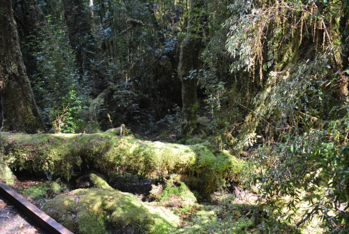
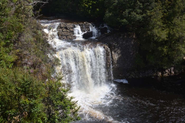
The following day we headed for Strahan, intent on joining the afternoon Gordon River Cruise. However, with the end of the peak season, we were informed that the afternoon tour was no longer available and the morning ones had already left. Since the Wilderness Railway had also left in the early morning, we were left with limited choices for keeping us occupied in Strahan. It seems the season ends a little early for the tourists as there were other enquiring at the booking office for alternatives for spending the day. At the bakery, customers were asking their waiter what they could do and there were many people wandering around Strahan looking quite lost! Still, we had a very pleasant walk through temperate rain forest to Hogarth Falls, then a drive to the northern beaches to check out the sea conditions at Hell's Gate, the entrance to Macquarie Harbour.
Hogarth Falls, Strahan
20 April 2017
The creek is lined with arctic tree ferns
20 April 2017
Mossy groundcover
20 April 2017
Mossy groundcover: Natures carpet in the forest
Fishbone fern
20 April 2017

Fishbone ferns abound on the forest floor
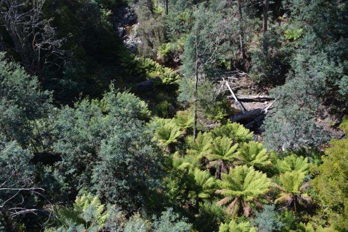
Gordon River Cruise
20 April 2017
The Gordon River Cruise is definitely an experience not to be missed, which we might very well have: having limited time away, we had debated not waiting around in Strahan until the next day. Our day was memorable from the wild ride through the waves at Hells Gates, to the tranquil cruise along the inspiring Gordon River, the eerie walk through the rain forest and the sobering historic tour of the penal settlement ruins on Sarah Island: well worth a day out of our short itinerary.
Hell's gate
20 April 2017
Hell's Gate is the narrow entrance to Macquarie Harbour. I thought it was named for the strong currents and shallow sandbanks creating continuous surf to the side of the channel, but it was named by the convicts for the entrance to the world they were entering. Anyway, I'm quite glad we were not sailing into Macquarie Harbour
Salmon pens on Macquarie Harbour
20 April 2017

Feeding the salmon with pellets propelled into the air to shower over the pens, the sea birds are getting a good feed too.
Huon Pine
20 April 2017
A Huon Pine on the banks of Gordon River, not many left on this stretch of the river at least.
Reflections on the Gordon River
20 April 2017

Reflections on the Gordon River, not many opportunities to get a picture like this as the wind blew for most of the cruise
Forest Walk landing
20 April 2017
Forest walk landing, a former Huon Pine logging station
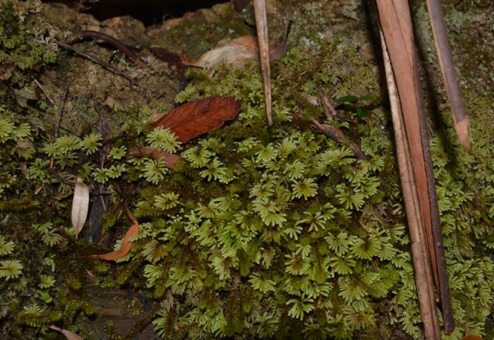
Fungus on a tree trunk
20 April 2017

A fairy world among the mosses under the forest canopy
20 April 2017
Sarah Island penal colony ruins
20 April 2017

Not the accommodation we were expecting
20 April 2017
With a mid afternoon finish to the cruise, we had booked a night, a couple of hours drive north, at the Tullah Lakeside Lodge, which conjured up images of cosy rooms, dark timbers, open log fires and views of the lake, while the website promised “a laid back, friendly atmosphere, good rooms and great dining”. Disappointingly, our room was set in a row of pre-fabricated single men's quarters and was barely big enough to accommodate the double bed. A can of cockroach spray occupied a prominent position on the window sill, with a warning that “if stolen, will be charged to your credit card”! Dark timbers did dominate the bar, but the lounge was a huge, cold open expanse, belatedly lit with a small open fire that attempted valiantly to heat an immediate vicinity of a few square metres, and our meal fell well short of our pub dinner in Queenstown. To add insult to injury, I walked over to the lounge in the morning, hoping to find a comfortable chair to read my book, since there was nowhere to sit in our room, only to find the lodge locked up until breakfast commenced at 8:30.
Dam on Lake Tullah
20 April 2017
A wash out at Cradle Mountain
20 April 2017
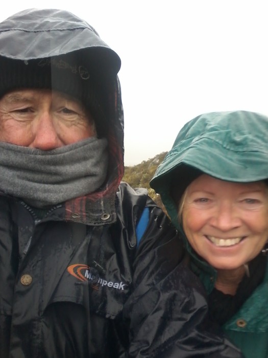
It was a drizzly, grey day as we left Lake Tullah, looking forward to a long walk on Cradle Mountain. In the foyer of the information centre, numerous visitors were browsing the clothing racks, selecting beanies, gloves and other warm apparel: Cradle Mountain in mid-February does not enjoy the warm climes of most places in Australia at that time of year. We hopped on the park bus, debating which of the many walks we would do first, and decided to go to the end of the line and walk round Dove Lake. As we disembarked from the bus the sun was glinting off the snow on the peak of Cradle Mountain, but there were ominous clouds in the distance. Only fifteen minutes into our walk the sky opened up and the rocky walk trail soon became a flowing stream. Our light spray jackets were no match for the downpour: we should have brought our blue water wet weather gear with us! The wind and rain looked to be set in for a while, so, along with most of the other walkers, we turned back to the shelter to await the bus to go back up the hill. We alighted at the midway information centre and perused the displays until the sun peaked out from the clouds again. But the respite from the rain was only long enough to take the 20 minute Pencil Pine walk to Kynvet Falls, after which we decided to call it a day and continue on to Launceston.
Lake Dove
20 April 2017
Lake Dove with snow on the peaks of Cradle Mountain. At least we got a glimpse when we first arrived before the clouds and rain hit it from view
Cold and very wet at Dove Lake, Cradle Mountain
20 April 2017
Kynvet Falls on the Pencil Pines Walk
20 April 2017
Launceston
20 April 2017
We had booked a couple of days at the Aldringham Hotel, a converted convent established in 1899. A majestic building with large modern rooms, just a 10-minute walk from the city its wide front balcony overlooked: what a contrast to our last night’s accommodation. Though not as historic, nor as scenic as Hobart, Launceston has many attractions, but, since our time was limited, we decided to just wander around town and enjoy the atmosphere. The only thing on our agenda was a tour of the local brewery; Cascade may be the oldest brewery in Australia, but Keith has been a devotee of James Boag Premium since it was released in 1994. Being yachties, we also had to check out Tamar Marine, reputedly the largest and best stocked chandlery in Australia: it certainly lived up to its reputation. From the chandlery we went in search of a walk along the river and stumbled across signposts to Cataract Gorge. On our arrival, our hotel receptionist had reamed off a number of Launceston’s ‘must see/do’ attractions and I recalled that the gorge was one of them. What a spectacular walk along the gorge wall alongside the South Esk River. The gorge opens up into a massive basin, where the water is up to 38m deep. It is surrounded by an open area with the world’s longest single span chairlift above it. On its terraced western slopes a café sits in the middle of landscaped Victorian gardens, with wallabies and grazing on the lawn, potaroos is snuffling among the shrubbery and peacocks strutting along the paths. I would have loved to view the basin from the chairlift, but had left my purse back in the car in Tamar Marine’s car park. I had about $12 in change in my pocket, enough for a chairlift ride for one or coffee for two. So we joined the peacock chicks sunning themselves on the café patio.
The old toll house
20 April 2017
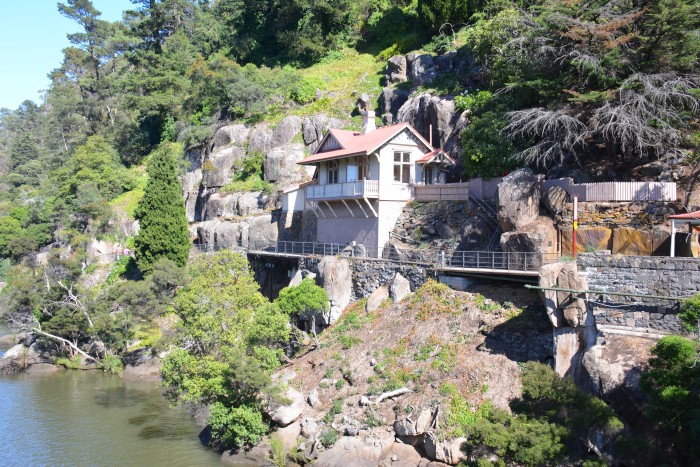
The old toll house at the Kings Bridge end of the Cataract Gorge Walk, which is now a private residence
View down the gorge to Kings Bridge
20 April 2017

View to the basin from Cataract Gorge
20 April 2017
The basin with the chairlift transecting it
20 April 2017
Keith in green luscious Victorian gardens Cataract Gorge
20 April 2017
Mother and baby peacocks at the Cataract Falls Cafe
20 April 2017

All the charm but none of the glamour of her father
20 April 2017

Wallaby enjoying European leaves for morning tea
20 April 2017

Time to head back to Hobart and reclaim BJ
20 April 2017
Kia Orana was heading back up the channel to the marina, so it was time for us to return to Hobart and reclaim BJ. Rather than take the main road back, we detoured for a scenic drive through the Great Lake Conservation area to the former hydro town of Waddamana. The site once housed two operational hydroelectric power plants, but one was decommissioned in 1964, as the water was diverted to a newer more efficient plant at Poatina. The second plant remained in service for a further 30 years, and after it too was decommissioned it was retained as a museum.
Echidna hiding under a rock
20 April 2017
On the drive back we saw a few echidnas, this one was hoping I wouldn't see it if it hid its snout undr a rock
Lots of boat maintenance
20 April 2017
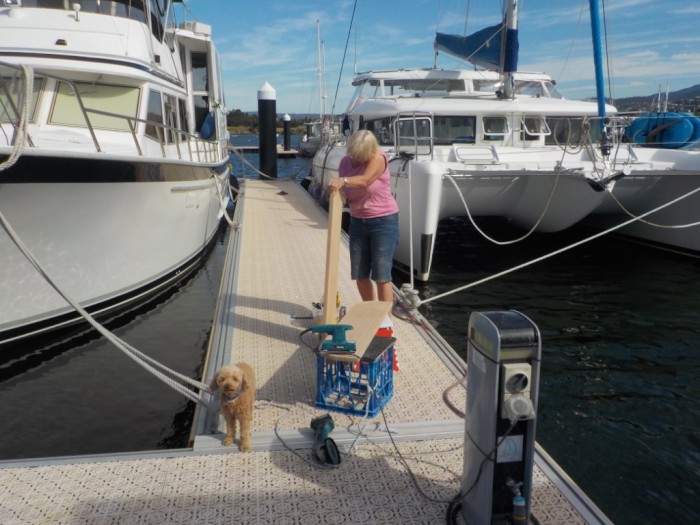
I mentioned earlier that we our jaunting around was interspersed with the usual boat maintenance. The first job was to get the luff line rip in our mainsail repaired, and it was opportune that a sailmaker from Doyle's sails was in the marina the day after we arrived. We threw the sail in the back of his ute and a few days later went down to their premises at Battery Point to pick it up. They did a fantastic repair and we couldn't believe they only charged $80! The next outsourced job was to get a rigger in to check for damage to our mast track, to determine if it was the cause of the cars becoming dislodged. Once he had determined that the track was sound, we contacted Harken for advice. They recommended that we replace the Teflon slide batten cars and sail head cars with much larger bearing cars. We were dreading the cost of seven of these, but he quoted us almost half what we were expecting to pay. On our maintenance days, Keith busied himself servicing the motors and winches, polishing the stainless, repairing various holes in the gel coat, replacing old, discoloured mastic and thinking up jobs for me! I stripped back and revarnished the saloon and cockpit tables (with lots of help sanding from Keith) and areas of worn timber trim in the saloon, touched up a few paint jobs, made some new straps to secure the dinghy to the davit's and completed various sewing repairs to the cockpit clears.
The tear in the main sail luff line
20 April 2017

Sanding the cockpit table
20 April 2017
An old story, not yet told!
20 April 2017
While Keith was undertaking his gel coat repairs, he decided to tackle the cracking at the bow where the anchor chain channel and roller were located. It was an insurance repair from a couple of years previous that we had never been satisfied with. I haven't told this story on the blog before, so I'd better rectify that! We had sustained extensive damage to the boat before we left Mooloolaba in 2014, when our anchor was caught on a reef during an unusually high swell event (resulting from cyclone Ita that had hammered the north of the state). While attempting to retrieve the anchor, the sudden, extreme chain tension caused the windlass to jam: we could neither wind the chain up nor down. Each successive swell lifted the bows up several metres, skewing the boat to starboard, then the chain violently yanked her back down. Within minutes, the stainless steel channel was crumpled, the chain jumped off the roller and out of the channel, ripped out the eyebolts securing the starboard trampoline, cut through the trampoline cords and commenced sawing through the central plinth between the trampolines! Fortunately, our good friends, Bill and Pat, were on board with us, as it took all the strength of Bill and Keith to cut through a link of the chain with our bolt cutters. Even then the chain did not let go until they made a second cut through the other side of the link(Note: we have since ensured we always have a fully charged cordless angle grinder on board). We had the stainless channel straightened, strengthened with side panels and a loop welded on to prevent the chain jumping out. The completed repair to the bow and deck looked pretty, but it wasn't long before I noticed the channel started to move if there was the slightest bit of sideways pressure when I retrieved the anchor. For the subsequent 2 ½ years I was obsessive about aligning the chain directly ahead as I retrieved the anchor. Keith had repeatedly tightened the three bolts that secured the stainless steel chain channel to the deck, but they would soon work loose, resulting in cracking of the gel coat. So, to the present dilemma: Keith scraped out the cracked gel coat but it was clear that the bolts had widened their holes through the deck and any repair of the gel coat was likely to be short term and ineffective. Lance had great respect for Royce as a boat builder: he had put off having his leaking water tank repaired until he got to Hobart and Royce could do the work. So he suggested we get Royce’s opinion. We had to wait a few weeks until Royce’s other work commitments were fulfilled but we finally have a first class, professional repair. With a side plate welded to the channel to accommodate a further two bolts and the deck substantially thickened with fibre glassing beneath and built up above, those bolts are not moving, and that stainless steel channel is rock solid!
Cruising down the channel
20 April 2017
Royce finished the repair to our bow in time for us to head down the channel for the last day of the Port of Cygnet Regatta. We could have followed the race down the channel the previous day but Keith had the opportunity of a Fergie tractor overdose at the Heritage Farming Expo at Cambridge, which we followed up with a lovely lunch at the Richmond bakery. We motored down with the Derwent with negligible wind and flat calm water, which made spotting the numerous huddles of Little Penguins very easy. Once out into D’entrecasteaux Channel, the penguins were replaced with basking seals, aimlessly floating along on their backs with their flippers waving to passing boats. When we arrived in Port Cygnet, most of the racing yachts were scattered throughout the course, seemingly wallowing as aimlessly as the seals had been. I am sure each boat had its own strategy for getting around the course, albeit via a slow, tortuous route and, eventually, the race organisers terminated their plight by cancelling the last lap.
Basking seal
20 April 2017
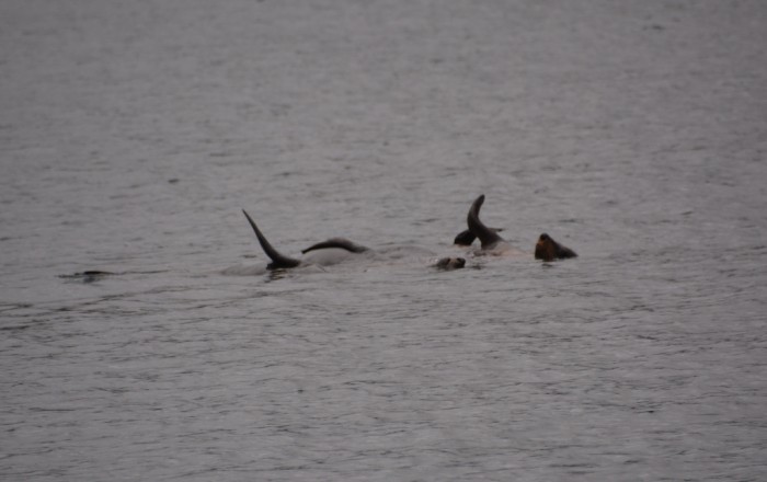
Basking seal floating along with the current in D’entrecasteaux Channel
Anchored in Port Cygnet
20 April 2017
We anchored close to Royce and Heathers lovingly restored wooden yacht, which was rafted up to their friend’s, Dave and Anne’s, boat. We had met Dave (aka Shorty) and Anne on our first weekend in Hobart, when Royce and Heather had included us in an invite to a welcome back dinner for Lance and Margaret. After we took BJ for a walk onshore, Royce invited us aboard for sundowners and Hugh, their 5 year old son, gave me a tour of his boat. The perfectionist in Royce as a boat builder was evident in the attention to detail and the extensive use of magnificent timbers throughout the saloon and cabins. Not long after we awakened the following morning, Hugh rowed the tender over to say good morning and came aboard to inspect our living quarters, before rowing off to do some fishing. As is the case with all our grandchildren, his attention was not held for long by any one particular activity and he soon returned, this time paddling his kayak. He had taken to BJ and asked if she could come for a paddle with him. She always loves going on our kayaks, so did not have to be asked twice!
Our little visitor, Hugh, fishing from the tender
20 April 2017

| Vessel Name: | G'day |
| Vessel Make/Model: | Lagoon 420 |
| Hailing Port: | Mooloolabah |
| Crew: | Keith and Lesley Brooker & BJ. |
| About: |
G'day's Photos - Main
 |
Who: Keith and Lesley Brooker & BJ.
Port: Mooloolabah