
Don & Deb's Big Adventure Continues in Oz
We are now living in Melbourne, Australia after selling our beautiful yacht 'Buena Vista' in New Zealand. Even so...the big adventure will continue one way or another!
09 November 2014 | At Sea - Day Nine to New Zealand
08 November 2014 | At Sea - Day Seven to New Zealand
07 November 2014 | At Sea - Day Seven to New Zealand
06 November 2014 | At Sea - Day Six to New Zealand
05 November 2014 | At Sea - Day Five to New Zealand
04 November 2014 | At Sea - Day Four to New Zealand
03 November 2014 | At Sea - Day Three to New Zealand
02 November 2014 | At Sea - Day Two to New Zealand
01 November 2014 | At Sea - Day One to New Zealand
31 October 2014 | Momi Bay, Fiji
31 October 2014 | Momi Bay, Fiji
24 September 2014 | Yasawa-irara, Yasawas, fiji
23 September 2014 | Yasawa-irara, Yasawas, Fiji
21 September 2014 | Cololevu, Yasawas, Fiji
19 September 2014 | Cololevu, Yasawas, Fiji
18 September 2014 | Namataya Bay, Yasawas, Fiji
16 September 2014 | Malacati Village, Yasawas, Fiji
13 September 2014 | Blue Lagoon, Fiji
08 September 2014 | Blue Lagoon, Fiji
06 September 2014 | Blue Lagoon, Nanuya Levu Island, Fiji
The Northern Highway
05 August 2012 | Passage from Bora Bora to Suwarrow
Day 2 - 117 nautical miles. When I look out at the 3 meter ocean swells passing by I feel a sense of awe. No fear at all any more. Our boat Buena Vista has proven to us that she is a tank and can handle anything you throw at her. Our current passage is directly downwind which means that if you turn around and look out the back of the boat the big swells come directly at you from behind. As one catches up with us the back of the boat lifts gently up and it either passes below us or we gently slide down the face. It looks lonely out here...the sea is so vast. But in reality this is the 'Northern Highway' (my term) for cruising boats. This is the path that maybe half of the fleet will take as they move from east to west. This path leaves Bora Bora and heads for Suwarrow in the Northern Cook Islands, then on to American Samoa and Western Samoa. After that you either turn left and down to Tonga or Fiji, or you go straight towards Australia. OR you turn right and go up toward the equator and further on to Kiribati and the Marshall Islands (a choice by some to escape the threat of tropical cyclones). The 'Southern Highway' leaves Bora Bora for the Southern Cook Islands, maybe Aitutaki or Rarotonga, then on to Palmerston Island (which is populated by the descendants of an Englishman and his many polynesian wives) and then on to Niue (named the Savage Island by Captain Cook because the natives ate blood red bananas to look fierce so that Captain Cook and his fleet would not stay--it worked) and then to Beveridge Reef and onto to Tonga. Most boats that head to Tonga are planning on heading south to New Zealand in early November - another option for escaping the wrath of tropical cyclones in this area. As of right now that is our plan too.
Comments
| Vessel Name: | Buena Vista |
| Vessel Make/Model: | 46' Formosa Peterson |
| Hailing Port: | Ventura, California |
| Crew: | Don and Debbie Robertson |
| About: | The idea of going cruising started when Deb read the book , "Sell up and Sail" around the time they purchased their first boat, a Catalina 22 and joined Chico Yacht Club in 1994. |
| Extra: |
Gallery not available
Buena Vista's Crew
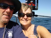
Who: Don and Debbie Robertson
Port: Ventura, California