C A R I N T H I A
Welcome to S/V Carinthia's Sailblog :
SailBlogs Friends


21 April 2013 | Noumea
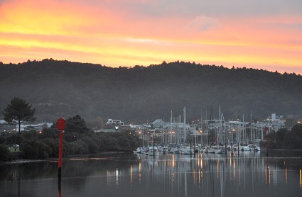
12 December 2012 | Gulf Harbour, Whangaparoa, New Zealand
01 December 2011 | Fiji - New Zealand
27 September 2011 | South Coast Vanua Levu, Fiji
26 June 2011 | Fiji, Lautoka
12 May 2011 | Malolo Island
30 April 2011 | Manoriki
02 January 2011 | Gulf Harbor, Whangaparoa
15 June 2010 | Whangarei NZ
09 June 2010 | whangarei nz
15 May 2010 | Whangarei, New Zealand
19 April 2010 | Gulf Harbor Marina
28 March 2010
11 March 2010 | Auckland New Zealand
27 February 2010 | Auckland New Zealand
07 January 2010 | New Zealand
01 January 2010 | Auckland New Zealand
09 December 2009 | Auckland New Zealand
13 November 2009 | 40 nm to Opua New Zealand
09 November 2009 | en route to New Zealand
Leaving New Zealand tomorrow- sailing to Fiji
15 May 2010 | Whangarei, New Zealand
174 20.042' E
Route: Whangarei, NZ to near Lautoka, Fiji
Depart: approx. 0600utc Mon, May 17, 2010
ETA: May 27, 2010 or earlier
Weather Routing Summary:
1) 992MB low pressure continues to spiral, centered SW of Auckland near
39S/170E, again today
a) this low has remained near this position as the upper level weather
pattern above has a cut off from the usual W to E flow
b) the latest forecast model consensus keeps this low SW of Auckland into
Sunday, utc time, when it is expected to begin to weaken
c) allowing the present offshore NW to NNW 15-25kts winds to begin to back
some and ease by later on Sunday and into the beginning of this coming week
2) in addition to this strong low, satellite shows a tropical frontal
boundary currently stretching from near Brisbane, Aust to near S Tonga then
to the SSE and S to a low on the front near 41S/170W
a) clouds, squalls and some thunderstorms are sliding E and then SE to S
along this frontal boundary
3) conditions around Opua for your departure time should keep winds out of
the WNW to NW, in the continued clockwise flow around the low to the SW of
Auckland
a) then expecting these winds to eventually back out of the W around 00utc
on the 19th, as the low pressure slides to the E of NZ
4) forecast models agree that the â�'��"cut offâ�'� low should weaken as it is
expected to slowly slide to the SE during the 18th and 19th, utc time
a) with the upper and surface lows forecast to be near the Chatham Islands
by 00utc on the 19th
b) as this low moves SE, high pressure will expand across the Tasman Sea
from the SW to the NE
c) eventually edging between North Island, NZ and Fiji, during the 20th
and 21st, utc time
d) to shift your winds out of the SSE to SE, as you work your way toward
Fiji
5) as this high edges to the NE, it will push the tropical frontal boundary
to the E
a) moving the boundary from near Samoa off to the SE
6) longer range forecast shows the possibility of another low forming on a
cold front just E of North Island by later on the 21st, utc time
a) with this low then intensifying as it's complex center moves near
40S/170W by 00utc on the 22nd
b) expecting the center of the high near the SW corner of South Island, NZ
helping to build S-SW winds of 30-50kts between North Island and the low to the E, near 40S/170W
c) these stronger winds should help to build swell out of the S-SSE along
your route, so with the additional SE winds, expecting seas to increase to
8-10ft by 00utc on the 22nd
7) we will also be watching for any activity along the tropical frontal
boundary sitting just S of New Caledonia, Fiji and Tonga
a) forecast models are hinting at a weak low in this region during the
18th and 19th, that may travel E to ESE
b) we will continue to watch this region and will keep you updated if
there are important changes to your forecast
Routing:
1) routed you on a 25-30 degree true course at around 150 nm/day for the
first 1.5 days in NW winds
a) then recommend a rhumbline route toward Fiji as winds back out of the W
then finally start to build out of the SE
b) routed you closer to 170 nm/day as SE winds begin to build
Wind forecast
Wind directions are TRUE, wind speed in kts, and time is UTC
Mon, May 17
00: 280-300/14-20
06: 290-310/12-20 approx departure
12: 300-320/10-18
18: 310-330/15-22
Weather: Variably cloudy with scattered showers/squalls, some isolated
thunderstorms
Seas 6-8ft, NW swell
Tue, May 18
00: 320-340/18-26 nr 33 30S/175 30E
06: 300-320/15-22
12: 270-290/14-20 shift on a rhumbline route to Fiji
18: 260-280/12-18
Weather: Variably to partly cloudy with slight chc of a shower/squall
Seas 6-8ft early then easing to 5-7ft, NW-W swell
Wed, May 19
00: 260-280/10-18 nr 31S/176 30E
12: 200-220/8-12 to light and variable
Weather: Variably to partly cloudy with slight chc of a shower/squall
Seas possibly as low as 4-6ft in easing winds
Thu, May 20
00: bcmg 150-170/10-18 nr 28 40S/176 30E
12: 140-160/10-15
Weather: Variably to partly cloudy with slight chc of a shower/squall
Seas 4-6ft
Fri, May 21
00: 140-160/12-18 nr 26S/176 30E
12: 140-160/10-15
Weather: Becoming variably cloudy with a better chc of showers/squalls
Seas up to 6-8ft in increasing S swell
Sat, May 22
00: 150-170/15-23 nr 23 10S/176 40W
12: 140-160/18-25
Weather: Variably cloudy with scattered showers/squalls
Seas up to 8-10ft, S-SE swell and increasing SE windwave
Best regards,
--
Commanders' Weather Tel: 603-882-6789
Email: info@commandersweather.com
***
Comments
| Vessel Name: | Carinthia |
| Vessel Make/Model: | Lagoon 444 #258 |
| Hailing Port: | Las Vegas |
| Crew: | Dietmar / Suzanne / Vienna / Kurt |
Gallery not available
SailBlogs Friends