C'est la Vie
C'est la Vie
Port: Everglades City, FL
Past Posts:
31 January 2010
02 September 2008 | Sunset Island, FL
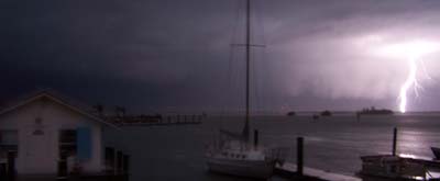
01 September 2008 | Gulf of Mexico
26 August 2008 | Coconut Grove, FL
25 August 2008 | Bahamas
24 August 2008 | Nassau Harbor
24 August 2008 | Atlantis Resort, Nassau
24 August 2008 | Atlantis Resort, Nassau
24 August 2008 | Atlantis Resort
24 August 2008 | Atlantis Resort, Nassau
24 August 2008 | Atlantis Resort, Nassau
23 August 2008 | Atlantis Resort, Nassau
23 August 2008 | Nassau
23 August 2008 | Nassau
22 August 2008 | Exumas
21 August 2008 | Exumas
20 August 2008 | Lee Stocking Island
20 August 2008 | Exumas
18 August 2008 | Stocking Island, Exumas
16 August 2008 | Elizabeth Harbor
Black Point Regatta
02 August 2008 | Staniel Cay
Jeff
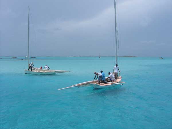
Emancipation Day, a Bahamas National Holiday, is celebrated the first weekend in August. The islanders take advantage of the three day weekend to celebrate the holiday. Multiple picnics, fireworks, music, and the Black Point Regatta are part of the Emancipation Day festivities. The regatta, a point to point course from Staniel Cay to Black Point Settlement, is for class C regatta boats. Lady Muriel pictured yesterday is a class A boat. I believe the boats are classified by length with class A being the largest vessels. The regatta boats are all rigged similarly with one vastly oversized mainsail. They carry a crew of 4 to 6. During the windward legs the crew hikes out on 2X12 timbers that cantilever out over the gunwale by at least 5 feet. Save for a 12 volt bilge pump the vessels have no electronics and no motors.
Comments
| Vessel Name: | Cest la Vie |
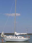
| Vessel Make/Model: | 1966 Charlie Morgan 34 |
| Hailing Port: | Everglades City, FL |
| About: | Anne - thirtysomething culinary godess that won't admit to being a fine sailor. Jeff - thirtysomething jack of all trades that constantly reminds Anne she is a fine sailor. Carlie - nine year old Jack Russell that loves to watch the dolphins. |
| Extra: | Currently our winters are spent working for the North Carlina Outward Bound School based on Indian Key Pass in Everglades City, FL. Our summers are spent in the Outer Banks of NC running the Outward Bound Schools sea kayak programs along the Cape Lookout National Seashore. |
Gallery not available
C'est la Vie
Port: Everglades City, FL