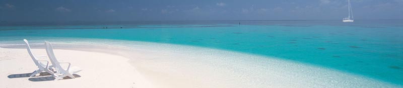
Taking Our Chances South
17 December 2014 | Green Cove Springs Marina, Fl
29 May 2014 | Toronto
11 May 2014 | Norfolk, Virginia
11 May 2014 | Indiantown Fl.
03 April 2014 | Stuart Florida
23 March 2014 | Marathon - Stuart Florida
18 March 2014 | Boot Key Marathon Florida
09 March 2014 | Boot Key Harboour, Marathon, Fl
19 February 2014 | Boot Key, Marathon Florida
09 February 2014 | Key Largo, Florida
08 February 2014 | South Beach, Miami Florida
27 January 2014 | West Palm Beach, Florida
23 January 2014 | West Palm Beach Florida
15 January 2014 | Stuart Florida
20 December 2013 | Green Turtle Cay to Ft Pierce Fl
16 December 2013 | Abaco Bight
11 December 2013 | Green Turtle Cay
04 December 2013 | Spanish Cay, Abacos, Bahamas
22 November 2013 | Stuart Florida
08 November 2013 | Ft Pierce Florida
Bringing Soulstice Home
11 May 2014 | Norfolk, Virginia
Dennis / Cool 62 F Sunny
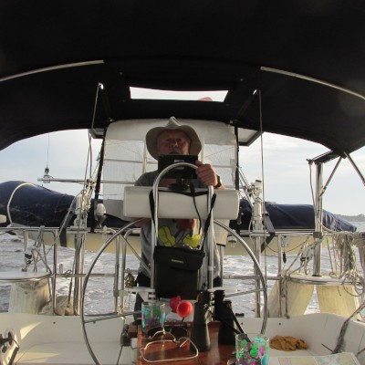
Bringing Soulstice Home
It is over fifteen miles from the naval base at Norfolk Va., from where you turn a sharp right off the Intracoastal Waterway, head east towards the Atlantic Ocean and to where you sail through the channel that crosses through the northern tunnel of the Chesapeake Bay Bridge. The Chesapeake Bay Bridge-Tunnel that crosses the bay, is itself a modern engineering miracle; a twenty mile four lane highway over causeways, bridges and tunnels across the mouth, reaching from Delaware to Virginia.
We had stopped mid-afternoon in Norfolk, at a marina to fuel up, take on some provisions for the run north to either Cape May or if the weather and wind were with us; to New York City. We needed to catch the out-going tide and the right wind if we wanted to clear Chesapeake Bay and reach the tunnel outlet before dark. Captain Mike, being the ever competent navigator, set a direct course to keep us to one side of the shipping lane and yet stay in the channel, all the time avoiding heavy traffic of naval and huge cargo container ships. Without requiring a single miracle we made it through the tunnel opening just before dusk and turned north in a brisk wind and sloppy seas.
A week earlier, and a lot further south, Mike had single handed Soulstice II from Indiantown, just east of Lake Okeechobee, down through the lock to pick me up at the Sunset Bay Marina in Stuart Fl. It was noon on May 5th and we were started on another adventure. He and I had taken Soulstice II and Chances down the Intracoastal Waterway individually, two years before, but we both wanted to take up the challenge of, at least once, ocean sailing north, up the eastern U.S. coast. The initial plan that afternoon was to motor the 18 miles up the Intracoastal to Ft Pierce, take on as much fuel as we could, and anchor for the night in the Inlet. After fueling up we listened to the weather forecast then looked at each and almost uttering the same words simultaneously. "Light winds from the south, why not go for it?" By 18:00, we had cleared the Ft Pierce Inlet, had both sails set in a dying breeze and were leaving the warm sandy beaches of Florida behind bound for any number of northern inlets in Georgia, South or North Carolina, all weather dependant .
Once we cleared the swell and were off the coast a couple of miles we settled into a routine which would become the norm for the next two weeks. We decided on a strict schedule of four hours on and four off, with a 2 hour shift at noon to change the shifts, so they were opposite to the day before. That meant the one that had the midnight to four o'clock shift one night would have different shifts the next day and night. Because we are somewhat the same about always wanting to be on call and love sailing the boat, we had to both agree to be resolute about keeping to our shift and how important it was to the safety and health of the boat. As it turned out, it worked perfect. Mike is a great guy to sail with, a great navigator, and forward planner especially the important stuff like the weather. Soulstice II on the other hand is so much like Chances, for obvious reasons, it was uncanny and most of the time it felt no different than being on my own boat.
After the first shift each through the night we settled easily into a routine checking the weather, preparing meals, washing dishes, and the general lookout for anything that changed; the operation of the boat or shift in wind. It was easy to forget that we were not crossing the Atlantic, although we were fifty miles off the coast as we headed north-east in a straight line on the first leg. We made a different plan for all kinds of possible landfalls depending on the weather, hoping for moderate winds to take us to somewhere around Cape Hatteras. Even as we left Ft. Pierce we knew we were leaving with a level of high pressure settling in over the region. The breeze became steady but not enough that we could sail all the time on sails alone. Because we were on boat delivery, whenever it fell below five knots we relied on the "diesel jenny" to gain as much north per hour as we could. With our trusty chart plotter we always knew at the present speed, when and where we could make landfall. It together with proper charts, both of the coast and all the possible inlets (there aren't as many as you might think) it gave us the confidence to keep well offshore to get some assist from the Gulf Stream. The first night was warm and full of stars and it wasn't long before that initial excitement of being at sea started to wear off.
Soulstice II has AIS (Automatic Identification System) on her VHF radio which allowed us to locate the position of other ships, fishing boats, or cruisers like ourselves. It also tells us in which the name of the ship, her direction, and the speed they are travelling, how far away as well as what time in minutes when they will be closest to us. Entertaining, as well as helpful, when you see a dot on the horizon and twelve minutes later a container or a cruise ship is passing close by. At the end of each shift both Mike and I could report the number of vessels that had passed us in every direction or who was following or leading us at present. Especially important at night, when the only life you can see is the solitary light somewhere on the horizon or one closing on you fast! Not quite radar but extremely helpful as the range can also be adjusted. I have the same radio on Chances and you can be sure I will have it connected before she launches in November this year.
The weather along the Florida coast would have been perfect except the winds were light and we had to burn some fuel. We decided we better ensure we had enough fuel in the event the winds went lighter as predicted. After 37 hours at sea we steered for the long channel, through really skinny water, entering Brunswick Inlet at the Florida Georgia border. We never left the boat, again taking on all the fuel we could hold and immediately heading out to sea again. Another fifty one hours, without incident , we were entering the inlet around dredging equipment filling the whole channel, in Beaufort North Carolina. In eighty eight hours, with a short stop for fuel, we were halfway up the coast. We felt like we were the lead boat in a race! Actually there was one incident worth mentioning. Somewhere off the Carolina coast Mike pointed out something that caught his eye over the starboard rail. Just as I turned my head to look, a shark launched itself three or four feet out of the water, for 10 or twelve feet, which was the length of its body. I had no idea that sharks jumped out of the water or had its upper tail fin four or five feet long. I discovered later that it was a thresher shark (no Google, no less!) that it is the only shark that breaches. It leaps forward out of the water to jump into the middle of a school of fish it is chasing and uses its tail fin to stun its prey. Another first for both of us and another reason to be out on the ocean!
Anchoring in the small bay along downtown Beaufort we lowered the dinghy to go ashore for a great burger, a couple of beers, stretch our legs and celebrate our return to terra firma, however brief. We both felt good about our progress but jointly decided not to press our good luck to round Cape Hatteras in the anticipated building wind. We would check in the morning and if it was as predicted, we would take the inside route up the Intracoastal, using the Pungo, Neuse and Alligator Rivers and cross Pamlico and Albemarle Sounds. This time the forecast was right and fortunately we knew we had done the right thing. After anchoring the first night above Sophie Island, just north of Bellhaven, NC in a small anchorage with eight other boats, all from Quebec, we tied up on the wall the second night at the last available space in the marina in Coinjock for showers and internet. Leaving early in the morning to motor north to the lock 37 miles away, it wasn't long before we ran into a thick blanket of fog on the Waterway, having to feel our way along for a couple of hours using the Chart Plotter. Again it is not radar, but a really useful electronic device. If we had been using only the paper charts we had with us we could not have moved an inch. Boats behind us were calling ahead to see what the conditions were like where we were. Shortly before the lock the fog dissipated and we locked through with the same flotilla of Montreal snowbirds heading north. The Great Bridge Lock is just south of the top entrance to the Dismal Swamp route and we knew Heritage, a boat from Sarnia with George and Jackie aboard, would be just ahead of us after taking the Swamp route. We managed radio contact with them, and sure enough they were headed for an anchorage just across the Bay in Newport News. Both Soulstice II and Chances had crossed over and spent time with them in the Abacos last fall. We would not be anchoring with them this time as the Atlantic was beckoning us again.
After three days from Beaufort we were in Norfolk, Virginia steering for the tunnel in Chesapeake Bay.
To Be Continued
Comments
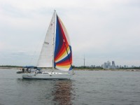
| Vessel Name: | CHANCES |
| Vessel Make/Model: | Catalina 34' MK II |
| Hailing Port: | Toronto |
| Crew: | Captain Dennis |
| About: | |
| Extra: | Thinking of the Florida Keys. From there who knows. |
Gallery not available
Life is good!
Who: Captain Dennis
Port: Toronto