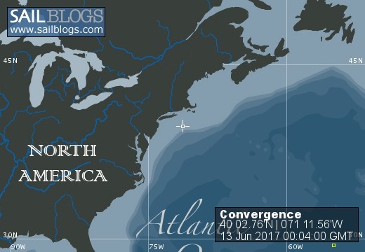
Convergence
12 June 2017 | North of Gulf Stream
11 June 2017 | Bermuda
10 June 2017 | Bermuda
31 May 2017 | 31 51�' N 63 14�' W
30 May 2017 | 30 58�' N 60 26�' W
28 May 2017
27 May 2017
25 May 2017
24 May 2017
22 May 2017
22 May 2017
21 May 2017
21 May 2017
20 May 2017 | 26 21' N, 24 55' W
18 May 2017
17 May 2017
16 May 2017 | Lanzarote Canary Islands
16 May 2017 | Lanzarote Canary Islands
16 May 2017 | Lanzarote Marina Canary Islands
28 February 2011
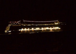
Cruise Ship Close Encounter
18 May 2017
Randy
As we sailed down between the islands, which at their closest are 50 miles apart, the wind increased from 17 to 21 at midnight so we put in reef number 1. And the boat settled down surging less and felt completely under control. An hour later the wind had increased to 28 so we put in reef number 2. The boat feels good and the boat is flying 20 degrees off dead down averaging 10, suging to 14 knots. The seas continued to build from under a meter to 4 plus meters. We can put the first two reefs in without anyone leaving the cockpit. At 3 AM the wind was averaging over 30 so we decided to put in our third reef. Tim goes forward to prepare for the reef. Unfortunately when we put in the 2nd reef, one of the 3rd reef lines got tangled around the steaming light about 15 feet up the mast. There was no way to clear it without going up the mast in well over 30 knot winds and big seas. By this time we were just past the island and expected the wind to get a bit lighter. The boat was under control so we carried on with the 2nd reef in.
Late in Kent-Harris midnight to 3 AM watch he spotted a boat going toward us about 15 miles away. Our AIS system which identifies commercial vessels and predicts their closest point of approach was on but this vessel did not show up. We were sailing along at 10 to 13 knots almost dead down wind in a lot of wind. We couldn't change course easily and by the way as a sailboat we did have the right of way.
As the boat got closer we could tell it was a large cruise liner. Our AIS finally picked up their information predicting they would clear us by a quarter of a mile. That's what it looked like to us also. Too close for comfort.
Our bright LED masthead running light was on and plainly visible and our AIS would have let them know our position but we shined our bright West Marine super spot light on our sail hoping the ship would alter course at least a little. It didn't. We passed them starboard to starboard getting too good view of them.
We found first hand that there are wind "acceleration zones" that extend 20 or more miles from the islands that cause a 10 knot increase in speed.
After passing the south end of Grand Canaira island the wind stayed in the high 20's till 5 PM. The seas are down from 3-4 meters to 1-2 meters.
We made 210 miles straight line in our first 24 hours.
We passed the tests. . . All is well aboard Convergence.
Comments
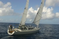
| Vessel Name: | Convergence |
| Vessel Make/Model: | Wylie 65 |
| Hailing Port: | Santa Cruz, California |
| Crew: | Sally-Christine Rodgers, Kent-Harris Repass, Randy Repass |
| Extra: |
Convergence's Photos - Main
No items in this gallery.
Background
Who: Sally-Christine Rodgers, Kent-Harris Repass, Randy Repass
Port: Santa Cruz, California