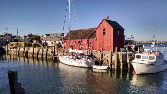
Cruising with Grace
Who: Alex Cullen
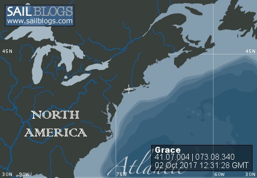
Port: Needham MA
20 May 2018 | My kitchen, Needham MA
16 May 2018 | Mooring 831, Hewitts Cove, Hingham MA
04 May 2018 | Cape May harbor, off the Coast Guard base
25 April 2018 | Onancock Creek
10 April 2018 | Barefoot Landing Marina, which is free while they are closed
02 April 2018 | Turtle Island, just inside the border with South Carolina
26 March 2018 | St Augustine Municipal Marina, right next to the Bridge of Lions
22 March 2018 | ICW Mile 946
17 March 2018 | Old Bahama Marina, West End, Bahamas
11 March 2018 | Conch Marina, Marsh Harbor
04 March 2018 | Anchored off Russell Island next to Spanish Wells
24 February 2018 | Off Monument Beach, Stocking Island
18 February 2018 | Anchored off Stocking Island, across the harbor from Georgetown
11 February 2018 | Georgetown
04 February 2018 | Nassau Harbor Club Marina
28 January 2018 | In a slip at the Nassau Harbor Club Marina
19 January 2018 | Anchorage between Whale and Bird Cay
15 January 2018 | South of Frazier Hog Island
11 January 2018 | Browns Marina, Bimini, Bahamas
07 January 2018 | No Name Harbor, Key Biscayne
Making my way towards Charleston, South Carolina
10 November 2017 | Price Creek
Sunny finally, but cold!
This blog post describes the route from the Osprey Marina in Socastee to an anchorage 20 miles away from Charleston. I will get to Charleston today.
The leg from the Osprey Marina to Georgetown follows the Waccamaw River. The Waccamaw River is reputed to be the most scenic stretch of the ICW, and one of the most referenced scenic rivers in the US. It wanders through cypress forests with water around their roots - dry land isn't very apparent for the first part of this leg. As the recommendation of another cruiser I met, I took Prince Creek, which is not really a creek but rather an alternate channel around Longwood Island. The creek is narrow, windy and deep. I took pictures while steering - a bit risky at time as while I was taking them, Grace would veer off course - thankfully, the creek is deep all the way to the trees. (pictures were taken with my old motorola phone, as my new Pixel phone died our last night at the Osprey Marina).
The Waccamaw river is very muddy and full of floating plants. It's not a uniform muddy water - but rather clouds of mud separated by slightly clearer water. Since I had to pay attention to the course as I motored my way down the river, I had lots of time to admire the muddy water.
The group spent two nights in Georgetown SC. The marina was right in town on the main street - a welcome change from many of the marinas we've stayed at, so it was easy to see the town, and get out to restaurants and bars. I went with others to the Rice Museum - dedicated to Georgetown's history as the leading rice producer in the world during the 19th century. I also walked around to look at the houses, walked 2.5 miles to the Verizon store to get my phone problems addressed, got a haircut and beard trim, went out to breakfast, and went with other group members to have drinks at the bars along the waterfront. Georgetown is noted for the oak trees planted along all the streets. Very charming - but before you think of moving to Georgetown, immediately outside it is the largest kraft paper mill in the world! Yes, Georgetown sometimes smells like those papermill towns in Maine...
The group was planning to spend three nights in a marina (an expensive marina) in Charleston. I decided to go a bit slower, spend two nights anchored out, and two nights in the marina. This stretch really gives you a sense of why this is called the Low Country. Salt marshes for miles with not an island or tree to break the vista. At high tide (tidal range is 5 ft here), only the tops of the marsh grass are visible, and low tide, the sides are mud banks. My first night's anchorage was at Five Fathoms Creek and my second was at Price Creek. Both places, the anchorage is in the middle of these marshes, with the nearest trees a mile away. These would have been very pretty places, but the weather is cold and rainy, and the damp penetrates you after a time. It's very nice to be able to get into the cabin after a day motoring along - but even in the cabin, everything feels damp.
Quick note for those considering making an ICW cruise who do not have a shoal-draft boat. The ICW has a 'charted depth' of 12 ft - but that is at best a good intention. As I was following the channel, my shallow water alarm - set at 10 ft, would often go off, and on several occasions, the depth got down to less than 7 ft. When that would happen, I would slow down, and wander left and right trying to find deeper water. At least one other person in the group has a draft over 6 ft, and several have touched bottom as they've progressed down.
As of yesterday, I've been on this journey for six weeks. In five weeks more, I'll be at Ft Lauderdale, and then fly home for two weeks over Christmas. Then it's back to Grace, and 19 weeks more cruising until I cruise into Hewitts Cove and my marina mooring.
Comments
| Vessel Name: | Grace |
| Vessel Make/Model: | Catalina 320 |
| Hailing Port: | Needham MA |
| Crew: | Alex Cullen |
| Extra: | This trip will be my 'transition to retirement' |
Grace's Photos - Main
 |
|
|
46 Photos
Created 14 November 2017
|
|
Who: Alex Cullen
Port: Needham MA