Doing the Loop in GH 3
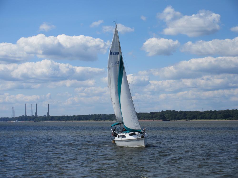
A retired couple from the midwest set off sailing the Loop in June 2016. They travel about 2400 miles on a 1999 Hunter 260 sailboat, "GH3". Beginning Jan. 2017, they continue the journey on their newly purchased 2008 Catalina 320 MK II sailboat.
| Vessel Name: | Bucket List |
| Vessel Make/Model: | Catalina 320 MK II |
| Hailing Port: | St. Louis, Missouri |
| Crew: | |
| About: |
22 November 2017 | MacKinaw City Marina
13 July 2017 | Port Severn, Ontario
11 July 2017 | Hyde Park, New York
30 June 2017 | Waterford, New York
28 June 2017 | Oswago, New York
01 June 2017 | Statue of Liberty, New York Harbor
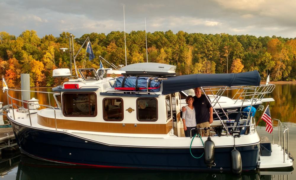
14 May 2017 | Waterside Marina - Norfork, VA
23 April 2017 | Morehead City, North Carolina ... Mile Marker 203.6
07 April 2017 | Beaufort, South Carolina
27 March 2017 | Jekyll Island, Georgia
18 March 2017 | Anchorage on ICW adjacent to Cape Canaveral
13 March 2017 | Ft. Pierce City Marina
04 March 2017 | Old Bahama Bay
16 February 2017 | Lighthouse Point, Florida
13 February 2017 | 30 Miles East of Marathon
19 January 2017 | Cape Coral, Florida
17 January 2017 | Dunedin Municipal Marina, Dunedin, Florida
31 December 2016 | Dunedin Municipal Marina, Dunedin, Florida
06 December 2016 | Carrabelle, Florida
29 November 2016 | St. Andrews Marina, Panama City, Florida
Recent Blog Posts
13 July 2017 | Port Severn, Ontario
Tales from the Trent Severn Waterway
"Roses are Red, Violets are Blue. We finished the Trent Severn Waterway; only 356 miles yet to Do!!!" T. Grass
30 June 2017 | Waterford, New York
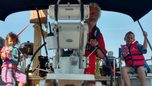
Kids in the Cockpit
"Grandparent doesn't mean that you have gray hair and stay home cooking cakes for your grandchildren." Carine Roitfeld
28 June 2017 | Oswago, New York
NY State Canals
"Fifteen Miles on the Erie Canal" from Erie Canal Song
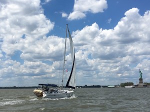
01 June 2017 | Statue of Liberty, New York Harbor
Our Slice of the BIG APPLE
"I say goodbye to all my sorrows And by tomorrow I'll be on my way. I guess the Lord must be in New York City." Lyrics to The Lord must live in New York City, Harry Nilsson
Up Around the Bend
31 December 2016 | Dunedin Municipal Marina, Dunedin, Florida
"You can ponder perpetual motion, Fix your mind on a crystal day, Always time for a good conversation, There's an ear for what you say. Come on the risin' wind, We're goin' up around the bend." Song Writer: John Cameron Fogerty; Performed by Creedence Clearwater Revival
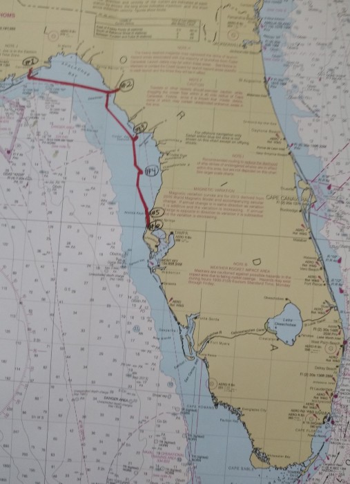
Above is a map of the gulf coast of Florida showing our route 'around the bend'.
#1 Carrabelle
#2 Steinhatchee - Sea Hag Marina
#3 Cedar Key Anchorage
#4 Anchorage in Gulf near Weeki Wachee
#5 Anchorage at Anclote Key near Tarpon Springs
#6 Dunedin - Dunedin Municipal Marina
(See text below for details about our journey 'round the bend'.)
Leaving Carabelle4
On Thurs., Dec. 8, 2016, the weather forecast finally included a prediction of weather possibly suitable for slower Looper boats to travel from Carrabelle to Steinhatchee, Florida. The possible weather window included primarily overnight hours, but it seemed like the opportunity that we had been waiting for for two weeks.
#1
After much discussion, three sailboats planned to leave Carrabelle together for Steinhatchee at 3 pm in an overnight crossing, thereby bypassing islands and shallow water in daylight. We planned to sail and/or motor through the overnight hours about 86 statute miles east to Steinhatchee at a slow enough pace so as to arrive near Steinhatchee and navigate reefs and other hazards in daylight hours. We talked to Eddy from Eddies Weather Wag. He indicated that the crossing would not be overly easy, but said that our plan was well thought out. This route would take us a maximum of 22 miles offshore. This plan was made even better because it included 3 buddy boats: Living Life, a Catalina 27 with Nancy and James and their two sons; Tranquility 2, a Catalina 30 with Jack and Andrew; and GH3, our Hunter 260. We agreed to make VHF radio contact on the hour every hour during the crossing.
The three boats left Carrabelle and safely navigated the 5.4 statute mile channel and then passed Dog Island to Buoy R26 in open water in the Gulf of Mexico. GH3 was provisioned to capacity with drinking water and fuel. We had every reason to feel optimistic. Seeing our buddy boats under sail framed by the sunset was an awesome sight. We overheard our friends, Rod and Susie on Behavin', talking on the radio to a shrimp boat. The fisherman said that the wind and waves would calm down overnight. Rod, whom we knew from the AGLCA rendezvous, wished us a safe crossing and asked we had filed a float plan. We had filed one including our route, destination, and anticipated time of arrival with our son, Tom. He knows to call the Coast Guard if we do not contact him by a predetermined time. We have never involved the Coast Guard and didn't expect to that night either.
The three sailboats confidently motor sailed east until Dog Island was nearly out of sight. The little flotilla continued under sail power alone for several hours. Hourly radio check in conversations included our expectation that the waves would die down overnight and discussion of getting used to moving in the rolling waves. Things were going well, but as the hours passed, the wind changed direction and waves were building. Our sailboats cut through these waves better under sail power than motor alone. Seeing our buddy boats under sail framed by the sunset was an awesome sight. GH3 decided to take down main and jib in the safety of the last few minutes of daylight rather than risk one of us having to go up top to take them down later in darkness with possible larger waves. Living Life turned their motor off at Dog Island and did not use it again until entering the channel at Steinhatchee. Tranquility 2 kept their main sail up most of the night.
Tom and Tracy took scheduled turns at the wheel. Each managed to get an hour or so of sleep early in the evening. We followed the mast light of Living Life as if it were our North Star, frequently checking our course on the iPad also. As the hours went on, the temperature dropped and the seas became very rough from many directions, so rough that it was difficult to even move about the cockpit. We made use of our tethers and jackline for safety.. Because of the darkness, we could not tell how large the waves were, but large waves hit us from random directions. Tasks like transferring fuel, or going to the head became difficult. Tom and Tracy both stayed awake in the cockpit from that time on. Living Life was sailing under jib only with no motor and sped ahead of us by miles. Nancy said that it felt like sailing through a washing machine. By 3 am, the hourly radio checks with the other boats, began to feel like a lifeline documenting the passing hours. The crew of GH3 remained vigilant throughout the night, but never felt anxious or even tired.
#2.
Just after sunrise, GH3 and Tranquility 2 entered the channel to Steinhatchee. When we arrived at Sea Hag Marina Living Life was there. Our friends, Ross and Ruth who had made the crossing on a trawler, had breakfast ready for the weary but successful travelers on the trio of sailboats.
DOCKTAILS at Steinhatchee
Christmas at Steinhatchee

We stayed in Steinhatchee at Sea Hag Marina from Dec. 9 - 12 waiting for the weather to improve. Steinhatchee was just recovering from the storm surge of Hurricane Hermine in September of 2016. The marina and Roy's Restaurant had recently reopened. The marina did not have potable water or pump out facilities. We had docktails, had a potluck, went out to eat at Roy's, and rode our bikes. We waited patiently until the next weather window arrived.
Eddie's Weather Wag forecast a weather window beginning early on Mon., Dec. 12 and ending Wed. morning. The family on Living Life planned one day to travel 60 statute miles to Cedar Key and another to get to Crystal River to see the manatees. We were determined to get to Tarpon Springs before that weather window closed so that we could get to St. Louis for Christmas. A cardinal rule of travelling the loop is to never have a schedule. We violated the rule because of our desire to be home for Christmas and to avoid being in the Gulf in marginal weather. We sent our son a float plan stating that we would leave before sunrise and travel about 70 statute miles to Crystal River before sunset, but if we could not make that, stopping at Cedar Key was our back up plan.
We headed out of the channel from Steinhatchee alone at 4 am on Mon., Dec. 12 for Crystal River with Tarpon Springs as our destination for the following day.
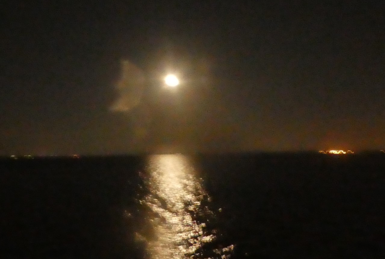
Pre-Dawn Moon Glow leaving Steinhatchee
There was wispy fog in the channel as we navigated using the bread crumb trail on our Garmin and following the buoys out the 5.4 statute mile channel. On VHF channel 22a, the Coast Guard reported that the fog advisory would end at 9 am. How lucky, we thought, for our friends on Living Life who planned to leave at sunrise and head and shorter distance to Cedar Key. It seemed they would miss the fog. However, the fog got thicker after sunrise and by 11 am we were travelling at a much reduced speed due to more dense fog. The Coast Guard issued a dense fog advisory until 9 am the following day. AIS on our radio assured us that there were no commercial boats in our area. Our slow speed, radar reflector and running lights were additional insurance. We ere far enough away from Steinhatchee that returning was not really an option.
#3
We travelled on slowly at 2 - 3 knots calculating that there were not enough hour of daylight to make Crystal River before sunset, so we decided to head to the South Channel into Cedar Key which is narrow and 6.9 statute miles long miles long with infrequently spaced buoys. The fog came and went several times making us question our decision, but we stuck with it and safely anchored in daylight in Cedar Key. The fog came in even more thickly after we were settled in with our generator running. Not knowing how long we might be stuck there with no way to reprovision, we put in place every effort to conserve our fresh water.
We got a call from Living Life on the VHF radio. They had entered Cedar Key in the shallower North Channel which is closer to Steinhatchee. They arrived safely having travelled very skinny water in blinding fog. They knew we were anchored nearby because they could hear our generator even though they could not see us.
The next morning, the fog subsided so that we could see Living Life anchored about 1000 feet away. The dense fog advisory was still in effect, but we could see a quarter of a mile or more. We had bread crumbs on our Garmin to help us stay in the narrow channel. We realize that this was not a very good weather window, but we wanted to get to Tarpon Springs and having been unable to replenish our water for 5 days, we were getting a little concerned about running out of drinking water. Nancy told us about an anchorage at Weeki Wachee Springs about half way between Tarpon Springs and our anchorage at Cedar Key. A local Looper named Hamp told us that he had safely anchored in open water over night in that area of the Gulf of Mexico.
With about 500 feet of visibility and the fog forecast to lift, GH3 headed out the South Channel of Cedar Key at 9 am with Living Life following.
Living Life Leaving Cedar Key with GH3

The two boats threaded their way carefully out the channel which was ust less than 7 mo;es log. Then Living Life headed southeast to Crystal River to swim with the manatees and we headed south in open Gulf water toward Tarpon Springs. We choose getting home for Christmas over seeing manatees, so we sent our son a float plan by text stating that we hoped to get to Tarpon Springs by sunset. We gave him the latitude and longitude of the Weeki Wachee anchorage as our back up plan. We had also made a reservation at a marina in Tarpon Springs by cell phone.
About 11 am the fog became very dense. We saw two stationary targets on AIS, so Tom called on the VHF radio to let them know that we would be passing near them. The captain assured us that they were anchored and would not be moving. He also told us he could see us on his radar and he could see another boat 2 miles east of us. It was reassuring that he could see us and he could see Living Living and that there were no other boats in the area.
Countdown: this marginal weather window would end the following morning with high wind and large waves.
#4
We were not going to get to Tarpon Spring by sunset, we would not even quite get to Weeki Wachee by then. We wanted to call our son to tell him that we were safe, don't call the Coast Guard. However, we had no cell phone coverage. On the VHF radio, we called Nancy on Living Life and asked her to contact our son when she got cell phone coverage in Crystal River.
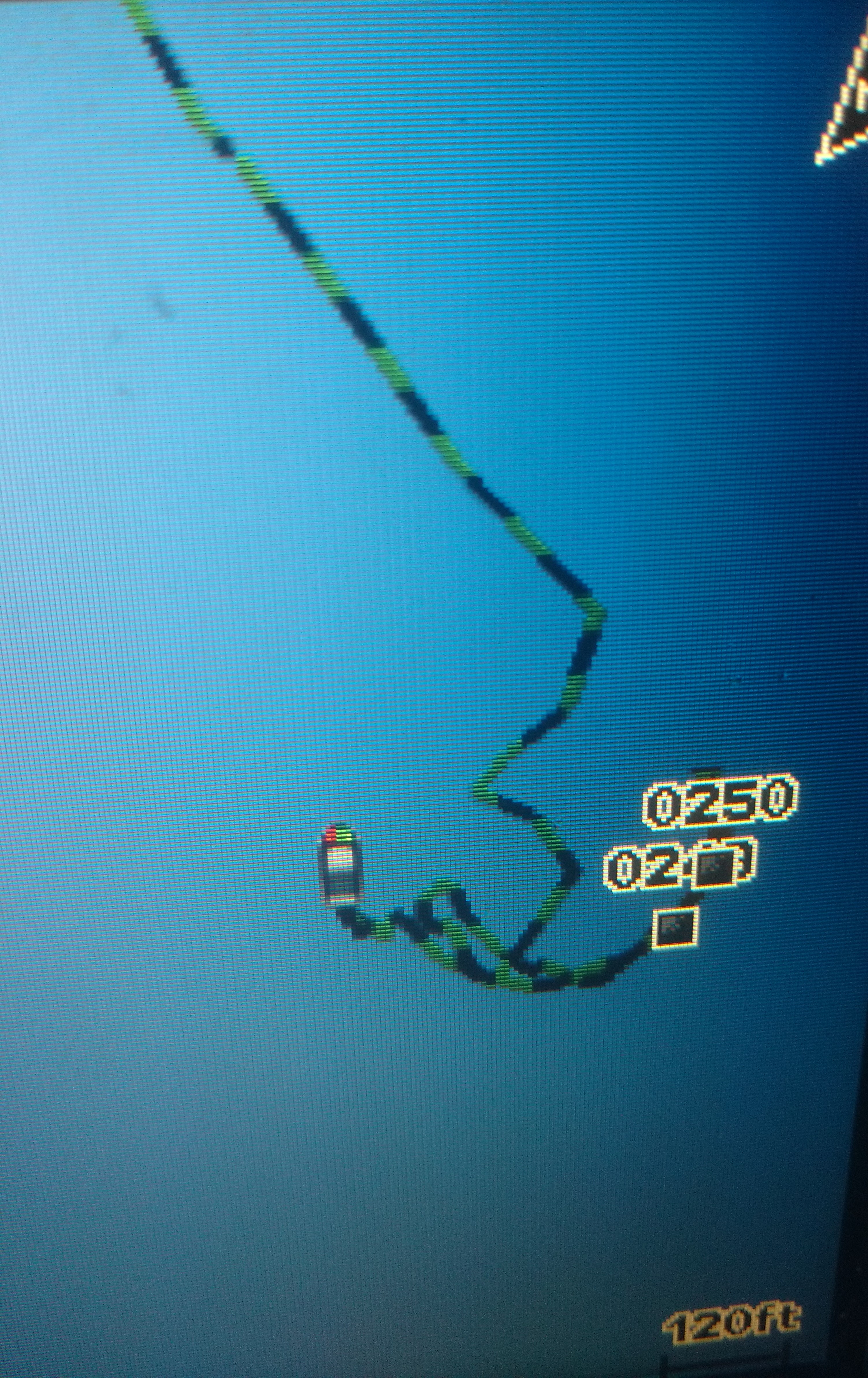
We continued travelling south cautiously at reduced speed. As sunset neared, we headed southeast toward land about 12 miles away. When we reached 10 miles from land we started seeing crab pots (see the next setion for an explanation of their significance) and the water was about 11 feet deep, so we decided that this was the best anchorage available. Tom dropped the anchor and it held firm! We felt isolated in the open Gulf water in the nighttime darkness and fog with no cell phone coverage. We put as much light as possible on our sailboat: anchor light, running lights, and a spot light shone on the deck. For several hours we took turns checking the Garmin and watching and listening for other boats. We went to sleep hoping for the best: hoping for safety at this anchorage, and hoping that our son had gotten the message and not called the Coast Guard.
The photo below is of our Garmin that evening in the open Gulf of Mexico. You can see where the line traces back and forth on itself. This assured us that the anchor was firm.
Photo of Garmin at Anchorage - in Gulf of Mexico - ten miles from Weeki Wachee
Here is a photo of one of the numerous crap pot floats encountered as we neared Tarpon Springs

Shallow waters in the Gulf of Mexico are excellent fishing grounds for crabs. Fishermen set out traps of wire mesh which are suspended below the surface by a line attached to a float about the size of a softball. The problem for boaters is that if a boat runs over a float, the line may snag and stop the boat's propeller. Fortunatley for boaters, fishermen arrange their traps in long orderly rows. A vigilant boater can typically avoid hitting them. We have an outboard, so this would be inconvenient, but we could tilt the motor out of the water, free the line, and continue on. Boats with inboard motors typically require a swimmer to free their propeller.
Wed., Dec. 14, we got up at 4:30 am happy to be safe and sound with absolutely calm seas but some fog. Tom went up on the bow with a spotlight to watch for crab pots while Tracy steered west toward open water. We used two way radio headsets called marriage savers to facilitate communication and avoid crab pots. Then we turned south 30 miles toward Tarpon Springs as the fog lifted. We motored expecting to see numerous boats heading to Tarpon Springs from Carrabelle. We saw only few such boats on the horizon. About 10 miles from Tarpon Springs dense fog returned in the midst of thick crab pots. So we reduced our speed and never hit a crab pot. Upon regaining cell phone coverage, we called all 5 marinas in Tarpon Springs but found no slips available (no room at the inn), so we decided to anchor behind Anclote Key near the entrance to Tarpon Springs. The fog was so thick that we could not even see Anclote Key as we anchored behind it. Tom went to the bow to raise our anchor and found it awkwardly heavy. As he lifted it close to the surface, he could see that our anchor and brought up an abandoned crab pot which was returned to the sandy bottom. Overnight the fog had disappeared but the wind had picked up greatly. We saw white caps in the bay, the weather window had closed. We had successfullygone 8 days without replenishing of drinking water which is a new record for us.
#5
At Anclote Key - a crab pot was brought up by our anchor.

#6
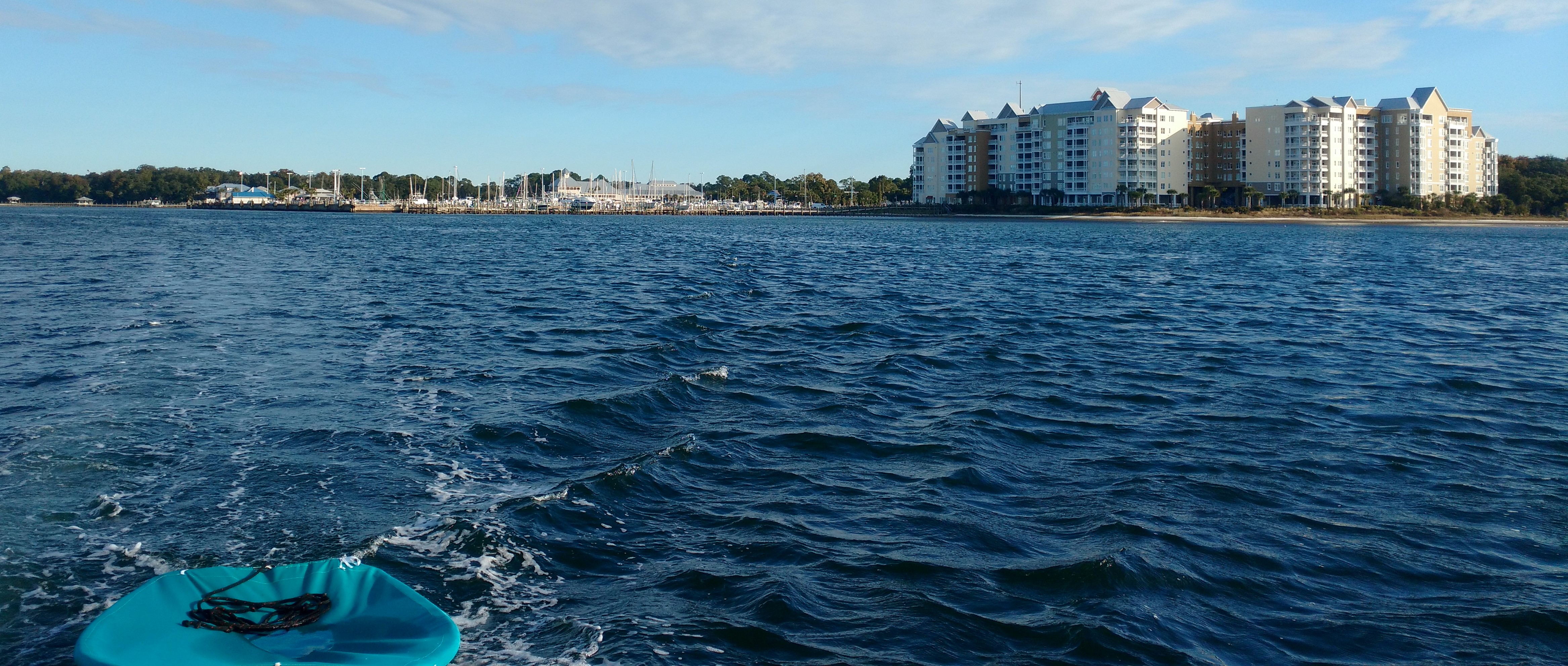
We never did stop at Tarpon Springs ... as we headed south for Dunedin we took this photo of it off of our stern.
The next morning on Thurs., Dec. 15, 2016, we headed down the intercoastal waterway past Tarpon Springs toward Dunedin. Our friends, Libby and Ron on Tug O My Heart, were waiting for our arrival at Dunedin Municipal Marina. On the radio we requested the opening of the 24 foot drawbridge named Dunedin Honeymoon Island Bridge. We thanked the bridge operator after passing. It was great to hear her say, "Welcome to Dunedin!" We had safely crossed open water of the Gulf of Mexico in The Bend of Florida and arrived back in the shelter of the intercoastal waterway in time to get home for Christmas!

who is online counter blog counter
Above is a map of the gulf coast of Florida showing our route 'around the bend'.
#1 Carrabelle
#2 Steinhatchee - Sea Hag Marina
#3 Cedar Key Anchorage
#4 Anchorage in Gulf near Weeki Wachee
#5 Anchorage at Anclote Key near Tarpon Springs
#6 Dunedin - Dunedin Municipal Marina
(See text below for details about our journey 'round the bend'.)
Leaving Carabelle4
On Thurs., Dec. 8, 2016, the weather forecast finally included a prediction of weather possibly suitable for slower Looper boats to travel from Carrabelle to Steinhatchee, Florida. The possible weather window included primarily overnight hours, but it seemed like the opportunity that we had been waiting for for two weeks.
#1
After much discussion, three sailboats planned to leave Carrabelle together for Steinhatchee at 3 pm in an overnight crossing, thereby bypassing islands and shallow water in daylight. We planned to sail and/or motor through the overnight hours about 86 statute miles east to Steinhatchee at a slow enough pace so as to arrive near Steinhatchee and navigate reefs and other hazards in daylight hours. We talked to Eddy from Eddies Weather Wag. He indicated that the crossing would not be overly easy, but said that our plan was well thought out. This route would take us a maximum of 22 miles offshore. This plan was made even better because it included 3 buddy boats: Living Life, a Catalina 27 with Nancy and James and their two sons; Tranquility 2, a Catalina 30 with Jack and Andrew; and GH3, our Hunter 260. We agreed to make VHF radio contact on the hour every hour during the crossing.
The three boats left Carrabelle and safely navigated the 5.4 statute mile channel and then passed Dog Island to Buoy R26 in open water in the Gulf of Mexico. GH3 was provisioned to capacity with drinking water and fuel. We had every reason to feel optimistic. Seeing our buddy boats under sail framed by the sunset was an awesome sight. We overheard our friends, Rod and Susie on Behavin', talking on the radio to a shrimp boat. The fisherman said that the wind and waves would calm down overnight. Rod, whom we knew from the AGLCA rendezvous, wished us a safe crossing and asked we had filed a float plan. We had filed one including our route, destination, and anticipated time of arrival with our son, Tom. He knows to call the Coast Guard if we do not contact him by a predetermined time. We have never involved the Coast Guard and didn't expect to that night either.
The three sailboats confidently motor sailed east until Dog Island was nearly out of sight. The little flotilla continued under sail power alone for several hours. Hourly radio check in conversations included our expectation that the waves would die down overnight and discussion of getting used to moving in the rolling waves. Things were going well, but as the hours passed, the wind changed direction and waves were building. Our sailboats cut through these waves better under sail power than motor alone. Seeing our buddy boats under sail framed by the sunset was an awesome sight. GH3 decided to take down main and jib in the safety of the last few minutes of daylight rather than risk one of us having to go up top to take them down later in darkness with possible larger waves. Living Life turned their motor off at Dog Island and did not use it again until entering the channel at Steinhatchee. Tranquility 2 kept their main sail up most of the night.
Tom and Tracy took scheduled turns at the wheel. Each managed to get an hour or so of sleep early in the evening. We followed the mast light of Living Life as if it were our North Star, frequently checking our course on the iPad also. As the hours went on, the temperature dropped and the seas became very rough from many directions, so rough that it was difficult to even move about the cockpit. We made use of our tethers and jackline for safety.. Because of the darkness, we could not tell how large the waves were, but large waves hit us from random directions. Tasks like transferring fuel, or going to the head became difficult. Tom and Tracy both stayed awake in the cockpit from that time on. Living Life was sailing under jib only with no motor and sped ahead of us by miles. Nancy said that it felt like sailing through a washing machine. By 3 am, the hourly radio checks with the other boats, began to feel like a lifeline documenting the passing hours. The crew of GH3 remained vigilant throughout the night, but never felt anxious or even tired.
#2.
Just after sunrise, GH3 and Tranquility 2 entered the channel to Steinhatchee. When we arrived at Sea Hag Marina Living Life was there. Our friends, Ross and Ruth who had made the crossing on a trawler, had breakfast ready for the weary but successful travelers on the trio of sailboats.
DOCKTAILS at Steinhatchee
Christmas at Steinhatchee
We stayed in Steinhatchee at Sea Hag Marina from Dec. 9 - 12 waiting for the weather to improve. Steinhatchee was just recovering from the storm surge of Hurricane Hermine in September of 2016. The marina and Roy's Restaurant had recently reopened. The marina did not have potable water or pump out facilities. We had docktails, had a potluck, went out to eat at Roy's, and rode our bikes. We waited patiently until the next weather window arrived.
Eddie's Weather Wag forecast a weather window beginning early on Mon., Dec. 12 and ending Wed. morning. The family on Living Life planned one day to travel 60 statute miles to Cedar Key and another to get to Crystal River to see the manatees. We were determined to get to Tarpon Springs before that weather window closed so that we could get to St. Louis for Christmas. A cardinal rule of travelling the loop is to never have a schedule. We violated the rule because of our desire to be home for Christmas and to avoid being in the Gulf in marginal weather. We sent our son a float plan stating that we would leave before sunrise and travel about 70 statute miles to Crystal River before sunset, but if we could not make that, stopping at Cedar Key was our back up plan.
We headed out of the channel from Steinhatchee alone at 4 am on Mon., Dec. 12 for Crystal River with Tarpon Springs as our destination for the following day.
Pre-Dawn Moon Glow leaving Steinhatchee
There was wispy fog in the channel as we navigated using the bread crumb trail on our Garmin and following the buoys out the 5.4 statute mile channel. On VHF channel 22a, the Coast Guard reported that the fog advisory would end at 9 am. How lucky, we thought, for our friends on Living Life who planned to leave at sunrise and head and shorter distance to Cedar Key. It seemed they would miss the fog. However, the fog got thicker after sunrise and by 11 am we were travelling at a much reduced speed due to more dense fog. The Coast Guard issued a dense fog advisory until 9 am the following day. AIS on our radio assured us that there were no commercial boats in our area. Our slow speed, radar reflector and running lights were additional insurance. We ere far enough away from Steinhatchee that returning was not really an option.
#3
We travelled on slowly at 2 - 3 knots calculating that there were not enough hour of daylight to make Crystal River before sunset, so we decided to head to the South Channel into Cedar Key which is narrow and 6.9 statute miles long miles long with infrequently spaced buoys. The fog came and went several times making us question our decision, but we stuck with it and safely anchored in daylight in Cedar Key. The fog came in even more thickly after we were settled in with our generator running. Not knowing how long we might be stuck there with no way to reprovision, we put in place every effort to conserve our fresh water.
We got a call from Living Life on the VHF radio. They had entered Cedar Key in the shallower North Channel which is closer to Steinhatchee. They arrived safely having travelled very skinny water in blinding fog. They knew we were anchored nearby because they could hear our generator even though they could not see us.
The next morning, the fog subsided so that we could see Living Life anchored about 1000 feet away. The dense fog advisory was still in effect, but we could see a quarter of a mile or more. We had bread crumbs on our Garmin to help us stay in the narrow channel. We realize that this was not a very good weather window, but we wanted to get to Tarpon Springs and having been unable to replenish our water for 5 days, we were getting a little concerned about running out of drinking water. Nancy told us about an anchorage at Weeki Wachee Springs about half way between Tarpon Springs and our anchorage at Cedar Key. A local Looper named Hamp told us that he had safely anchored in open water over night in that area of the Gulf of Mexico.
With about 500 feet of visibility and the fog forecast to lift, GH3 headed out the South Channel of Cedar Key at 9 am with Living Life following.
Living Life Leaving Cedar Key with GH3
The two boats threaded their way carefully out the channel which was ust less than 7 mo;es log. Then Living Life headed southeast to Crystal River to swim with the manatees and we headed south in open Gulf water toward Tarpon Springs. We choose getting home for Christmas over seeing manatees, so we sent our son a float plan by text stating that we hoped to get to Tarpon Springs by sunset. We gave him the latitude and longitude of the Weeki Wachee anchorage as our back up plan. We had also made a reservation at a marina in Tarpon Springs by cell phone.
About 11 am the fog became very dense. We saw two stationary targets on AIS, so Tom called on the VHF radio to let them know that we would be passing near them. The captain assured us that they were anchored and would not be moving. He also told us he could see us on his radar and he could see another boat 2 miles east of us. It was reassuring that he could see us and he could see Living Living and that there were no other boats in the area.
Countdown: this marginal weather window would end the following morning with high wind and large waves.
#4
We were not going to get to Tarpon Spring by sunset, we would not even quite get to Weeki Wachee by then. We wanted to call our son to tell him that we were safe, don't call the Coast Guard. However, we had no cell phone coverage. On the VHF radio, we called Nancy on Living Life and asked her to contact our son when she got cell phone coverage in Crystal River.
We continued travelling south cautiously at reduced speed. As sunset neared, we headed southeast toward land about 12 miles away. When we reached 10 miles from land we started seeing crab pots (see the next setion for an explanation of their significance) and the water was about 11 feet deep, so we decided that this was the best anchorage available. Tom dropped the anchor and it held firm! We felt isolated in the open Gulf water in the nighttime darkness and fog with no cell phone coverage. We put as much light as possible on our sailboat: anchor light, running lights, and a spot light shone on the deck. For several hours we took turns checking the Garmin and watching and listening for other boats. We went to sleep hoping for the best: hoping for safety at this anchorage, and hoping that our son had gotten the message and not called the Coast Guard.
The photo below is of our Garmin that evening in the open Gulf of Mexico. You can see where the line traces back and forth on itself. This assured us that the anchor was firm.
Photo of Garmin at Anchorage - in Gulf of Mexico - ten miles from Weeki Wachee
Here is a photo of one of the numerous crap pot floats encountered as we neared Tarpon Springs
Shallow waters in the Gulf of Mexico are excellent fishing grounds for crabs. Fishermen set out traps of wire mesh which are suspended below the surface by a line attached to a float about the size of a softball. The problem for boaters is that if a boat runs over a float, the line may snag and stop the boat's propeller. Fortunatley for boaters, fishermen arrange their traps in long orderly rows. A vigilant boater can typically avoid hitting them. We have an outboard, so this would be inconvenient, but we could tilt the motor out of the water, free the line, and continue on. Boats with inboard motors typically require a swimmer to free their propeller.
Wed., Dec. 14, we got up at 4:30 am happy to be safe and sound with absolutely calm seas but some fog. Tom went up on the bow with a spotlight to watch for crab pots while Tracy steered west toward open water. We used two way radio headsets called marriage savers to facilitate communication and avoid crab pots. Then we turned south 30 miles toward Tarpon Springs as the fog lifted. We motored expecting to see numerous boats heading to Tarpon Springs from Carrabelle. We saw only few such boats on the horizon. About 10 miles from Tarpon Springs dense fog returned in the midst of thick crab pots. So we reduced our speed and never hit a crab pot. Upon regaining cell phone coverage, we called all 5 marinas in Tarpon Springs but found no slips available (no room at the inn), so we decided to anchor behind Anclote Key near the entrance to Tarpon Springs. The fog was so thick that we could not even see Anclote Key as we anchored behind it. Tom went to the bow to raise our anchor and found it awkwardly heavy. As he lifted it close to the surface, he could see that our anchor and brought up an abandoned crab pot which was returned to the sandy bottom. Overnight the fog had disappeared but the wind had picked up greatly. We saw white caps in the bay, the weather window had closed. We had successfullygone 8 days without replenishing of drinking water which is a new record for us.
#5
At Anclote Key - a crab pot was brought up by our anchor.
#6
We never did stop at Tarpon Springs ... as we headed south for Dunedin we took this photo of it off of our stern.
The next morning on Thurs., Dec. 15, 2016, we headed down the intercoastal waterway past Tarpon Springs toward Dunedin. Our friends, Libby and Ron on Tug O My Heart, were waiting for our arrival at Dunedin Municipal Marina. On the radio we requested the opening of the 24 foot drawbridge named Dunedin Honeymoon Island Bridge. We thanked the bridge operator after passing. It was great to hear her say, "Welcome to Dunedin!" We had safely crossed open water of the Gulf of Mexico in The Bend of Florida and arrived back in the shelter of the intercoastal waterway in time to get home for Christmas!
who is online counter blog counter
Comments
Bucket List's Photos - Leaving on the Loop (Main)
Photos 1 to 3 of 3 |
1 |
 |
 |
 |
1 |
 |
|
|
|
|
|
|
|
|
|
|
|
|
|
|
|
|
|
|
|
|
|
|
 |
 |
|
|
|
|
|
Loop Adventure in Beaver Island, LeLand and Frankfort dealing with high winds
4 Photos
Created 17 July 2016
|
 |
|