Dutchess and the girls
28 June 2013
15 June 2013 | Caicos Marina and Shipyard, Providenciales, Caicos, British West Indies
19 May 2013 | Providenciales, Caicos, British West Indies
10 May 2013 | Cockburn Town, Grand Turk, Turks and Caicos Islands
04 April 2013 | American Yacht Harbor, Vessup Bay, St Thomas, US Virgin Islands
29 March 2013 | Great Harbour and White Bay, Jost Van Dyke, British Virgin Islands
17 March 2013 | Christmas Cove, Great St James Island, St Thomas, USVI
30 December 2012 | Houston / St Thomas
24 August 2012 | Maho Bay, St John, US Virgin Islands
23 August 2012 | American Yacht Harbor, Vessup Bay, St Thomas, USVI
22 August 2012 | American Yacht Harbor, Vessup Bay, St Thomas, USVI
22 August 2012 | American Yacht Harbor, Vessup Bay, St Thomas, USVI
15 August 2012 | Everywhere.....
26 July 2012 | Houston, Tx
23 May 2012 | American Yacht Harbor Marina, Vessup Bay, St Thomas
08 May 2012 | American Yacht Harbor Marina, Vessup Bay, St Thomas
28 April 2012 | American Yacht Harbor Marina, Vessup Bay, St Thomas
18 April 2012 | Cinnamon Bay, Virgin Islands National Park, St. John
17 April 2012 | Maho Bay, US Virgin Islands National Park, St John
16 April 2012 | Lind Point, US Virgin Islands National Park, St. John
West Caicos to Georgetown, Exuma, Bahamas
28 June 2013
Donna
Stop and smell the roses is what I believe the theme of this trip is. Each time we decide that we are stopping for a day or two, the Universe decides otherwise. Although we do not currently have a hurricane chasing us back to Texas, we do need to get there before another storm chases us there. The following is a narrative of the next leg of our journey from West Caicos to Gerogetown, Exuma, Bahamas.
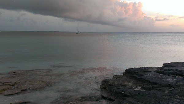
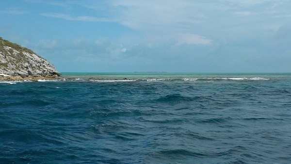
We left West Cacios and Mayaguana was our first stop in the Bahamas. It was too late for us to venture into the reef that encompasses Abraham's Bay so we stayed offshore on Southeast Point, which was not much more than a small reef to the east that kept the bigger waves from really bouncing us around all night. The anchor held well but I still got up and checked it often as it was quite rocky. I need to set the anchor alarm on the chartplotter and see how that works one of these days.
Just stopped and dropped the anchor off of Southeast Point... small reef with water breaking
We were pulling up the anchor and once again the starboard engine alternator belt was loose so we had no power in that engine. Thankfully we were off the reef and just floated out into deeper water while Jettie stuck her head once again down in the engine compartment and tried to tighten it. The fan belt was getting torn up and filled the engine compartment full of ground up rubber bits. It was only a matter of time and the bolt broke as Jettie applied pressure. We dug through the stainless steel screws, nuts and bolts that we had and came up with a screw and a nut to hold for the time being. Maybe we will find something on Mayaguana.
Jettie's Least Favorite Position.... head in the engine compartment
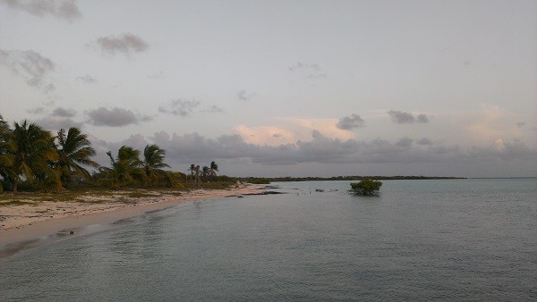
Abraham's Bay has two entrances. One goes right over the reef and inside and the other is a larger more respectable entrance. As advised by the cruising guide when there is an offshore swell, waves coming from the ocean, they make it hard to see the "entrance" to the reef on the south side. We watched another cat just go right on in and looked to be stuck at one point. We opted for the longer route to the other end and through the wider area. We had to make our way through the coral heads, of which I had not actually seen one, only dark patches which look like sea grass. Well, this time we saw a few coral heads. Big ol' bolder of coral just waiting to take you out and then a few fingers of fire coral sticking above the water waving at us. Oh my goodness, that was crazy. It is so hard to see stuff like that if the light is not perfect. Somehow we made it all the way through the Caicos banks and never saw one coral head in our path in twelve to fourteen hours of watching off the front of the boat. I don't know how we were so lucky. Mind you, we did see coral reefs that we avoided but we never saw any menacing heads lurking just below the surface of the water as we made our way to Providenciales.
Sunset on Abraham's Bay, Mayaguana, Bahamas
Beach off of dock to town
So where is the town and how do you get ashore? We chatted with the one couple that went in the south entrance and then with a man named Scully. Internationally known he says he is. Well, they tried to steer us to the path into town across the bay. "Look for the three sticks / poles and follow the white path then along side the dock." What three sticks? We could see some on shore by the edge of one entrance. We were headed in the wrong direction once Scully caught up to us. It was three thin metal rods with sailboat radar reflectors attached to them and they were spaced out at least 50 feet apart not together like the statement of looking for three sticks. The white path was where the outboard motors have brushed away the dark growth on the ocean floor and left only the white sand. It is a white path, but again not like it was communicated. With the cell phones safely tucked away in the dry bag and the underwater camera no longer working, I was unable to capture these Abraham's Bay directional originals. Maybe next time.
The dock was constructed with a base of conch shells. There are just piles of them everywhere it seems. I did get a few pictures of the mound of shells by the dock. It will be only a matter of time when this area too has over-fished these creatures. From what I have heard and read, conch is not allowed to be taken up north in Florida or Bermuda. We heard that there would be many fisherman coming in each with 1,500 or more conch each daily in Mayaguana. Some conch live as long as 40 years. There shells are magnificent and it is amazing that they use them for the base of a dock.
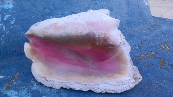
Old Queen Conch shell lying on an old boat
Conch pile across from Conch based dock
We made it to the customs office and filled out many papers and were even hit up for some cash to send a church group on a trip. We contributed $10 each to the cause. After becoming official visitors to the Bahamas we asked where we might find some lunch. Based on the cruising guide, we knew there were a few places so we thought it best to ask the locals. The customs lady rattles off conch, fish, burgers, wings, what do you want? I had no idea at that point, so she suggested going to Debby's, who just happens to be her sister. She would also call her and tell her that we were on our way. She pointed out the grocery store next to the black pickup truck and Debby's was the red roof just beyond. Sounds easy enough.
We made our way down the road to the grocery store, which had a sign proclaiming it's status as such an establishment. We walked down a hallway to a door proudly displaying an OPEN sign, although the door was locked and no one would answer our knock. Next door was a place the cruising guide talked about "Reggie's Guesthouse and Bar" and we knocked there. Nope, no one is home there either. Onward we walked passing a burnt down house and another small building and then we came to an intersection. To the left was a vacant tiny building with no glass in the windows, to the right was a bunch of weeds and trees, across the street to the left was a church with a gazebo where the locals hung out to catch a breeze. To the right was a playground with a basketball court that was being constructed. (At one point, we watched a pickup truck pull up and take a load of cinder blocks from the construction site. At that rate they will never get the court built.) Two door down from the playground was a bar with air conditioning and WIFI. Wow! That says a lot for an island of 300 people. And everyone had a cell phone. Bahama Telephone is doing well. (In the middle of the ocean between Mayaguana and Rum Cay Jettie got a text from Joel. I guess Bahama Tel has good coverage too.)
We got to the gazebo and asked about the grocery store and when it might be opened again. They said it was open, that he must just be at the house. A nice gentleman walked us back to Reggie's where we met Reggie's uncle and he took us into the store. There were only a few green peppers for fresh veggie and the mail boat was to be arriving a day or two ago, but was still at the dock in Nassau. We bought a six pack of a variety of sodas and that was it. It was good to have something cold to drink.
We started noticing that most of the houses had red roofs so we had to ask which way it was to Debby's. Again, they pointed towards more red roofs. Well, surely we will see the sign for the restaurant. Um... No. There is no sign as it is not a restaurant. It is a house. Debby said she had wings and burgers. So we got wings. Jettie asked "Where do we sit?" "You can sit out here," said Debby, pointing to the one chair and the wall surrounding her small porch. Okay, this will be interesting. Shortly thereafter a skinny Bahamian man came up to the door and talked to those inside. His name was Freeman and he chatted with us for a few. He said that Mayaguana is a wonderful place and there is no crime. Without missing a beat he yells angrily "Shut up, I was not talking to you! You shut up!" No crime, just a bit of hostility? He said that all of the people in the house were his aunts, nieces and cousins. Then as he waited with us and I looked at him closer and decided he looked like a black version of Neil. And he acted like Neil. His mannerisms, his speech, nearly everything about him. I asked Jettie who he reminded her of... Neil. Yep, Neil's doppelganger lives on Mayaguana. Bizarre! Then here comes Debby with a plastic grocery bag filled with two to-go containers of our lunch. So it is just a house with a woman that cooks food for other people to take away. And pricey $18 for chicken wings and fries. Very bizarre. Back to the gazebo to eat on the wooden bench seats.
We found out that the last game of the NBA playoff's was the next day, so we decided to rest one more day before our 24 hour sail to Rum Cay and go watch the game with the locals. It has been a while since I have been in a straight bar and now I recall why. Both Jettie and I got the attention of a set of brothers whom wanted to cart us off, put a ring on our fingers and have babies with us. Um...NOT! At one point, I was trying to get Jettie's attention, so I opened my eyes wide and kinda looked to my left where my "future husband" was sitting. Jettie says aloud "What is wrong with you? Why are your eyes wide like this?" as she imitates me. (She can be so blonde sometimes. LOL) Well she finally got it and understood after I told her what was going on. Then she made the mistake of accepting a drink from the brother and then she was saddled with him every step the rest of the night. I managed to get Anton to give us a ride back to the dock thinking I could skirt my fiance, but he hopped in the truck and rode with us. They were both gentlemen and helped us get ourselves and three frozen gallon bottles of water (Mayaguana's version of ice) we got from Anton, into the boat at low tide. We followed Scully as well as we could along the invisible white path given it was nearly midnight by then although the moon was bright. We got stuck once and had to go around in a circle until we were back in the one foot deep water area instead of the six inch deep water area.
We had heard from Gil (Hugh) that the Sumner Point Marina in Rum Cay was damaged and therefore not charging for dockage (to tie up to their docks and stay) and that is where they left their camera with a woman named Gro. So according to the cruising guide, I tried to call the marina a few times to check on the marks and entrance into the harbor but I got no reply. We had opted to do an overnight as it was just about 24 hours sail so we got there a little earlier than expected. So we slogged along with the Sun too low and in our faces to see very well in the coral strewn waters. We dodged as many of the dark spots as we could as we motored from one redish marker to another redish marker until the water was just dark everywhere. While I was putting out the fenders on the port side assuming from the pic I saw of Gil's boat, one of those expensive things bounced and rolled off the boat. Jettie spun us around and I managed on the first try to wind the line around the end of the boat hook successfully and got it back on deck. Then when trying to line back up we ran aground in the sand for just a minute or two as Jettie got us back in 4 feet of water and not 3.5 feet. Boy, it is shallow around these parts! The dock on the left is nothing but poles and the one on the right was tacked back together and in places sagged, rose and tipped. Scary stuff! Fortunately we are able to get water here as we were down to 75 of 200 gallons. Water is $.40 a gallon. In Puerto Rico it was free and in St Thomas it was $.18 a gallon.
What's left of the Sumner Point Marina
Rum Cay is only a few miles long and maybe a mile wide. I will have to check the dimensions. It is like Mayaguana in that there are few named business and the rest are run out of a person's home with or without signage. The grocery stores are barely stocked with items which I am not sure why they are still there. With as little fresh food and such that arrives on the island, one would think that nearly everything would be bought up. The "bar" on Rum Cay was the front yard at Delores' house. She is the mother of Kaye, who runs the grocery store and whom the "bar and restaurant" is named after. Wifi is also available "at the bar" under the tree (with a bunch of mosquitoes and noseeum's). Slap, type, swat, type, repeat!
Bar and internet at Kaye's
Jettie had a nice talk with Delores while Kaye and I chatted. Jettie bought a copy of Delores' book about Rum Cay and it's people for $10 and she also gave her some crab. We had lunch at the "park" which was across the street from Kaye and Delores' house. I had ribs, rice with crab (not pieces of crab meat, but whole pieces of crabs in the shell), mac and cheese and spicy coleslaw. Jettie had fish instead of ribs. It was quite good sans the crab. There were dogs everywhere to clean up the leftovers except there were no takers for the leftover coleslaw.
There are less than 100 people that live on this island. There is no bank so I wonder how they transact business. Does the bank somewhere mail you cash in a box disguised as a book? The marina fortunately takes credit cards or we would be up a harbor in a boat as the last of our cash went to pay the $300 cruising and fishing permit for the Bahamas. The customs guy in Caicos told me they would take a credit card. Good thing I did not believe him and had cash. I am going to have to ask around to find out which island has an ATM or bank as I am down to my trusty two dollar bill stash.
Mike and Ben (guys with their boats at the marina) have been great help in finding us another nut and bolt and in looking for an extra long bolt in case that one breaks. I think changing the torn up belt will fix our problem as it was a Perkins belt and not a Volvo Penta belt. It was smaller than the one they looked up for our engine sometime ago and maybe why it keeps coming loose. Jettie got it replaced, the excess oil from her oil change overflow pumped out and the engine compartments cleaned out. Ben also brought us two five gallon buckets of ice which he and Mike humped over to our boat. And we filled up our water tanks from Ben's boat's watermaker. That was so nice! We even invited them back for a cold beer once the ice did its job but neither came back for one.
Now we have to decide where to stop next and when to leave. I am glad we will filled up with water. We are getting a little low on drinking water but should be able to make it to Georgetown or Nassau without running out.
We decided to take the quick hop to Calabash Bay on Long Island so we would be a bit closer to Georgetown. It was a beautiful bay but there was a bazillion bugs after dark. That was evident in all of the screens that enclosed all of the buildings that comprised of the Cape Santa Maria Resort.
We pulled in and navigated around the dark spots and coral areas and I stopped quite a way from shore, but Jettie wanted to get closer. I don't like getting close because of the bugs. The further away the better. So we went back and forth about where to go and I decided to stay put. Good thing I did as we took the kayaks to the shore and on the way, I thought it looked awfully shallow so I stuck my paddle in and it hit the bottom with about 18 inches at most under water. Yikes! You can see it in the pic below.
Cape Santa Maria Resort with shoal (high spot like sandbar) visible in middle of pic
Jettie out front of Cape Santa Maria Resort
Dutchess off in the distance
We met a nice family from Austin. Denise and Ken and their two girls. Ken and one daughter swam out to the boat from the beach. As you can see from the pic, that was quite a chore especially with the tide going against you on the way back.
Next stop Georgetown, Exuma, where the chartplotter makes it look really scary with all of the coral head notations, but it was one of the easier ones as it was nicely marked. Only drawback was the shifter for the engine is really tight on starboard side and really hard to even get in reverse. I don't want to land up like Dianne and Kelly and have it break underway so we will have to address it before we leave Georgetown. We met Billy and Leslie on S/V (Sailing Vessel) Bye Polar and started hanging out with them. They are great folks. Lots of fun dinners and a lot of game nights in our future.
More when I have a wifi connection that will not make me want to pull my hair out in gobs!
We left West Cacios and Mayaguana was our first stop in the Bahamas. It was too late for us to venture into the reef that encompasses Abraham's Bay so we stayed offshore on Southeast Point, which was not much more than a small reef to the east that kept the bigger waves from really bouncing us around all night. The anchor held well but I still got up and checked it often as it was quite rocky. I need to set the anchor alarm on the chartplotter and see how that works one of these days.
Just stopped and dropped the anchor off of Southeast Point... small reef with water breaking
We were pulling up the anchor and once again the starboard engine alternator belt was loose so we had no power in that engine. Thankfully we were off the reef and just floated out into deeper water while Jettie stuck her head once again down in the engine compartment and tried to tighten it. The fan belt was getting torn up and filled the engine compartment full of ground up rubber bits. It was only a matter of time and the bolt broke as Jettie applied pressure. We dug through the stainless steel screws, nuts and bolts that we had and came up with a screw and a nut to hold for the time being. Maybe we will find something on Mayaguana.
Jettie's Least Favorite Position.... head in the engine compartment
Abraham's Bay has two entrances. One goes right over the reef and inside and the other is a larger more respectable entrance. As advised by the cruising guide when there is an offshore swell, waves coming from the ocean, they make it hard to see the "entrance" to the reef on the south side. We watched another cat just go right on in and looked to be stuck at one point. We opted for the longer route to the other end and through the wider area. We had to make our way through the coral heads, of which I had not actually seen one, only dark patches which look like sea grass. Well, this time we saw a few coral heads. Big ol' bolder of coral just waiting to take you out and then a few fingers of fire coral sticking above the water waving at us. Oh my goodness, that was crazy. It is so hard to see stuff like that if the light is not perfect. Somehow we made it all the way through the Caicos banks and never saw one coral head in our path in twelve to fourteen hours of watching off the front of the boat. I don't know how we were so lucky. Mind you, we did see coral reefs that we avoided but we never saw any menacing heads lurking just below the surface of the water as we made our way to Providenciales.
Sunset on Abraham's Bay, Mayaguana, Bahamas
Beach off of dock to town
So where is the town and how do you get ashore? We chatted with the one couple that went in the south entrance and then with a man named Scully. Internationally known he says he is. Well, they tried to steer us to the path into town across the bay. "Look for the three sticks / poles and follow the white path then along side the dock." What three sticks? We could see some on shore by the edge of one entrance. We were headed in the wrong direction once Scully caught up to us. It was three thin metal rods with sailboat radar reflectors attached to them and they were spaced out at least 50 feet apart not together like the statement of looking for three sticks. The white path was where the outboard motors have brushed away the dark growth on the ocean floor and left only the white sand. It is a white path, but again not like it was communicated. With the cell phones safely tucked away in the dry bag and the underwater camera no longer working, I was unable to capture these Abraham's Bay directional originals. Maybe next time.
The dock was constructed with a base of conch shells. There are just piles of them everywhere it seems. I did get a few pictures of the mound of shells by the dock. It will be only a matter of time when this area too has over-fished these creatures. From what I have heard and read, conch is not allowed to be taken up north in Florida or Bermuda. We heard that there would be many fisherman coming in each with 1,500 or more conch each daily in Mayaguana. Some conch live as long as 40 years. There shells are magnificent and it is amazing that they use them for the base of a dock.
Old Queen Conch shell lying on an old boat
Conch pile across from Conch based dock
We made it to the customs office and filled out many papers and were even hit up for some cash to send a church group on a trip. We contributed $10 each to the cause. After becoming official visitors to the Bahamas we asked where we might find some lunch. Based on the cruising guide, we knew there were a few places so we thought it best to ask the locals. The customs lady rattles off conch, fish, burgers, wings, what do you want? I had no idea at that point, so she suggested going to Debby's, who just happens to be her sister. She would also call her and tell her that we were on our way. She pointed out the grocery store next to the black pickup truck and Debby's was the red roof just beyond. Sounds easy enough.
We made our way down the road to the grocery store, which had a sign proclaiming it's status as such an establishment. We walked down a hallway to a door proudly displaying an OPEN sign, although the door was locked and no one would answer our knock. Next door was a place the cruising guide talked about "Reggie's Guesthouse and Bar" and we knocked there. Nope, no one is home there either. Onward we walked passing a burnt down house and another small building and then we came to an intersection. To the left was a vacant tiny building with no glass in the windows, to the right was a bunch of weeds and trees, across the street to the left was a church with a gazebo where the locals hung out to catch a breeze. To the right was a playground with a basketball court that was being constructed. (At one point, we watched a pickup truck pull up and take a load of cinder blocks from the construction site. At that rate they will never get the court built.) Two door down from the playground was a bar with air conditioning and WIFI. Wow! That says a lot for an island of 300 people. And everyone had a cell phone. Bahama Telephone is doing well. (In the middle of the ocean between Mayaguana and Rum Cay Jettie got a text from Joel. I guess Bahama Tel has good coverage too.)
We got to the gazebo and asked about the grocery store and when it might be opened again. They said it was open, that he must just be at the house. A nice gentleman walked us back to Reggie's where we met Reggie's uncle and he took us into the store. There were only a few green peppers for fresh veggie and the mail boat was to be arriving a day or two ago, but was still at the dock in Nassau. We bought a six pack of a variety of sodas and that was it. It was good to have something cold to drink.
We started noticing that most of the houses had red roofs so we had to ask which way it was to Debby's. Again, they pointed towards more red roofs. Well, surely we will see the sign for the restaurant. Um... No. There is no sign as it is not a restaurant. It is a house. Debby said she had wings and burgers. So we got wings. Jettie asked "Where do we sit?" "You can sit out here," said Debby, pointing to the one chair and the wall surrounding her small porch. Okay, this will be interesting. Shortly thereafter a skinny Bahamian man came up to the door and talked to those inside. His name was Freeman and he chatted with us for a few. He said that Mayaguana is a wonderful place and there is no crime. Without missing a beat he yells angrily "Shut up, I was not talking to you! You shut up!" No crime, just a bit of hostility? He said that all of the people in the house were his aunts, nieces and cousins. Then as he waited with us and I looked at him closer and decided he looked like a black version of Neil. And he acted like Neil. His mannerisms, his speech, nearly everything about him. I asked Jettie who he reminded her of... Neil. Yep, Neil's doppelganger lives on Mayaguana. Bizarre! Then here comes Debby with a plastic grocery bag filled with two to-go containers of our lunch. So it is just a house with a woman that cooks food for other people to take away. And pricey $18 for chicken wings and fries. Very bizarre. Back to the gazebo to eat on the wooden bench seats.
We found out that the last game of the NBA playoff's was the next day, so we decided to rest one more day before our 24 hour sail to Rum Cay and go watch the game with the locals. It has been a while since I have been in a straight bar and now I recall why. Both Jettie and I got the attention of a set of brothers whom wanted to cart us off, put a ring on our fingers and have babies with us. Um...NOT! At one point, I was trying to get Jettie's attention, so I opened my eyes wide and kinda looked to my left where my "future husband" was sitting. Jettie says aloud "What is wrong with you? Why are your eyes wide like this?" as she imitates me. (She can be so blonde sometimes. LOL) Well she finally got it and understood after I told her what was going on. Then she made the mistake of accepting a drink from the brother and then she was saddled with him every step the rest of the night. I managed to get Anton to give us a ride back to the dock thinking I could skirt my fiance, but he hopped in the truck and rode with us. They were both gentlemen and helped us get ourselves and three frozen gallon bottles of water (Mayaguana's version of ice) we got from Anton, into the boat at low tide. We followed Scully as well as we could along the invisible white path given it was nearly midnight by then although the moon was bright. We got stuck once and had to go around in a circle until we were back in the one foot deep water area instead of the six inch deep water area.
We had heard from Gil (Hugh) that the Sumner Point Marina in Rum Cay was damaged and therefore not charging for dockage (to tie up to their docks and stay) and that is where they left their camera with a woman named Gro. So according to the cruising guide, I tried to call the marina a few times to check on the marks and entrance into the harbor but I got no reply. We had opted to do an overnight as it was just about 24 hours sail so we got there a little earlier than expected. So we slogged along with the Sun too low and in our faces to see very well in the coral strewn waters. We dodged as many of the dark spots as we could as we motored from one redish marker to another redish marker until the water was just dark everywhere. While I was putting out the fenders on the port side assuming from the pic I saw of Gil's boat, one of those expensive things bounced and rolled off the boat. Jettie spun us around and I managed on the first try to wind the line around the end of the boat hook successfully and got it back on deck. Then when trying to line back up we ran aground in the sand for just a minute or two as Jettie got us back in 4 feet of water and not 3.5 feet. Boy, it is shallow around these parts! The dock on the left is nothing but poles and the one on the right was tacked back together and in places sagged, rose and tipped. Scary stuff! Fortunately we are able to get water here as we were down to 75 of 200 gallons. Water is $.40 a gallon. In Puerto Rico it was free and in St Thomas it was $.18 a gallon.
What's left of the Sumner Point Marina
Rum Cay is only a few miles long and maybe a mile wide. I will have to check the dimensions. It is like Mayaguana in that there are few named business and the rest are run out of a person's home with or without signage. The grocery stores are barely stocked with items which I am not sure why they are still there. With as little fresh food and such that arrives on the island, one would think that nearly everything would be bought up. The "bar" on Rum Cay was the front yard at Delores' house. She is the mother of Kaye, who runs the grocery store and whom the "bar and restaurant" is named after. Wifi is also available "at the bar" under the tree (with a bunch of mosquitoes and noseeum's). Slap, type, swat, type, repeat!
Bar and internet at Kaye's
Jettie had a nice talk with Delores while Kaye and I chatted. Jettie bought a copy of Delores' book about Rum Cay and it's people for $10 and she also gave her some crab. We had lunch at the "park" which was across the street from Kaye and Delores' house. I had ribs, rice with crab (not pieces of crab meat, but whole pieces of crabs in the shell), mac and cheese and spicy coleslaw. Jettie had fish instead of ribs. It was quite good sans the crab. There were dogs everywhere to clean up the leftovers except there were no takers for the leftover coleslaw.
There are less than 100 people that live on this island. There is no bank so I wonder how they transact business. Does the bank somewhere mail you cash in a box disguised as a book? The marina fortunately takes credit cards or we would be up a harbor in a boat as the last of our cash went to pay the $300 cruising and fishing permit for the Bahamas. The customs guy in Caicos told me they would take a credit card. Good thing I did not believe him and had cash. I am going to have to ask around to find out which island has an ATM or bank as I am down to my trusty two dollar bill stash.
Mike and Ben (guys with their boats at the marina) have been great help in finding us another nut and bolt and in looking for an extra long bolt in case that one breaks. I think changing the torn up belt will fix our problem as it was a Perkins belt and not a Volvo Penta belt. It was smaller than the one they looked up for our engine sometime ago and maybe why it keeps coming loose. Jettie got it replaced, the excess oil from her oil change overflow pumped out and the engine compartments cleaned out. Ben also brought us two five gallon buckets of ice which he and Mike humped over to our boat. And we filled up our water tanks from Ben's boat's watermaker. That was so nice! We even invited them back for a cold beer once the ice did its job but neither came back for one.
Now we have to decide where to stop next and when to leave. I am glad we will filled up with water. We are getting a little low on drinking water but should be able to make it to Georgetown or Nassau without running out.
We decided to take the quick hop to Calabash Bay on Long Island so we would be a bit closer to Georgetown. It was a beautiful bay but there was a bazillion bugs after dark. That was evident in all of the screens that enclosed all of the buildings that comprised of the Cape Santa Maria Resort.
We pulled in and navigated around the dark spots and coral areas and I stopped quite a way from shore, but Jettie wanted to get closer. I don't like getting close because of the bugs. The further away the better. So we went back and forth about where to go and I decided to stay put. Good thing I did as we took the kayaks to the shore and on the way, I thought it looked awfully shallow so I stuck my paddle in and it hit the bottom with about 18 inches at most under water. Yikes! You can see it in the pic below.
Cape Santa Maria Resort with shoal (high spot like sandbar) visible in middle of pic
Jettie out front of Cape Santa Maria Resort
Dutchess off in the distance
We met a nice family from Austin. Denise and Ken and their two girls. Ken and one daughter swam out to the boat from the beach. As you can see from the pic, that was quite a chore especially with the tide going against you on the way back.
Next stop Georgetown, Exuma, where the chartplotter makes it look really scary with all of the coral head notations, but it was one of the easier ones as it was nicely marked. Only drawback was the shifter for the engine is really tight on starboard side and really hard to even get in reverse. I don't want to land up like Dianne and Kelly and have it break underway so we will have to address it before we leave Georgetown. We met Billy and Leslie on S/V (Sailing Vessel) Bye Polar and started hanging out with them. They are great folks. Lots of fun dinners and a lot of game nights in our future.
More when I have a wifi connection that will not make me want to pull my hair out in gobs!
Stuck in an expensive paradise
15 June 2013 | Caicos Marina and Shipyard, Providenciales, Caicos, British West Indies
Donna / Overcast and sprinkling
You know how I've said before that BOAT stands for Bring Out Another Thousand or Ten thousand? Well here in the Caicos Islands they have taken that to the extreme with their 32 - 54% import duties. Along with that the Caicos Marina and Shipyard managed even more billing atrocities, such as a mark up of ten percent on all work their fellow diesel office did on the boat. Then add to that a 4% charge for using your credit card and even sales tax and a delivery fee on a FedEx shipment I had sent myself that I had delivered to the marina. So our "T" was not Twenty but nearly caused a heart attack. ::sigh::
The fuel tanks were full of algae and the one that was half full actually had the fuel gauge installed improperly and was stuck on the side of the tank, thus always indicating a half of a tank regardless of the actual fuel level. Due to running the tank dry unknowingly we plugged everything with what looked like fine black seaweed but it was algae. Although the glass bowl on the bottom of the fuel pre-filter (before it gets to the engine fuel filter) was clear, it had to be taken apart and every crevice cleaned out due to that crap. It caused the engine to lose power as no fuel to speak of was making it to the filter.
It was, of course dirty, hot, bottom paint dust everywhere and only a little a/c unit, so we went to the Sands on Grace Bay. It was nice to have a/c and a place to hang out that was not miserable, but it sure was expensive. Seems like a common theme here in the Caicos!
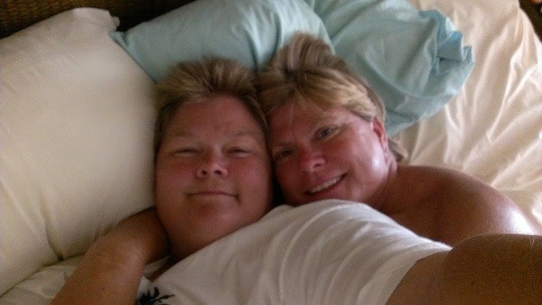
Pic of us enjoying the a/c
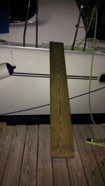
The tides here are just over two feet high and then 3 centimeters low, twice a day. My short legs cannot deal with that, so out comes the "Donna Plank." It is not much fun either as it is nearly straight up. I feel like I am gonna topple right into the drink next to the boat. Need some floating docks in these places!
Pic o' the plank!
We went to a place called Coral Gardens to go snorkeling off the beach. It is a weird cordoned off area that you swim around so no one can touch the coral. It was okay but much prettier stuff in Christmas Cove and diving in Grand Turk.
Pic of cordoned off "reef"
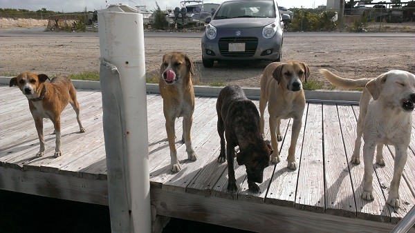
Once the boat was back in the water, we checked out of the hotel and sweated it out in the marina. We have our own guard dogs that protect the boat as Jettie bought two bags of dog biscuits. One of the dogs was left here by her owner when she sailed away. She looks just like the dogs (and the cat) at Jettie's parents place. And her name is Tiger as well. How can someone be so cruel? Makes me wanna scream! Humans! Wish we could bottle them all up and take them with us. There are thousands of wild and abandoned dogs on this island. They call them Potcakes as that is what the locals would feed them. They put the scraps from the day all in a pot and make a sort of a cake to feed them at the end of the day.
Tiger is in the middle.
Once we were thoroughly cleaned out, bank account included, and it was time to head to the Bahamas, but a storm came from the Pacific across Mexico and developed into the first named storm, Andrea. Even though she is way up in Florida, she is stirring up high winds and waves here. So once again, we remain stuck in paradise. At least we are out of the hotel. We stayed there because it was so hot, little wind and lots of mosquitoes. Right now it is wind and flies! I just hate bugs! Where is my zapper?? (Hundreds of dead bug notches on the handle!)
Speaking of bugs.... conch is the ugliest seafood around. I had never had the desire to eat it and now I really don't want to. We went to a conch shack on the beach in Providenciales called Boogaloo's. Huge wooden furniture on the deck so it would not blow away into the ocean as the place is right on the beach and tables built around the trees. Then we got to see CONCH being removed from the shells right outside of the restaurant. I took a few videos and now have stitched them together and here is a link:
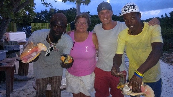
There is a pic with me in it but the guy took a bad pic so it is all blurry, so you only get Jettie and Joel!
It was so hot and buggy and sometimes windy that I put the "Harem" back up. Otherwise known as the "MacGyver Tent" which is constructed with a blanket with a Diet Coke plastic lid in the middle, sheets (sleeping kind, not sailing), our broken flag line cut up into many pieces, a halyard (pulls things up the mast) and knots tied in the sheets to the tramp. It really looks like the Clampetts especially with Joel's undies upfront, our clothes, towels and such hanging all over the boat. Someday, when we can afford it, we will have a Sunbrella one with battens made. For now, they viewing public will have to endure this one!
We originally checked out of Caicos on the 5th of June, with a departure of the 6th. Due to the weather I had to call the Customs guy. Officer Samuels is a great guy as well as a professional, reasonable and intelligent man. He said that due to the crappy weather they were not encouraging mariners to leave but stay put in the harbor. So they are extending of departure.
I was disappointed to find out that a completion of the Discover SCUBA Diving course at Blue Water Divers in Grand Turk, was only a fee to take THEIR course. To go to another dive place, THEY want you to take it again. Go to another place, and yet again they want you to take it so the dive instructors know what your status is as a new diver. So the only way to avoid such nonsense is to get your diving certification. I am not sure I am up to that right now but it would be the most economical decision.
Joel and I took the eLearning from PADI and then did the pool course. It kicked my ass physically. The next day after getting only 3 hours of sleep two days in a row, I was wiped out. I felt so bad, but I let them talk me into going out and giving it a shot. I just couldn't do it. Maybe another time. Joel got his certification which was good.
PADI torture pool via Dive Provo at Ports of Call
After what seems like forever, we were about to leave, again! Dropped Joel off at the airport so he could go to NY for a business meeting. One the way to check out a few anchorages around the island, we stopped to see if we could get a map at the airport only to be hit by a taxi cab van! Out of the country more than 25 miles and State Farm insurance doesn't cover you. His insurance better pay for running into that car. So after three more days of traffic investigator and police hassle, they are going to have to email us the police report anyway. ::sigh::
Since this place is littered with coral heads and reefs one cannot safely travel in unfamiliar water especially after three in the afternoon, so today, June 14th, is a bust. I could see the white caps crashing onto the shore out on the Caicos banks from the helm seat where I was sitting reviewing the chart plotter data around the Sapodilla anchorage.
Speaking of that, I had previously written that we did not have any chart plotter data for anything outside of Puerto Rico despite assuming my purchase covered these areas. I was not happy and called Navionics to find out why the data was missing. Oddly enough, the lady that helped me was named Andrea, same as the named storm that had us stuck here. She was quite helpful in instructing me to find some goofy Select Chart option in the chart setup that listed all of the charts on the memory card. Select the correct one and Bam...there it was. Tons of little splats on the screen (coral heads) and shallow water colors to scare the pants off ya. Thanks to Andrea, we can see the data all the way up the Bahamas!
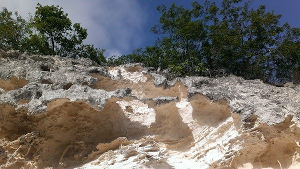
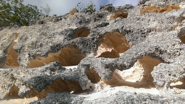
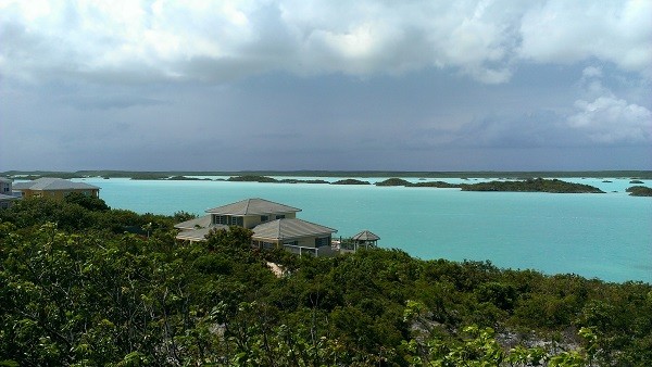
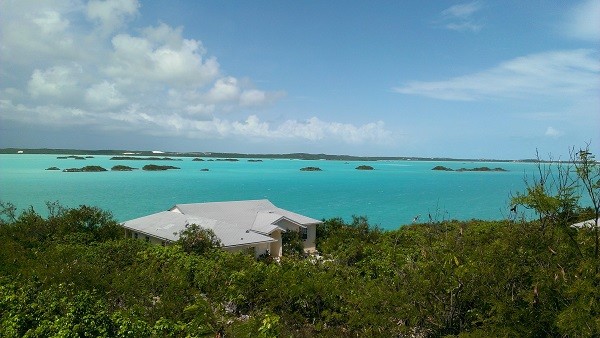
When we were out looking at the anchorages, we drove around the Chalk Sound. It is a shallow inland ocean area that looks a lot like the Caicos Banks except for the land masses. The whole area has a lot of lime stone which adds to the silkiness of the sand. It sticks to you like powder, not like typical grainy sand. On the road to the marina there is a hillside that is eroding. It was so interesting looking that I had to take some pictures.
Limestone wall erosion
Chalk Sound
While warming the engines to leave, the fan belt started screaming. So now we are late leaving, which gives me more time to get this blog posted.
Off to the Bahamas...
Here are a few more pics and one to ponder about what it is. Any guesses?
The fuel tanks were full of algae and the one that was half full actually had the fuel gauge installed improperly and was stuck on the side of the tank, thus always indicating a half of a tank regardless of the actual fuel level. Due to running the tank dry unknowingly we plugged everything with what looked like fine black seaweed but it was algae. Although the glass bowl on the bottom of the fuel pre-filter (before it gets to the engine fuel filter) was clear, it had to be taken apart and every crevice cleaned out due to that crap. It caused the engine to lose power as no fuel to speak of was making it to the filter.
It was, of course dirty, hot, bottom paint dust everywhere and only a little a/c unit, so we went to the Sands on Grace Bay. It was nice to have a/c and a place to hang out that was not miserable, but it sure was expensive. Seems like a common theme here in the Caicos!
Pic of us enjoying the a/c
The tides here are just over two feet high and then 3 centimeters low, twice a day. My short legs cannot deal with that, so out comes the "Donna Plank." It is not much fun either as it is nearly straight up. I feel like I am gonna topple right into the drink next to the boat. Need some floating docks in these places!
Pic o' the plank!
We went to a place called Coral Gardens to go snorkeling off the beach. It is a weird cordoned off area that you swim around so no one can touch the coral. It was okay but much prettier stuff in Christmas Cove and diving in Grand Turk.
Pic of cordoned off "reef"
Once the boat was back in the water, we checked out of the hotel and sweated it out in the marina. We have our own guard dogs that protect the boat as Jettie bought two bags of dog biscuits. One of the dogs was left here by her owner when she sailed away. She looks just like the dogs (and the cat) at Jettie's parents place. And her name is Tiger as well. How can someone be so cruel? Makes me wanna scream! Humans! Wish we could bottle them all up and take them with us. There are thousands of wild and abandoned dogs on this island. They call them Potcakes as that is what the locals would feed them. They put the scraps from the day all in a pot and make a sort of a cake to feed them at the end of the day.
Tiger is in the middle.
Once we were thoroughly cleaned out, bank account included, and it was time to head to the Bahamas, but a storm came from the Pacific across Mexico and developed into the first named storm, Andrea. Even though she is way up in Florida, she is stirring up high winds and waves here. So once again, we remain stuck in paradise. At least we are out of the hotel. We stayed there because it was so hot, little wind and lots of mosquitoes. Right now it is wind and flies! I just hate bugs! Where is my zapper?? (Hundreds of dead bug notches on the handle!)
Speaking of bugs.... conch is the ugliest seafood around. I had never had the desire to eat it and now I really don't want to. We went to a conch shack on the beach in Providenciales called Boogaloo's. Huge wooden furniture on the deck so it would not blow away into the ocean as the place is right on the beach and tables built around the trees. Then we got to see CONCH being removed from the shells right outside of the restaurant. I took a few videos and now have stitched them together and here is a link:
There is a pic with me in it but the guy took a bad pic so it is all blurry, so you only get Jettie and Joel!
It was so hot and buggy and sometimes windy that I put the "Harem" back up. Otherwise known as the "MacGyver Tent" which is constructed with a blanket with a Diet Coke plastic lid in the middle, sheets (sleeping kind, not sailing), our broken flag line cut up into many pieces, a halyard (pulls things up the mast) and knots tied in the sheets to the tramp. It really looks like the Clampetts especially with Joel's undies upfront, our clothes, towels and such hanging all over the boat. Someday, when we can afford it, we will have a Sunbrella one with battens made. For now, they viewing public will have to endure this one!
We originally checked out of Caicos on the 5th of June, with a departure of the 6th. Due to the weather I had to call the Customs guy. Officer Samuels is a great guy as well as a professional, reasonable and intelligent man. He said that due to the crappy weather they were not encouraging mariners to leave but stay put in the harbor. So they are extending of departure.
I was disappointed to find out that a completion of the Discover SCUBA Diving course at Blue Water Divers in Grand Turk, was only a fee to take THEIR course. To go to another dive place, THEY want you to take it again. Go to another place, and yet again they want you to take it so the dive instructors know what your status is as a new diver. So the only way to avoid such nonsense is to get your diving certification. I am not sure I am up to that right now but it would be the most economical decision.
Joel and I took the eLearning from PADI and then did the pool course. It kicked my ass physically. The next day after getting only 3 hours of sleep two days in a row, I was wiped out. I felt so bad, but I let them talk me into going out and giving it a shot. I just couldn't do it. Maybe another time. Joel got his certification which was good.
PADI torture pool via Dive Provo at Ports of Call
After what seems like forever, we were about to leave, again! Dropped Joel off at the airport so he could go to NY for a business meeting. One the way to check out a few anchorages around the island, we stopped to see if we could get a map at the airport only to be hit by a taxi cab van! Out of the country more than 25 miles and State Farm insurance doesn't cover you. His insurance better pay for running into that car. So after three more days of traffic investigator and police hassle, they are going to have to email us the police report anyway. ::sigh::
Since this place is littered with coral heads and reefs one cannot safely travel in unfamiliar water especially after three in the afternoon, so today, June 14th, is a bust. I could see the white caps crashing onto the shore out on the Caicos banks from the helm seat where I was sitting reviewing the chart plotter data around the Sapodilla anchorage.
Speaking of that, I had previously written that we did not have any chart plotter data for anything outside of Puerto Rico despite assuming my purchase covered these areas. I was not happy and called Navionics to find out why the data was missing. Oddly enough, the lady that helped me was named Andrea, same as the named storm that had us stuck here. She was quite helpful in instructing me to find some goofy Select Chart option in the chart setup that listed all of the charts on the memory card. Select the correct one and Bam...there it was. Tons of little splats on the screen (coral heads) and shallow water colors to scare the pants off ya. Thanks to Andrea, we can see the data all the way up the Bahamas!
When we were out looking at the anchorages, we drove around the Chalk Sound. It is a shallow inland ocean area that looks a lot like the Caicos Banks except for the land masses. The whole area has a lot of lime stone which adds to the silkiness of the sand. It sticks to you like powder, not like typical grainy sand. On the road to the marina there is a hillside that is eroding. It was so interesting looking that I had to take some pictures.
Limestone wall erosion
Chalk Sound
While warming the engines to leave, the fan belt started screaming. So now we are late leaving, which gives me more time to get this blog posted.
Off to the Bahamas...
Here are a few more pics and one to ponder about what it is. Any guesses?
Next leg, to the Caicos Islands
19 May 2013 | Providenciales, Caicos, British West Indies
Donna / Warm and breezy
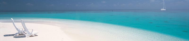
Map of our trip across the Caicos Bank
After Jettie played with the engine for quite sometime it would not start with even a half a tank of fuel. When she bled off the fuel from the pre-filter, it was slimy so we didn't want to take fuel in the other tank and just waste what little we had if the tank was bad. So we limped into the Turks Islands avoiding Salt Cay (pronounced Key), Cotton Cay and Big Sand Cay under one motor. We could have sailed but we never found the sail tape and it has been quite bumpy still for getting on the bimini with a ton of sail pulled out.
Just before we got to the Grand Turk island, with reefs and islands that were not on our chartplotter (the electronic version of the paper charts) we were nearly out of fuel. (I'll be contacting the chartplotter map company as soon as I verify that they sold me a memory card which should have had data for the Turks and Caicos Islands, so I won't state their name....yet. We have a depth finder but it is crazy that in 2013 someone has not mapped the whole planet. We probably know more about Mars or the Moon that planet Earth! Okay, I'll get off my soapbox...for now.) We have never run the tanks dry or been able to accurately compute the hours per gallon, so we had no idea how close to empty we really were. But if we ran out of fuel in the only functioning motor and with the mainsail still ripped up, we could have been in a world of do-do. So we used our SeaTow subscription. For $168 a year, they will send someone out to tow you or bring you fuel. One trip with fuel or a short tow is $300 so it is well worth it and it even worked in the middle of no where Grand Turk. SeaTow got in touch with Daniel and he brought us 20 gallons of diesel while we dropped anchor in 30 feet of water off the reef so Jettie would not have to bleed the air out of the fuel line if we ran the tank dry. It was a group effort with the boat Prince of Whales, Daniel on Crystal Sea Adventures and Bonefish on the VHF making sure we were safe and taken care of.
We followed Daniel to where he told us to get in about 30 feet of water and drop the anchor. I was at the helm and thinking the depth finder must be broken or wrong, as we were only 100 yards off shore and still in 230+ feet of water. Then it started moving 150, 100, 50, 40, 20... bam. What the heck? We found out we were over a huge reef wall that drops quite a ways down there. At one point the front of the boat was in 30 feet of water and the back was hanging over the deep dark abyss. The light stops going down and looks eerie!
After having a diesel mechanic over to bleed the crap out of the engine fuel line, injectors and filters, we decided to move to another location so Jettie checked the fluids and guess what? Salt water in the saildrive! We knew there was a possibility that it would occur but hoped to change the seals out in Texas, but no, it has to happen in the middle of no where on an island! Well, that is if we can find a place to be able to haul us out. Time to start looking at our options and talking to people.
We stayed in Grand Turk for several days and it was a good thing. Jettie, Joel and I went diving. It was quite interesting. It was the first time for Joel and I. I had a tough time due to not really thinking about having a weight belt on, getting off the dive boat and going into the water. I didn't come back up as easily and quickly as I should have having 12+ pounds strapped to me. If Nat, the dive instructor, would have reminded me of such, I don't think that I would have freaked out like I did when suddenly I found I didn't take a big huge breath and could not figure out why I did not come up immediately. That freak out set the tone for the rest of the dive instruction. Pierre was with me and did my training. I was freaking out and going back up for air, despite the fact that I had an air regulator in my mouth. I had to take my regulator out of my mouth, blow little bubbles, toss the regulator over my shoulder, then put my hand on my thigh, lean over to the right and let the regulator fall over my shoulder, then put it back in my mouth and press the purge button to get the water out of the regulator. Then fill your mask up half way with water, put your head back and blow air out your nose to refill the mask with air. I had to check my gauge and signal the amount of air remaining and also keep track so we could go back to the boat when at a certain level. After I "mastered" all of that stuff, I was to go actually down like forty feet out on the wall. I was so not ready for that. I figured that I was going to panic and want to bolt and go right back up to the surface. Everyone tried to talk me into it but I was determined. I was not going! Have a nice dive! But Nat decided to stay with me and talked me into going in for a bit stating that I had done the hard stuff. So I went in. I grabbed a hold of the anchor line they dropped for us to hold on to. Nat hit my BC (buoyancy control) vest and let the air out and we plunged to the ocean floor. Suddenly I was standing on the ocean floor. Wow! What a trip. I didn't want to let go of the line but after about five or so minutes of standing there, we moved along and went swimming over the coral and looked at the fish. It was like being in the bottom of a fish tank, like one of those air devices that has an old fashioned scuba diver with the air coming out. That is exactly how I felt and I never panicked but the thought that I might stayed on my mind. And they were right. The hard stuff was the training and once under water, there was no real weight to all that stuff piled on your back and hips. I was worried I would tire out quite fast, but it hit me that night. I am glad I went down despite my determination to stay on the boat. Unfortunately, our crappy underwater camera only works to 3 meters or 9 feet. Whatever! I knew that thing was not that good, but 9 feet! So Joel and Jettie tried to take some pics but they were not all that good. I will see if I can clean some of them up and post later.
We were picked up and dropped off at the boat by Blue Water Divers which was great. The boys stayed on the boat for a while and had a few drinks afterward. Then we saw a few charter boats out with some dolphins. We collectively thought that by the time we tried to get out there that they would leave so we did not make a move to try to go out there. Then we noticed they were still there and again collectively decided, why don't we hop in the dive boat and go out there and see if we can see them. Not only did we get to see them but we got to swim with three to five wild dolphins (not JoJo, he is in the Caicos). I was sooooo glad that the crappy little camera decided to work. I got some great videos and pics. I posted some videos on Facebook. I don't think Sailblogs will allow video posts, but I will give it a shot.
Here is a link from Facebook (membership not required): https://www.facebook.com/photo.php?v=10151668793928523&l=8891195666044300847
https://www.facebook.com/photo.php?v=10151668777128523&l=687254962866026324
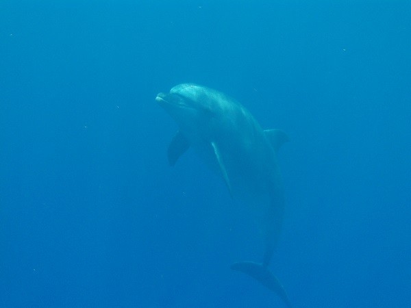
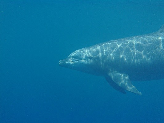
Still pics of the dolphins
We met a family that is delivering a boat from Trinidad to Florida. They were great. Gil, Monica, Nikki, Daan, Luuk and Shush (St George), the dog. They took off in their dingy and went out to see the dolphins too. Even the dog. The dolphins made sure they stayed away from us, but they were interested in the dog. One of them poked the dog in the belly with it's nose. Pierre picked up Shush and gave him back to Monica in the dingy afraid that the dolphin might try to have a snack. Yikes. I think we were out there with ten people and they just swam around us for 30 - 40 minutes. It was amazing. What an incredible end to a wonderful day.
The next night we were invited over to Gil and Monica's for a delicious dinner. While we were chatting Monica yells "whale fish" and everyone turns the direction she was looking. I saw nothing but the back of Joel's head where apparently others saw the splash. Then the kids came up and everyone was standing around looking. Gil says "Come on! Do it again!" and nearly on cue the whale leaps out of the water and kicks over it's tail and makes a huge splash. We could not help but erupt in a huge cheer. It was the first time I saw a wild whale. They stayed around for a while blowing water and air into the air and sneaking out of the water just enough for us to see them, but nothing like that wondrous show of power and agility moments before. Where's the crappy camera when you need it? I need to mount a GoPro on my head!
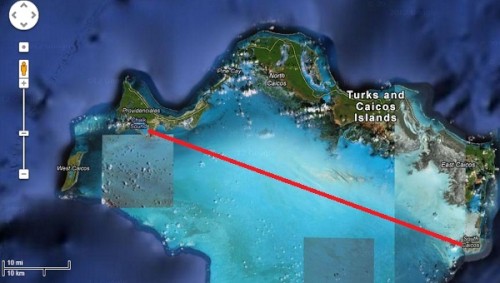
Well, we figured out that we could not take the safe, deep water route around the north side of the Caicos Islands, but we have to go through the shallow Caicos Banks. (See the top pic our of approximate route across the Pearl Channel) The scary, shallow, coral head, sandbar, coral reef strewn shallow Caicos Banks. The same ones that there is NO DATA on our chartplotter and lots of "area unsurveyed" and "mostly unsurveyed" and "nearly dries" notations on the paper charts. That is the only way we can safely get to the Caicos Marina and Shipyard is via a southern approach. Fun. And it can only be done when the Sun is high in the sky, not overcast or rainy. So what does the forecast say? Exactly what we don't need.
We left Grand Turk and arrived at the bottom of the Caicos Islands late in the afternoon and did not want to go into the Caicos Banks until morning, so we turned around and headed back to the South Caicos Island and looked for the Sea View Marina. We pulled up to the dock and tried to pull to the right side despite the marina's instruction to tie up to the end. We tired both and could not get close due to the current, the wind and only one blasted engine. We were fortunate that a gentleman was on the dock to catch our four lines and pull like hell to get us next to the end of the dock. We would never have gotten tied up if it were not for him. I cannot recall his name but he was an invaluable member of our crew right then!
Now, one would think a marina would charge for docking. Nope. Not here. No water, no electricity, No charge for staying overnight. While Jettie and Joel were out looking for the Customs folks to try to get our visa extended, I bent the ear of the captain of a fishing boat that travels the Caicos Banks. There was not a whole lot there but we did find a good red snapper dinner for $15 a plate at a tiny place with one bartender / cook. Jettie met a guy named Larry and we met him at the diner. He came over the next morning and helped us with getting info on our route.
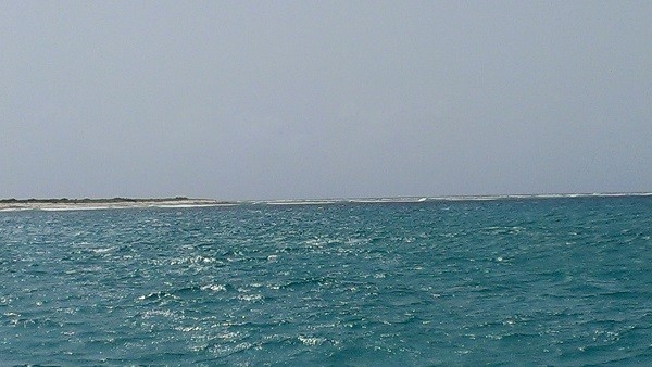
Dark waters just out side the banks leaving South Caicos
Light shallow waters in the Caicos Banks
The Sun was not very bright as the clouds were gathering and we had to get into the Banks while the Sun was high. The depths started at 16 feet and the cruising guide stated that we should avoid all of the dark spots. So we put two people on the bows to direct the one at the helm. Left, right, go through the middle. We never saw any coral heads but we did see the coral reefs and by 3 o'clock the light was not efficient to see by and the weather looked threatening. The So we made an executive decision that since the chart showed more coral heads, we would do what the cruising guide suggested and dropped the hook (anchor) and stayed over night on the banks. It was a rough night and I worried that we were going to drag our anchor. There is an application on Jettie's phone called Drag Queen, which cracks me up given it is an anchor dragging application and not gay men impersonating women. Anyway, I couldn't use the app as I had not set it when we dropped the anchor. I hardly slept. I kept getting up and checking the Latitude and Longitude that we recorded to make sure it was still the same. It never changed each time I checked but that didn't make me feel any better. Finally the Sun came up and Jettie and I took a dip. It was so rough and there was nothing underwater but a star fish and lots of sand. The
tide had gone out so now it was only 8 feet deep at the most where we were anchored. Wow! Crazy!
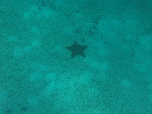
Huge starfish surrounded by Parrotfish poop (aka sand)
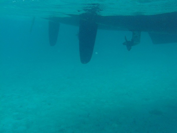
Underwater pics from the Caicos Banks
It was overcast again and we needed to get going. After breakfast, it cleared a bit and we were on our way. We needed to get into the Caicos Marina and Shipyard before it got too dark. We had the Lat and Long but I think our chartplotter is a little off because we were not where we were supposed to be. I called the marina and he told us to go the opposite direction and thankfully he saw another boat approaching the inlet of the harbor. Bruce said "That boat is in front of the harbor." If he would not have been directing us, I would not have believed it but I saw the boat go in there. Jettie didn't believe it even though I told her I saw a boat go in the harbor. I wish I had a pic because it looks like you are just going to drive the boat right up on the sand. We finally got in there and thankfully there were some folks to take our lines and pull us in to the dock. Boy will I be glad when we have two engines again!
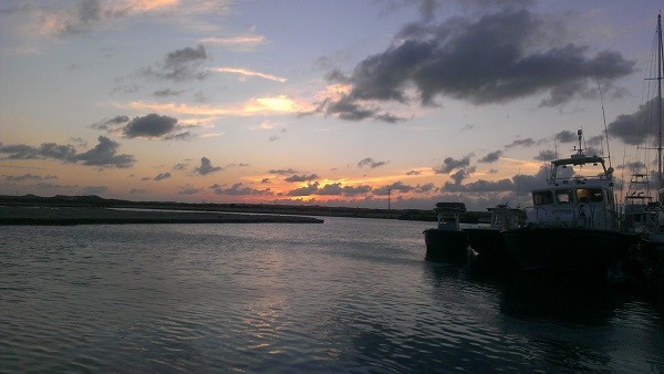
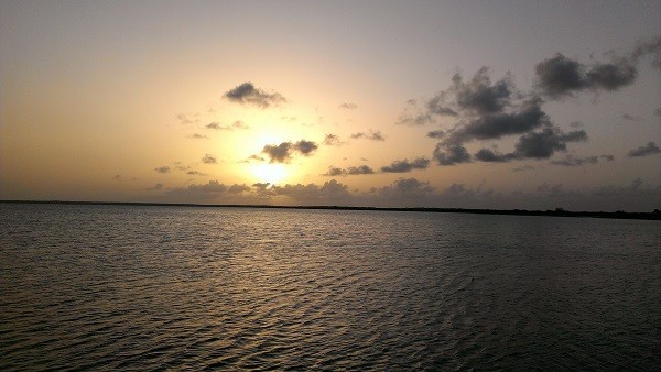
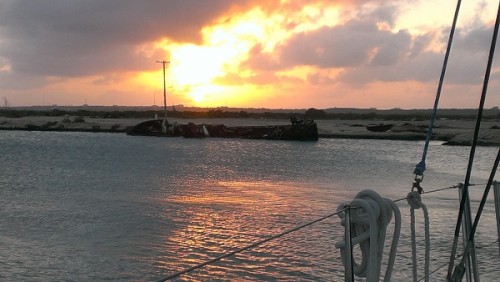
Sunset in the Caicos Marina and Shipyard
I almost forgot to write about this but was reminded by the pictures I took. How could I forget? We had enough trouble just docking along side a dock. Now we were going to need to go forward, the turn to the right and back up in to essentially a boat slip. Plus who allows us to do that with a boat to the right where we have to turn? We told them it was not going to be easy, but I don't think they really understood until they had to go get about five more guys to bring the total to eight guys on the dock to turn us around by hand pulling on lines. Jettie was at the helm and Joel and I ran around throwing lines, extending lines, holding fenders between the boat and concrete and steel walls that the slip was comprised of to keep it from leaving gashes in the boat and Joel fended off the boat from the wall with his brute strength. Once that stressful hour was complete then came the Travel Lift. An Erector Set like frame on wheels with straps that are strategically placed under the boat so that it can be lifted out of the water. After many jostling backwards and forwards, the boat was raised only to run into the wind generator (whom we call Windy). We turned it off and Jamie turned it around so it would not get broken and they managed to get the boat above the ground a matter of inches only. Then when they went to put it on the stands, they could not lift it up high enough so they had to take Windy down for a few.
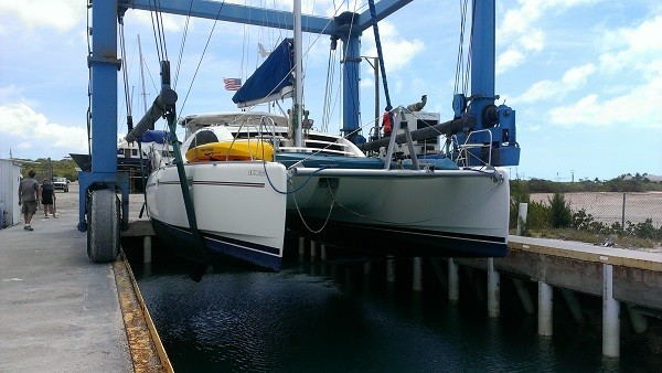
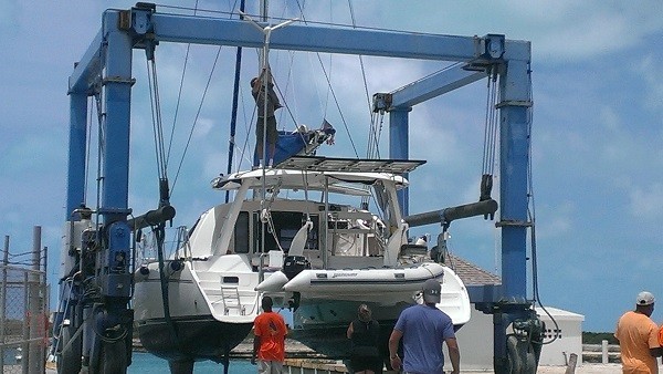
Dutchess on the Travel Lift
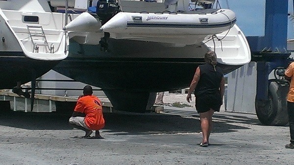
When Jettie and I went back to get a few things out of the boat, we were dismayed to see that the floor boards in the back of the boat were not level. The Caicos Marina and Shipyard had not balanced the boat properly on her keels and the stands and were deforming the hulls. OMG! They could not get anyone back to the shipyard after hours but Bruce tried to lighten the load by adjusting the four stands up higher until they could come back in the morning and lift her back up and relevel her. ::sigh:: There best not be any damage from that mistake or there will be hell to pay as well as repairs to be done.
Well we got bad info about the ordering and shipping of parts. We had to do it ourselves which was not too bad as we had the list from last time. I ordered them with the statement that they would be received the next day and shipped international FedEx the next day. Well, that was not correct. They failed to contact me and let me know that the bellows were not in and then a week later they had not mailed them. Then when they were mailed it was International Economy which equals SLOW. Note to self: don't ever order anything from Marine Parts Express dot com. Nothing express about these folks!
The boat is out of the water, it is too hot to stay on it and we are stuck in a pricey hotel, for way too long pissed off waiting for the slow package. Next note to self: Do not allow the boat to be taken out of the water until the parts are IN HAND! We thought that we had dealt with this problem by ordering it before the boat was taken out of the water.
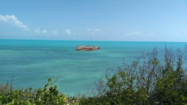
We could have been stranded in a worse place.
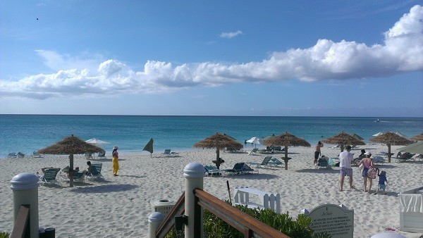
The beach off of the Sands Resort
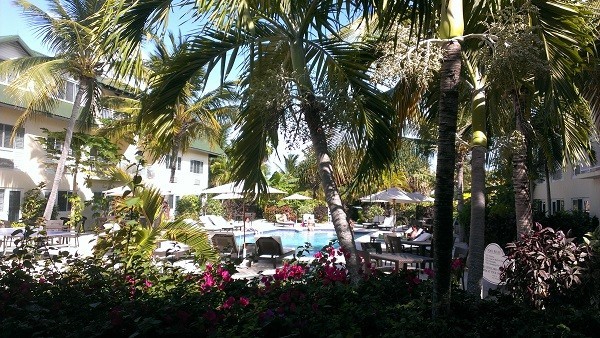
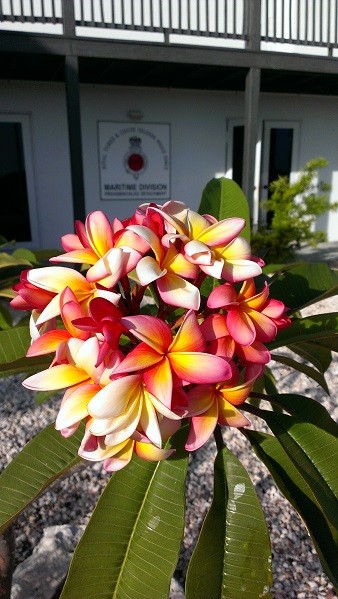
Do we need an ocean view? Nah, how about a garden view instead? Flowers, trees, grass.
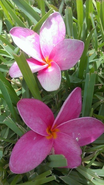
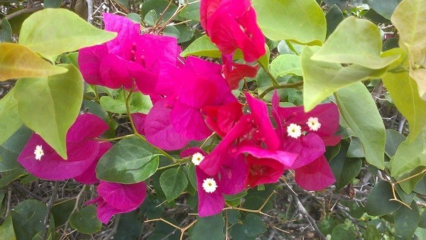
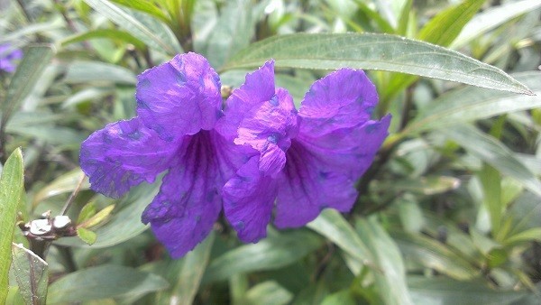
Me and my flower pics.
After Jettie played with the engine for quite sometime it would not start with even a half a tank of fuel. When she bled off the fuel from the pre-filter, it was slimy so we didn't want to take fuel in the other tank and just waste what little we had if the tank was bad. So we limped into the Turks Islands avoiding Salt Cay (pronounced Key), Cotton Cay and Big Sand Cay under one motor. We could have sailed but we never found the sail tape and it has been quite bumpy still for getting on the bimini with a ton of sail pulled out.
Just before we got to the Grand Turk island, with reefs and islands that were not on our chartplotter (the electronic version of the paper charts) we were nearly out of fuel. (I'll be contacting the chartplotter map company as soon as I verify that they sold me a memory card which should have had data for the Turks and Caicos Islands, so I won't state their name....yet. We have a depth finder but it is crazy that in 2013 someone has not mapped the whole planet. We probably know more about Mars or the Moon that planet Earth! Okay, I'll get off my soapbox...for now.) We have never run the tanks dry or been able to accurately compute the hours per gallon, so we had no idea how close to empty we really were. But if we ran out of fuel in the only functioning motor and with the mainsail still ripped up, we could have been in a world of do-do. So we used our SeaTow subscription. For $168 a year, they will send someone out to tow you or bring you fuel. One trip with fuel or a short tow is $300 so it is well worth it and it even worked in the middle of no where Grand Turk. SeaTow got in touch with Daniel and he brought us 20 gallons of diesel while we dropped anchor in 30 feet of water off the reef so Jettie would not have to bleed the air out of the fuel line if we ran the tank dry. It was a group effort with the boat Prince of Whales, Daniel on Crystal Sea Adventures and Bonefish on the VHF making sure we were safe and taken care of.
We followed Daniel to where he told us to get in about 30 feet of water and drop the anchor. I was at the helm and thinking the depth finder must be broken or wrong, as we were only 100 yards off shore and still in 230+ feet of water. Then it started moving 150, 100, 50, 40, 20... bam. What the heck? We found out we were over a huge reef wall that drops quite a ways down there. At one point the front of the boat was in 30 feet of water and the back was hanging over the deep dark abyss. The light stops going down and looks eerie!
After having a diesel mechanic over to bleed the crap out of the engine fuel line, injectors and filters, we decided to move to another location so Jettie checked the fluids and guess what? Salt water in the saildrive! We knew there was a possibility that it would occur but hoped to change the seals out in Texas, but no, it has to happen in the middle of no where on an island! Well, that is if we can find a place to be able to haul us out. Time to start looking at our options and talking to people.
We stayed in Grand Turk for several days and it was a good thing. Jettie, Joel and I went diving. It was quite interesting. It was the first time for Joel and I. I had a tough time due to not really thinking about having a weight belt on, getting off the dive boat and going into the water. I didn't come back up as easily and quickly as I should have having 12+ pounds strapped to me. If Nat, the dive instructor, would have reminded me of such, I don't think that I would have freaked out like I did when suddenly I found I didn't take a big huge breath and could not figure out why I did not come up immediately. That freak out set the tone for the rest of the dive instruction. Pierre was with me and did my training. I was freaking out and going back up for air, despite the fact that I had an air regulator in my mouth. I had to take my regulator out of my mouth, blow little bubbles, toss the regulator over my shoulder, then put my hand on my thigh, lean over to the right and let the regulator fall over my shoulder, then put it back in my mouth and press the purge button to get the water out of the regulator. Then fill your mask up half way with water, put your head back and blow air out your nose to refill the mask with air. I had to check my gauge and signal the amount of air remaining and also keep track so we could go back to the boat when at a certain level. After I "mastered" all of that stuff, I was to go actually down like forty feet out on the wall. I was so not ready for that. I figured that I was going to panic and want to bolt and go right back up to the surface. Everyone tried to talk me into it but I was determined. I was not going! Have a nice dive! But Nat decided to stay with me and talked me into going in for a bit stating that I had done the hard stuff. So I went in. I grabbed a hold of the anchor line they dropped for us to hold on to. Nat hit my BC (buoyancy control) vest and let the air out and we plunged to the ocean floor. Suddenly I was standing on the ocean floor. Wow! What a trip. I didn't want to let go of the line but after about five or so minutes of standing there, we moved along and went swimming over the coral and looked at the fish. It was like being in the bottom of a fish tank, like one of those air devices that has an old fashioned scuba diver with the air coming out. That is exactly how I felt and I never panicked but the thought that I might stayed on my mind. And they were right. The hard stuff was the training and once under water, there was no real weight to all that stuff piled on your back and hips. I was worried I would tire out quite fast, but it hit me that night. I am glad I went down despite my determination to stay on the boat. Unfortunately, our crappy underwater camera only works to 3 meters or 9 feet. Whatever! I knew that thing was not that good, but 9 feet! So Joel and Jettie tried to take some pics but they were not all that good. I will see if I can clean some of them up and post later.
We were picked up and dropped off at the boat by Blue Water Divers which was great. The boys stayed on the boat for a while and had a few drinks afterward. Then we saw a few charter boats out with some dolphins. We collectively thought that by the time we tried to get out there that they would leave so we did not make a move to try to go out there. Then we noticed they were still there and again collectively decided, why don't we hop in the dive boat and go out there and see if we can see them. Not only did we get to see them but we got to swim with three to five wild dolphins (not JoJo, he is in the Caicos). I was sooooo glad that the crappy little camera decided to work. I got some great videos and pics. I posted some videos on Facebook. I don't think Sailblogs will allow video posts, but I will give it a shot.
Here is a link from Facebook (membership not required): https://www.facebook.com/photo.php?v=10151668793928523&l=8891195666044300847
https://www.facebook.com/photo.php?v=10151668777128523&l=687254962866026324
Still pics of the dolphins
We met a family that is delivering a boat from Trinidad to Florida. They were great. Gil, Monica, Nikki, Daan, Luuk and Shush (St George), the dog. They took off in their dingy and went out to see the dolphins too. Even the dog. The dolphins made sure they stayed away from us, but they were interested in the dog. One of them poked the dog in the belly with it's nose. Pierre picked up Shush and gave him back to Monica in the dingy afraid that the dolphin might try to have a snack. Yikes. I think we were out there with ten people and they just swam around us for 30 - 40 minutes. It was amazing. What an incredible end to a wonderful day.
The next night we were invited over to Gil and Monica's for a delicious dinner. While we were chatting Monica yells "whale fish" and everyone turns the direction she was looking. I saw nothing but the back of Joel's head where apparently others saw the splash. Then the kids came up and everyone was standing around looking. Gil says "Come on! Do it again!" and nearly on cue the whale leaps out of the water and kicks over it's tail and makes a huge splash. We could not help but erupt in a huge cheer. It was the first time I saw a wild whale. They stayed around for a while blowing water and air into the air and sneaking out of the water just enough for us to see them, but nothing like that wondrous show of power and agility moments before. Where's the crappy camera when you need it? I need to mount a GoPro on my head!
Well, we figured out that we could not take the safe, deep water route around the north side of the Caicos Islands, but we have to go through the shallow Caicos Banks. (See the top pic our of approximate route across the Pearl Channel) The scary, shallow, coral head, sandbar, coral reef strewn shallow Caicos Banks. The same ones that there is NO DATA on our chartplotter and lots of "area unsurveyed" and "mostly unsurveyed" and "nearly dries" notations on the paper charts. That is the only way we can safely get to the Caicos Marina and Shipyard is via a southern approach. Fun. And it can only be done when the Sun is high in the sky, not overcast or rainy. So what does the forecast say? Exactly what we don't need.
We left Grand Turk and arrived at the bottom of the Caicos Islands late in the afternoon and did not want to go into the Caicos Banks until morning, so we turned around and headed back to the South Caicos Island and looked for the Sea View Marina. We pulled up to the dock and tried to pull to the right side despite the marina's instruction to tie up to the end. We tired both and could not get close due to the current, the wind and only one blasted engine. We were fortunate that a gentleman was on the dock to catch our four lines and pull like hell to get us next to the end of the dock. We would never have gotten tied up if it were not for him. I cannot recall his name but he was an invaluable member of our crew right then!
Now, one would think a marina would charge for docking. Nope. Not here. No water, no electricity, No charge for staying overnight. While Jettie and Joel were out looking for the Customs folks to try to get our visa extended, I bent the ear of the captain of a fishing boat that travels the Caicos Banks. There was not a whole lot there but we did find a good red snapper dinner for $15 a plate at a tiny place with one bartender / cook. Jettie met a guy named Larry and we met him at the diner. He came over the next morning and helped us with getting info on our route.
Dark waters just out side the banks leaving South Caicos
Light shallow waters in the Caicos Banks
The Sun was not very bright as the clouds were gathering and we had to get into the Banks while the Sun was high. The depths started at 16 feet and the cruising guide stated that we should avoid all of the dark spots. So we put two people on the bows to direct the one at the helm. Left, right, go through the middle. We never saw any coral heads but we did see the coral reefs and by 3 o'clock the light was not efficient to see by and the weather looked threatening. The So we made an executive decision that since the chart showed more coral heads, we would do what the cruising guide suggested and dropped the hook (anchor) and stayed over night on the banks. It was a rough night and I worried that we were going to drag our anchor. There is an application on Jettie's phone called Drag Queen, which cracks me up given it is an anchor dragging application and not gay men impersonating women. Anyway, I couldn't use the app as I had not set it when we dropped the anchor. I hardly slept. I kept getting up and checking the Latitude and Longitude that we recorded to make sure it was still the same. It never changed each time I checked but that didn't make me feel any better. Finally the Sun came up and Jettie and I took a dip. It was so rough and there was nothing underwater but a star fish and lots of sand. The
tide had gone out so now it was only 8 feet deep at the most where we were anchored. Wow! Crazy!
Huge starfish surrounded by Parrotfish poop (aka sand)
Underwater pics from the Caicos Banks
It was overcast again and we needed to get going. After breakfast, it cleared a bit and we were on our way. We needed to get into the Caicos Marina and Shipyard before it got too dark. We had the Lat and Long but I think our chartplotter is a little off because we were not where we were supposed to be. I called the marina and he told us to go the opposite direction and thankfully he saw another boat approaching the inlet of the harbor. Bruce said "That boat is in front of the harbor." If he would not have been directing us, I would not have believed it but I saw the boat go in there. Jettie didn't believe it even though I told her I saw a boat go in the harbor. I wish I had a pic because it looks like you are just going to drive the boat right up on the sand. We finally got in there and thankfully there were some folks to take our lines and pull us in to the dock. Boy will I be glad when we have two engines again!
Sunset in the Caicos Marina and Shipyard
I almost forgot to write about this but was reminded by the pictures I took. How could I forget? We had enough trouble just docking along side a dock. Now we were going to need to go forward, the turn to the right and back up in to essentially a boat slip. Plus who allows us to do that with a boat to the right where we have to turn? We told them it was not going to be easy, but I don't think they really understood until they had to go get about five more guys to bring the total to eight guys on the dock to turn us around by hand pulling on lines. Jettie was at the helm and Joel and I ran around throwing lines, extending lines, holding fenders between the boat and concrete and steel walls that the slip was comprised of to keep it from leaving gashes in the boat and Joel fended off the boat from the wall with his brute strength. Once that stressful hour was complete then came the Travel Lift. An Erector Set like frame on wheels with straps that are strategically placed under the boat so that it can be lifted out of the water. After many jostling backwards and forwards, the boat was raised only to run into the wind generator (whom we call Windy). We turned it off and Jamie turned it around so it would not get broken and they managed to get the boat above the ground a matter of inches only. Then when they went to put it on the stands, they could not lift it up high enough so they had to take Windy down for a few.
Dutchess on the Travel Lift
When Jettie and I went back to get a few things out of the boat, we were dismayed to see that the floor boards in the back of the boat were not level. The Caicos Marina and Shipyard had not balanced the boat properly on her keels and the stands and were deforming the hulls. OMG! They could not get anyone back to the shipyard after hours but Bruce tried to lighten the load by adjusting the four stands up higher until they could come back in the morning and lift her back up and relevel her. ::sigh:: There best not be any damage from that mistake or there will be hell to pay as well as repairs to be done.
Well we got bad info about the ordering and shipping of parts. We had to do it ourselves which was not too bad as we had the list from last time. I ordered them with the statement that they would be received the next day and shipped international FedEx the next day. Well, that was not correct. They failed to contact me and let me know that the bellows were not in and then a week later they had not mailed them. Then when they were mailed it was International Economy which equals SLOW. Note to self: don't ever order anything from Marine Parts Express dot com. Nothing express about these folks!
The boat is out of the water, it is too hot to stay on it and we are stuck in a pricey hotel, for way too long pissed off waiting for the slow package. Next note to self: Do not allow the boat to be taken out of the water until the parts are IN HAND! We thought that we had dealt with this problem by ordering it before the boat was taken out of the water.
We could have been stranded in a worse place.
The beach off of the Sands Resort
Do we need an ocean view? Nah, how about a garden view instead? Flowers, trees, grass.
Me and my flower pics.
First Legs
10 May 2013 | Cockburn Town, Grand Turk, Turks and Caicos Islands
Donna / Warm and breezy
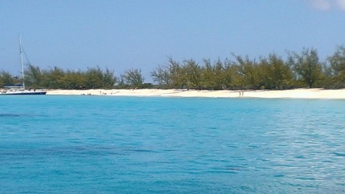
Beach off Grand Turk Island
We were planning to take the boat back to Texas before hurricane season starts instead of spending the year dodging hurricanes from St Thomas like last year. In 2012 Mother Nature ignored the usual beginning date of hurricane season and the first one was making a ruckus on May 19th. So we had a reason to be in a bit of a hurry but also to stop and smell the roses along the way, therefore we opted for the middle of April, but as with any plan, it will change. By the time we finally had a firm date set so the folks that stated they wanted to come along could get tickets, we blew the port engine, as noted in the prior post. We were so busy getting ready, I haven't even had time to update the blog to say we got a "new to us" engine and got it installed for a total of about $2k.
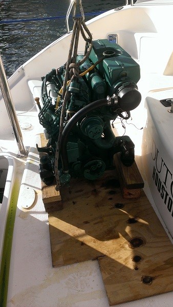
Old Engine.... poor thing
Once that problem had been resolved we found out a few days before the latest departure date that our US Coast Guard documentation was expired in March. How is it that we had been in two different countries, the BVI and the US and no one had noticed? Now what? Well the US Coast Guard used my Fedex International Overnight mail service and got us a $5 renewed document in two days! Way to go! Then there was Diego's birthday party and since we didn't know if the documentation was going to get here on Friday or Monday, it was Sunday at Magens Bay. It gave us one last day this year with all of our boat friends, Diane, Kelly, Randy, Frenchie and Ms. Doggles herself, CoCo.
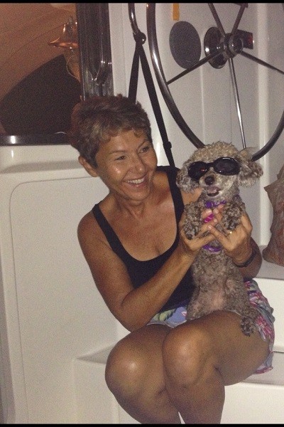
Frenchie and CoCo with her Doggles
With our crew of Joel Roach, son of Lori Roach, an old friend and co-worker in Utah at the IRS, on board, we finally got underway on DATE and off to Culebra, Puerto Rico. We had planned to go to Flaminco Bay and drop the anchor but we didn't want to get run off at 5 p.m. as it is a natural park and then have to find another place to stay in the dark! So being the creatures of familiarity we are, we went to Ensenanda Honda and stayed out on the little reef where we had stayed last year when we attempted our trip home. We got in one last Spanish Virgin Island snorkel and mainly saw hundreds of starfish (left the camera on the boat! Grrr!) in the stirred up waters by the reef.
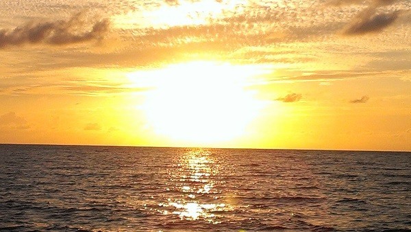
Sunset from the reef
The next morning, with no wind we motored to Fajardo, Puerto Rico for a last fill up on fuel, water and ice. When we came into Puerto Del Rey Marina, we passed an old boat that looked like it should be scrap as it had no masts and was who knows how old. While Jettie and Joel hit the marine store, I got the scoop on the boat. It is the ship for the Pirates of the Caribbean 4. Suddenly it didn't look like such a piece of crap.
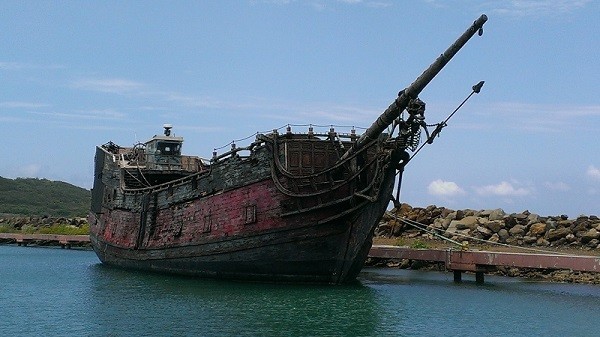
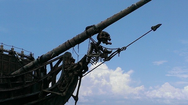
B4 Pirates of the Caribbean 4
Filled up and ready to get to the Turks and Caicos Islands, we had no wind to speak of. Like 1 to 2 knots. Hopefully we would not be plagued with light winds for this trip or crazy ones either! On came the motors again because we don't have time to be making a half a knot an hour if we want to get back before 2014.
We finally got the sails up and the main with one reef so we did not have to contend with doing it in the middle of the night. Then came the first storm of the trip. Jettie was on watch and woke Joel and me up with a start. "It's blowing 25 with gusts to 30, we need to get the sails down," she yelled down the stairs.
The next day we had the wind vacillating from side to side off our rear end. Now with a new crew member and the two of us without a whole lot of experience sailing down wind without a whisker pole (to hold the jib out on one side of the boat) and without a boom preventer (more like accidental jibe preventer to keep the boom from slamming over from one side of the boat to the other when then wind or the motion of the boat changes its position to the wind), I opted to just run with the motor. Just keeping the boat with the wind and waves (which gladly were coming in the same direction) behind us was considerable work at the helm. Turn right, turn right some more, wait, okay, she's coming back, wait, oh no, too far, turn left a lot, turn left some more, oh no, too far again (and that is every minute). See why I was concerned with sailing down wind? I didn't want to rip the cleat off the side of the boat or take the mast down on day two).
We put two reefs in and put up the sails and we good until a big ole storm got us. Wind, rain, lightening, waves 8 to 10 feet crashing into side of the boat. We got everything taken down when we got up to 30 knots. Speaking of 30 knots, that is what our jib sheets (lines that control the jib) looks like.
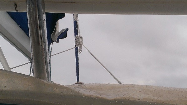
What a mess! (pic of knot)
Our course had been to go down below the Navidad, Silver and Mouchoir Banks, but with all of the weather issues and our taking some big hits to the side of the boat, our heading changed. We did not want a rouge wave to knock us over, so our plotted course was shelved and we turned our butt to the wind again. Now we were going close to the banks than out closer to Dominican Republic. We had been in water as deep as 12,000 feet so the depth finder reports only the last one that it got a response back on, which might be 150 - 175 feet deep. So when I was at watch and it suddenly started ticking off 100, 98, 96, 93, 90, 85, 80, 70, 60, 50 feet, I freaked out. OMG we are going thru the Silver Banks not around them. "Jettie, we need to talk!" (She was cranky as she hadn't been getting much rest and here I was waking her again...sorry, but it's urgent.) We looked at the chart and started seeing coral head sticking out of the water in the middle of the ocean. It's a wonder it's not called Shipwreck Bank with little islands of coral and rock breaking the surface. We hung a left back towards the Dominican Republic again to skirt all of the shallowness Silver Banks contained and kept ourselves in thousands of feet of water hoping like hell our GPS unit had us in the right place and not a mile to the right where the coral was!
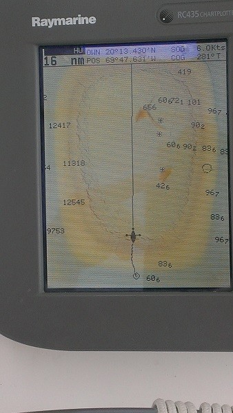
Note the 12000 depth and the 42 and a half foot mark in less than a few miles!
The next morning Joel got the knots out of the poor jib sheet (why is a jib sheet a line and not a sail? It seems more like a sheet? Anyway....) and since the winds were good we wanted to sail. We got into the wind, and Jettie and Joel got the main up, the 2nd reef we put in the other day removed and just one reef as we were getting some pretty good gusts. While they were pulling it up, I noticed two rips in the back side of the sail. :( That's not good. We have the tools to patch and sew it by hand, but it is too rough to be doing that out here right now. May if it calms down. Good thing the solar panels are not on the bimini or we'd never get the sail dealt with at sea without shredding it more on the sharp corners and not being able to walk up there. So do we hang a left and go backwards to the Dominican Republic (DR) and try to get it fixed or continue on our way? Jettie opted for adventure and not turning back. So off we go. We should be close on fuel if we can't sail just with the jib. We'll have to wait til the wind changes from vacillating behind us before it will be worth fighting every minute at the helm to keep the wind in the sail.
There was a huge lightening storm off to our starboard (right) so Jettie turned us back towards DR so we could avoid having to go it. Then there was one off our rear, but the sky was clear above us. One night we even saw the beautiful Milky Way given we have no moon and little light pollution. We kept the jib rolled up and motored along in the black night watching the bio-luminescence get aggravated by the waves and the prop. They glow bright green and look like fireflies or thousands of shooting stars darting through the black water. I can be mesmerized by just watching them dance like the licking flames of a fire.
As I write this, we are adrift while Jettie tries to change the fuel filter and bleed the fuel line on the starboard engine while we roughly bounce around. Just like Russ, our fuel probably got stirred up and brought sediment from the bottom of the tank up into the the filter. I believe the term is polishing the fuel to pump it out, filter it and put it back. Not sure if that is possible in the Turks or Caicos, so we may have to do it ourselves. We can sail on the jib possibly, but getting into port with one engine is a bitch. :: sigh :: Are all trips fraught with difficulties? I'm not sure I can deal with then punishing physical needs of a passage. I'm better just hanging on a mooring ball in Christmas cove!
Time to go investigate the situation! More later along with the pics.... as soon as I have decent WIFI!
We were planning to take the boat back to Texas before hurricane season starts instead of spending the year dodging hurricanes from St Thomas like last year. In 2012 Mother Nature ignored the usual beginning date of hurricane season and the first one was making a ruckus on May 19th. So we had a reason to be in a bit of a hurry but also to stop and smell the roses along the way, therefore we opted for the middle of April, but as with any plan, it will change. By the time we finally had a firm date set so the folks that stated they wanted to come along could get tickets, we blew the port engine, as noted in the prior post. We were so busy getting ready, I haven't even had time to update the blog to say we got a "new to us" engine and got it installed for a total of about $2k.
Old Engine.... poor thing
Once that problem had been resolved we found out a few days before the latest departure date that our US Coast Guard documentation was expired in March. How is it that we had been in two different countries, the BVI and the US and no one had noticed? Now what? Well the US Coast Guard used my Fedex International Overnight mail service and got us a $5 renewed document in two days! Way to go! Then there was Diego's birthday party and since we didn't know if the documentation was going to get here on Friday or Monday, it was Sunday at Magens Bay. It gave us one last day this year with all of our boat friends, Diane, Kelly, Randy, Frenchie and Ms. Doggles herself, CoCo.
Frenchie and CoCo with her Doggles
With our crew of Joel Roach, son of Lori Roach, an old friend and co-worker in Utah at the IRS, on board, we finally got underway on DATE and off to Culebra, Puerto Rico. We had planned to go to Flaminco Bay and drop the anchor but we didn't want to get run off at 5 p.m. as it is a natural park and then have to find another place to stay in the dark! So being the creatures of familiarity we are, we went to Ensenanda Honda and stayed out on the little reef where we had stayed last year when we attempted our trip home. We got in one last Spanish Virgin Island snorkel and mainly saw hundreds of starfish (left the camera on the boat! Grrr!) in the stirred up waters by the reef.
Sunset from the reef
The next morning, with no wind we motored to Fajardo, Puerto Rico for a last fill up on fuel, water and ice. When we came into Puerto Del Rey Marina, we passed an old boat that looked like it should be scrap as it had no masts and was who knows how old. While Jettie and Joel hit the marine store, I got the scoop on the boat. It is the ship for the Pirates of the Caribbean 4. Suddenly it didn't look like such a piece of crap.
B4 Pirates of the Caribbean 4
Filled up and ready to get to the Turks and Caicos Islands, we had no wind to speak of. Like 1 to 2 knots. Hopefully we would not be plagued with light winds for this trip or crazy ones either! On came the motors again because we don't have time to be making a half a knot an hour if we want to get back before 2014.
We finally got the sails up and the main with one reef so we did not have to contend with doing it in the middle of the night. Then came the first storm of the trip. Jettie was on watch and woke Joel and me up with a start. "It's blowing 25 with gusts to 30, we need to get the sails down," she yelled down the stairs.
The next day we had the wind vacillating from side to side off our rear end. Now with a new crew member and the two of us without a whole lot of experience sailing down wind without a whisker pole (to hold the jib out on one side of the boat) and without a boom preventer (more like accidental jibe preventer to keep the boom from slamming over from one side of the boat to the other when then wind or the motion of the boat changes its position to the wind), I opted to just run with the motor. Just keeping the boat with the wind and waves (which gladly were coming in the same direction) behind us was considerable work at the helm. Turn right, turn right some more, wait, okay, she's coming back, wait, oh no, too far, turn left a lot, turn left some more, oh no, too far again (and that is every minute). See why I was concerned with sailing down wind? I didn't want to rip the cleat off the side of the boat or take the mast down on day two).
We put two reefs in and put up the sails and we good until a big ole storm got us. Wind, rain, lightening, waves 8 to 10 feet crashing into side of the boat. We got everything taken down when we got up to 30 knots. Speaking of 30 knots, that is what our jib sheets (lines that control the jib) looks like.
What a mess! (pic of knot)
Our course had been to go down below the Navidad, Silver and Mouchoir Banks, but with all of the weather issues and our taking some big hits to the side of the boat, our heading changed. We did not want a rouge wave to knock us over, so our plotted course was shelved and we turned our butt to the wind again. Now we were going close to the banks than out closer to Dominican Republic. We had been in water as deep as 12,000 feet so the depth finder reports only the last one that it got a response back on, which might be 150 - 175 feet deep. So when I was at watch and it suddenly started ticking off 100, 98, 96, 93, 90, 85, 80, 70, 60, 50 feet, I freaked out. OMG we are going thru the Silver Banks not around them. "Jettie, we need to talk!" (She was cranky as she hadn't been getting much rest and here I was waking her again...sorry, but it's urgent.) We looked at the chart and started seeing coral head sticking out of the water in the middle of the ocean. It's a wonder it's not called Shipwreck Bank with little islands of coral and rock breaking the surface. We hung a left back towards the Dominican Republic again to skirt all of the shallowness Silver Banks contained and kept ourselves in thousands of feet of water hoping like hell our GPS unit had us in the right place and not a mile to the right where the coral was!
Note the 12000 depth and the 42 and a half foot mark in less than a few miles!
The next morning Joel got the knots out of the poor jib sheet (why is a jib sheet a line and not a sail? It seems more like a sheet? Anyway....) and since the winds were good we wanted to sail. We got into the wind, and Jettie and Joel got the main up, the 2nd reef we put in the other day removed and just one reef as we were getting some pretty good gusts. While they were pulling it up, I noticed two rips in the back side of the sail. :( That's not good. We have the tools to patch and sew it by hand, but it is too rough to be doing that out here right now. May if it calms down. Good thing the solar panels are not on the bimini or we'd never get the sail dealt with at sea without shredding it more on the sharp corners and not being able to walk up there. So do we hang a left and go backwards to the Dominican Republic (DR) and try to get it fixed or continue on our way? Jettie opted for adventure and not turning back. So off we go. We should be close on fuel if we can't sail just with the jib. We'll have to wait til the wind changes from vacillating behind us before it will be worth fighting every minute at the helm to keep the wind in the sail.
There was a huge lightening storm off to our starboard (right) so Jettie turned us back towards DR so we could avoid having to go it. Then there was one off our rear, but the sky was clear above us. One night we even saw the beautiful Milky Way given we have no moon and little light pollution. We kept the jib rolled up and motored along in the black night watching the bio-luminescence get aggravated by the waves and the prop. They glow bright green and look like fireflies or thousands of shooting stars darting through the black water. I can be mesmerized by just watching them dance like the licking flames of a fire.
As I write this, we are adrift while Jettie tries to change the fuel filter and bleed the fuel line on the starboard engine while we roughly bounce around. Just like Russ, our fuel probably got stirred up and brought sediment from the bottom of the tank up into the the filter. I believe the term is polishing the fuel to pump it out, filter it and put it back. Not sure if that is possible in the Turks or Caicos, so we may have to do it ourselves. We can sail on the jib possibly, but getting into port with one engine is a bitch. :: sigh :: Are all trips fraught with difficulties? I'm not sure I can deal with then punishing physical needs of a passage. I'm better just hanging on a mooring ball in Christmas cove!
Time to go investigate the situation! More later along with the pics.... as soon as I have decent WIFI!
| Vessel Name: | Dutchess |
| Vessel Make/Model: | Robertson & Caine / Leopard 40 |
| Hailing Port: | Houston, Texas |
| Crew: | Jettie and Donna |
| About: |
Gallery not available
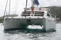
Who: Jettie and Donna
Port: Houston, Texas