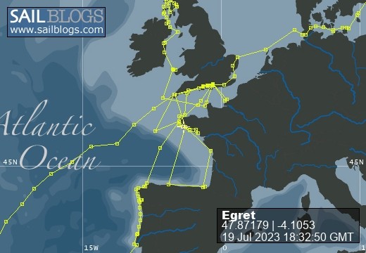
Egret
09 August 2022 | Picture: The Sunk Inner Light Vessel in the Thames Estuary
03 August 2022 | Egret at the Royal Norfolk and Suffolk Yacht Club, Lowestoft
23 July 2022 | Picture: One of the smaller locks at Holtenau
20 July 2022 | Picture: Patrick reminiscing with Juergen at Rostock
11 July 2022 | Picture: Egret at Stralsund, with the barque Gorch Fock beyond
04 July 2022 | Picture: Amanda on Bornholm
01 July 2022 | Picture: Kristianopol, with Egret at far right
26 June 2022 | Ernemar
19 September 2020 | Picture: Egret being lifted out at Ernemar, Sweden
08 September 2020 | Chart: our route from Mem into the Tjust Archipelago
01 September 2020 | Picture: the Carl Johans flight of seven locks
29 August 2020 | Picture: Egret (by G. Einefors)
27 August 2020 | Picture: Egret at Vadstena Castle
25 August 2020 | Picture: Norrkvarn Lock
23 August 2020 | Picture: Egret crossing Lake Vänern
19 August 2020 | Picture: Inside the lowest Trollhatte lock
17 August 2020 | Picture: The Gota Alv Bron in Gothenburg
16 August 2020 | Picture: the GKSS, Langedrag
13 August 2020 | Picture: Egret alongside (left) at Fisketangen
10 August 2019
45. Oh We do Like to be Beside the Seaside
30 June 2012
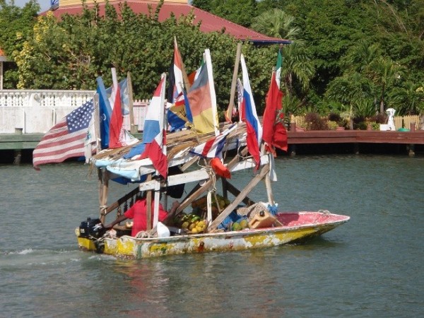
We left our sheltered anchorage in the Sassafras River to find 25 knots blowing out in the Chesapeake, which gave us a fast 10-mile fetch up to the entrance to the C & D Canal. This very conveniently connects the head of the Chesapeake to the Delaware Bay. Sailing isn't allowed, but otherwise transiting the 10 miles of the canal is straightforward as it is wide and deep enough for large ships. The Delaware is a 50 mile long estuary leading down to the Atlantic at Cape May, half way between Norfolk and New York. It is wide, shallow, can get very choppy and has few stopping off points along the way, so not really a place to linger. Timing the tides is essential as the current runs at up to 3 knots in the upper reaches. We stopped for a night behind Reedy Island, a remote but recognised small boat anchorage 6 miles downstream of the canal junction.
We raised the anchor as a beautiful dawn was breaking. On the far shore, a plume of steam billowed upwards into the early morning sky from the giant cooling tower of a nuclear power station. The ebb was soon helping us along our way, and, with a fresh breeze behind us, we clocked 8.7 knots over the ground at its peak. Typical of estuaries however, the new flood starts earlier the further downstream you are, which means you only get about 5 hours of fair tide when heading towards the sea. The deep water channel is well marked by buoys and lighthouses, some with evocative names such as "Ship John Shoal" and others with more prosaic ones such as "Fourteen Foot Bank". We encountered several ocean-going ships and tugs with enormous barges along the way, and a couple of car ferries crossed our path near the mouth of the estuary. The Atlantic was at its most benign as we sailed out into it and round to the entrance of Cape May Harbour, a few miles up the coast. It was over a month since we were last in open waters: 300 miles to the south, where we entered the ICW at Beaufort. We dropped our hook in the crowded anchorage next to the US Coastguard training centre.
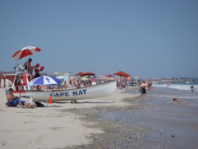
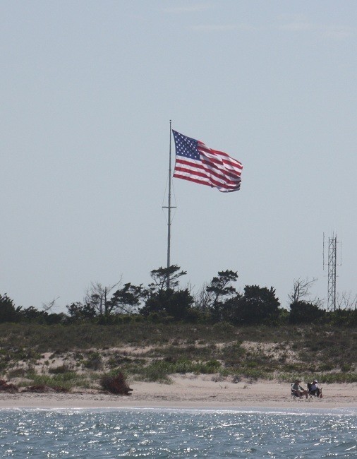
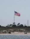
Cape May claims to be America's first seaside resort, and it has retained much of its genteel charm by preserving its fine Victorian era buildings and resisting the development of high rise blocks and big amusement parks. The magnificent beach was packed with holidaymakers enjoying the traditional pleasures of splashing about in the surf, sunbathing and crunching their way through the sand in their sandwiches. Cape May is also a major fishing port, and we stopped off on our way back from a long walk to buy some fish at the Lobster House, a very popular shop, takeaway and restaurant on the quay. On our second day we took our bikes ashore and rode out to the lighthouse at Cape May Point. We climbed the 199 steps to admire the 19th C. stonemasons' skills and take in the view, and then spent some time spotting birds on the adjoining nature reserve, a significant stopping off point on their migratory routes. We had hoped to swim from the nearby beach, but were put off by the large numbers of horseshoe crabs, looking like woodlice the size of dinner plates, being tossed around in the surf.
Since arriving in America we'd been concerned about getting decent weather forecasts when we didn't have access to the internet. We had heard about the continuous weather broadcasts but couldn't work out how to receive them. We asked around and were told "just press the weather button on your VHF radio-telephone set". Not having an American set, we didn't have a weather button. We couldn't even listen to the coastguard channel (22A) until we realised that our set was reprogrammable to receive the unique US frequencies. Eventually we found an "All Hazards Radio" in a chandlery, which just broadcasts the weather channels as well as having an automated alert for special marine warnings. Now we could really frighten ourselves. Most evenings a warning was broadcast with the robotic voice saying something like "NWS doppler radar indicated thunderstorms producing strong winds 34 knots or greater moving across such and such an area. Expect strong gusty winds, high waves and deadly lightning. Seek safe harbour immediately. If caught out on open water stay below decks and keep away from metal objects". It wasn't long before we found out what it was like to experience such a storm.
We raised the anchor as a beautiful dawn was breaking. On the far shore, a plume of steam billowed upwards into the early morning sky from the giant cooling tower of a nuclear power station. The ebb was soon helping us along our way, and, with a fresh breeze behind us, we clocked 8.7 knots over the ground at its peak. Typical of estuaries however, the new flood starts earlier the further downstream you are, which means you only get about 5 hours of fair tide when heading towards the sea. The deep water channel is well marked by buoys and lighthouses, some with evocative names such as "Ship John Shoal" and others with more prosaic ones such as "Fourteen Foot Bank". We encountered several ocean-going ships and tugs with enormous barges along the way, and a couple of car ferries crossed our path near the mouth of the estuary. The Atlantic was at its most benign as we sailed out into it and round to the entrance of Cape May Harbour, a few miles up the coast. It was over a month since we were last in open waters: 300 miles to the south, where we entered the ICW at Beaufort. We dropped our hook in the crowded anchorage next to the US Coastguard training centre.
Cape May claims to be America's first seaside resort, and it has retained much of its genteel charm by preserving its fine Victorian era buildings and resisting the development of high rise blocks and big amusement parks. The magnificent beach was packed with holidaymakers enjoying the traditional pleasures of splashing about in the surf, sunbathing and crunching their way through the sand in their sandwiches. Cape May is also a major fishing port, and we stopped off on our way back from a long walk to buy some fish at the Lobster House, a very popular shop, takeaway and restaurant on the quay. On our second day we took our bikes ashore and rode out to the lighthouse at Cape May Point. We climbed the 199 steps to admire the 19th C. stonemasons' skills and take in the view, and then spent some time spotting birds on the adjoining nature reserve, a significant stopping off point on their migratory routes. We had hoped to swim from the nearby beach, but were put off by the large numbers of horseshoe crabs, looking like woodlice the size of dinner plates, being tossed around in the surf.
Since arriving in America we'd been concerned about getting decent weather forecasts when we didn't have access to the internet. We had heard about the continuous weather broadcasts but couldn't work out how to receive them. We asked around and were told "just press the weather button on your VHF radio-telephone set". Not having an American set, we didn't have a weather button. We couldn't even listen to the coastguard channel (22A) until we realised that our set was reprogrammable to receive the unique US frequencies. Eventually we found an "All Hazards Radio" in a chandlery, which just broadcasts the weather channels as well as having an automated alert for special marine warnings. Now we could really frighten ourselves. Most evenings a warning was broadcast with the robotic voice saying something like "NWS doppler radar indicated thunderstorms producing strong winds 34 knots or greater moving across such and such an area. Expect strong gusty winds, high waves and deadly lightning. Seek safe harbour immediately. If caught out on open water stay below decks and keep away from metal objects". It wasn't long before we found out what it was like to experience such a storm.
Comments
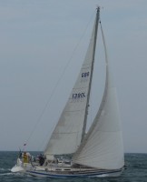
| Vessel Name: | Egret |
| Vessel Make/Model: | Sweden Yachts 390 |
| Hailing Port: | Chichester Harbour |
| Crew: | Patrick & Amanda Marshall |
Egret's Photos - Main
R.jpg) |
The Gota River, Trollhatte Canal, Lakes Vanern & Vattern and the Gota Canal
2 Photos | 9 Sub-Albums
Created 30 September 2020
|
 |
The Inner and Outer Hebrides, Orkney, Fair Isle, Shetland, Norway and Sweden's west coast.
1 Photo
Created 14 November 2019
|
.JPG) |
Normandy, Scilly, Pembrokeshire, Ireland, Isle of Man, Northern Ireland, Inner Hebrides and the Crinan Canal.
1 Photo
Created 14 November 2018
|
.JPG) |
 Marina Miss Mei II arriving.JPG) |
 |
|
Dune 7.JPG) |
.JPG) |
 |
Blogs 114-117
1 Photo | 5 Sub-Albums
Created 11 December 2014
|
 |
 |
, Pentecost, Naghol (Land diving)a.jpg) |
Amanda raising the Quarantine & New Zealand courtesy flagedit_edited-1 a.jpg) |
 |
 |
 |
 |
 |
Blogs 68-76
1 Photo | 9 Sub-Albums
Created 13 February 2013
|
 |
 |
|
|
|
|
|
|
Setting off on our circumnavigation
2 Sub-Albums
Created 16 August 2011
|
Egret
Who: Patrick & Amanda Marshall
Port: Chichester Harbour
Gallery

 Vallee Gran Rey.JPG)