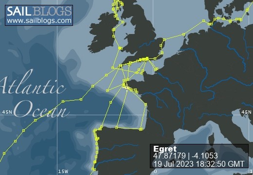
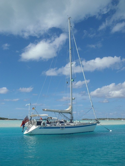
Egret
09 August 2022 | Picture: The Sunk Inner Light Vessel in the Thames Estuary
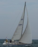
03 August 2022 | Egret at the Royal Norfolk and Suffolk Yacht Club, Lowestoft
23 July 2022 | Picture: One of the smaller locks at Holtenau
20 July 2022 | Picture: Patrick reminiscing with Juergen at Rostock
11 July 2022 | Picture: Egret at Stralsund, with the barque Gorch Fock beyond
04 July 2022 | Picture: Amanda on Bornholm
01 July 2022 | Picture: Kristianopol, with Egret at far right
26 June 2022 | Ernemar
19 September 2020 | Picture: Egret being lifted out at Ernemar, Sweden
08 September 2020 | Chart: our route from Mem into the Tjust Archipelago
01 September 2020 | Picture: the Carl Johans flight of seven locks
29 August 2020 | Picture: Egret (by G. Einefors)
27 August 2020 | Picture: Egret at Vadstena Castle
25 August 2020 | Picture: Norrkvarn Lock
23 August 2020 | Picture: Egret crossing Lake Vänern
19 August 2020 | Picture: Inside the lowest Trollhatte lock
17 August 2020 | Picture: The Gota Alv Bron in Gothenburg
16 August 2020 | Picture: the GKSS, Langedrag
13 August 2020 | Picture: Egret alongside (left) at Fisketangen
10 August 2019
132. About Ascension
21 April 2015
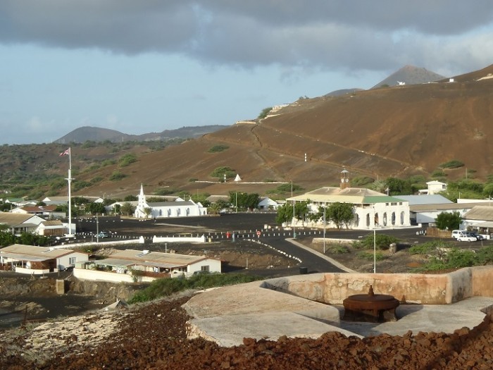
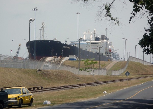
Looking towards Long Beach from where we were anchored, we could see the ocean swell beginning to rise before turning into combers which tumbled onto the yellow sand with a burst of spray. We were about 500m off the beach and could feel a disconcerting amount of surge as the waves went past, but much further off and it would have been too deep to anchor. Beyond the beach sits the perfect cone of an extinct but relatively recent volcano. Two huge white guns stick out prominently from platforms half way up the barren slope. A road spirals upwards towards a cluster of radio masts on the summit. In the far distance, the 859m peak of the aptly named Green Mountain was often hidden by cloud. A floating pipeline snaked across the water just to the east of us, ready for the next fuel tanker to connect and pump her cargo ashore. To the east lay a number of work boats and barges at their moorings, and beyond these was Georgetown's quay, partially hidden by an outcrop of black rocks against which the waves crashed in a mass of foam.
As we approached the quay by dinghy, we could appreciate the size of the swell from the difference in levels as it surged up and down against the wall. It was with some difficulty that we laid an anchor astern to hold the dinghy off to prevent it bashing against the wall, yet still get close enough to grab the ladder and scramble up to tie off the painter. We checked in at the harbour office, where we met Kitty, the wonderfully competent person in charge. She gave us a print-out of the forecast for the next couple of days which included a warning of a higher swell from the north - straight onshore - which was a bit of a worry. We moved on to the police station and had our passports stamped by a friendly constable. Security is a bit of an issue on Ascension, presumably because of the military and communications bases, and we had had to submit our details in advance by e-mail for vetting. The whole town seemed deserted, but perhaps it was the lunch hour as well as the heat of the midday sun that kept people indoors. We managed, with a little persuasion, to get a drink and a sandwich at the Obsidium Hotel. Normally they ask for two hours advance notice of a of an order for a meal! It seemed reasonably full of guests, but most were staying just a couple of nights between the twice weekly military flight from Brize Norton and the onwards Royal Mail ship to St. Helena.
After lunch, we called at the Conservation Centre, manned by an enthusiastic team who seem to be doing wonders studying and protecting the environment. There are guides published about everything and everywhere on the island, including leaflets on endemic forms of life ranging from Pteris through Priolepsis to a Psocid (a plant, a fish and a booklouse). We spoke to a staff member who had been born on Ascension, trained for the merchant navy in England and worked as first mate on a Southampton dredger. She had recently returned to resume life in her old home and start a new career as a naturalist. She told us about the Ascension Green Turtles that were currently arriving each night to lay their eggs in the sand at Long Beach. They were leading a tour to watch them that evening. Would we like to join them? Of course we would, but then we thought about getting back to "Egret" by dinghy. The quay had been dicey enough this morning. In darkness it could be positively dangerous, so we sadly had to turn down the opportunity.
At just 400 miles south of the equator, Georgetown is hot, with hardly a tree to provide shade. The roads and pavements are surfaced with black volcanic chippings, in sharp contrast to the dazzling whitewash of the buildings. An impressive building still in use is the Government Stores on the quay, which was massively constructed from stone and cast iron in 1852. It was originally used as a food store, but now stocks building materials and hardware (but not, unfortunately, the hose tail that we needed for our engine). The old Royal Marines Barracks was built in 1830, and it subsequently became the "Exiles Club". Now it is occupied by a few small shops, but we didn't see much sign of any being open. A pair of incongruous signs were fixed above one door - the upper one was engraved "W iv R 1856", the lower one advertised: "Glamour, Fashion and Beauty", with a picture of a pair of high heels and red lips. St. Mary's Church, built in the 1840s, has a low nave and an elegantly stepped tower with a steeple. Apart from the Administration building, most of the others are relatively modern and entirely lacking in architectural interest. There are a couple of streets of prefabricated houses built for military officers which still appear to be in use, probably for government employees. Most people, however, live in one of the villages in the foothills of Green Mountain, where the climate is cooler and there is a chance of growing flowers and vegetables. They are called "One Boat" and "Two Boats", after the hulls which stand vertically beside the road to provide shade for travellers. We bought some food from Solomon's supermarket, and also booked a hire car for the following Friday, the earliest they had one available. We filled our water containers from the coin-operated tap on the quay.
We learnt that the museum opens only on Mondays and Fridays after 5 p.m., and, it being a Monday, we stayed ashore longer than intended for perhaps our only chance to visit. The museum depends on volunteers from the Heritage Society who curate fascinating exhibits and sell pamphlets about every aspect of island life. We were impressed by the amount of time Ascension islanders must devote to such esoteric works. The island is geologically young, emerging about a million years ago with the most recent volcanic activity within the last thousand years. It was discovered in 1501 by, of course, the Portuguese, but as it had little to offer in the way of water, food or shelter, it remained unclaimed for three centuries. It was only when Napoleon was exiled to St. Helena that the British set up a garrison as part of the deterrent against attempts to rescue him. After the Emperor's death, a small contingent of troops was maintained to monitor pirates off the African coast. The island later became a coaling station for steam-ships. After the laying of a submarine cable between the UK and South Africa via Ascension in 1899, management of the island was passed to the Eastern Telegraph Company (later Cable and Wireless). Defences were re-established during the Second World War, including the installation of two big guns from the battleship HMS Hood - the ones that we had seen on the hill behind the beach. They were fired only once in anger: against a German U-boat which fled. Later in the War, the USA built a runway and airbase to refuel aircraft on missions to North Africa. During the 1960s, the BBC set up a relay station for the World Service. The last military use was during the Falklands War in 1982 when the airport was used for refuelling aircraft. One of the five ground antennae for the GPS navigational system and a tracking station for the European Space Agency are also located on the island. Administratively, it is now part of the British Overseas Territory of St. Helena, Ascension and Tristan da Cunha, with a population of 800 people.
By the time we got back to the dinghy it was high tide. The swell had increased but its period was long, so all looked fine for a while as we stood on the quay, but as the crest approached we found ourselves up to our thighs in water clinging to the railings! We decided to leave our water cans behind, as just getting ourselves into the dinghy would be interesting enough. With a bit of assistance from bystanders, we got away safely but wet - a wag from Northern Ireland commenting that we reminded him of a Peyton cartoon!
Comments
| Vessel Name: | Egret |
| Vessel Make/Model: | Sweden Yachts 390 |
| Hailing Port: | Chichester Harbour |
| Crew: | Patrick & Amanda Marshall |
Egret's Photos - Main
R.jpg) |
The Gota River, Trollhatte Canal, Lakes Vanern & Vattern and the Gota Canal
2 Photos | 9 Sub-Albums
Created 30 September 2020
|
 |
The Inner and Outer Hebrides, Orkney, Fair Isle, Shetland, Norway and Sweden's west coast.
1 Photo
Created 14 November 2019
|
.JPG) |
Normandy, Scilly, Pembrokeshire, Ireland, Isle of Man, Northern Ireland, Inner Hebrides and the Crinan Canal.
1 Photo
Created 14 November 2018
|
.JPG) |
 Marina Miss Mei II arriving.JPG) |
 |
|
Dune 7.JPG) |
.JPG) |
 |
Blogs 114-117
1 Photo | 5 Sub-Albums
Created 11 December 2014
|
 |
 |
, Pentecost, Naghol (Land diving)a.jpg) |
Amanda raising the Quarantine & New Zealand courtesy flagedit_edited-1 a.jpg) |
 |
 |
 |
 |
 |
Blogs 68-76
1 Photo | 9 Sub-Albums
Created 13 February 2013
|
 |
 |
|
|
|
|
|
|
Setting off on our circumnavigation
2 Sub-Albums
Created 16 August 2011
|
Egret
Who: Patrick & Amanda Marshall
Port: Chichester Harbour
Gallery
R Angra do Heroismo, Town Hall.jpg)
R Faja dos Cubres.jpg)