Endless Summer
Endless Summer is a 43ft Ian Farrier cruising catamaran.
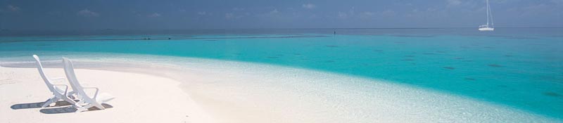
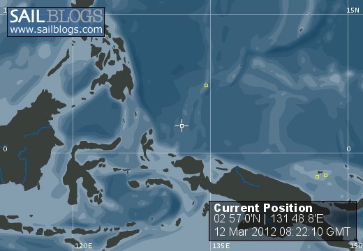
12 March 2012 | Helen Reef
12 March 2012 | Helen Reef
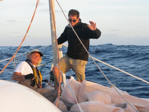
12 March 2012 | Palau
12 March 2012 | Palau
12 March 2012 | Palau
12 March 2012 | Palau
12 March 2012 | Palau
12 March 2012 | Palau
15 November 2011
16 October 2011
30 July 2011 | Kavieng, and Manus Province, Papua New Guinea
30 July 2011 | Kavieng, and Manus Province, Papua New Guinea
30 July 2011 | Kavieng, and Manus Province, Papua New Guine
30 July 2011 | Kavieng, and Manus Province, Papua New Guinea
30 July 2011 | Kavieng, and Manus Province, Papua New Guinea
30 July 2011 | Kavieng, and Manus Province, Papua New Guinea
30 July 2011 | Kamatal Island, Louisiades, PNG
30 July 2011 | Kamatal Island, Louisiades, PNG
29 July 2011 | 10 56'S:152 42'E, Louisiade Achipelago
28 July 2011 | Panasia Island, Louisiades, PNG
Forbidden Atoll 2nd of 6 installments
06 September 2010 | It's a secret
Steve
Asking around in the last anchorage we had received a promising tip from
a British couple. A friend of theirs had spent three weeks at Tern Atoll
last year. The chart showed a pass into the lagoon, but no detail, no
navigational markers, and no depth information. But we were encouraged
reasoning that for someone to have spent three weeks there, there must
be a good anchorage.
So bolstered with that knowledge I was starting to feel more excitement
than dread as I awoke the morning of our third day at sea with about 25
miles to go. The last two days and nights had been some of the mellowest
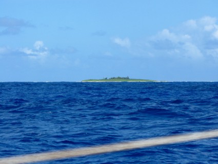
sailing we had done. I sipped coffee and started to look for the low island that the chart indicated lay on the south east corner of the approximately 1 mile wide atoll. It was not until we were about 8 miles off that we began to see
it. First a low green smudge on the horizon and then a shaggy shape as
the trees came into view. When we were 3 miles off I could see the waves
breaking on the coral reef. Approaching an island like this, there is no
telling how far off the chart will be. Many of the modern electronic and
paper charts are exact copies of the surveys done in the 1800s. So we
switched to eye ball navigation relying on our chart for reference only.
a British couple. A friend of theirs had spent three weeks at Tern Atoll
last year. The chart showed a pass into the lagoon, but no detail, no
navigational markers, and no depth information. But we were encouraged
reasoning that for someone to have spent three weeks there, there must
be a good anchorage.
So bolstered with that knowledge I was starting to feel more excitement
than dread as I awoke the morning of our third day at sea with about 25
miles to go. The last two days and nights had been some of the mellowest
sailing we had done. I sipped coffee and started to look for the low island that the chart indicated lay on the south east corner of the approximately 1 mile wide atoll. It was not until we were about 8 miles off that we began to see
it. First a low green smudge on the horizon and then a shaggy shape as
the trees came into view. When we were 3 miles off I could see the waves
breaking on the coral reef. Approaching an island like this, there is no
telling how far off the chart will be. Many of the modern electronic and
paper charts are exact copies of the surveys done in the 1800s. So we
switched to eye ball navigation relying on our chart for reference only.
Comments
| Vessel Name: | Endless Summer |
| Vessel Make/Model: | F-41 sailing catamaran |
| Hailing Port: | San Francisco, California |
| Crew: | Steve May and Manjula Dean |
| About: | |
| Extra: |
Endless Summer's Photos - Main
Photos 1 to 8 of 8 |
1 |
 |
 |
 |
 |
 |
 |
 |
 |
1 |
 |
 |
2nd half of the South Pacific crossing
220 Photos
Created 25 November 2010
|
 |
Photos from our passage from LA, California to the Marquesas
50 Photos
Created 26 April 2010
|
Australia to Indonesia 2011
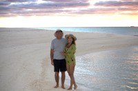
Who: Steve May and Manjula Dean
Port: San Francisco, California
Gallery


Favorites
- Papua New Guinea Video
- 21 DAYS TO THE SOUTH PACIFIC, (SHORT FILM)
- Invitation to share our adventure (TRAILER)
- Tanna Island Rescue video (SHORT FILM)
- Tahiti Morea Sailboat Race (SHORT FILM)
- Monterey Bay Aquarium (Educate yourself)
- Ocean Conservancy (Get Involved)
- FishWise (Sustainable Fish Choices)
- Whale study and conservation