The Voyage of S/V Estelle
Cruising the British Columbia Coast
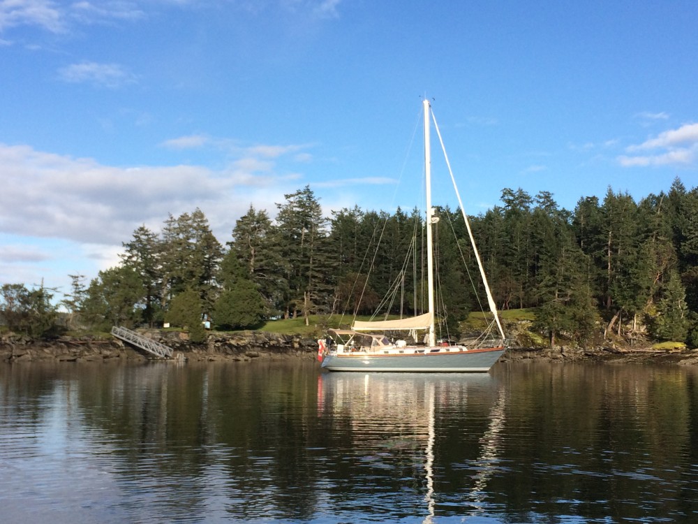
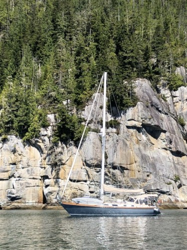
Estelle Profile
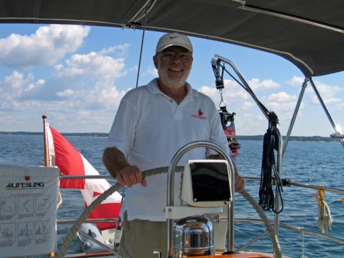
Who: Jeannie & Jim Lea
Port: Charlottetown, PEI
Gallery


SailBlogs Friends


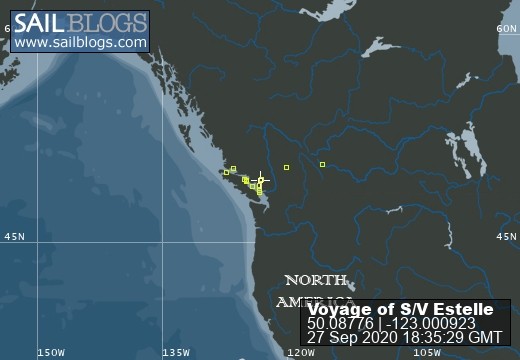
27 September 2020
26 September 2020
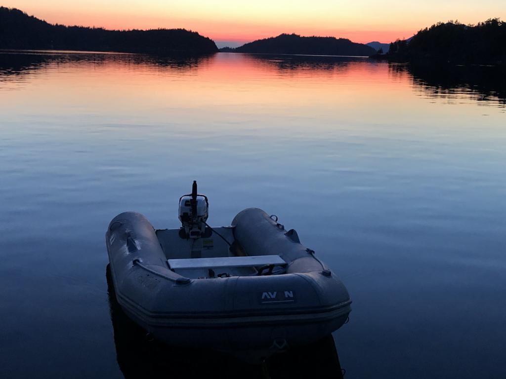
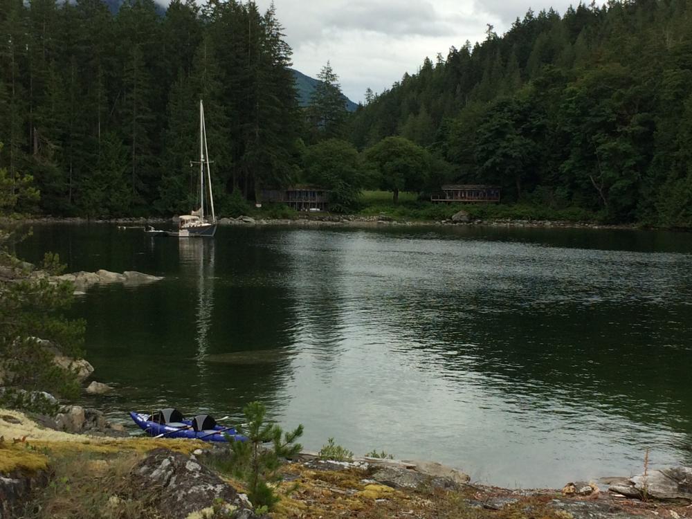
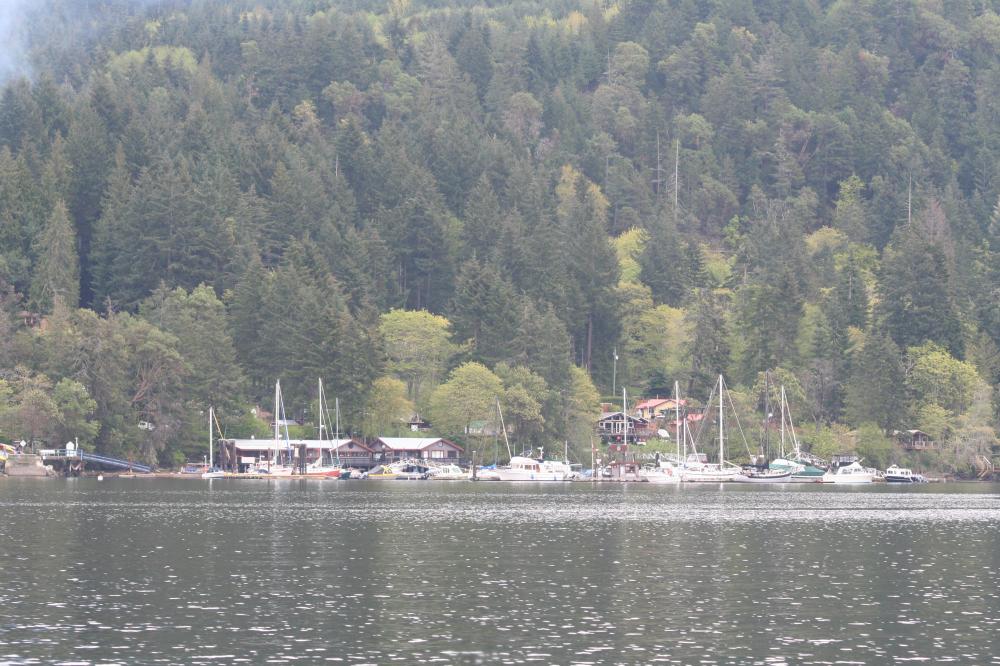
26 September 2020 | The Broughtons
26 September 2020 | Vancouver Rowing Club
07 February 2020
03 February 2020 | Northern Georgia Strait
30 September 2018 | Vancouver Rowing Club
10 September 2018 | The Laughing Oyster, Okeover Landing
08 September 2018 | Von Donop Inlet, Desolation Sound
08 September 2018 | Port McNeill, BC
08 September 2018 | Port McNeill, BC
16 August 2018
16 August 2018 | Turnbull Cove, BC
15 August 2018 | Pierre's Echo Bay Resort
15 August 2018 | Kwatsi Bay Marina, The Broughtons
15 August 2018 | Potts Lagoon, West Cracroft Island, BC
05 August 2018 | Kwatsi Bay
01 August 2018 | Big Bay
01 August 2018 | Von Donop Inlet
27 July 2018 | Lancelot Inlet, Desolation Sound Marine Park
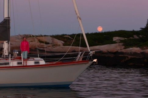
Penobscott Bay
05 July 2006 | Maine
Sun/Fog, warm
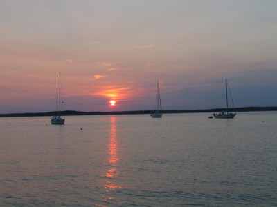
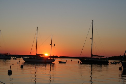
Sunset
July 1, 2006
Today we're off!! The weather seems to be cooperating, so started off for Buckle Harbor, a small anchorage (not a harbor really) created by a small island tucked up close to a larger (Swan) island. But the forecast for strong winds for tomorrow pushed us further on. We passed Buckle at noon after a leisurely breakfast and yet another shopping expedition for food and wine (tonight's wine was a $3.99 special! Not memorable, but not bad.).
We left Northeast Harbor (with its spotty Wi-Fi) about 10:00 am, motoring out past Great Cranberry Island (not to be confused with Little Cranberry Island with the village of Islesford, not to be confused with the Island in Penobscott Bay called Isleboro).
We set the main and motor-sailed for a couple of hours until past Casco Passage, a narrow and rocky channel between a few islands. Then we pulled out the jib, sailing across Jerrico Bay into Eggemoggin Reach where we had a beautiful sail up the 12 mile long channel created by Deer Island and the Blue Hill peninsula. Then we had to motorsail (because we couldn't be bothered tacking out the narrow exit) a couple of miles out the exit, and sailed into Penobscott Bay. We then turned north at "Head of the Cape" and sailed up the bay into a little unnamed bay that is created by Holbrook Island. We picked up a (Free!!) mooring put out by the Holbrook Island Sanctuary, where we will spend the night It should provide good protection from the predicted gales of tonight and tomorrow. It is just a mile from Castine, a (typically) beautiful Maine coastal town. It was from Castine that the United Empire Loyalists dismantled their homes and moved them by ship to St Andrews, N.B.
We went for a short (~5km) walk through the woods, fed the mosquitoes, and returned to a SGT (sundown Gin & Tonic) and dinner of grilled salmon with maple sugar and dill, fresh beans and a baked tomato/provolone/basil dish and our cheap wine . Dessert was grapes, raspberries and cheese. The new generator is great for providing hot water for showers, but there is some confusion among the instruments about the state of battery charge (a big issue for boaters!). Some further investigation required.
The weather forecast is for high (25-35 kts) winds tonight and tomorrow. Hopefully tonight won't be too wild as our anchorage should be in the lee of the island. A large (48' ) wooden sloop (1938 vintage) is moored beside us. They take out charter customers, but today's customers were newlyweds who decided that they needed more privacy, so elected to spend the night ashore. If tomorrow is as windy as they predict, I'm not sure what they will do with them.
July 2, 2006
Well, the forecast for high winds was a bit off. Flat calm all night. But we stayed put as the forecast continued to call for gale force winds in the afternoon, and sure enough, they did appear. It blew for most of the day, starting mid-morning, but we were secure, and the cove we were in was still calm enough that we could go off in the dinghy and not get (too) wet. The area surrounding Tom Cod Cove is called the Holbrook Island Sanctuary, and as the name suggests, is a land preserve run by the state. There are a number of trails and interesting hikes, many of which we have done, but there are others that we will do when we are back again. With hikes, eating and some small boat jobs, we consumed the day. Dinner was coconut stir-fried chicken with some pasta and fresh peas.
The forecast for tomorrow is for north-west winds, ideal for a sail down Penobscot Bay. But we'll wait and see.
July 3, 2006
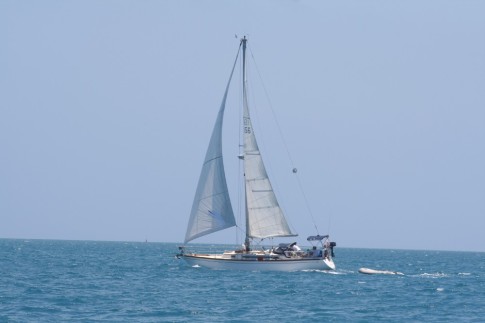
True to their word, NOAA (National Oceanographic and Space Administration, aka the weatherman in the US) delivered north-west winds, and we set off (after a breakfast of scrambled eggs, bacon, toast & coffee) down Penobscot Bay. We had no clear objective in mind, but "down the bay". By the end of the day, after some beautiful sailing (that turned from broad reach to beating to windward in 10-15 knots when the sea breeze filled in) we found ourselves in a small anchorage off Muscle Ridge Channel, in south-western Penobscot Bay. It is a beautiful and sheltered anchorage between three small islands. Two of the islands are sites of former quarries where granite for many of New York's famous buildings (including The Cathedral of Saint John the Divine) was quarried. Looking at it today, and imagining conditions at that time make it unimaginable to consider the plight of the Italian stonecutters who left their homes to come to this!
July 4, 2006
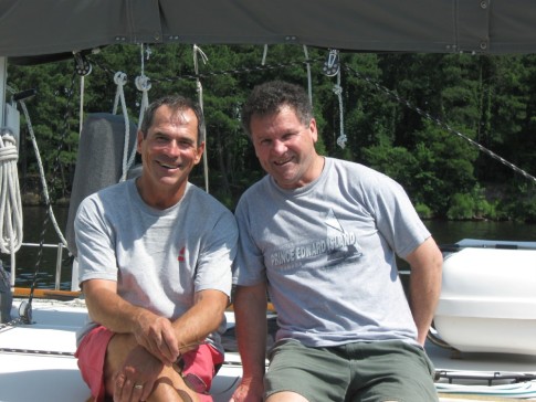
Today we traveled from our anchorage at Dix Island to Pulpit Harbor, on North Haven (Island). We motored up Muscle Ridge Channel, then through Owl's Head Bay back into Penobscot Bay where we shut the engine down and had a beautiful sail across the bay, arriving about 2:30 pm. We expected that the little harbor would be full of boats, as it is just 8 miles from Camden, which is a busy sailing enter normally, but add to that the fact that its Independence Day and we expected plenty of traffic. But we were wrong. Except for about 20 permanently moored boats, there were only two visitors (you can tell a visitor, as they are using an anchor, not a permanent mooring). By the end of the day, three more arrived, including a Rival 40 from England with two children aboard. The reason its called Pulpit Harbor is that there is a large rock at the entrance that's supposed to resemble a pulpit from a church. But it just looks like another big rock (with an osprey nest on top) to me. We went for a walk to a store a mile or so up the road, and bought a few things, but we will hold off re-stocking the groceries until tomorrow when we will go to Camden, where we will meet Florence and Eugene Rossiter. Florence and Eugene will be sailing with us for a few days.
Since our arrival here, the day has gotten continuously more hazy, with it being too close to fog for comfort by nightfall. Fog is a common occurrence here along the coast, and although we have radar and an excellent navigation system, it can be a strain to do any amount of sailing in it if it is really thick.
Hopefully I'll get internet access in Camden to post these notes.
July 5, 2006
This morning I could see the top of the mast from the deck, but not much more! A real "pea-souper"!! But by 9:30 am, it was clear enough to see the shore, about 1/2 mile visibility. Not too bad for navigation with the radar.
Before we left, the skipper of the Rival 40 ketch with a Red Ensign (English boat) came over to chat, having seen our Canadian flag. They were planning to leave for Nova Scotia as soon as the weather looked fit, and he had no detailed charts of Yarmouth, so wondered if we had any he could look at and make a sketch of. Because we have never sailed in that area, we have no paper ones, but I have them on the computer, so I was able to print off a few for him on our tiny HP 450 printer.
But by noon in Camden it was sunny and scorching hot! We spent the afternoon doing laundry, updating internet stuff and buying groceries.
Eugene & Florence arrived about 5:30 pm, and we left shortly after for Pulpit Harbor, where we had salmon with new potatoes for dinner.
July 1, 2006
Today we're off!! The weather seems to be cooperating, so started off for Buckle Harbor, a small anchorage (not a harbor really) created by a small island tucked up close to a larger (Swan) island. But the forecast for strong winds for tomorrow pushed us further on. We passed Buckle at noon after a leisurely breakfast and yet another shopping expedition for food and wine (tonight's wine was a $3.99 special! Not memorable, but not bad.).
We left Northeast Harbor (with its spotty Wi-Fi) about 10:00 am, motoring out past Great Cranberry Island (not to be confused with Little Cranberry Island with the village of Islesford, not to be confused with the Island in Penobscott Bay called Isleboro).
We set the main and motor-sailed for a couple of hours until past Casco Passage, a narrow and rocky channel between a few islands. Then we pulled out the jib, sailing across Jerrico Bay into Eggemoggin Reach where we had a beautiful sail up the 12 mile long channel created by Deer Island and the Blue Hill peninsula. Then we had to motorsail (because we couldn't be bothered tacking out the narrow exit) a couple of miles out the exit, and sailed into Penobscott Bay. We then turned north at "Head of the Cape" and sailed up the bay into a little unnamed bay that is created by Holbrook Island. We picked up a (Free!!) mooring put out by the Holbrook Island Sanctuary, where we will spend the night It should provide good protection from the predicted gales of tonight and tomorrow. It is just a mile from Castine, a (typically) beautiful Maine coastal town. It was from Castine that the United Empire Loyalists dismantled their homes and moved them by ship to St Andrews, N.B.
We went for a short (~5km) walk through the woods, fed the mosquitoes, and returned to a SGT (sundown Gin & Tonic) and dinner of grilled salmon with maple sugar and dill, fresh beans and a baked tomato/provolone/basil dish and our cheap wine . Dessert was grapes, raspberries and cheese. The new generator is great for providing hot water for showers, but there is some confusion among the instruments about the state of battery charge (a big issue for boaters!). Some further investigation required.
The weather forecast is for high (25-35 kts) winds tonight and tomorrow. Hopefully tonight won't be too wild as our anchorage should be in the lee of the island. A large (48' ) wooden sloop (1938 vintage) is moored beside us. They take out charter customers, but today's customers were newlyweds who decided that they needed more privacy, so elected to spend the night ashore. If tomorrow is as windy as they predict, I'm not sure what they will do with them.
July 2, 2006
Well, the forecast for high winds was a bit off. Flat calm all night. But we stayed put as the forecast continued to call for gale force winds in the afternoon, and sure enough, they did appear. It blew for most of the day, starting mid-morning, but we were secure, and the cove we were in was still calm enough that we could go off in the dinghy and not get (too) wet. The area surrounding Tom Cod Cove is called the Holbrook Island Sanctuary, and as the name suggests, is a land preserve run by the state. There are a number of trails and interesting hikes, many of which we have done, but there are others that we will do when we are back again. With hikes, eating and some small boat jobs, we consumed the day. Dinner was coconut stir-fried chicken with some pasta and fresh peas.
The forecast for tomorrow is for north-west winds, ideal for a sail down Penobscot Bay. But we'll wait and see.
July 3, 2006
True to their word, NOAA (National Oceanographic and Space Administration, aka the weatherman in the US) delivered north-west winds, and we set off (after a breakfast of scrambled eggs, bacon, toast & coffee) down Penobscot Bay. We had no clear objective in mind, but "down the bay". By the end of the day, after some beautiful sailing (that turned from broad reach to beating to windward in 10-15 knots when the sea breeze filled in) we found ourselves in a small anchorage off Muscle Ridge Channel, in south-western Penobscot Bay. It is a beautiful and sheltered anchorage between three small islands. Two of the islands are sites of former quarries where granite for many of New York's famous buildings (including The Cathedral of Saint John the Divine) was quarried. Looking at it today, and imagining conditions at that time make it unimaginable to consider the plight of the Italian stonecutters who left their homes to come to this!
July 4, 2006
Today we traveled from our anchorage at Dix Island to Pulpit Harbor, on North Haven (Island). We motored up Muscle Ridge Channel, then through Owl's Head Bay back into Penobscot Bay where we shut the engine down and had a beautiful sail across the bay, arriving about 2:30 pm. We expected that the little harbor would be full of boats, as it is just 8 miles from Camden, which is a busy sailing enter normally, but add to that the fact that its Independence Day and we expected plenty of traffic. But we were wrong. Except for about 20 permanently moored boats, there were only two visitors (you can tell a visitor, as they are using an anchor, not a permanent mooring). By the end of the day, three more arrived, including a Rival 40 from England with two children aboard. The reason its called Pulpit Harbor is that there is a large rock at the entrance that's supposed to resemble a pulpit from a church. But it just looks like another big rock (with an osprey nest on top) to me. We went for a walk to a store a mile or so up the road, and bought a few things, but we will hold off re-stocking the groceries until tomorrow when we will go to Camden, where we will meet Florence and Eugene Rossiter. Florence and Eugene will be sailing with us for a few days.
Since our arrival here, the day has gotten continuously more hazy, with it being too close to fog for comfort by nightfall. Fog is a common occurrence here along the coast, and although we have radar and an excellent navigation system, it can be a strain to do any amount of sailing in it if it is really thick.
Hopefully I'll get internet access in Camden to post these notes.
July 5, 2006
This morning I could see the top of the mast from the deck, but not much more! A real "pea-souper"!! But by 9:30 am, it was clear enough to see the shore, about 1/2 mile visibility. Not too bad for navigation with the radar.
Before we left, the skipper of the Rival 40 ketch with a Red Ensign (English boat) came over to chat, having seen our Canadian flag. They were planning to leave for Nova Scotia as soon as the weather looked fit, and he had no detailed charts of Yarmouth, so wondered if we had any he could look at and make a sketch of. Because we have never sailed in that area, we have no paper ones, but I have them on the computer, so I was able to print off a few for him on our tiny HP 450 printer.
But by noon in Camden it was sunny and scorching hot! We spent the afternoon doing laundry, updating internet stuff and buying groceries.
Eugene & Florence arrived about 5:30 pm, and we left shortly after for Pulpit Harbor, where we had salmon with new potatoes for dinner.
Comments
| Vessel Name: | Estelle |
| Vessel Make/Model: | Bristol 41.1 |
| Hailing Port: | Charlottetown, PEI |
| Crew: | Jeannie & Jim Lea |
| About: | |
| Extra: | After cruising the east coast of North America for 10 years, from Nova Scotia to Panama, it's time for a change. Estelle will be cruising the coast of British Columbia and Alaska beginning in 2017. |
Estelle's Photos - The Voyage of S/V Estelle (Main)
 |
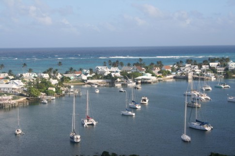
Cruise to Desolation Sound and the Broughtons, British Columbia
81 Photos
Created 26 September 2020
|
 |
From Pender Harbour to Sidney, July 20-26
18 Photos
Created 4 February 2020
|
 |
|
|
 |
 |
 |
Our cruise of the Gulf Islands and San Juan Islands in May & June, 2017
84 Photos
Created 21 July 2017
|
 |
Our first BC cruise, from Pender Harbour to Strait Marine in Steveston BC
26 Photos
Created 27 April 2017
|
|
|
|
Our first year cruising... Exumas, Bahamas.
11 Photos
Created 28 July 2015
|
|
|
 |
 |
 |
 |
 |
 |
 |
 |
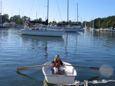
Pics of our trip from Mount Desert Islans to the Saint John River in July 2014.
64 Photos
Created 14 August 2014
|
 |
 |
 |
 |
 |
 |
 |
 |
 |
 |
 |
 |
 |
 |
 |
 |
 |
 |
 |
 |
 |
 |
 |
 |
 |
 |
 |
 |
 |
 |
 |
 |
 |
 |
 |
 |
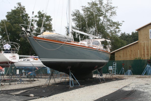
Some photos at John Williams Boatyard as we prepare for departure.
7 Photos
Created 14 September 2010
|
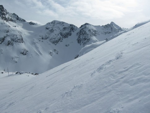 |
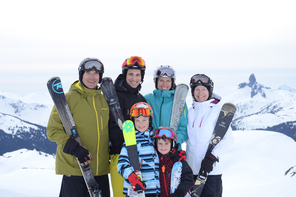
Our trip to various BC ski resorts Jan-Feb 2010
69 Photos
Created 7 February 2010
|
 |
 |
Our trip from Norfolk Va to Mount Desert Island, June 20th to July 7th, 2009. Gerard Watts aboard as crew!
89 Photos
Created 8 July 2009
|
 |
 |
 |
 |
 |
 |
 |
 |
 |
 |
Trip south from Maine to Bahamas, Sept-Dec 2007
42 Photos
Created 26 December 2007
|
 |
 |
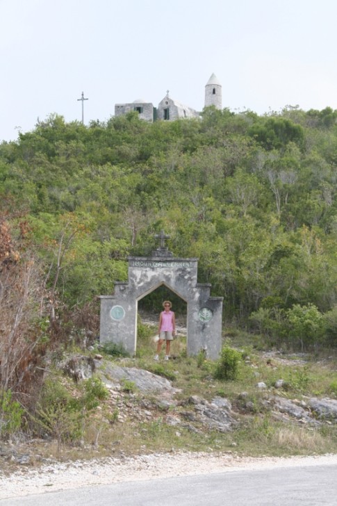 |
These are pictures of The Hermitage on Cat Island, Bahamas. It was built single-handedly by Faather Jerome who was sent out by the Church of England to rebuild churches destroyed in the hurricanes in the early 20th century. He then converted to catholicism and built a number of Roman Catholic churches until he sought and received permission to build this hermitage where he spent the remainder of his life.
10 Photos | 1 Sub-Album
Created 24 June 2007
|
 |
 |
 |
 |
These pictures were taken while on Long Island, Bahamas, in February, 2007
6 Photos
Created 11 March 2007
|
 |
This album contains some photos of our time in the Jumentos Islands, in the Bahamas
11 Photos
Created 11 March 2007
|
 |
 |
 |
 |
 |
 |
 |
 |
 |
 |
Estelle Profile
Who: Jeannie & Jim Lea
Port: Charlottetown, PEI
Gallery
SailBlogs Friends