Once in a lifetime adventure
10 June 2012 | Manjack Cay, Abacos
28 May 2012 | Titusville, Florida
16 May 2012 | Green Turtle Cay, Abaco
16 May 2012 | Green Turtle Cay, Abaco
16 May 2012 | Green Turtle Cay, Abaco
16 May 2012 | Green Turtle Cay, Abaco
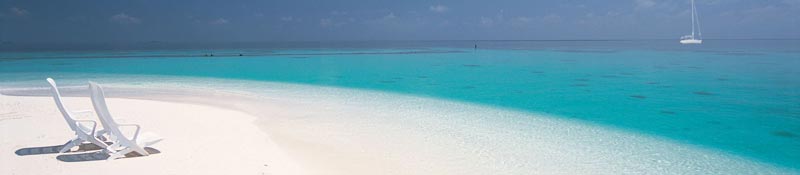
16 May 2012 | Tahiti Beach, Abaco
16 May 2012 | Abacos, The Bahamas
12 May 2012 | Abacos, The Bahamas
29 April 2012 | Great Guana Cay, Abaco
29 April 2012 | Big Guana Cay, Abaco
29 April 2012 | Sea of Abaco
29 April 2012 | Hope Town, Abaco
24 April 2012 | Man O War Cay, Abacos
24 April 2012 | Sea of Abaco
24 April 2012 | Sea of Abaco
14 April 2012 | Great Guana Cay, Abaco
13 April 2012 | Elbow Cay, Abaco
13 April 2012 | Marsh Harbor, Abaco
13 April 2012 | Hope Town, Abaco
Dude, where's our boat?!
20 January 2012 | Warderick Wells, Exuma Islands
Kevin / Sunny 82 degrees
After making the crossing from Fort Lauderdale to the Bahamas, we spent 6 nights on the Island of Grand Bahama, getting ready to continue our journey. The first two in West End, at the Old Bahama Bay Yacht Club, then two days at anchor on a canal near Port Lucaya, then two more days at the Grand Bahama Yacht Club, which is not more than a quarter mile from where we had been anchored.
Old Bahama Bay is the first marina we’ve ever visited where you could see the bottom of the harbor. The place itself is a very nice resort, and has all the amenities of such. A couple of restaurants, a stunning beach, a multi-level pool, and a gym that sadly, I did not take advantage of while there. I was told that John Travolta owned one of the nice houses out on the point, near the entrance of the harbor.
Our trip from West End to Lucaya, was old school. We discovered that our Garmin GPS which was supposed to have charts for the entire East Coast and the Bahamas was somehow lacking any detail for the islands. Oh, you could see the land masses, but the detail was not there. You’re on your own, mack. Bring out the paper charts, dividers, and your parallel rulers, ‘cause the GPS is on vacation. And by the way, watch out for the reefs. But we don’t have no stinkin’ reefs on the Chesapeake! Now, on this trip, we have always had paper charts in the cockpit to back up our GPS. But all the sudden we’re making a 25 mile run around the west side of Grand Bahama to a small inlet in a place we’ve never been. To be cautious, we sailed about 3 miles off shore in water that was thousands of feet deep. Not a lot of possibility that we’re going to hit a reef there. Our guidebook was almost useless, because it said there were four large cruise ship moorings just south of the inlet, that you just could not miss. Additionally, it had a nice large color photograph of the inlet and the surrounding buildings. Problem was, the photo was over ten years old, and all the buildings on the left side of the inlet had been torn down to build a huge hotel. There were no cruise ship moorings. The cruising guide was the 2011 edition. Nice. Thanks, Mr. publisher! I almost peed my pants entering that inlet because of the damn cruising guide. I convinced myself we were going into the wrong place which if true, we could have been motoring right into a shoal area too shallow for Foolish Heart. Not a good thing I will tell you. It was a white knuckle ride the entire way in, and to our relief we were in the right place. We anchored in the canal about a half mile from the Lucaya marketplace, a kind of Bahamian Inner Harbor. On our second day we met Forrest and Susan aboard the Island Packet ,Rejoice!, who were sharing our anchorage. Forrest is a ham radio guy, and gets the latest on the weather over the single side band radio, or SSB. We were informed that the next day there would be winds in the 30 - 40 mph range coming, so by insight and the fact I’m totally chicken, we decided a marina would be the thing to do.
We motored the short distance to the Grand Bahama Yacht Club in rising winds. I did my best not to bounce off the concrete docks, which I am told are not too forgiving on fiberglass boats. After some assistance from fellow boaters and the dock staff, we got Foolish Heart tied up and we waited for the big blow. During this time we met Tom and Sandy from the Taswell 43, Anania. Tom is also a SSB guy, and he and Sandy “adopted” us for the next 6 days by keeping an eye on us, making sure we didn’t do anything stupid. Tough Job.
After 2 days in the marina, the weather cooperated and it was time to head south again.
At 6am we motored out of the marina, through the inlet and out into the Atlantic Ocean. As the sun came up, we raised the sails and had a nice run all the way to Great Stirrup Cay, (pronounced as key) in the Berry Islands. Great Stirrup is used as a “private island” for NCL cruise lines, and I’m sure they call it something like “sunset key” or “paradise isle” or something their marketing department came up with. The name Great Stirrup Cay just won’t hack it in the cruise ship business. We anchored behind the island as the cruise ship sailed off into the distance. At this time Tom & Sandy called on the VHF radio and invited us over for sundowners (drinks). We were anchored not more that 200 feet off their port side, so we rowed the dingy over to avoid the hassle of installing the outboard. It was only 5pm, so I didn’t turn on our anchor light, I figured we’d only be gone an hour or two at best. After 3 hours of exchanging boating war stories, Dorothy and I climbed up into the cockpit of Anania to see only darkness. Now, I don’t mean your average it’s two hours after sunset kind of darkness, but an all encompassing someone locked me in a closet and I can’t see a damn thing kind of darkness. The moon had yet to rise, and we were over 60 miles from any island that had any kind of population. No lights from car dealers, movie theaters, houses, or any kind of civilization. And by the way, we couldn’t see Foolish Heart where we had left her only 3 hours before. I asked Tom if he had a spotlight so I could find our boat, but he came up with a flashlight. It was like turning on a 25 watt bulb in a black hole. Nothing. Nada. Zip. Your boat be gone dude. OK, I was fighting panic at this time, but trying to be calm in front of our new friends. I calmly asked if they had a spotlight onboard, which Sandy managed to locate after about 10 nervous minutes. As we fired that sucker up, there she was, just where we had left her within spitting distance. Holy crap it’s dark! We all cracked up, I think half from relief, half just because it was darn funny. You just don’t realize how much light there is around you all the time when you live on the east coast. Even out in the country, the lights from the cities are always there, giving you some light in the background. In the same vein, it makes the stars pop out here at night, and it puts on one heck of a show.
The next morning we pulled anchor about 10am to make the short hop to Little Harbor Cay, about a 23 mile hop. Again, the winds were kind and we sailed the entire distance. Little Harbor Cay has a population of 3, and those 3 people run a small restaurant on the hillside of the island called Flo’s Conch Bar. We called Chester on the VHF radio to make reservations for the night, but he informed us he was on another island getting supplies, Flo’s would not be open that night. Bummer.
At daybreak, we headed through the island cut and set our GPS for Nassau on New Providence Island, about a 40 mile run. Once again, the winds were with us and we screamed downwind in 6 to 8 foot seas almost reaching 10 knots numerous times. (for those not in the know, for a 35 foot sailboat, it’s like doing 120 mph in your car) We pulled into Nassau shortly after 1pm and made our way past the 7 cruise ships in port, and located an anchorage in the east portion of the harbor. After buying Tom and Sandy a late lunch at the Poop Deck restaurant, (we owed them big for their help) we headed back to our boats and hit our bunks by 9pm for an early departure the next morning for Highbourne Cay in the Exumas. Raising our sails as the sun came up, we were treated to a beautiful sunrise. The winds were strong, and it was a tough run to the island. At one time a wave came over the side of Foolish Heart, soaking me to the bone. Dorothy stayed dry as she was under the protection of the dodger, a kind of tent that covers the entrance into the cabin. As we snuggled up to the lee side of Highbourne Cay, you couldn’t help but notice the clarity of the water. It was like we were sitting in a giant swimming pool. I’ve been to the Bahamas at least 10 times in my lifetime, but never to the outer islands, this was different. In the morning we launched the dingy and motored up to Allen’s Cay where there is a large population of iguanas which will greet you on the beach. They are bold ugly dudes, and they expect to be fed. I’ve got some good video of one chasing me across the beach, and one getting so aggressive with Dorothy she had to retreat into the water. As you walk the island, they just tend to drop out of the trees around you.
The next day Tom & Sandy took off for Georgetown on Great Exuma Cay, leaving us on our own. We sailed the 15 miles to Shroud Cay which is at the top of the Exuma Land & Sea park where we stayed 2 days. We jumped in the dingy to a shallow creek that winded through the island to a beach on the Exuma Sound side of the island. The water was so clear in the creek, that at times it felt like we were flying 10 feet over the creek bed. Besides running into a few people from another boat, we had the entire beach to ourselves. Quite an epic day I would say.
In the morning, we headed out of Shroud Cay and made a run to Warderick Wells, the headquarters for the park about 16 miles away. Even though there was wind, we motored the entire distance just to charge our house batteries. It had been a week since we had been in a marina, and with all the sailing we were doing our batteries were getting low, so we played slow motorboat for the day. After picking up a mooring ball in the harbor, we hiked up to Boo Boo Hill where hundreds of cruisers have left their boat names on pieces of driftwood in a huge mound. The view of the northern Exumas from there is incredible, and we soaked it all in. Every now and then on this trip I get a chill, this was one of those times.
Today we volunteered with the Park Service, doing some painting, trying to do our share to keep this paradise as it is. Tomorrow we will finish up the last of the work we started today, then hopefully make a dive on the reef here. I hear it’s quite spectacular, and I’’m anxious to say hello to the fishes again. Well that’s about it for now. If I get some time tomorrow, I’ll get into Photoshop and resize some pics so we can post them on this site.
Thanks for reading!
Comments
| Vessel Name: | Foolish Heart |
| Vessel Make/Model: | Hunter Legend 35.5 |
| Hailing Port: | Havre De Grace, Maryland |
| Crew: | Kevin Irwin, Dorothy Irwin |
| About: | Kevin - Dorothy - |
Gallery not available
Who: Kevin Irwin, Dorothy Irwin
Port: Havre De Grace, Maryland