
s/v MORNING GLORY

19 January 2014 | 02 21.241'S:105 37.595'E, between Bangka and Sumatra
10 January 2014 | 02 44.5'S:111 43.9'E, Kumai, Kalimantan, Indonesia (Borneo)
07 January 2014 | 06 59.103'S:114 07.199'E, East end of Madura, Eastern end of Java, Indonesia
24 December 2013 | 08 30.473'S:116 01.389'E, Lombok, Indonesia
19 December 2013 | Komodo National Park, Indonesia
14 December 2013 | Komodo National Park, Indonesia
06 December 2013 | 08 31.113'S:119 52.065'E, Labuan Bajo, Flores, Indonesia
05 December 2013 | 08 23.583'S:120 02.972'E, Flores Sea
04 December 2013 | 07 57'S:120 49'E, Flores Sea
03 December 2013 | 07 16.0'S:122 11.7'E, Bone Rate, Indonesia
02 December 2013 | 06 03.9'S:124 08'E, Wakatobi, Indonesia
01 December 2013 | 04 54.932'S:126 13.158'E, The Banda Sea
30 November 2013 | 3 42.134'S:128 10.149'E, Ambon City
25 November 2013 | 4 31.374'S:129 53.872'E, Melissa's Garden, Raja Ampat, Papua
25 November 2013 | 4 31.374'S:129 53.872'E, Raja Ampat
25 November 2013 | 4 31.374'S:129 53.872'E, Banda Neira
18 November 2013 | 1 53.459'S:129 43.990'E, Raja Ampat, Indonesia
18 November 2013 | 1 13.245'S:129 45.069'E, Raja Ampat, Indonesia
17 November 2013 | 0 26.578'S:130 26.639'E, Raja Ampat
10 November 2013 | 0 57.185'S:130 40.136'E, Raja Ampat
On Passage to Tuamotus--Monday July 2
02 July 2012 | 15 41.032'S:145 26.077'W, Tuamotus, French Polynesia
Arthur
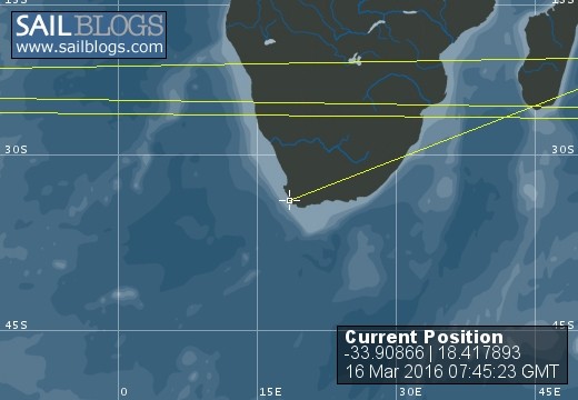
Enjoyed a very bright moonset a couple of hours ago, Followed by sunrise a few minutes ago. We are amongst the Tuamotus, watching some of them slowly pass by on radar. We have yet to actually see on. We are expecting to be at the North Pass of Fakarava at about 11 am where we will take a look at the conditions of the pass. The passes into the various atolls can have strong currents Up to 8-9 or more knots depending on the tide, the seas and the wind. As the seas are small, and the wind is light, and the north pass at fakarava is wide, we are not expecting strong currents. Having spent time in the bahamas going through the many cuts to and from the banks to the the deep water--we've had a bit of training. If the cut is passable when we arrive, we expect to be at anchor around noon today, and snorkeling within minutes thereafter.
Position is as of 1600z (6am local UTC - 10). SOG 6 kts. COG 204 Mag.
Take a look at the google earth position map once we are at anchor, you ought to get a cool view of the atoll and the others nearby!
Position is as of 1600z (6am local UTC - 10). SOG 6 kts. COG 204 Mag.
Take a look at the google earth position map once we are at anchor, you ought to get a cool view of the atoll and the others nearby!
Comments
| Vessel Name: | Morning Glory |
| Vessel Make/Model: | Catana 431 |
| Hailing Port: | New York, Ohio, North Dakota |
| Crew: | Arthur, Amy, Stephen & Rivers Hoag |
| About: | Life is too short to live behind a desk and let a school raise your children. So, we are showing them the world--we are trading the crazy stupid risks that landlubbers accept with blindness and choosing a different path with eyes wide open. Warts and all.... |
| Extra: | So far: Bahamas, Jamaica, Kuna Yala, Panama, Galapagos, Marquesas, Tuamotus, Societies, Suwarrow, Am. Samoa, Tonga, New Zealand, Fiji and Vanuatu, Indonesia, Singapore, and Malaysia, Thailand, Sri Lanka, Maldives, Chagos, Seychelles, Madagascar, Mozambique, South Africa. |
| Home Page: | www.svmorningglory.com |
| Social: |
|
Morning Glory's Photos - Main
 |
 |
 |
 |
 |
 |
 |
 |
 |
 |
 |
Lucked into the Bayou Boogaloo
Cajun Food and Music Festival
13 Photos
Created 4 October 2011
|
 |
 |
 |
 |
 |
 |
 |
 |
 |
12 days on Nathanael
20 Photos
Created 4 October 2011
|
 |
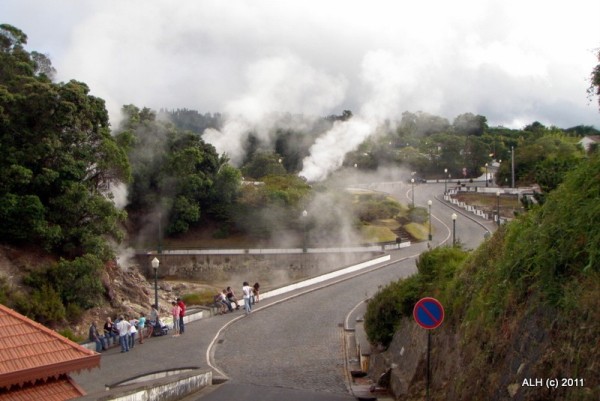
The Azores are the best place I've been yet.
20 Photos
Created 4 October 2011
|
 |
Top of an active underwater volcano about halfway between Terceira and Sao Miguel. Yes, Active. And there is no land in sight. We anchored in 100 feet of water. The dive was between 90 and 110 feet. With sheer drops to amazing depths all around.
Outstanding!!!
10 Photos
Created 4 October 2011
|
 |
 |
 |
 |
 |
 |
 |
April 2010, Rock Sound Rocks.
This is a special place.
23 Photos
Created 24 June 2010
|
 |
April 2010, On the Banks side of Eleuthera, north to south
18 Photos
Created 24 June 2010
|
 |
 |
April 3, 2010 We Made It! Safely in Marsh Harbor, Abacos, Bahamas
23 Photos
Created 24 June 2010
|
 |
March 2010, Departing Beaufort and the Offshore Trip to the Abacos
14 Photos
Created 24 June 2010
|
 |
 |
 |
The Crew of Morning Glory
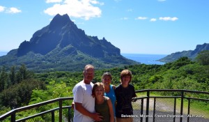
Who: Arthur, Amy, Stephen & Rivers Hoag
Port: New York, Ohio, North Dakota
Gallery


SailBlogs Friends


