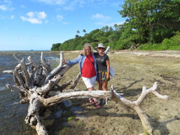
IOLEA 2019
We are an Australian couple who have been cruising on our Hylas 49 since 2010. We are currently in Alaska having sailed from NZ via French Polynesia and Hawaii last year.

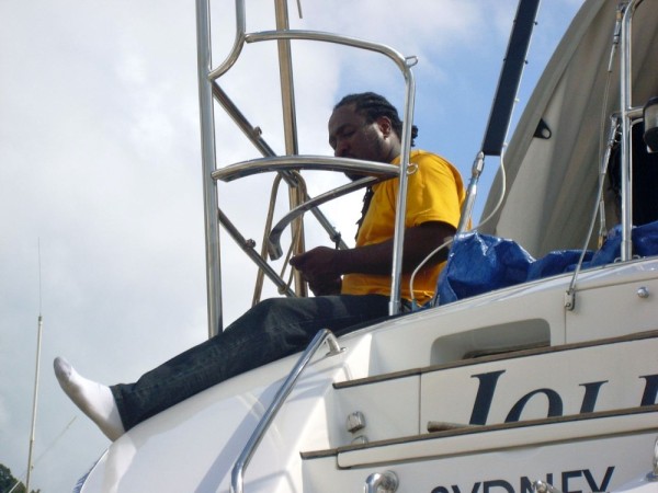
IOLEA
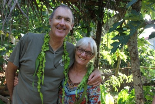
Who: Paul and Kate
Port: Sydney, Australia
Gallery

.jpg)
USEFUL LINKS
- 2019 Alaska
- 2017 Vanuatu
- 2017 Solomon Islands
- 2017 Kosrae
- 2016-17 The Marshall Islands
- 2016 Kiribati
- 2016 Vanuatu
- 2015 Fiji
- Boat systems
- 2013 Panama to Galapagos
- 2013 galapagos to Marquesas
- 2013 Marquesas
- 2013 Rarotonga
- 2013 Niue
- 2011-12 Trinidad
- 2013-15 New Zealand
- 2013 Tonga
- 2013 French Polynesia
- 2013 Galapagos
- 2012-13 Panama
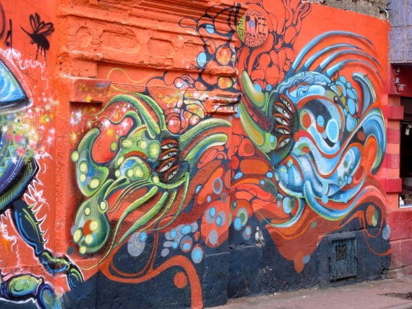
- 2012 Columbia
- 2012 Bonaire
- 2011 East Caribbean
- 2011 Bahamas
- 2010-11 Florida
- 2010 Annapolis - ICW
- Show All Posts
12 July 2020
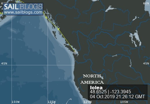
04 October 2019
17 September 2019
08 September 2019
27 August 2019
15 August 2019
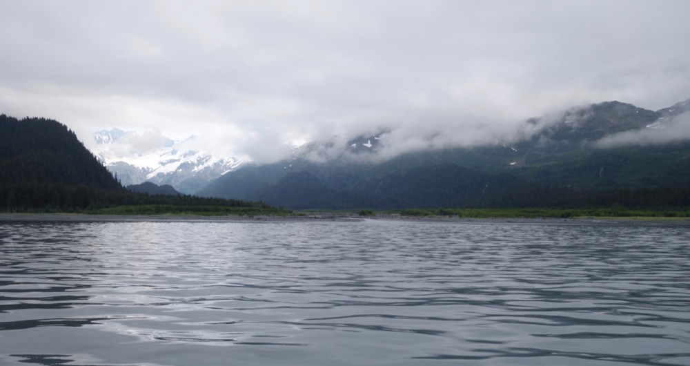
29 July 2019 | Prince William Sound: Snug Harbor
19 July 2019
17 July 2019
16 July 2019 | Aialik Bay, Kenai Peninsular
15 July 2019
14 July 2019 | Northwestern Glacier
13 July 2019 | Kenai Penninsular
12 July 2019 | Pilot Harbor, Kenai Peninsular
11 July 2019 | Kenai Peninsular
10 July 2019 | Kenai Peninsular
09 July 2019 | Afognak Island
08 July 2019 | Afognak Island
06 July 2019 | Afognak Island
05 July 2019 | Kodiak Island
Butaritari, Kiribati
23 November 2016 | Butaritari, Kiribati
November 2016
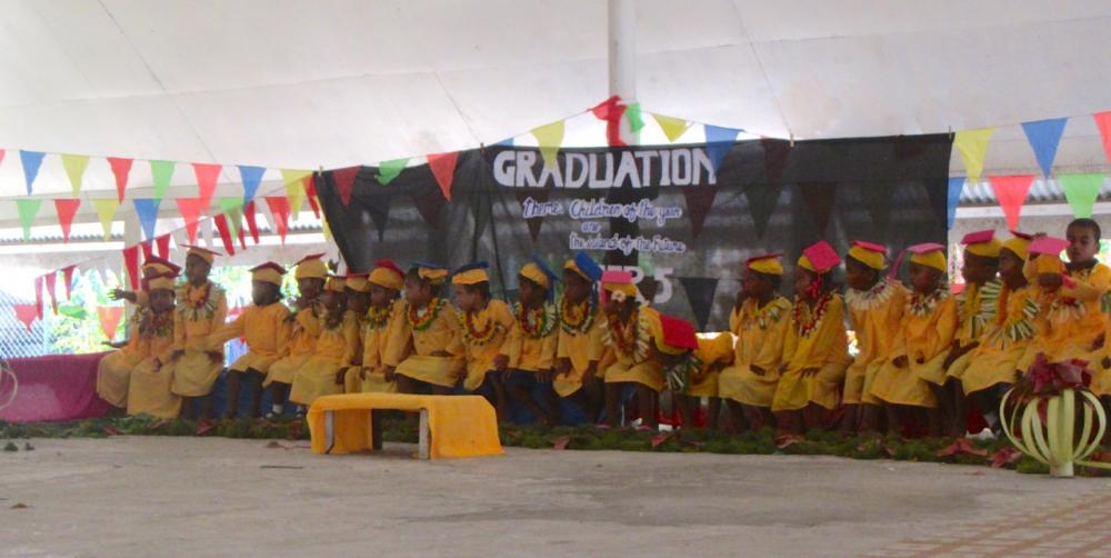
Butaritari is a jewel of a place with warm friendly people. We arrived as the school year was ending and there were graduation celebrations on every day - even for those in pre-school! These little guys behaved beautifuuly all morning and only became uncontrollable after a very late lunch and with their gowns gone.
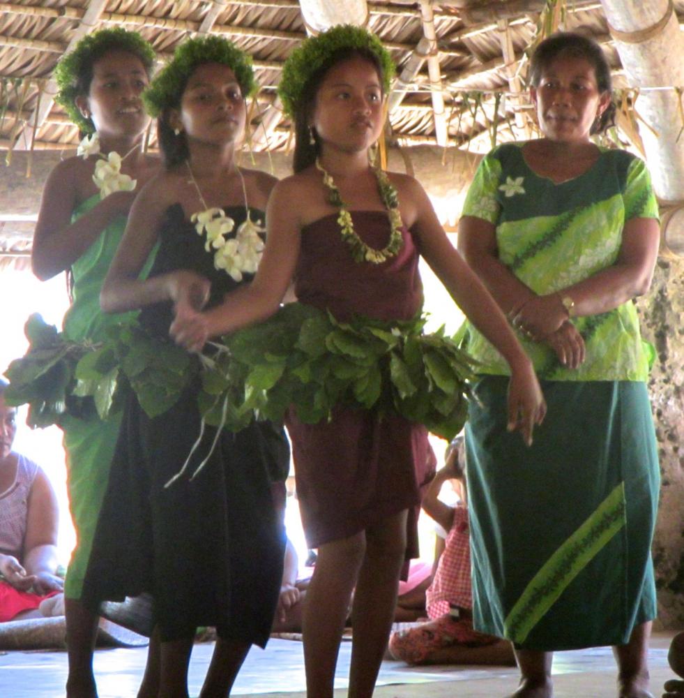
Our friends Rod and Brenda on State of Mind had arranged to sit in on a graduation ceremony at a primary school in Ukiangang and we joined them. We were surprised to see shades of French Polynesia in the girls dancing.
Kiribati is a genuinely quirky country and they love nothing more than to have a good chuckle and to shake-their-bootie. When the boys in the video below got up to dance the whole Manaeba fell about in peels of laughter.
video coming
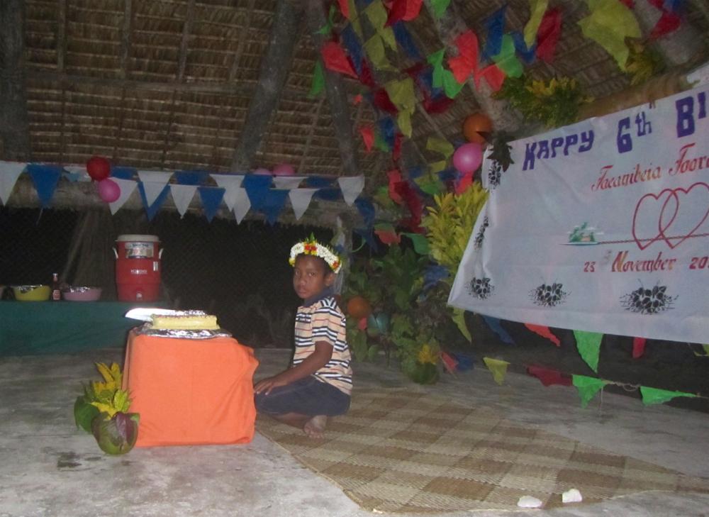
The hospitality in Butaritari is enormous and we could have spent every night at someone's birthday or celebration. This birthday celebration was for the town clerk's son. Its quite formal. None of the wild running around of western birthdays. The cake was made by Tim the policeman.
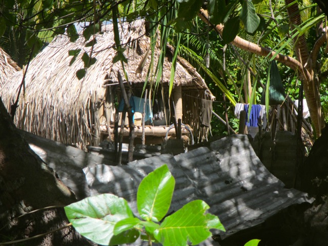
The people of Butaritari have a reputation in Kiribati for being lazy and they certainly are not the most industrious people we have come across. Then, they don't need much. The sea is full of fish and seafood (albeit diminishing) and they grow coconuts, bananas, pawpaw, pumpkins and other vegetables, as well as raising pigs, with little effort. They live in grass huts which are cool and comfortable and have only limited access to western goods and internet so want for very little. This doesn't mean they are simple people. School is very important, most children speak some English, and many adults we met were well travelled. When we arrived it was white ribbon day and there were a good number of women dressed in black preparing to march.
We hired bicycles rather than a motorcycle on Butaritari so we could meander along the roads and avoid missing things. We underestimated the heat and stopped for a rest near a village called Tabukintetau. One of the families came out and ushered us into the cool of their house and gave us drinking coconuts. They also introduced us to toddy which is a delicious black syrup made from cooking the flesh of young coconuts. We had had something similar in Vanuatu at Lakona Bay.
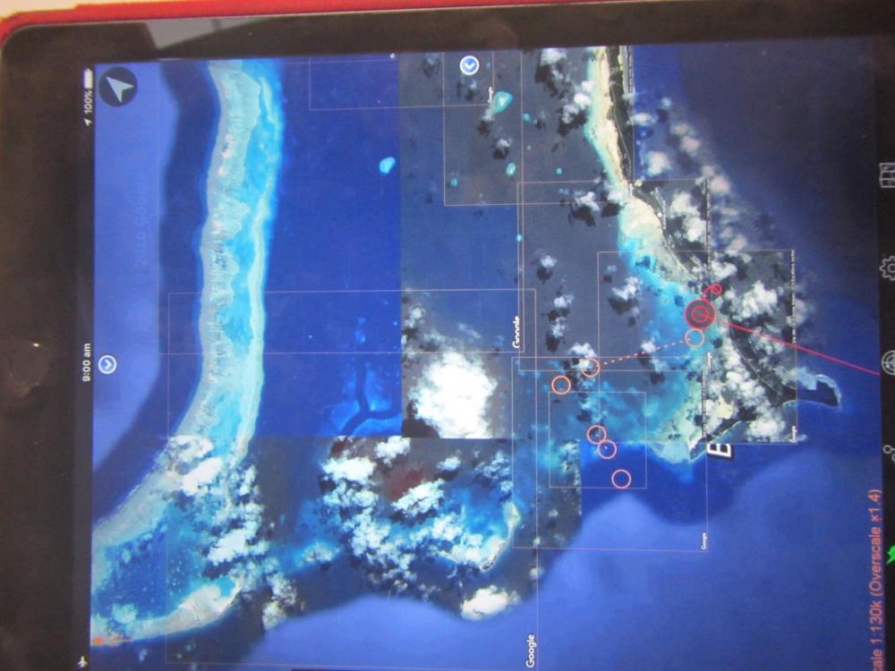
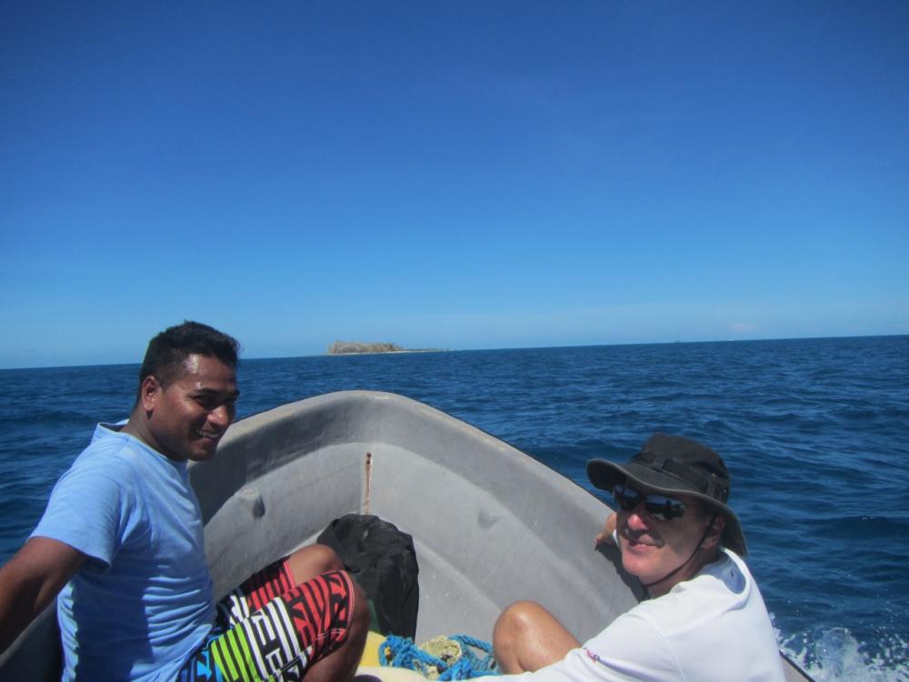
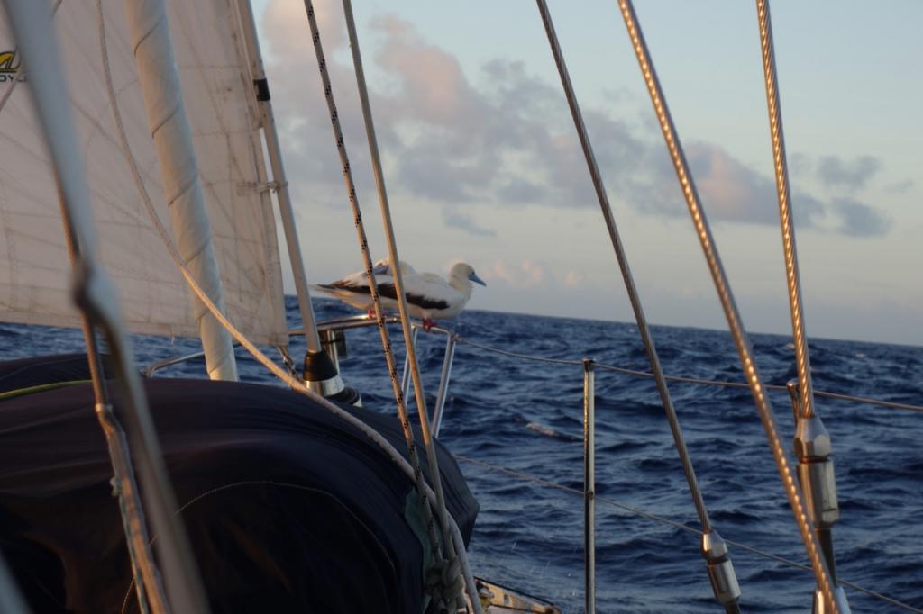
One feature of Butaritari that had intrigued me since looking at a google map was a series of channels on its north west side. They are so sharply defined they look man-made. We hired a longboat with a guide for the day to take us up to the channels. On the way we stopped at Bird Island with its nesting terns, frigates, and gannets. The channels are naturally formed and were used by US Frigates......
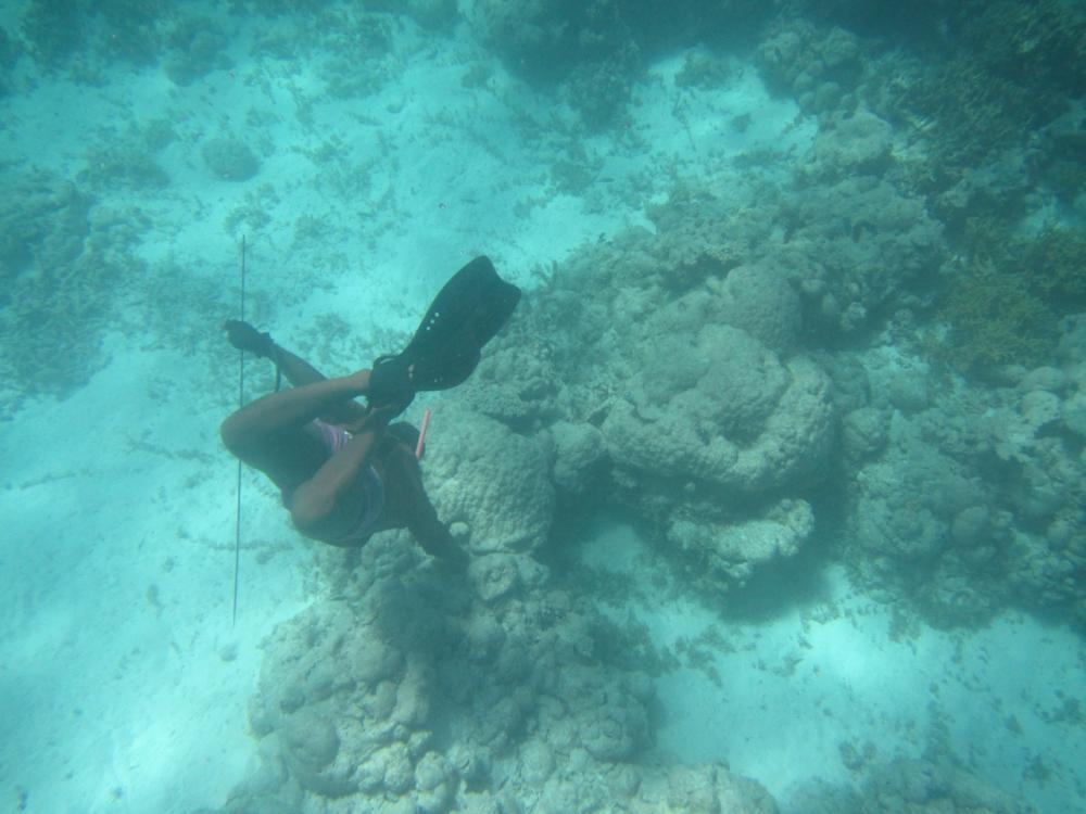
We stopped to watch a couple of men harvesting young giant clams. They had a bucket-full of flesh.
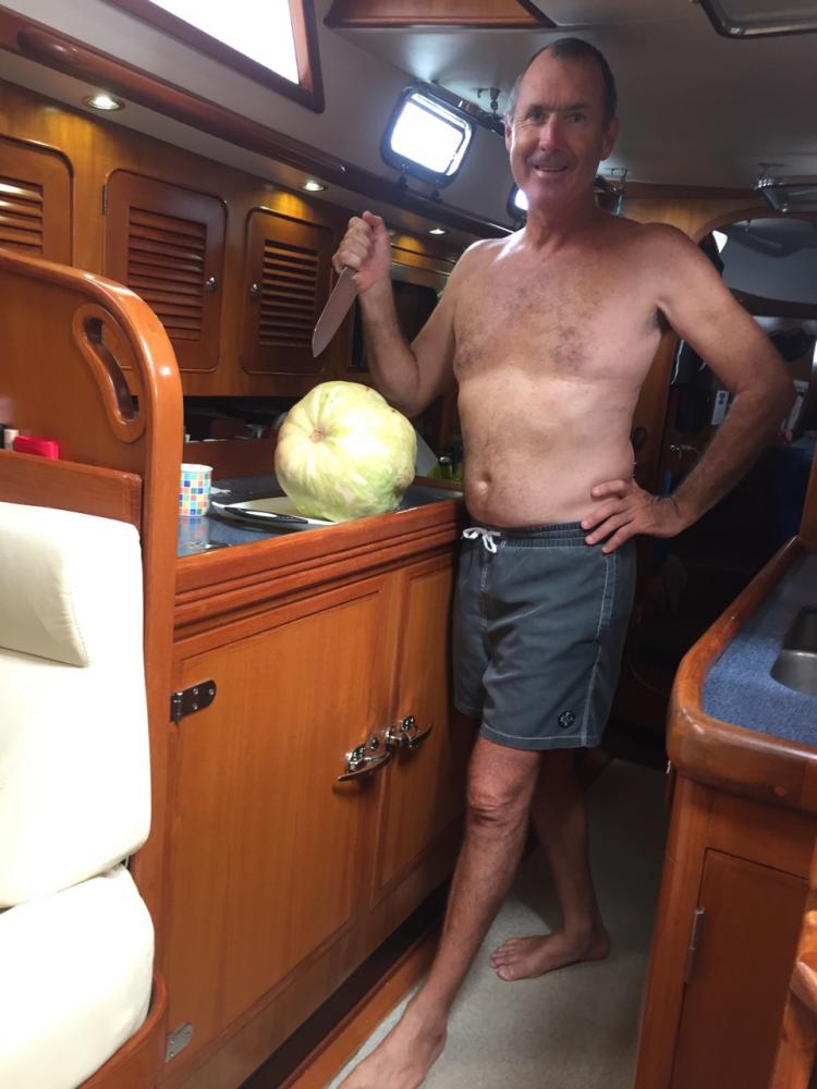
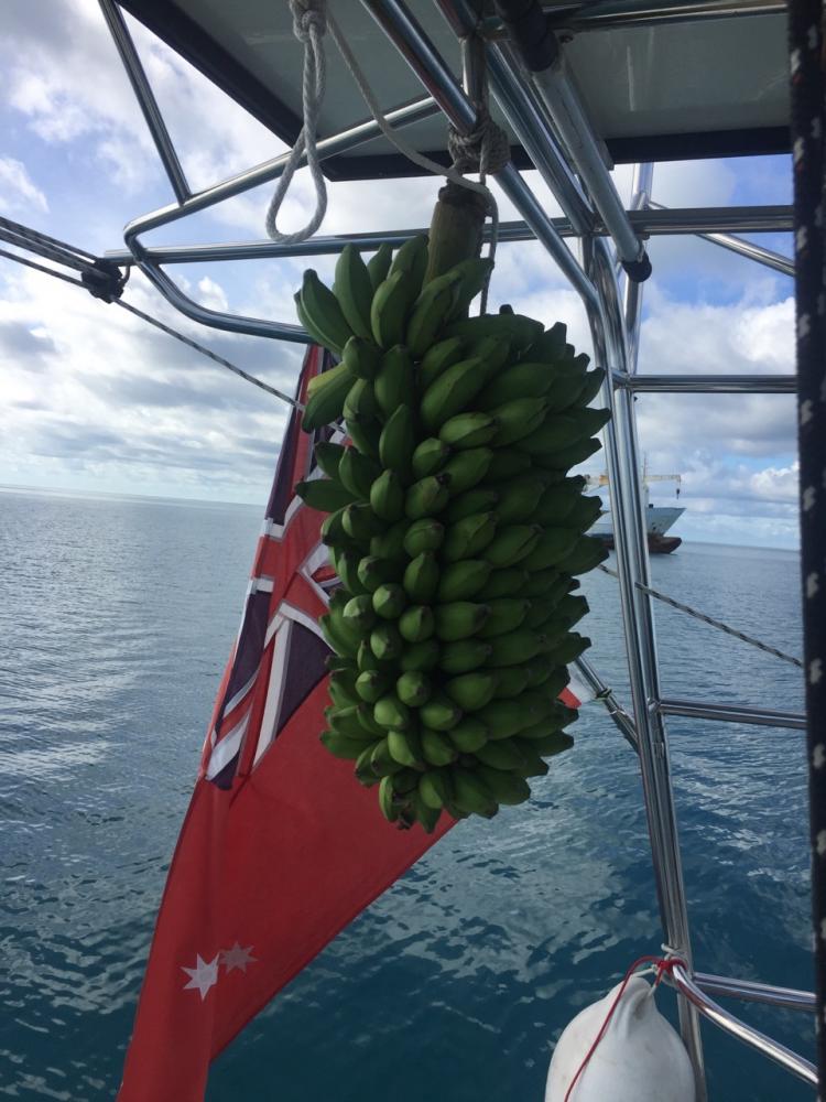
On our last morning in Butaritari Johnny who had been a skipper on trading ships travelling between The Solomons, Vanuatu, Fiji, and Kiribati came to have a look at the boat and brought with him a full stand of bananas. The day before we had been given a massive pumpkin and a dozen limes so we were heading back to Tarawa fully laden. The Stand ripened all at once when we arrived in Tarawa and we became the go-to place for locals to get a free hand of bananas.
Postcript: We left Butaritari thinking it a wonderfully benign place and it is for the most part. But all societies have their secrets and shortly after we left a 9 year old girl from the school where the graduation was held was raped and murdered which was quite a shock.
Our friends Rod and Brenda on State of Mind had arranged to sit in on a graduation ceremony at a primary school in Ukiangang and we joined them. We were surprised to see shades of French Polynesia in the girls dancing.
Kiribati is a genuinely quirky country and they love nothing more than to have a good chuckle and to shake-their-bootie. When the boys in the video below got up to dance the whole Manaeba fell about in peels of laughter.
video coming
The hospitality in Butaritari is enormous and we could have spent every night at someone's birthday or celebration. This birthday celebration was for the town clerk's son. Its quite formal. None of the wild running around of western birthdays. The cake was made by Tim the policeman.
The people of Butaritari have a reputation in Kiribati for being lazy and they certainly are not the most industrious people we have come across. Then, they don't need much. The sea is full of fish and seafood (albeit diminishing) and they grow coconuts, bananas, pawpaw, pumpkins and other vegetables, as well as raising pigs, with little effort. They live in grass huts which are cool and comfortable and have only limited access to western goods and internet so want for very little. This doesn't mean they are simple people. School is very important, most children speak some English, and many adults we met were well travelled. When we arrived it was white ribbon day and there were a good number of women dressed in black preparing to march.
We hired bicycles rather than a motorcycle on Butaritari so we could meander along the roads and avoid missing things. We underestimated the heat and stopped for a rest near a village called Tabukintetau. One of the families came out and ushered us into the cool of their house and gave us drinking coconuts. They also introduced us to toddy which is a delicious black syrup made from cooking the flesh of young coconuts. We had had something similar in Vanuatu at Lakona Bay.
One feature of Butaritari that had intrigued me since looking at a google map was a series of channels on its north west side. They are so sharply defined they look man-made. We hired a longboat with a guide for the day to take us up to the channels. On the way we stopped at Bird Island with its nesting terns, frigates, and gannets. The channels are naturally formed and were used by US Frigates......
We stopped to watch a couple of men harvesting young giant clams. They had a bucket-full of flesh.
On our last morning in Butaritari Johnny who had been a skipper on trading ships travelling between The Solomons, Vanuatu, Fiji, and Kiribati came to have a look at the boat and brought with him a full stand of bananas. The day before we had been given a massive pumpkin and a dozen limes so we were heading back to Tarawa fully laden. The Stand ripened all at once when we arrived in Tarawa and we became the go-to place for locals to get a free hand of bananas.
Postcript: We left Butaritari thinking it a wonderfully benign place and it is for the most part. But all societies have their secrets and shortly after we left a 9 year old girl from the school where the graduation was held was raped and murdered which was quite a shock.
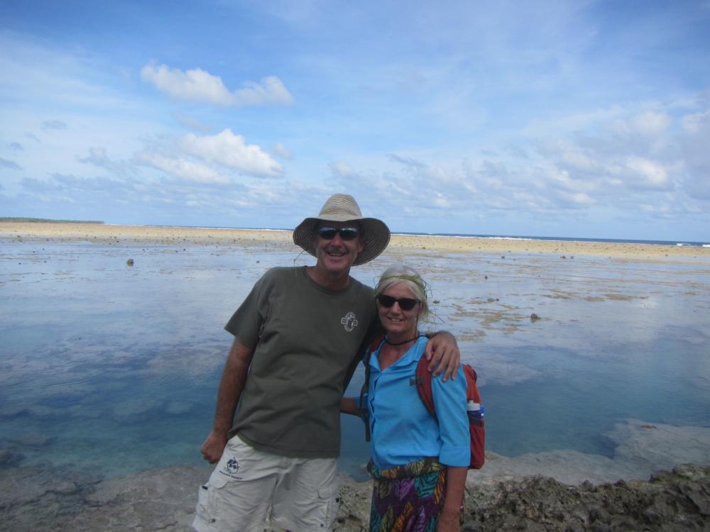
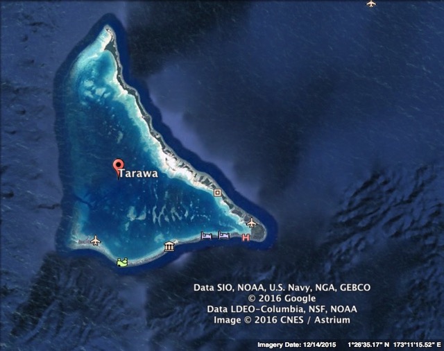
Abaiang, Kiribati
13 November 2016 | Abating, Kiribati
November 2016
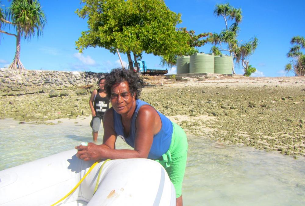
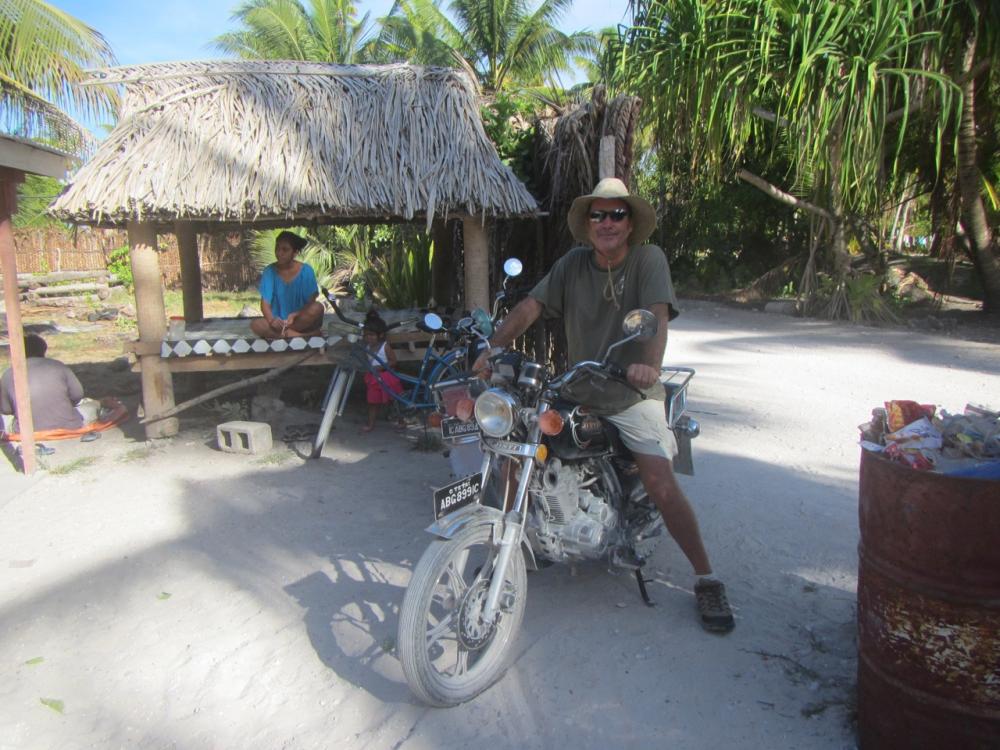
After a couple of weeks in Tarawa we collected our permits to visit Abaiang and Butaritari Atolls which are to the north of Tarawa. Ideally we would visit these as we made our way to Majuro but Kiribati Immigration made it very clear that we should return to Tarawa to check-out of the country. Immigration also limit stays on atolls outside Tarawa to 10 days. There is some leeway in this timing as we discovered in Abaiang when we were given an extra 4 days to wait for a decent sailing window to Butaritari but the local police and quarantine officers on these atolls do monitor visiting boats and note your length of stay. The quarantine officer in Abaiang was particularly vigilant because he had had a run in with a Boat that had brought its dog to shore despite having been told they were not to do so. Still, once he knew we were OK he was chatty and showed us around his Eco resort which is quite lovely. We discovered that dual occupations in government and business can be common. On Butaritari the local policeman, Tim, also makes cakes for birthdays, weddings etc and it was clear where his preference lay.
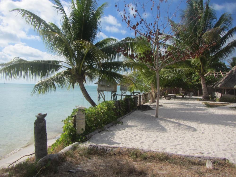
In Abaiang we anchored off the communications tower and government offices and arranged to hire a motorcycle from Nei Wa who runs the private ferries and has a shop and guest accommodation about a km east of the communication tower. Motorcycles and legs are the main transport on Abaiang and it is easy to arrange to hire a motorbike from the council or a local family. Abiang island is about 20kms long and is easily covered by motorcycle in a day.
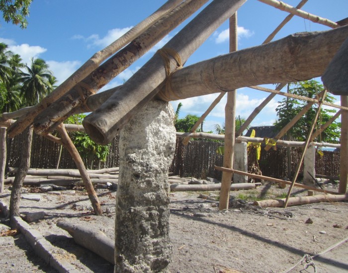
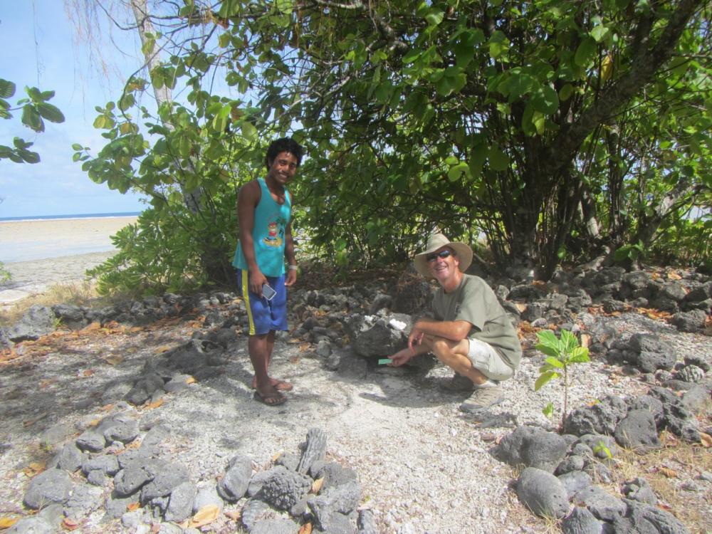
We headed west to the end of the island and to the western ancestral shrine. It is customary when visiting an atoll in Kiribati to first visit the ancestral shrines and make an offering (usually irish tabacco or money). If you fail to pay respect to the ancestors your stay may be cursed and we were happy to avoid any chance of that. The local chief or elder is the keeper of the ancestral shrine. In the west his son took us to the shrine and once we had left our offering placed crowns of local vines on our heads to indicate we had paid our respects. At the eastern shrine, which once again you could easily miss because its just a circle of coral stones almost indistinguishable from the surrounds, the local Chief took us to the site with his daughter.
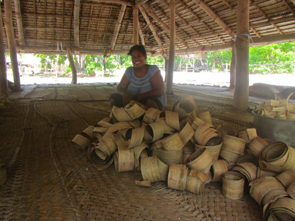
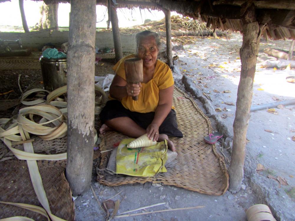
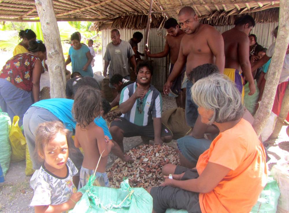
On our way back from the western shrine we stopped to see pandanus being prepared for weaving, then to watch dried copra being sorted and bagged for the copra boat that had arrived during the morning.
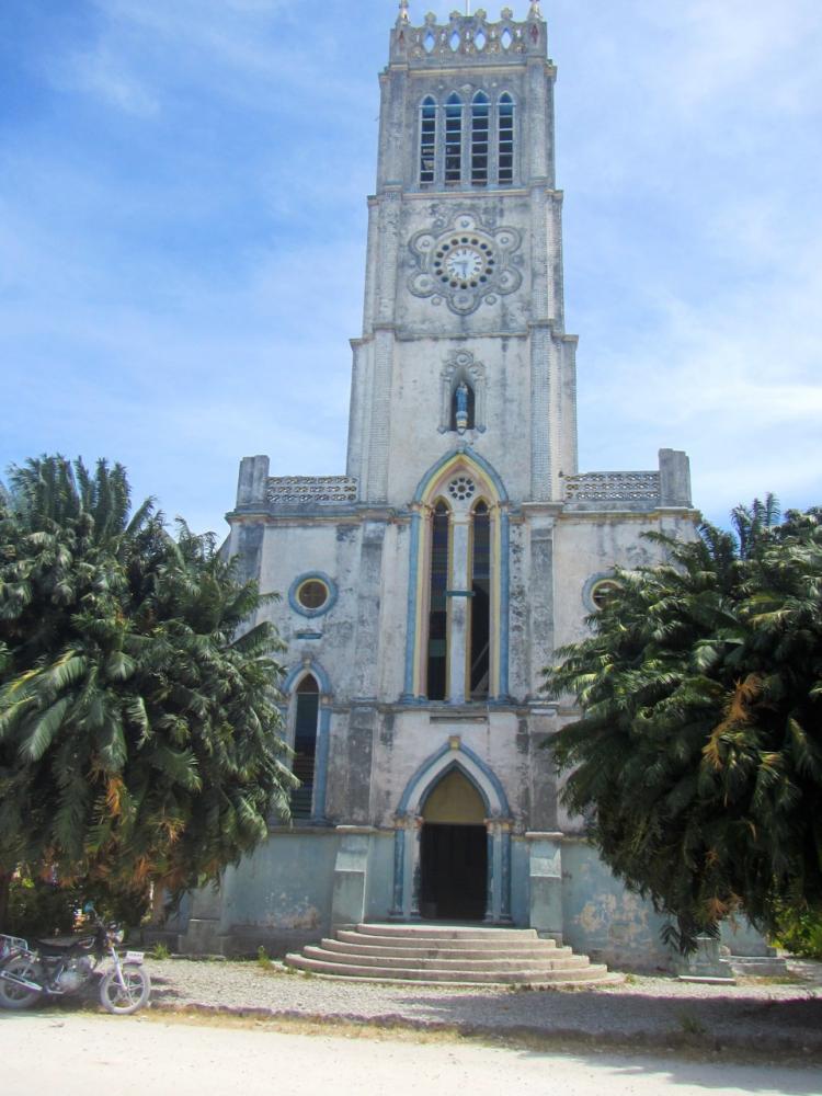
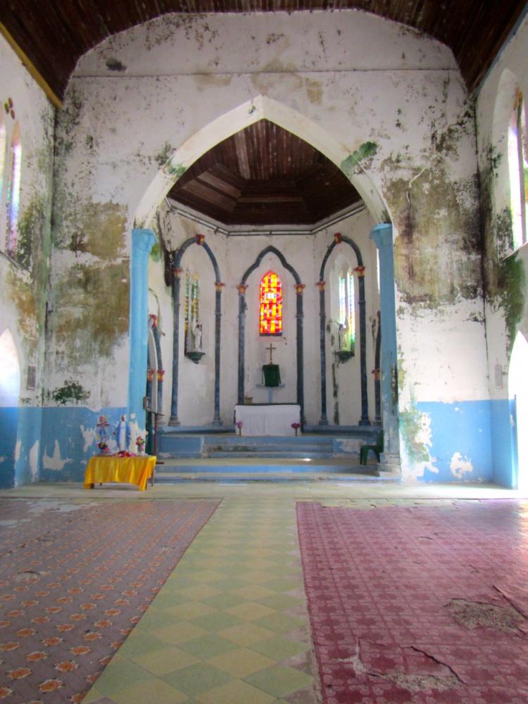
The Cathedral of our Lady of Rosary is large and white and has a bell tower which dominates the skyline and can be seen from well off the coast. The stairs to the top of the bell tower have fallen into disrepair which was disappointing as the view would be panoramic. We were invited by the couple who caretake the Cathedral to sit in the Maneaba to eat our lunch. They are always wonderfully cool.
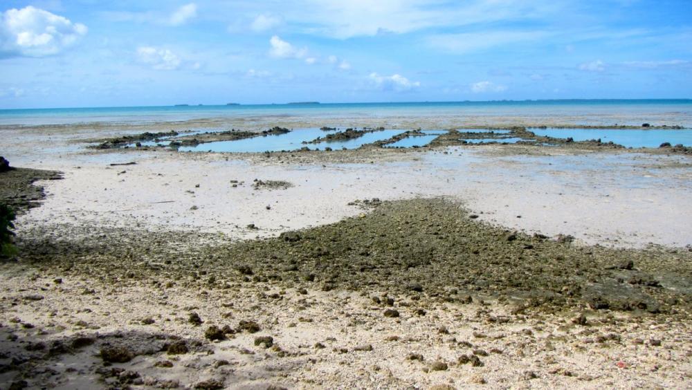
We also stopped at several spots along the road to look at the fish traps carved into the reef. These traps use the tide to trap fish in pools which makes them easy to catch. They have been used for centuries and are still used today.
In Abaiang we anchored off the communications tower and government offices and arranged to hire a motorcycle from Nei Wa who runs the private ferries and has a shop and guest accommodation about a km east of the communication tower. Motorcycles and legs are the main transport on Abaiang and it is easy to arrange to hire a motorbike from the council or a local family. Abiang island is about 20kms long and is easily covered by motorcycle in a day.
We headed west to the end of the island and to the western ancestral shrine. It is customary when visiting an atoll in Kiribati to first visit the ancestral shrines and make an offering (usually irish tabacco or money). If you fail to pay respect to the ancestors your stay may be cursed and we were happy to avoid any chance of that. The local chief or elder is the keeper of the ancestral shrine. In the west his son took us to the shrine and once we had left our offering placed crowns of local vines on our heads to indicate we had paid our respects. At the eastern shrine, which once again you could easily miss because its just a circle of coral stones almost indistinguishable from the surrounds, the local Chief took us to the site with his daughter.
On our way back from the western shrine we stopped to see pandanus being prepared for weaving, then to watch dried copra being sorted and bagged for the copra boat that had arrived during the morning.
The Cathedral of our Lady of Rosary is large and white and has a bell tower which dominates the skyline and can be seen from well off the coast. The stairs to the top of the bell tower have fallen into disrepair which was disappointing as the view would be panoramic. We were invited by the couple who caretake the Cathedral to sit in the Maneaba to eat our lunch. They are always wonderfully cool.
We also stopped at several spots along the road to look at the fish traps carved into the reef. These traps use the tide to trap fish in pools which makes them easy to catch. They have been used for centuries and are still used today.
Tarawa: What a difference a day makes
05 November 2016 | Tarawa, Kiribati
Kate
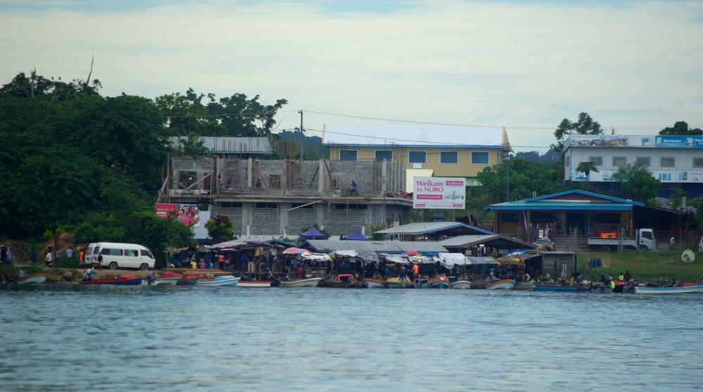
What a difference a day makes. There is a new security man at the dock who speaks English and who takes us to an office where they give us permission to tie at the dock and to come and go around Parliament House. We stop briefly to chat with Sawaii. She has a couple of girlfriends with her and they discuss our plans and what it will cost us to travel to Buota on the bus. We catch an aircon bus down to Bikenibeu where we discover the I-Mart and fresh tomatoes and cucumber and soft icecream cones, as well as the postoffice. We catch another bus that takes us around the fish ponds to the south east, up past the airport which has an impressive runway and is very busy and up to the bridge to Buota which is as far as the bus goes (the bridge is a little rusty).
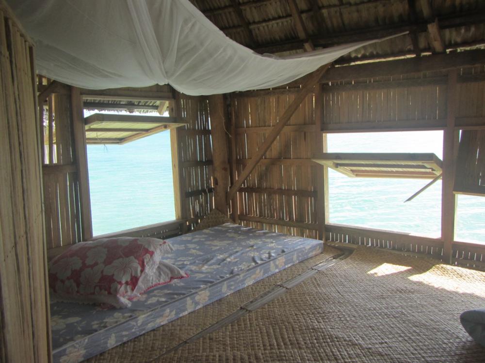
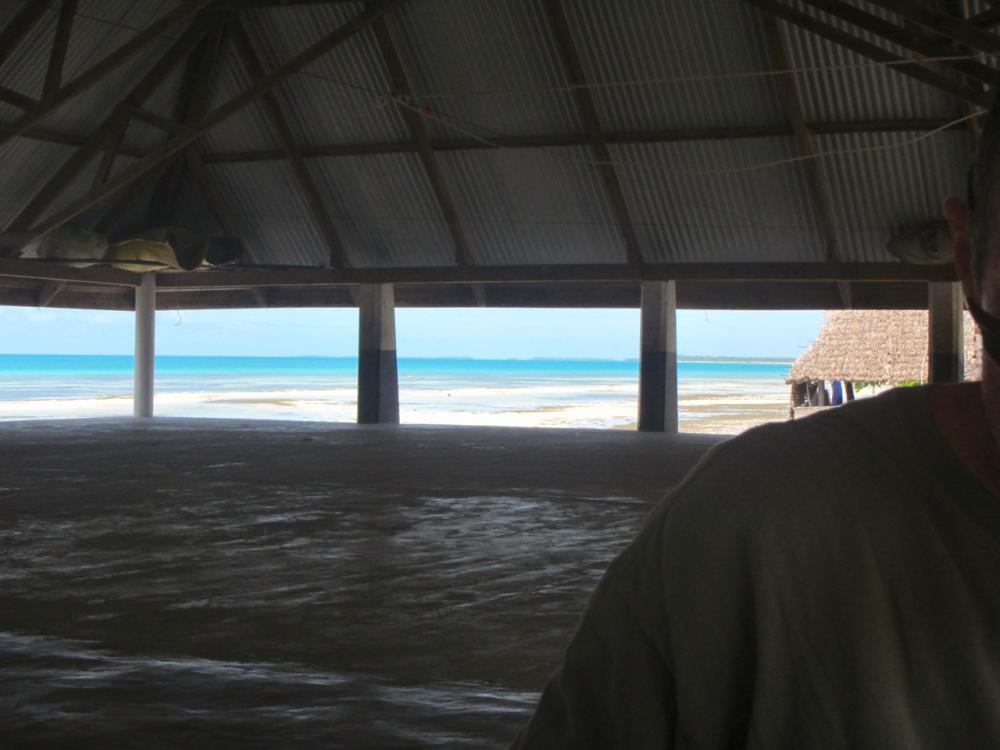
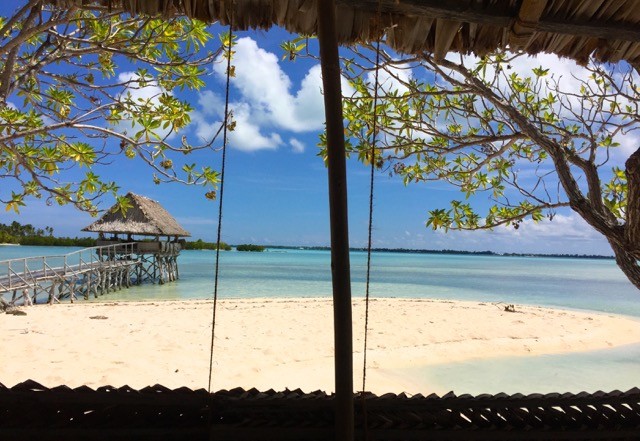
We cross the bridge and walk into Buota, past increasingly traditional villages with their stilted houses, past hammocks swinging between pandanus, their occupants in a semi-stupor as they gaze out to sea, and past sleepy dogs, and families eating lunch in the deep shade of their huts. Eventually we arrive at the cut between Buota and Abatao and our final destination the Tabon Te Keekee. There are two ways to get across the cut. At low tide you can walk across but at higher tides an outrigger with an engine ferries people as they arrive. The tide is up so we pay our 50 cents a head and take the short ride across. A few more steps and we arrive at the resort and sink into chairs with cold beers and softdrinks.
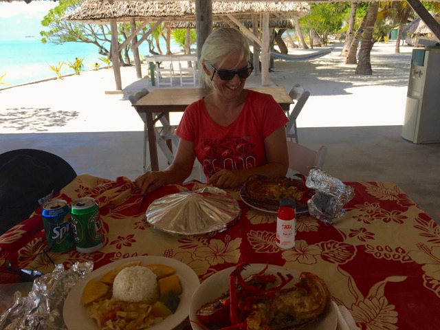
The resort is on the edge of the cut and lagoon. Two sleeping huts sit over the water, Their sides are panels of woven palm which are raised or lowered by twine for privacy and breeze. To the west the lagoon stretches in ribbons of blue and green to the horizon. The water here is clear and two women carry a net and fish below us. We have asked the waitress for fish; me with coconut and Paul's in a curry. She returns apologetic. They have no fish, only lobster. Would that do? We sigh and grin and agree to lobster. Our meal plus 2 beers and 2 softdrinks comes to $42.
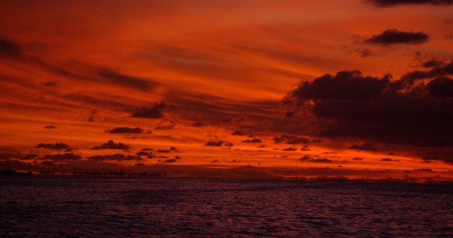
Mid-afternoon we walk back across Buota and catch another minibus. This one has a window missing and the differential is about to drop out but it takes us all the way to Ambo. Our final stop is at one of the local shops where we buy bread and eggs and learn how to say "please stop" for the bus (taiaoka ikai). A final wave and laugh with Sawaii and cold cokes for the security guys and we are back on the boat with no thoughts of heading home. Tarawa is hot and dusty and grubby. But its hard not to like a place when there is lobster on the menu; where the water is the most impossible blue-green; where Gauguinesque women secure their hair with diamond studded clasps or richly coloured combs; where you can take a bus from Ambo to Buota for $2 and when you ask for the bus to stop everyone on the bus choruses in just to make sure he does stop; when you wander into a garden and the owner is more than happy to explain how they live, what they are planting, and the effects of climate change on them; when the 5th shop you enter has a stash of tomatoes and ice-cream cones; and where you can sit in the garden bar at Parliament House and watch the sunset and have a natter to whoever turns up there.
We cross the bridge and walk into Buota, past increasingly traditional villages with their stilted houses, past hammocks swinging between pandanus, their occupants in a semi-stupor as they gaze out to sea, and past sleepy dogs, and families eating lunch in the deep shade of their huts. Eventually we arrive at the cut between Buota and Abatao and our final destination the Tabon Te Keekee. There are two ways to get across the cut. At low tide you can walk across but at higher tides an outrigger with an engine ferries people as they arrive. The tide is up so we pay our 50 cents a head and take the short ride across. A few more steps and we arrive at the resort and sink into chairs with cold beers and softdrinks.
The resort is on the edge of the cut and lagoon. Two sleeping huts sit over the water, Their sides are panels of woven palm which are raised or lowered by twine for privacy and breeze. To the west the lagoon stretches in ribbons of blue and green to the horizon. The water here is clear and two women carry a net and fish below us. We have asked the waitress for fish; me with coconut and Paul's in a curry. She returns apologetic. They have no fish, only lobster. Would that do? We sigh and grin and agree to lobster. Our meal plus 2 beers and 2 softdrinks comes to $42.
Mid-afternoon we walk back across Buota and catch another minibus. This one has a window missing and the differential is about to drop out but it takes us all the way to Ambo. Our final stop is at one of the local shops where we buy bread and eggs and learn how to say "please stop" for the bus (taiaoka ikai). A final wave and laugh with Sawaii and cold cokes for the security guys and we are back on the boat with no thoughts of heading home. Tarawa is hot and dusty and grubby. But its hard not to like a place when there is lobster on the menu; where the water is the most impossible blue-green; where Gauguinesque women secure their hair with diamond studded clasps or richly coloured combs; where you can take a bus from Ambo to Buota for $2 and when you ask for the bus to stop everyone on the bus choruses in just to make sure he does stop; when you wander into a garden and the owner is more than happy to explain how they live, what they are planting, and the effects of climate change on them; when the 5th shop you enter has a stash of tomatoes and ice-cream cones; and where you can sit in the garden bar at Parliament House and watch the sunset and have a natter to whoever turns up there.
Tarawa: First Impressions
27 October 2016 | Tarawa, off Parliament House near Ambo
Kate
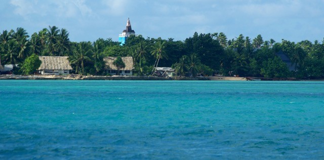
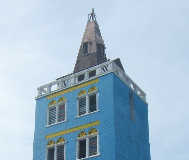
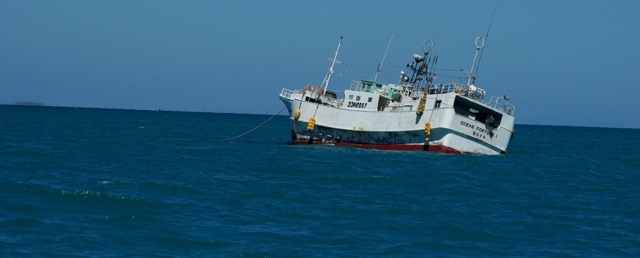
Our first impression of Tarawa from the anchorage in Betio is of golden sand with thatched houses scattered among coconut palms. A spire of blue and gold reaches above the trees looking more like a Moroccan mosque than a Catholic Church. Off the shore fishing boats long wrecked by storms lie settled in spreading rust - deep red contrasting with the bright blue-green of the lagoon. We are anchored amongst a fleet of fishing boats. The only jar in an otherwise idyllic setting.
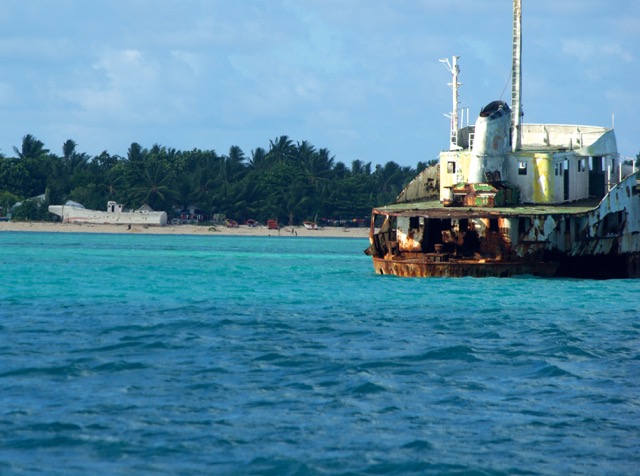
Tarawa is a low-lying atoll which is 3m above sea level at its highest; a point that is highlighted on their maps and stressed in Climate Change conferences. In most areas its possible to see the sea on one side and the lagoon on the other. Sandbags covered with concrete provide protection against the encroaching sea. South Tarawa has one of the highest concentrations of population in the world with a population of around 50,000 crowded on its slivers of land. Coconut palms, pandanus and breadfruit trees provide much needed shade, food, and building materials, and fish ponds help to restock muddied reefs. Tarawa does not have a good reputation; particularly amongst cruisers. Its seen as a scruffy place, covered with rubbish and with an anchorage littered with shipwrecks and the constant threat of decrepit fishing boats dragging their anchors. Their view is reflected in Maarten Troost's "The Sex Lives of Cannibals", a very funny, but affectionate, account of 2 years living in South Tarawa (thank you Laura).
Our first excursion ashore from the anchorage at Betio* began to dispel our early impressions of serene beauty. The water in the small boat harbour is filthy and smelly. Many of the buildings are in disrepair and everywhere is covered in rubble and rubbish - particularly the plastic wraps from iceblocks which are sold everywhere. The spire that looked so impressive from the anchorage is only partially completed and sad close up. Still, there is an underlying charm in the higgledy-piggledy buildings in concrete, fibro, corrugated iron, and traditional thatch.
We had been warned about the lack of fresh produce in Kiribati and so were not disappointed to find only tired refrigerated oranges, apples, pears, and cabbage. Onions are widely available but potatoes not. Apparently, Australia hasn't exported potatoes to Kiribati for a while because of a disease affecting the potato crops. We gathered a few items and headed back to the dinghy where three young boys, stark naked with big white smiles, were playing in the putrid water. We marvelled at their immune systems.
Over the next few days our first impressions gave way to the cruising view. The wind picked up and the Betio anchorage became quite boisterous. Iolea pitched and so did the rickety fishing boats around us so we decided to move to an anchorage off Parliament House near Ambo that friends on Pacific Highway had recommended .
We picked around reefs and found a comfortable and far less choppy spot off parliament. We had been told that another advantage of this anchorage is the dock at Parliament House. Tarawa's lagoon has extensive reefs and so there are limited spots where it is possible to dinghy ashore at all tides. The PH dock has a low-tide channel and 24hr security so is ideal for cruisers, but on our first attempt to tie-up we were told that no dinghies are allowed. The security guard had very little English so it wasn't possible to enquire further. Instead, we dinghied along the side of the house in a shallow drain to where a local woman called Sawaii greeted us with big smiles. She helped us ashore, took our oars and fueltank and secreted them in one of her huts. She then took us to the bus stop and explained how much it costs to go to Bairiki, our destination, and how the buses work. Sawaii has only 7 years of schooling but her English is great. Something we were surprised to find was not so common in Kiribati.
Our destination was a 2-storey shopping mall and ATHKL - the government telecom and internet service. Our phones were up and running in no time with the going rate $20 for 1.6gigs. The mall was a disappointment but again not unexpected. The escalator gave out long ago and is rusted into place. Downstairs is a supermarket with basics and some refrigerated goods. There is no "fresh" margarine, and butter is scarce, but you can buy both in longlife versions. There are shelves of oil, rice, soya sauce, and crackers. A woman across the road sells bananas and pumpkin which is a bonus.
We hadn't had a meal off the boat for two weeks so decided to have lunch at the Utirerei Hotel just down the road from Sawaii. We ordered fish and chips and were served tired looking tuna and chips - nothing else. No sign of any other colour than yellow. Still, it meant a night off cooking and so we ate our meal and took our weary, hot bodies back to Sawaii's and the putrid drain and dinghied back to the boat feeling a little deflated.
Today we are staying on the boat and I dream of turning around and sailing south. All I want to do is go home. I am sick of the heat, of the prospect of dusty, sweaty rides to find modest bits of fresh produce. Of tasteless meals ashore and the need to wade in putrid water every time we go anywhere. We are now firmly in the negative camp on Tarawa. Going home is not an option though, so we decide to head to North Tarawa for the day tomorrow and to a little resort called Tabon Te Keekee that has nice reviews on Tripadvisor. It means a series of bus rides where we can hop on and off and explore a bit more and maybe even swim in clean water. Paul is also determined to dock at Parliament. Cruisers have done so in the past and a nearby local has indicated that it is possible so we will tackle the security man on the dock tomorrow.
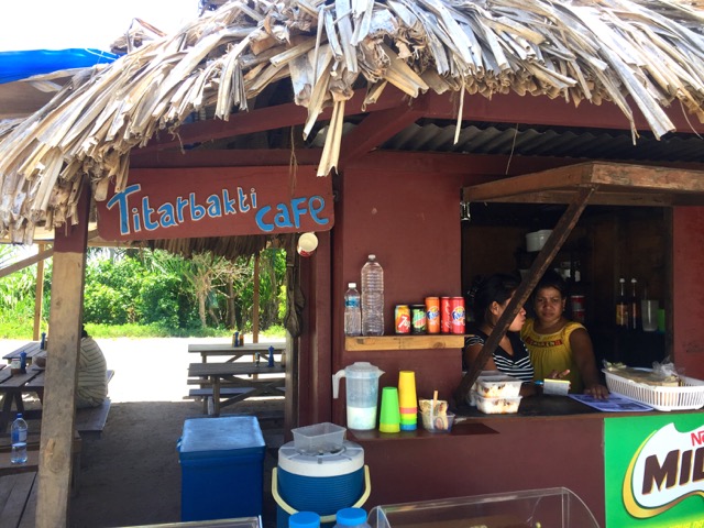
*(Betio is pronounced Beso since ti = s, hence Kiribati is pronounced Kiribass and Titabakti = Starbucks!).
Tarawa is a low-lying atoll which is 3m above sea level at its highest; a point that is highlighted on their maps and stressed in Climate Change conferences. In most areas its possible to see the sea on one side and the lagoon on the other. Sandbags covered with concrete provide protection against the encroaching sea. South Tarawa has one of the highest concentrations of population in the world with a population of around 50,000 crowded on its slivers of land. Coconut palms, pandanus and breadfruit trees provide much needed shade, food, and building materials, and fish ponds help to restock muddied reefs. Tarawa does not have a good reputation; particularly amongst cruisers. Its seen as a scruffy place, covered with rubbish and with an anchorage littered with shipwrecks and the constant threat of decrepit fishing boats dragging their anchors. Their view is reflected in Maarten Troost's "The Sex Lives of Cannibals", a very funny, but affectionate, account of 2 years living in South Tarawa (thank you Laura).
Our first excursion ashore from the anchorage at Betio* began to dispel our early impressions of serene beauty. The water in the small boat harbour is filthy and smelly. Many of the buildings are in disrepair and everywhere is covered in rubble and rubbish - particularly the plastic wraps from iceblocks which are sold everywhere. The spire that looked so impressive from the anchorage is only partially completed and sad close up. Still, there is an underlying charm in the higgledy-piggledy buildings in concrete, fibro, corrugated iron, and traditional thatch.
We had been warned about the lack of fresh produce in Kiribati and so were not disappointed to find only tired refrigerated oranges, apples, pears, and cabbage. Onions are widely available but potatoes not. Apparently, Australia hasn't exported potatoes to Kiribati for a while because of a disease affecting the potato crops. We gathered a few items and headed back to the dinghy where three young boys, stark naked with big white smiles, were playing in the putrid water. We marvelled at their immune systems.
Over the next few days our first impressions gave way to the cruising view. The wind picked up and the Betio anchorage became quite boisterous. Iolea pitched and so did the rickety fishing boats around us so we decided to move to an anchorage off Parliament House near Ambo that friends on Pacific Highway had recommended .
We picked around reefs and found a comfortable and far less choppy spot off parliament. We had been told that another advantage of this anchorage is the dock at Parliament House. Tarawa's lagoon has extensive reefs and so there are limited spots where it is possible to dinghy ashore at all tides. The PH dock has a low-tide channel and 24hr security so is ideal for cruisers, but on our first attempt to tie-up we were told that no dinghies are allowed. The security guard had very little English so it wasn't possible to enquire further. Instead, we dinghied along the side of the house in a shallow drain to where a local woman called Sawaii greeted us with big smiles. She helped us ashore, took our oars and fueltank and secreted them in one of her huts. She then took us to the bus stop and explained how much it costs to go to Bairiki, our destination, and how the buses work. Sawaii has only 7 years of schooling but her English is great. Something we were surprised to find was not so common in Kiribati.
Our destination was a 2-storey shopping mall and ATHKL - the government telecom and internet service. Our phones were up and running in no time with the going rate $20 for 1.6gigs. The mall was a disappointment but again not unexpected. The escalator gave out long ago and is rusted into place. Downstairs is a supermarket with basics and some refrigerated goods. There is no "fresh" margarine, and butter is scarce, but you can buy both in longlife versions. There are shelves of oil, rice, soya sauce, and crackers. A woman across the road sells bananas and pumpkin which is a bonus.
We hadn't had a meal off the boat for two weeks so decided to have lunch at the Utirerei Hotel just down the road from Sawaii. We ordered fish and chips and were served tired looking tuna and chips - nothing else. No sign of any other colour than yellow. Still, it meant a night off cooking and so we ate our meal and took our weary, hot bodies back to Sawaii's and the putrid drain and dinghied back to the boat feeling a little deflated.
Today we are staying on the boat and I dream of turning around and sailing south. All I want to do is go home. I am sick of the heat, of the prospect of dusty, sweaty rides to find modest bits of fresh produce. Of tasteless meals ashore and the need to wade in putrid water every time we go anywhere. We are now firmly in the negative camp on Tarawa. Going home is not an option though, so we decide to head to North Tarawa for the day tomorrow and to a little resort called Tabon Te Keekee that has nice reviews on Tripadvisor. It means a series of bus rides where we can hop on and off and explore a bit more and maybe even swim in clean water. Paul is also determined to dock at Parliament. Cruisers have done so in the past and a nearby local has indicated that it is possible so we will tackle the security man on the dock tomorrow.
*(Betio is pronounced Beso since ti = s, hence Kiribati is pronounced Kiribass and Titabakti = Starbucks!).
Passaging from Vanuatu to Kiribati and The Marshalls
26 October 2016 | Tarawa, Kiribati
Sunny, Light breeze (same for the last week)
When we first decided to sail north from Vanuatu for the cyclone season we started to look for others' experience of the same passage. The common route outlined in cruising guides to the Marshall Islands is via Wallis and Futuna, then Tuvalu, Kiribati (Gilbert Islands) and finally on to Majuro. This route takes advantage of the SE-E trades which blow fairly constantly until Nov when more northerly winds can set in. There is quite a lot written on that route and its ups and downs. Most bemoaning the need to beat against northerly winds that have a habit of arriving just as they are trying to reach Tarawa. Only one other boat, that we could find, had written on this passage, the sv Lorelie. They left in November for Kiribati also from Luganville and took 11 days. Their blog gives a good overview of their trip.
We considered our options. One was to sail/motor to Fiji in one of the rare periods where the SE trades are down and the winds are either more north or more south or backing north to south. This would put us on the traditional route and mean we could visit Tuvalu and its islands and break up the passage to Kiribati. On the downside we first had to get to Fiji which meant we had to take a weather window when it arose and that might mean cutting our time in Vanuatu short and there was still so much to see. Also, we had Iolea's 24 tonnes which is almost impossible to move in light winds from behind. The other option was to sail the 1,100 (2,000kms) miles straight from Vanuatu and try to get some easting in early and along route. Iolea goes well to windward and we thought she would do Ok close-hauled in lightish winds. We contacted Met Bob in NZ and asked his opinion. He felt that either way faced the challenges of head winds and the convergence zones with their squalls and windless periods. So we decided to stick with Vanuatu.
In early October we got serious and had Bob Met start assessing the weather for going north along with us. The last time we passaged in the tropics was to and from Galapagos and we travelled over glassy mountains travelling north from Antartica and through lines of squalls that rolled over us and spat us out the other side. This time we were to go through the South Pacific Convergence Zone to Kiribati then through the InterTropical Convergence Zone to The Marshall Islands. Ideally, you want to travel through these when they are least active to avoid nasty squalls. So, for now that means waiting because the SPCZ is active and we need it to drop a lot of rain and head south. Then we need some winds that will allow us to go north east. The prevailing winds in this area are SE-E and so is the swell which means we need SE or light easterlies to get some easting in. If we don't we will be spending the cyclone season in The Solomon Islands which is not a bad prospect but not one we had planned. At that time it looked like we might be able to head to Kiribati Tuesday 11th but tropical weather is unreliable so we waited to see how the current activity played out.
As expected a tropical disturbance developed north of Fiji and promised to pull a lot of moisture out of the tropics. At the same time the MJO which was moving towards the west Pacific had weakened which reduced the risk of substantial convection in the convergence zones. The tropical disturbance was to pass between Vanuatu and Fiji and so provide us with a southerly wind lift then a day or so of no wind which would help us get in the necessary easting. The SPCZ at around 10 degrees was fairly inactive and from there the winds were forecast to be ESE-E 8-14 knots for most of the passage. Bob thought this was a reasonable window too and to get the best lift from the southerlies Sunday 9 looked good for departure on the back of the depression.
Sunday arrived and we weren't ready. We had been uncertain as to how long the depression would take to go through and had decided to hold off checking out on Friday. Our experience of sailing in Vanuatu waters is that any sea 2 metres-plus is a total pain to sail in, especially if you are sailing into them. The period between peaks is often 5-7 seconds so the boat hardly has time to recover from one wave when another is on top of her. We had been close hauled in 1.5 metre seas going to Gaua from Santo and could hardly get above 3 knots, even with the help of the engine.
Anyway, the delay turned out to be the right decision even if we did miss a little of the push from the southerlies. An unforecast low suddenly appeared off New Caledonia on the Saturday and churned the seas even further than the depression. So, our final departure on Tuesday meant a little more motoring at the start but into relatively easy seas. By the way, the Segond Channel off Luganville accelerates wind and so the conditions can seem worse than they are off Santo.
The passage took 9 days to the hour. It was longer than anticipated but we didn't mind. It was one of the easiest passages we have experienced and we chose to sail at 3-4knots at times rather than turn on the engine - comfort rather than heat. We had daily Met Bob updates and pulled down grib files and satellite images to keep us abreast of weather conditions.
Here is a summary of the passage over 11-20 October:
We left quite early from Vanuatu for several reasons. We weren't sure how many weather opportunities there would be for sailing north from there and didn't want to a. run into northerlies and b. get caught in an early cyclone since Vanuatu can be prone to cyclones.
We motored or motor-sailed for 2 days (50 hrs). Some of this was to work around and through squalls but mostly because we had insufficient wind to sail. Otherwise, the sailing was very pleasant but leisurely. I think we averaged just over 5 knots.
We started out on SW-S 5-8 knots, then ESE to E 10-15 knots for most of the trip. It went NE and light for a short period around 06 00 - 07 00S then back to E and then NE 10 knots after the equator.
Currents were favourable (ie east or north) until around 06 00S then it went more NW to W at over a knot (this could be partly our log but it certainly affected our speed and meant we were pinching more).
We would try to make more easting next time. At 6 00S we were 173 12E. 173 30E would have given us more scope to counter the west-going current which became quite strong north of the equator 2.5 -2.9 knots.
We ran into the SPCZ at around 10 degrees and had squalls on and off for two days but they were moderate thanks to the convergence zone being relatively inactive. The strongest and first squall had a 35 knot spike but most were only up to 25 knots. We initially tried to dodge them but in the end chose to drove through - we would have been less willing to do this if they were 35 plus knots.
The swell never got higher than 1.5 metres and for most of the time was around 0.5m. Occasionally we had a small swell from the north which slowed us down.
Wish all sailing was like this.!
[Will update for the Marshall's leg when we do it]
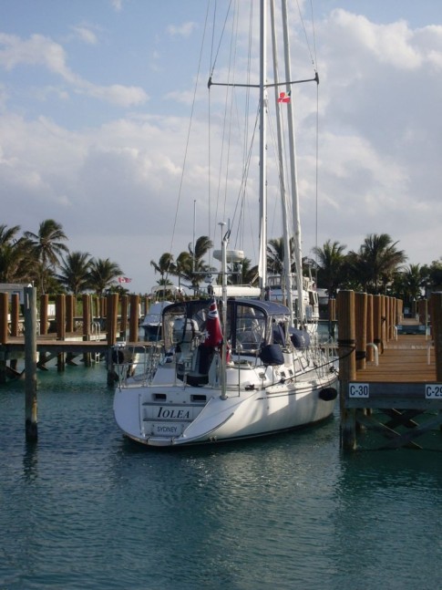
| Vessel Name: | Iolea |
| Vessel Make/Model: | Hylas 49 |
| Hailing Port: | Sydney, Australia |
| Crew: | Paul and Kate |
| About: | We are an Australian couple on a 2003 Hylas 49 and have been cruising from the Caribbean to the South Pacific since 2010. We are now in Alaska after 6 years in the tropical Pacific |
| Social: |
|
Iolea's Photos - Main
 |
|
 |
 |
 |
 |
 |
.jpg) |
 |
 |
 |
 |
 |
 |
Another visit to Minca and 10 days anchoring in Tayrona Park
34 Photos
Created 18 August 2012
|
 |
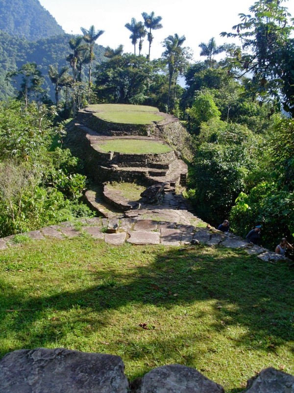 |
6 day hike to Cuidad Perdida (the Lost City) in Columbia
39 Photos
Created 17 August 2012
|
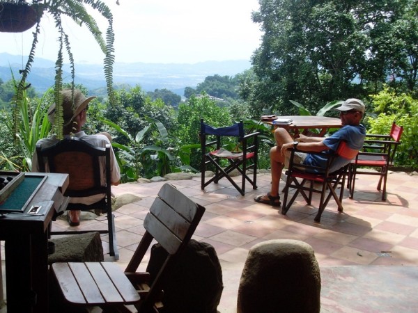 |
Today we took a taxi with bob and Vicky from FoxSea to the foothills of Sierra Nevada de Santa Marta to a place called Minca. It sits in heavy rainforest. Basic concete dwellings ,cafes, and restaurants and music and children everywhere. We visited a local artist, Leila, and her agronomist husband Guillame and I plan to take an afternoon class with her to make paper and build a visual diary - I'm looking forward to it, they are delightful people. Above the town via the stairs next to the church, across the concrete basketball field for the high school and up 200 stairs sits a hostel with hammocks, cold beer and views to the coast. Its run by Stephanie who is English and a refugee from London. Her dog Lola took us for a walk through the forest earlier in the day - very deliberate and well mannered
5 Photos
Created 19 June 2012
|
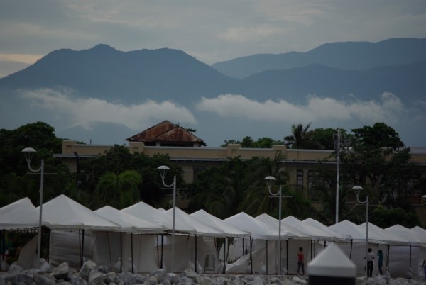 |
The colour of the sunset is not enhanced. That is how it looked - blood red.
The remaining three photos are arriving in Santa Marta
9 Photos
Created 19 June 2012
|
 |
 |
 |
Will get to this tomorrow
22 Photos
Created 29 February 2012
|
 |
 |
 |
 |
 |
 |
 |
 |
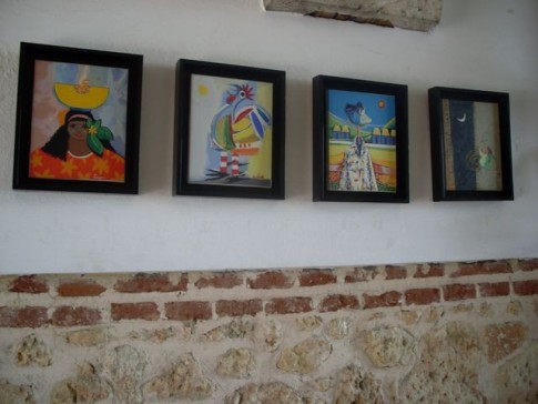 |
photos of artworks
43 Photos
Created 17 May 2011
|
 |
 |
 |
 |
IOLEA
Who: Paul and Kate
Port: Sydney, Australia
Gallery
USEFUL LINKS
- 2019 Alaska
- 2017 Vanuatu
- 2017 Solomon Islands
- 2017 Kosrae
- 2016-17 The Marshall Islands
- 2016 Kiribati
- 2016 Vanuatu
- 2015 Fiji
- Boat systems
- 2013 Panama to Galapagos
- 2013 galapagos to Marquesas
- 2013 Marquesas
- 2013 Rarotonga
- 2013 Niue
- 2011-12 Trinidad
- 2013-15 New Zealand
- 2013 Tonga
- 2013 French Polynesia
- 2013 Galapagos
- 2012-13 Panama
- 2012 Columbia
- 2012 Bonaire
- 2011 East Caribbean
- 2011 Bahamas
- 2010-11 Florida
- 2010 Annapolis - ICW
- Show All Posts