
SV Irish Melody
12 November 2017 | Vuda Marina Fiji
26 June 2014 | 17 14.963'S:176 50.086'E, South of the Yasawas
23 June 2014 | 13 40.036'S:177 51.919'E, South of Rotuma
16 June 2014 | 08 31.477'S:179 11.432'E, Funafuti Atoll, Tuvalu
11 June 2014 | 06 21.740'S:177 10.005'E, West of Niutao
08 June 2014 | 04 34.534'S:175 20.080'E, North of Nanumea
04 June 2014 | 02 27.040'S:174 17.216'E, West of Tamana and Arorae, Southern Kiribati Group
01 June 2014 | 01 00.577'S:173 34.626'E, West of Nonouti, Southern Kiribati Group
30 May 2014 | 01 21.334'N:173 01.965'E, Parliament House, Ambo, Tarawa, Kiribati
23 May 2014 | 01 21.334'N:173 01.965'E, Parliament House, Ambo, Tarawa, Kiribati
18 May 2014 | 01 21.334'N:173 01.965'E, Parliament House, Ambo, Tarawa, Kiribati
05 May 2014 | 07 06.486'N:171 22.050'E, Republic of the Marshall Islands (RMI)
06 January 2014 | 07 06.486'N:171 22.050'E, Majuro - Marshall Islands
03 January 2014 | 05 38.276'N:171 38.759'E, South of Mili Atoll - Marshall Islands
29 December 2013 | 01 21.338'N:173 01.958'E, Ambo �- Parliament House �- Tarawa Lagoon.
23 December 2013 | Ambo, Tarawa Lagoon
13 January 2013 | off Ambo Village - Tarawa Lagoon
29 December 2012 | Near Banreaba - Parliament House - Tarawa Lagoon
21 December 2012 | 01 21.925'N:172 55.772'E, Betio Harbour, Tarawa, Kiribati
20 December 2012 | Southwest of Tarawa, Kiribati
Ghosting through the Coral Sea
19 November 2012 | 10 28.947'S:146 09.059'E, Coral Sea - off Port Moresby
Andy

Tuesday 20 November 2012
We are not sure if the last blog (Sun 18 Nov) uploaded successfully through the HF radio winlink email system so apologies if some blogs are uploaded twice until we get the propagation sorted. Learning the intricacies of HF radio and getting to use it has added another great tool for us as we can now successfully download weather faxes and synoptics en route (for no charge), in addition to our GRIB wind files. We have been using the satellite phone and still have that for back up, but that becomes expensive after a while. Listening to the daily weather reports on the HF is now part of the boat routine. It still seems magic to me that a voice transmitted from Charleville thousands of miles away arrives into the little box on our nav station wall. Even though the voice is computer generated, the reassuring timbre tells us �"warnings �- nil�" - a great way to start the day. The voice appears to be BBC Received Pronunciation (Queen�'s English) and gives us a giggle, especially when it suddenly changes to Broad Australian on the odd word that has had to be spliced in. I must google and see if BOM have any info about �'the voice�' next time we are in port and have internet access. I suspect the voice and I will be very good friends by the end of this passage. We have passed the infamous Ashmore Reef and are now dealing with variable light winds, 100NM off shore from Port Moresby. The sea is calm, with a slight swell. We ghosted along so silently last night, you could almost hear the occasional shooting star as it streaked across the sky. Last night was the first time in ages without cloud cover, so we looked out for the Leonid meteor shower, but think it is past the peak. We could also make out the glow of Port Moresby, even at this distance. Midday �- mid-afternon wind lulls have been the pattern for the last couple of days and we motored for 6 hours yesterday before a useful wind kicked in.
A night of mild thunderstorms on the way through Pandora�'s Passage kept us on our toes on Sunday night, always a bit nerve wracking in case they get ugly, or fry our beloved electronics and connectivity to the outside world. It even got wet and cold enough to dig out the wet weather gear. Now that we are further off-shore and out of the Gulf of Papua we can see them flickering just over the horizon, a distant weather war bringing the wet season closer every day.
Yesterday we translated our passage planning into way points in the GPS, taking into account the actual dates we left TI (quite a few days later than we had anticipated!) From TI to Gizo in the Solomon Islands (SI) is about 1080 NM. From Pandora�'s Passage at the top of the Great Barrier Reef to the Louisiaides Papua New Guinea (where we turn the corner north to SI) is about 500 NM. Our total distance so far covered on this leg is 268 NM , so are about a fifth of the way to Gizo! Slowly eating the elephant�... Ciao for now.
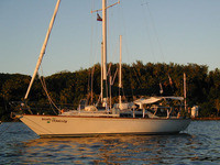
Photo Note: The morning after the night before - it was a big night of rolling thunderstorms, and like all big nights, sometimes you just fall asleep where-ever you end up and in whatever you were dressed in�....
We are not sure if the last blog (Sun 18 Nov) uploaded successfully through the HF radio winlink email system so apologies if some blogs are uploaded twice until we get the propagation sorted. Learning the intricacies of HF radio and getting to use it has added another great tool for us as we can now successfully download weather faxes and synoptics en route (for no charge), in addition to our GRIB wind files. We have been using the satellite phone and still have that for back up, but that becomes expensive after a while. Listening to the daily weather reports on the HF is now part of the boat routine. It still seems magic to me that a voice transmitted from Charleville thousands of miles away arrives into the little box on our nav station wall. Even though the voice is computer generated, the reassuring timbre tells us �"warnings �- nil�" - a great way to start the day. The voice appears to be BBC Received Pronunciation (Queen�'s English) and gives us a giggle, especially when it suddenly changes to Broad Australian on the odd word that has had to be spliced in. I must google and see if BOM have any info about �'the voice�' next time we are in port and have internet access. I suspect the voice and I will be very good friends by the end of this passage. We have passed the infamous Ashmore Reef and are now dealing with variable light winds, 100NM off shore from Port Moresby. The sea is calm, with a slight swell. We ghosted along so silently last night, you could almost hear the occasional shooting star as it streaked across the sky. Last night was the first time in ages without cloud cover, so we looked out for the Leonid meteor shower, but think it is past the peak. We could also make out the glow of Port Moresby, even at this distance. Midday �- mid-afternon wind lulls have been the pattern for the last couple of days and we motored for 6 hours yesterday before a useful wind kicked in.
A night of mild thunderstorms on the way through Pandora�'s Passage kept us on our toes on Sunday night, always a bit nerve wracking in case they get ugly, or fry our beloved electronics and connectivity to the outside world. It even got wet and cold enough to dig out the wet weather gear. Now that we are further off-shore and out of the Gulf of Papua we can see them flickering just over the horizon, a distant weather war bringing the wet season closer every day.
Yesterday we translated our passage planning into way points in the GPS, taking into account the actual dates we left TI (quite a few days later than we had anticipated!) From TI to Gizo in the Solomon Islands (SI) is about 1080 NM. From Pandora�'s Passage at the top of the Great Barrier Reef to the Louisiaides Papua New Guinea (where we turn the corner north to SI) is about 500 NM. Our total distance so far covered on this leg is 268 NM , so are about a fifth of the way to Gizo! Slowly eating the elephant�... Ciao for now.
Photo Note: The morning after the night before - it was a big night of rolling thunderstorms, and like all big nights, sometimes you just fall asleep where-ever you end up and in whatever you were dressed in�....
Comments
| Vessel Name: | Irish Melody |
| Vessel Make/Model: | C&C Landfall 38 |
| Hailing Port: | Brisbane (formerly Santa Rosa) |
| Crew: | Anthony (Tony) and Andrea Mitchell |
| About: | Decided to act on our mid-life crisis and take a gap year....so 2012-13 will see us heading out into the Pacific via Thursday Island and the Solomon Islands. |
Gallery not available
SV Irish Melody
Who: Anthony (Tony) and Andrea Mitchell
Port: Brisbane (formerly Santa Rosa)
Favorite Links
No Links Added Yet