18 April 2011 | Alexandria, VA
11 May 2010
26 September 2009
31 July 2009
26 April 2009
24 January 2009 | Cadle Creek
27 December 2008 | Chesapeake Bay
09 November 2008
13 October 2008
30 September 2008
13 July 2008 | Warehouse Creek
08 June 2008
30 May 2008 | St. Mary's River
26 May 2008 | Rhode River & Chesapeake Bay
24 May 2008 | Chesapeake Bay
04 May 2008 | Chesapeake Bay
03 May 2008
29 April 2008
29 April 2008
16 April 2008
Warehouse Creek Anchorage
30 September 2007
Saturday I planned to sail some where across the bay single handed for an overnight trip. When I woke up in the morning, I checked what the latest forecast was for the next two days. Saturday had a small craft advisory until 3pm with winds in the high teens and gusts in the mid 20 knots coming from the north. Winds were to taper off to lower to mid teens through the afternoon and then Sunday they were supposed to be 6-8 knots from the south. Sunny and 70-80F for a high each day and lows in the mid 50s overnight would make some great weather. Taking all this into consideration especially the wind direction and possibility that Sunday may be calm, I got out my charts and cruising guide to determine what would be some good options for a new anchorage destination. Since I was getting a late start, I looked at my closest options across into Eastern Bay. I thought about maybe sailing over to some creeks by Kent Narrows but then decided that might be stretching my time frame. I found Warehouse Creek to be one of the first well protected creeks just north of coming into Eastern Bay. When you enter the creek, it is split in two sides. I noticed the northern side showed more docks in the water. The western side barely had any, so it should have less traffic and I would assume less development. I decided that would be my first choice and plotted a few waypoints into my GPS.
I packed everything up and got on the road. It was not until 2pm that released my dock lines and set sail. I motored just out my creek, raised the sails and made my way to the Chesapeake Bay. The small craft advisory conditions had dissipated, but I still had a spirited sail across the bay. After I crossed the main channel portion of the bay, this large cargo ship passed.

The winds were lightening up around 10 knots near the time I was approaching Eastern Bay and Bloody Point Lighthouse.

Once I came around the southern point of Kent Island, I sailed close hauled towards my destination. The sun was getting lower and I was beginning to realize my hours of day lights were dwindling down. My genoa backlit by the sun:

I had to make several close hauled tacks to make my way. Here are some homes on the water front I sailed by:

My GPS has the sun and moon calculations and I found out that the sun was to set around 7:03 pm. It was already around 6pm and I was estimating I still had another 5+ miles to go. The winds were beginning to lighten up and I was only making about 3 knots. My goal was to sail past the red day marker, take down the main, and motor my way in the creek. The sun is getting lower as I'm sailing.

I sailed past the red marker, lowered my sails, and began motoring.

I reached my anchorage just after the sun dipped below the horizon. According to my GPS, the trip distance was 21.4 nm and I averaged 4.12 knots. I took these photos just after setting my anchor:


I tested out my new mast mounted deck light; works very well.

I was the only boat in the entire creek and there were only a couple homes on the water. The wind was almost nonexistent and mainly all you could hear was the wildlife. I could faintly hear a highway in the distance, probably Rt. 50. As I came up the creek I could actually see the towers of the bay bridge on the horizon. Later in the night, I then heard what must have been a bar there on Kent Island. I could faintly hear the music. I had a chicken salad for dinner out in the cockpit and then went down in the cabin and read a book for a bit. I drop the dinette, place the center cushion and it makes a large comfortable lounge to sit and lay back on. So, I just stayed down below since it was cooling off outside.
It was a very clear night and the moon was very bright.

I woke up around 8am and this was my view out the companionway:

The local fishermen were out early in the morning:

After having some breakfast, I weighed my anchor and motored out of the creek. There is a very narrow channel you have to go through in order to enter the creek and I didn't want to attempt to sail through. Shortly after motoring through, I went ahead and opened the genoa and shut off the outboard. I was in no rush, had all day to get back to my port. I leisurely sailed 1.5-2.5 knots on the flat calm waters towards Eastern Bay. There was barely any wind, but it was just enough to get me moving.

Clear blue sky with a view of the moon:

After a couple hours, I reached the point in Eastern Bay and just about came to a stand still. The powerboats in the bay were creating wakes that would just stop me and cause me to rock back and forth. My knot meter was reading 0 knots most of the time, but my GPS did show about 1 knot over ground. I decided to give it an hour, have lunch and see if the wind would pick up. Dave called me up to let me know he was sailing out the West River and there was enough wind to get him up to around 3 knots. We were going to meet up on the Chesapeake. After waiting an hour and not making much progress, I decided to start motoring. Every 20 minutes or so I set the engine to idle and checked the wind; each time finding the wind to barely exist. Once I got into the Chesapeake Bay, I found a slight breeze that was just enough to keep my sails filled. I shut off the engine and started sailing. My cell phone rang and it was Dave. He and his friend Chris spotted me in the distance. I changed my tack to in front of him. Shortly after we took some photos of each other (thanks Dave!):


Here is Dave's C-250:


Well, the sailing only lasted for a few more minutes, and then we were just hobby horsing back and fourth with our sails luffing. We gave it some time, but it wasn't improving, so I began motoring back. I had to motor all the way back, but I sure love my 15 hp Honda 4 stroke. Barely turn the throttle to the start setting and I'm cruising along at 5-5.5 knots! Good thing I didn't sail too much further into Eastern Bay or that would have meant even more motoring.
Here are some charts showing my course. This is a close up of where I anchored:

Here is my complete sail:

Complete trip distance was 41.4 nm according to my GPS.
I packed everything up and got on the road. It was not until 2pm that released my dock lines and set sail. I motored just out my creek, raised the sails and made my way to the Chesapeake Bay. The small craft advisory conditions had dissipated, but I still had a spirited sail across the bay. After I crossed the main channel portion of the bay, this large cargo ship passed.
The winds were lightening up around 10 knots near the time I was approaching Eastern Bay and Bloody Point Lighthouse.
Once I came around the southern point of Kent Island, I sailed close hauled towards my destination. The sun was getting lower and I was beginning to realize my hours of day lights were dwindling down. My genoa backlit by the sun:
I had to make several close hauled tacks to make my way. Here are some homes on the water front I sailed by:
My GPS has the sun and moon calculations and I found out that the sun was to set around 7:03 pm. It was already around 6pm and I was estimating I still had another 5+ miles to go. The winds were beginning to lighten up and I was only making about 3 knots. My goal was to sail past the red day marker, take down the main, and motor my way in the creek. The sun is getting lower as I'm sailing.
I sailed past the red marker, lowered my sails, and began motoring.
I reached my anchorage just after the sun dipped below the horizon. According to my GPS, the trip distance was 21.4 nm and I averaged 4.12 knots. I took these photos just after setting my anchor:
I tested out my new mast mounted deck light; works very well.
I was the only boat in the entire creek and there were only a couple homes on the water. The wind was almost nonexistent and mainly all you could hear was the wildlife. I could faintly hear a highway in the distance, probably Rt. 50. As I came up the creek I could actually see the towers of the bay bridge on the horizon. Later in the night, I then heard what must have been a bar there on Kent Island. I could faintly hear the music. I had a chicken salad for dinner out in the cockpit and then went down in the cabin and read a book for a bit. I drop the dinette, place the center cushion and it makes a large comfortable lounge to sit and lay back on. So, I just stayed down below since it was cooling off outside.
It was a very clear night and the moon was very bright.
I woke up around 8am and this was my view out the companionway:
The local fishermen were out early in the morning:
After having some breakfast, I weighed my anchor and motored out of the creek. There is a very narrow channel you have to go through in order to enter the creek and I didn't want to attempt to sail through. Shortly after motoring through, I went ahead and opened the genoa and shut off the outboard. I was in no rush, had all day to get back to my port. I leisurely sailed 1.5-2.5 knots on the flat calm waters towards Eastern Bay. There was barely any wind, but it was just enough to get me moving.
Clear blue sky with a view of the moon:
After a couple hours, I reached the point in Eastern Bay and just about came to a stand still. The powerboats in the bay were creating wakes that would just stop me and cause me to rock back and forth. My knot meter was reading 0 knots most of the time, but my GPS did show about 1 knot over ground. I decided to give it an hour, have lunch and see if the wind would pick up. Dave called me up to let me know he was sailing out the West River and there was enough wind to get him up to around 3 knots. We were going to meet up on the Chesapeake. After waiting an hour and not making much progress, I decided to start motoring. Every 20 minutes or so I set the engine to idle and checked the wind; each time finding the wind to barely exist. Once I got into the Chesapeake Bay, I found a slight breeze that was just enough to keep my sails filled. I shut off the engine and started sailing. My cell phone rang and it was Dave. He and his friend Chris spotted me in the distance. I changed my tack to in front of him. Shortly after we took some photos of each other (thanks Dave!):
Here is Dave's C-250:
Well, the sailing only lasted for a few more minutes, and then we were just hobby horsing back and fourth with our sails luffing. We gave it some time, but it wasn't improving, so I began motoring back. I had to motor all the way back, but I sure love my 15 hp Honda 4 stroke. Barely turn the throttle to the start setting and I'm cruising along at 5-5.5 knots! Good thing I didn't sail too much further into Eastern Bay or that would have meant even more motoring.
Here are some charts showing my course. This is a close up of where I anchored:
Here is my complete sail:
Complete trip distance was 41.4 nm according to my GPS.
Comments
| Vessel Name: | Sapphire Breeze |
| Vessel Make/Model: | 1982 Catalina 25 SK/SR |
| Hailing Port: | Mayo, MD |
| Crew: | Justin |
| Extra: | This site is all about my experiences with my first boat; from restoring it, to my sailing adventures. I enjoy hearing from my readers, so feel free to send me an email. I'm also interested in meeting new people in the area, especially people in my age range since I hardly know any that sail. |
Gallery not available
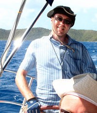
Who: Justin
Port: Mayo, MD
SailBlogs Friends
