Kaimusailing
s/v Kaimu Wharram Catamaran
| Vessel Name: | Kaimu |
| Vessel Make/Model: | Wharram Custom |
| Hailing Port: | Norwalk, CT |
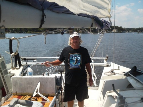
| Crew: | Andy and the Kaimu Crew |
| About: | Sailors in the Baltimore, Annapolis, DC area. |
23 April 2024 | St Marys, GA
D4 Launchie
The laptop pooped the bed, so I have to scurry around with alternatives. Not as bad as typing on the phone.
17 April 2024 | St Marys, GA
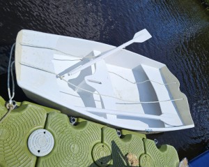
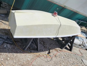
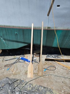
Dinghy Skeg
I was suffering with what seemed like a cold and also had allergy symptoms. I awoke and felt fine. The green pollen that was coating everything was gone. Maybe it will return.
07 April 2024 | St. Marys, GA
Clammy Hands
Items came in from TEMU, the Chinese cut rate retailer. One was a nice little drone that cost about twelve and a half dollars. It looked like an easy thing to play with while I coughed and sneezed. I was fighting a summer cold, even though it is not summer elsewhere, it seems like it here. A nice [...]

02 April 2024 | St. Marys, GA
Sun Doggie
After laminating the cedar strips onto the gunwales of the dinghy I found the screws I used wouldn’t come out. The epoxy had seized them. The screw heads were stripped so I cut a straight slot in the heads with the cut off wheel. The cedar smoked when the screw heads got red hot. I could remove [...]
21 March 2024 | St. Marys, GA
Just Add Water
The rainy weekend started off with overcast and fog but no rain. It looked like I might be able to get something done on the D4 dinghy. I wanted to change the bow seat which is really the bow deck. The sailing option uses the deck to hold the freestanding mast. I didn’t like how the deck looked, [...]
01 March 2024 | St. Marys, GA
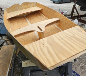
D4 Dinghy Alternative Seats
The rain event was more wind than rain, strong winds with gusts up to 44 mph. We drove into town to see what the harbor was like. There was a small sailboat that had dragged anchor and was sitting close to shore. The tide was out. We left and played with Bleu at Notter’s Pond.
Dowry, Pungo, Neuse, Beaufort, Masonboro, Myrtle Beach in One Part
.
The catamaran is a Gemini 3400MC and well appointed. It has a Garmin chartplotter, model 6208, which is coordinated with a Garmin radar. The other instruments are a Raymarine cluster of depth, wind speed and direction, and autohelm control. Most of the steering is done with the autohelm, trimming the course up and down by a degree, or hitting the + and - ten degree buttons to initiate a turn. The chartplotter has AIS input, which shows vessels with AIS transmitters overlaid on the electronic chart with their projected courses, distance from the vessel, speed, and an indication of CPA, closest point of approach, hopefully not on top of us. The vessels name is Kotuku and the owner has it up for sale, although we are delivering it to Ft. Pierce for his use later this winter.
.
We had made great distance the previous day, crossing Albemarle Sound and the length of the Alligator-Pungo Canal. Now we were hoping to get down to the coast to Beaufort, NC. The route consisted of traveling down the Pungo River, then taking a canal over to the Neuse River, then taking a canal to the coast, all going in a southerly direction.
.
It was chilly, down to 36 overnight, and we were bundled up. There was no wind except the apparent wind from our motion forward. When the engine is running the cabin is heated by a heater that gets its heat from the heat exchanger. In port we had to borrow an electric space heater.
.
I was allowed helm time and after a while I realized the skipper was spending a lot of time down on the chart table. I know he had to make a lot of decisions about how far we could go in daylight, how much fuel we would use, and where to get more. He had two charts laid out and his notebook, making notes. Wait a minute, it doesn’t take THAT long to organize a route. He was staying at the chart table because it was where the hot air from the heater came out. (He confessed this later, I really didn’t catch on).
.
The day warmed up into the 60‘s and the foul weather gear came off. The sea was flat and we chugged along like a trawler. I made grilled turkey melt sandwiches with sliced deseeded tomatoes, then we had leftover garden pasta with mini-meatballs, mushrooms, and onions. The crew has to keep their strength up.
.
There was a huge mushroom cloud on the horizon to the East, too big to be a house fire at that distance. We overheard another boat calling the Coast Guard to report it. It turned out to be a practice target range. It was not far from where I had anchored Trillium on my way down two months ago.
.
We ran up the Neuse River toward Adam’s Creek, the canal that goes to Beaufort, NC, and soon were in the creek fighting a tidal current. Skipper wanted to tie up in Beaufort and refuel there, maybe stay a while, even overnight. A few calculations showed we couldn’t possibly make it before the fuel docks closed. What should we do, stay there overnight and waste half a day getting fueled and working our way out the channel, or go inside in the ICW and anchor somewhere when it got dark, or sail right on through the port out to sea, sail all night, and come back in at Masonboro Inlet? We decided to do the Masonboro Inlet. I was sent below to make soup and salad while skipper piloted through the port.
.
The ports of Beaufort and Morehead City have a confusing buoyage coming down the ICW, because the ICW channel splits in half, one half going through a lift bridge into Beaufort, and the other passing under a high bridge and then out to sea, with the ICW continuing off to the South after passing the high bridge.
.
I made a normal salad, but the soup I made was classic sailor’s soup. Things like onions and potatoes are staples of the sailing diet because they need no refrigeration. I did use a couple strips of bacon to start the soup, but salt pork would have been used in the old days. Mince the bacon, small dice (4mm) the onions and potatoes, fry the bacon with the onions, add the potatoes and keep cooking until the potatoes get soft. Whisk in enough milk or half and half to make it soupy. The potatoes get pulverized by the whisk and thicken the soup, so the goal is to partially pulverize the potatoes. Evaporated milk can be used, thus no refrigeration required.
.
Skip likes the soup, it’s the second time he asked for it. It is a good way to utilize our potatoes and milk, which we have plenty of, and save some of our other foods that we are running out of.
.
Out at sea we negotiated the channel around what looked like a dredge and tug. Then we left the channel to the right and set a course for Masonboro Inlet. Skip gave me the first watch and went below to nap.
.
I was dressed for cold weather, but it was only down to around 50, which seemed balmy after the previous night’s 36. We were running on autopilot, so there wasn’t much to do, keep a sharp lookout, keep an eye on the engine’s oil and water, and make sure we don’t hit anything on our route.
.
The wind was from the West which was on the nose, of course, so sailing was not an option. I turned on the radar and adjusted it. There was a fishtrap marked on the chart in our path, so I edged the autopilot to port a couple of degrees to pass by the fishtrap, then had to edge it back to starboard to avoid a yellow buoy marking a danger zone. There was nothing above the surface at the fishtrap, but it’s best to avoid, just in case. The radar painted the yellow buoy and it showed up as a fat blob on the screen. It is a Garmin radar and I do not recommend it. I was in radar when I was in the Navy many years ago, so I know what a radar should do.
.
We were on a four hour watch schedule, 4 on and 4 off. I was given the 5 to 10 shift, which was 5 hours, but I didn’t mind, and skipper came on at 10. I wasn’t tired and made coffee and later did take a short nap, then went on duty again at 2 AM. This was more difficult. It became colder and the wind picked up. It was disconcerting to see our speed drop due to the increased head wind. It was rougher. The boat began to pound and hobby horse, pitching into the waves.
.
We ended up on watch together in the morning as the sun rose. I made ham and mushroom omelets with cheese, and put them in sandwiches. Coffee from a new can really hit the spot. We saw an amazing sunrise and then pointed the boat into the Masonboro Inlet, following two other boats that we hoped knew the route.
.
I went below to sleep, feeling very tired, while skip took us the 12 miles on the ICW to Snow’s Cut. I awoke before we got very far and made more coffee. We went down Snow’s Cut into the Cape Fear River, which is a very fearsome river, and down that to the port of Southport, then entered the next leg of the ICW. We followed that to Myrtle Beach and the Myrtle Beach Yacht Club where we had a reserved slip. After fueling up and topping off the water tanks, we showered and headed out for dinner at the yacht club restaurant.
.
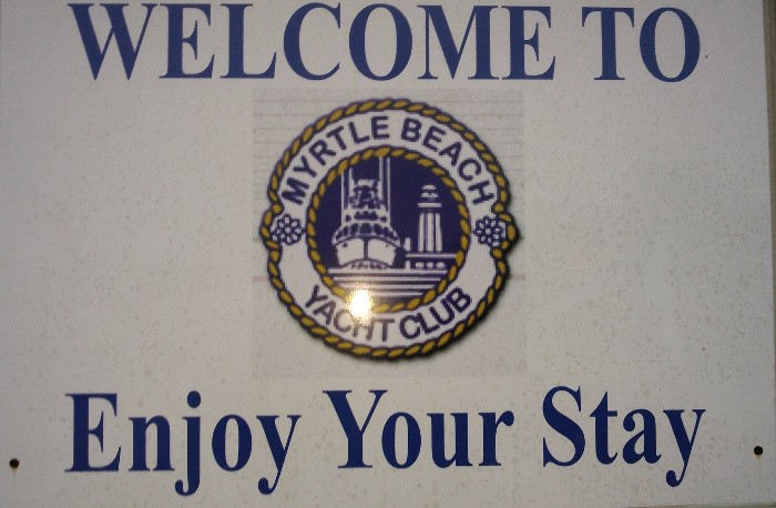
We had essentially done something that I had done alone many times, sail a 36 hour schedule. You sail all day, sail all night, and all the next day. We have yet to tally the mileage, but we left Belhaven, NC in the morning, sailed down the Pungo River, took the canal to the Neuse River, sailed up the Neuse River to Adam’s Creek Canal, down that to Beaufort, then out to sea at sunset and sailed across the sound to Masonboro Inlet, in there at dawn, down the ICW to Cape Fear River, down that to the continuation of the ICW, and down that to Myrtle Beach, right on the border of South Carolina. Whew! The image is the Myrtle Beach Yacht Clubs welcome sign.