Kaimusailing
s/v Kaimu Wharram Catamaran
| Vessel Name: | Kaimu |
| Vessel Make/Model: | Wharram Custom |
| Hailing Port: | Norwalk, CT |
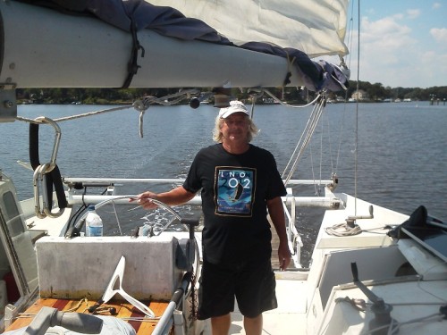
| Crew: | Andy and the Kaimu Crew |
| About: | Sailors in the Baltimore, Annapolis, DC area. |
17 April 2024 | St Marys, GA
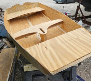
Dinghy Skeg
I was suffering with what seemed like a cold and also had allergy symptoms. I awoke and felt fine. The green pollen that was coating everything was gone. Maybe it will return.
07 April 2024 | St. Marys, GA
Clammy Hands
Items came in from TEMU, the Chinese cut rate retailer. One was a nice little drone that cost about twelve and a half dollars. It looked like an easy thing to play with while I coughed and sneezed. I was fighting a summer cold, even though it is not summer elsewhere, it seems like it here. A nice [...]

02 April 2024 | St. Marys, GA
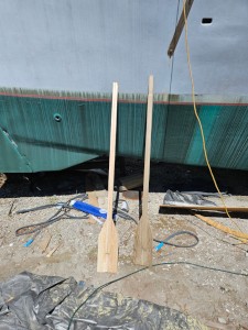
Sun Doggie
After laminating the cedar strips onto the gunwales of the dinghy I found the screws I used wouldn’t come out. The epoxy had seized them. The screw heads were stripped so I cut a straight slot in the heads with the cut off wheel. The cedar smoked when the screw heads got red hot. I could remove [...]
21 March 2024 | St. Marys, GA
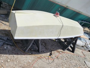
Just Add Water
The rainy weekend started off with overcast and fog but no rain. It looked like I might be able to get something done on the D4 dinghy. I wanted to change the bow seat which is really the bow deck. The sailing option uses the deck to hold the freestanding mast. I didn’t like how the deck looked, [...]
01 March 2024 | St. Marys, GA
D4 Dinghy Alternative Seats
The rain event was more wind than rain, strong winds with gusts up to 44 mph. We drove into town to see what the harbor was like. There was a small sailboat that had dragged anchor and was sitting close to shore. The tide was out. We left and played with Bleu at Notter’s Pond.
23 February 2024 | St. Marys, GA
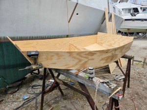
D4 Inside Seams
Day two of the dinghy build started out with me finishing wiring the hull bottoms together on the centerline of the bottom panels. This was much easier than the wiring of the chine edges of the bottom panels and the side panels.
Into Gulfport

.
In the morning we left the dock and raised just the main with 2 reefs in it. Wind forecast up to 30 knots, which is why we stayed in port for a day. The reach to Gulfport is about 165 miles and we expect to make it in about 27 hours. Our route was replanned to be closer to the beach all the way, maybe 2 miles off except at Mobile entrance where there is an obstruction. The idea was to sail along in water that has little fetch for the wind to build waves. The downside is that land features can create turbulence and then the wind can be erratic.
.
We found the boat speed to be too slow on our first leg so we bore off on a heading for Pensacola. We decided to run an engine both to keep the batteries charged and to keep our speed up. We wanted to arrive at the Gulfport sea buoy in daylight.
.
I felt like napping in the afternoon and when I was in the bunk looking up at the lexan hatch over my head a wave broke over it. I decided to take a picture of the next one. After a half hour I was tired of holding the camera in position to take that picture and no waves breaking over the bow. I put the camera down and a wave broke over the hatch. Sheesh.
.
Skipper tried to find a course that gave us speed and smooth ride at the same time, but it was rough. Our speed over the ground was around 7 knots with 2 reefs in the main and 70 percent of the roller furling jib. Lagoon provides reefing suggestions based on wind speed. Our arrangement would be good up to 33 knots of wind
.
We were now on Central time and the sun was setting at a quarter to 5. I will be on watch at 8 to 11 and then on at 5 in the morning. Our ETA at the sea buoy would be early afternoon at the current rate.
.
Skipper was on watch and it was blowing 25 knots across the deck at about 60 degrees off the bow. I was using the computer for a game, then calling up the nav program when he wanted to know about boat speed or resetting our course. Near the end of his watch I went on deck to see what I was up against. Just then the wind meter went up to 33 and I got the feeling we were OK but not OK if it got much higher. I suggested we shorten the jib. The reefing plan for 38 knots of wind is what we had in the main and 30 percent jib. We shortened it to about 50 percent. We also eased sails. The boat eased up. At the same time we killed the engine as we had about 9 knots of boat speed, no need for the engine. The batteries were topped up fully charged.
.
The owner was awakened by the sudden stop of the engine and he came up on deck. What’s happening, well the wind went up so we killed the engine and reduced sail.
.
We continued sailing toward Pensacola on a course of about 280 true through very rough water. The wind dropped down after a while, but would rear up again for a short time at around 30 knots. The boat was now conservatively rigged and jumped around anyway. At Pensacola we were to turn off the wind on a course of 260 true, not much of a change, but enough to make close reaching into beam reaching. We will also be closer to the beach in smoother water so our boat speed should go up.
.
I slept the whole 6 hours between watches. It was cold on the boat, the North wind had brought chilly temperatures. I came up in the cabin where skipper was managing the situation, even he was chilled, even under what looked like eskimo parka foul weather gear. He was concerned because there were oil rigs all around and a course had to be replotted and checked for obstructions. He was now going dead downwind to the sea buoy at Mobile and our speed had dropped due to the jib being blanketed by the main. He had made coffee which I eagerly had with some coffee cake, making sure I didn’t take the very last piece.
.
I looked at our route along the beach which we could not take and deactivated it. In the OpenCPN nav program it looks like only one route can be active at a time. Then I right clicked on the Gulfport sea buoy and selected Navigate to This. Now a route was formed from our current position directly to the sea buoy. It was like a direct line between the sea buoys of Mobile and Gulfport. Then I zoomed in on the line and traced along it, looking for any obstacles or shallows. I had to put one more waypoint midway in that line and move it a bit, creating a slight dogleg. Then the origin of the route, our position when I started it, had to be moved seaward slightly. Now the route was complete. A nav panel is created on the chart when you activate a route and it displays all the parameters in one place, velocity made good, time to go, estimated time of arrival, and range and bearing of the final destination. We were making around 6 knots and ETA was early afternoon. I had rolled out a bit more of the jib now that it was not blanketed. On this route we could come up around 15 degrees and that opened up the wind angle on jib.
.
The sun was rising and so I took a picture. Now I could see the ships at anchor that had triggered AIS alarms. We had our alarm set at 2 miles, so any ship that would come within 2 miles triggers an alarm. These anchored ships must be within 2 miles. I thought about starting the radar, but with the sun up we could see any unlit obstacles. We did have one tower appear, white so it looked like a sail at first, and it wasn’t on any of our charts.
.
The owner came up and had coffee, then took over the watch. We were getting close now. Skipper came up and I made super egg toasties for breakfast. Time to go was now 3 hours. We had scrubbed our original route and now headed right for the Gulfport channel, cutting off the sea buoy. We would join the channel just to seaward of Ship Island.
.
I took a nap with skipper on watch. He and the owner furled the sails and were now running at about 2800 turns on both engines. The wind was calm and the sea flat. In the cabin was like being in the bridge of a tug boat. The cabin windows of a Lagoon catamaran are vertical and wrap around the cabin just like a ship’s bridge.
.
The centerpiece of the bridgedeck is the Getac computer and it’s OpenCPN nav program. It had been running the whole time of this trip from day one, on an AC adapter powered by an inverter. When we were entering or leaving port it was placed in front of the helm and gave a graphic view of the channel. It is waterproof and shock resistant and is daylight viewable.
.
The image is shot over the shoulders of the skipper and owner as we line up the channel into Gulfport.