Kaimusailing
s/v Kaimu Wharram Catamaran
| Vessel Name: | Kaimu |
| Vessel Make/Model: | Wharram Custom |
| Hailing Port: | Norwalk, CT |
| Crew: | Andy and the Kaimu Crew |
| About: | Sailors in the Baltimore, Annapolis, DC area. |
17 April 2024 | St Marys, GA
Dinghy Skeg
I was suffering with what seemed like a cold and also had allergy symptoms. I awoke and felt fine. The green pollen that was coating everything was gone. Maybe it will return.
07 April 2024 | St. Marys, GA
Clammy Hands
Items came in from TEMU, the Chinese cut rate retailer. One was a nice little drone that cost about twelve and a half dollars. It looked like an easy thing to play with while I coughed and sneezed. I was fighting a summer cold, even though it is not summer elsewhere, it seems like it here. A nice [...]

02 April 2024 | St. Marys, GA
Sun Doggie
After laminating the cedar strips onto the gunwales of the dinghy I found the screws I used wouldn’t come out. The epoxy had seized them. The screw heads were stripped so I cut a straight slot in the heads with the cut off wheel. The cedar smoked when the screw heads got red hot. I could remove [...]
21 March 2024 | St. Marys, GA
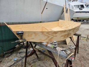
Just Add Water
The rainy weekend started off with overcast and fog but no rain. It looked like I might be able to get something done on the D4 dinghy. I wanted to change the bow seat which is really the bow deck. The sailing option uses the deck to hold the freestanding mast. I didn’t like how the deck looked, [...]
01 March 2024 | St. Marys, GA
D4 Dinghy Alternative Seats
The rain event was more wind than rain, strong winds with gusts up to 44 mph. We drove into town to see what the harbor was like. There was a small sailboat that had dragged anchor and was sitting close to shore. The tide was out. We left and played with Bleu at Notter’s Pond.
23 February 2024 | St. Marys, GA
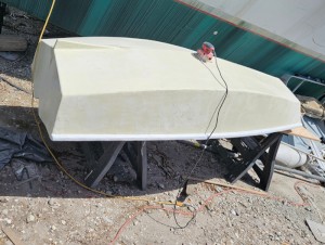
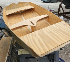
D4 Inside Seams
Day two of the dinghy build started out with me finishing wiring the hull bottoms together on the centerline of the bottom panels. This was much easier than the wiring of the chine edges of the bottom panels and the side panels.
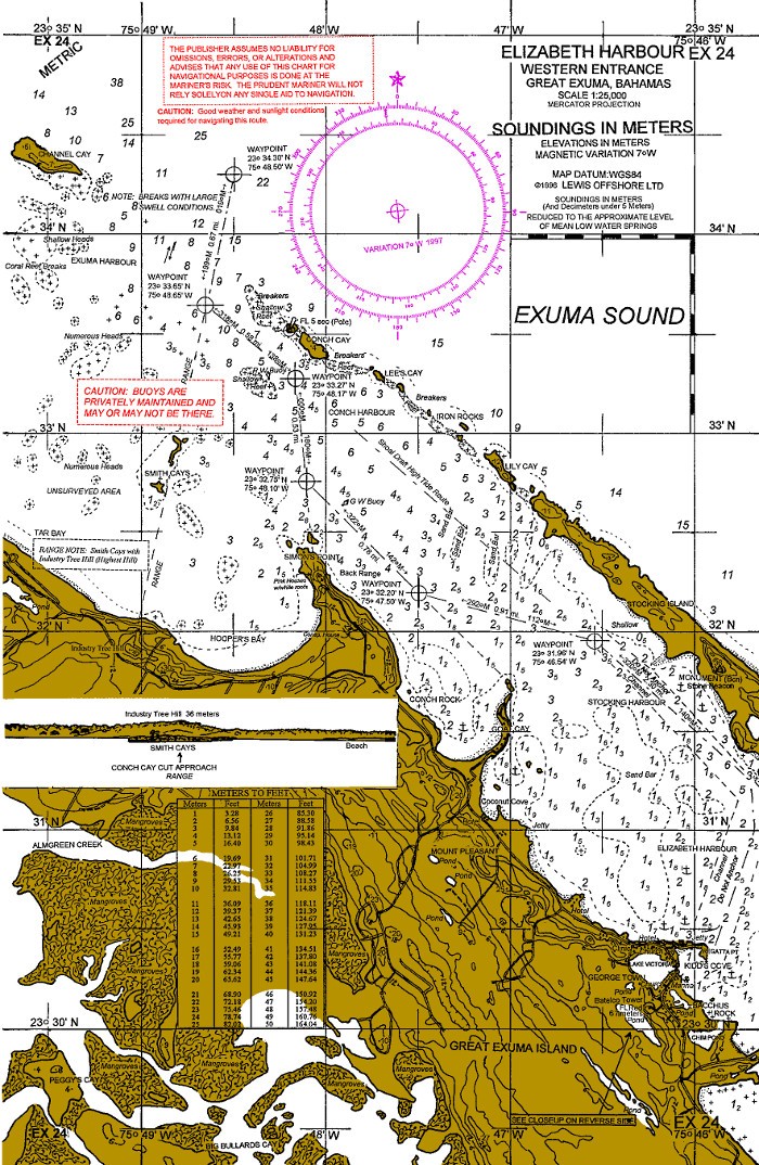
Happy New Year Chart Wrap Up
.
I'm happy with the charts. When I tried to calibrate one chart and had to use two computers and ended up with an error message, it signified to me the end of trying to use them in a navigation software. They are useful as planning aids, more information on them than is on the electronic charts that are out today.
.
When you look at how quickly electronic charts came along and displaced paper, it seems like only yesterday that we had no electronic charts. First we had age old paper charts, sextants, a chart table, plotting instruments, and then along came electronics. I guess back then it was loran, which became a new feature on the charts, loran lines. Then satnav. You could get your lat and long from an electronic device and track it on your paper charts. But if you were smart, you kept your sextant and mechanical clock as a backup.
.
Even now boats get hit with lightning and have to limp back to port somehow. Imagine being out in the ocean with no charts, nothing, just a vague idea of where to go. You can't even call for help without electronics.
.
How did the old guys do it, back in day one? They worked at it really hard, took soundings whenever they could, with a lead line, and they weren't sailing little boats, they had a crew to do the tasks that a captain would require, since he had no charts, he required gathering information manually and creeping along, avoiding uncharted perils. Even Capn Cook ran aground famously, but it was his interactions with the natives in Hawaii that killed him.
.
The Polynesians had a navigation culture, best described in a book by Steve Thomas, yes, the same Steve Thomas that was a host on This Old House. Most people don't know that he is a serious anthropologist and lived with Mau Pialug in Satawal and was initiated into the clan's navigational school and learned how to navigate using no European instruments, just knowledge of the stars, currents, sea creatures, birds, and patterns of waves. If your GPS fails after a lightning strike you can rely on your innate knowledge to navigate to safety.
.
Probably your European compass, which was invented in China, will help you maintain a proper course, if you write down these things from time to time, before the lightning hits. Some of the Bahamian charts I wanted to use have magnetic courses from waypoint to waypoint through the Bahamas.
.
So we have now a boating culture that has migrated to the electronic world. But the world still has lightning, North Korea, rogue waves, and lots of other things that will kill the electronics. It's like the ocean is prehistory, preevolution, not something modern like urban planning, the ocean exists out there beyond the jetties and sea buoys. It's a primitive world with elemental interaction and we, as humans, are fascinated with such things.
.
It's like the fascination with Jurassic Park, the scientists that can probe the secrets of the distant primordial past, but wait, it comes back to get them, so we are focused on it. At every level it is a fascinating story. But when you get out of the movie theater and put yourself on a sailboat out in the ocean, the fascination comes to grips with practicality. Sailing is a simple process, but we make it very complicated. It's good to keep the basics on board and in good shape. The electronic charts and devices are fine until they die, then you can look to your basic tools to navigate.
.
Life expectancy of electronics on board a small sailboat, maybe tomorrow. I used a cell phone to navigate a small boat that had electrics so bad I didn't dare to turn anything on, lest the batteries would be dead. But I had a magnetic compass and could sail by that on my course from out in the ocean to approach the sea buoy. We need a paper chart to figure out how to get inshore from the sea buoy, if we have nothing else.
.
So, the basics include paper charts of large areas that include your voyage, plus paper charts of various ports you might have to use, and compass courses that you write down as you are navigating, your compass might get you home from a lightning strike. Unfortunately, paper charts have to be printed on special paper and special ink that won't suffer from sea water on them. You can't just print them off your computer onto paper from Office Plus.
.
I've been recently on well funded boats as a paid crew and along with a paid skipper. They mostly didn't have basic navigation aids available, but they had lots of electronics. We ended up using our own military grade computers and some free software that works a lot better than what the marine electronics manufacturers supply. The owners of these boats had the financial capacity to have almost anything they wanted on their boats, so it was wise they chose us, with our free navigation software. I did use the Raymarine and Garmin chartplotters, and I am very capable with serial communication protocols and getting stuff to work with other stuff. But mostly, these electronics package were out of the box, installed to work without regard to the other electronics stuff.
.
I like mental challenges, and getting electronic devices working together can be a challenge. Getting Garmin to work with Raymarine is like getting Donald Trump to install a hotel in North Korea. Or vice versa.
.
The problem is not with the ocean or the electronics industry, they are completely separate and evolving separately. The problem is that business managers recognize that all their expenditure to render nautical charts and develop software to use them might be circumvented by open source programmers who delight in providing computational solutions to the problems that we, the non-computer people, face. So the manufacturers try to complicate matters by organizing their software so that only a person who buys their package can use their eCharts, plus, they can't use any other available charts, only the eCharts. And you get Garmin_eCharts and Raymarine_eCharts, and chart packages that cost a lot, but never the twain shall meet.
.
But it doesn't matter out in the ocean, it's a large place and your software is an intrusion, so getting anything to work out there seems like a blessing, but you are relying on something that can be snuffed out in an instant by a thunderstorm, or a North Korea nuclear attack. Even the ubiquitous cell phone that works like magic on its own out there is a device that will drop dead when the lightning hits. Some people put such things in their microwave oven, if you've got one, or their regular cooking oven. The idea is that the surrounding metalwork will stop any electromagnetic pulses from damaging what's inside. I think this works, based on reports of those at sea who have done this, on the Cruiser's Forum.
.
One last job with the charts was to make an index, a chart directory so that I could find the chart for Virgin Gorda, for instance, and have the chart numbers in a list with the chart names. This job is just as tedious as you can imagine. The chart names are in individual files called header files, so for each chart you have to open file and copy down its name and add it to the list. Also the list has to be in numerical order. But I'm indoors with a cold and it isn't as bad as going outside in the cold. It is all done, now I can copy the charts and directories to the navigation computers.
.
The image is a chart of course, one of the Explorer Bahamas charts. They are about 20 years old and now out of date.