
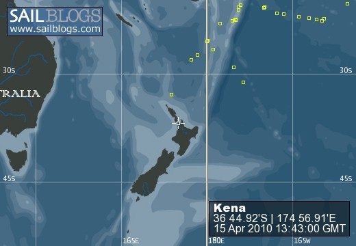
Kena
22 November 2009 | Tutukaka
11 November 2009
10 November 2009
09 November 2009
07 November 2009
07 November 2009
04 November 2009
03 November 2009
01 October 2009
29 September 2009
05 September 2009 | Nuku'alofa
27 August 2009
27 August 2009
23 August 2009
16 August 2009
14 August 2009
12 August 2009
09 August 2009
08 August 2009
08 August 2009
Hurricane Force
01 October 2009
Tane
September 2nd-4th, 2009
We left Nuku'alofa on Wednesday the 2nd of September. Both Tomas and I had been given colds from the crew of Kalalau and were feeling under the weather. Despite not feeling a hundred percent, we were anxious to leave given the weather window. Nuku'alofa is not the most idyllic place, and we wanted to make it to Vava'u as soon as possible to settle in and begin working on the boat.
At 2pm we raised the anchor and motored out of the harbor. We hoisted the sails and headed across the lagoon and into Piha Passage. Piha passage is a long, narrow pass lined with reefs. In the middle of the pass is a tight 90 degree turn that would be an unfortunate one to miss. As we went through the pass the boat was tossed and turned by the strong current leaving the lagoon. We had cloud cover and low visibility, so I had Tomas up on bow as look out as we sped out of the pass at 7 knots. Where the pass entered the open ocean short steep waves caused by the wind against the current tossed Kena around like we were in a washing machine. When we reached the open ocean the wind was 20-25 knots from the northeast and in the waves were 2-3 meters (6-9ft) high.
I had Tomas put up the main as I held the boat pointed into the wind, and since had a torn jib from back at Beveridge Reef, we had to put the staysail up instead to keep the boat balanced. I went up to the bow and raised the staysail and to my dismay, the stay (the woven metal cable that the front of the sail attaches to) sagged and made it impossible to get the sail up properly. It had somehow come loose over the past few days. With great difficulty I got the staysail back down. It was hard because the waves were very confused, pushing us in all direction, making it hard for Tomas to keep the boat pointed into the wind, causing the staysail boom thrash back and forth. After securing the sail I had to go back up to the bow and attempt to tighten the stay. After about ten minutes of battling the stay, while waves poured over the bow, I managed to tighten the stay to the appropriate tension and got the sail back up. Cold and wet we set course to Vava'u.
The Kingdom of Tonga is formed by three distinct island groups. Tongatapu is in the southern most group, Ha'apai in the middle, and Vava'u at the northern end. They are arranged roughly from north to south with Vava'u slightly to the east and Tongatapu to west, like a lazy forward slash. After reviewing the weather our plan was to leave on the eastern side of Tongatapu and beat into it, heading northeast towards Vava'u. The GRIB file showed that the wind was coming from the east at 20kts, however, when we got out there this was not the case. It was coming from the northeast at 25-30kts, which made the ride very uncomfortable. It is called 'close hauled' when you are heading into the wind with the minimum sailable wind angle, about 30-40 degrees off the bow. It's the worst point of sail for two reasons: one because it is much slower and inefficient, and two because it is very unpleasant since you are heading against the seas. It is also loud and wet, with the wind whistling through the rigging and plumes of spray drenching the boat as you pound into the waves.
For a few hours we beat into the weather, often making less than three knots. The wind slowly clocked around to NNE pushing us toward the Ha'apai making it impossible for us to continue on our previous course. We had no choice but to go in-between Tongatapu and the Ha'apai. The problem with this rout, and the reason that no one uses it unless it's necessary, is because it is riddled with reefs and small islands and is unnervingly shallow in some places. To add some excitement it was now dark and before the sunset ominous clouds were building on the horizon.
Tomas went to bed feeling quite sick, the rough seas most likely amplifying his nausea. It took us six hours to traverse the lower Ha'apai. The charts in Tonga are up to half mile off, so I used the radar and dept sounder to determine our position on the charts. I rarely took my weary eyes off the instruments the whole time, only leaving to check for lights of other boats in murky blackness. Whether it was because I was less sick or because I didn't really have a choice to let it slow me down is unknown, but what I do know is that I certainly didn't feel spectacular, and had to fight the bed's constant call for my company.
At three in the morning when we were through the cluster f**! of reefs and on the western side of Ha'apai, I woke up Tomas for watch. We tacked the boat and began to head north again. I slept in the settee next to the navigation station in case Tomas had a problem. Every twenty minutes or so I would wake up terrified from living a nightmarish situation in my mind of us aground on a reef. Tomas got me up at six in the morning and when I looked at the nav computer and showed us within ten nautical miles of the Queen Asika sinking position. The Queen Asika was an inter-island ferry that had sunk only a few weeks before. There was a funeral in Niue while we were there for a local New Zealand police officer who had died when it sank. The Queen Asika had failed to pass safety inspections multiple times, and as happens in many developing countries, the palms of the right corrupt official were greased and she was cleared to go. On a similar route that we were taking to Vava'u, heavy seas came up and a weak section in the hull suddenly gave out, and she sank in less than a minute. The boat was over crowded, and sadly mainly women and children died since they were inside the cabin. The men, being chivalrous, were outside on deck in the weather and were the only ones who could make it into the life rafts to escape. In Nuku'alofa the people were extremely upset by the disaster, and the governmental corruption that had caused it, that they were on the verge of rioting. Percentage wise, this loss was far more devastating to the population of Tonga than the events of September 11th: every Tongan was close to someone who was senselessly lost on the Queens Asika.
A maritime warning issued by Tonga's government advised boats to keep a distance of ten nautical miles. As dawn broke and silhouetted the palm tree covered islands of Ha'apai, we were eight nautical miles from Queens Asika, and given the winds and location of the islands, we had no choice but to continue on our path. The closest we came was 7.5 miles, and it gave me an eerie feeling being so close to so many who had been taken by the sea. Perhaps we angered the Tongan gods by our proximity, because we were punished severely in the next twelve hours. As we made our way along the eastern side of the Ha'apai, we passed to perfect volcanic cones, one still active, smoke pouring from its pinnacle. On the charts in Tonga, there are quite a few obstructions that state that a volcano may or may not be present! I have never seen that before. These islands are a hot bed of volcanic activity, part of the Ring if Fire, and within a decade islands will rise and disappear.
Tomas got up at around midday, looking a little worse for wear, and still feeling ill. I asked him to take a watch while I got some much needed sleep. During his watch he decided to watch a movie, and poorly choose 'Supersize Me.' Soon after the point in the film where the main character has to consume his first Supersized meal, and begins puking, Tomas followed suit not the best movie to watch while sick during bad weather.
I awoke after two hours of light sleep to find a green looking Tomas, and relieved him from watch. Within the first hour of my watch, menacing clouds began to form to the west of us. Since the wind was coming from the northeast I assumed we would be okay, and the storm would be pushed away from us. Soon I realized this was an incorrect assumption, and we were obviously in its path. I changed our course and revved up the engine to attempt to outrun the storm. We have rarely seen lightening storms on this trip, but this one was putting on one hell of a light show. As the thunderheads rose, and loomed ominously over us I began to prepare for battle. I triple reefed the main, took down the staysail, and put out a small, postage-stamp sized piece of jib. I took out cruising books, such as 'Surviving the Storm" and began reading them feverishly for appropriate storm tactics. I even read our emergency sea anchor manual (a sea anchor is a big underwater parachute that you deploy in desperate situations to slow you down and keep you pointed into the waves). Tomas got up to use the head to find me frantically cleaning the dishes and putting everything away that had a potential to fall over or fly across the cabin. I also put all of our important electronics, such as the navigation computer, GPSs, satellite phone, etc. into the oven. You do this because an oven creates a faraday cage, which protects the objects inside it from electrical charges.
Right at dusk the storm hit us. The beautiful sunset was blotted out by the black wall of clouds, and I could see in the faint light a white wall of spray and rain quickly approaching. I turned the boat 180 degrees, revved up to full speed and headed straight into the squall. The wind hit with an almighty bang as the rigging stretched and groaned under the pressure. I reached back and felt the back stay and it felt slack, terrified, I was sure the rigging was coming down. I looked at wind instrument and saw it rise- 45, 55, 65 and then 70 knots and felt my heart sink. I had to duck down, because if I stood up, the rain felt like gravel hitting you in the face, forcing you to close your eyes and making it difficult to breath. I was screaming to Tomas, who was laying only 5 feet away on his bunk, and heard nothing of my cries for help. All sorts of thoughts were going through my head, like about what to do if I could no longer control the boat, what if the rig comes down, what is drowning going to feel like, what I have gotten Tomas into, and the main one being why, only days after my dad left, did this have to happen. Fortunately, the winds above 60 knots only lasted about three minutes, and over 35 for about 15-20 minutes. In the middle of the storm it dropped to less than ten knots, making the main slap back and forth and left us rocking in uncomfortable and confused seas.
We were in a torrential downpour for four hours. In the heart of the storm there was tons of lightening, but no thunder, which was very peculiar and added to the foreboding feeling of the storm. I stayed on watch, to let Tomas rest and in case we had heavy winds again within the storm. As we exited out of the other side of the storm, the wind began to pick up again and as it rose to 35 knots my adrenaline kicked in as I braced myself for another powerful blow. Fortunately, it only reached 38 knots and calmed back down to a manageable 25 knots.
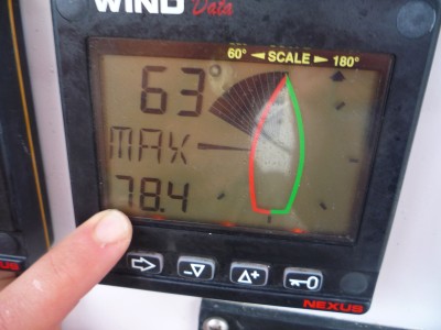
I put the boat back on course and trimmed her canvas. Out of curiosity I looked at the maximum wind reading for the squall and it was an astonishing 78.4 knots. That's hurricane force winds! It was most likely what is called a micro-burst, which is a strong winds caused by convection activity that come off the top of large thunderheads. Luckily, the high winds did not last, because sustained winds of this magnitude create massive seas and Tomas and I would have been in life-threatening trouble.
I made sure that there were no more storms on the radar, or any other impending dooms, and got Tomas for another watch. Exhausted, I asked Tomas to do the longest watch he felt comfortable with, and to wake me if any storms show up on the radar. Tomas had a rough time and again throwing up during his watch. He woke me up three and half hours and I had the pleasure of the sunrise watch, my favorite. As the sun rose above the horizon of blue on blue, and ignited the clouds with orange, red and pink, I could just make out the faint silhouettes of the southern islands of Vava'u. The wind swung around to the east, pushing us on a ripping beam reach to a waypoint in the entrance of Vava'u, that during the storm I had aptly named Haven. At about 10am we were crossing the sea wall that rises from thousands of feet to fewer than a hundred in less than a mile. I said to Tomas we should put out the lines, drop offs like these are notorious for good game fishing, and within minutes we had a 30 pound yellow fin on the line, and sashimi on the mind.
We entered the main channel in Vava'u and a wave of relief came over us. We gave a celebratory cheer and gave a call to my dad to tell him that we were safely in the waters of Vava'u. I did not, however, tell him about the horrific storm because we had not picked up a mooring yet, and if I tooted my horn and then ran into another boat or reef before we were safely at port, I would never live it down.
We entered the port of Neiafu, and got on the radio and talked to Victory Cat who explained what the protocol was. A few other boats called in to check up on us. The anchorage was packed and we picked up the last available mooring of the 75 in the harbor. It was so full because we had serendipitously come across the first annual Vava'u Sailing Regatta. We were allowed to sign up 4 hours after registration was closed and prepared for a week of festivities.
We got back to the boat from checking in I decided to take a much needed nap. As I laid down to sleep, exhausted from less than 9 hours of sleep in the last 50, I closed my eyes relieved and proud that I had successfully made my first trip as captain while sick, navigated reef riddled waters in the dark, survived hurricane force winds, sustained no damage, and arrived with enough sashimi for a party.
We left Nuku'alofa on Wednesday the 2nd of September. Both Tomas and I had been given colds from the crew of Kalalau and were feeling under the weather. Despite not feeling a hundred percent, we were anxious to leave given the weather window. Nuku'alofa is not the most idyllic place, and we wanted to make it to Vava'u as soon as possible to settle in and begin working on the boat.
At 2pm we raised the anchor and motored out of the harbor. We hoisted the sails and headed across the lagoon and into Piha Passage. Piha passage is a long, narrow pass lined with reefs. In the middle of the pass is a tight 90 degree turn that would be an unfortunate one to miss. As we went through the pass the boat was tossed and turned by the strong current leaving the lagoon. We had cloud cover and low visibility, so I had Tomas up on bow as look out as we sped out of the pass at 7 knots. Where the pass entered the open ocean short steep waves caused by the wind against the current tossed Kena around like we were in a washing machine. When we reached the open ocean the wind was 20-25 knots from the northeast and in the waves were 2-3 meters (6-9ft) high.
I had Tomas put up the main as I held the boat pointed into the wind, and since had a torn jib from back at Beveridge Reef, we had to put the staysail up instead to keep the boat balanced. I went up to the bow and raised the staysail and to my dismay, the stay (the woven metal cable that the front of the sail attaches to) sagged and made it impossible to get the sail up properly. It had somehow come loose over the past few days. With great difficulty I got the staysail back down. It was hard because the waves were very confused, pushing us in all direction, making it hard for Tomas to keep the boat pointed into the wind, causing the staysail boom thrash back and forth. After securing the sail I had to go back up to the bow and attempt to tighten the stay. After about ten minutes of battling the stay, while waves poured over the bow, I managed to tighten the stay to the appropriate tension and got the sail back up. Cold and wet we set course to Vava'u.
The Kingdom of Tonga is formed by three distinct island groups. Tongatapu is in the southern most group, Ha'apai in the middle, and Vava'u at the northern end. They are arranged roughly from north to south with Vava'u slightly to the east and Tongatapu to west, like a lazy forward slash. After reviewing the weather our plan was to leave on the eastern side of Tongatapu and beat into it, heading northeast towards Vava'u. The GRIB file showed that the wind was coming from the east at 20kts, however, when we got out there this was not the case. It was coming from the northeast at 25-30kts, which made the ride very uncomfortable. It is called 'close hauled' when you are heading into the wind with the minimum sailable wind angle, about 30-40 degrees off the bow. It's the worst point of sail for two reasons: one because it is much slower and inefficient, and two because it is very unpleasant since you are heading against the seas. It is also loud and wet, with the wind whistling through the rigging and plumes of spray drenching the boat as you pound into the waves.
For a few hours we beat into the weather, often making less than three knots. The wind slowly clocked around to NNE pushing us toward the Ha'apai making it impossible for us to continue on our previous course. We had no choice but to go in-between Tongatapu and the Ha'apai. The problem with this rout, and the reason that no one uses it unless it's necessary, is because it is riddled with reefs and small islands and is unnervingly shallow in some places. To add some excitement it was now dark and before the sunset ominous clouds were building on the horizon.
Tomas went to bed feeling quite sick, the rough seas most likely amplifying his nausea. It took us six hours to traverse the lower Ha'apai. The charts in Tonga are up to half mile off, so I used the radar and dept sounder to determine our position on the charts. I rarely took my weary eyes off the instruments the whole time, only leaving to check for lights of other boats in murky blackness. Whether it was because I was less sick or because I didn't really have a choice to let it slow me down is unknown, but what I do know is that I certainly didn't feel spectacular, and had to fight the bed's constant call for my company.
At three in the morning when we were through the cluster f**! of reefs and on the western side of Ha'apai, I woke up Tomas for watch. We tacked the boat and began to head north again. I slept in the settee next to the navigation station in case Tomas had a problem. Every twenty minutes or so I would wake up terrified from living a nightmarish situation in my mind of us aground on a reef. Tomas got me up at six in the morning and when I looked at the nav computer and showed us within ten nautical miles of the Queen Asika sinking position. The Queen Asika was an inter-island ferry that had sunk only a few weeks before. There was a funeral in Niue while we were there for a local New Zealand police officer who had died when it sank. The Queen Asika had failed to pass safety inspections multiple times, and as happens in many developing countries, the palms of the right corrupt official were greased and she was cleared to go. On a similar route that we were taking to Vava'u, heavy seas came up and a weak section in the hull suddenly gave out, and she sank in less than a minute. The boat was over crowded, and sadly mainly women and children died since they were inside the cabin. The men, being chivalrous, were outside on deck in the weather and were the only ones who could make it into the life rafts to escape. In Nuku'alofa the people were extremely upset by the disaster, and the governmental corruption that had caused it, that they were on the verge of rioting. Percentage wise, this loss was far more devastating to the population of Tonga than the events of September 11th: every Tongan was close to someone who was senselessly lost on the Queens Asika.
A maritime warning issued by Tonga's government advised boats to keep a distance of ten nautical miles. As dawn broke and silhouetted the palm tree covered islands of Ha'apai, we were eight nautical miles from Queens Asika, and given the winds and location of the islands, we had no choice but to continue on our path. The closest we came was 7.5 miles, and it gave me an eerie feeling being so close to so many who had been taken by the sea. Perhaps we angered the Tongan gods by our proximity, because we were punished severely in the next twelve hours. As we made our way along the eastern side of the Ha'apai, we passed to perfect volcanic cones, one still active, smoke pouring from its pinnacle. On the charts in Tonga, there are quite a few obstructions that state that a volcano may or may not be present! I have never seen that before. These islands are a hot bed of volcanic activity, part of the Ring if Fire, and within a decade islands will rise and disappear.
Tomas got up at around midday, looking a little worse for wear, and still feeling ill. I asked him to take a watch while I got some much needed sleep. During his watch he decided to watch a movie, and poorly choose 'Supersize Me.' Soon after the point in the film where the main character has to consume his first Supersized meal, and begins puking, Tomas followed suit not the best movie to watch while sick during bad weather.
I awoke after two hours of light sleep to find a green looking Tomas, and relieved him from watch. Within the first hour of my watch, menacing clouds began to form to the west of us. Since the wind was coming from the northeast I assumed we would be okay, and the storm would be pushed away from us. Soon I realized this was an incorrect assumption, and we were obviously in its path. I changed our course and revved up the engine to attempt to outrun the storm. We have rarely seen lightening storms on this trip, but this one was putting on one hell of a light show. As the thunderheads rose, and loomed ominously over us I began to prepare for battle. I triple reefed the main, took down the staysail, and put out a small, postage-stamp sized piece of jib. I took out cruising books, such as 'Surviving the Storm" and began reading them feverishly for appropriate storm tactics. I even read our emergency sea anchor manual (a sea anchor is a big underwater parachute that you deploy in desperate situations to slow you down and keep you pointed into the waves). Tomas got up to use the head to find me frantically cleaning the dishes and putting everything away that had a potential to fall over or fly across the cabin. I also put all of our important electronics, such as the navigation computer, GPSs, satellite phone, etc. into the oven. You do this because an oven creates a faraday cage, which protects the objects inside it from electrical charges.
Right at dusk the storm hit us. The beautiful sunset was blotted out by the black wall of clouds, and I could see in the faint light a white wall of spray and rain quickly approaching. I turned the boat 180 degrees, revved up to full speed and headed straight into the squall. The wind hit with an almighty bang as the rigging stretched and groaned under the pressure. I reached back and felt the back stay and it felt slack, terrified, I was sure the rigging was coming down. I looked at wind instrument and saw it rise- 45, 55, 65 and then 70 knots and felt my heart sink. I had to duck down, because if I stood up, the rain felt like gravel hitting you in the face, forcing you to close your eyes and making it difficult to breath. I was screaming to Tomas, who was laying only 5 feet away on his bunk, and heard nothing of my cries for help. All sorts of thoughts were going through my head, like about what to do if I could no longer control the boat, what if the rig comes down, what is drowning going to feel like, what I have gotten Tomas into, and the main one being why, only days after my dad left, did this have to happen. Fortunately, the winds above 60 knots only lasted about three minutes, and over 35 for about 15-20 minutes. In the middle of the storm it dropped to less than ten knots, making the main slap back and forth and left us rocking in uncomfortable and confused seas.
We were in a torrential downpour for four hours. In the heart of the storm there was tons of lightening, but no thunder, which was very peculiar and added to the foreboding feeling of the storm. I stayed on watch, to let Tomas rest and in case we had heavy winds again within the storm. As we exited out of the other side of the storm, the wind began to pick up again and as it rose to 35 knots my adrenaline kicked in as I braced myself for another powerful blow. Fortunately, it only reached 38 knots and calmed back down to a manageable 25 knots.
I put the boat back on course and trimmed her canvas. Out of curiosity I looked at the maximum wind reading for the squall and it was an astonishing 78.4 knots. That's hurricane force winds! It was most likely what is called a micro-burst, which is a strong winds caused by convection activity that come off the top of large thunderheads. Luckily, the high winds did not last, because sustained winds of this magnitude create massive seas and Tomas and I would have been in life-threatening trouble.
I made sure that there were no more storms on the radar, or any other impending dooms, and got Tomas for another watch. Exhausted, I asked Tomas to do the longest watch he felt comfortable with, and to wake me if any storms show up on the radar. Tomas had a rough time and again throwing up during his watch. He woke me up three and half hours and I had the pleasure of the sunrise watch, my favorite. As the sun rose above the horizon of blue on blue, and ignited the clouds with orange, red and pink, I could just make out the faint silhouettes of the southern islands of Vava'u. The wind swung around to the east, pushing us on a ripping beam reach to a waypoint in the entrance of Vava'u, that during the storm I had aptly named Haven. At about 10am we were crossing the sea wall that rises from thousands of feet to fewer than a hundred in less than a mile. I said to Tomas we should put out the lines, drop offs like these are notorious for good game fishing, and within minutes we had a 30 pound yellow fin on the line, and sashimi on the mind.
We entered the main channel in Vava'u and a wave of relief came over us. We gave a celebratory cheer and gave a call to my dad to tell him that we were safely in the waters of Vava'u. I did not, however, tell him about the horrific storm because we had not picked up a mooring yet, and if I tooted my horn and then ran into another boat or reef before we were safely at port, I would never live it down.
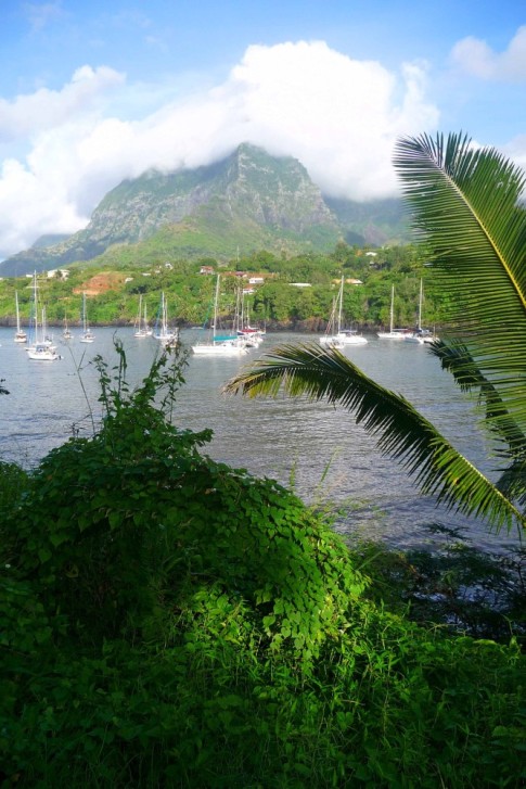
We entered the port of Neiafu, and got on the radio and talked to Victory Cat who explained what the protocol was. A few other boats called in to check up on us. The anchorage was packed and we picked up the last available mooring of the 75 in the harbor. It was so full because we had serendipitously come across the first annual Vava'u Sailing Regatta. We were allowed to sign up 4 hours after registration was closed and prepared for a week of festivities.
We got back to the boat from checking in I decided to take a much needed nap. As I laid down to sleep, exhausted from less than 9 hours of sleep in the last 50, I closed my eyes relieved and proud that I had successfully made my first trip as captain while sick, navigated reef riddled waters in the dark, survived hurricane force winds, sustained no damage, and arrived with enough sashimi for a party.
Comments
| Vessel Name: | Kena |
| Vessel Make/Model: | Ganley Pacemaker 40 |
| Hailing Port: | Tutukaka, New Zealand |
| Crew: | Roger, Sally, Tane, Hunters all |
| About: | The Hunter family: Roger, originally from Tutukaka, New Zealand Sally, from Tasmania, Australia and Tane is from New Mexico. |
| Extra: | This leg of the trip is from Puerto Lucia, Ecuador to New Zealand. |
Kena's Photos - Main
 |
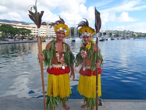
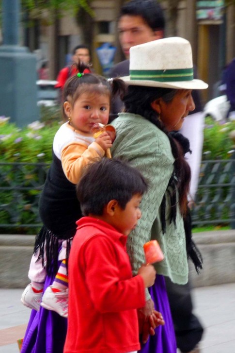
Playing in the world's smallest independent nation.
47 Photos
Created 15 September 2009
|
 |
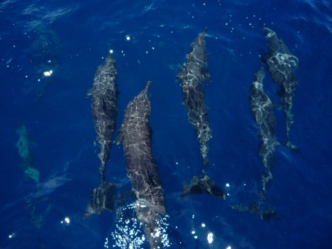
A few picks of Roratonga, where we picked up Tomas, and of the incredible Beveridge Reef
20 Photos
Created 1 September 2009
|
 |
Our adventure in the islands of Tahaa and Raiatea in The Society Islands
18 Photos
Created 5 August 2009
|
 |
Mystical Bora Bora in French Polynesia
31 Photos
Created 5 August 2009
|
 |
The Sailing Rendezvous in Tahiti and Moorea, plus a little of Huahine
35 Photos
Created 5 August 2009
|
 |
Our journey through the coral atolls of the Tuamotus in French Polynesia
65 Photos
Created 19 June 2009
|
 |
 |
25 days of open seas and our first few days on Hiva Oa
51 Photos
Created 28 April 2009
|
 |
Our journeys to Puerto Lucia, Cuenca, Guayaquil and about
55 Photos
Created 25 March 2009
|
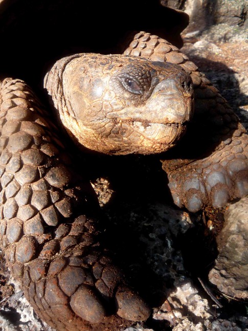 |
Our journey through the Galapagos Islands.
50 Photos
Created 17 April 2008
|
 |
 |
 |
 |
 |
 |
S/V Kena
Who: Roger, Sally, Tane, Hunters all
Port: Tutukaka, New Zealand
SailBlogs Friends


