NORFOLK TO GREAT BRIDGE
02 December 2009
This portion on the Atlantic Intracoastal Waterway, which most people think of as the ICW, begins at Mile "0", off Hospital Point at marker R36, in Norfolk, Virginia.
Today's journey begins from this very point, Mile "0", and will end, if all goes as planned, at Mile "12.1" in Great Bridge.
Yes, you read it right. A good part of a day to do 12 miles.
Well, our boat, which can travel at a speed of about 7 mph should be able to cover that distance in less than 2 hours. Right? Wrong!
Why? Because of the bridges. Today we run the 'gauntlet'!
There are 8 bridges and 1 lock to pass through or under.
We left Mile "0" around 8 am.
The first 3 were railroad bridges and, as our guide book told us, are usually open. Bridge # 1 (Mile 2.5) was closed and had a train on it. After a short wait we were able to get through. Bridge # 2 (Mile 2.7) had been removed, yeah! And bridge # 3 (Mile 3.5) was open.
Bridge # 4, Gilmerton (Mile 5.8). We had timed our departure from our anchorage to arrive here at its opening. Due to bridge # 1 having been closed, we were a little behind. As we were approaching Gilmerton, the Bridge Master told us to hurry, or we would miss the opening. I radioed back to say that we were at full throttle and doing the best we could. We made it.
Bridge # 5 was the railroad bridge directly beside the Gilmerton Bridge and it was open.
Bridge # 6: Interstate 64 Bridge (Mile 7.1). We motored under this 65 foot bridge, no problem.
Bridge # 7, Dominion Blvd Bridge (Mile 8.8). It opens every hour on the hour. We had a 45 minute wait, so Michael took the helm and played around with moving the boat backwards, turning on a dime and coming in to dock and pulling away at the last minute.
Great Bridge Lock (Mile 11.5). This lock raises and lowers boats about 2 feet. This was a breeze after some of the locks in the Erie Canal.
Lock # 8, Great Bridge (Mile 12.1). It is timed to open shortly after the lock through.
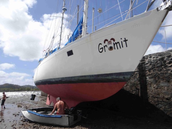
Just south of the last bridge is a free dock to which we tied Gromit at 11:30 am. Yahoo! We did it in only ½ a day!!!!
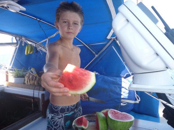
It is a 15 minute walk from the dock to many shops. We needed to get some groceries and also, Maia's birthday is coming up and I had something in mind for her. The girls and I, (Liam's foot was still too sore for him to join us), with backpack and folding shopping cart, headed to the grocery store to stock up. I found the present I wanted for Maia and then we headed back to the boat, heavily laden with supplies. I decided to give her, her present early as it is quite cold these days. I knew she would welcome the fleece blanket I had bought. The huge smile on her face confirmed that I was right.
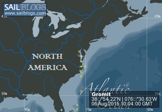
GREAT BRIDGE (Mile 12.1) to BROAD CREEK ANCHORAGE, COINJOCK (Mile 61.2)
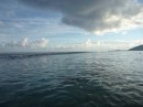
It was a grey, rainy day. We had another couple of bridges to get through. Again, we timed our departure to coincide with the bridge openings, so it was not a crack-of-dawn departure. We were able to do a bit of motor-sailing today, which gained us 1 knot of speed. We anchored in an anchorage we'd used before and had restful night.
COINJOCK (Mile 61.2) to PUNGO RIVER ANCHORAGE (Mile 127.4)
At the crack of dawn the next morning (no bridges to worry about), we pulled anchor and motored away. We were able to motor-sail a bit today as well. Sailing without the motor would be ideal, but the winds aren't always in the right direction or strong enough for us to do the mileage we need to in a day.
We got as far as the end of the Pungo Canal and chose an anchorage that was protected from the predicted winds of 50-60 kmph. We spent a day there and headed out the next morning expecting to make it to within about 20 miles of Beaufort, NC. It was another beautiful day and we were able to sail part of the way. Yahoo!
By late afternoon, we were anchored in Cedar Creek (Mile 187.7). We were now within 20 miles of Beaufort, NC. Our plan was to go to Beaufort tomorrow and wait for ideal weather for our ocean passage to Jekyll Island.
Big winds were predicted, so I didn't want to wait in Beaufort. The currents are strong and you have to double anchor. Michael suggested that we back track a bit to Oriental, (Mile 180.8) and wait out the storm there.
We pulled anchor, left Cedar Creek and while Michael was hosing down the anchor, I tried to cut into the channel too soon and got us into about 4 1/2 feet of water. Needless to say, we came to a stop. Luckily, we weren't going too fast, so I was able to back us up out of the shallows and get back to deeper water.
We had only about 7 miles to go to Oriental so it only took an hour. We anchored behind the break wall. The next day, we moved to the free dock.
We'll be here until Friday morning, when the weather looks to be really good for a passage on the ocean to Jekyll Island.