
Kristinly
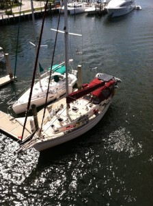
38' Island Packet cutter rigged sailboat - sailed 20,000 nautical miles from New England to the Bahamas. Now with new owners Tim & Susan Tiefenbach
17 June 2013 | Mallets Bay, VT
05 July 2012 | West Pont, NY
02 July 2012 | Brigantine Shoals near Little Egg Inlet, NJ
30 June 2012 | Reedy Island, Delaware River
29 June 2012 | Annapolis, MD
26 June 2012 | Antipoison Creek, VA
23 June 2012 | Burlington, VT
28 March 2012 | Deltaville, VA
27 March 2012 | Deltaville, VA
26 March 2012 | Hampton, VA
25 March 2012 | Hampton, VA
24 March 2012 | South of Norfolk, VA
23 March 2012 | Elizabeth City, NC
22 March 2012 | Cedar Creek, NC
21 March 2012 | Wrightsville Beach, NC
20 March 2012 | Little River, NC
18 March 2012 | South Santee River, SC
17 March 2012 | Charleston, SC
17 March 2012 | Charleston, SC
16 March 2012 | NE of Savannah, GA
Near Cape Canaveral N28° 31.848' W80° 45.267'
07 February 2008 | N28° 31.848' W80° 45.267'
Randy

I knew there had to be a way for you to find me easily enough given the latitude and longitude coordinates I give you when I give you my location; I just wasn't sure how to do it. My friend Joe finally clued me in tonight. Some of you have probably figured this out already, but if you go to http://maps.google.com/ and copy and paste the coordinates I give you (e.g.: N28° 31.848' W80° 45.267' for when I was near Cape Canaveral) and use the satellite view, you will be able to see within something like 50 - 200 ft. or so of where I actually am. Then you can zoom in or out, whatever you prefer. Now, I am assuming you would like to know this bit of knowledge, and undoubtedly some of you have figured this out already, but for those of us just realizing it, this is some pretty cool shit!
Comments
| Vessel Name: | Kristinly |
| Vessel Make/Model: | Island Packet 38, hull #83 |
| Hailing Port: | Mallets Bay, VT |
| Crew: | Captain Randy Kruml, 1st Mate Nikki St Mary |
Gallery not available
Kristinly
Who: Captain Randy Kruml, 1st Mate Nikki St Mary
Port: Mallets Bay, VT
Favorites
- BouyWeather.com
- Defender Marine
- Google Maps
- Island Packet Yacht Owners Association
- Lake Champlain ECHO lake cam
- Mack Borings
- Plattsburgh Boat Basin
- Point Bay Marina - Charlotte, VT
- SailFlow.com
- Salty Southeast Cruiser's Net
- Seven Seas Cruising Association
- Weather Channel
- Weather Underground
- West Marine