
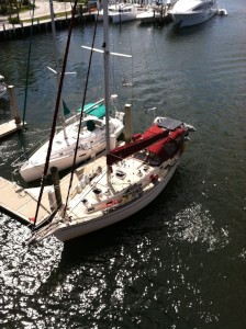
Kristinly
38' Island Packet cutter rigged sailboat - sailed 20,000 nautical miles from New England to the Bahamas. Now with new owners Tim & Susan Tiefenbach
17 June 2013 | Mallets Bay, VT
05 July 2012 | West Pont, NY
02 July 2012 | Brigantine Shoals near Little Egg Inlet, NJ
30 June 2012 | Reedy Island, Delaware River
29 June 2012 | Annapolis, MD
26 June 2012 | Antipoison Creek, VA
23 June 2012 | Burlington, VT
28 March 2012 | Deltaville, VA
27 March 2012 | Deltaville, VA
26 March 2012 | Hampton, VA
25 March 2012 | Hampton, VA
24 March 2012 | South of Norfolk, VA
23 March 2012 | Elizabeth City, NC
22 March 2012 | Cedar Creek, NC
21 March 2012 | Wrightsville Beach, NC
20 March 2012 | Little River, NC
18 March 2012 | South Santee River, SC
17 March 2012 | Charleston, SC
17 March 2012 | Charleston, SC
16 March 2012 | NE of Savannah, GA
Manteo, NC N35° 54.524' W75° 40.105'
15 May 2009 | 35 54.524N 75 40.105W
Randy
I arrived here Wednesday afternoon at about 1800. Joe and Deb followed just after sunset. It was a difficult beat into the wind all day that required one tack back east and then north again as the "east" winds that were forecasted never happened and we fought NE 15 - 20 kts winds all day. C-Note had a few problems along the way such as the dinghy coming loose in the davits and had to heave-to several times to deal. It took us 11 hours to travel 38 miles, and we were all tired at the end of the day. As reported by Tow Boat US, the channel down the east side of Roanoke Island had plenty of water but is very narrow near the bridge. Actually, I was talking to C-Note just after I passed under the bridge and wasn't paying close enough attention and ran aground - pretty hard too, but was moving fast enough and just on the edge of the channel and basically skipped off the mud and right back into the channel. C-Note and I were talking afterwards about how I had freaked when doing that at the Carolina Inlet just after I had met them about 1 1/2 years ago. Now, it is just another event in the day of the life of a cruiser and not necessarily even a big deal.
Roanoke Island turned out to be a fabulous place to stop over for a couple of nights. The folks at Manteo Waterfront Marina were very hospitable and allowed us to stay for the first two nights free on the bulkhead since the winds were blowing hard and essentially had us pinned to the pier. Roanoke is a tourist destination, so things like dining aren't cheap, and we did not do a lot of that. But it is rich in history and happens to be the place of the first colony established by the English in the late 1500's. The colony actually soon disappeared without a trace and was never heard from again, and this is the place known as the "Lost Colony".
Most cruisers do not travel this route, primarily I think because there is not much written about it and weather can be an issue on the large open sounds. The upside if you hit it right is you get to sail the entire distance from the Neuse River up through the Pamlico and Albemarle sounds instead of motoring through the ICW. It takes three days to go either route, so my money is on the way. I am hoping to hit this again on the return trip south in the fall.
We did a lot of site seeing at places like the Cape Hatteras light house and the Wright Brothers National Memorial - both very impressive and I recommend seeing them if you haven't. We also saw some people sail boarding and kite surfing. Strong winds and smooth water on the lee of the barrier islands seem to make conditions pretty ideal. I attached a picture for Mark Mc., who has been here to do this stuff.
Comments
| Vessel Name: | Kristinly |
| Vessel Make/Model: | Island Packet 38, hull #83 |
| Hailing Port: | Mallets Bay, VT |
| Crew: | Captain Randy Kruml, 1st Mate Nikki St Mary |
Gallery not available
Kristinly
Who: Captain Randy Kruml, 1st Mate Nikki St Mary
Port: Mallets Bay, VT
Favorites
- BouyWeather.com
- Defender Marine
- Google Maps
- Island Packet Yacht Owners Association
- Lake Champlain ECHO lake cam
- Mack Borings
- Plattsburgh Boat Basin
- Point Bay Marina - Charlotte, VT
- SailFlow.com
- Salty Southeast Cruiser's Net
- Seven Seas Cruising Association
- Weather Channel
- Weather Underground
- West Marine