
Kristinly
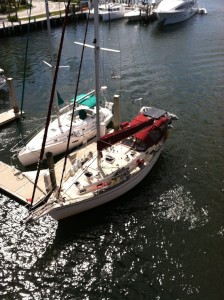
38' Island Packet cutter rigged sailboat - sailed 20,000 nautical miles from New England to the Bahamas. Now with new owners Tim & Susan Tiefenbach
17 June 2013 | Mallets Bay, VT
05 July 2012 | West Pont, NY
02 July 2012 | Brigantine Shoals near Little Egg Inlet, NJ
30 June 2012 | Reedy Island, Delaware River
29 June 2012 | Annapolis, MD
26 June 2012 | Antipoison Creek, VA
23 June 2012 | Burlington, VT
28 March 2012 | Deltaville, VA
27 March 2012 | Deltaville, VA
26 March 2012 | Hampton, VA
25 March 2012 | Hampton, VA
24 March 2012 | South of Norfolk, VA
23 March 2012 | Elizabeth City, NC
22 March 2012 | Cedar Creek, NC
21 March 2012 | Wrightsville Beach, NC
20 March 2012 | Little River, NC
18 March 2012 | South Santee River, SC
17 March 2012 | Charleston, SC
17 March 2012 | Charleston, SC
16 March 2012 | NE of Savannah, GA
St. Michaels, MD N38° 47.181' W76° 13.046'
10 June 2009 | 38 47.181N 76 13.046W
Randy
I have had a few people ask me lately what the significance of the lat/long coordinates (i.e.: N38° 47.181' W76° 13.046') is in the subject line of the emails. Some are new to the list since I explained last, and a few may have forgotten. These coordinates are the exact location (within something like the length of the boat) of where I am at the time the coordinates are given. It is more for future reference for me than anything else. But if you are interested in seeing for yourself, you can go to http://maps.google.com and copy and paste the coordinates into the search line and voila! You will be able to see just where I am. There is a feature on this site (satellite) that if you click on it, you get an actual photo view from an overhead satellite shot. Pretty cool ...
Other than that, today was pretty uneventful. Motored north to St. Michaels on the east side of the bay from Solomons (52 nm) in 7 hours, so made pretty good time. This is supposed to be a place where sailors on the Chesapeake make an annual pilgrimage to once a year. I guess there is a great maritime museum plus other neat nautical flavor
stuff. Will hang here through the weekend, and then on over to Annapolis (only 25 nm) Monday or Tuesday where Nikki flies in to meet me on Thursday of next week. Can't wait! We also have three friends from Burlington (Tim, Jess, and Mark) who will fly down the following Saturday to spend 3 days with us and do some sailing, assuming the
weather cooperates. I have to say that I am always happy to be on the boat, even alone, but it will be MUCH more fulfilling once Nikki arrives.
Lastly, Bruce Ray of s/v Zingara showed up yesterday, almost exactly one year to the day (minus 7 days) that we met here last year. And just like last year, he came over to Kristinly for dinner and the thunderstorms moved in. Go figure ...
Comments
| Vessel Name: | Kristinly |
| Vessel Make/Model: | Island Packet 38, hull #83 |
| Hailing Port: | Mallets Bay, VT |
| Crew: | Captain Randy Kruml, 1st Mate Nikki St Mary |
Gallery not available
Kristinly
Who: Captain Randy Kruml, 1st Mate Nikki St Mary
Port: Mallets Bay, VT
Favorites
- BouyWeather.com
- Defender Marine
- Google Maps
- Island Packet Yacht Owners Association
- Lake Champlain ECHO lake cam
- Mack Borings
- Plattsburgh Boat Basin
- Point Bay Marina - Charlotte, VT
- SailFlow.com
- Salty Southeast Cruiser's Net
- Seven Seas Cruising Association
- Weather Channel
- Weather Underground
- West Marine