
LeuCat Adventures
Join us in sharing our adventures as we sail around the world. NEW!!************************************************************************* GET A COPY OF OUR TECHNO-TIPS DOCUMENTS--JUST CLICK ON THEM UNDER THE "FAVORITES" HEADING ON THE RIGHT

24 September 2017
30 August 2017 | San Francisco, CA
07 July 2017
02 July 2017 | Simpson Bay Marina, Cole Bay, Sint Maarten
01 July 2017 | Simpson Bay Marina, Cole Bay, Sint Maarten
30 June 2017 | Simpson Bay Marina, Cole Bay, Sint Maarten
29 June 2017 | Simpson Bay Marina, Cole Bay, Sint Maarten
28 June 2017 | Simpson Bay Marina, Cole Bay, Sint Maarten
27 June 2017 | Simpson Bay Marina, Cole Bay, Sint Maarten
26 June 2017 | Simpson Bay Marina, Cole Bay, Sint Maarten
25 June 2017 | Simpson Bay Marina, Cole Bay, Sint Maarten
24 June 2017
24 June 2017 | Simpson Bay Marina, Cole Bay, Sint Maarten
22 June 2017 | Simpson Bay Marina, Cole Bay, Sint Maarten
21 June 2017 | Simpson Bay Marina, Cole Bay, Sint Maarten
20 June 2017 | Simpson Bay Marina, Cole Bay, Sint Maarten
18 June 2017 | Simpson Bay Marina, Cole Bay, Sint Maarten
17 June 2017 | Simpson Bay Marina, Cole Bay, Sint Maarten
16 June 2017 | Simpson Bay Marina, Cole Bay, Sint Maarten
15 June 2017 | Simpson Bay Marina, Cole Bay, Sint Maarten
Year 9 Day 200 A New Double Threat
18 August 2016 | Rodney Bay Marina, St. Lucia
Dave/Mostly Sunny
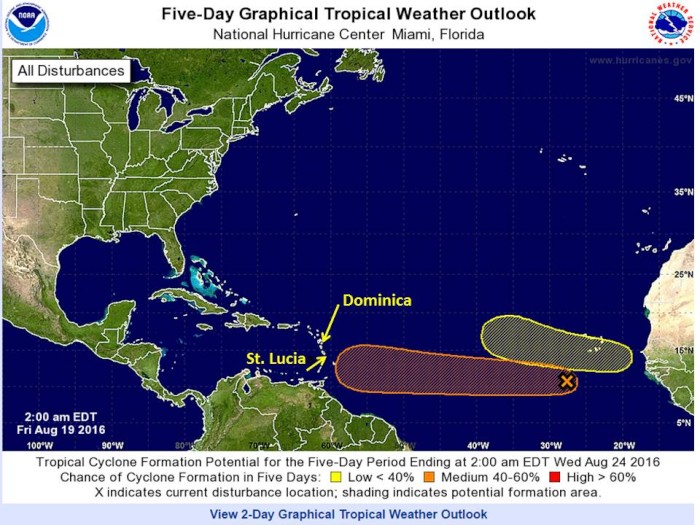
As we ready ourselves and Leu Cat for departure tomorrow, a new, double threat in the weather formed. There is now the potential for two new hurricanes to form from tropical waves moving from the coast of Africa. This is in addition to tropical storm Fiona, which is well to the north of us and offers no threat to us here in the Lessor Antilles.
The first of the new tropical disturbances is following a track that is heading toward the southern and central islands of the Lessor Antilles. Thus, at this moment, heading south to Trinidad does not look to offer much security. Instead, heading north up to the Leeward Island group (those islands of the Lessor Antilles which are north of Martinique) appears to be the better choice to move out of the predicted path of this potential nasty weather.
The problem with that strategy is that the second tropical disturbance, which has not even moved offshore of Africa yet, is predicted to move in a more WNW trajectory than the first one. Thus, by sailing north, we head closer to its potential path. The photo attached to this blog graphically shows the predicament this unusual weather phenomenon presents to us.
Fortunately, the second disturbance which has not even formed yet is projected to be move to the north and may even move to the north of the Leeward Islands and is predicted to be slow moving. Now, all of this may change as each disturbance ages and moves west. What this means is that we need to monitor these very closely and be prepared to cut north or south, or possibly juke in both directions to dance around these weather patterns.
Our initial thoughts are to go ahead and leave for Martinique tomorrow and quickly get up to Dominica which is the next island to the north of Martinique. This has the dual advantage of moving to the northern most edge of the potential path of this disturbance as well as progress us closer to St. Martin. Even if the disturbance does mature into a tropical storm or hurricane and its trajectory does drift northward, we will still be in a position to sail south to Trinidad within two days as it will only be 300 nm to the south of us. If its trajectory stays as now shown, and if we wanted to move even further north, we would only be a 24 hour sail from St. Martin ( 170 nm).
Being in Dominica also gives us a good spot to be to watch the development of the second disturbance. We would be on the southern side of that disturbances potential path and we would well position for an easy sail to the south to either return to Martinique or St. Lucia or even one of the more southern islands such as St. Vincent, one of the Grenadines or Grenada.
Thus, it is looking like we will be leaving Rodney Bay and St. Lucia for Martinique tomorrow. Here is the latest NOAA description of the two disturbances that have so much of our attention.
TROPICAL WEATHER OUTLOOK
NWS NATIONAL HURRICANE CENTER MIAMI FL
200 AM EDT FRI AUG 19 2016
For the North Atlantic...Caribbean Sea and the Gulf of Mexico:
The National Hurricane Center is issuing advisories on Tropical storm Fiona, located over the central tropical Atlantic.
1. A tropical wave located about 350 miles southwest of the Cabo Verde Islands is producing an elongated area of cloudiness and disorganized shower activity. Environmental conditions are expected to be conducive for gradual development, and a tropical depression could form early next week while the system moves westward at about 15 mph across the tropical Atlantic Ocean.
* Formation chance through 48 hours...low...10 percent
* Formation chance through 5 days...medium...50 percent
2. A tropical wave is forecast to move off of the coast of Africa on Saturday. Environmental conditions appear conducive for gradual development of this system early next week while it moves generally west-northwestward over the eastern tropical Atlantic Ocean.
* Formation chance through 48 hours...low...near 0 percent
* Formation chance through 5 days...low...30 percent
Comments
| Vessel Name: | Leu Cat |
| Vessel Make/Model: | Lagoon 440 |
| Hailing Port: | Dana Point, CA |
| Crew: | Mary Margaret and Dave Leu |
| About: | Our goals are to spend the next 10 to 15 years cruising around the world and sharing this adventure with family and friends. |
| Extra: | S/V Leu Cat is Lagoon 440 rigged for blue water sailing. It is 44 feet long with a 25 foot beam |
| Social: |
|
Leu Cat's Photos - (Main)
 |
 |
Wedding and Reception photos April 18, 2015, Yosemite, CA
49 Photos
Created 30 April 2015
|
 |
Here are some pics that I took while visiting w/ my parents in the Galapagos Islands
22 Photos
Created 29 March 2010
|
 |
 |
 |
 |
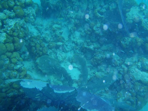 |
Pictures of the sea life in the cut between Little Jost Van Dyke and Green Cay, BVI
30 Photos
Created 17 March 2008
|
 |
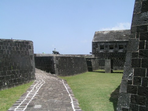
Here are a number of pictures of St. Maarten and the places we visited
36 Photos
Created 21 January 2008
|
 |
Photos of Nanny Cay
6 Photos
Created 11 January 2008
|
 |
Join us as we explore the Spanish, American, and British Virgin Ilsands.
15 Photos
Created 20 October 2007
|
 |
To help get you ready to go sailing with us, we wish to introduce you to Leu Cat so you will know what to expect when you get here! Just click on the first photo and then use the "next" button to advance through this slide show.
19 Photos
Created 19 October 2007
|
 |
This is a collection of photos documenting our sail through the Windward Islands during May/June 2006 with our son, David Paul.
62 Photos
Created 14 October 2007
|

Who: Mary Margaret and Dave Leu
Port: Dana Point, CA
Gallery


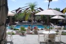

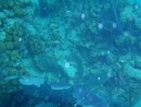
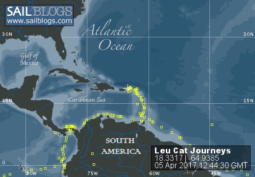
Table of Contents
Favorites
- Get A Copy Of Our Techno Tips Document
- Galley Tips For Cruisers
- Land Travel Tips For Cruisers
- Get A Copy Of Our Yanmar Drive Cone Repair Manual
- Updated Pirate Report
- My Bother Don's and Debbie's Blog
- A Great Sailing Blog
- A remarkable Sail Blog
- Celestial Navigation
- Here is Another Great Sailing Blog
- S/V Totem's Sail Blog
- S/V Infini's Blog Site
SailBlogs Friends


