
LeuCat Adventures
Join us in sharing our adventures as we sail around the world. NEW!!************************************************************************* GET A COPY OF OUR TECHNO-TIPS DOCUMENTS--JUST CLICK ON THEM UNDER THE "FAVORITES" HEADING ON THE RIGHT

24 September 2017
30 August 2017 | San Francisco, CA
07 July 2017
02 July 2017 | Simpson Bay Marina, Cole Bay, Sint Maarten
01 July 2017 | Simpson Bay Marina, Cole Bay, Sint Maarten
30 June 2017 | Simpson Bay Marina, Cole Bay, Sint Maarten
29 June 2017 | Simpson Bay Marina, Cole Bay, Sint Maarten
28 June 2017 | Simpson Bay Marina, Cole Bay, Sint Maarten
27 June 2017 | Simpson Bay Marina, Cole Bay, Sint Maarten
26 June 2017 | Simpson Bay Marina, Cole Bay, Sint Maarten
25 June 2017 | Simpson Bay Marina, Cole Bay, Sint Maarten
24 June 2017
24 June 2017 | Simpson Bay Marina, Cole Bay, Sint Maarten
22 June 2017 | Simpson Bay Marina, Cole Bay, Sint Maarten
21 June 2017 | Simpson Bay Marina, Cole Bay, Sint Maarten
20 June 2017 | Simpson Bay Marina, Cole Bay, Sint Maarten
18 June 2017 | Simpson Bay Marina, Cole Bay, Sint Maarten
17 June 2017 | Simpson Bay Marina, Cole Bay, Sint Maarten
16 June 2017 | Simpson Bay Marina, Cole Bay, Sint Maarten
15 June 2017 | Simpson Bay Marina, Cole Bay, Sint Maarten
Year 10 Day 134 Yes, We Are In The Hurricane Season
13 June 2017 | Simpson Bay Marina, Cole Bay, Sint Maarten
Dave/Partly Cloudy

The traditional view of the North Atlantic Hurricane season is that it starts on June 1 and runs through the end of October. While it is true that the vast majority of hurricanes in this part of the world are born and die during this period, there have been a number of exceptions. For example, Hurricane Alex just last year formed near the Bahamas in January and moved north, passed by Bermuda before turning east and then south and finally turned north and went right through the heart of the Azores before dying out just south of Greenland. Wow!
Last year was predicted to be slightly above average year for hurricanes with all of them predicted to fall to the north of the West Indies. As it turned out, there were 7 hurricanes, 8 tropical storms and 1 tropical depression (pretty much as predicted). I will post a graph that shows the dates of these tropical disturbances and their strengths above this post. I am posting to this blog a photo that shows the tracks of these disturbances. As you can see, the prediction was mostly correct, however, Hurricane Mathew was the exception as it roared just to the north of Grenada as a tropical storm and then marched into the Caribbean as a hurricane. It strengthened briefly to a Category 5 just before it turned north, when it eased just a bit but stayed a Category 4 as it passed between Cuba and Haiti and then blew by the east coast of the Southeastern US.
Please note that seven of these topical disturbances passed right over the route we need to take to sail to the Azores. This is the main reason we have decided that if we cannot leave before the end of this month, we will give up on our dream of sailing to the Med and return to Grenada for the rest of the hurricane season.
I offer this information not only because it is the reason we would abandoned our dream of sailing over to the Med but also because today is the first day during this hurricane season that a strong tropical wave has formed off the coast of Africa and is heading toward the Caribbean. As I explained last year at this time, tropical waves are what spawn most of the tropical disturbances which end up being tropical depressions, tropical storms and then hurricanes. Right now, NOAA is predicting that there is only a 20% chance that this tropical wave may form a hurricane during the next 5 days. As you will be able to see from the photo that I am posting above this blog, its projected path is westerly and is running along a line that is well to the south of what is normal. I would guess as it moves west, it will begin turning to the NW but at this point in time, NOAA is not predicting that. Time will tell.
The tendency for earlier hurricanes, larger hurricanes, and the possibility of them running well south of where they normally go, as well as reaching all the way up to the tip of Greenland, just underscores the impact of global warming on our weather. This explains the reason for the amazing amount of unstable upper atmospheric air that has cursed the North Atlantic as we have closely watched its weather patterns, waiting for a decent and safe weather window to start our passage to the Azores.
Comments
| Vessel Name: | Leu Cat |
| Vessel Make/Model: | Lagoon 440 |
| Hailing Port: | Dana Point, CA |
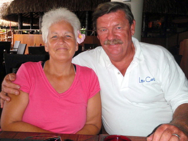
| Crew: | Mary Margaret and Dave Leu |
| About: | Our goals are to spend the next 10 to 15 years cruising around the world and sharing this adventure with family and friends. |
| Extra: | S/V Leu Cat is Lagoon 440 rigged for blue water sailing. It is 44 feet long with a 25 foot beam |
| Social: |
|
Leu Cat's Photos - (Main)
 |
 |
Wedding and Reception photos April 18, 2015, Yosemite, CA
49 Photos
Created 30 April 2015
|
 |
Here are some pics that I took while visiting w/ my parents in the Galapagos Islands
22 Photos
Created 29 March 2010
|
 |
 |
 |
 |
 |
Pictures of the sea life in the cut between Little Jost Van Dyke and Green Cay, BVI
30 Photos
Created 17 March 2008
|
 |
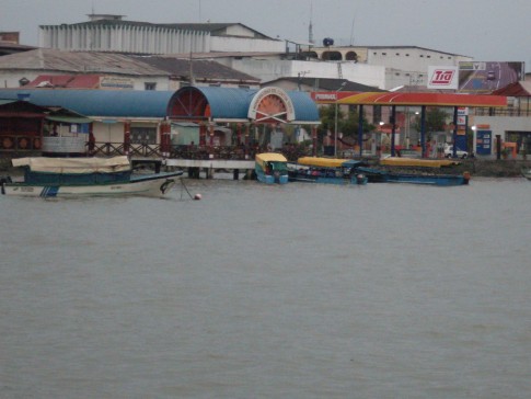
Here are a number of pictures of St. Maarten and the places we visited
36 Photos
Created 21 January 2008
|
 |
Photos of Nanny Cay
6 Photos
Created 11 January 2008
|
 |
Join us as we explore the Spanish, American, and British Virgin Ilsands.
15 Photos
Created 20 October 2007
|
 |
To help get you ready to go sailing with us, we wish to introduce you to Leu Cat so you will know what to expect when you get here! Just click on the first photo and then use the "next" button to advance through this slide show.
19 Photos
Created 19 October 2007
|
 |
This is a collection of photos documenting our sail through the Windward Islands during May/June 2006 with our son, David Paul.
62 Photos
Created 14 October 2007
|
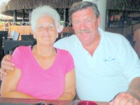
Who: Mary Margaret and Dave Leu
Port: Dana Point, CA
Gallery


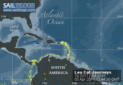
Table of Contents
Favorites
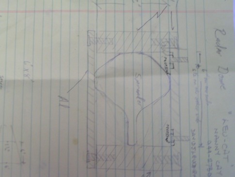
- Get A Copy Of Our Techno Tips Document
- Galley Tips For Cruisers
- Land Travel Tips For Cruisers
- Get A Copy Of Our Yanmar Drive Cone Repair Manual
- Updated Pirate Report
- My Bother Don's and Debbie's Blog
- A Great Sailing Blog
- A remarkable Sail Blog
- Celestial Navigation
- Here is Another Great Sailing Blog
- S/V Totem's Sail Blog
- S/V Infini's Blog Site
SailBlogs Friends


