
Madcap Sailing

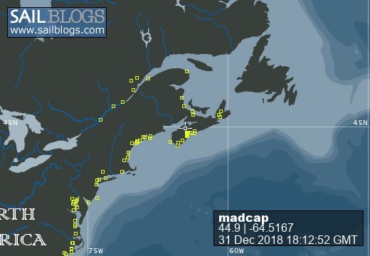
31 December 2018 | Gold River Marina, Nova Scotia, Canada
06 August 2018 | Mahone Bay, Nova Scotia
15 June 2018
26 May 2018 | Gold River Marina, Gold River, NS
18 May 2018 | Gold River Marina, Gold River, NS
24 March 2018 | boat in Gold River, NS and crew in Halifax
22 May 2017 | Whittaker Creek, Oriental, NC
15 May 2017 | Boat in Oriental, crew in New Orleans and Nova Scotia
26 April 2017 | Oriental, NC
26 April 2017 | Oriental, NC
23 April 2017 | Oriental, NC
20 April 2017 | Ocean Isle Marina, Ocean Beach, NC at Mile 335.6
17 April 2017 | Dewees Creek, near Charleston, NC
14 April 2017 | St Simons Island
12 April 2017 | Fernandina Beach, FL
11 April 2017 | St Augustine, FL
07 April 2017 | Vero Beach, Florida
04 April 2017 | Ft Pierce
03 April 2017 | Ft Pierce, FL
30 March 2017 | Ft Pierce, Florida
Navigating to Rogues Roost
19 August 2007 | Rogues Roost, near Prospect, NS
Beth
We've been developing our navigational skills over the last couple of days - and having a decidedly good time at it too!
By the time we detached ourselves from Halifax, it was midafternoon on Friday. Time enough to get to a couple of possible anchorages on our way to Mahone Bay. The weather was so-so, and the forecast was the same: chance of fog, no shortage of wind. We cruised out along the coves on the outskirts of Halifax, past Chebucto Head, and the fog gradually descended. It was decision time. We had been planning to make a much celebrated little anchorage called Rogues Roost, near Prospect on the NS road map, but opted to enter the easier and closer Ketch Harbour. It was a chance to use the radar skills we had last used leaving Liscomb Mills, only this time it was to enter an unfamiliar harbour.
We made the turn at Whistle Buoy, HE19, and crept slowly toward the shoreline. The radar showed there was land on each side and nothing in front of us - a nice picture. Next came one of those moments coastal sailors talk about but heretofore unexperienced by us; there was nothing but fog - and in the next instant, we could see surf breaking on rocks a couple of boat lengths away! It was breathtaking enough with radar and chart plotter in front of me. I can't imagine what it feels like to sailors without these sophisticated instruments.
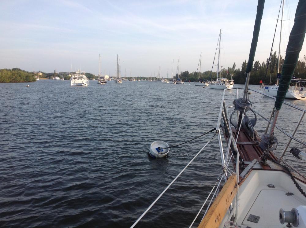
With a visual image to confirm the instrument information, we moved further into this long harbour, ringed by pretty houses. Jim dropped the anchor in 15 feet of water; we put up our cockpit enclosure and spent a pleasant night gently rocking on the long, slow swells.
We thought we might be kept here for another day, but the morning forecast offered a chance to try to make it further along the coast so we waved good bye to fog-free but still grey Ketch Harbour and headed out.
Once again, our goal was Rogues Roost. All the Nova Scotia sailors with whom we have ever talked, and all the books and guides mention this as a must see spot, so even though we've been anxious to catch up with Strathspey, we kept this on our A-list.
Oh what a spectacular place it is!
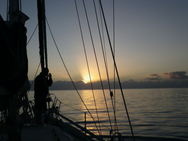
Here is the picture. It's drizzling and cold. We are both dressed head to toe in our foul weather gear. There is a canvas roof over my head, but the sides and the windscreen are open so I can see. There is no dry spot anywhere. Jim is moving back and forth between the bow and the side decks, binoculars slung around his neck; I'm at the wheel with the compass and chart plotter in front of me and a guidebook, to confirm Jim's waypoints, clutched in one hand. My eyes move from chartplotter to depth sounder, to the shoals and islands around me, to book, to compass and back around again. My ears hear Jim call out the buoys (and occasionally say with concern "Do you see those rocks in front of us?"). My hands turn the wheel to adjust our course, and we keep moving forward.
(Just an aside here about the chartplotter - it's a little screen with a detailed map, including water depths, and a boat-shaped icon. We can enter a route with waypoints for each day's journey. The icon moves across the map, so as long as the system is working, we always know exactly where we are. It is one tool, however, and not infallible, so we always use paper charts and our eyes to double-check the information.)
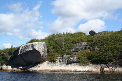
Now - back to my story: There are waves breaking on rocks EVERYWHERE! It looks like a solid wall ahead of us - but the book already told me it would look this way so I'm OK with that. There is not much more than a boatlength between Madcap (not only our means of transportation but our home!) and the rocks, and yet there is never less than 10 feet of water under our keel. We twist and turn around shoals that are visible, and those underwater, and come at last into a remarkable little cove with just one boat anchored there. There is nothing around us but rock, scrubby trees and bushes, and pure wilderness. Single rocks seem dropped on other rocks just where they were left by the last glacier that went through.
Oh what a grand hideout this must have been for many rogues in many eras. What a grand stop it is for sailing ships and kayakers and anyone who appreciates such powerful scenery. We feel incredibly blessed to be here, and share this space for a brief time with the birds and seals, and the memories, stored among these rocks, of other boats and other sailors.
By the time we detached ourselves from Halifax, it was midafternoon on Friday. Time enough to get to a couple of possible anchorages on our way to Mahone Bay. The weather was so-so, and the forecast was the same: chance of fog, no shortage of wind. We cruised out along the coves on the outskirts of Halifax, past Chebucto Head, and the fog gradually descended. It was decision time. We had been planning to make a much celebrated little anchorage called Rogues Roost, near Prospect on the NS road map, but opted to enter the easier and closer Ketch Harbour. It was a chance to use the radar skills we had last used leaving Liscomb Mills, only this time it was to enter an unfamiliar harbour.
We made the turn at Whistle Buoy, HE19, and crept slowly toward the shoreline. The radar showed there was land on each side and nothing in front of us - a nice picture. Next came one of those moments coastal sailors talk about but heretofore unexperienced by us; there was nothing but fog - and in the next instant, we could see surf breaking on rocks a couple of boat lengths away! It was breathtaking enough with radar and chart plotter in front of me. I can't imagine what it feels like to sailors without these sophisticated instruments.
With a visual image to confirm the instrument information, we moved further into this long harbour, ringed by pretty houses. Jim dropped the anchor in 15 feet of water; we put up our cockpit enclosure and spent a pleasant night gently rocking on the long, slow swells.
We thought we might be kept here for another day, but the morning forecast offered a chance to try to make it further along the coast so we waved good bye to fog-free but still grey Ketch Harbour and headed out.
Once again, our goal was Rogues Roost. All the Nova Scotia sailors with whom we have ever talked, and all the books and guides mention this as a must see spot, so even though we've been anxious to catch up with Strathspey, we kept this on our A-list.
Oh what a spectacular place it is!
Here is the picture. It's drizzling and cold. We are both dressed head to toe in our foul weather gear. There is a canvas roof over my head, but the sides and the windscreen are open so I can see. There is no dry spot anywhere. Jim is moving back and forth between the bow and the side decks, binoculars slung around his neck; I'm at the wheel with the compass and chart plotter in front of me and a guidebook, to confirm Jim's waypoints, clutched in one hand. My eyes move from chartplotter to depth sounder, to the shoals and islands around me, to book, to compass and back around again. My ears hear Jim call out the buoys (and occasionally say with concern "Do you see those rocks in front of us?"). My hands turn the wheel to adjust our course, and we keep moving forward.
(Just an aside here about the chartplotter - it's a little screen with a detailed map, including water depths, and a boat-shaped icon. We can enter a route with waypoints for each day's journey. The icon moves across the map, so as long as the system is working, we always know exactly where we are. It is one tool, however, and not infallible, so we always use paper charts and our eyes to double-check the information.)
Now - back to my story: There are waves breaking on rocks EVERYWHERE! It looks like a solid wall ahead of us - but the book already told me it would look this way so I'm OK with that. There is not much more than a boatlength between Madcap (not only our means of transportation but our home!) and the rocks, and yet there is never less than 10 feet of water under our keel. We twist and turn around shoals that are visible, and those underwater, and come at last into a remarkable little cove with just one boat anchored there. There is nothing around us but rock, scrubby trees and bushes, and pure wilderness. Single rocks seem dropped on other rocks just where they were left by the last glacier that went through.
Oh what a grand hideout this must have been for many rogues in many eras. What a grand stop it is for sailing ships and kayakers and anyone who appreciates such powerful scenery. We feel incredibly blessed to be here, and share this space for a brief time with the birds and seals, and the memories, stored among these rocks, of other boats and other sailors.
Comments
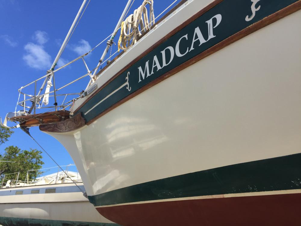
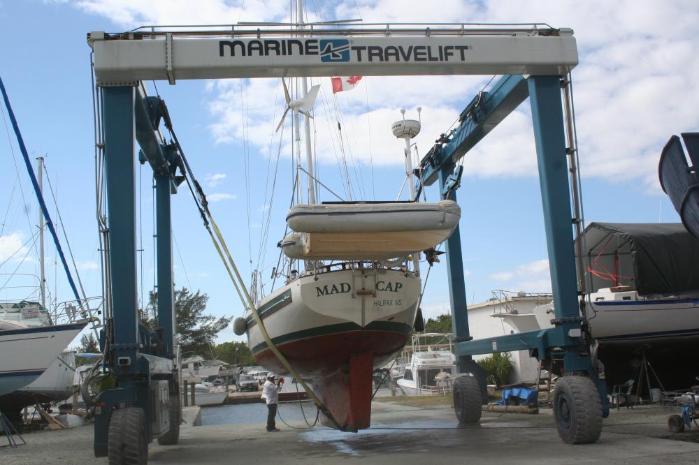
| Vessel Name: | Madcap |
| Vessel Make/Model: | Bayfield 36 |
| Hailing Port: | Halifax, Nova Scotia |
| Crew: | James D Bissell (Jim) and Elizabeth Lusby (Beth) |
| About: | Beth and Jim have spent several winters sailing southern waters on s/v Madcap. They love Halifax in the summer, but loved to spend the winters exploring warmer places - the Bahamas, Cuba, Mexico, Guatemala, Belize, Honduras. |
| Extra: | |
| Social: |
|
Madcap's Photos - Mad Cap Sailing (Main)
 |
 |
 |
 |
 |
 |
 |
 |
 |
 |
 |
 |
 |
 |
 |
 |
 |
 |
 |
 |
 |
Guatemala pics starting Nov 22, 2012
43 Photos
Created 6 December 2012
|
 |
 |
trip to Zion National Park and Bryce Canyon National Park (via Las Vegas)
23 Photos
Created 4 November 2012
|
 |
 |
 |
 |
 |
 |
 |
Madcap
Who: James D Bissell (Jim) and Elizabeth Lusby (Beth)
Port: Halifax, Nova Scotia
SailBlogs Friends


