
20 May 2007
29 June 2006
26 June 2006
24 June 2006
21 June 2006
20 June 2006
20 June 2006
20 June 2006
20 June 2006
20 June 2006
20 June 2006
20 June 2006
20 June 2006
20 June 2006
20 June 2006
20 June 2006
20 June 2006
20 June 2006
20 June 2006
20 June 2006
Navigation programs?
29 June 2006
JeanneP
QUESTION:
I am embarking on an extended cruise beginning in 22 months. I have amassed a large volume of paper charts and am interested in an electronic nav program. I see numerous out there (Maxsea, The Cap'n, etc.,) but I have no idea which one to pursue. I understand that most soft raster charts are compatible or interface with most of the programs, but I would truly like a cruising perspective on the pros and cons and, ultimately, which is the "cruiser's choice". Any assistance or direction you could give me would be most appreciated.
ANSWER:
I wish I could help you, but I'm floundering myself. I have downloaded trial versions of Fugawi and Digiboat's SOB software, and plan to try them over this summer and Fall.
There were no electronic nav programs when we started cruising, and I still distrust them. Our new power catamaran has a GPS chart plotter, but so far we pretty much use it only for lat/long positions.
Although I like the ease with which I can set waypoints, Peter and I still plot our course on paper charts, and confirm any course with the paper charts, and parallel rule.
Keep tuned to my blogs, I'll try to do more with electronic charting over the next year.
Fair winds,
Jeanne
Comments
| Vessel Make/Model: | Jeanneau Sun Fizz |
| Hailing Port: | THE TROPICS |
| About: | Jeanne and Peter Pockel - Cruising in the Tropics |
| Extra: | We left Boston in 1986 to go cruising for a few years. Sixteen years later we are still "cruising for a few years". |
| Home Page: | http://www.sailblogs.com/member/melon/?xjMsgID=3624 |
Gallery not available
YACHT WATERMELON
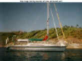
Port: THE TROPICS