
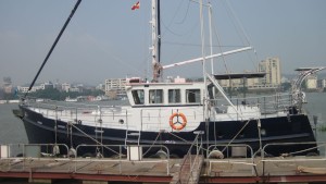
MV Shearwater
08 September 2013 | Kitchen Table
06 September 2013 | Admiralty Inlet
06 September 2013 | Mid Pacific
06 September 2013 | Off Oregon coast
06 September 2013 | Neah Bay
05 September 2013 | 47 42.7'N:125 27.6'W, 50nm from Wa entrance
04 September 2013 | 45 44.9'N:127 41.5'W, 197nm from Wa entrance
03 September 2013 | 43 51.3'N:130 07.0'W, 350nm from Wa entrance
02 September 2013 | 42 18.2'N:132 43.2'W, 498nm from Wa
01 September 2013 | 40 47.1'N:135 11.7'W, 636 nm from Wa
31 August 2013 | 40 23'N:138 20'W, 754 nm from Wa
30 August 2013 | 39 42.4'N:141 25.8'W, 882nm from Wa
29 August 2013 | 38 50.3'N:144 27.3'W, 1021nm from Wa
28 August 2013 | 37 18.7'N:146 40.4'W, 1160 nm from Wa
27 August 2013 | 34 41.2'N:148 30.1'W, 1292 nm from Wa
26 August 2013 | 34 11.0'N:150 23.5'W, 1420 nm from Wa
25 August 2013 | 32 25.1'N:152 21.8'W, 1565nm from Wa
24 August 2013 | 27 25.9'N:153 57.0'W, 1706 nm from Wa
23 August 2013 | 27 25.9'N:153 57.0'W, 1893 nm from Wa
23 August 2013 | 24 57.9'N:154 31.8'W, NE of Hawaii
I Should Know Better
30 August 2013 | 39 42.4'N:141 25.8'W, 882nm from Wa
David C
Position and Weather Report Position: Lat: 33deg 42.1" Long: 141deg 25.8 " Predicted 24h position: Lat: 39deg 42".4 Long: 138deg 09.8" COG: 088deg SOG: 7.5kts Baro: 1011 mb 24h range: 29.95-29.89 Wind: 22kts 24h range:NW 07 kts to SW 22 kts Waves SW 2 M Sails furled Paravanes in Present gph 3.5 Clouds: overcast Summary: Breezy from the SW with building sea. Comfortable ride. Lee, thanks for your welcome input. We are continuing on Eastward course toward 135deg and will check again at 12:00utc
24h summary Fuel used:59g Gal/hr 2.5 Fuel at destination:1117g Distance made good:148 Ave. Speed:6.2 MPG:2.5 Fuel remaining:1484g Max range:3710 Range to Destination:917nm Reserve Range:2793nm
I should know better.
Remember my somewhat flip comment about certificates of added qualification for cruising in head and beam seas but not following seas. I should have learned from previous experience that one should never taunt Mother Nature! This morning I got the news from Lee that a low pressure system is headed this way from Alaska and suggested a course change to the East to take the resulting wind and waves on the port quarter - yes, the following seas I had not yet experienced! I thought it was still summer and we could relax all the way to Seattle but what can you do. So we mobilized and got the boat into ship shape and ready for heavier weather. Fortunately, as I have mentioned so many times previously, all the work we did in Hong Kong and underway has made the preparation quick and organized. Dave and I created a check list of things to do when nasty weather approaches. Roger labeled and organized lexan storm windows for easy orientation and placement and fabricated foam plugs f or outboard vents. All our safety gear has been customized and labeled. Loose items are all stowed. The drogue and para anchor are organized and ready in case they are needed. Lee is giving us q12 hour updates and course headings. The good news is that the low will lose some oomph as it travels South but we will still get the effects of its earlier strength with big swell from the NW. Better news is that the Duck is built to be safe in just this kind of weather. When you see her, you will see what I mean. Just got email from Lee that current predictions have the system curving North and giving us a glancing blow. We shall see but are prepared. Wade and I made a big pot of soup for quick energy. As it looks now, by Monday weather should improve and we can continue running home to Puget Sound.
One other bit of good news is that a following sea is way more comfortable than plowing into the teeth of it on the nose. Right now we have 20 kts off the Stbd quarter with 2M seas and the boat is riding smoothly without undue motion.
Last night was a great night for celestial navigation. Mark and I shot a total of 7 different celestial bodies including Venus and the stars, Arcturus, Deneb, Altair, Spica, Denebola, and Enif. The sextant measures the angle from the star to the horizon at a specific time by using a split screen to superimpose the star on the horizon. It is a bit of a challenge to get as many sights as possible from the time the stars are visible till the time the horizon disappears in darkness. The angle is read off the sextant as the exact moment of sighting is recorded. One second off the mark represents a mile of distance so we use a reliable time source accurate to less than 1 second. The SSB radio has exact time "tics" useful for setting our watches. Then the not so fun part of doing all the math and various corrections necessary to come up with a plot which locates us in space. As fishing lines are stowed with weather approaching, I see mathematical computation in my near fu ture if it doesn't interfere with afternoon nap.
Comments
| Vessel Name: | Shearwater |
| Vessel Make/Model: | Seahorse Marine Diesel duck 462 |
| Hailing Port: | Avatiu, Cook Islands |
| Crew: | Dave C, Dave N, Roger R, Wade B John M, Mark R |
Gallery not available
Who: Dave C, Dave N, Roger R, Wade B John M, Mark R
Port: Avatiu, Cook Islands