Voyages North
23 July 2023
21 August 2021
11 July 2021 | Posted in Seattle
16 May 2021
07 January 2021
10 April 2020 | Posted in Seattle
31 August 2019 | Posted at Port McNeill
31 August 2019
30 August 2019
30 August 2019 | Posted at Port MCNeill
13 August 2019 | Posted at Prince Rupert
13 August 2019 | Posted at Prince Rupert
03 August 2019 | Posted at Ketchikan
02 August 2019 | Posted at Metlakatla
02 August 2019 | posted in Metlakatla AK
22 July 2019 | Posted at Klawock/Craig
22 July 2019 | Posted at Klawock/Craig
09 July 2019 | Posted at Juneau
09 July 2019 | Posted at Juneau
27 June 2019
Mole Harbor, Seymour Canal. July 9.-10, 2013
24 July 2013 | posted at Craig
Elsie Hulsizer
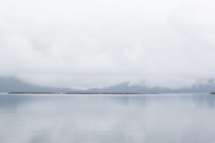
Photo: Mole Harbor. The mole is the thin brown line: a rock that serves as a breakwater.
We motored down Seymour Canal, rain lashing our faces. We abandoned our plans to go on to Gambier Bay or Cannery Cove and decided to settle for Mole Harbor, near the entrance to Seymour Canal and only 15 miles away. I wondered why it was called Mole Harbor. Surely there wouldn't be moles where the ground was mostly rock.
The chart showed few details but the Coast Pilot recommended entering between Rasp Ledge on the north and Beacon Rock on the south. Inside, the wind settled down but the waves still curved into our anchorage. As the tide fell, however, the waves diminished.
In the morning we woke up to a quiet anchorage. I looked out the port light and was amazed to see one long flat rock stretching across much of the entrance at low tide. Then I remembered that "mole" doesn't mean just a little furry creature. It's also means "breakwater."
Post script. August 4, 2013. In Ketchikan I learned that Mole Harbor was the home of the Bear Man of Admiralty Inlet. I bought the book. More to come later after I read it.
Comments
| Vessel Name: | Osprey |
| Vessel Make/Model: | Annapolis 44 sloop |
| Hailing Port: | Seattle |
| Crew: | Steve and Elsie Hulsizer (author of Glaciers, Bears and Totems and Voyages to Windward) |
| About: | |
| Extra: |
Osprey's Photos - Main
No items in this gallery.
Voyages North on SV Osprey
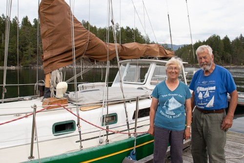
Who: Steve and Elsie Hulsizer (author of Glaciers, Bears and Totems and Voyages to Windward)
Port: Seattle
SailBlogs Friends

