Voyages North
23 July 2023
21 August 2021
11 July 2021 | Posted in Seattle
16 May 2021
07 January 2021
10 April 2020 | Posted in Seattle
31 August 2019 | Posted at Port McNeill
31 August 2019
30 August 2019
30 August 2019 | Posted at Port MCNeill
13 August 2019 | Posted at Prince Rupert
13 August 2019 | Posted at Prince Rupert
03 August 2019 | Posted at Ketchikan
02 August 2019 | Posted at Metlakatla
02 August 2019 | posted in Metlakatla AK
22 July 2019 | Posted at Klawock/Craig
22 July 2019 | Posted at Klawock/Craig
09 July 2019 | Posted at Juneau
09 July 2019 | Posted at Juneau
27 June 2019
Kaigani Strait. July 27, 2013.
31 July 2013 | posted at Metlakatla, Ak
Elsie Hulsizer
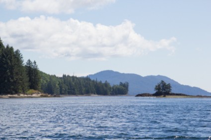
Photo: Howkan, the site of a former Haida village.
A patchwork of clearcuts on Dall Island revealed themselves as we approached Kaigani Strait, the 12-mile long, one-mile wide body of water between Dall Island and Long Island.
We had come to Kaigani Strait to see the locations of the original Alaskan Haida (called "Kaigani" Haida) villages. We planned to visit Mission Cove and the site of the Haida village, Howkan, just to the south. But when we rounded the corner of the cove, all we saw was an unbroken wall of trees on the shore and clearcuts above. No sign of the European-style houses that the missionaries once occupied, not even a roof peaking above the trees as at many villages in British Columbia. And at the village site to the south, no sign of even a midden to mark a great village that once had longhouses and totem poles.
"Even if there's something there," said Steve. "We'd never find it."
We motored on past the village site which was interesting just for its geography. The village had stood on a promontory that jutted into the strait with a large reef just off shore. The site would have provided good shelter for canoes on the beach and good visibility for protection from marauding enemies while the mission site in the cove provided a place to anchor for steamships. But the site had been too remote and the village was consolidated with other Haida villages at Hydaburg to provide a population base large enough for a school.
[postscript: In Ketchikan we met a fisherman whose father had been born at Howkan. He told us that when they clearcut the land above the villages, the loggers had gone in and stripped the site of any remnants of the village. It was illegal, of course, but nothing was done about it.]
A northwest wind blew down the strait. We raised sail and headed south along the island which got lower in elevation as we approached Dixon Entrance. The clear cuts didn't extend this far south and it was easy to imagine that this was what the land looked like when the first Haida arrived in the 1700s. It was a wild and lonely place.
That afternoon we anchored in South Kaigani Harbor where the wind blew across the low hills to the west and gusts pummeled the boat. It was easy to realize that the Pacific Ocean was just a few miles to the west and the Dixon Entrance just a few miles to the south. A fishing "resort" consisting of a mother boat and a fleet of small day boats shared the anchorage with us. By nightfall the wind died and we had a peaceful night.
Comments
| Vessel Name: | Osprey |
| Vessel Make/Model: | Annapolis 44 sloop |
| Hailing Port: | Seattle |
| Crew: | Steve and Elsie Hulsizer (author of Glaciers, Bears and Totems and Voyages to Windward) |
| About: | |
| Extra: |
Osprey's Photos - Main
No items in this gallery.
Voyages North on SV Osprey
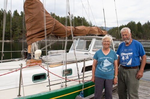
Who: Steve and Elsie Hulsizer (author of Glaciers, Bears and Totems and Voyages to Windward)
Port: Seattle
SailBlogs Friends

