Voyages North
23 July 2023
21 August 2021
11 July 2021 | Posted in Seattle
16 May 2021
07 January 2021
10 April 2020 | Posted in Seattle
31 August 2019 | Posted at Port McNeill
31 August 2019
30 August 2019
30 August 2019 | Posted at Port MCNeill
13 August 2019 | Posted at Prince Rupert
13 August 2019 | Posted at Prince Rupert
03 August 2019 | Posted at Ketchikan
02 August 2019 | Posted at Metlakatla
02 August 2019 | posted in Metlakatla AK
22 July 2019 | Posted at Klawock/Craig
22 July 2019 | Posted at Klawock/Craig
09 July 2019 | Posted at Juneau
09 July 2019 | Posted at Juneau
27 June 2019
Chaatl, Buck Channel, West Coast of Moresby Island. July 23.
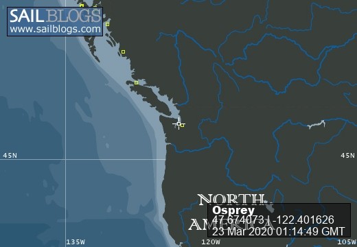
17 August 2009 | 53 07.7N, 132 23.9 W
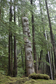
Photo: "Mosquito pole" at Chaatl.
Lines of sea foam stretched across the inlet and surf broke on rocks ahead of us. Osprey rolled and tossed in confused seas. We were entering Buck Channel, an uncharted inlet just south of Skidegate Inlet, where we had crossed from the east side of the Queen Charlottes the day before.
Buck Channel was our first experience with the West Coast's uncharted inlets: only an outline with a large blank space showed on the chart -- no soundings. This is less dangerous than it sounds: the waters are deep and the Sailing Directions describe the dangers. Don Douglass and Reanne Hemingway Douglas have also described the inlets and given a few soundings in their guide, Exploring the North Coast of British Columnbia, 2nd Edition.
But the entrance to Buck Channel looked terrifying. The chart showed a tiny dot of an island at the entrance near the north shore. Instead of the wide channel with a little island that we expected, we saw a narrow channel and a big island -- and rocks leading south across the inlet. We headed for the south side of the channel, as the Douglasses recommended, and a smooth patch of water opened up. We motored through into calm water as the rain began to fall. We anchored in a small cove, called Nesi cove, on the south side. The chart showed the cove but not the island in its entrance. But the island helped protect the cove and only a low surge came in.
We were lucky, the best weather for going into Buck Channel is southeast winds and that's what we had. (West winds funnel right in from the Pacific).
Buck Channel's main attraction is the site of the former Haida village of Chaatl and its two remaining totem poles. The next morning the channel was absolutely calm and we took the dinghy across to a pebble beach and walked into the forest. We didn't know exactly where the poles were, only that there was a trail to them and they were somewhere near this beach. We walked among beautiful spruce and hemlock trees on a forest floor of springy moss, past a small waterfall tumbling down a rock wall. I saw the first of the two poles standing among a group of trees, visibly separate from them only by the shape of its carvings. Nearby we found the remains of a frontal pole with the door opening still visible and a fallen mortuary pole with its top carved to fit a box for human remains. The second pole, the mosquito pole, was further east on a trail leading along the edge of the forest. Like the first it stood surrounded by trees larger than it, all grown from nothing since the village had been abandoned sometime in the 1850s. Both poles faced south towards the water and the halves of the figures on the west side of both poles were still clear and new looking. The halves on the east side were badly eroded. It's not hard to figure where the bad weather comes from.
Comments
| Vessel Name: | Osprey |
| Vessel Make/Model: | Annapolis 44 sloop |
| Hailing Port: | Seattle |
| Crew: | Steve and Elsie Hulsizer (author of Glaciers, Bears and Totems and Voyages to Windward) |
| About: | |
| Extra: |
Osprey's Photos - Main
No items in this gallery.
Voyages North on SV Osprey
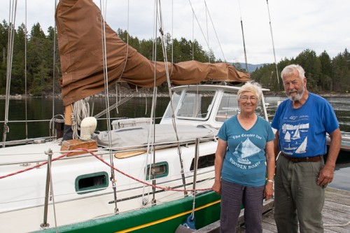
Who: Steve and Elsie Hulsizer (author of Glaciers, Bears and Totems and Voyages to Windward)
Port: Seattle
SailBlogs Friends

