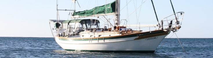

Adventures On Venture.
Who: Dave Edwards, Terry Jackson
Port: Adelaide, South Australia.
Gallery

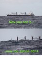
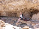
Table of Contents
Favorites
09 May 2014
02 May 2014 | Sandringham - Middle Brighton Beach - Frankston
26 April 2014 | As it suggests.... Williamstown :)
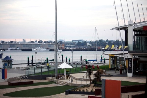
09 April 2014 | Melbourne- Docklands
04 April 2014 | Limeburner's Lagoon/Bay
28 March 2014 | Queenscliff
28 March 2014 | Apollo Bay
21 March 2014
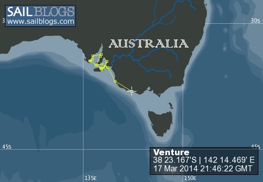
17 March 2014 | To Port Fairy
05 March 2014 | Mount Gambier surrounds
01 March 2014 | I'd say... Mount Gambier
25 February 2014 | Port MacDonnell
23 February 2014 | Port MacDonnell
18 February 2014 | Beachport
16 February 2014 | Robe
13 February 2014 | Victor to Robe and arriving at Robe
10 February 2014 | From Kingscote then Victor Harbor for a couple of days
09 February 2014 | Kingscote - KI
06 February 2014 | GIYC
06 February 2014 | American River (the heading to Kingscote)
LEAVING SAILBLOGS..... GOING TO BLOGGER
09 May 2014
As many may know, I've had a lot of strife with SAILBLOGS with disappearing text and images, things not working how they should and, after getting no response form the administrators abut the issues I've had, I've decided to end it with them and move to BLOGGER.
You can find the new blog here. or here on Facebook on Facebook
This will be the last link from this site. I'm hoping I can at least recover some of what I've written on here and move it to the other blog site.
You can find the new blog here. or here on Facebook on Facebook
This will be the last link from this site. I'm hoping I can at least recover some of what I've written on here and move it to the other blog site.
From cabins to castles... fun with sand! (A catch-up)
02 May 2014 | Sandringham - Middle Brighton Beach - Frankston
ABOVE PHOTO: Rainbows on the boat.
MONDAY MARCH 31st To Sandringham
We found out that 'bona fide' travellers (rather than being just anyone within Port Phillip Bay or indeed Victoria) get 48 hours free and then $35 per day thereafter in the Sandringham Yacht Club, so that was our destination for 3 days. Upon investigation, the club was in the right spot for a couple of interesting places that we could get to by train and bike, so even better and, being Sandringham, we expected some swish facilities that's for sure.
Photos: Various views towards Sandringham Yacht Club and Marina
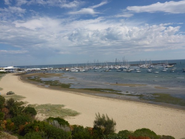
It was a fabulous sail, with the breeze pushing us fairly speedily all the way and the water smooth and calm, which made the fact that it was only for a couple of hours a little annoying. Why can't it be like that on really long trips?
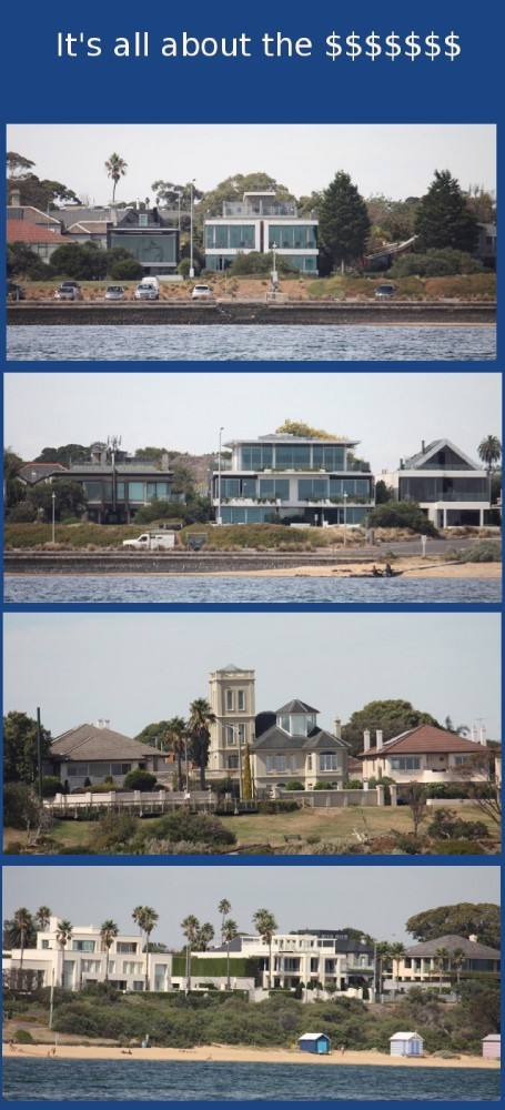
As we approached Sandringham we sailed past Middle Brighton Beach, which I'll go into a little more down the page. This was one of the places that cemented my choice of berths. There were some terribly swish houses along the beachfront. Cha-ching!
Photo: All posh like.
Having previously rung about the berth, we were told where to temporarily tie up whilst we made all the arrangements. Problem one, someone was already tied up where we were supposed to be and problem two, we couldn't hurriedly see anywhere else that was suitable and so a snap decision was made to tie up to the fuel dock. "No, we don't need fuel, thank you all the same... No, we won't be there for long." Mind you, a familiar scene unfolded when the first person to see the boat just had to have a long chat about her and once again we relished the praise on our choice of vessel.
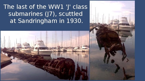
We organised the berth, took the boat over and tied up then wandered over to the club to check it out and pick up the gate key. On the way we passed the large, long dead skeleton of a submarine that had been scuttled many years before and was now used as a reef in the marina. It was both creepy and fascinating as I watch fish and other sea life moving about the rusted spines of the beast.
Photo: Long dead submarine
While we were standing about waiting for the key in the opulent reception area of the $12.75m SYC Clubhouse, we noticed that Prince Phillip (yes the Queen's hubby) became SYC's Commodore in Chief on the 25th January 1980and had been named Marina of the Year 2013 - 2014. Ooooooooh.... la de daaaaa!
After we got the key we went up the wide, sweeping staircase to the bar. I asked for a Cruiser, but apparently they don't keep anything so common. Instead the barmaid (who was snooty as buggery) asked if I wanted a mixer. I opted for straight Coke instead. We sat out on the huge balconied area, sipping our drinks and quietly having a dig at the 'beautiful people' who seemed to frequent the club, then slipped down the outside staircase to go back to the boat.
On the way I decided to visit the ablutions facilities, expecting opulence all the way. Well.... my expectations and reality couldn't have been further apart. The 'public' showers and toilets were pretty daggy to say the least. The ladies loos looked as though they had been out of action for night time use for quite a long time as the faded, sagging and torn hand written "electrical fault - lights not working" sign on the door indicated. Painted concrete walls, mould, cobwebs, dripping taps and running toilets. It really changed my ideas about the place in a split second. I doubted that any of the upper crust ever saw this part of it. It was a real disappointment but then again, we weren't paying much. Just as well really or I may have had grounds for complaint. As it is, I ended up having to use the equally daggy single disabled facilities for my shower but the water was hot, and that's all that mattered really.
TUESDAY APRIL 1st
The morning started with my sudden plan to get a puppy for the boat, or maybe even two so that they could keep each other company, so I assaulted Dave with the idea. To say he was uneasy about the idea was an understatement as I explained the pros of having a dog on board and my plans to visit animal shelters, names I had chosen, the type of dog I felt would work in such a small space etc, etc. I could almost see the sweat popping out on his brow as he began to fidget and tried to talk me out of it. I kept him going for a good while and then decided to remind him of the date by pointing out that he names I'd chosen were April and Fool. If relief was palpable, I'd have seen it come out of every single pore! Nyuck, nyuck!
Today the bikes came out as we planned to see what Sandringham had to offer. Turns out that Sandringham itself is about as boring as bat guano (unless bat guano happens to be your thing. Then, of course, I imagine it's possibly somewhat interesting.) We stopped at a local bakery and unwittingly bought one of the most expensive pasties in history ... $34 for a a can of coke and a coffee, a pastie for Dave and a small quiche for me with a 'salad' consisting of a tiny shred of lettuce, a couple of cherry tomatoes and a sliver of cucumber. That makes the 'meals' around $13 - $14 each... and not even any chips. Ripoff!!
We made sure we licked up every single costly crumb off of the plate in order to get our money's worth and then donned the helmets once more to take a ride along the esplanade. The weather was warm (31 degrees) and so the plan was to just go a little way and then come back.
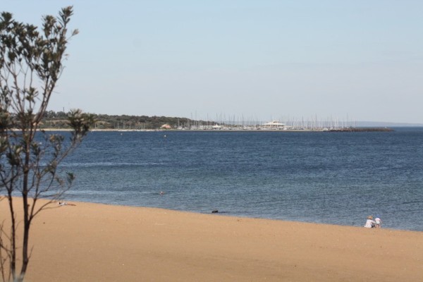
Photo: View of the breakwaters towards Middle Brighton.
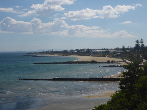
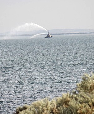
Photo: Fire boat spraying water off Middle Brighton beach'
The problem is that at Middle Brighton Beach (told you I'd get there), about 4km away, is the rare sight of beach boxes that were built over a century ago and it's one of the places I wanted to see. But it's hot, but I want to see them, but it's reeeeeally hot and they're 4km away, but I still want to see them.... what to do???
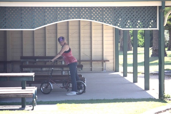
Photo: Biker Nan taking in the shade.
Photos: The bathing boxes at Middle Brighton Beach.
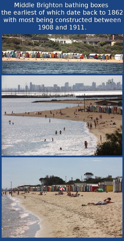
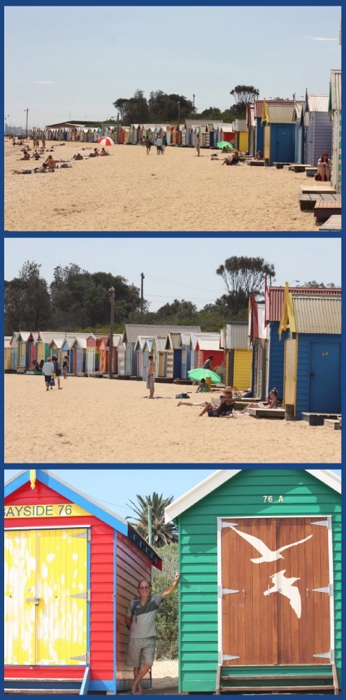
Photo: Interesting sculpture on the way back to the boat.
So we rode the 4km, looked at the boxes, took piccies, came back and collapsed. A shower and a Nana nap were never so welcome.
WEDNESDAY APRIL 2nd
Our trip today was in a different direction, on mixed transport, as we took the bikes onto the train for the first time. We were heading for Frankston and the annual Sand Sculpture display. So, a train from Sandringham station to South Yarra and, with bikes in tow, change trains at South Yarra to get to Frankston. Even by train, it was a reasonably long trip (over an hour) but luckily they were running on time and none of the carriages were full. We were fairly lucky with the weather because even though it rained on and off for most of the day, we managed to avoid it for the most part.
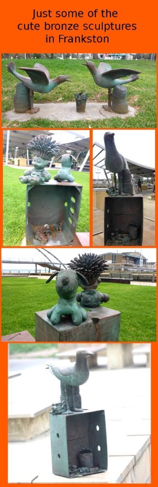
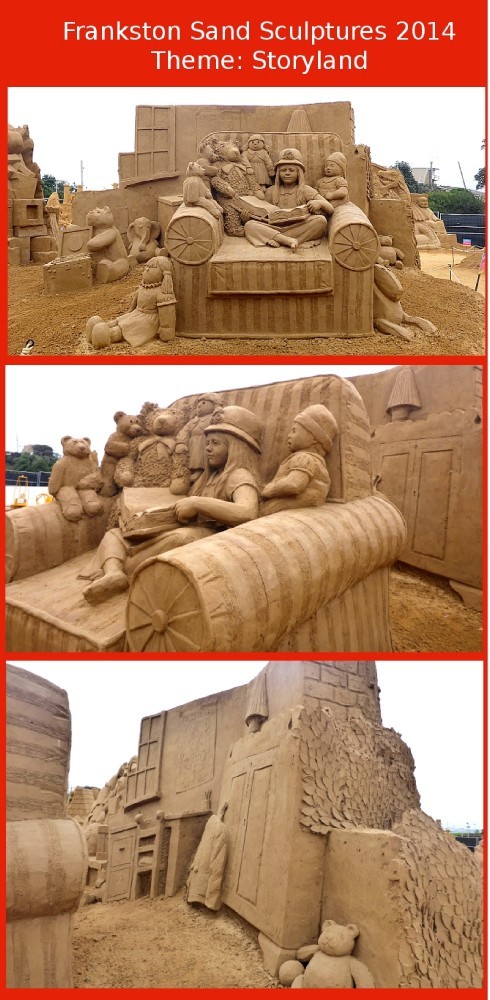
When we arrived we went across the curved footbridge and into a small park that had some wonderful little sculptures in it. They were so cute,
Photo: The footbridge.
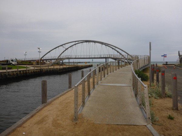
Photo: Sculptures in the park.
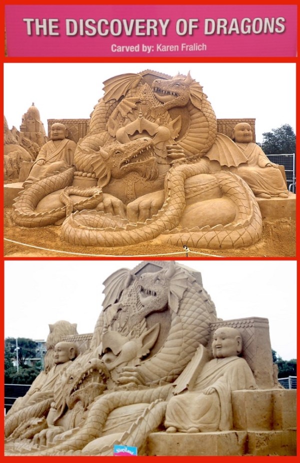
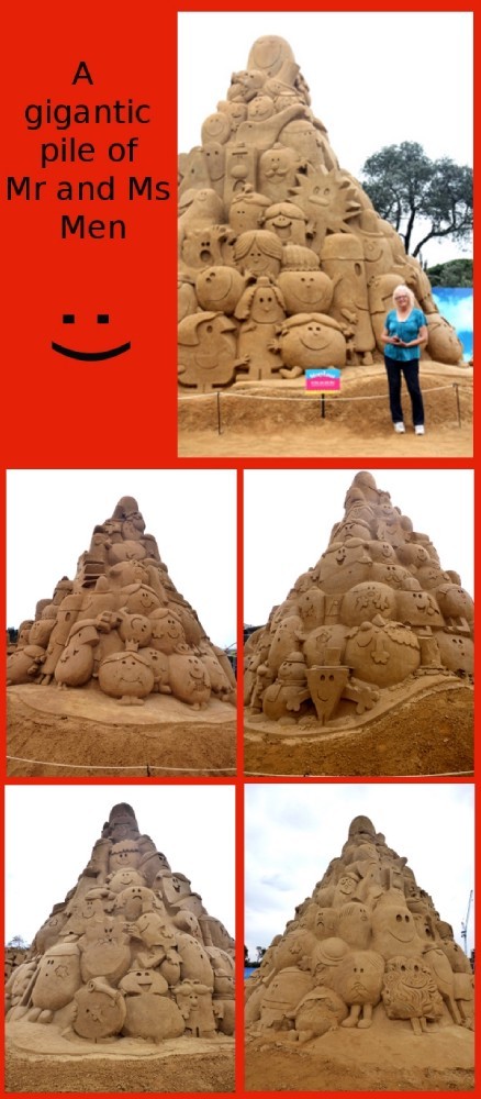
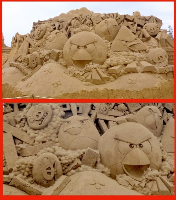
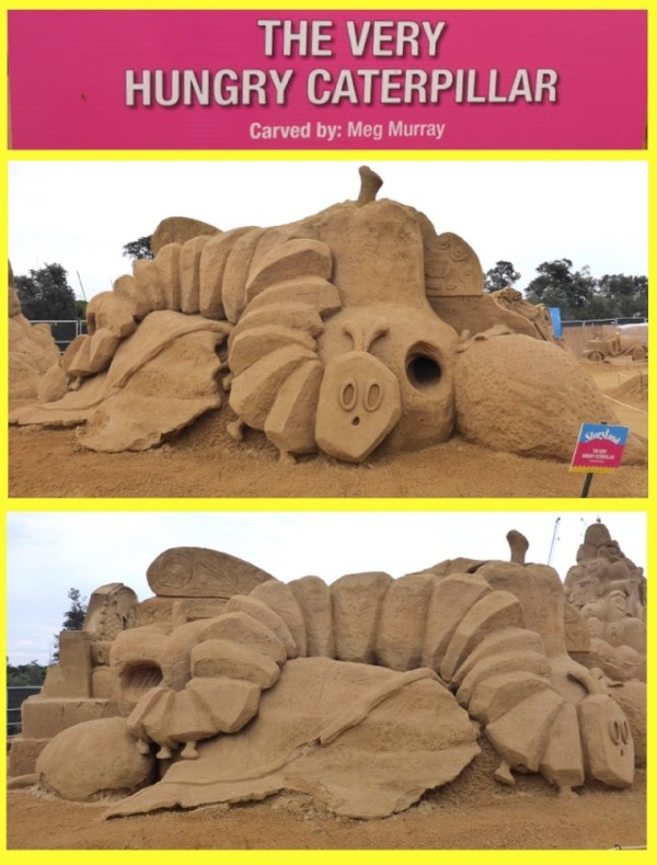
The sand sculptures themselves were AWESOME. It's certainly a lot different from your normal sand castles but I can imagine that that's where many of these sand artists started. It really made me want to go to a beach and build something. The Sand Sculpture display features different themes each year and began its life at Glenelg in SA before it moved to Frankston. 3,500 tonnes of sand is carved by a bunch of talented Aussie artists and during the season there are other displays and demos plus hands on stuff to do. It's worth a visit. This year's theme was STORYLAND.
Photos: Sand Sculptures.... LOTS!!
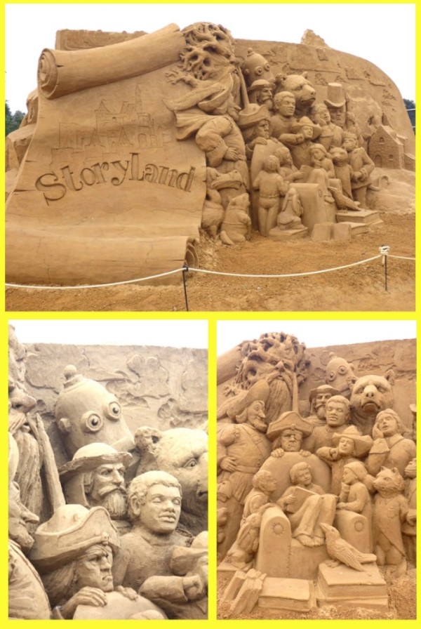
And yet more!!....
AND MORE!!!!!!.................

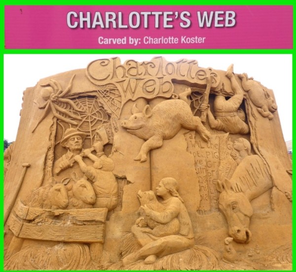
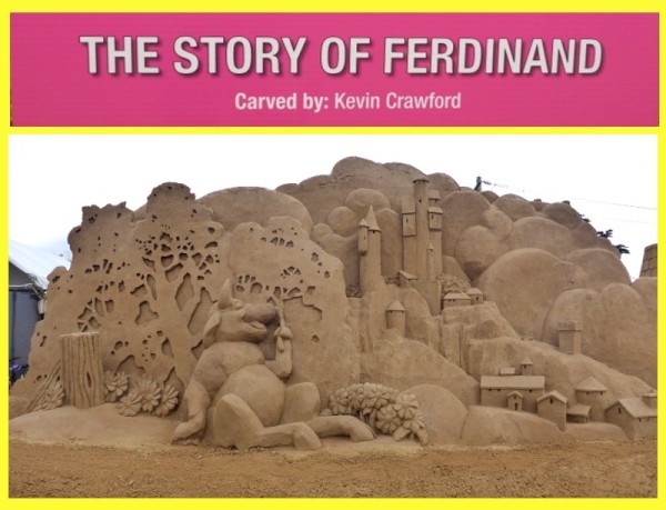

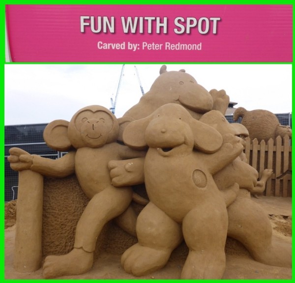
Photo: The best for last. (I'll rework these and make them a little bigger)
Another place we decided to visit after we had been to Frankston was the Seaford wetlands. On the website and looking at Google earth, it looked great so once again we bundled the bikes on the train and headed off. When we got there the drizzle had started but we took refuge in a lookout/shelter for a while.
Photos: Seaford Wetlands and birds.

We watched the water-birds that were paddling and feeding nearby and then decided to ride around the wetlands and do a bit of exploration. However, as we rode we discovered that there really wasn't a lot to see and it was mostly fenced off and the rain had started again and the decision to abort the mission was sudden and mutual. Bugger riding in the rain. We ended up back at the shelter until the rain stopped and then returned to the station only slightly bedraggled.
For some reason it was decided to get off the train early, at Highett station and cycle the 4km back to Sandringham. It was another really long day but so worth it.
MONDAY MARCH 31st To Sandringham
We found out that 'bona fide' travellers (rather than being just anyone within Port Phillip Bay or indeed Victoria) get 48 hours free and then $35 per day thereafter in the Sandringham Yacht Club, so that was our destination for 3 days. Upon investigation, the club was in the right spot for a couple of interesting places that we could get to by train and bike, so even better and, being Sandringham, we expected some swish facilities that's for sure.
Photos: Various views towards Sandringham Yacht Club and Marina
It was a fabulous sail, with the breeze pushing us fairly speedily all the way and the water smooth and calm, which made the fact that it was only for a couple of hours a little annoying. Why can't it be like that on really long trips?
As we approached Sandringham we sailed past Middle Brighton Beach, which I'll go into a little more down the page. This was one of the places that cemented my choice of berths. There were some terribly swish houses along the beachfront. Cha-ching!
Photo: All posh like.
Having previously rung about the berth, we were told where to temporarily tie up whilst we made all the arrangements. Problem one, someone was already tied up where we were supposed to be and problem two, we couldn't hurriedly see anywhere else that was suitable and so a snap decision was made to tie up to the fuel dock. "No, we don't need fuel, thank you all the same... No, we won't be there for long." Mind you, a familiar scene unfolded when the first person to see the boat just had to have a long chat about her and once again we relished the praise on our choice of vessel.
We organised the berth, took the boat over and tied up then wandered over to the club to check it out and pick up the gate key. On the way we passed the large, long dead skeleton of a submarine that had been scuttled many years before and was now used as a reef in the marina. It was both creepy and fascinating as I watch fish and other sea life moving about the rusted spines of the beast.
Photo: Long dead submarine
While we were standing about waiting for the key in the opulent reception area of the $12.75m SYC Clubhouse, we noticed that Prince Phillip (yes the Queen's hubby) became SYC's Commodore in Chief on the 25th January 1980and had been named Marina of the Year 2013 - 2014. Ooooooooh.... la de daaaaa!
After we got the key we went up the wide, sweeping staircase to the bar. I asked for a Cruiser, but apparently they don't keep anything so common. Instead the barmaid (who was snooty as buggery) asked if I wanted a mixer. I opted for straight Coke instead. We sat out on the huge balconied area, sipping our drinks and quietly having a dig at the 'beautiful people' who seemed to frequent the club, then slipped down the outside staircase to go back to the boat.
On the way I decided to visit the ablutions facilities, expecting opulence all the way. Well.... my expectations and reality couldn't have been further apart. The 'public' showers and toilets were pretty daggy to say the least. The ladies loos looked as though they had been out of action for night time use for quite a long time as the faded, sagging and torn hand written "electrical fault - lights not working" sign on the door indicated. Painted concrete walls, mould, cobwebs, dripping taps and running toilets. It really changed my ideas about the place in a split second. I doubted that any of the upper crust ever saw this part of it. It was a real disappointment but then again, we weren't paying much. Just as well really or I may have had grounds for complaint. As it is, I ended up having to use the equally daggy single disabled facilities for my shower but the water was hot, and that's all that mattered really.
TUESDAY APRIL 1st
The morning started with my sudden plan to get a puppy for the boat, or maybe even two so that they could keep each other company, so I assaulted Dave with the idea. To say he was uneasy about the idea was an understatement as I explained the pros of having a dog on board and my plans to visit animal shelters, names I had chosen, the type of dog I felt would work in such a small space etc, etc. I could almost see the sweat popping out on his brow as he began to fidget and tried to talk me out of it. I kept him going for a good while and then decided to remind him of the date by pointing out that he names I'd chosen were April and Fool. If relief was palpable, I'd have seen it come out of every single pore! Nyuck, nyuck!
Today the bikes came out as we planned to see what Sandringham had to offer. Turns out that Sandringham itself is about as boring as bat guano (unless bat guano happens to be your thing. Then, of course, I imagine it's possibly somewhat interesting.) We stopped at a local bakery and unwittingly bought one of the most expensive pasties in history ... $34 for a a can of coke and a coffee, a pastie for Dave and a small quiche for me with a 'salad' consisting of a tiny shred of lettuce, a couple of cherry tomatoes and a sliver of cucumber. That makes the 'meals' around $13 - $14 each... and not even any chips. Ripoff!!
We made sure we licked up every single costly crumb off of the plate in order to get our money's worth and then donned the helmets once more to take a ride along the esplanade. The weather was warm (31 degrees) and so the plan was to just go a little way and then come back.
Photo: View of the breakwaters towards Middle Brighton.
Photo: Fire boat spraying water off Middle Brighton beach'
The problem is that at Middle Brighton Beach (told you I'd get there), about 4km away, is the rare sight of beach boxes that were built over a century ago and it's one of the places I wanted to see. But it's hot, but I want to see them, but it's reeeeeally hot and they're 4km away, but I still want to see them.... what to do???
Photo: Biker Nan taking in the shade.
Photos: The bathing boxes at Middle Brighton Beach.
Photo: Interesting sculpture on the way back to the boat.
So we rode the 4km, looked at the boxes, took piccies, came back and collapsed. A shower and a Nana nap were never so welcome.
WEDNESDAY APRIL 2nd
Our trip today was in a different direction, on mixed transport, as we took the bikes onto the train for the first time. We were heading for Frankston and the annual Sand Sculpture display. So, a train from Sandringham station to South Yarra and, with bikes in tow, change trains at South Yarra to get to Frankston. Even by train, it was a reasonably long trip (over an hour) but luckily they were running on time and none of the carriages were full. We were fairly lucky with the weather because even though it rained on and off for most of the day, we managed to avoid it for the most part.
When we arrived we went across the curved footbridge and into a small park that had some wonderful little sculptures in it. They were so cute,
Photo: The footbridge.
Photo: Sculptures in the park.
The sand sculptures themselves were AWESOME. It's certainly a lot different from your normal sand castles but I can imagine that that's where many of these sand artists started. It really made me want to go to a beach and build something. The Sand Sculpture display features different themes each year and began its life at Glenelg in SA before it moved to Frankston. 3,500 tonnes of sand is carved by a bunch of talented Aussie artists and during the season there are other displays and demos plus hands on stuff to do. It's worth a visit. This year's theme was STORYLAND.
Photos: Sand Sculptures.... LOTS!!
And yet more!!....
AND MORE!!!!!!.................
Photo: The best for last. (I'll rework these and make them a little bigger)
Another place we decided to visit after we had been to Frankston was the Seaford wetlands. On the website and looking at Google earth, it looked great so once again we bundled the bikes on the train and headed off. When we got there the drizzle had started but we took refuge in a lookout/shelter for a while.
Photos: Seaford Wetlands and birds.
We watched the water-birds that were paddling and feeding nearby and then decided to ride around the wetlands and do a bit of exploration. However, as we rode we discovered that there really wasn't a lot to see and it was mostly fenced off and the rain had started again and the decision to abort the mission was sudden and mutual. Bugger riding in the rain. We ended up back at the shelter until the rain stopped and then returned to the station only slightly bedraggled.
For some reason it was decided to get off the train early, at Highett station and cycle the 4km back to Sandringham. It was another really long day but so worth it.
Wandering Williamstown
26 April 2014 | As it suggests.... Williamstown :)
FRIDAY MARCH 28th - Williamstown
We found out overnight that many VERY LARGE cargo ships sneak almost silently in and out during the night, and the mooring is not a long way from the edge of the shipping channel, though far enough away to be safe. I wouldn't have imagined cargo ships to be so quiet but with almost all of them, you feel rather than hear them coming, with a low, vibrating thrum in the air before you hear the muted bass pitch of the gigantic engines. It's quite disconcerting to find yourself in the ship's shadow before you hear it.
We also discovered that idiots in speed boats make a much larger wake than any giant ship. In the bay at Williamstown are scores upon scores of moored and anchored yachts, and watching a large wake come through is fascinating. It begins nearest the channel with boats beginning to sway. After a few seconds the sway becomes a violent undulation as the wave spreads in towards the shore several hundred metres away, jostling each boat until the masts of almost all of the vessels in the path of the wake look like humongous metronomes set to tick at different times. (This is especially disconcerting when your own boat is convulsively pitching from side to side with you in it).
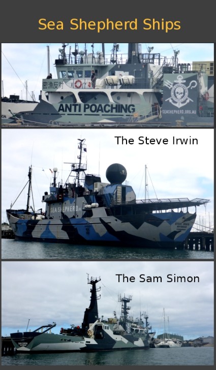
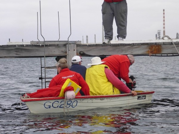
Rather than stay on a rocking boat, we took the dinghy and headed for town on a reconnaissance mission to see what was what in Williamstown. We took the roundabout way via the nearby wharfs and a close up view of the Sea Shepherd boats the "Steve Irwin" and the newest in the fleet, the "Sam Simon", which were tied up near the ship HMAS Adelaide, which itself was nearing completion in the docks. After snapping some photos we wove our way through the flotilla of boats to the public jetty. By that stage the first priority was to find the nearest toilets (isn't that always the way?).
Photo : Sea Shepherds!
Well, finding a loo was far easier said than done that's for sure Williamstown please get a clue.... signpost your public conveniences better! I ended up having to use the library's facilities and even that wasn't signposted, despite being on the "Where's the nearest public toilet" app (yes that's how desperate I was and how frustrating it was!!) . Once relief was established we wandered the main around a bit, found the shops, ate some stuff and basically dicked about until my knees were ready to pop their caps. Ugh... walking is hard work these days but unfortunately the jetty is high and the bikes are a little awkward to lift up a ladder so whilst we're here, the bipedal method will have to suffice.
SATURDAY MARCH 29th
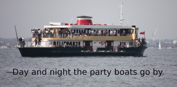
Into the wee small hours the double-decker party boats kept chugging past with music blaring and happy people laughing and drinking and dancing and wooohoooing. The odd cargo ship also snuck past, like a giant trying not to attract the attention of the clamorous Lilliputians. Luckily though, the water was still and so sleeping without fear of being tossed out of bed was possible once the parties had gone back to the city.
Photo: Party boats were constant.
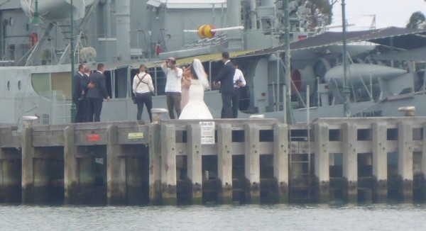
Photos: Busy times in the Bay... even a wedding.
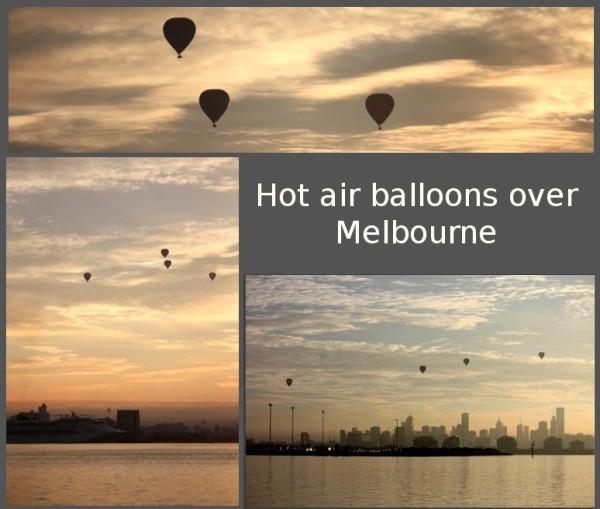
Come the dawn and Dave woke me to let me know that there were half a dozen hot air balloons outside. Though being cognisant at that time was in itself unpleasant and being cognisant after dealing with party animals for half the night is even worse, I was glad he gave me a shake. How wonderful it was watching them silhouetted against the pink and mauve sky. There was just the slightest breath of wind and it felt almost ethereal watching the silent, distant pinpoints of flame and the subtle ascension of each balloon as they floated lazily across the hazy, waking city and harbour.
Photos: Balloons and more.
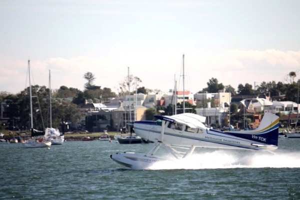
We needed a few bits and pieces from the shops and so headed back to the jetty in the dinghy. It was a funny thing but for some reason the streets felt decidedly more 'up' than it had yesterday and the Indian summer weather was also considerably warmer so we didn't hang around for too long. A quick visit to Coles, a loaf from Baker's Delight and it was back to the boat for the afternoon to watch the action in the harbour, from yachts to jet-skis, fishing boats to disgustingly expensive penis envy vessels, sea planes to powered paragliders. It was all happening on and around the water and with the weather being simply glorious, it turned into a really nice afternoon.
SUNDAY MARCH 30th
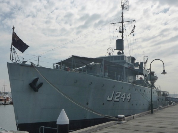
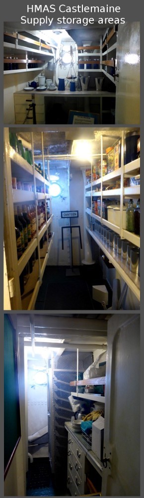
Our last day here was spent looking around the docks, mainly going aboard the very interesting HMAS Castlemaine Maritime Museum which is berthed at Gem Pier in Williamstown. Here's just a little history of the ship....
!!*
"HMAS Castlemaine is one of the sixty Australian-built Bathurst Class corvettes to serve throughout World War II, and is one of 36 initially manned and commissioned solely by the Royal Australian Navy. She is one of only two such vessel still afloat, the other being HMAS Whyalla and has been restored by volunteers over four decades."
Photo: HMAS Castlemaine
I could say a lot about this ship but instead, here's a heap of photos because I've been told that I'm writing too much. :)
Photos: Inside HMAS Castlemaine.
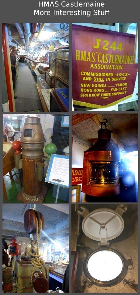
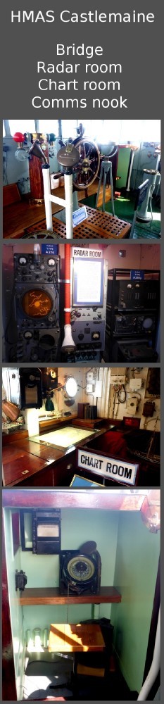
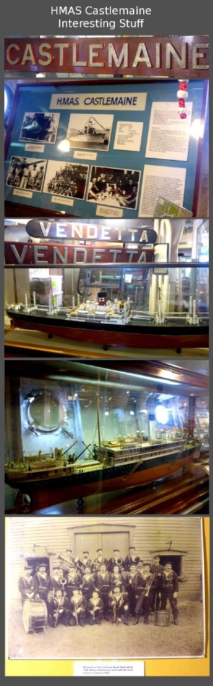
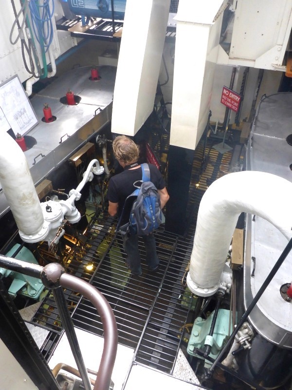
AND MORE.....
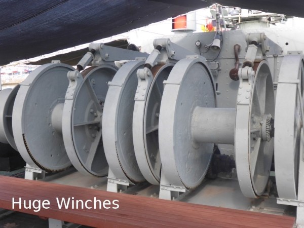
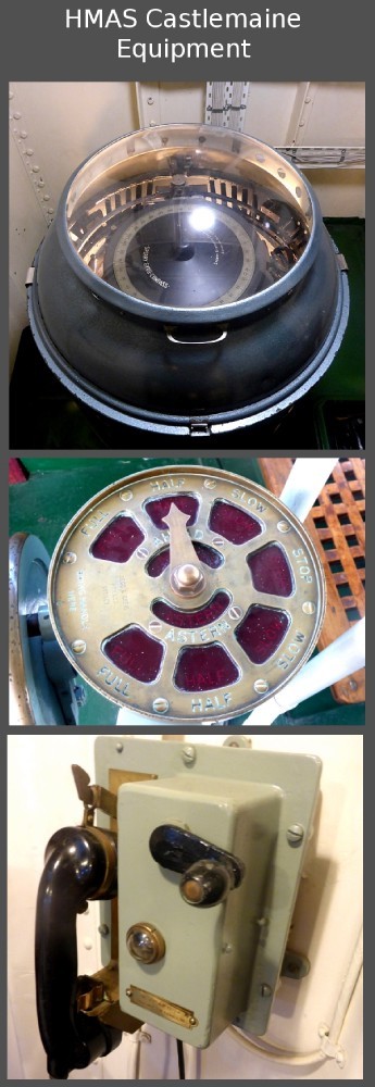
AND YET MORE......
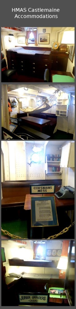
AND ONE LAST ONE....
On the way back we just strolled through the Point Gellibrand Coastal Heritage Park and along the esplanade and loved seeing just how many people were out and about enjoying the sunshine with picnics and barbecues with the whole scene against a backdrop of beautifully preserved heritage buildings and old fashioned, pastel hued shop fronts.
Tomorrow we leave for the other side of the bay.... to Sandringham
We found out overnight that many VERY LARGE cargo ships sneak almost silently in and out during the night, and the mooring is not a long way from the edge of the shipping channel, though far enough away to be safe. I wouldn't have imagined cargo ships to be so quiet but with almost all of them, you feel rather than hear them coming, with a low, vibrating thrum in the air before you hear the muted bass pitch of the gigantic engines. It's quite disconcerting to find yourself in the ship's shadow before you hear it.
We also discovered that idiots in speed boats make a much larger wake than any giant ship. In the bay at Williamstown are scores upon scores of moored and anchored yachts, and watching a large wake come through is fascinating. It begins nearest the channel with boats beginning to sway. After a few seconds the sway becomes a violent undulation as the wave spreads in towards the shore several hundred metres away, jostling each boat until the masts of almost all of the vessels in the path of the wake look like humongous metronomes set to tick at different times. (This is especially disconcerting when your own boat is convulsively pitching from side to side with you in it).
Rather than stay on a rocking boat, we took the dinghy and headed for town on a reconnaissance mission to see what was what in Williamstown. We took the roundabout way via the nearby wharfs and a close up view of the Sea Shepherd boats the "Steve Irwin" and the newest in the fleet, the "Sam Simon", which were tied up near the ship HMAS Adelaide, which itself was nearing completion in the docks. After snapping some photos we wove our way through the flotilla of boats to the public jetty. By that stage the first priority was to find the nearest toilets (isn't that always the way?).
Photo : Sea Shepherds!
Well, finding a loo was far easier said than done that's for sure Williamstown please get a clue.... signpost your public conveniences better! I ended up having to use the library's facilities and even that wasn't signposted, despite being on the "Where's the nearest public toilet" app (yes that's how desperate I was and how frustrating it was!!) . Once relief was established we wandered the main around a bit, found the shops, ate some stuff and basically dicked about until my knees were ready to pop their caps. Ugh... walking is hard work these days but unfortunately the jetty is high and the bikes are a little awkward to lift up a ladder so whilst we're here, the bipedal method will have to suffice.
SATURDAY MARCH 29th
Into the wee small hours the double-decker party boats kept chugging past with music blaring and happy people laughing and drinking and dancing and wooohoooing. The odd cargo ship also snuck past, like a giant trying not to attract the attention of the clamorous Lilliputians. Luckily though, the water was still and so sleeping without fear of being tossed out of bed was possible once the parties had gone back to the city.
Photo: Party boats were constant.
Photos: Busy times in the Bay... even a wedding.
Come the dawn and Dave woke me to let me know that there were half a dozen hot air balloons outside. Though being cognisant at that time was in itself unpleasant and being cognisant after dealing with party animals for half the night is even worse, I was glad he gave me a shake. How wonderful it was watching them silhouetted against the pink and mauve sky. There was just the slightest breath of wind and it felt almost ethereal watching the silent, distant pinpoints of flame and the subtle ascension of each balloon as they floated lazily across the hazy, waking city and harbour.
Photos: Balloons and more.
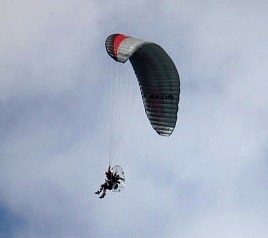
We needed a few bits and pieces from the shops and so headed back to the jetty in the dinghy. It was a funny thing but for some reason the streets felt decidedly more 'up' than it had yesterday and the Indian summer weather was also considerably warmer so we didn't hang around for too long. A quick visit to Coles, a loaf from Baker's Delight and it was back to the boat for the afternoon to watch the action in the harbour, from yachts to jet-skis, fishing boats to disgustingly expensive penis envy vessels, sea planes to powered paragliders. It was all happening on and around the water and with the weather being simply glorious, it turned into a really nice afternoon.
SUNDAY MARCH 30th
Our last day here was spent looking around the docks, mainly going aboard the very interesting HMAS Castlemaine Maritime Museum which is berthed at Gem Pier in Williamstown. Here's just a little history of the ship....
!!*
"HMAS Castlemaine is one of the sixty Australian-built Bathurst Class corvettes to serve throughout World War II, and is one of 36 initially manned and commissioned solely by the Royal Australian Navy. She is one of only two such vessel still afloat, the other being HMAS Whyalla and has been restored by volunteers over four decades."
Photo: HMAS Castlemaine
I could say a lot about this ship but instead, here's a heap of photos because I've been told that I'm writing too much. :)
Photos: Inside HMAS Castlemaine.
AND MORE.....
AND YET MORE......
AND ONE LAST ONE....
On the way back we just strolled through the Point Gellibrand Coastal Heritage Park and along the esplanade and loved seeing just how many people were out and about enjoying the sunshine with picnics and barbecues with the whole scene against a backdrop of beautifully preserved heritage buildings and old fashioned, pastel hued shop fronts.
Tomorrow we leave for the other side of the bay.... to Sandringham
All laid on in Docklands...
09 April 2014 | Melbourne- Docklands
Dry then wet, then dry again
TUESDAY MARCH 25th.
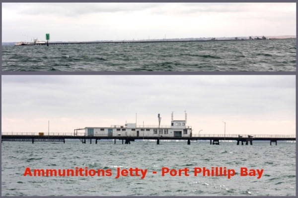
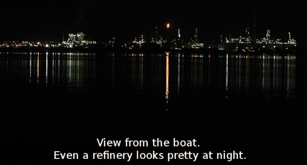
The sail from Limeburner's Bay to Docklands was about 8 hours long but fairly interesting in itself as we followed the shoreline. We sailed slowly past the explosives jetty at Port Wilson which, during peacetime would see navy ships unloading their ammunitions and explosives and then go on into Melbourne. This was not done during wartime. The structure itself is a 2,700 metre long steel and concrete jetty and wharf.
Photo: Long, long ammunitions jetty.
Photos: Boats and stuff.
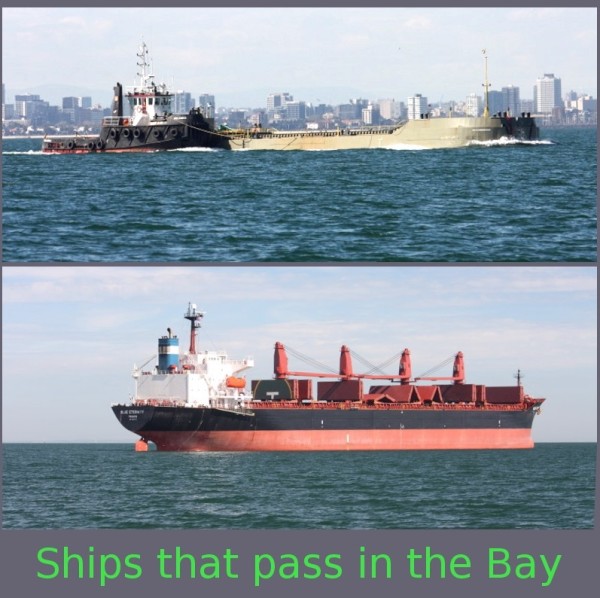
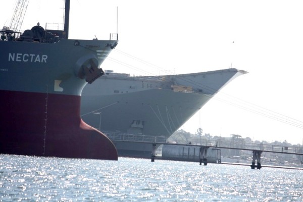
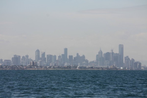
Photo: The view to Melbourne.
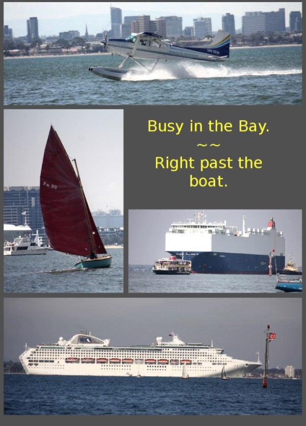
Tankers and vessels of all shapes and sizes zigzagged across the bay towards their assorted destinations. It was certainly the busiest waterway we'd seen so far and I was certainly occupied enough to stop my brain from telling my stomach to feel pukey. I did have a little Nana nap and woke in time to see a seal doing the same thing on top of a big yellow navigation buoy. We're still not entirely sure how it got up there unless it totally launched itself out of the water in one flying leap.
Photo: A flying seal?!
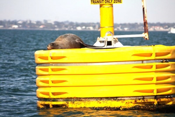
Photo: The HMAS Adelaide tied up in Williamstown on the way to Melbourne
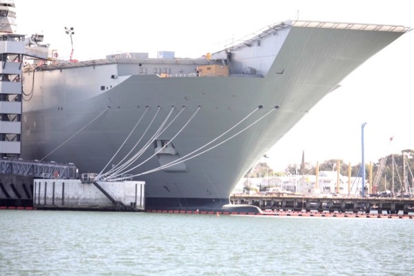
Photo: Sea plane also at Williamstown.
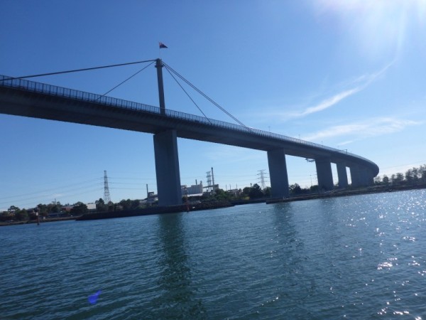
Coming under the Westgate and Bolte bridges was slightly harrowing because even though I knew the mast was miles away from the bridge, when you're sailing underneath, depth perception becomes somewhat skewed to the point where the mast seems to have maybe 10cm of clearance, rather than 10 metres or more. It was kind of freaky.
Photos: The bridges Westgate and Bolte.
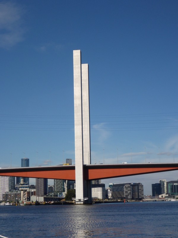
I was initially curious about the gigantic columns in the centre of the Bolte bridge and wondered if perhaps they were a mistake of some kind or they were going to do something with them at a later date but no, nothing of the kind. They were an 'aesthetic feature', done deliberately by the architect. The columns aren't even attached to the bridge and are hollow, with a door at the top for... something. Seems a bit wanky to me.
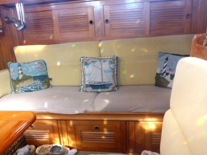
We tied up in Docklands and were greeted by Angus who gave us the pass codes for various gates, elevators, and the Marine Lounge which was totally private and contained sofas and dining area, computer with free Internet access, a barbecue on the balcony, a kitchen, 2 full bathrooms and a washing machine, dryer and folding area. They even supplied big, white, fluffy towels and bath mats. Gosh we felt special and where else could you get completely secure and scenic waterfront accommodation in the middle of Melbourne for $45 a night? Harbour Town shopping precinct and even better, the free City Circle Trams were just a couple of minutes walk away. Brilliant! I spent the evening having a lovely long shower, catching up on Internet videos and watching a bit of telly.
Photo: Dave cooking dinner :)
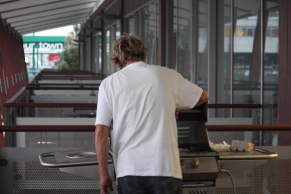
Photo: View from the Marina Lounge balcony
And from the time we pulled into the pen until we left we had admirers looking at the boat, even going so far as to have their photos taken with her. She really is a pretty thing (as Dave never stops exclaiming.)
Photo: Dragon Boat practice on the Yarra
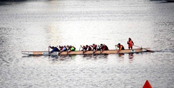
Photo: Party boat on the Yarra at night.
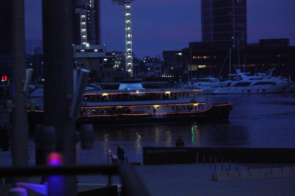
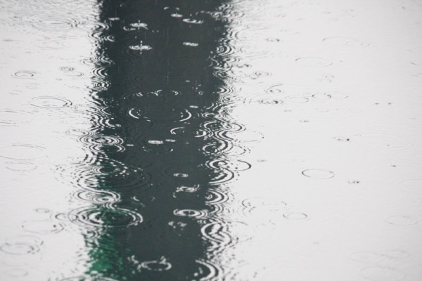
Photo: Typical Melbourne weather.
I'm not going to go into much detail about Melbourne simply because it's a capital city and I could write all day about the history, the places and so on and still not be able to convey anything that's here for the uninitiated. I guess if we were going to be here longer than 2 days it might be different but as we're not, it isn't. :)
WEDNESDAY we looked around Docklands and went to Harbour Town. I love the wide open spaces around Docklands but as yet it isn't as thriving as it could be and apparently there are plans afoot to bring some life into the area. I hope so. It's lovely and yes, I'd totally live there if I could have the city/water views.
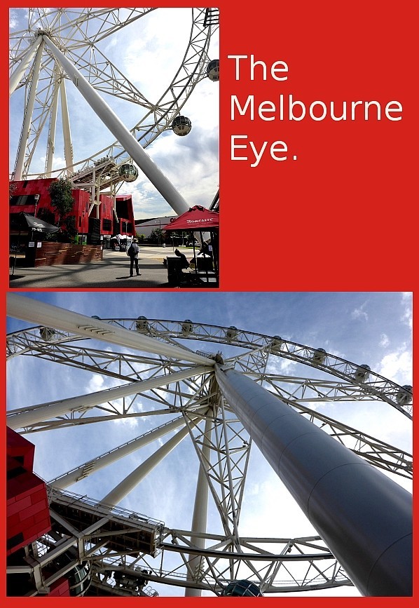
Photo: The Melbourne Eye.
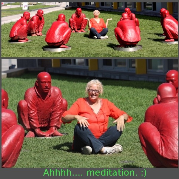
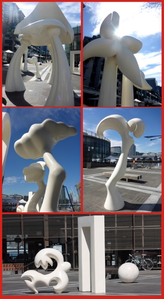
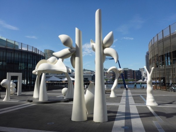
Photos: Sculptures around Docklands
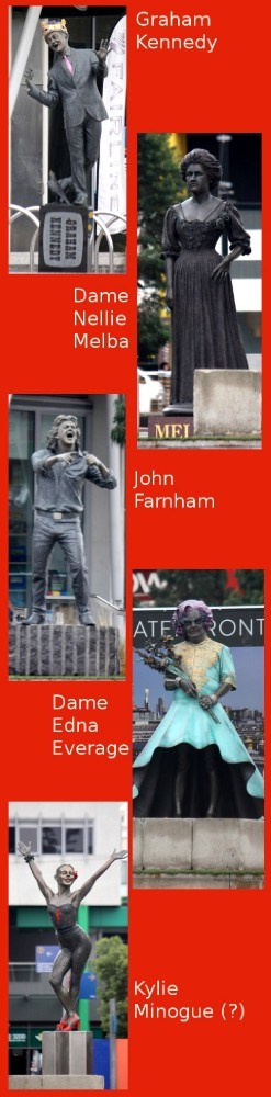
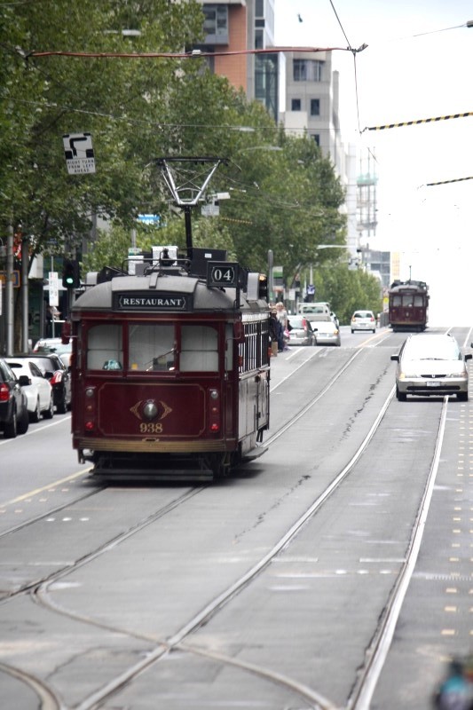
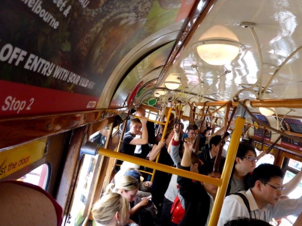
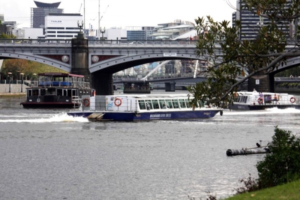
THURSDAY we caught the free tram and trundled into town. We possibly should have made a few plans but as it is, we just tram hopped and wandered. Though we would have liked to do more, we ended up seeing only the market (I say only but it's HUGE!) and Federation Square, with a wander back to the tram along the Yarra. It was a gorgeous day but in the end the knee goblins came a-visiting with picks and jackhammer's at the ready, just waiting to bring me down. Well screw you goblins ... I managed to hobble home (wait... does that make them hobble-goblins???) 😃
Photos: The famous Melbourne trams.
Photos: In and around Melbourne.
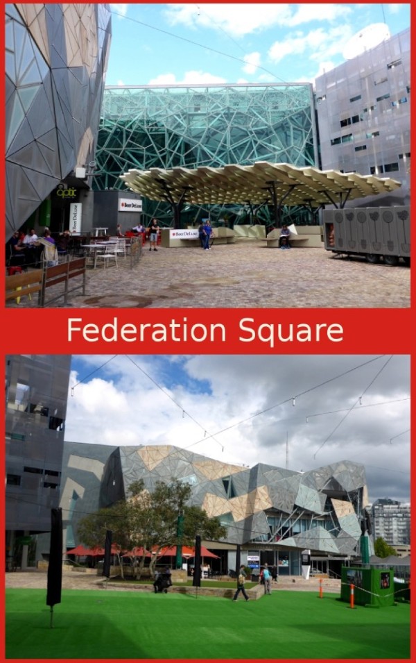
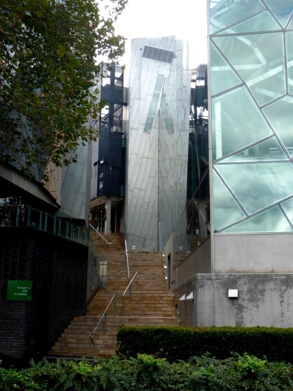
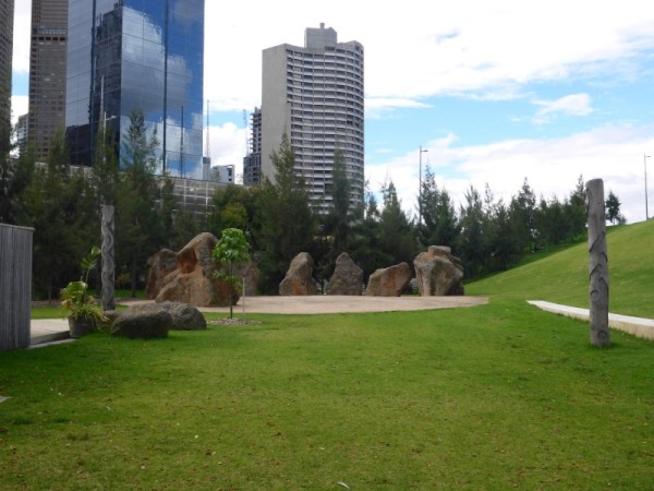
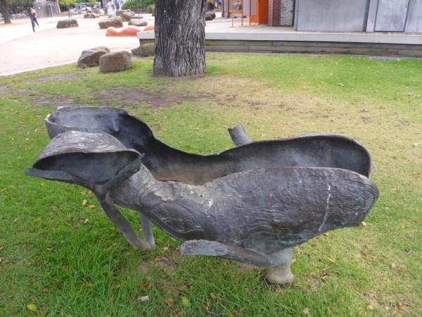
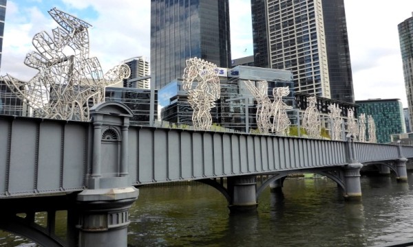
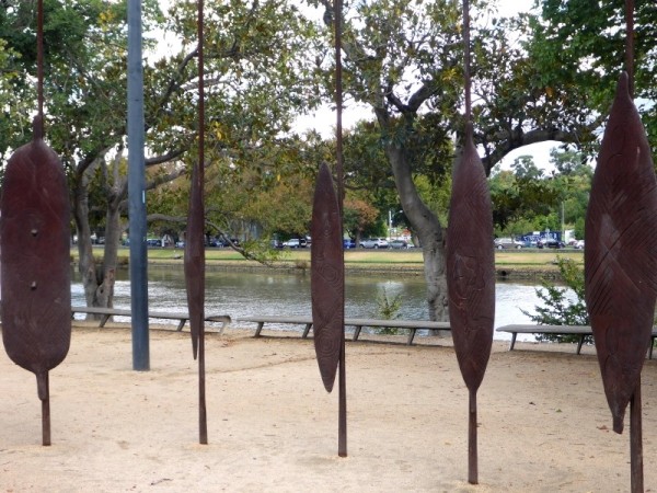
Photo: Us on the big screen in Fed Square
Photo: Traffic jam on the Yarra
When we got back to the boat we packed up, released the lines and headed for Williamstown, which was less than an hour out the way we'd come. Our destination was a public mooring in, I discovered when I steered us in, almost disturbingly shallow water and possibly slightly less comfortable nights than we'd just had. Oh the fun!
The sail from Limeburner's Bay to Docklands was about 8 hours long but fairly interesting in itself as we followed the shoreline. We sailed slowly past the explosives jetty at Port Wilson which, during peacetime would see navy ships unloading their ammunitions and explosives and then go on into Melbourne. This was not done during wartime. The structure itself is a 2,700 metre long steel and concrete jetty and wharf.
Photo: Long, long ammunitions jetty.
Photos: Boats and stuff.
Photo: The view to Melbourne.
Tankers and vessels of all shapes and sizes zigzagged across the bay towards their assorted destinations. It was certainly the busiest waterway we'd seen so far and I was certainly occupied enough to stop my brain from telling my stomach to feel pukey. I did have a little Nana nap and woke in time to see a seal doing the same thing on top of a big yellow navigation buoy. We're still not entirely sure how it got up there unless it totally launched itself out of the water in one flying leap.
Photo: A flying seal?!
Photo: The HMAS Adelaide tied up in Williamstown on the way to Melbourne
Photo: Sea plane also at Williamstown.
Coming under the Westgate and Bolte bridges was slightly harrowing because even though I knew the mast was miles away from the bridge, when you're sailing underneath, depth perception becomes somewhat skewed to the point where the mast seems to have maybe 10cm of clearance, rather than 10 metres or more. It was kind of freaky.
Photos: The bridges Westgate and Bolte.
I was initially curious about the gigantic columns in the centre of the Bolte bridge and wondered if perhaps they were a mistake of some kind or they were going to do something with them at a later date but no, nothing of the kind. They were an 'aesthetic feature', done deliberately by the architect. The columns aren't even attached to the bridge and are hollow, with a door at the top for... something. Seems a bit wanky to me.
We tied up in Docklands and were greeted by Angus who gave us the pass codes for various gates, elevators, and the Marine Lounge which was totally private and contained sofas and dining area, computer with free Internet access, a barbecue on the balcony, a kitchen, 2 full bathrooms and a washing machine, dryer and folding area. They even supplied big, white, fluffy towels and bath mats. Gosh we felt special and where else could you get completely secure and scenic waterfront accommodation in the middle of Melbourne for $45 a night? Harbour Town shopping precinct and even better, the free City Circle Trams were just a couple of minutes walk away. Brilliant! I spent the evening having a lovely long shower, catching up on Internet videos and watching a bit of telly.
Photo: Dave cooking dinner :)
Photo: View from the Marina Lounge balcony
And from the time we pulled into the pen until we left we had admirers looking at the boat, even going so far as to have their photos taken with her. She really is a pretty thing (as Dave never stops exclaiming.)
Photo: Dragon Boat practice on the Yarra
Photo: Party boat on the Yarra at night.
Photo: Typical Melbourne weather.
I'm not going to go into much detail about Melbourne simply because it's a capital city and I could write all day about the history, the places and so on and still not be able to convey anything that's here for the uninitiated. I guess if we were going to be here longer than 2 days it might be different but as we're not, it isn't. :)
WEDNESDAY we looked around Docklands and went to Harbour Town. I love the wide open spaces around Docklands but as yet it isn't as thriving as it could be and apparently there are plans afoot to bring some life into the area. I hope so. It's lovely and yes, I'd totally live there if I could have the city/water views.
Photo: The Melbourne Eye.
Photos: Sculptures around Docklands
THURSDAY we caught the free tram and trundled into town. We possibly should have made a few plans but as it is, we just tram hopped and wandered. Though we would have liked to do more, we ended up seeing only the market (I say only but it's HUGE!) and Federation Square, with a wander back to the tram along the Yarra. It was a gorgeous day but in the end the knee goblins came a-visiting with picks and jackhammer's at the ready, just waiting to bring me down. Well screw you goblins ... I managed to hobble home (wait... does that make them hobble-goblins???) 😃
Photos: The famous Melbourne trams.
Photos: In and around Melbourne.
Photo: Us on the big screen in Fed Square
Photo: Traffic jam on the Yarra
When we got back to the boat we packed up, released the lines and headed for Williamstown, which was less than an hour out the way we'd come. Our destination was a public mooring in, I discovered when I steered us in, almost disturbingly shallow water and possibly slightly less comfortable nights than we'd just had. Oh the fun!
Loving it at Limeburner's
04 April 2014 | Limeburner's Lagoon/Bay
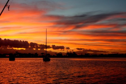
Photo: Sunrise over the bay.
THURSDAY MARCH 20th to MONDAY MARCH 24th
Slowly moving ever closer to Melbourne, today our destination was LIMEBURNER'S BAY.
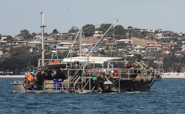
Photos: Just some of the sights on the way to Limeburner's Bay.
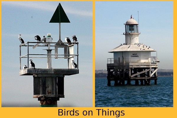
Yep... birds on stuff.
Almost in the water!
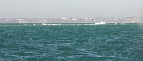
Nasty sandbar with breaking waves in the Bay
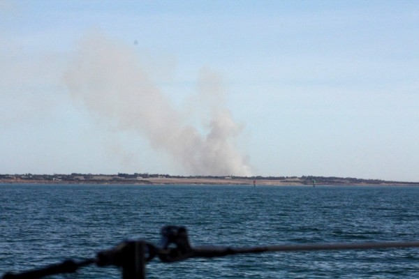
Big fire somewhere
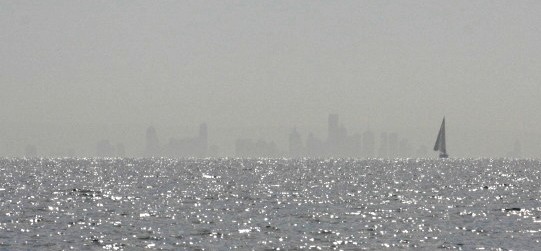
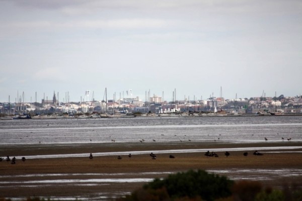
Melbourne through the haze.
It's an odd name so I'll put in a small history tidbit right about here...
**!
The bay was named after lime kilns located on the east side of Corio Bay, used to burn limestone for making cement. Nowadays, Limeburner's Bay is characterised by open, shallow tidal water, which supports a high diversity of birdlife and has listed as a Wetland of International Importance. Yep, that's about it.**
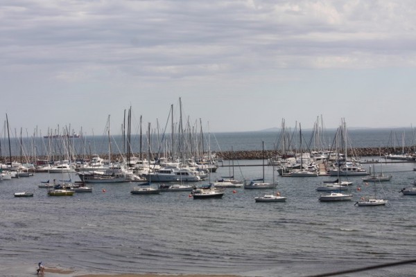
We got through the doglegged marker buoys at Limeburner's at high tide, which is just as well because low tide would definitely have had us grounded. The bay is just lovely, tiny, shallow and packed with the vessels belonging to the members of the Limeburner's Lagoon Boat Club. As we neared one of the two public mooring buoys, we had to be careful not to run into any of the dozen tiny dinghy yachts being sailed around the bay by students from the adjacent Geelong Grammar School.
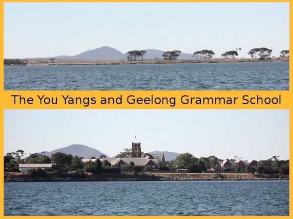
Photo: Approaching Limeburner's Bay with the You Yangs behind
Despite the shallow water alarm's incessant beeping, we managed to tie off without scraping the bottom, which was a definite plus considering we'd been worried about the depth. If the keel had been any deeper, we wouldn't have got in at all.
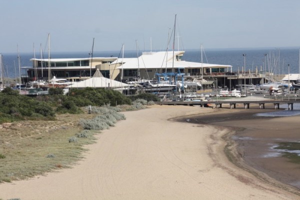
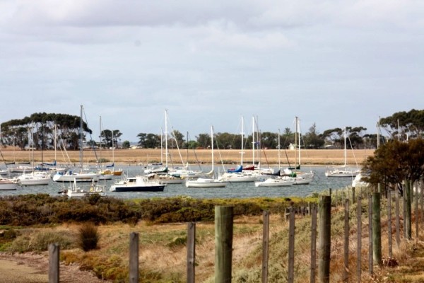
Photo: Beautiful Limeburner's Lagoon Yacht Club
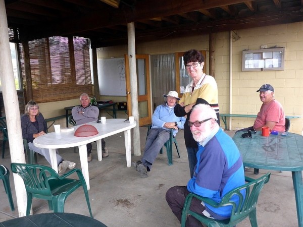
After a nice cup of tea and as evening fell, Dave dropped the dinghy into which we loaded the bikes (Dave had a couple of maintenance things to do on them) and we tootled along to the boat club to see if anyone was there and hopefully meet some of the locals. We actually had no need to be hopeful because there were locals aplenty and right from the first hello, they turned out to be a first-class bunch of people with the kind of club we were used to. No pretences, no snobbishness, just great, down-to-earth friendly folk. We felt right at home. Introductions were made all round and we found ourselves in the company of a whole bucket load of Peters and a barrel full of Rons as well as the usual sprinkling of Daves, not to mention Sandy, Mandy, Carolyn, Rudy and so many others whose names I can't remember but who made us feel so welcome. They freely gave us so much invaluable advice and information and so many ideas about the best places to moor and berth around Port Phillip Bay and beyond, where was free or cheap, who to talk to. Just brilliant.
Photo: Just a very small number of the wonderful yacht club members.
The most hospitable and generous of all was Peter McKinnon who basically took us under his wing and immediately offered not only his club key, but his services should we need to go anywhere. Though initially we felt that we didn't want to put him out at all, once we found out that the nearest supermarket was miles away, we figured we may just avail ourselves of his bighearted offer. Dave and he chatted about the bikes, how we needed to find a particular gear part, what they were like to ride, which then had other members asking if they could take them for a spin and naturally we said yes.
After ordering ourselves a pizza (which was delivered to the club... a regular occurrence apparently) and with Dave chugging beers and me sipping a cider, it felt more and more like the GIYC and all was good. We left the bikes ashore to use at a later time. By the time we left to go back to the boat it was pitch dark. There were no lights on the dock and very little light from the street around the bay. The moon wasn't around and so we had to basically squint our way through the water to try and find home, which was parked a fair distance away. Dave was feeling just a little bit tipsy and a whole lot happy, and apart from almost running us into a moored boat, we didn't tip over or drown or anything! That night I slept like the dead on one of the stillest moorings we'd come across, despite the fact that the wind came up overnight.
Photo: Night view from the boat.
The following day we took Peter up on his gracious offer of taking us to the shops, but it turned out to be a full on tour of the area, including shopping centres, the best and cheapest chemists and petrol stations, how to get to there going different ways, showing us sights and giving interesting facts and even taking us all the way to his hometown of Lara where the bike trail near the boat club led. It was fantastic. After more than half an hour, we were dropped at the large shopping centre and left to it with instructions to just give him a bell when we're done and he'll pick us up. Seriously, I had never met such a generous individual. As it is, Carolyn and her fella were walking in as we were walking out with phone in hand to call Peter and they kindly gave us a lift back.
FRIDAY....
It rained heavily all day so we didn't even manage to get off the boat. We read, we snoozed, Meh!
SATURDAY....
The weather had cleared and so we went ashore once more. We had to wait to tie up at the jetty while some of the group boarded a little tinny with the most tragic looking rescue dummy ever, which was used for man overboard practice. The last one had apparently fallen apart because they kept rescuing it with gaff hooks. Yikes!!
Photo: Taking the dummy out for some rough treatment. :)
The first person we came across on shore was Peter, who was going to be heading Beckley Park Community Market in Corio, and offered to take us along. I could never say no to a market so Dave went back for the backpack and off we went, but Peter had other ideas before we actually went market-ward. Unbeknownst to us, Peter had ordered the gear part for the bike and was going to take us in to town to pick it up! I mean... wow!
Then before we knew it we were being given the royal tour around Geelong where he knew we were going to be mooring for a while when our newest granddaughter arrives. It was totally unexpected and just another thing this very wonderful man did for us just out of the goodness of his own heart. After the sightseeing in Geelong, we went to the market, which is held every Saturday, and just wandered around. Peter went one way to buy his cheap ciggies, and we went another and just wandered. Then it was another trip through Lara where he dropped the ciggies off with his daughter, a bit more of a drive around and then back to the club. It was an excellent time and Peter... you're a absolute LEGEND!!
SUNDAY....
Today was going to be an interesting day. The weather was beautiful and the decision had been made to ride the bike trail to Lara, a 6 kilometre journey from the club to the highway, with Lara just beyond that. With helmets in hand and the backpack filled with stuff, we dinghy hopped to the jetty, grabbed the bikes and went. The path was wide, well maintained and ran alongside the wetlands all the way to the highway. Along its length people were jogging, walking their dogs, cycling. It was gorgeous.
Photo: Many Kilometres to ride.
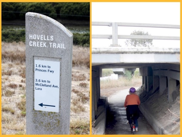
The view along the way. Many feathered friends.
Half way along we took a seat and were joined by another cyclist who stopped to ask about our bikes. She then chatted with us for more than 15 minutes about another market that was happening in Lara, the bikes, travel and the Hume and Hovell monument (initially I thought she'd said the Human Hovel Monument. O_o ). I was still amazed at how friendly the people were.
We made it to Lara with no problems at all. There was a bit of up and also some down but mostly it was flat ground and with the wind behind us, the going was good. We didn't linger all that long in Lara itself. The market turned out to be another 8 kilometres on the other side of town and being a Sunday, a lot of the shops were shut and basically, I am kinda lazy so the extra bike ride didn't appeal to me so after a bite to eat and a bit of a look around, we headed home.
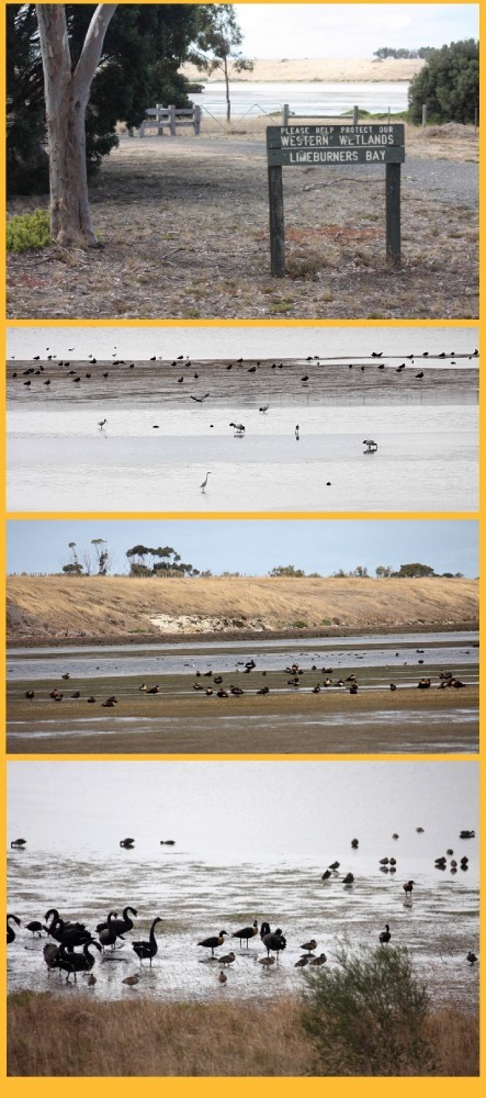
Okay, who's idea was it to ride home in a head wind??!! No, seriously! Who was it? Pffft. There seemed to be a little down and one hell of a lot of up on the way back and it was hard going on the 12" pizza wheels but we broke it up by stopping at the wetlands and having a wander along the boardwalk through the bird habitat and what can only be described as questionable mangroves. For some reason I expected a little more but the only mangroves I saw were some roots beneath the shallow edges of the river. A kind of super mini mangrove that never quite seems to break the surface.
Photos: At the Limeburner's Wetland Sanctuary.
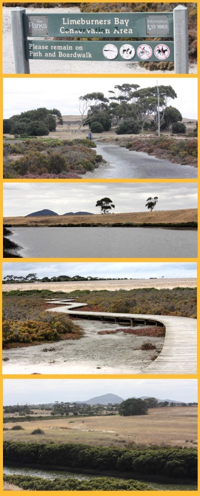
Looking back over the sanctuary towards the yacht club.
We did find the boardwalk itself quite interesting though, as someone had cut a wide, straight swathe through the scrub and plants and then a zig-zagging, snake like structure had been installed. It was as though there had been zero communication between the guy who bulldozed the route and the people who were going to establish the piles so as a consequence, either side of the wooden path, rather than tracking through 'untouched wetland', runs through an eight metre wide, dead straight gouge. Hopefully one day nature will once again reclaim the ugly rent and it really will seem as though the walk goes through virgin territory. Oh, and yes, there were some birds there too but I am pretty sure it wasn't breeding season as most of them were ducks, swans and ibis.
We got back to Limeburner's absolutely knackered. The ride had been about a 14 kilometre round trip. Worth it if I lose some weight I guess but I'll be more than a little miffed if I do all this exercise and nothing happens. Of course one day the tim-tams may have to go, and the chocolate for dessert, and the biscuits.... *sigh*. We were almost tempted to hang around at the club but in the end it was a nice, quiet rest we needed. We parked the bikes and went home to a nice cup of tea
Photo: Swan storm near the boat
MONDAY...
The day started with rain and never let up so Dave went shoreward and collected the bikes. It was a shame because we didn't really get to catch up with anyone from the club before we were due to leave. We readied the boat for departure the following day and basically did nothing but mess about on the computers or read. Rain can be a bugger when space is short and the jetty is a long dinghy ride away.
So far this had been one of our favourite places to be.
THURSDAY MARCH 20th to MONDAY MARCH 24th
Slowly moving ever closer to Melbourne, today our destination was LIMEBURNER'S BAY.
Photos: Just some of the sights on the way to Limeburner's Bay.
Yep... birds on stuff.
Almost in the water!
Nasty sandbar with breaking waves in the Bay
Big fire somewhere
Melbourne through the haze.
It's an odd name so I'll put in a small history tidbit right about here...
**!
The bay was named after lime kilns located on the east side of Corio Bay, used to burn limestone for making cement. Nowadays, Limeburner's Bay is characterised by open, shallow tidal water, which supports a high diversity of birdlife and has listed as a Wetland of International Importance. Yep, that's about it.**
We got through the doglegged marker buoys at Limeburner's at high tide, which is just as well because low tide would definitely have had us grounded. The bay is just lovely, tiny, shallow and packed with the vessels belonging to the members of the Limeburner's Lagoon Boat Club. As we neared one of the two public mooring buoys, we had to be careful not to run into any of the dozen tiny dinghy yachts being sailed around the bay by students from the adjacent Geelong Grammar School.
Photo: Approaching Limeburner's Bay with the You Yangs behind
Despite the shallow water alarm's incessant beeping, we managed to tie off without scraping the bottom, which was a definite plus considering we'd been worried about the depth. If the keel had been any deeper, we wouldn't have got in at all.
Photo: Beautiful Limeburner's Lagoon Yacht Club
After a nice cup of tea and as evening fell, Dave dropped the dinghy into which we loaded the bikes (Dave had a couple of maintenance things to do on them) and we tootled along to the boat club to see if anyone was there and hopefully meet some of the locals. We actually had no need to be hopeful because there were locals aplenty and right from the first hello, they turned out to be a first-class bunch of people with the kind of club we were used to. No pretences, no snobbishness, just great, down-to-earth friendly folk. We felt right at home. Introductions were made all round and we found ourselves in the company of a whole bucket load of Peters and a barrel full of Rons as well as the usual sprinkling of Daves, not to mention Sandy, Mandy, Carolyn, Rudy and so many others whose names I can't remember but who made us feel so welcome. They freely gave us so much invaluable advice and information and so many ideas about the best places to moor and berth around Port Phillip Bay and beyond, where was free or cheap, who to talk to. Just brilliant.
Photo: Just a very small number of the wonderful yacht club members.
The most hospitable and generous of all was Peter McKinnon who basically took us under his wing and immediately offered not only his club key, but his services should we need to go anywhere. Though initially we felt that we didn't want to put him out at all, once we found out that the nearest supermarket was miles away, we figured we may just avail ourselves of his bighearted offer. Dave and he chatted about the bikes, how we needed to find a particular gear part, what they were like to ride, which then had other members asking if they could take them for a spin and naturally we said yes.
After ordering ourselves a pizza (which was delivered to the club... a regular occurrence apparently) and with Dave chugging beers and me sipping a cider, it felt more and more like the GIYC and all was good. We left the bikes ashore to use at a later time. By the time we left to go back to the boat it was pitch dark. There were no lights on the dock and very little light from the street around the bay. The moon wasn't around and so we had to basically squint our way through the water to try and find home, which was parked a fair distance away. Dave was feeling just a little bit tipsy and a whole lot happy, and apart from almost running us into a moored boat, we didn't tip over or drown or anything! That night I slept like the dead on one of the stillest moorings we'd come across, despite the fact that the wind came up overnight.
Photo: Night view from the boat.
The following day we took Peter up on his gracious offer of taking us to the shops, but it turned out to be a full on tour of the area, including shopping centres, the best and cheapest chemists and petrol stations, how to get to there going different ways, showing us sights and giving interesting facts and even taking us all the way to his hometown of Lara where the bike trail near the boat club led. It was fantastic. After more than half an hour, we were dropped at the large shopping centre and left to it with instructions to just give him a bell when we're done and he'll pick us up. Seriously, I had never met such a generous individual. As it is, Carolyn and her fella were walking in as we were walking out with phone in hand to call Peter and they kindly gave us a lift back.
FRIDAY....
It rained heavily all day so we didn't even manage to get off the boat. We read, we snoozed, Meh!
SATURDAY....
The weather had cleared and so we went ashore once more. We had to wait to tie up at the jetty while some of the group boarded a little tinny with the most tragic looking rescue dummy ever, which was used for man overboard practice. The last one had apparently fallen apart because they kept rescuing it with gaff hooks. Yikes!!
Photo: Taking the dummy out for some rough treatment. :)
The first person we came across on shore was Peter, who was going to be heading Beckley Park Community Market in Corio, and offered to take us along. I could never say no to a market so Dave went back for the backpack and off we went, but Peter had other ideas before we actually went market-ward. Unbeknownst to us, Peter had ordered the gear part for the bike and was going to take us in to town to pick it up! I mean... wow!
Then before we knew it we were being given the royal tour around Geelong where he knew we were going to be mooring for a while when our newest granddaughter arrives. It was totally unexpected and just another thing this very wonderful man did for us just out of the goodness of his own heart. After the sightseeing in Geelong, we went to the market, which is held every Saturday, and just wandered around. Peter went one way to buy his cheap ciggies, and we went another and just wandered. Then it was another trip through Lara where he dropped the ciggies off with his daughter, a bit more of a drive around and then back to the club. It was an excellent time and Peter... you're a absolute LEGEND!!
SUNDAY....
Today was going to be an interesting day. The weather was beautiful and the decision had been made to ride the bike trail to Lara, a 6 kilometre journey from the club to the highway, with Lara just beyond that. With helmets in hand and the backpack filled with stuff, we dinghy hopped to the jetty, grabbed the bikes and went. The path was wide, well maintained and ran alongside the wetlands all the way to the highway. Along its length people were jogging, walking their dogs, cycling. It was gorgeous.
Photo: Many Kilometres to ride.
The view along the way. Many feathered friends.
Half way along we took a seat and were joined by another cyclist who stopped to ask about our bikes. She then chatted with us for more than 15 minutes about another market that was happening in Lara, the bikes, travel and the Hume and Hovell monument (initially I thought she'd said the Human Hovel Monument. O_o ). I was still amazed at how friendly the people were.
We made it to Lara with no problems at all. There was a bit of up and also some down but mostly it was flat ground and with the wind behind us, the going was good. We didn't linger all that long in Lara itself. The market turned out to be another 8 kilometres on the other side of town and being a Sunday, a lot of the shops were shut and basically, I am kinda lazy so the extra bike ride didn't appeal to me so after a bite to eat and a bit of a look around, we headed home.
Okay, who's idea was it to ride home in a head wind??!! No, seriously! Who was it? Pffft. There seemed to be a little down and one hell of a lot of up on the way back and it was hard going on the 12" pizza wheels but we broke it up by stopping at the wetlands and having a wander along the boardwalk through the bird habitat and what can only be described as questionable mangroves. For some reason I expected a little more but the only mangroves I saw were some roots beneath the shallow edges of the river. A kind of super mini mangrove that never quite seems to break the surface.
Photos: At the Limeburner's Wetland Sanctuary.
Looking back over the sanctuary towards the yacht club.
We did find the boardwalk itself quite interesting though, as someone had cut a wide, straight swathe through the scrub and plants and then a zig-zagging, snake like structure had been installed. It was as though there had been zero communication between the guy who bulldozed the route and the people who were going to establish the piles so as a consequence, either side of the wooden path, rather than tracking through 'untouched wetland', runs through an eight metre wide, dead straight gouge. Hopefully one day nature will once again reclaim the ugly rent and it really will seem as though the walk goes through virgin territory. Oh, and yes, there were some birds there too but I am pretty sure it wasn't breeding season as most of them were ducks, swans and ibis.
We got back to Limeburner's absolutely knackered. The ride had been about a 14 kilometre round trip. Worth it if I lose some weight I guess but I'll be more than a little miffed if I do all this exercise and nothing happens. Of course one day the tim-tams may have to go, and the chocolate for dessert, and the biscuits.... *sigh*. We were almost tempted to hang around at the club but in the end it was a nice, quiet rest we needed. We parked the bikes and went home to a nice cup of tea
Photo: Swan storm near the boat
MONDAY...
The day started with rain and never let up so Dave went shoreward and collected the bikes. It was a shame because we didn't really get to catch up with anyone from the club before we were due to leave. We readied the boat for departure the following day and basically did nothing but mess about on the computers or read. Rain can be a bugger when space is short and the jetty is a long dinghy ride away.
So far this had been one of our favourite places to be.
Oo roo you roos
28 March 2014 | Queenscliff
WEDNESDAY MARCH 19TH,
Photo: High water on the way.
Photo: Keeping us company
We left at 6am for Port Phillip Bay and our next stop, an overnight at Queenscliff Cruising Yacht Club. The seas were high and choppy and the timing had to be right to get us safely through what is called The Rip which is the narrow and quite dangerous stretch of water that connects the bay to Bass Strait. Because of large tidal flows through the fairly narrow channel from the bay to the ocean, and a high rocky seabed, The Rip has claimed many ships and lives so getting through at slack tide is, to put it mildly, fairly important. It was also far better to do it during the day as this is the main shipping channel for Melbourne as we had seen the size of some of those ships.
Photo: Headed for The Rip
Photo: And through we go. No tender needed here thanks.
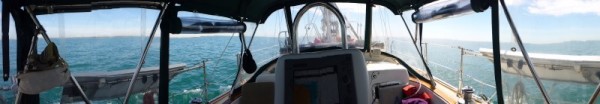
Photo: Dave's cockpit shot in panorama
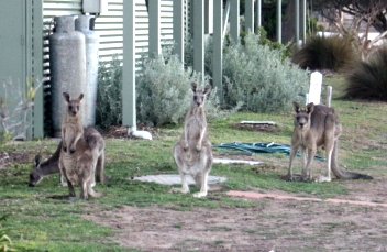
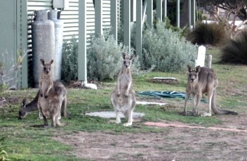
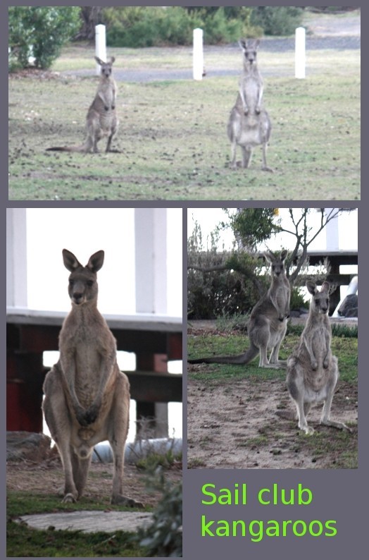
We got to Queenscliff at around 6.30pm, the trip taking a little longer than we'd hoped. Unfortunately the two public mooring buoys were occupied so we had to tie up to the wharf, which ended up costing us $40 for the privilege (which we've since found out we shouldn't have had to pay). Luckily the clubrooms were open so showers and freshen ups were the go. We'd no sooner stepped off the boat and walked the few feet to the clubhouse lawns when we were confronted by a small and totally endearing mob of kangaroos that regarded us with curiosity as we quickly whipped out the cameras and snapped their portraits.
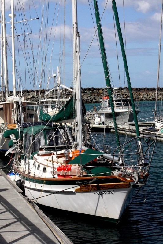
Photo: Venture docked at Queenscliff YC
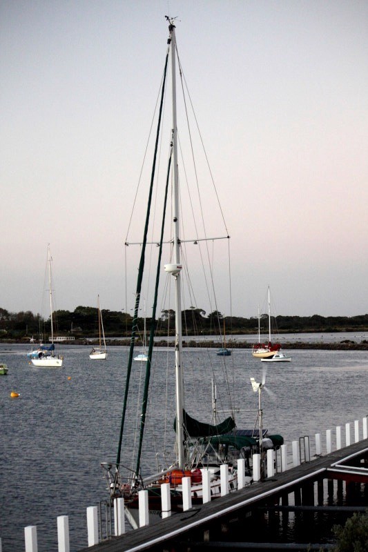
Photo: Some of the kangaroos.
The following morning, before we headed off, we once again had the pleasure of meeting a couple of really helpful and friendly guys who were full of tips on how to preserve the fabric on the bimini and information as to the best places to go, to moor and anchor and dock.
Photo: High water on the way.
Photo: Keeping us company
We left at 6am for Port Phillip Bay and our next stop, an overnight at Queenscliff Cruising Yacht Club. The seas were high and choppy and the timing had to be right to get us safely through what is called The Rip which is the narrow and quite dangerous stretch of water that connects the bay to Bass Strait. Because of large tidal flows through the fairly narrow channel from the bay to the ocean, and a high rocky seabed, The Rip has claimed many ships and lives so getting through at slack tide is, to put it mildly, fairly important. It was also far better to do it during the day as this is the main shipping channel for Melbourne as we had seen the size of some of those ships.
Photo: Headed for The Rip
Photo: And through we go. No tender needed here thanks.
Photo: Dave's cockpit shot in panorama
We got to Queenscliff at around 6.30pm, the trip taking a little longer than we'd hoped. Unfortunately the two public mooring buoys were occupied so we had to tie up to the wharf, which ended up costing us $40 for the privilege (which we've since found out we shouldn't have had to pay). Luckily the clubrooms were open so showers and freshen ups were the go. We'd no sooner stepped off the boat and walked the few feet to the clubhouse lawns when we were confronted by a small and totally endearing mob of kangaroos that regarded us with curiosity as we quickly whipped out the cameras and snapped their portraits.
Photo: Venture docked at Queenscliff YC
Photo: Some of the kangaroos.
The following morning, before we headed off, we once again had the pleasure of meeting a couple of really helpful and friendly guys who were full of tips on how to preserve the fabric on the bimini and information as to the best places to go, to moor and anchor and dock.
Life's a beach
28 March 2014 | Apollo Bay
WEDNESDAY MARCH 12th Apollo Bay
Blaaaargh!! The overnight trip to Apollo Bay was horrible. The seas were, as Dave put it, confused. Oh really!? You think?? An accurate representation would be ... Sea: "Shall I go this way or that way? ... Ohhhh I just don't know. Maybe I should try a bit of a wave this way.... or maybe the other way. Less swell? More swell? Oh hell .... lets have a whole heap of watery fun and just do all of it ALL AT THE SAME TIME!!" There was very little wind so we basically had to motor sail the entire way whilst bobbling about like a ping pong ball in a kiddies wading pool filled with puppies. I did end up sleeping quite a bit, which seems to be my way of coping with my cowardliness of night sailing but I also did my obligatory watches, albeit in my dressing gown. Yes that's right people.... in my big, blue, fluffy dressing gown. Possibly not the safest attire to wear in the middle of the ocean but it sure was comfy. Dave, of course, was his usual calm and capable self.
Photo: Rough water overnight. Yuck.
I also now realise I have to invest in some Paihia Bombs or, now that I know the ingredients, at least take the components that make them up as I was seasick yet again. I really feel for Dave having to empty the bucket of my abject purges. I'm not sure I'll ever really enjoy travelling overnight but I know that sometimes it's going to be inevitable.
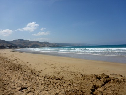
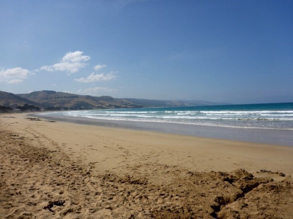
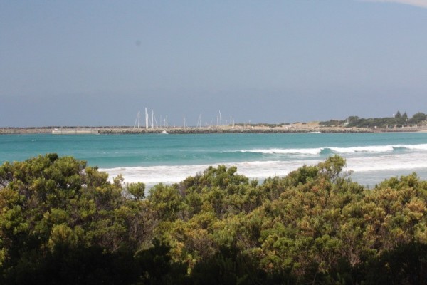
However, once the sun came up and we rounded the bend, all became a little bit better with the world as we approached Apollo Bay. The town setting is just gorgeous, situated halfway along the Great Ocean Road and nestled between Cape Otway and the lowest slopes of the beautiful Otway ranges, it looked like an image from a picture book, with long sweeping sandy beaches hugging the small curved bay, the hills behind gently rising to a clear blue sky.
Photo: Gorgeous view of the bay. Of course this pic was taken on land, not the boat
Dave rang ahead to let the marina know of our approach and to find a berth or place to tie up only to be told that there was very little room and that we'd likely have to tie up to pylons along the marina wall. The marina area inside the breakwater was quite small and we found that all of the mooring buoys as well as the berths were indeed full. Not what we were hoping for that's for sure. As we got nearer to the pylon wall we were greeted by the bloke Dave had spoken to who, after seeing the boat, said that we'd be much better off tied up to the public walkway between the two private docks, so off we tootled again and within 15 minutes we were tied off, boiling the kettle and talking to some of the audience that had seen us coming in. We had admirers wherever we went ... okay WE didn't, Venture did.
Photo: Venture at berth
After a well deserved hot beverage and an equally well deserved rest, Dave got the bikes out and we pedalled our way to the marina office and collected the key to the ATCO hut toilet/shower, which was public during the day and thus, made you feel just a little guilty if you happened to want a shower between 8.30am and 4.30pm. A quick look at the beaches over the top of the stoned up marina walls and it was back to the boat. As we came down the ramp to the boat, we looked down only to see a small stingray and fish in the water. We would have to check it out more thoroughly, when my brain had recovered. I was glad to stop.
Mind you, we found out from night one just how noisy this berth was going to be. The dock and the boat moved at different times when even the slightest swell came in, which caused the fenders, which were pushed up hard against the dock, to squeak and grind against the dock. It sounded like a rubber fetish orgy gone wrong.
THURSDAY MARCH 13th
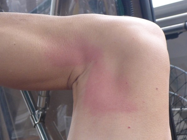
And in the immortal words of Monty Python's Flying Circus.... "And now for something completely different!" There are some lessons you learn whilst on a boat and lesson #53 is, beware boiling coffee when wearing shorts.....
While I lay warm, cosy and semi conscious in bed, good ol' Cap'n Tweaky did his usual morning routine of readying weetbix and coffee for breakfast upstairs in the cockpit. The coffee was usually made without milk and then once he had it outside, the milk was poured in when he'd done the weetbix. This particular morning however, all didn't go according to plan. Now normally I don't hear much during his breakfast routine but on this day I could hear all kinds of thumping and water pumps going on and off and murmuring and more thumping and pumps and the odd 'ow'. After a few minutes of this I figured I was awake for good so went to see what the hell was going on that so disturbed my slumber. Dave sat in the cockpit with the shower nozzle running on his leg and wetting a cloth. He had apparently done as he always did and stepped over the coffee while he moved around the table but this morning the left leg of his shorts somehow caught the cup, tipping it sideways and he ended up copping the scalding, sans milk coffee down the inside of his right knee and thigh. Oh no! Poor Cap'n Tweaky.... whatever should I do? I went downstairs and did the only right and proper thing.... grabbed the camera and took photos and then looked for something to put on his burns. Unfortunately I came to discover that burn stuff is lacking so basically he just had to keep it cool and suffer in his jocks. I'll get something from a chemist later.
Photo: Cap'n Tweaky and his red right leg. Ouchy!
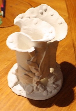
During the rest of the morning I kept myself awake by making a toothbrush/toothpaste holder out of polymer clay and oven baking it. It actually turned out pretty well but I now realise that Sculpey clay can be quite brittle when baked and will be looking for stronger stuff. In the meantime though, I sealed it and painted it twice with Aliphatic, which is a clear top coat that is used on the boat's woodwork, and that has strengthened it nicely and at least I know it won't get waterlogged. I was ever smart enough to put some drain/cleaning holes in it for when that gross slimy gunk gets in the bottom of it. Oh and I made Dave several cups of coffee, all with a little cold water added, just in case.
Photo: My toothbrush holder!
We stayed on the boat for the rest of the day and caught up on a few bits and pieces that needed seeing to as well as catching up on a whole lot of sleep later in the day at a quarter past nana-nap-time. (These overnights screw badly with my body clock, which is set to slumber mode anyway.)
FRIDAY MARCH 14th,
With the bikes unloaded and put together, and with a sunny day ahead of us, it was time to check out the town of Apollo Bay and go food shopping The going was fairly level (apart from the first ¼ kilometre which was really up). Once we got around into the main precinct we found that the foreshore around the bay is lovely, with wide open grassed areas, playgrounds and views. For such a small town, there seemed to be a lot of shops but at this time we decided to leave the exploration and just do the mundane but essential stock up. And besides, we'd left the cameras behind.
But before we go on, here is the brief history lesson for today.....
**!
The first recorded sighting of the area was made by Lieutenant Grant on 8 December 1800 on his voyage through Bass Strait in the Lady Nelson but the bay itself was named by Captain James Loutit in 1845 when he sheltered his vessel, the Apollo, from a storm.
The township of Krambruk, meaning Sandy Place in the language of the local Gadubanud people was established in 1877, and a school was open by 1880. Krambruk was officially renamed Apollo Bay on 2 May 1898. Access to the area was initially only possibly by sea but with the upgrade of the road to the town in 1927 and the completion of the Great Ocean Road in 1932, the town became a tourist destination and an important fishing port.
Apollo Bay began as a small whaling station, and was soon after overtaken by timber logging which was in turn was replaced by farming in the 1880s. The town is now best known for its music festival, arts and tourism. In winter to spring, during their migration season, Southern Right Whales come to the area mainly to breed, to give birth their calves and eventually enter the warmer, calm waters of South Australia. Humpbacks are also seen occasionally. **
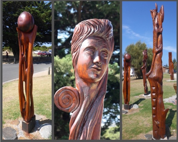
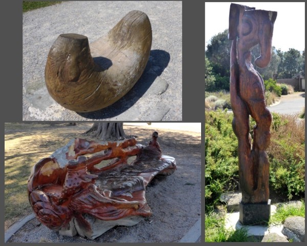
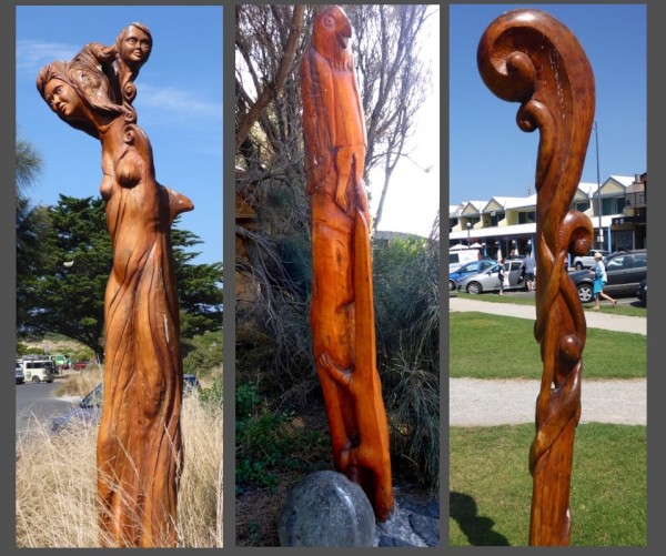
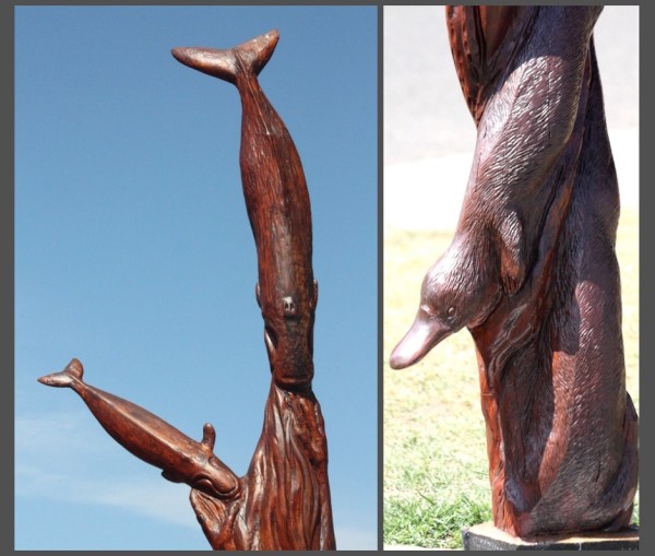
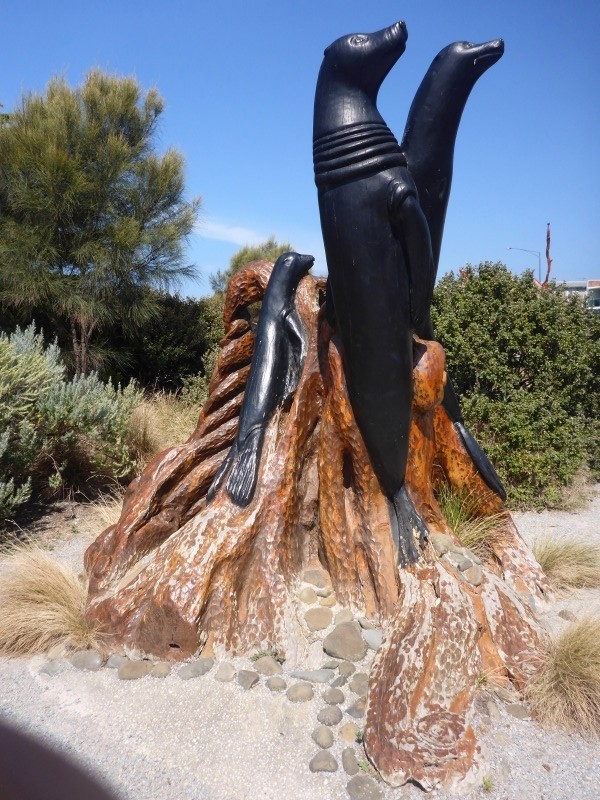
By afternoon the weather had become gorgeous so after dropping the shopping off it was back to town to take photos. The carved wooden sculptures that we had seen previously were widespread along the foreshore park areas and really gorgeous. Bus loads of tourists flocked to the town and I bought some really groovy pants.
Photos: Some of the beautiful wooden sculptures and totems.
We followed this up with a walk along the beautiful sandy beaches. The air was so fresh, you could taste it but there was one thing I noticed about this beach.... there wasn't a single shell on it. Not even tiny ones.
Photos: The main beach stretching around the coast.
When we got back that afternoon we had a little bit of a look around the actual dock, which not only had marine plants and corals growing from the underside, but was its own little eco system. The water was spotlessly clean and clear so fish were easy to see. Small reef fish darted in and out of the growth but the prettiest and most awwwwwww of them all was a little smiling puffer fish. We managed to some film of it before it went all shy on us.
However, as cute as that was, there are some creatures that just creep me out, especially when they appear unexpectedly inside the boat, like the giant thing that was big enough to feel (despite wearing a top and cardigan) when it landed on my unsuspecting back that evening while I was sitting at my computer. After some slightly less than composed beckoning and a little high pitched squealing Dave, who was sitting in the cockpit, figured there was a problem, especially when I started saying getitoff, getitoff!! It was only made worse when Dave started saying "Keep still, don't move" because it confirms suspicions that something horrendous is lurking upon your personage. As it turned out, it was one of the largest grasshoppers I have ever seen, and the only black one. After 3 or 4 lunges it was finally within Dave's grip and dispatched out the door to hopefully live a happier life away from my crawling flesh. I'm not normally that cringy with grasshoppers but this one took me by surprise. Not a good thing to do when someone thinks that you're a huge moth.
SATURDAY MARCH 15th
The day was wet and miserable from start to finish so nothing to report here people except that I was informed by Cap'n Spoiler that we had completely missed the 12 Apostles and quite a sizeable chunk of the Great Ocean Road whilst we were coming to Apollo Bay. They had been off to the left sometime around midnight during the trip. Not happy Jan as it was one thing I really wanted to see. In fact, to put it fairly, I was pissed off. Oh well... I figure they'll still be there when we're able to visit by car.. :)
SUNDAY MARCH 16th
It was a little less wet this morning so a trip to the local Farmer's Market was in order. I'm not sure what I was expecting but it did turn out a bit disappointing. I was hoping to stock up on some nice fresh veg but most people were selling jams and preserves and knitted items. The only thing we bought were candy coated macadamias and cashews. The rest we ended up buying at the supermarket.
MONDAY MARCH 17th
Rain again... doin' nothin'! Tonight the boat wore almost all of the totally delicious nuts that we'd bought when Dave tipped them into a container, shook it, and the lid flew off (and wouldn't you know it, I hadn't vacuumed the floor so it was covered in hair and dirt and sand... sigh). Just the smell of them made me drool and now the bin was enjoying them. *sob*
TUESDAY MARCH 18th
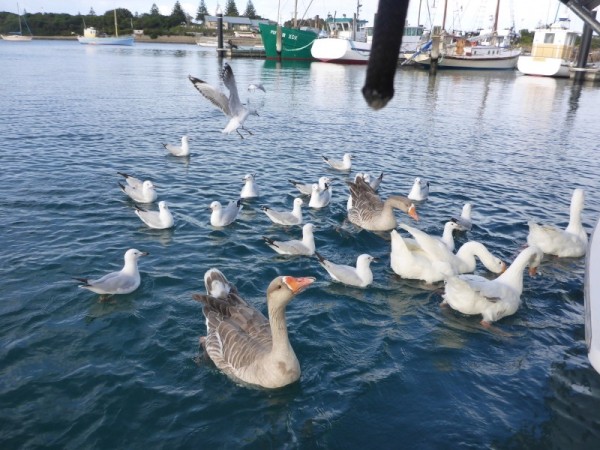
The last day here started beautifully with the resident friendly geese coming over for a visit and a little bread snackage (not too much because I know it's not good for them). It made my morning standing there in my pyjamas tossing breakfast bites to the not-so-wild-life. The geese didn't like the fact that the seagulls also wanted a piece of the action and more than one or two of the gulls had their wings tweaked and snapped at.
Photo: Geese! (and the odd hanger-on seagull)
After that little interlude the day was overcast but not raining and so we rode towards a different part of the beach behind the absolutely immaculate golf course. We left the bikes up top and walked down to the beach below, where the Wye river met the sea. The waves pounded just off of the almost deserted sands but a strong undertow must have been present because by the time they reached the shore, those huge waves were barely a lick at my feet.
Photo: Where the river meets the sea.

Photo: Big seas.... little licks
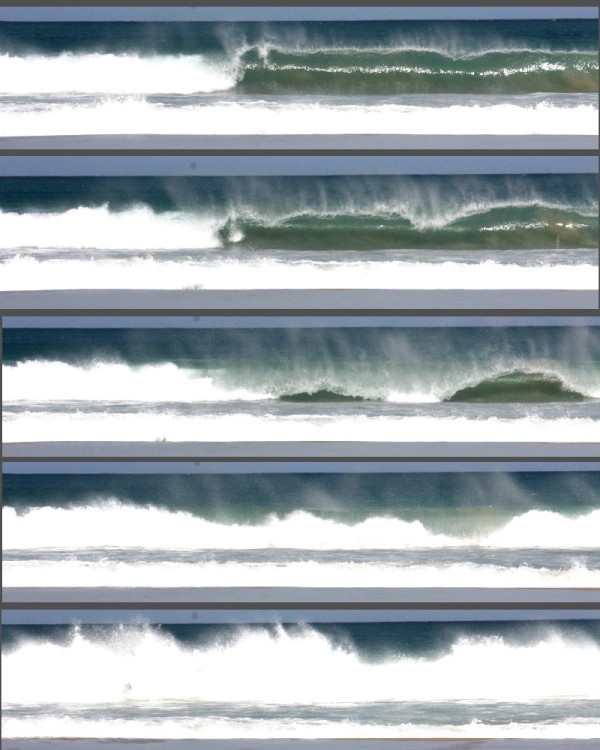
Photo: The Old Man and the Sea
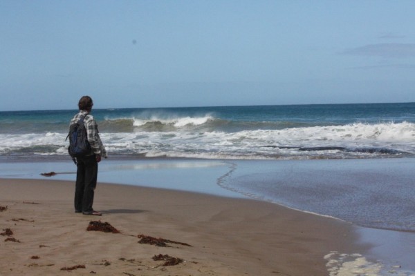
We walked the beach as far as we could and when we reached the breakwater we climbed up it and followed a narrow walking track at the edge of the golf course back to the bikes. The golf course gave us the most magnificent views of the bay and the marina with the Otways framing the whole scene. If the weather had been nicer and we didn't have to ready the boat for leaving in the morning, we may have even gone for a game of golf.
Photos: The gorgeous views from the golf club
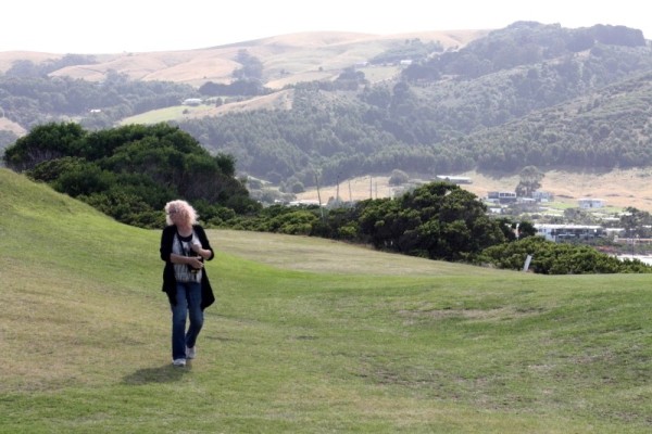
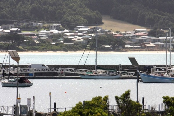
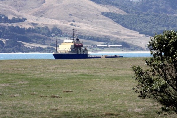
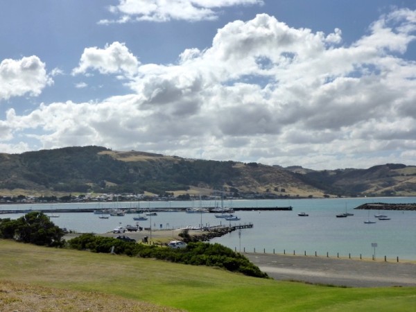
Blaaaargh!! The overnight trip to Apollo Bay was horrible. The seas were, as Dave put it, confused. Oh really!? You think?? An accurate representation would be ... Sea: "Shall I go this way or that way? ... Ohhhh I just don't know. Maybe I should try a bit of a wave this way.... or maybe the other way. Less swell? More swell? Oh hell .... lets have a whole heap of watery fun and just do all of it ALL AT THE SAME TIME!!" There was very little wind so we basically had to motor sail the entire way whilst bobbling about like a ping pong ball in a kiddies wading pool filled with puppies. I did end up sleeping quite a bit, which seems to be my way of coping with my cowardliness of night sailing but I also did my obligatory watches, albeit in my dressing gown. Yes that's right people.... in my big, blue, fluffy dressing gown. Possibly not the safest attire to wear in the middle of the ocean but it sure was comfy. Dave, of course, was his usual calm and capable self.
Photo: Rough water overnight. Yuck.
I also now realise I have to invest in some Paihia Bombs or, now that I know the ingredients, at least take the components that make them up as I was seasick yet again. I really feel for Dave having to empty the bucket of my abject purges. I'm not sure I'll ever really enjoy travelling overnight but I know that sometimes it's going to be inevitable.
However, once the sun came up and we rounded the bend, all became a little bit better with the world as we approached Apollo Bay. The town setting is just gorgeous, situated halfway along the Great Ocean Road and nestled between Cape Otway and the lowest slopes of the beautiful Otway ranges, it looked like an image from a picture book, with long sweeping sandy beaches hugging the small curved bay, the hills behind gently rising to a clear blue sky.
Photo: Gorgeous view of the bay. Of course this pic was taken on land, not the boat
Dave rang ahead to let the marina know of our approach and to find a berth or place to tie up only to be told that there was very little room and that we'd likely have to tie up to pylons along the marina wall. The marina area inside the breakwater was quite small and we found that all of the mooring buoys as well as the berths were indeed full. Not what we were hoping for that's for sure. As we got nearer to the pylon wall we were greeted by the bloke Dave had spoken to who, after seeing the boat, said that we'd be much better off tied up to the public walkway between the two private docks, so off we tootled again and within 15 minutes we were tied off, boiling the kettle and talking to some of the audience that had seen us coming in. We had admirers wherever we went ... okay WE didn't, Venture did.
Photo: Venture at berth
After a well deserved hot beverage and an equally well deserved rest, Dave got the bikes out and we pedalled our way to the marina office and collected the key to the ATCO hut toilet/shower, which was public during the day and thus, made you feel just a little guilty if you happened to want a shower between 8.30am and 4.30pm. A quick look at the beaches over the top of the stoned up marina walls and it was back to the boat. As we came down the ramp to the boat, we looked down only to see a small stingray and fish in the water. We would have to check it out more thoroughly, when my brain had recovered. I was glad to stop.
Mind you, we found out from night one just how noisy this berth was going to be. The dock and the boat moved at different times when even the slightest swell came in, which caused the fenders, which were pushed up hard against the dock, to squeak and grind against the dock. It sounded like a rubber fetish orgy gone wrong.
THURSDAY MARCH 13th
And in the immortal words of Monty Python's Flying Circus.... "And now for something completely different!" There are some lessons you learn whilst on a boat and lesson #53 is, beware boiling coffee when wearing shorts.....
While I lay warm, cosy and semi conscious in bed, good ol' Cap'n Tweaky did his usual morning routine of readying weetbix and coffee for breakfast upstairs in the cockpit. The coffee was usually made without milk and then once he had it outside, the milk was poured in when he'd done the weetbix. This particular morning however, all didn't go according to plan. Now normally I don't hear much during his breakfast routine but on this day I could hear all kinds of thumping and water pumps going on and off and murmuring and more thumping and pumps and the odd 'ow'. After a few minutes of this I figured I was awake for good so went to see what the hell was going on that so disturbed my slumber. Dave sat in the cockpit with the shower nozzle running on his leg and wetting a cloth. He had apparently done as he always did and stepped over the coffee while he moved around the table but this morning the left leg of his shorts somehow caught the cup, tipping it sideways and he ended up copping the scalding, sans milk coffee down the inside of his right knee and thigh. Oh no! Poor Cap'n Tweaky.... whatever should I do? I went downstairs and did the only right and proper thing.... grabbed the camera and took photos and then looked for something to put on his burns. Unfortunately I came to discover that burn stuff is lacking so basically he just had to keep it cool and suffer in his jocks. I'll get something from a chemist later.
Photo: Cap'n Tweaky and his red right leg. Ouchy!
During the rest of the morning I kept myself awake by making a toothbrush/toothpaste holder out of polymer clay and oven baking it. It actually turned out pretty well but I now realise that Sculpey clay can be quite brittle when baked and will be looking for stronger stuff. In the meantime though, I sealed it and painted it twice with Aliphatic, which is a clear top coat that is used on the boat's woodwork, and that has strengthened it nicely and at least I know it won't get waterlogged. I was ever smart enough to put some drain/cleaning holes in it for when that gross slimy gunk gets in the bottom of it. Oh and I made Dave several cups of coffee, all with a little cold water added, just in case.
Photo: My toothbrush holder!
We stayed on the boat for the rest of the day and caught up on a few bits and pieces that needed seeing to as well as catching up on a whole lot of sleep later in the day at a quarter past nana-nap-time. (These overnights screw badly with my body clock, which is set to slumber mode anyway.)
FRIDAY MARCH 14th,
With the bikes unloaded and put together, and with a sunny day ahead of us, it was time to check out the town of Apollo Bay and go food shopping The going was fairly level (apart from the first ¼ kilometre which was really up). Once we got around into the main precinct we found that the foreshore around the bay is lovely, with wide open grassed areas, playgrounds and views. For such a small town, there seemed to be a lot of shops but at this time we decided to leave the exploration and just do the mundane but essential stock up. And besides, we'd left the cameras behind.
But before we go on, here is the brief history lesson for today.....
**!
The first recorded sighting of the area was made by Lieutenant Grant on 8 December 1800 on his voyage through Bass Strait in the Lady Nelson but the bay itself was named by Captain James Loutit in 1845 when he sheltered his vessel, the Apollo, from a storm.
The township of Krambruk, meaning Sandy Place in the language of the local Gadubanud people was established in 1877, and a school was open by 1880. Krambruk was officially renamed Apollo Bay on 2 May 1898. Access to the area was initially only possibly by sea but with the upgrade of the road to the town in 1927 and the completion of the Great Ocean Road in 1932, the town became a tourist destination and an important fishing port.
Apollo Bay began as a small whaling station, and was soon after overtaken by timber logging which was in turn was replaced by farming in the 1880s. The town is now best known for its music festival, arts and tourism. In winter to spring, during their migration season, Southern Right Whales come to the area mainly to breed, to give birth their calves and eventually enter the warmer, calm waters of South Australia. Humpbacks are also seen occasionally. **
By afternoon the weather had become gorgeous so after dropping the shopping off it was back to town to take photos. The carved wooden sculptures that we had seen previously were widespread along the foreshore park areas and really gorgeous. Bus loads of tourists flocked to the town and I bought some really groovy pants.
Photos: Some of the beautiful wooden sculptures and totems.
We followed this up with a walk along the beautiful sandy beaches. The air was so fresh, you could taste it but there was one thing I noticed about this beach.... there wasn't a single shell on it. Not even tiny ones.
Photos: The main beach stretching around the coast.
When we got back that afternoon we had a little bit of a look around the actual dock, which not only had marine plants and corals growing from the underside, but was its own little eco system. The water was spotlessly clean and clear so fish were easy to see. Small reef fish darted in and out of the growth but the prettiest and most awwwwwww of them all was a little smiling puffer fish. We managed to some film of it before it went all shy on us.
However, as cute as that was, there are some creatures that just creep me out, especially when they appear unexpectedly inside the boat, like the giant thing that was big enough to feel (despite wearing a top and cardigan) when it landed on my unsuspecting back that evening while I was sitting at my computer. After some slightly less than composed beckoning and a little high pitched squealing Dave, who was sitting in the cockpit, figured there was a problem, especially when I started saying getitoff, getitoff!! It was only made worse when Dave started saying "Keep still, don't move" because it confirms suspicions that something horrendous is lurking upon your personage. As it turned out, it was one of the largest grasshoppers I have ever seen, and the only black one. After 3 or 4 lunges it was finally within Dave's grip and dispatched out the door to hopefully live a happier life away from my crawling flesh. I'm not normally that cringy with grasshoppers but this one took me by surprise. Not a good thing to do when someone thinks that you're a huge moth.
SATURDAY MARCH 15th
The day was wet and miserable from start to finish so nothing to report here people except that I was informed by Cap'n Spoiler that we had completely missed the 12 Apostles and quite a sizeable chunk of the Great Ocean Road whilst we were coming to Apollo Bay. They had been off to the left sometime around midnight during the trip. Not happy Jan as it was one thing I really wanted to see. In fact, to put it fairly, I was pissed off. Oh well... I figure they'll still be there when we're able to visit by car.. :)
SUNDAY MARCH 16th
It was a little less wet this morning so a trip to the local Farmer's Market was in order. I'm not sure what I was expecting but it did turn out a bit disappointing. I was hoping to stock up on some nice fresh veg but most people were selling jams and preserves and knitted items. The only thing we bought were candy coated macadamias and cashews. The rest we ended up buying at the supermarket.
MONDAY MARCH 17th
Rain again... doin' nothin'! Tonight the boat wore almost all of the totally delicious nuts that we'd bought when Dave tipped them into a container, shook it, and the lid flew off (and wouldn't you know it, I hadn't vacuumed the floor so it was covered in hair and dirt and sand... sigh). Just the smell of them made me drool and now the bin was enjoying them. *sob*
TUESDAY MARCH 18th
The last day here started beautifully with the resident friendly geese coming over for a visit and a little bread snackage (not too much because I know it's not good for them). It made my morning standing there in my pyjamas tossing breakfast bites to the not-so-wild-life. The geese didn't like the fact that the seagulls also wanted a piece of the action and more than one or two of the gulls had their wings tweaked and snapped at.
Photo: Geese! (and the odd hanger-on seagull)
After that little interlude the day was overcast but not raining and so we rode towards a different part of the beach behind the absolutely immaculate golf course. We left the bikes up top and walked down to the beach below, where the Wye river met the sea. The waves pounded just off of the almost deserted sands but a strong undertow must have been present because by the time they reached the shore, those huge waves were barely a lick at my feet.
Photo: Where the river meets the sea.
Photo: Big seas.... little licks
Photo: The Old Man and the Sea
We walked the beach as far as we could and when we reached the breakwater we climbed up it and followed a narrow walking track at the edge of the golf course back to the bikes. The golf course gave us the most magnificent views of the bay and the marina with the Otways framing the whole scene. If the weather had been nicer and we didn't have to ready the boat for leaving in the morning, we may have even gone for a game of golf.
Photos: The gorgeous views from the golf club
All is groovy baby!
21 March 2014
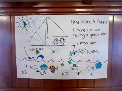
THURSDAY FEB 27TH....
We had to visit the post office first thing as we'd been expecting a parcel from Sarah, so naturally it was going to become a sightseeing trip as well. We'd had an excellent night, finding that the water in the river is so still (despite it being tidal), the boat didn't even wiggle, let alone lurch. I hadn't felt the boat be so still since it was up on a dry stand, and even then it rocked when it was windy.
Before I go much further though, allow me to give you some insight into the history of the place with the best name ever....
**!
The Fairy Bay was named by the crew of the whaling ship The Fairy in 1828. In 1835, a whaling station was built, followed by a store in 1839. In 1843, James Atkinson, a Sydney solicitor, purchased land in the town by special survey. He drained the surrounding swamps, subdivided and leased the land, and built a harbour on the Moyne River. He named the town Belfast after his hometown in Ireland but the post office opened on 1 July 1843 as "Port Fairy". The town was re-renamed "Belfast" on 1 January 1854.
By 1857, due to the success of agriculture, the town of Belfast had become an important transport hub and had a population of 2,190. By the mid-to-late 19th century, Belfast was one of Australia's largest ports, catering to the whaling industry. until an Act of Parliament permanently reverted the town to the original name of Port Fairy on 20 July 1887.**
Photo: Original Irish mile marker to Belfast and to Dublin.
Our first day in Port Fairy was a discovery one. So many people had told us what a lovely town it was, we had high hopes of finding some good stuff to ogle at and do the touristy thing with. We decided against taking the bikes, instead opting for a leisurely stroll across the river and into the town centre just to see how far it was, how easy it might be to take the bikes, and why not? Though not my knees and ankles favourite mode of transport, it was at least level and easy to walk, which would make it even easier to ride. Yay!!
We came across the Information Centre fairly quickly and figured that whatever we needed to know, we'd find there. Perusing rack after rack of information about everywhere in Victoria, we came to realise that from a purely touristy point of view, and if you didn't have a car, Port Fairy really had very little to offer within the town, though there was loads to see miles beyond the outskirts. The best we found that was even slightly suitable for us was a biking trail that would take us on a roundabout trip to Warrnambool and even then we'd only end up going halfway as, for the second half, mountain bikes were recommended as there was a lot of 'up'.
One thing we did discover though, was that Port Fairy, apart from being a really pretty little town (if deficient in the general stuff-for-the-holidaymaker side of things), is renowned for its festivals and in just over a week was going to be their biggest of the year, the Port Fairy Folk Festival (the 38th) which, according to the Info lady was probably going to far exceed last year, in that an estimated 30,000 people were expected to attend and in fact tickets had all sold out for the music venues. Interesting!
We left the Information Centre one the one hand, a little disappointed and on the other hand, with a plan hatching. We found the post office, collected our parcel and found a coffee shop where we could sit outside and open it. The parcel, apart from spewing out a couple of bills (yuck) also yielded my super cool soft laptop covers and the most pleasant surprise of a gorgeous drawing from our grandson Reilley (helped by his mum just a little). It made our day.
Photo: A little bit of love from home.
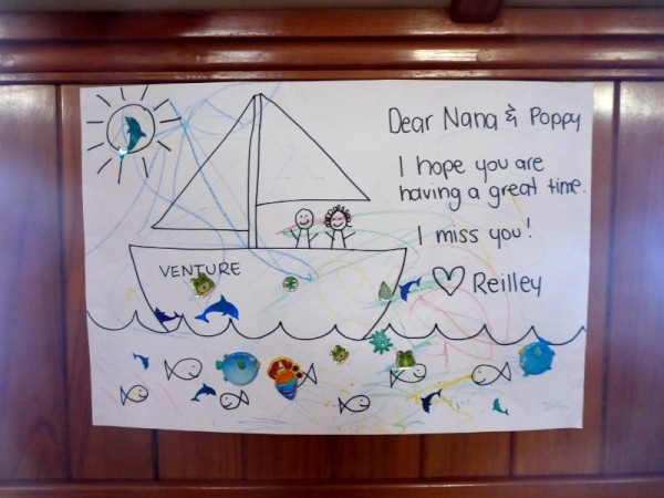
Savouring the caffeine and the cakes (which somehow deliciously materialised on the table... gosh, can't think how that happened), my brain was ticking over as an opportunity presented itself on a tie-dyed macramé platter. Unforeseen folk festival + loads of people + $ka-ching$ = possible chance to sell some artwork. Excellent! Of course that would mean staying in Port Fairy much longer than we'd anticipated but it might be worth it.
After wandering about the town a bit more, finding the all important bakery, supermarket and hardware shops and doing a little shopping in each, it was back to the boat to plan my strategies for joining the festival.
But first, there was movement a little way along the pier/walkway to which we were tied and when we looked out, a seal was slowly turning somersaults in the middle of the river. This was my very first close-up glimpse of an actual seal during our journey so far (rather than Dave yelling "Seal!" and me responding "Where, where, where?" as I aggravate my whiplash with frenzied head snapping in the vain hope of spying it before Dave says "Ah....It's gone now.", leaving me to wonder whether there actually was a seal of if he's just screwing with my head.)
Photo: The local identity. Let's hear it for SEAL! (and the crowd goes wild!!)
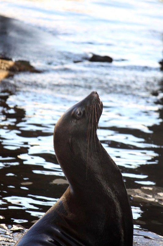
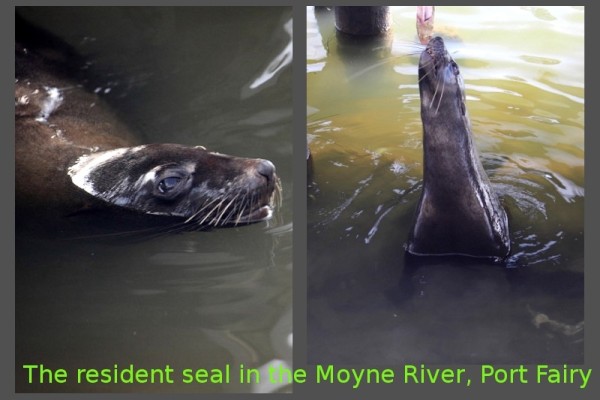
This time however, the seal was very real and very friendly and put on quite a show as it lazily spun its slinky body in circles and waved its fins at us. Then no sooner had we finished looking at the seal when I heard movement behind me along the cemented angle of the river wall 6 feet below us. It was a huge stingray slapping its fin against the wall, which I thought was awesome until another joined it in its sinuous dance. Apparently the seal and rays are regulars that turn up when fishing boats come in. The fisher-folk usually clean their catches on large slate tables that stand at the river's edge and toss the detritus (guts, backbones, heads etc) into the water. I also now understood why the seagulls never seemed hungry. They got all they needed from the fish feasts.
Photo: And Seal's entourage... the Stingrays!
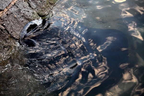
THEN FOR THE NEXT WEEK OR SO....
I worked on some artworks for the upcoming festival (that ran from March 7th - 10th) and spent an equal amount of time just doing not a lot although we did go into town a few times on the bikes. During one of these trips we dropped into the hardware store and asked about refilling gas bottles, one of which was empty. Yep they could do it no problem they said, so Dave jumped on my bike which has a rack, and went back to the boat to get the bottle. I was dubious because it was a fairly big bottle and a very little rack but with the aid of many octopus straps he actually managed not only to bring the empty in, but take the full one back without it either falling off the bike or causing the bike to topple. Good job Cap'n Smartarse.
Dave organised to have some work done on the bimini and came across a wonderful young woman who came and collected what we needed done, came back, measured a bit more, came back and took other parts with her and fixed those too... she was truly awesome. Her name, for anyone who is in Port Fairy and needs stitching or repairs done on their biminis or fabric work, is Tracy Riddle and she's just terrific.
We did go for a cycle around the town, along the river front and up and down side streets and tried to find things to do but very little took our fancy which, compared to other places we'd been, was a little disappointing.
Photo: Just a dorky bird to look at.
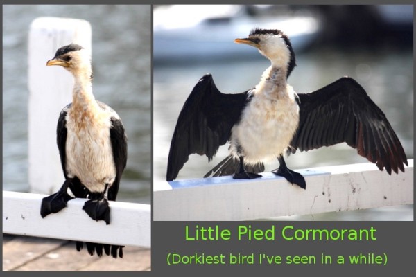
By FRIDAY MARCH 7th, Port Fairy's main thoroughfare was blocked off and large tents had sprung up all over town and several stalls appeared in grassed areas. On a large grassed area next to the Information Centre a large marquee and stage was in place. This was the venue for the free musical part of the festival. The atmosphere seemed to be building as all manner of people were seen busily occupying their time getting things ready for the bigger day tomorrow. As for me, I'd completed several works and had also put together all of the other artwork I already had on the boat, and was organising my art gear and easel. Now all we needed was a place to prop.
Saturday morning we rode back into town to scope out the scene and try and find a good place to set up. So many portable pergolas, tents and food trucks had popped up overnight it was amazing. The main street had stalls along its whole length, buskers of every type, from pan pipes to singers and magicians scattered along the footpaths under the shade of the shop verandahs. And quite seriously, I had never seen so many hippie types in one place at one time, with long plaited or dread-locked hair, flowers and ankle bells, baggy drop crotch Aladdin pants and that's just the guys!! And the amazing part was, the majority of them would have been under the age of 35. The sixties would have been proud and I loved it. Plus, many of the stalls were also selling 'hippie' accoutrements, from tie-dyed clothing, loads of cheesecloth stuff, bells and incense, wind chimes and hand made soaps, there were fortune tellers and street performers, oils and natural remedies. Mind you, there was heaps of other things as well..... toys and bubbles, crochet, sculptures and artwork and prints and photos, jams and pickles, food, umbrellas, hats, hats and more hats and lots of hand made items. Plus, there was a couple walking their pet ferrets on leads. HOW CUTE IS THAT?! The place was abuzz with activity and the glorious weather added to the ambience by seemingly making everyone happy. Thousands upon thousands of people of all ages filled the streets. We didn't even get to see the main events or arena as they were the paid ones but judging by the size of the tents and marquees and the crowds inside the fences, it was HUGE.
Photo: The cutest ferret.
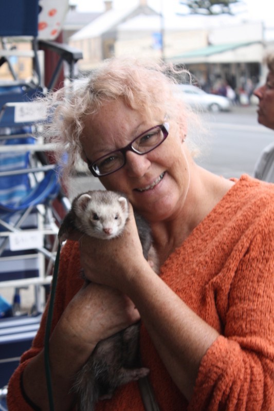
Photo: The Port Fairy Folk Fair... or PFFF for short.
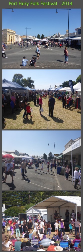
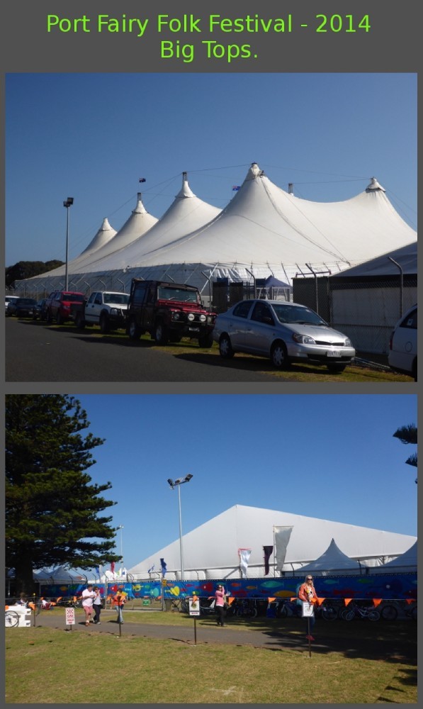
We hung around for a couple of hours, me perusing the stalls and drooling over the things I couldn't buy, Dave patiently standing in the wings and reading the book he had on his phone. We vaguely decided where I'd set up and went back to the boat to make sure everything was organised for tomorrow. Lunch, a Nana nap, making sure I had all of my gear ready, dinner and then bed.
SUNDAY MARCH 9th and we loaded ourselves up with the easel, huge portfolio folders, my handbag and the backpack with water and my pencils inside. We walked... my knee goblins cackling and jack-hammering my kneecaps and I swore vengeance the whole way there. I found a great little spot in front of a shop named Mangowood (OMG the boots they sold were to die for!) where the manager, a lovely woman named Jennifer, allowed me to use a chair (the one thing I didn't have) that was out the front of her shop and I couldn't have been more grateful.
Photo: Lots of attention.
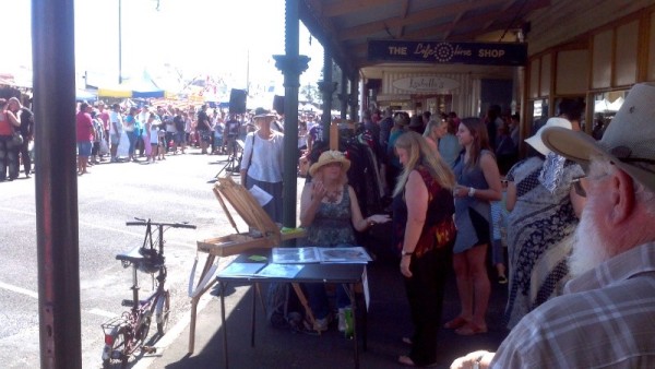
Photo: The local laws! LOL
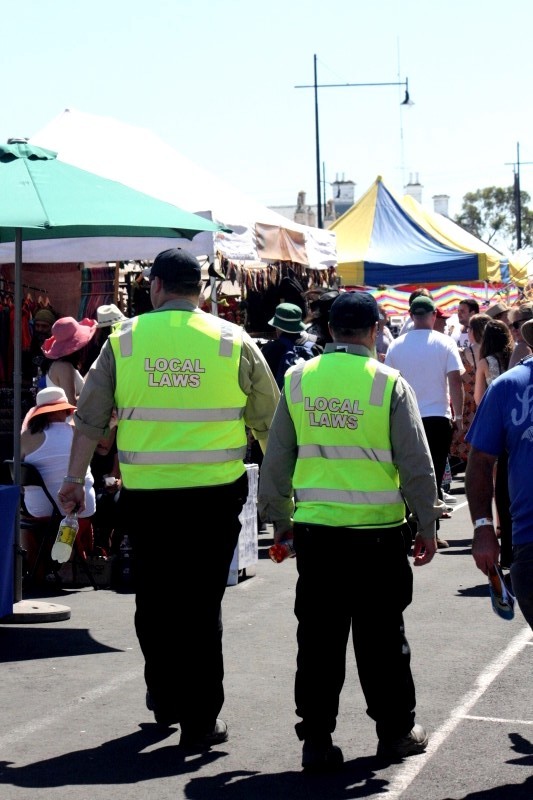
I was drawing live on the easel with my portfolio opened in front of me and immediately I had several people watching me and flipping through the work. It was a little difficult as any breeze that wafted though toppled the folders over, so half my time was spent trying to prop them up. Dave, in the meantime, had gone back to the boat or so I thought until suddenly ... Daaaaaaave was here to save the daaaaaaaaay!! He had bought a card table... what a guy! From then on it was much easier and I was more visible. Dave went back to the boat and I spent so much time chatting to people, I didn't get a lot of the drawing done, but I didn't mind one little bit. He came back in the early afternoon with lunch and lollies, some fruit and white Tim Tams... again I say... what a guy!! I was lucky enough to make a little money on the day and when I finally packed it in for the day I had decided to come back again tomorrow.
MONDAY MARCH 10th. This time we tied all of my art gear, except for the easel, onto the push bikes to take it into town and again, the occy straps worked a treat. Today I had planned to just do my drawing leaning on the table and see how it went but the decision to set up again was not a good one. The whole event was winding down at a rapid rate of knots and people were scant on the ground. Many of the stall holders were already packing up and moving on to the next town to have a festival. They'd be back next year no doubt. I sat in my spot for a couple of hours and chatted to one or two people but in the end rang Dave to come and help me get it packed up and taken home. If I ever do it again it'll be the weekend days, not the beginning and end.
Back on the boat we relaxed for a while. Not long afterwards a few fishing boats came in and the friendly neighbourhood seal and his flappy stinging buddies were back and waiting for their handouts so we wandered over to have a look. The seal was thrashing about in the water, seemingly having a great time flinging something about. It would toss and shake whatever it was like a baton twirler tossing her club (I'm going to say that it was a fish even though I'm kind of sure it may have been one very luckless seagull, mainly because fish don't usually have feet. There wasn't an awful lot left to identify it further :( ),. Then it would be spinning in circles and thrusting itself out of the water, playing with its treasure with all the enthusiasm of a young child tossing a ball at a playground. It was fun to watch (if you tactfully ignored the somewhat mentally fabricated fish it was doing it with.) In the meantime the stingrays and gulls were getting a gutful of offal and bits as one fisherman cleaned his haul of small sharks and washed the debris into the river. It was icky and fascinating all at the same time.
Photo: Seal and it's slightly icky gymnastics show.
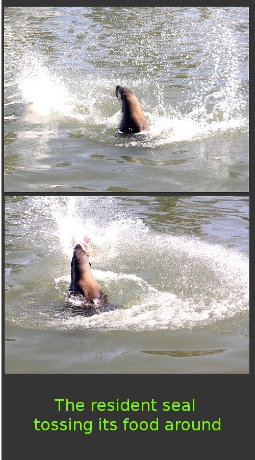
TUESDAY MARCH 11th . Today was our last day in the enchanting hamlet of Port Fairy. One more ride was in order before we packed the bikes into their bags and stuffed them into the lazarette again. It wasn't going to be a long or too strenuous a journey as the plan was to leave on another overnight sail (*sob*) to Apollo Bay. A journey of approximately 16 hours, leaving Port Fairy at about 5pm after a petrol and water top up. No need to think of that yet. Think of nice things, like rainbows, butterflies, kittens .....anything but the prospect of another overnighter. *sigh*
We took a ride out to Griffiths Island, a small island near the mouth of the Moyne river and one side of the channel leading into the river proper. It was a little chilly and a little windy but we tried to make the most of the exercise as we pedalled out to see what we could see. It's been a little while so here today's history lesson...'
**!
Griffiths Island (sometimes called Griffith) was named after John Griffiths, an entrepreneur and merchant from Launceston in northern Tasmania, who figures prominently in the early history of the area. From the mid 1830s until 1843 this small island served as a base for a bay whaling station for Southern Right Whales until the supply of whales was exhausted and the industry went into permanent decline.
The Griffiths Island Lighthouse was built in 1859 by Scottish stonemasons out of bluestone. The unique stairway is cut with each step being inserted in the next course of stone in the outside wall. The lighthouse was initially manned by two keepers. The last keeper to live on the island was there from 1929 to 1954, when the light was automated; the two stone keepers' cottages were subsequently demolished in about 1956.
Some 80-90 bird species have been recorded from the island, especially seabirds and waders. There is a large breeding colony of Short Tailed Shearwaters also known as 'muttonbirds', with an estimated 100,000 nesting burrows. Other animals resident on the island include swamp wallabies short beaked echidnas, blue tongued lizards and tiger snakes.**
Photo: Short Tailed Shearwater breeding grounds.
Photo: Lighthouse on Griffiths Island.
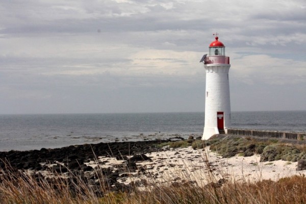
Photo: Birds On Griffiths Island
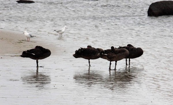
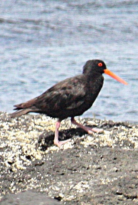
Riding around the island, we saw none of the above wildlife, but we did see the lighthouse, five swans-a-sleeping and an oyster catcher so that was something. We pedalled slowly back to the boat (mainly because there was a head wind) and readied it and ourselves for the journey ahead. A little nap in the early afternoon and then we were once again slipping the ropes , filling up with petrol and water before we left at 4.30pm, hitting the ocean for the long trip ahead in the dark.
Photos: And just some other birds. :)
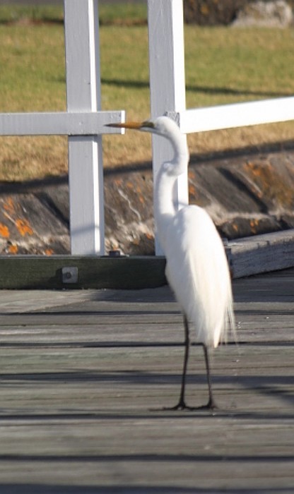
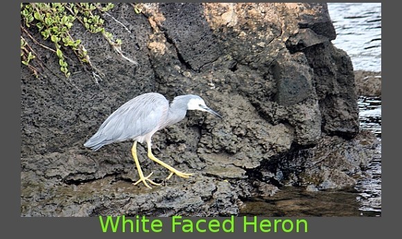
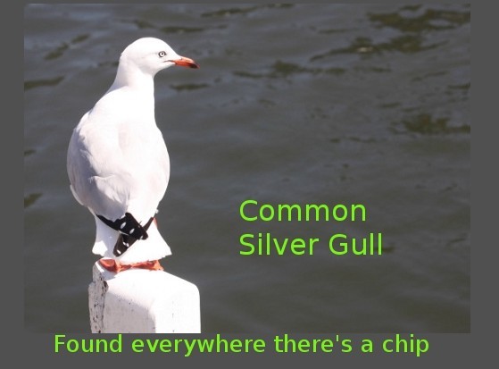
There were no boats leaving with us this time. No fanfare, no farewells by an odd friendly sea creature. Just us and the waves. Goodbye Port Fairy.... hello Apollo Bay.
We had to visit the post office first thing as we'd been expecting a parcel from Sarah, so naturally it was going to become a sightseeing trip as well. We'd had an excellent night, finding that the water in the river is so still (despite it being tidal), the boat didn't even wiggle, let alone lurch. I hadn't felt the boat be so still since it was up on a dry stand, and even then it rocked when it was windy.
Before I go much further though, allow me to give you some insight into the history of the place with the best name ever....
**!
The Fairy Bay was named by the crew of the whaling ship The Fairy in 1828. In 1835, a whaling station was built, followed by a store in 1839. In 1843, James Atkinson, a Sydney solicitor, purchased land in the town by special survey. He drained the surrounding swamps, subdivided and leased the land, and built a harbour on the Moyne River. He named the town Belfast after his hometown in Ireland but the post office opened on 1 July 1843 as "Port Fairy". The town was re-renamed "Belfast" on 1 January 1854.
By 1857, due to the success of agriculture, the town of Belfast had become an important transport hub and had a population of 2,190. By the mid-to-late 19th century, Belfast was one of Australia's largest ports, catering to the whaling industry. until an Act of Parliament permanently reverted the town to the original name of Port Fairy on 20 July 1887.**
Photo: Original Irish mile marker to Belfast and to Dublin.
Our first day in Port Fairy was a discovery one. So many people had told us what a lovely town it was, we had high hopes of finding some good stuff to ogle at and do the touristy thing with. We decided against taking the bikes, instead opting for a leisurely stroll across the river and into the town centre just to see how far it was, how easy it might be to take the bikes, and why not? Though not my knees and ankles favourite mode of transport, it was at least level and easy to walk, which would make it even easier to ride. Yay!!
We came across the Information Centre fairly quickly and figured that whatever we needed to know, we'd find there. Perusing rack after rack of information about everywhere in Victoria, we came to realise that from a purely touristy point of view, and if you didn't have a car, Port Fairy really had very little to offer within the town, though there was loads to see miles beyond the outskirts. The best we found that was even slightly suitable for us was a biking trail that would take us on a roundabout trip to Warrnambool and even then we'd only end up going halfway as, for the second half, mountain bikes were recommended as there was a lot of 'up'.
One thing we did discover though, was that Port Fairy, apart from being a really pretty little town (if deficient in the general stuff-for-the-holidaymaker side of things), is renowned for its festivals and in just over a week was going to be their biggest of the year, the Port Fairy Folk Festival (the 38th) which, according to the Info lady was probably going to far exceed last year, in that an estimated 30,000 people were expected to attend and in fact tickets had all sold out for the music venues. Interesting!
We left the Information Centre one the one hand, a little disappointed and on the other hand, with a plan hatching. We found the post office, collected our parcel and found a coffee shop where we could sit outside and open it. The parcel, apart from spewing out a couple of bills (yuck) also yielded my super cool soft laptop covers and the most pleasant surprise of a gorgeous drawing from our grandson Reilley (helped by his mum just a little). It made our day.
Photo: A little bit of love from home.
Savouring the caffeine and the cakes (which somehow deliciously materialised on the table... gosh, can't think how that happened), my brain was ticking over as an opportunity presented itself on a tie-dyed macramé platter. Unforeseen folk festival + loads of people + $ka-ching$ = possible chance to sell some artwork. Excellent! Of course that would mean staying in Port Fairy much longer than we'd anticipated but it might be worth it.
After wandering about the town a bit more, finding the all important bakery, supermarket and hardware shops and doing a little shopping in each, it was back to the boat to plan my strategies for joining the festival.
But first, there was movement a little way along the pier/walkway to which we were tied and when we looked out, a seal was slowly turning somersaults in the middle of the river. This was my very first close-up glimpse of an actual seal during our journey so far (rather than Dave yelling "Seal!" and me responding "Where, where, where?" as I aggravate my whiplash with frenzied head snapping in the vain hope of spying it before Dave says "Ah....It's gone now.", leaving me to wonder whether there actually was a seal of if he's just screwing with my head.)
Photo: The local identity. Let's hear it for SEAL! (and the crowd goes wild!!)
This time however, the seal was very real and very friendly and put on quite a show as it lazily spun its slinky body in circles and waved its fins at us. Then no sooner had we finished looking at the seal when I heard movement behind me along the cemented angle of the river wall 6 feet below us. It was a huge stingray slapping its fin against the wall, which I thought was awesome until another joined it in its sinuous dance. Apparently the seal and rays are regulars that turn up when fishing boats come in. The fisher-folk usually clean their catches on large slate tables that stand at the river's edge and toss the detritus (guts, backbones, heads etc) into the water. I also now understood why the seagulls never seemed hungry. They got all they needed from the fish feasts.
Photo: And Seal's entourage... the Stingrays!
THEN FOR THE NEXT WEEK OR SO....
I worked on some artworks for the upcoming festival (that ran from March 7th - 10th) and spent an equal amount of time just doing not a lot although we did go into town a few times on the bikes. During one of these trips we dropped into the hardware store and asked about refilling gas bottles, one of which was empty. Yep they could do it no problem they said, so Dave jumped on my bike which has a rack, and went back to the boat to get the bottle. I was dubious because it was a fairly big bottle and a very little rack but with the aid of many octopus straps he actually managed not only to bring the empty in, but take the full one back without it either falling off the bike or causing the bike to topple. Good job Cap'n Smartarse.
Dave organised to have some work done on the bimini and came across a wonderful young woman who came and collected what we needed done, came back, measured a bit more, came back and took other parts with her and fixed those too... she was truly awesome. Her name, for anyone who is in Port Fairy and needs stitching or repairs done on their biminis or fabric work, is Tracy Riddle and she's just terrific.
We did go for a cycle around the town, along the river front and up and down side streets and tried to find things to do but very little took our fancy which, compared to other places we'd been, was a little disappointing.
Photo: Just a dorky bird to look at.
By FRIDAY MARCH 7th, Port Fairy's main thoroughfare was blocked off and large tents had sprung up all over town and several stalls appeared in grassed areas. On a large grassed area next to the Information Centre a large marquee and stage was in place. This was the venue for the free musical part of the festival. The atmosphere seemed to be building as all manner of people were seen busily occupying their time getting things ready for the bigger day tomorrow. As for me, I'd completed several works and had also put together all of the other artwork I already had on the boat, and was organising my art gear and easel. Now all we needed was a place to prop.
Saturday morning we rode back into town to scope out the scene and try and find a good place to set up. So many portable pergolas, tents and food trucks had popped up overnight it was amazing. The main street had stalls along its whole length, buskers of every type, from pan pipes to singers and magicians scattered along the footpaths under the shade of the shop verandahs. And quite seriously, I had never seen so many hippie types in one place at one time, with long plaited or dread-locked hair, flowers and ankle bells, baggy drop crotch Aladdin pants and that's just the guys!! And the amazing part was, the majority of them would have been under the age of 35. The sixties would have been proud and I loved it. Plus, many of the stalls were also selling 'hippie' accoutrements, from tie-dyed clothing, loads of cheesecloth stuff, bells and incense, wind chimes and hand made soaps, there were fortune tellers and street performers, oils and natural remedies. Mind you, there was heaps of other things as well..... toys and bubbles, crochet, sculptures and artwork and prints and photos, jams and pickles, food, umbrellas, hats, hats and more hats and lots of hand made items. Plus, there was a couple walking their pet ferrets on leads. HOW CUTE IS THAT?! The place was abuzz with activity and the glorious weather added to the ambience by seemingly making everyone happy. Thousands upon thousands of people of all ages filled the streets. We didn't even get to see the main events or arena as they were the paid ones but judging by the size of the tents and marquees and the crowds inside the fences, it was HUGE.
Photo: The cutest ferret.
Photo: The Port Fairy Folk Fair... or PFFF for short.
We hung around for a couple of hours, me perusing the stalls and drooling over the things I couldn't buy, Dave patiently standing in the wings and reading the book he had on his phone. We vaguely decided where I'd set up and went back to the boat to make sure everything was organised for tomorrow. Lunch, a Nana nap, making sure I had all of my gear ready, dinner and then bed.
SUNDAY MARCH 9th and we loaded ourselves up with the easel, huge portfolio folders, my handbag and the backpack with water and my pencils inside. We walked... my knee goblins cackling and jack-hammering my kneecaps and I swore vengeance the whole way there. I found a great little spot in front of a shop named Mangowood (OMG the boots they sold were to die for!) where the manager, a lovely woman named Jennifer, allowed me to use a chair (the one thing I didn't have) that was out the front of her shop and I couldn't have been more grateful.
Photo: Lots of attention.
Photo: The local laws! LOL
I was drawing live on the easel with my portfolio opened in front of me and immediately I had several people watching me and flipping through the work. It was a little difficult as any breeze that wafted though toppled the folders over, so half my time was spent trying to prop them up. Dave, in the meantime, had gone back to the boat or so I thought until suddenly ... Daaaaaaave was here to save the daaaaaaaaay!! He had bought a card table... what a guy! From then on it was much easier and I was more visible. Dave went back to the boat and I spent so much time chatting to people, I didn't get a lot of the drawing done, but I didn't mind one little bit. He came back in the early afternoon with lunch and lollies, some fruit and white Tim Tams... again I say... what a guy!! I was lucky enough to make a little money on the day and when I finally packed it in for the day I had decided to come back again tomorrow.
MONDAY MARCH 10th. This time we tied all of my art gear, except for the easel, onto the push bikes to take it into town and again, the occy straps worked a treat. Today I had planned to just do my drawing leaning on the table and see how it went but the decision to set up again was not a good one. The whole event was winding down at a rapid rate of knots and people were scant on the ground. Many of the stall holders were already packing up and moving on to the next town to have a festival. They'd be back next year no doubt. I sat in my spot for a couple of hours and chatted to one or two people but in the end rang Dave to come and help me get it packed up and taken home. If I ever do it again it'll be the weekend days, not the beginning and end.
Back on the boat we relaxed for a while. Not long afterwards a few fishing boats came in and the friendly neighbourhood seal and his flappy stinging buddies were back and waiting for their handouts so we wandered over to have a look. The seal was thrashing about in the water, seemingly having a great time flinging something about. It would toss and shake whatever it was like a baton twirler tossing her club (I'm going to say that it was a fish even though I'm kind of sure it may have been one very luckless seagull, mainly because fish don't usually have feet. There wasn't an awful lot left to identify it further :( ),. Then it would be spinning in circles and thrusting itself out of the water, playing with its treasure with all the enthusiasm of a young child tossing a ball at a playground. It was fun to watch (if you tactfully ignored the somewhat mentally fabricated fish it was doing it with.) In the meantime the stingrays and gulls were getting a gutful of offal and bits as one fisherman cleaned his haul of small sharks and washed the debris into the river. It was icky and fascinating all at the same time.
Photo: Seal and it's slightly icky gymnastics show.
TUESDAY MARCH 11th . Today was our last day in the enchanting hamlet of Port Fairy. One more ride was in order before we packed the bikes into their bags and stuffed them into the lazarette again. It wasn't going to be a long or too strenuous a journey as the plan was to leave on another overnight sail (*sob*) to Apollo Bay. A journey of approximately 16 hours, leaving Port Fairy at about 5pm after a petrol and water top up. No need to think of that yet. Think of nice things, like rainbows, butterflies, kittens .....anything but the prospect of another overnighter. *sigh*
We took a ride out to Griffiths Island, a small island near the mouth of the Moyne river and one side of the channel leading into the river proper. It was a little chilly and a little windy but we tried to make the most of the exercise as we pedalled out to see what we could see. It's been a little while so here today's history lesson...'
**!
Griffiths Island (sometimes called Griffith) was named after John Griffiths, an entrepreneur and merchant from Launceston in northern Tasmania, who figures prominently in the early history of the area. From the mid 1830s until 1843 this small island served as a base for a bay whaling station for Southern Right Whales until the supply of whales was exhausted and the industry went into permanent decline.
The Griffiths Island Lighthouse was built in 1859 by Scottish stonemasons out of bluestone. The unique stairway is cut with each step being inserted in the next course of stone in the outside wall. The lighthouse was initially manned by two keepers. The last keeper to live on the island was there from 1929 to 1954, when the light was automated; the two stone keepers' cottages were subsequently demolished in about 1956.
Some 80-90 bird species have been recorded from the island, especially seabirds and waders. There is a large breeding colony of Short Tailed Shearwaters also known as 'muttonbirds', with an estimated 100,000 nesting burrows. Other animals resident on the island include swamp wallabies short beaked echidnas, blue tongued lizards and tiger snakes.**
Photo: Short Tailed Shearwater breeding grounds.
Photo: Lighthouse on Griffiths Island.
Photo: Birds On Griffiths Island
Riding around the island, we saw none of the above wildlife, but we did see the lighthouse, five swans-a-sleeping and an oyster catcher so that was something. We pedalled slowly back to the boat (mainly because there was a head wind) and readied it and ourselves for the journey ahead. A little nap in the early afternoon and then we were once again slipping the ropes , filling up with petrol and water before we left at 4.30pm, hitting the ocean for the long trip ahead in the dark.
Photos: And just some other birds. :)
There were no boats leaving with us this time. No fanfare, no farewells by an odd friendly sea creature. Just us and the waves. Goodbye Port Fairy.... hello Apollo Bay.
Off to see the Fairy Folk
17 March 2014 | To Port Fairy
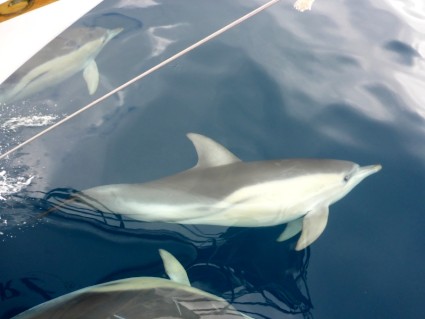
TUESDAY FEB 25th - Heading to Port Fairy with 1 night stopover in Portland in between.
Even the sparrows weren't farting when I got up. It was still a couple of hours until dawn even began to creep, let alone spring up over the horizon and I had slept poorly. It was 4am (yes, it's true.... there actually IS a time in the am that starts with a 4, and I think I can say in all honesty, it'll never be a favourite time with me...EVER!) and not a single drop of tea had touched my delicate lips before we dropped the mooring and wove our way between the dormant fishing boats, with me standing at the bow with a torch, picking out the position of empty mooring buoys before we ran them over. For some reason, Dave thinks I can actually get my eyes to focus at that time of day even though I'm sure I've explained to him more than once that my eyes actually wake up only after a couple of cups of tea. Thank goodness most of the buoys were coloured and that they showed up in the torchlight as beautiful multi faceted blurs reflecting off of my pre-dawn retinas. It was also almost cold enough to figuratively freeze my bazongas off. What a way to start the day. The brightest part of this whole dark start was being accompanied out by Flobby, the local friendly dolphin. He stayed with us for a very long time before turning back to the safe haven of the breakwater.
Not all of the fishing boats were inactive though. Several had already headed out before we set off, and others were preparing to. Outside the breakwater, as we puttered along at less than breakneck speed, several bright spotlights materialised behind us, the boat's skippers focussing them on Venture and then passing us by with a hearty wave as they hastened towards the horizon and their morning's work.
One fishing boat in particular looked most beautiful as it passed by a couple of hundred feet away. It was well lit, with huge spotlights front and back, and all around it, dipping and swooping in and out of the light's beams, looking like bright, silvery flakes in a giant snow-globe, were hundreds of seagulls. The odd part was, the only noise to be heard was the low chug of the boat's engine. The gulls made not a single sound. It seemed almost surreal as it was the only vessel where this was occurring. As we watched it out to sea, the gulls never let up on their dance and seemed intent on guiding it to its destination.
As the sun peeped above the wakening horizon my brain finally rebelled and I went back to bed to try and catch up on some sleep. A couple of hours later I rose to the fact that we had very little wind to fill the sails, and so another day of stinky diesel was in store, or at least seven hours worth until the breeze decided to play with us in the afternoon. Birds of many types seemed to be our constant companions as we followed the coast to Portland. Apart from the avian entourage, not a lot else happened on that day. We arrived in Portland at 5.30pm, tired and weary. Tomorrow we head off again for Port Fairy, a much shorter trip.
WEDNESDAY FEB 26th - Port Fairy
Ahhhhh, 8am and the pleasure of not having to be up before the the sun was palpable. A couple of cups of the nectar that is tea, and all is right with the world. By nine o'clock we were on our way again on the short (well 6-7 hours-ish) leg to Port Fairy.
Weatherwise, the trip itself was relatively unremarkable with a few engine on-engine off moments as the wind picked up and dropped away but it was made much more entertaining with the attendant dolphins that came and went for the entire journey. It really is something I never tire of. The swell however, was huge.... around 3-4 metres. Along the way we saw many wind farms that disappeared from view as the waters rose and fell and one boat that was passing the other way could have been mistaken for a sinking ship at times. It took a few hours for the swell to die down but at least the crests were spaced well apart, making it more like a kiddie-coaster than a mad-mouse.
Photo : Not Sinking... waving!
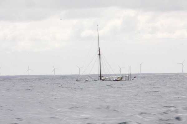
Photo: More dolphin friends.

Another most wonderful and eerie few minutes happened when we passed by Lady Julia Percy Island which is approximately 12 nautical miles (or around 22km) from Port Fairy.
Okay... here comes a lesson
**!
Lady Julia Percy Island is Australia's only submarine volcano developed from a basaltic lava shield and related flows. Formed around seven million years ago by violent underwater eruptions related to the final separation of Australia from Antarctica, it is much older than other volcanoes in the region. Wreathed by cliffs, with a flat treeless top, the island is 2 km long and 1 km wide at the south-western end, with a plateau surface averaging 30 to 40 metres above sea level.
It is one of four large fur seal breeding colonies in Victoria and is the largest colony in Australia with an estimated 23,000 seals. There are also many bird species on the island including little penguin, diving petrel, peregrine falcon, short tailed shearwater, white fronted chats, fairy prion, Australian pipits and the sooty oyster catcher. Some rare plants also survive in the caves. The waters around the island are also important hunting grounds for the Great White Shark. **
Photos: Lady Julia Percy Island.
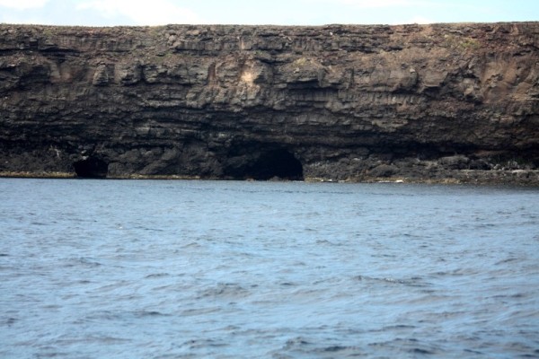
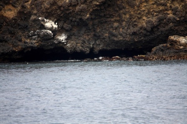
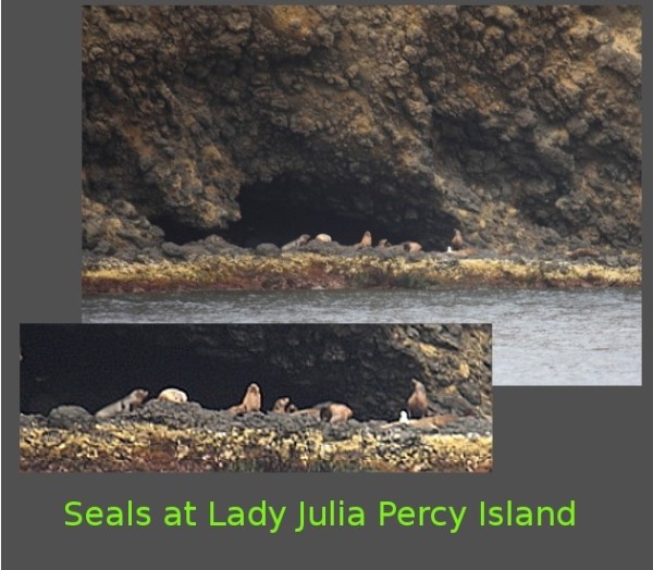
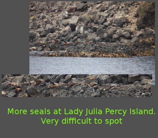
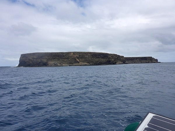
The almost vertical cliffs around the island extend deep into the water, so we were able to cruise quite close Though far enough away to avoid any hidden objects). Since we were under sail at the time, we silently and slowly drifted along the western edge, close enough to hear the eerily haunting barks and bleats of the seals as they echoed through the caves along the water's edge. Initially I thought I was imaging things and so had to ask Dave if he heard it too. Luckily he did so I knew that most of my mental faculties were still intact. At times the cries sounded like sheep up on the plateau, at other times like a bellow or the dirge of old sailors long dead. At all times the calls rebounded off of the cliff face, distorting into wails and cries. It really was spooky but fascinating at the same time especially since, despite hearing all those seals, we saw none until we looked at the photos and spotted tiny seals in the rocks (actually the seals were normal sized.... the rocks and indeed the entire island were FAR larger than they looked from the boat). It was a creepy place.
After that little sojourn into spookiness, we set our course for George the auto pilot and had him take us the remaining couple of hours to Port Fairy.
Photo: Rough waters into Port Fairy
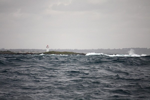
Dave called ahead too the Harbour Master only to be informed that a place for us may be quite difficult as there was a fishing competition being held that coming weekend, and so we'd have to tie up near the boat ramp. I was initially none too happy about this. The thought of being docked in such a public arena,with loud, stinky boats coming and going constantly didn't fill me with happiness but there was little we could do about it. We had to take what we could get.
Photos: Into the Moyne River. What a pleasant surprise. :)
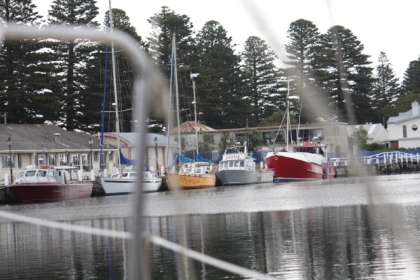
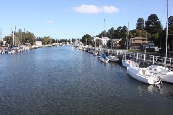
When we touched our way through the narrow inlet to the Moyne River we were pleasantly surprised at the immediate beauty of the place. Unlike seaside towns with a cove or bay or breakwater with moorings, Port Fairy's 'marina' was the river itself, a lovely safe haven for the yachts and fishing boats that tied up along its well maintained board-walks and landings on the western bank and the small 'marina' on the eastern side.
We pulled up where we thought we were supposed to be, on the boat ramp pontoon, tied off and relaxed for a few minutes only to have a 'knock' on the hatch and an introduction to a lovely man named Bill who, within 5 minutes of meeting us, offered to drive us into Warrnambool if we needed anything. His hospitality was very welcome.
After Bill left, we strolled across the footbridge and sauntered the board-walks along the river until we came across a fish and chip shop that had outdoor dining. It was all very pleasant and civilised and even the seagulls were on their best behaviour. Not a single one hassled us or the other people there munching on their chips. In a way, it was totally weird. Where was the 'Mine! Mine!'. All I could figure was, they were exceptionally well fed gulls.
After a while, and with a belly full of the deep fried goodness that is chips, we wandered back to the boat, only to find a note telling us that we were in the wrong place and, if we didn't want to end up with half the keel in the mud, we'd better move. Ah crap. Here we go again.
After a quick call to the number provided, we untied yet again and moved a little further upstream into a deeper and actually far more pleasant tie-up. It was a public dock with no security and normally anything longer than a fifteen minute mooring isn't allowed, but apparently with the fishing competition, room was limited. We didn't care. It was nice and when the harbour master met us there with a key to the toilets and showers I realised it was the better spot anyway.
Photo: In the right spot at last.
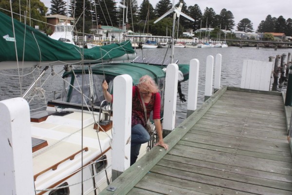
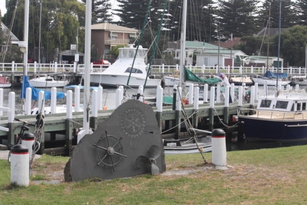
We'd made it to yet another point on our way around Australia and will explore tomorrow. :)
Even the sparrows weren't farting when I got up. It was still a couple of hours until dawn even began to creep, let alone spring up over the horizon and I had slept poorly. It was 4am (yes, it's true.... there actually IS a time in the am that starts with a 4, and I think I can say in all honesty, it'll never be a favourite time with me...EVER!) and not a single drop of tea had touched my delicate lips before we dropped the mooring and wove our way between the dormant fishing boats, with me standing at the bow with a torch, picking out the position of empty mooring buoys before we ran them over. For some reason, Dave thinks I can actually get my eyes to focus at that time of day even though I'm sure I've explained to him more than once that my eyes actually wake up only after a couple of cups of tea. Thank goodness most of the buoys were coloured and that they showed up in the torchlight as beautiful multi faceted blurs reflecting off of my pre-dawn retinas. It was also almost cold enough to figuratively freeze my bazongas off. What a way to start the day. The brightest part of this whole dark start was being accompanied out by Flobby, the local friendly dolphin. He stayed with us for a very long time before turning back to the safe haven of the breakwater.
Not all of the fishing boats were inactive though. Several had already headed out before we set off, and others were preparing to. Outside the breakwater, as we puttered along at less than breakneck speed, several bright spotlights materialised behind us, the boat's skippers focussing them on Venture and then passing us by with a hearty wave as they hastened towards the horizon and their morning's work.
One fishing boat in particular looked most beautiful as it passed by a couple of hundred feet away. It was well lit, with huge spotlights front and back, and all around it, dipping and swooping in and out of the light's beams, looking like bright, silvery flakes in a giant snow-globe, were hundreds of seagulls. The odd part was, the only noise to be heard was the low chug of the boat's engine. The gulls made not a single sound. It seemed almost surreal as it was the only vessel where this was occurring. As we watched it out to sea, the gulls never let up on their dance and seemed intent on guiding it to its destination.
As the sun peeped above the wakening horizon my brain finally rebelled and I went back to bed to try and catch up on some sleep. A couple of hours later I rose to the fact that we had very little wind to fill the sails, and so another day of stinky diesel was in store, or at least seven hours worth until the breeze decided to play with us in the afternoon. Birds of many types seemed to be our constant companions as we followed the coast to Portland. Apart from the avian entourage, not a lot else happened on that day. We arrived in Portland at 5.30pm, tired and weary. Tomorrow we head off again for Port Fairy, a much shorter trip.
WEDNESDAY FEB 26th - Port Fairy
Ahhhhh, 8am and the pleasure of not having to be up before the the sun was palpable. A couple of cups of the nectar that is tea, and all is right with the world. By nine o'clock we were on our way again on the short (well 6-7 hours-ish) leg to Port Fairy.
Weatherwise, the trip itself was relatively unremarkable with a few engine on-engine off moments as the wind picked up and dropped away but it was made much more entertaining with the attendant dolphins that came and went for the entire journey. It really is something I never tire of. The swell however, was huge.... around 3-4 metres. Along the way we saw many wind farms that disappeared from view as the waters rose and fell and one boat that was passing the other way could have been mistaken for a sinking ship at times. It took a few hours for the swell to die down but at least the crests were spaced well apart, making it more like a kiddie-coaster than a mad-mouse.
Photo : Not Sinking... waving!
Photo: More dolphin friends.
Another most wonderful and eerie few minutes happened when we passed by Lady Julia Percy Island which is approximately 12 nautical miles (or around 22km) from Port Fairy.
Okay... here comes a lesson
**!
Lady Julia Percy Island is Australia's only submarine volcano developed from a basaltic lava shield and related flows. Formed around seven million years ago by violent underwater eruptions related to the final separation of Australia from Antarctica, it is much older than other volcanoes in the region. Wreathed by cliffs, with a flat treeless top, the island is 2 km long and 1 km wide at the south-western end, with a plateau surface averaging 30 to 40 metres above sea level.
It is one of four large fur seal breeding colonies in Victoria and is the largest colony in Australia with an estimated 23,000 seals. There are also many bird species on the island including little penguin, diving petrel, peregrine falcon, short tailed shearwater, white fronted chats, fairy prion, Australian pipits and the sooty oyster catcher. Some rare plants also survive in the caves. The waters around the island are also important hunting grounds for the Great White Shark. **
Photos: Lady Julia Percy Island.
The almost vertical cliffs around the island extend deep into the water, so we were able to cruise quite close Though far enough away to avoid any hidden objects). Since we were under sail at the time, we silently and slowly drifted along the western edge, close enough to hear the eerily haunting barks and bleats of the seals as they echoed through the caves along the water's edge. Initially I thought I was imaging things and so had to ask Dave if he heard it too. Luckily he did so I knew that most of my mental faculties were still intact. At times the cries sounded like sheep up on the plateau, at other times like a bellow or the dirge of old sailors long dead. At all times the calls rebounded off of the cliff face, distorting into wails and cries. It really was spooky but fascinating at the same time especially since, despite hearing all those seals, we saw none until we looked at the photos and spotted tiny seals in the rocks (actually the seals were normal sized.... the rocks and indeed the entire island were FAR larger than they looked from the boat). It was a creepy place.
After that little sojourn into spookiness, we set our course for George the auto pilot and had him take us the remaining couple of hours to Port Fairy.
Photo: Rough waters into Port Fairy
Dave called ahead too the Harbour Master only to be informed that a place for us may be quite difficult as there was a fishing competition being held that coming weekend, and so we'd have to tie up near the boat ramp. I was initially none too happy about this. The thought of being docked in such a public arena,with loud, stinky boats coming and going constantly didn't fill me with happiness but there was little we could do about it. We had to take what we could get.
Photos: Into the Moyne River. What a pleasant surprise. :)
When we touched our way through the narrow inlet to the Moyne River we were pleasantly surprised at the immediate beauty of the place. Unlike seaside towns with a cove or bay or breakwater with moorings, Port Fairy's 'marina' was the river itself, a lovely safe haven for the yachts and fishing boats that tied up along its well maintained board-walks and landings on the western bank and the small 'marina' on the eastern side.
We pulled up where we thought we were supposed to be, on the boat ramp pontoon, tied off and relaxed for a few minutes only to have a 'knock' on the hatch and an introduction to a lovely man named Bill who, within 5 minutes of meeting us, offered to drive us into Warrnambool if we needed anything. His hospitality was very welcome.
After Bill left, we strolled across the footbridge and sauntered the board-walks along the river until we came across a fish and chip shop that had outdoor dining. It was all very pleasant and civilised and even the seagulls were on their best behaviour. Not a single one hassled us or the other people there munching on their chips. In a way, it was totally weird. Where was the 'Mine! Mine!'. All I could figure was, they were exceptionally well fed gulls.
After a while, and with a belly full of the deep fried goodness that is chips, we wandered back to the boat, only to find a note telling us that we were in the wrong place and, if we didn't want to end up with half the keel in the mud, we'd better move. Ah crap. Here we go again.
After a quick call to the number provided, we untied yet again and moved a little further upstream into a deeper and actually far more pleasant tie-up. It was a public dock with no security and normally anything longer than a fifteen minute mooring isn't allowed, but apparently with the fishing competition, room was limited. We didn't care. It was nice and when the harbour master met us there with a key to the toilets and showers I realised it was the better spot anyway.
Photo: In the right spot at last.
We'd made it to yet another point on our way around Australia and will explore tomorrow. :)
Mount Gambier meanderings - day 2
05 March 2014 | Mount Gambier surrounds
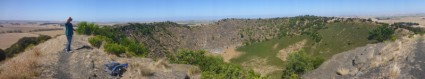
Day 2 in the Mount Gambier shenanigans began with us deciding not to go to Mount Gambier but to visit Mount Schank.
Trundling along in our little not-very-gutsy car on the way to Mount Schank we passed a rather large hole in the road. Literally. In the centre of the main road to Gambier was a fenced off hole. This turned out to be the Allendale Sinkhole, apparently once known as the 'Middle of the Road Hole' (well imagine that... can't think why!). There was no access to it but then again I'm not sure I'd really want to get that close. Popular with properly licensed and equipped thrill seeking cave divers, or in other words, lunatics with a death wish, but not with me. I get claustrophobic in a sleeping bag. But here for your reading and learning pleasure is a short history lesson!
**!
The Allendale cave was used in the early years of settlement to water the teams of horses and bullocks that made their way to and from Port MacDonnell. It was difficult to extract the water so a hand pump and trough was installed to make it easier. In later years a stone wall was built around the cave as a safety measure. At one time an attempt was made to fill the cave so they could build the road over it, but the filling subsided and the cave remains open. It is now a popular spot for cave divers.**
Photos : Allendale Cave and legends
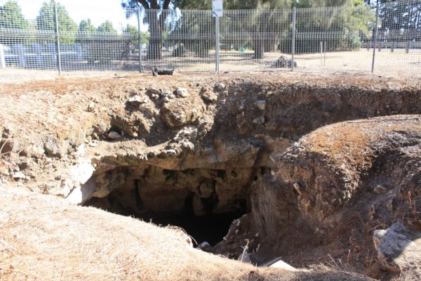
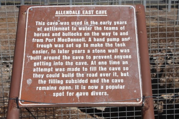
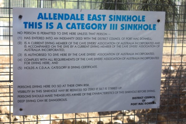 '
'
After our little side trip (or rather straight through trip since it was totally in the centre of the road along which we were travelling) we headed towards our ultimate morning destination and the only visible point on the near landscape that wasn't cow shaped, Mount Schank. Get ready for it.... Lesson 2!
Photo: Mount Schank panorama shot.
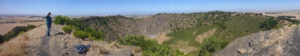
**!
Mount Schank (previously spelled Schanck) is a dormant maar (a circular volcanic land-form resulting from explosive ash eruptions) volcano in the south-east of South Australia, near Mount Gambier. It was named by James Grant in 1800 after Admiral John Schank who was the designer of Grant's ship, the HMS Lady Nelson (the replica of which is outside the information centre). Mount Schank is believed to be amongst the youngest volcanoes in Australia (less than 5,000 years old). Because the volcano base is above the water table, it doesn't hold water, unlike the volcano in which the Blue Lake now exists.**
We puttered our way to the volcanic Mount. As we travelled along the approach road, still about a kilometre away from the car park and with nothing but roadway for the past kilometre, I saw a very tanned, athletic looking young couple and their dog. I knew they were serious walkers as they were decked out in fluoro green and yellow from cap to Nike's and everywhere in between. It was a sunny day and the glare off of them almost seared my retinas. I had a feeling I would be seeing them soon.
In the carpark an unusual sight came as small groups of tourists sat around card tables in front of their various and scattered hire vehicles and ate breakfast. I felt decidedly out of place without food in my hand. One couple (I hypothesised that they were German since they spoke German) walked with a sandwich in their hand towards a low fence and it was then I noticed that there were horses. Now, I don't usually like horses but these were super friendly and probably use to being given treats by the many people who frequent Mount Schank so I got in a couple of pats when I could which was just as well because they totally ignored me when they found I wasn't laden with goodies. Drat, I didn't think to pack the chaff, silly me.
Photos : Horses at Mount Schank
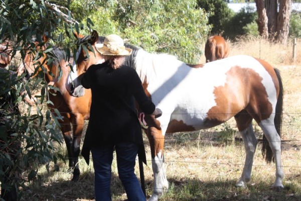
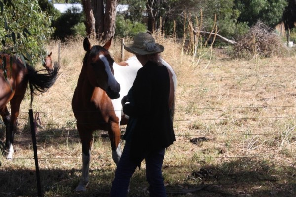
Photo: Loo visit # 188 (or 189 , who knows, I can't keep up) where some of the the breakfast feasters can be seen
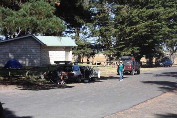
After patting the horses, visiting the loo and reading every information board I could find, I knew that I had actually done everything I could to delay the approaching task at hand, which was climbing the side of the volcano. I looked at the steps. They were tall and uneven and rough. Oh, the fun I was going to have, especially when I read that the climb to the rim, though not far (about 450 metres) had steep sections. Right, sleeves up, sunscreen on, hat pulled tight. Let's go!
Photos: Up we go
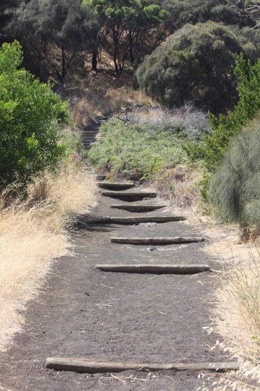
Photo : Views along the way.
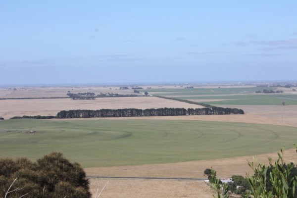
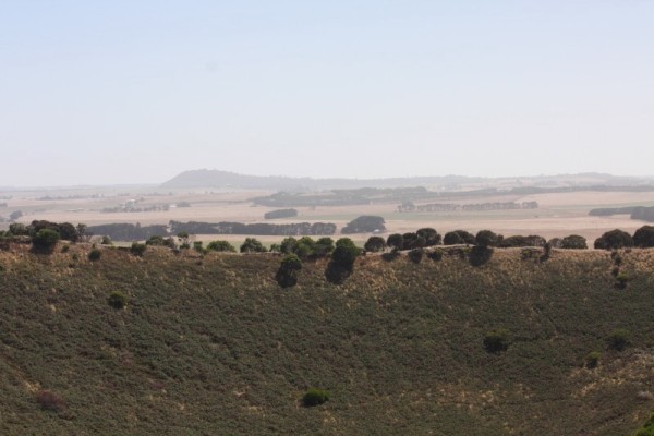
Half way up and sure enough, we were passed by the peppy fluoro twosome and their perky little dog. Oh to be young again but I never want to be so young that full fluoro is an acceptable form of attire. Even in the 70's it wasn't on, and that's the decade that fashion forgot!
I watched them disappear from view and as I continued to climb it didn't take long before the knee goblins started setting off firecrackers under my kneecaps. I courageously fought through the hurt and swore death to all hobs via demise by toothpicks if I ever caught them. As it is the threats of goblin annihilation did nothing and my knees continued to bicker with my kneecaps the whole way up. Reaching the crown was all worth it though as I looked down on what was, not long ago by Earth standards, a big hole spewing lava and rocks hither and yon, all watched on by the local Aboriginal Bunganditj people. How incredible it must have seemed. Now it was a giant, peaceful divot filled with grass, trees, birds and tranquillity. What was the best thing to do up here? Fly the kite of course!
Photos: At the top!
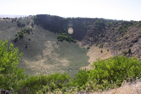
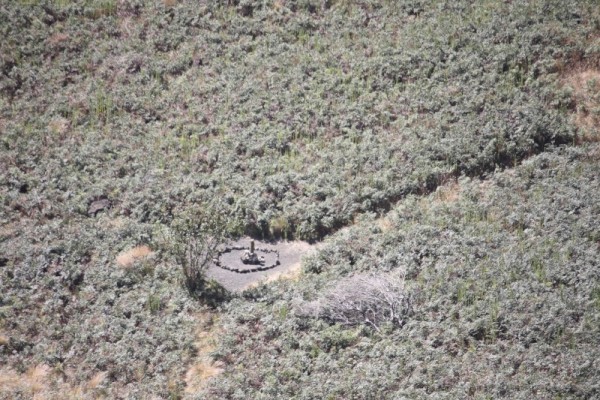
I snapped a few pictures (keeping well away from the edge, which has no barrier and some really steep falls) as Dave unpacked the kite and got it ready. On the other side of the rim I could make out the acerbic luminescence of the dayglo duo pacing themselves in perfect rhythm. In the meantime the kite was ready to go. The wind wasn't too light so a good launch seemed imminent. The kite was tossed up, the wind caught it. Up, up it went and down, down it also went. Okay, take two.... up, down. Crap. Once more... toss and down. Hmmmm.... it was going to be more difficult than we thought getting the kite out over the crater, mainly because the wind was in the wrong direction but no one could accuse us of not persisting for at least another 3 goes. The best we did on the side was when the wind finally took it about three metres over the inner edge of the rim before dumping it. Yay! At least we got photos. Flying it out over the outer edge was easier. We managed at least 15 metres, and with a daylight moon in the frame before it came crashing down again. I totally call that a victory.
Photos: 1) Kite flying over the rim. 2) Flying with the moon

By the time the kite had been hauled in and packed away, the dayglo duo were back at the steps and heading down, but not before telling us that, although tricky in places and the fact that it snakes around a bit (but no REAL snakes laughed the girl, with a toss of her blonde ponytail), the walk is worth it. I saw something light up in Dave's eyes and I knew we were going to walk the rim, but about that, I wasn't worried. It was fairly flat and had a well defined, if narrow path. At least for the first couple of hundred metres and then a sign informed me that the path beyond that point was not maintained and that it was a 'use at your own discretion and risk' type sign. So, throwing discretion to the wind (which went further than the kite) we ventured forth at our own peril. It really wasn't that bad, at least until the ¾ mark of the circumference when it did get a little tricky when the path disappeared and all there was to follow was a foot-width fissure in the rock, with nothing but spindly shrubs on one side to slow down any tumble we might take and a sheer drop down the lava and rock face on the other, with absolutely nothing to slow you down. Such fun (actually it really was!). Along the way though, the views out over the plains and towards the ocean were amazing and through the no-path-anywhere bits, skinks darted back and forth in front of us. One even 'followed' me in order to take a bit if a rest in my shadow. I moved, it moved. It was really kind of cute.
Photo : The path narrows.
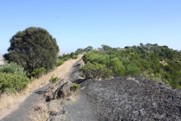
Photo : Skink trying to enjoy my shade.
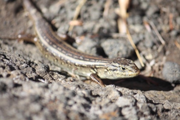
Photo : A tad too narrow.
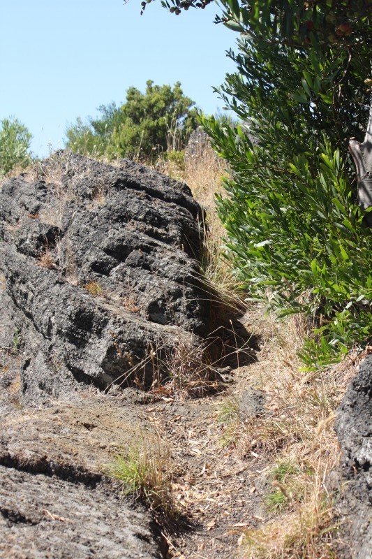
The last hundred metres of the rim was the most difficult because even the fissure disappeared and it was a case of very carefully stumbling over rocks and boulders and trying not to tip sideways.
Photo : We did it!!
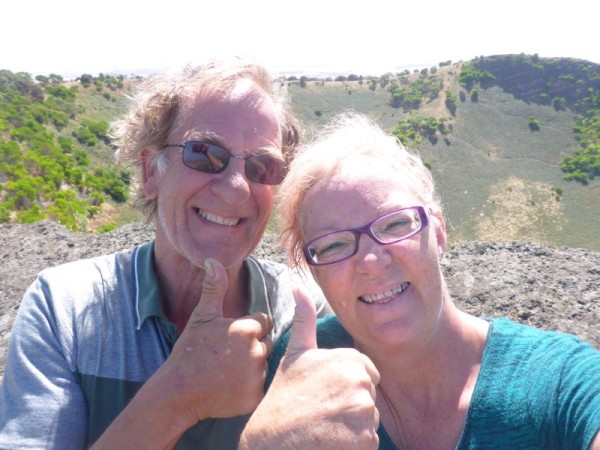
A sigh of relief was felt when I saw the rough stairway again and I rejoiced the fact that I hadn't fallen into the volcano. What a plus. Now the only thing I was dreading was going down because I knew those bloody goblins were rubbing their gnarly little hands together and setting up the fireworks again, but Dave made a suggestion that shut the little sods up. Take the stairs sideways instead of walking straight. Yes I was dubious and was worried that my occasional less-than-sure-footedness would somehow cause me a come a cropper at some stage of the descent but no. I actually made it down safely with no hurt stops, no exploding kneecaps and in great time. Well done Dave, you saved yourself a lot of my ahhhhing and ouching noises.
Photo : Almost down.... yay!!
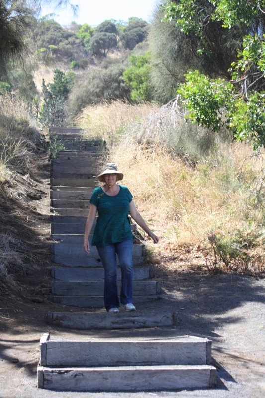
Having conquered the Mount, and consulting the rudimentary map that we had, the next stop was going to be Little Blue Lake, some foresty thingy on the same road and another thing that was supposedly nearby (the reason I sound vague on the two following the LBL is because we never managed to find them and as such, I've forgotten what they were). The Little Blue Lake was actually fascinating in itself. A natural water filled sinkhole that was obviously used for swimming (except there was a warning sign about possible blue-green algae), with steps and platforms. What a wonderful place it would have been after school on a hot day.
Photo : Little Blue Lake.
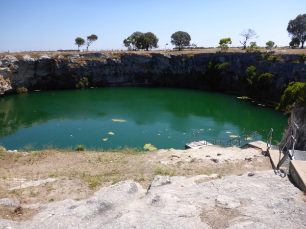
**!
With a diameter of around 45 metres the Little Blue Lake is a sinkhole and is popular with divers and local swimmers.. The walls are sheer and undercut all the way around. The Lake used to turn blue annually, however, pollution from agricultural fertilisers has increased the nutrient levels of these lakes to the extent that they now remain a year-round green colour. Swimming is allowed, but discouraged. The depth ranges from 25m to 36 metres or deeper. The first reference of this sinkhole was in June 1961, although it is almost positive that scuba divers came here in the late 1950s.**
After snapping a few photos and driving in circles trying to find the other places, we gave up and headed towards the interesting sounding Blackfellows Caves. I was looking forward to seeing the caves but was disappointed when we followed the signs into a small town named, you guessed it, Blackfellows Caves. So where are the caves? Well apparently there are some small caves along the limestone coastline that you can see at low tide but they're nothing special so after that slight disappointment we instead turned our attention to another wonderful sounding place that smacked of rugged shores and crashing seas, Carpenter Rocks. As we followed the signs, and with camera poised in anticipation of another of nature's marvels, my excitement mounted only to be dashed like Morse code without the dots. The road to Carpenter Rocks ended abruptly at a carpark in front of a small bay that moored about 15 - 20 fishing boats. Beyond the boats, waves surfed in against some reefs and rocks, but apart from that, the view was a little underwhelming and again I realised that the name, like Blackfellows Caves was merely the name of the town, not an actual representation of the surrounds. Again disappointing. Nearby was a small shop and at this stage the suggestion of junk food was a brilliant one, and so one demolished potato pie, bottle of Coke and a chocolate doughnut later we perused the map and were again on our way to (hopefully) more interesting locations. This time, the Tantanoola Cave.
Photo : The not-so-thrilling Carpenter Rocks
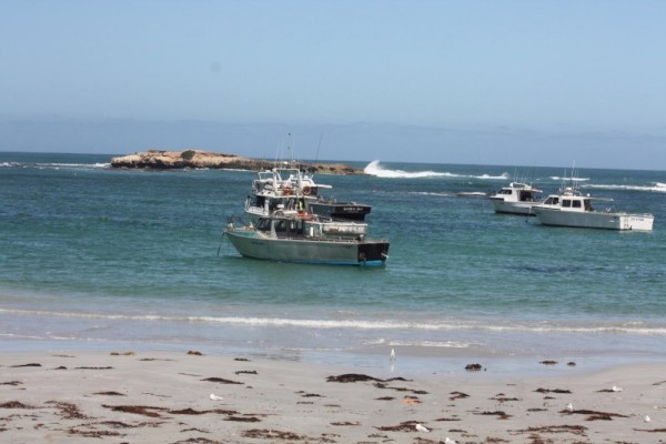
On sealed back roads from Carpenter Rocks, we tootled to town of Tantanoola, all the time keeping an eye out for the signs to the caves. Not a single sign has been spied when we actually drove down the main street in the town and on the third run it was becoming frustrating. Where are the Caves?? At one end of town I noticed some young men clearing tree cuttings in front of a house so we pulled over and, winding my window down and in my most polite manner said "Where the hell are these bloody caves?" I could see by the mirth on their faces that this was perhaps not an uncommon question in these parts and the lady-of-the-house kindly gave us directions to the main highway. Ah, that's where the confusion lay.... the Tantanoola Caves were not actually situated IN Tantanoola. Got it.
Finally, after about 10 minutes driving, we spied a sign for the caves. Huzzah!! Into the carpark and out of the car, I couldn't wait to see it. I love caves and rocks. Maybe I was a geologist in another life. However I dislike dark, tight places (need I remind you of my previous comment alluding to sleeping bags?) so I couldn't have been a spelunker. So, rocks yes, holes no. And history lesson time .....
Photo : Finally at Tantanoola Caves
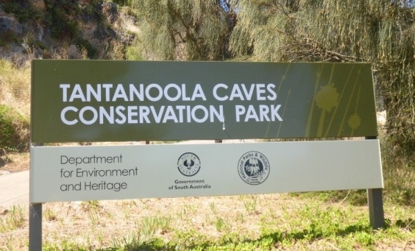
Photo : Me and my buddy.
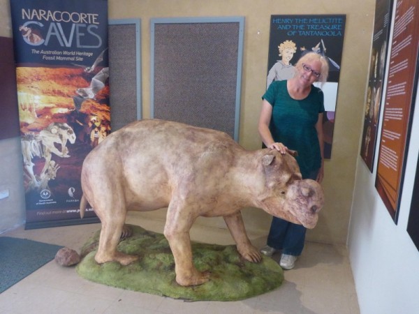
**!
The Tantanoola Caves is a large chamber of 30m width and 8m overall height. However, it is one of the smallest caves in South Australia that has numerous stunning speleothems and several helictites. Its limestone and pink dolomite caverns are within Up and Down Rock, which is a prehistoric marine cliff near the highway and are one of Australia's most beautiful and magical limestone caverns. The cave was discovered purely by accident in 1930 when 16 year old Boyce Lane's rabbiting ferret went down a hole and didn't come back. The boy scrambled down after it and discovered the cave. Though there are 7 caves altogether but only one is safely accessible. The main chamber with its wheelchair ramps makes the Tantanoola Cave one of the most accessible in the country.**
Photos : Tantanoola Caves!!
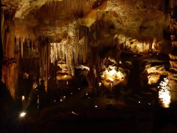
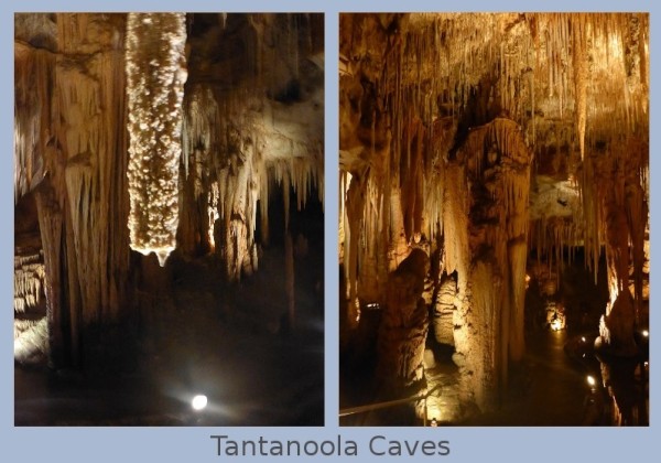
On the left, the 80 year old 'drip'!
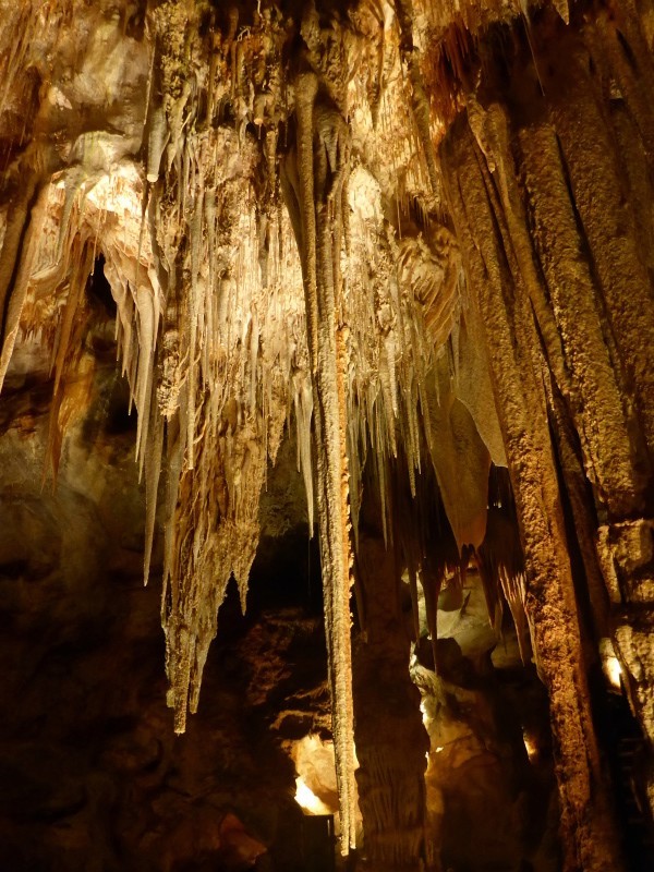
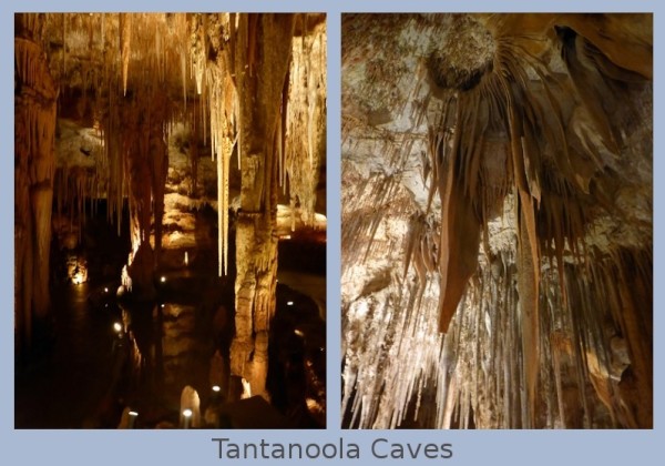
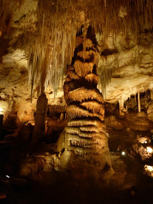
The 'Wedding Cake' or 'Chocolate Fountain'
Our wonderful personal cave guide filled us in on the history of the caves and then left us for our self guided tour, complete with encouragement to take heaps of photos. It was a beautiful and completely fascinating place. There were so many different formations and Tantanoola Cave is what is known as a 'working cave' where the limestone laden water still seeps and trickles and deposits, making the most minute changes every moment, most of which wouldn't be noticed for hundreds of years. When it was first discovered and later when the caves were opened up to the public, quite a few straws and stalactites were broken off but these are very slowly growing. In my photos you can see one such stalactite with a 'drip' on the bottom. This 'drip' is approximately 80 years old. Pretty amazing. We spent almost an hour slowly wandering the small space. I just love caves and it was so worth the hassle of finding it.
Time was marching on and we had one more place to see before our car had to be returned.... Piccaninnie Ponds.
**!
The Piccaninnie Ponds Conservation Park borders Discovery Bay on the Limestone Coast and conserves a wetland fed by freshwater springs in a karst (a geological formation shaped by the dissolving of a layer or layers of soluble bedrock, usually carbonate rock such as limestone or dolomite) landscape.
Piccaninnie Ponds are known as being of global significance for several bird species. The Ponds contain three main features of interest to cave divers and snorkellers. The 'First Pond' is an open depression about 10m deep with a silt floor and an abundance of aquatic life, the 'Chasm' is a sinkhole with a depth of over 100m, and the 'Cathedral' is an enclosed area with limestone formations and a depth of about 35m. Underwater visibility is excellent and may go beyond 40m. Permit only. **.
Dave hazily remembered the ponds from a much earlier time in his life (well pre-me) when he was with Greenpeace. Foggy memories of possibly camping next to the ponds along with hippie type people all smoking funny stuff, and of maybe swimming in the absolutely crystal clear water whilst rather mellow. At least that one recollection. I can only imagine what a time it must have been.
On arriving at Piccaninnie Ponds we followed the main road around (noting several side roads) to its end and found nothing but a carpark and a sand track up the side of a dune (strictly 4 wheel drives only as was evidenced by the huge one we saw disappearing over the top) that led onto the beach. Since we couldn't see the ponds, a trip to the beach was the next best thing at the moment so we scrambled up the track, hoping that a 4WD didn't come barrelling over the top towards us. Down the other side we found ourselves on a long, wide, sandy stretch of beach. Judging by the many tyre tracks it was a popular 4WD haunt.
After we'd walked a while and collected a sea shell, we once again hopped in our far-from-4-wheel-drive car and took a roundabout way to find the ponds. Dave's recollections of where they might be in relation to the tracks were muzzy to say the least. We followed one track that petered out after a few minutes, backtracked, followed another and were about to give up and were in fact heading to the exit of the conservation park when we saw another track. Out of this one came a car, so we figured that there may indeed be something along there. Besides, this seemed to be the only road left so it couldn't hurt. When we saw a carpark with a couple of cars in it, and an information sign next to a gap in the overgrowth and a fancy little building that turned out not to be a bird hide or viewing platform, but a really cool looking toilet we knew we had found something at least. When we further spied a teenager in board shorts and clutching a towel sitting on a bench about 3 metres inside the narrow opening, and given that the sign we had spied gave us information about Piccaninnie Ponds, we cleverly surmised that we were in the right place.
Photo : The right place.
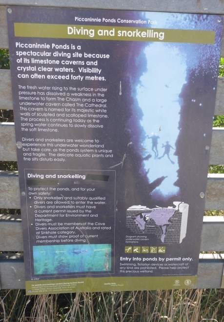
Photos : Beautiful Piccaninnie Ponds
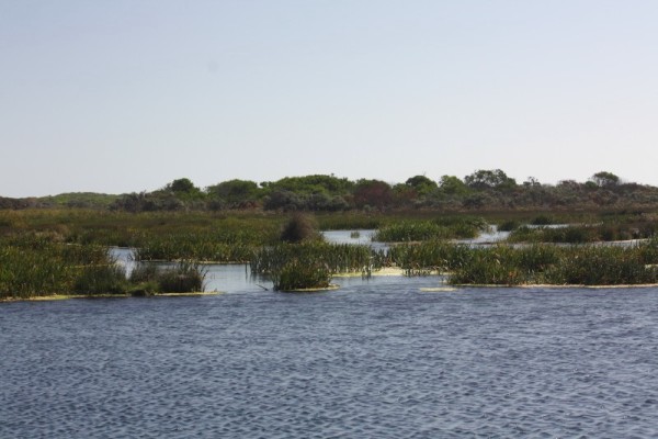
Through the gap and past the damp teenager (who somehow managed to look sullen even though he was wearing sunglasses) was a lovely sight. A small pontoon was attached to shore and from there the cerulean blue ponds spread out before us, interspersed with islets of reeds. The crystal clear, but quite frigid water was home to a huge variety of grasses, weed and fish. Three brave young souls were sitting on the end of the pontoon, readying themselves for a snorkelling expedition. Another young couple were launching a small rubber ring canoe. It was such a thoroughly peaceful place and watching the young snorkellers quietly gliding away, floating atop the barely rippling water was a lovely thing to see. Mind you, it got a little noisy when the female half of the canoeists began squealing. It seemed that she hadn't done this before and wasn't too sure (I know how she felt) but he reassured her and the squealing died down to giggles.
Photo : Snorkellers
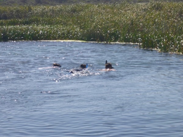
We stayed a little longer, got some underwater photos and video and decided to leave when more young people turned up for a swim. There was limited space at the pontoon and we decided to leave the kids to their fun. Better them than me. It'd have to be 40 degrees before I'd go into water that cold.
Photos : 1) Getting ready for the watery stuff. 2) From above 3) In the water.
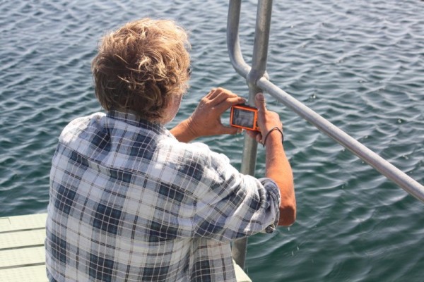
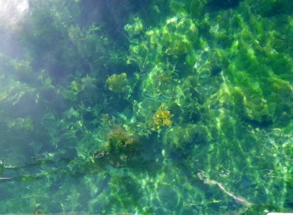
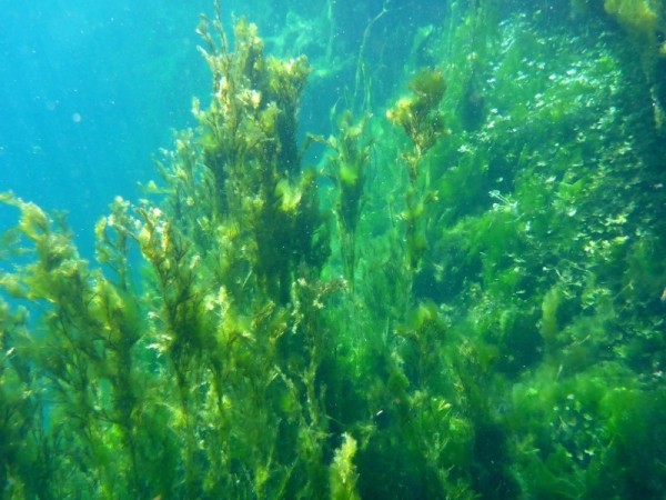
We took an extremely leisurely drive along the coast road back to Port MacDonnell (we were typical Sunday drivers.... 40 in the 80 zone but at least he pulled over when he saw a car coming up behind). Part way back we stopped at a little beach where some massive limestone boulders had been stacked up in the car park. Initially I was going to grab some of the smaller bits that had fallen off (for carving) but decided it would probably be better if I actually used up what was already on the boat (soapstone) before I added more ballast. Instead we walked along the beach, found another couple of shells and then went on our way again.
Just one more stop occurred before returning the car, and this came about because of the different approach into the town. There were more awesome limestone sculptures that we hadn't seen previously and it was one last chance to snap a little more of this gorgeous artwork. I wish I knew who the artist was.
Photos: Sculptures at Port MacDonnell.
Back in the fisher fellow's carpark at last and waiting for the hire car people, I took one last opportunity to take a picture of the pelicans. It had been a really long day and was going to have to be an early night because in the morning (dead early as usual) we were setting out for Port Fairy.
Photo : Pelicans. A last goodbye.
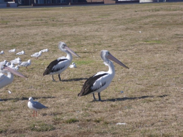
Stay Tuned!
Trundling along in our little not-very-gutsy car on the way to Mount Schank we passed a rather large hole in the road. Literally. In the centre of the main road to Gambier was a fenced off hole. This turned out to be the Allendale Sinkhole, apparently once known as the 'Middle of the Road Hole' (well imagine that... can't think why!). There was no access to it but then again I'm not sure I'd really want to get that close. Popular with properly licensed and equipped thrill seeking cave divers, or in other words, lunatics with a death wish, but not with me. I get claustrophobic in a sleeping bag. But here for your reading and learning pleasure is a short history lesson!
**!
The Allendale cave was used in the early years of settlement to water the teams of horses and bullocks that made their way to and from Port MacDonnell. It was difficult to extract the water so a hand pump and trough was installed to make it easier. In later years a stone wall was built around the cave as a safety measure. At one time an attempt was made to fill the cave so they could build the road over it, but the filling subsided and the cave remains open. It is now a popular spot for cave divers.**
Photos : Allendale Cave and legends
'After our little side trip (or rather straight through trip since it was totally in the centre of the road along which we were travelling) we headed towards our ultimate morning destination and the only visible point on the near landscape that wasn't cow shaped, Mount Schank. Get ready for it.... Lesson 2!
Photo: Mount Schank panorama shot.
**!
Mount Schank (previously spelled Schanck) is a dormant maar (a circular volcanic land-form resulting from explosive ash eruptions) volcano in the south-east of South Australia, near Mount Gambier. It was named by James Grant in 1800 after Admiral John Schank who was the designer of Grant's ship, the HMS Lady Nelson (the replica of which is outside the information centre). Mount Schank is believed to be amongst the youngest volcanoes in Australia (less than 5,000 years old). Because the volcano base is above the water table, it doesn't hold water, unlike the volcano in which the Blue Lake now exists.**
We puttered our way to the volcanic Mount. As we travelled along the approach road, still about a kilometre away from the car park and with nothing but roadway for the past kilometre, I saw a very tanned, athletic looking young couple and their dog. I knew they were serious walkers as they were decked out in fluoro green and yellow from cap to Nike's and everywhere in between. It was a sunny day and the glare off of them almost seared my retinas. I had a feeling I would be seeing them soon.
In the carpark an unusual sight came as small groups of tourists sat around card tables in front of their various and scattered hire vehicles and ate breakfast. I felt decidedly out of place without food in my hand. One couple (I hypothesised that they were German since they spoke German) walked with a sandwich in their hand towards a low fence and it was then I noticed that there were horses. Now, I don't usually like horses but these were super friendly and probably use to being given treats by the many people who frequent Mount Schank so I got in a couple of pats when I could which was just as well because they totally ignored me when they found I wasn't laden with goodies. Drat, I didn't think to pack the chaff, silly me.
Photos : Horses at Mount Schank
Photo: Loo visit # 188 (or 189 , who knows, I can't keep up) where some of the the breakfast feasters can be seen
After patting the horses, visiting the loo and reading every information board I could find, I knew that I had actually done everything I could to delay the approaching task at hand, which was climbing the side of the volcano. I looked at the steps. They were tall and uneven and rough. Oh, the fun I was going to have, especially when I read that the climb to the rim, though not far (about 450 metres) had steep sections. Right, sleeves up, sunscreen on, hat pulled tight. Let's go!
Photos: Up we go
Photo : Views along the way.
Half way up and sure enough, we were passed by the peppy fluoro twosome and their perky little dog. Oh to be young again but I never want to be so young that full fluoro is an acceptable form of attire. Even in the 70's it wasn't on, and that's the decade that fashion forgot!
I watched them disappear from view and as I continued to climb it didn't take long before the knee goblins started setting off firecrackers under my kneecaps. I courageously fought through the hurt and swore death to all hobs via demise by toothpicks if I ever caught them. As it is the threats of goblin annihilation did nothing and my knees continued to bicker with my kneecaps the whole way up. Reaching the crown was all worth it though as I looked down on what was, not long ago by Earth standards, a big hole spewing lava and rocks hither and yon, all watched on by the local Aboriginal Bunganditj people. How incredible it must have seemed. Now it was a giant, peaceful divot filled with grass, trees, birds and tranquillity. What was the best thing to do up here? Fly the kite of course!
Photos: At the top!
I snapped a few pictures (keeping well away from the edge, which has no barrier and some really steep falls) as Dave unpacked the kite and got it ready. On the other side of the rim I could make out the acerbic luminescence of the dayglo duo pacing themselves in perfect rhythm. In the meantime the kite was ready to go. The wind wasn't too light so a good launch seemed imminent. The kite was tossed up, the wind caught it. Up, up it went and down, down it also went. Okay, take two.... up, down. Crap. Once more... toss and down. Hmmmm.... it was going to be more difficult than we thought getting the kite out over the crater, mainly because the wind was in the wrong direction but no one could accuse us of not persisting for at least another 3 goes. The best we did on the side was when the wind finally took it about three metres over the inner edge of the rim before dumping it. Yay! At least we got photos. Flying it out over the outer edge was easier. We managed at least 15 metres, and with a daylight moon in the frame before it came crashing down again. I totally call that a victory.
Photos: 1) Kite flying over the rim. 2) Flying with the moon
By the time the kite had been hauled in and packed away, the dayglo duo were back at the steps and heading down, but not before telling us that, although tricky in places and the fact that it snakes around a bit (but no REAL snakes laughed the girl, with a toss of her blonde ponytail), the walk is worth it. I saw something light up in Dave's eyes and I knew we were going to walk the rim, but about that, I wasn't worried. It was fairly flat and had a well defined, if narrow path. At least for the first couple of hundred metres and then a sign informed me that the path beyond that point was not maintained and that it was a 'use at your own discretion and risk' type sign. So, throwing discretion to the wind (which went further than the kite) we ventured forth at our own peril. It really wasn't that bad, at least until the ¾ mark of the circumference when it did get a little tricky when the path disappeared and all there was to follow was a foot-width fissure in the rock, with nothing but spindly shrubs on one side to slow down any tumble we might take and a sheer drop down the lava and rock face on the other, with absolutely nothing to slow you down. Such fun (actually it really was!). Along the way though, the views out over the plains and towards the ocean were amazing and through the no-path-anywhere bits, skinks darted back and forth in front of us. One even 'followed' me in order to take a bit if a rest in my shadow. I moved, it moved. It was really kind of cute.
Photo : The path narrows.
Photo : Skink trying to enjoy my shade.
Photo : A tad too narrow.
The last hundred metres of the rim was the most difficult because even the fissure disappeared and it was a case of very carefully stumbling over rocks and boulders and trying not to tip sideways.
Photo : We did it!!
A sigh of relief was felt when I saw the rough stairway again and I rejoiced the fact that I hadn't fallen into the volcano. What a plus. Now the only thing I was dreading was going down because I knew those bloody goblins were rubbing their gnarly little hands together and setting up the fireworks again, but Dave made a suggestion that shut the little sods up. Take the stairs sideways instead of walking straight. Yes I was dubious and was worried that my occasional less-than-sure-footedness would somehow cause me a come a cropper at some stage of the descent but no. I actually made it down safely with no hurt stops, no exploding kneecaps and in great time. Well done Dave, you saved yourself a lot of my ahhhhing and ouching noises.
Photo : Almost down.... yay!!
Having conquered the Mount, and consulting the rudimentary map that we had, the next stop was going to be Little Blue Lake, some foresty thingy on the same road and another thing that was supposedly nearby (the reason I sound vague on the two following the LBL is because we never managed to find them and as such, I've forgotten what they were). The Little Blue Lake was actually fascinating in itself. A natural water filled sinkhole that was obviously used for swimming (except there was a warning sign about possible blue-green algae), with steps and platforms. What a wonderful place it would have been after school on a hot day.
Photo : Little Blue Lake.
**!
With a diameter of around 45 metres the Little Blue Lake is a sinkhole and is popular with divers and local swimmers.. The walls are sheer and undercut all the way around. The Lake used to turn blue annually, however, pollution from agricultural fertilisers has increased the nutrient levels of these lakes to the extent that they now remain a year-round green colour. Swimming is allowed, but discouraged. The depth ranges from 25m to 36 metres or deeper. The first reference of this sinkhole was in June 1961, although it is almost positive that scuba divers came here in the late 1950s.**
After snapping a few photos and driving in circles trying to find the other places, we gave up and headed towards the interesting sounding Blackfellows Caves. I was looking forward to seeing the caves but was disappointed when we followed the signs into a small town named, you guessed it, Blackfellows Caves. So where are the caves? Well apparently there are some small caves along the limestone coastline that you can see at low tide but they're nothing special so after that slight disappointment we instead turned our attention to another wonderful sounding place that smacked of rugged shores and crashing seas, Carpenter Rocks. As we followed the signs, and with camera poised in anticipation of another of nature's marvels, my excitement mounted only to be dashed like Morse code without the dots. The road to Carpenter Rocks ended abruptly at a carpark in front of a small bay that moored about 15 - 20 fishing boats. Beyond the boats, waves surfed in against some reefs and rocks, but apart from that, the view was a little underwhelming and again I realised that the name, like Blackfellows Caves was merely the name of the town, not an actual representation of the surrounds. Again disappointing. Nearby was a small shop and at this stage the suggestion of junk food was a brilliant one, and so one demolished potato pie, bottle of Coke and a chocolate doughnut later we perused the map and were again on our way to (hopefully) more interesting locations. This time, the Tantanoola Cave.
Photo : The not-so-thrilling Carpenter Rocks
On sealed back roads from Carpenter Rocks, we tootled to town of Tantanoola, all the time keeping an eye out for the signs to the caves. Not a single sign has been spied when we actually drove down the main street in the town and on the third run it was becoming frustrating. Where are the Caves?? At one end of town I noticed some young men clearing tree cuttings in front of a house so we pulled over and, winding my window down and in my most polite manner said "Where the hell are these bloody caves?" I could see by the mirth on their faces that this was perhaps not an uncommon question in these parts and the lady-of-the-house kindly gave us directions to the main highway. Ah, that's where the confusion lay.... the Tantanoola Caves were not actually situated IN Tantanoola. Got it.
Finally, after about 10 minutes driving, we spied a sign for the caves. Huzzah!! Into the carpark and out of the car, I couldn't wait to see it. I love caves and rocks. Maybe I was a geologist in another life. However I dislike dark, tight places (need I remind you of my previous comment alluding to sleeping bags?) so I couldn't have been a spelunker. So, rocks yes, holes no. And history lesson time .....
Photo : Finally at Tantanoola Caves
Photo : Me and my buddy.
**!
The Tantanoola Caves is a large chamber of 30m width and 8m overall height. However, it is one of the smallest caves in South Australia that has numerous stunning speleothems and several helictites. Its limestone and pink dolomite caverns are within Up and Down Rock, which is a prehistoric marine cliff near the highway and are one of Australia's most beautiful and magical limestone caverns. The cave was discovered purely by accident in 1930 when 16 year old Boyce Lane's rabbiting ferret went down a hole and didn't come back. The boy scrambled down after it and discovered the cave. Though there are 7 caves altogether but only one is safely accessible. The main chamber with its wheelchair ramps makes the Tantanoola Cave one of the most accessible in the country.**
Photos : Tantanoola Caves!!
On the left, the 80 year old 'drip'!
The 'Wedding Cake' or 'Chocolate Fountain'
Our wonderful personal cave guide filled us in on the history of the caves and then left us for our self guided tour, complete with encouragement to take heaps of photos. It was a beautiful and completely fascinating place. There were so many different formations and Tantanoola Cave is what is known as a 'working cave' where the limestone laden water still seeps and trickles and deposits, making the most minute changes every moment, most of which wouldn't be noticed for hundreds of years. When it was first discovered and later when the caves were opened up to the public, quite a few straws and stalactites were broken off but these are very slowly growing. In my photos you can see one such stalactite with a 'drip' on the bottom. This 'drip' is approximately 80 years old. Pretty amazing. We spent almost an hour slowly wandering the small space. I just love caves and it was so worth the hassle of finding it.
Time was marching on and we had one more place to see before our car had to be returned.... Piccaninnie Ponds.
**!
The Piccaninnie Ponds Conservation Park borders Discovery Bay on the Limestone Coast and conserves a wetland fed by freshwater springs in a karst (a geological formation shaped by the dissolving of a layer or layers of soluble bedrock, usually carbonate rock such as limestone or dolomite) landscape.
Piccaninnie Ponds are known as being of global significance for several bird species. The Ponds contain three main features of interest to cave divers and snorkellers. The 'First Pond' is an open depression about 10m deep with a silt floor and an abundance of aquatic life, the 'Chasm' is a sinkhole with a depth of over 100m, and the 'Cathedral' is an enclosed area with limestone formations and a depth of about 35m. Underwater visibility is excellent and may go beyond 40m. Permit only. **.
Dave hazily remembered the ponds from a much earlier time in his life (well pre-me) when he was with Greenpeace. Foggy memories of possibly camping next to the ponds along with hippie type people all smoking funny stuff, and of maybe swimming in the absolutely crystal clear water whilst rather mellow. At least that one recollection. I can only imagine what a time it must have been.
On arriving at Piccaninnie Ponds we followed the main road around (noting several side roads) to its end and found nothing but a carpark and a sand track up the side of a dune (strictly 4 wheel drives only as was evidenced by the huge one we saw disappearing over the top) that led onto the beach. Since we couldn't see the ponds, a trip to the beach was the next best thing at the moment so we scrambled up the track, hoping that a 4WD didn't come barrelling over the top towards us. Down the other side we found ourselves on a long, wide, sandy stretch of beach. Judging by the many tyre tracks it was a popular 4WD haunt.
After we'd walked a while and collected a sea shell, we once again hopped in our far-from-4-wheel-drive car and took a roundabout way to find the ponds. Dave's recollections of where they might be in relation to the tracks were muzzy to say the least. We followed one track that petered out after a few minutes, backtracked, followed another and were about to give up and were in fact heading to the exit of the conservation park when we saw another track. Out of this one came a car, so we figured that there may indeed be something along there. Besides, this seemed to be the only road left so it couldn't hurt. When we saw a carpark with a couple of cars in it, and an information sign next to a gap in the overgrowth and a fancy little building that turned out not to be a bird hide or viewing platform, but a really cool looking toilet we knew we had found something at least. When we further spied a teenager in board shorts and clutching a towel sitting on a bench about 3 metres inside the narrow opening, and given that the sign we had spied gave us information about Piccaninnie Ponds, we cleverly surmised that we were in the right place.
Photo : The right place.
Photos : Beautiful Piccaninnie Ponds
Through the gap and past the damp teenager (who somehow managed to look sullen even though he was wearing sunglasses) was a lovely sight. A small pontoon was attached to shore and from there the cerulean blue ponds spread out before us, interspersed with islets of reeds. The crystal clear, but quite frigid water was home to a huge variety of grasses, weed and fish. Three brave young souls were sitting on the end of the pontoon, readying themselves for a snorkelling expedition. Another young couple were launching a small rubber ring canoe. It was such a thoroughly peaceful place and watching the young snorkellers quietly gliding away, floating atop the barely rippling water was a lovely thing to see. Mind you, it got a little noisy when the female half of the canoeists began squealing. It seemed that she hadn't done this before and wasn't too sure (I know how she felt) but he reassured her and the squealing died down to giggles.
Photo : Snorkellers
We stayed a little longer, got some underwater photos and video and decided to leave when more young people turned up for a swim. There was limited space at the pontoon and we decided to leave the kids to their fun. Better them than me. It'd have to be 40 degrees before I'd go into water that cold.
Photos : 1) Getting ready for the watery stuff. 2) From above 3) In the water.
We took an extremely leisurely drive along the coast road back to Port MacDonnell (we were typical Sunday drivers.... 40 in the 80 zone but at least he pulled over when he saw a car coming up behind). Part way back we stopped at a little beach where some massive limestone boulders had been stacked up in the car park. Initially I was going to grab some of the smaller bits that had fallen off (for carving) but decided it would probably be better if I actually used up what was already on the boat (soapstone) before I added more ballast. Instead we walked along the beach, found another couple of shells and then went on our way again.
Just one more stop occurred before returning the car, and this came about because of the different approach into the town. There were more awesome limestone sculptures that we hadn't seen previously and it was one last chance to snap a little more of this gorgeous artwork. I wish I knew who the artist was.
Photos: Sculptures at Port MacDonnell.
Back in the fisher fellow's carpark at last and waiting for the hire car people, I took one last opportunity to take a picture of the pelicans. It had been a really long day and was going to have to be an early night because in the morning (dead early as usual) we were setting out for Port Fairy.
Photo : Pelicans. A last goodbye.
Stay Tuned!
| Vessel Name: | Venture |
| Vessel Make/Model: | Cabo Rico 38-106, B-plan |
| Hailing Port: | Adelaide, South Australia. |
| Crew: | Dave Edwards, Terry Jackson |
| About: | |
| Extra: | |
| Social: |
|
Adventures On Venture.
Who: Dave Edwards, Terry Jackson
Port: Adelaide, South Australia.
Gallery