s/v Patty K Too's 2017 Adventure
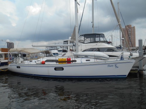
| Vessel Name: | Patty K Too |
| Vessel Make/Model: | Catalina 445 |
| Hailing Port: | Solomons, Maryland |
| Crew: | Patty Kimmel & Rich Freeman |
05 November 2017 | Charleston Harbor Marina
Charleston, South Carolina
On Tuesday morning, 24 October, we waited on the diver until 0900 hours. He called and said he had an emergency and would not be able to dive for us. We departed on the rising tide and figured we could make a couple of the bridges. We called Hazzard Marine in Georgetown and they said they can short haul [...]
24 October 2017 | Barefoot Landing, SC
Barefoot Landing, SC
The weather briefing was conducted by Hank@CarolinaYachtCare

22 October 2017 | Southport, NC
Southport, NC
We departed Oriental heading down the ICW towards Beaufort, NC. The twenty-one mile trek was generally uneventful. We were able to go under the fixed bridge at MM 196 without bumping. The tide station at Core Creek was very helpful, as was the bridge board. As we approached Beaufort we took the Russell [...]
18 October 2017 | Oriental Marina, Oriental, NC
Oriental, NC
We departed Ocracoke at 0715 hours with the winds still blowing 11 knots. Heading out to the Pamlico Sound can’t be any worse than what we experienced the day before. Well, it was. We ran aground, again, at Red 10B. This time it was more difficult to get away, but we did.
16 October 2017 | Ocracoke Island
Roanoke Island
We departed the marina at Manteo at 0730 hours. We eased under the bridge and didn’t even spring the VHF antenna. The bridge board read 64+ feet… It took us 2 hours and 55 minutes to get out of the skinny water around the east side of Roanoke Island and into the Pamlico Sound. The route is marked [...]
Resting...
Charleston, South Carolina
We were able to ride the tide down the ICW and made it under six bridges and made it to Georgetown. We were trying to use the Cruising Guide to get to an anchorage and we ran aground. We called Tow Boats US asking for local knowledge. The operator was most helpful and told us to use the other channel and told us we could tie up to a vacant mooring. He later called us and asked if we were alright. He even came by checking on us.
The next morning we went over to Hazzard Marine and had a short haul. We lost a chunk of wing keel to whatever we hit. They faired it out the best they could and painted it with our bottom paint. We let it dry for a couple of hours. We bought some shrimp from the local shrimper and headed out.
Our destination was Prices Creek, about ten miles north of Charleston. Didn’t want to enter the marina with the tide running. The entrance to the creek was shoaled but after a couple of attempts to get in we did. It immediately dropped to thirty-five feet and remained in excess of twenty feet. We noticed on the chart a nice feeder creek off the main channel and anchored in nine feet of water. There was one other boat, a tug from Annapolis, anchored there, too. I peeled the shrimp and we had a nice supper.
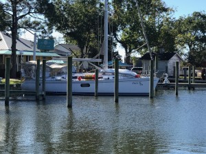
Friday morning we left about 0900 hours to time the tide in Charleston Harbor. We arrived at the Charleston Harbor & Resort Marina about 1100 hours, fueled up, pumped out and we into slip B39.
We ate supper at a new restaurant on property. The food was okay but way overpriced. Saturday we took the shuttle and went down to Market Street and shopped. Sunday Patty flew home for a week to take care of some things. She left me a ‘honey do list’ for the week.
She called our insurance carrier about the keel and they want a survey by their surveyor. So we will be leaving this marina Monday morning to go to Ross Marina on the Stono River for another short haul. Then we will once again be on our way to Brunswick, our interim destination for Thanksgiving.
Barefoot Landing, SC
.com. He is a retired meteorologist and sailor and began these briefs about six years ago. In addition to weather updates, he provides updates on shoaling and movement of navigation aids down the ICW from folks that report back to him. His weather forecast proved to be right on. The weather deteriorated through out Monday. We decided to anchor in the Calabash River, near Red 119 on the ICW, just into South Carolina.
We anchored between Green 3 and Red 4, just off the channel. The depths were nominal 6 feet at low tide (with a five foot tide). We anchored mid-afternoon to get ready for the storm over night. We put the anchor in good, knowing it was forecast to blow 22 knots pretty steady and gusts to 30 knots. Unbeknown to us, there is an eddy where we anchored and the tide runs swift and the usual winds, to 15 knots, are not enough to turn the boat. So we had the anchor down behind us and we were pointing the other way. Very interesting.
After supper, the storm began and the winds were definitely strong enough to straighten us out. It blew and rained from 1900 hours until midnight. I stood anchor watch and clocked 29.1 knots as the strongest. After midnight, the winds lessened but the rain continued for another three hours. Then the clouds went away and the stars came out. This morning was clear and winds were less than 10 knots.
We left this morning at 0730 hours on a rising tide so we could make the Nixons Crossroads fixed bridge. No bridge board. But the water marks looked good on the pilings and we went under, slowly, and didn’t ping. Figured we were good to the Barefoot Landing swing bridge. But, a new fixed span loomed before us that was not on our charts. Again, no bridge board, but the water lines looked good. The tide was still rising but we slowed and went under. The antenna pinged. After going through the Barefoot Landing swing bridge we tied up along the wharf at Barefoot Landing Marina. We stopped here so Patty can have supper with old family friends Sandi and Brian. As a note, Bruce, the dock master, said the marina is losing their lease in December and may not be here when we come back through. That will be a loss because of all the restaurants nearby.
After going through the last unknown bridge, we were motoring down the stretch they call the “Rockpile”, mm 347 to 365. Apparently we were too far starboard and we collided with what we think was a rock. We slammed into it and everything above and below decks went flying. I was down below making breakfast and when we hit everything went flying, including me. I got thrown against the sink and rebounded against some shelving which had some knives and utensils in motion. I got a nasty “scratch” across my posterior. Patty got thrown against the wheel and rebounded in the seat. Immediately checked for hull integrity and found no unusual water in the bilge. Then checked other lockers and found nothing unusual. We have called a diver to come by in the morning at 0800 hours to take a look at the hull and keel.
Tomorrow we are heading to Georgetown, SC, some 50 miles down the ICW with five, count ‘em, five bridges, all at 65 feet. The first four are relatively close and might make them if the diver doesn’t take too much time. Otherwise we will have to find someplace to spend the night.
Our intention is to go out at Georgetown down the Winyah Bay and then run outside to Charleston. But that will depend on the weather in the ocean. Will be watching that closely…
Southport, NC
We wanted to get a good start on our leg to Wrightstown Beach since we planned on going off-shore. We left at 0515 hours and the bridge tender at the MM 204 Bridge opened for us and we went through and while Rich was shining his flashlight looking for day markers Patty skillfully guided us into the main channel where the markers are lighted.
We heard a couple of sport fisherman’s talking to each other behind us. Suddenly two of these 48 foot power boats {ASSHOLES} blew by us in the channel, with little regards to what happens with their wake. Their wakes tossed us around like mouse in a cat’s mouth. Just about everything below as tossed on the floor and Patty’s white cushion she liked to sit on went overboard. We were PISSED. Normally in the ICW when one of these large powerboats come up behind, or meet, us they power down and do a slow pass. NOT THESE ASSHOLES…
Once we cleared the outer markers of the Beaufort Inlet I set a course of 250 degrees to the Masonboro Inlet. One of the reasons we wanted to go off-shore was to miss the Atlantic Beach Bridge at MM 206.7 because it is listed as “offering less that 65 feet clearance.” And another is that we miss the Camp Lejeune firing ranges. They are firing off and on during the month of October and we didn’t want any delays. They have some of the firing positions on one side of the ICW and the targets on the other…
Once we set our course we were able to motor sail for about three hours and motored @ 2450 rpm the rest of the sixty-five mile trip. The engine seems to like that setting. We eased into the Masonboro Inlet and turned starboard and anchored in a little basin labeled Harbor 1. We have anchored there before and the holding is excellent.
On Saturday we went into Sea Path Yacht Club to leave the dinghy there for the day as we rented an Enterprise car. Patty called the day before and they said it would be fine. We drove over to our new house in Brunswick Forest for a visit. We are both looking forward to moving in next year. It was a nice night at anchor.
We met Mike and Linda for lunch at The Joyce, an Irish pub at Brunswick Forest the next day. I had ordered some cables for our satellite dish and had them sent to Mike. We met for lunch and I got my cables. We went to the Lowe’s supermarket there for fresh vegetables and staples. Stopped by Walmart so Patty could buy a new FitBit. She has gone through three in the past year. She purchased a Garmin instead. Enterprise delivered us back to Sea Path and we got back aboard.
We departed Sunday morning for Southport. We had one bridge to go under but when we got there the bridge board at Snows Cut showed sixty-three and a half feet. We turned around and anchored near the Carolina Beach mooring field to wait for a lower tide. The closest tide station is Wilmington Beach, a little over a mile away on the far side of the bridge. We sat for two and one-half hours waiting for the tide to go out. When we got to the bridge the second time the bridge board read sixty-five and one-half. So when the tide station is at mid-tide or lower we are able to transit the bridge.
Spending the night at the Southport Marina. Fueled up; pumped out; filled our water tanks and connected with their wifi… Had supper at Fishy Fishy. Weather tomorrow is going to be interesting; we will be attending a weather briefing this evening before going to supper. We have two bridges to transit early tomorrow, both to Oak Island. Then a third further on down. Will be watching the tides closely…
Oriental, NC

Before we could set a course we had to get through Blue Shoal. Once on the other side we set a course to the Neuse River, avoiding the Brant I Shoal. The winds picked up to 20 knots on the nose and the sky cleared. We wanted to get to Oriental before the cold front passed.
Once in the Neuse River the wind reduced to 8 knots and we made it to Oriental Marina by 1315 hours. We went into slip 9, the same slip we had last time we were here. We cleaned up the boat and put all the curtains down anticipating the front passing. Sure enough, an hour later the rain began and the temperature dropped 15 degrees. Lucky for us there is a high pressure system coming that will make the later parts of the week nice. Cooler, but nice.
We stayed in Oriental until Thursday. Tisha & Rich came down for supper Tuesday night and we went to eat at M & M’s. A good place to eat a block or so from the marina. Patty went home with them since she secured an appointment with an orthopaedic doctor in New Bern. She had some fluid removed from her left knee and some cortisone inserted. She returned this evening and is feeling much better at the moment.
We plan on leaving in the morning for Beaufort, NC. We have one 65 foot bridge between Oriental and Beaufort to go under. Hopefully we will make it…
Roanoke Island
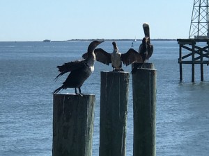
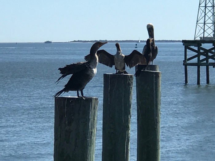
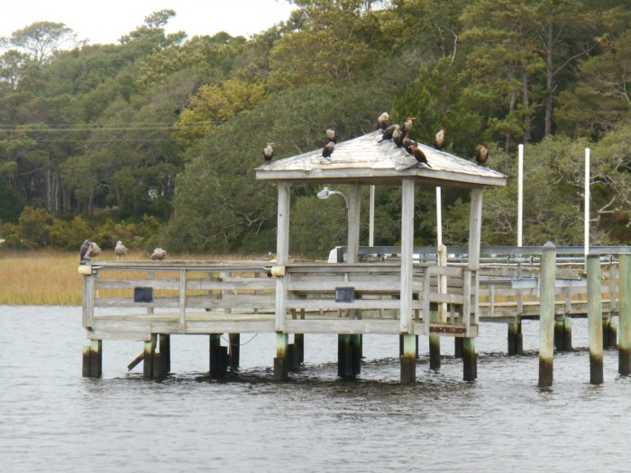
The wind was 10 to 12 knots from the SSW. The clouds went away and the sun came out. It was nice. We were able to sail for about an hour before we changed course for Ocracoke. We were accompanied by some dolphins for a while and when we were in shallow water pelicans followed us as we stirred up fish with our keel and rudder. It’s amazing how flat the sound is. The average depth is about 15 feet everywhere except near the land. The approaches to the harbors are well marked but shoaling makes navigation exciting. We briefly ran aground near Red 10B coming in because the channel shoaled.
It was a long day; we did 59.9 NM. Tomorrow’s run to Oriental will be much shorter. That is good as the winds really pick up tomorrow evening to more than 30 knots. We tied up to a tee head at the Anchor Inn & Marina. Not a marina we will recommend; no reliable wifi and showers & bathrooms not convenient. Primarily focus is on fishing charters. Staff is helpful, though....
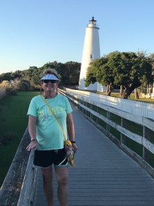
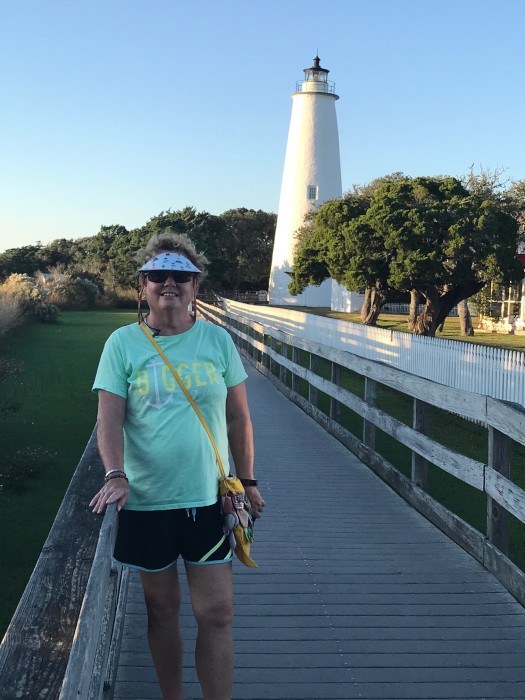
We walked down to the Ocracoke lighthouse, on the other side of Silver Lake, for some exercise. We had supper on the boat; heated up some soup we had made before we left and had in the freezer. Hit the spot.
We plan on an early morning departure to arrive in Oriental before the heavy winds.