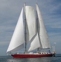
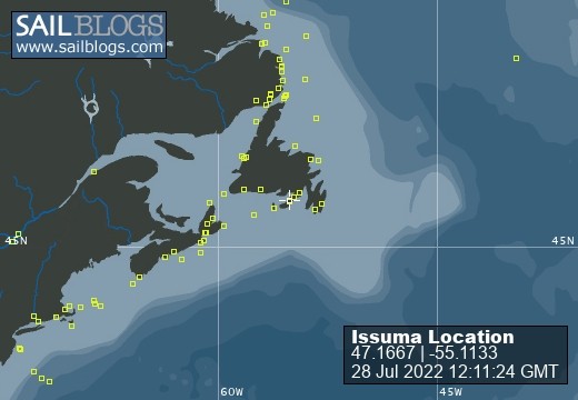
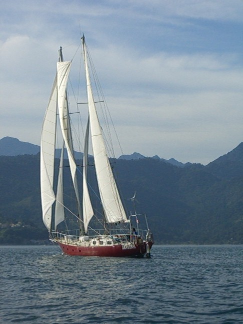
Issuma

28 July 2022
28 July 2022
08 May 2022
18 April 2022
07 April 2022
04 March 2022
17 February 2022 | Little Bay, Marystown, Newfoundland, Canada
16 February 2022
09 February 2022
06 February 2022 | Little Bay, Marystown, Newfoundland, Canada
05 February 2022 | Little Bay, Marystown, Newfoundland, Canada
01 February 2022 | Little Bay, Marystown, Newfoundland, Canada
30 January 2022 | Little Bay, Marystown, Newfoundland, Canada
25 January 2022 | Little Bay, Marystown, Newfoundland, Canada
24 January 2022 | Duricle Cove
17 January 2022
11 September 2021 | Little Bay, Marystown, Newfoundland, Canada
27 August 2021 | Grey River
26 August 2021 | Grand Bruit
26 July 2021 | Isle Valen
Bellot Strait
19 August 2011 | Bellot Strait
Richard
Bellot Strait is an 18 mile long passage between Prince Regent Inlet and Peel Sound. It was named after Lieutenant Bellot of the French Navy who came across it in 1852. It has a difficult reputation due to its fast tidal currents and a rock that is awash (so hard to see) near the eastern end of it. While there was no ice when we passed, Bellot Strait has a reputation for quickly jamming with ice. The Sailing Directions note: "The tidal streams run with great strength through Bellot Strait...In the vicinity of Magpie Rock, the currents are highly variable; localised 7-8 knot westerly currents have been reported on the north side of the channel at the same time that equally strong easterly currents were flowing on the south side. Mariners should exercise extreme caution in this area."
There is a range (two markers on shore, if you keep the boat in line with the two markers, you know what course you are on, despite not knowing how the currents are pushing you around) which the Sailing Directions mention as in need of paint in 1977 (no updates since then--this is not a frequently-travelled route). The ranges were visible enough (we had good visibility), and we entered the strait, intending to pass Magpie Rock (the real danger) just before the current turned and started going in our direction (so we would pass slowly, with more control). The chart notes that the current turns there about two hours before High Water at nearby Fort Ross.
To figure out when the current would turn (ie, when was High Water at Fort Ross), we had three methods of getting tide information, the Canadian Tide & Current Tables for the Arctic, NOAA's Tide Tables for East Coast of North & South America, and wxtide32, the free tidal calculation software program. The three methods of determining the tide resulted in three answers, differing by as much as two hours :). We left in time to be early, so no matter which source of tidal information was correct, by slowing down as necessary, we could arrive on time. Of the three methods we used to figure the tides, the free software program came up with what seemed the closest result.
---
Thanks all for the comments and greetings. I've not heard of the Mars on Earth Project (when we get to a town where we can get internet access, I'll look into it).
Comments
| Vessel Name: | Issuma |
| Vessel Make/Model: | Damien II, 15m/50' steel staysail schooner with lifting keel |
| Extra: | Designed for Antarctica. Built in France by META in 1981. Draft 1.3m/4.5' with keel up, 3.2m/10.5' with keel down. More details at http://www.issuma.com/rhudson/issumaboat/IssumaDetails.htm |
| Home Page: | http://www.issuma.com/rhudson/ |
| Social: |
|
Issuma's Photos - Main
 |