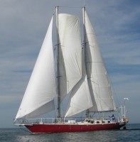
Issuma

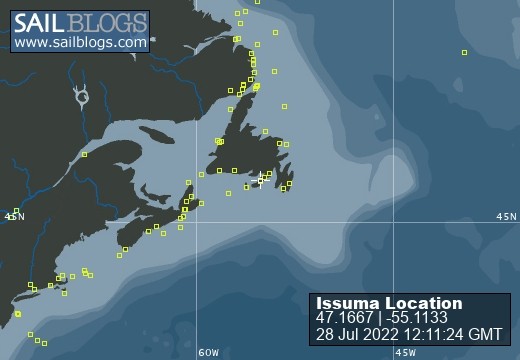
28 July 2022
28 July 2022
08 May 2022
18 April 2022
07 April 2022
04 March 2022
17 February 2022 | Little Bay, Marystown, Newfoundland, Canada
16 February 2022
09 February 2022
06 February 2022 | Little Bay, Marystown, Newfoundland, Canada
05 February 2022 | Little Bay, Marystown, Newfoundland, Canada
01 February 2022 | Little Bay, Marystown, Newfoundland, Canada
30 January 2022 | Little Bay, Marystown, Newfoundland, Canada
25 January 2022 | Little Bay, Marystown, Newfoundland, Canada
24 January 2022 | Duricle Cove
17 January 2022
11 September 2021 | Little Bay, Marystown, Newfoundland, Canada
27 August 2021 | Grey River
26 August 2021 | Grand Bruit
26 July 2021 | Isle Valen
Winds and Coastlines
01 April 2016 | Maxwell Bay
Richard
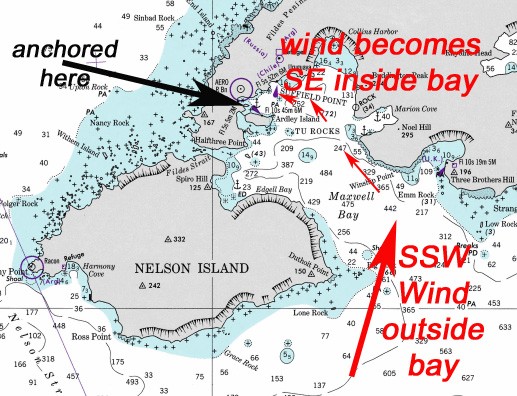
Weather forecasts can be tricky sometimes. We were anchored peacefully where the black arrow is on the picture, with a moderate (20-25 knot) SSW wind forecast for the general area (I get these forecasts from Gridded Binary (GRIB) data from a US National Weather Service computer via email). I figured we would be well protected by the long island south of us (Ardley Island).
What I didn't think about was the possible effect on the wind that the shape of the bay we were in could have. As the wind steadily built, it moved to the ESE, from which we had no protection. While the anchor was holding, it might drag if the wind increased a lot (one always needs to think about what might happen if the wind is stronger than expected), and floating ice would then be blown towards where we were anchored. It was time to leave.
We raised anchor and motored out into a 25 knot headwind and choppy seas. Still surprised by the wind direction and increasing strength, I called up the nearby Chilean base on the VHF radio and asked if they had a forecast for Maxwell Bay.
They said yes, the wind forecast was for ESE to SE 40 knots. That would be a major problem to have stayed anchored where we were. It took several hours of motoring into the wind and seas to reach a bay on the eastern side, where we found a place to anchor near a glacier. At one point, we hit either a growler or an uncharted rock with the centerboard--the centerboard pivoted up and then broke the centerboard cable when it fell back down after passing over the obstruction. We replaced the centerboard cable later at anchor (this is not a big job, but it involves climbing into the narrow centerboard case to thread the new cable, which Sarah--who is thinner than I am--did).
Looking at the chart later, I began to understand why the SSW wind that I expected was actually a SE wind inside Maxwell Bay. The way I've drawn the arrows on the chart picture, it looks obvious, but it wasn't until I looked closely at the chart, and considered the height of the mountains (which deflected the wind, instead of letting it pass over), that I concluded the outside wind probably was a SSW and that it was deflected by the shape of the bay.
The Chilean forecast is probably available to vessels with Inmarsat C, but is not on NAVTEX (which Issuma can receive). I could receive the Chilean Antarctic forecasts via email from the internet, but only after a delay of 24 or more hours (for a 24-hour forecast). Later, I learned of a great Norwegian website (www.yr.no) that collects weather forecasts from various sources and makes them available (in a way that can be retrieved via email). I was then able to get China's forecasts for Maxwell Bay via email.
Comments
| Vessel Name: | Issuma |
| Vessel Make/Model: | Damien II, 15m/50' steel staysail schooner with lifting keel |
| Extra: | Designed for Antarctica. Built in France by META in 1981. Draft 1.3m/4.5' with keel up, 3.2m/10.5' with keel down. More details at http://www.issuma.com/rhudson/issumaboat/IssumaDetails.htm |
| Home Page: | http://www.issuma.com/rhudson/ |
| Social: |
|
Issuma's Photos - Main
 |