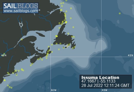
Issuma

28 July 2022
28 July 2022
08 May 2022
18 April 2022
07 April 2022
04 March 2022
17 February 2022 | Little Bay, Marystown, Newfoundland, Canada
16 February 2022
09 February 2022
06 February 2022 | Little Bay, Marystown, Newfoundland, Canada
05 February 2022 | Little Bay, Marystown, Newfoundland, Canada
01 February 2022 | Little Bay, Marystown, Newfoundland, Canada
30 January 2022 | Little Bay, Marystown, Newfoundland, Canada
25 January 2022 | Little Bay, Marystown, Newfoundland, Canada
24 January 2022 | Duricle Cove
17 January 2022
11 September 2021 | Little Bay, Marystown, Newfoundland, Canada
27 August 2021 | Grey River
26 August 2021 | Grand Bruit
26 July 2021 | Isle Valen
Fish Farms and Anchorages
20 February 2015
Richard
The plan seemed good--it just didn't work out that way.
After a good night's sleep, we left our serene anchorage at Bahia Manao to motor 40 miles to an island--Isla Guar--where we intended to anchor for the night.
Nestled into a fjord lined with farms and forests, we went to the old river at its head, to anchor in what we expected to be mud and gravel. Twice we set the spade anchor, twice we dragged. Late in the day, with an onshore wind now funnelling up the fjord where we were a boat-length away from the steep beach if we dragged, we left for what looked on the chart as a potential anchorage. It was just a wide bay, but the American chart I was using indicated a gradually sloping bottom, taking a mile to go from 100m deep to the shore, and with a sandy bottom (good for anchors to dig into).
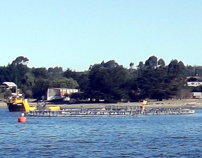
We'd seen a lot of fish farms (salmoneras)--large, penned-off areas containing fish--in Chile, and expected there would be some in the bay. Avoiding fish farms is not easy--they seem to have only two flashing lights, and judging where they start and end at night, especially with multiple farms around, is difficult.
It would be night when we arrived, I considered just putting to sea and heaving-to for the night. But first, I decided to try anchoring, which would allow us a good nights sleep (by not having to stand watches).
Some more checking of charts showed that an old Chilean chart of the area agreed with the American chart, but a newer Chilean chart showed no information about the type of bottom (sand, mud, rock, etc), or the depths.
In the darkness, we motored slowly into the bay. Max was on the foredeck with a spotlight, I steered and looked at the chartplotter, radar and depthsounder. Sometimes we would see the fish farms on radar before picking them up with the spotlight. Not only were there fish farms with their minimal lights, there were what seemed to be disassembled fish farms, with no lights. And large, unlit, plastic (invisible to radar) buoys with thick ropes between them.
We picked our way carefully thru the dark maze. When we reached the position the chart said should be 16m and sandy bottom, the depth was over 100m. No problem, I thought, the longitude could be incorrect on the chart--a common problem with old charts (surveyed before accurate time or satellite positioning was easily available), even though the chart said that satellite-derived positions could be plotted directly on the chart.
Another hour of picking our way thru the maze found us in 50m of water, about 100m from shore, surrounded by moored boats and barges--an area bearing no resemblance to the chart. It was time to back out.
What a blessing it was having a track on the chartplotter of the route we had come in on. We tried taking a simpler route out, but found too many fish farms and anchored pieces of them to be able to leave that way. So we retraced our entrance route completely , and ultimately left the bay and got into open water, away from shore and islands, and under sail by 0400.
We divided the remaining three hours of night into two watches, though Max kindly didn't wake me for mine until dawn, so I had three blissful hours of sleep, awakening shivering (from not having taken out enough blankets for the temperature) and refreshed.
Cold, wet and misty, the dawn brought an invigorating tailwind. With hot cups of tea, I set more sail and we headed towards our destination, the city of Puerto Montt.
After a good night's sleep, we left our serene anchorage at Bahia Manao to motor 40 miles to an island--Isla Guar--where we intended to anchor for the night.
Nestled into a fjord lined with farms and forests, we went to the old river at its head, to anchor in what we expected to be mud and gravel. Twice we set the spade anchor, twice we dragged. Late in the day, with an onshore wind now funnelling up the fjord where we were a boat-length away from the steep beach if we dragged, we left for what looked on the chart as a potential anchorage. It was just a wide bay, but the American chart I was using indicated a gradually sloping bottom, taking a mile to go from 100m deep to the shore, and with a sandy bottom (good for anchors to dig into).
We'd seen a lot of fish farms (salmoneras)--large, penned-off areas containing fish--in Chile, and expected there would be some in the bay. Avoiding fish farms is not easy--they seem to have only two flashing lights, and judging where they start and end at night, especially with multiple farms around, is difficult.
It would be night when we arrived, I considered just putting to sea and heaving-to for the night. But first, I decided to try anchoring, which would allow us a good nights sleep (by not having to stand watches).
Some more checking of charts showed that an old Chilean chart of the area agreed with the American chart, but a newer Chilean chart showed no information about the type of bottom (sand, mud, rock, etc), or the depths.
In the darkness, we motored slowly into the bay. Max was on the foredeck with a spotlight, I steered and looked at the chartplotter, radar and depthsounder. Sometimes we would see the fish farms on radar before picking them up with the spotlight. Not only were there fish farms with their minimal lights, there were what seemed to be disassembled fish farms, with no lights. And large, unlit, plastic (invisible to radar) buoys with thick ropes between them.
We picked our way carefully thru the dark maze. When we reached the position the chart said should be 16m and sandy bottom, the depth was over 100m. No problem, I thought, the longitude could be incorrect on the chart--a common problem with old charts (surveyed before accurate time or satellite positioning was easily available), even though the chart said that satellite-derived positions could be plotted directly on the chart.
Another hour of picking our way thru the maze found us in 50m of water, about 100m from shore, surrounded by moored boats and barges--an area bearing no resemblance to the chart. It was time to back out.
What a blessing it was having a track on the chartplotter of the route we had come in on. We tried taking a simpler route out, but found too many fish farms and anchored pieces of them to be able to leave that way. So we retraced our entrance route completely , and ultimately left the bay and got into open water, away from shore and islands, and under sail by 0400.
We divided the remaining three hours of night into two watches, though Max kindly didn't wake me for mine until dawn, so I had three blissful hours of sleep, awakening shivering (from not having taken out enough blankets for the temperature) and refreshed.
Cold, wet and misty, the dawn brought an invigorating tailwind. With hot cups of tea, I set more sail and we headed towards our destination, the city of Puerto Montt.
Comments
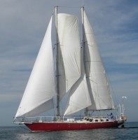
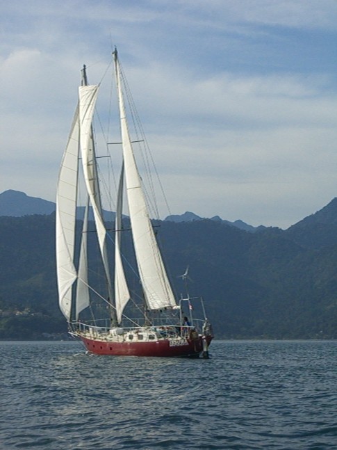
| Vessel Name: | Issuma |
| Vessel Make/Model: | Damien II, 15m/50' steel staysail schooner with lifting keel |
| Extra: | Designed for Antarctica. Built in France by META in 1981. Draft 1.3m/4.5' with keel up, 3.2m/10.5' with keel down. More details at http://www.issuma.com/rhudson/issumaboat/IssumaDetails.htm |
| Home Page: | http://www.issuma.com/rhudson/ |
| Social: |
|
Issuma's Photos - Main
 |