
Rockin' on RobinLeigh
The High Seas adventures of the sailing vessel RobinLeigh
28 February 2011 | Rock Sound, Eleuthera
21 February 2011
17 February 2011 | White Cay Anchorage - Berry Islands
09 February 2011 | Bimini to Berry Islands
03 February 2011 | Bimini - Bahamas
01 February 2011 | No Name harbor Key Biscayne
26 January 2011 | Ft Lauderdale, FL
17 January 2011 | Ft Lauderdale
07 January 2011 | Jacksonville, FL
03 December 2010
30 November 2010 | Cumberland Island, GA
22 November 2010
20 November 2010 | Cape Lookout
17 November 2010 | Severn River Marina, Hayes VA
30 April 2009 | Hayes, Virginia
15 June 2008 | Florida
01 June 2008 | Severn River Marina - Hayes VA
09 May 2008 | Severn River Marina - Hayes, VA
04 May 2008 | The Chesapeake Bay
30 April 2008 | Georgetown, SC
Keep Left!
21 February 2011
We arrived at Hatchett Bay on the island of Eleuthera with the hope of finding a mooring or a safe spot to anchor. The bay is a man made, created by blasting an opening through the limestone to connect a lake to the Eleuthera bight (map of harbor). It looked like it would provide good protection from most winds.
The sign at the town entrance says "Hatchett Bay - the safest harbor on Eleuthera"; the cruising guide said otherwise. It warned of out of date or missing moorings, poor holding in the anchorage, and problems with theft. We were determined to find out who was right.
We pulled into the harbor around 4:30 pm and found a number of moorings close to the dock with reasonably good hardware and good depth all around. There was great protection from the gusty NE winds so we slept well that night.
The next day we visited the town and found everyone there to be friendly and helpful. We also met other cruisers and found they had been there for some time. It seems free parking in a safe harbor is hard to pass up. We bought groceries at the local store and arranged to rent a car on Friday to explore the island.
Wednesday night we had dinner at the "Front Porch", a cute restaurant that sits on a hill overlooking the harbor. Francis prepared us fish with Bahamian spices and vegetables and it was delicious. This restaurant is well worth a visit by land or sea.
On Friday we went to pick up our car from the gas station and found it was not available. The fellow who was supposed to give us the car had gone to Nassau for the day. On the walk back to the dingy we talked about what to do and had almost decided to head south to another harbor when Francis called to us from the Front Porch and asked how things were going. We told him about the car problem and he called us up to the restaurant.
15 minutes later he had arranged a car for us at the airport 10 miles down the road. His friend Falcon drove us down to pick it up. When we picked up the car we decided to keep it for 2 days to make sure we saw the entire island. We found the car rental process very informal. David Cooper (airport employee) gave us his personal car for 2 days for $160 cash. We told him we would leave it at the Front Porch in Hatchett Bay for him to pick up Sunday morning and he said to just leave it unlocked with the keys under the floor mat. David did not ask to see a drivers license or any other form of identification but we gave him our boat card and assured him he could find us through Francis at the Front Porch.

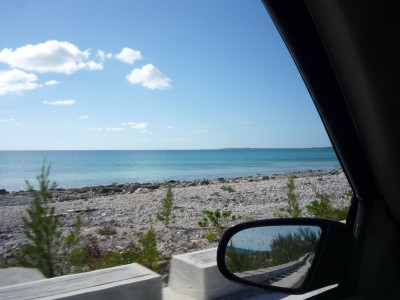
Eleuthera is 110 miles long and skinny. At it's narrowest point (the glass window bridge) it is only a few hundred feet wide from the bay to the Atlantic. The single, primary road "Queen's highway" is paved without a center line and runs the length of the island. Other roads might be paved but are more likely to be sand, gravel, or dirt.
Here are some high points from our 2 day trip:
Day 1 -
*Successfully acquired a car and learning to "keep left" on the road (they drive on the left side here). Charles drove both days so he gets a blue ribbon for mastering this skill.
*We headed north and made out first stop the Glass Window Bridge. THis bridge was built over a natural limestone hole where water used to pass from the deep Atlantic side to the shallow turquoise bight.
*Drove south to the Current Cut, a narrow passage from the bight to west side of the island on the way to Spanish Wells. The tides run fierce here and we saw a dive boat in the channel with people doing a drift dive with the current.
*At the NW corner of the island we parked the car and took a small ferry over to Spanish Wells for a walk and lunch. Spanish Wells is a colorful cluster of houses on St. George's Cay, 1km (2/3 mile) off the coast of northwest Eleuthera. Arriving by ferry the town looks a lot like the small fishing harbors we have seen in New England. The houses have New England saltbox styling but bright tropical coloring. The town is small and you can easily walk it but the primary mode of transportation is a golf cart - there were hundreds of them.
Arriving after 12:00 we noticed all the shops closed for lunch. we walked on the main road until we found a popular lunch spot -"The Generation Gap". Talking to the the locals at lunch we decided the island felt more like a village than a tourist destination. We strolled around the town for a while longer and then hopped on the ferry to resume our tour of the island.
*From the ferry dock we headed to Preacher's Cave, northeast of North Eleuthera Airport. In this barren and isolated backwater, the Eleutherian Adventurers (that was their chartered name) found shelter during the mid-17th century, when they were shipwrecked with no provisions. The road to this historic landmark has just been redone making it an easier drive.
Preacher's Cave is one of the most historically important sites in The Bahamas -- the point from which the origins of the country emerged. Set amid scrub and bush, the Preacher's Cave looks something like an amphitheater, with niches carved into its walls for seating for the community's elders, and a central boulder allegedly used as either a pulpit or an altar. The devout Eleutherian Adventurers held religious services inside the cave, which is pierced by natural holes in the roof, allowing light and rainfall to intrude.
For several years after they were stranded on reefs near this site, the settlers developed an elaborate series of religious and cultural codes and bylaws, which in some ways factored into the legal and social codes of The Bahamas. The landscapes around this cave are rich with buried workaday artifacts from that early impromptu community, and much excavation work remains to be done, a project of ongoing interest to the Bahamian government. DNA tests of skeletons unearthed from the cave have drawn distinct links between the Eleutherian Adventurers and the modern-day residents of Spanish Wells.
*Before hopping on the ferry to Spanish Wells we met a woman who spends 10 weeks a year on Harbor Island and she told us we really needed to visit. Back in the car and past the airport we hopped on another ferry to Harbor Island.
This island gets more traffic from the 'rich and famous' than most other islands in the Bahamas but we saw no celebrities this day. The island was actually very quiet. Even "Valentines marina", normally full this time of year, only had a few visiting boats.
We walked around Harbor island for about an hour, enjoying the colorful homes and beautiful tropical landscaping. After a short ice-cream break, we hopped on the ferry and returned to the mainland.
*Toward the end of day 1 we drove west past the airport and visited one of the larger supermarkets on the island, picking up a hitchhiker along the way (the most popular mode of transportation on the island). We bought a good supply of milk, bread, and other necessities and headed back to the boat.
Day 2 was devoted to the south side of the island... We had seen the top third of the island the day before.
* We drove a good distance south before stopping - Our first destination was an abandoned marina about 20 miles south of Hatchett Bay. It was reported to be out of business and abandoned but we heard there was a really good French restaurant at the harbor. We wanted to see if we could tie up at the old marina for a few nights and have a nice meal at the restaurant. The marina was without water or electricity but the dock looked good and the depths coming in looked OK as well. Charles visited the restaurant and picked up a menu. The food looked really good and the owner was very friendly. We made a note to stop here on our way south.
* We took a lot of side trips to the Atlantic side of the island and found an amazing variety of communities. From festive community parks on beautiful protected bays, to exclusive private islands, to ancient resorts. We had read about the private island of Windemere Bay in the guide so we wanted to check it out. The island gained notoriety when Prince Charles wad there with very pregnant Princess Di and a photographer snapped a picture of her in a bikini. Since then the island has had it's share of trouble, the hotel is no longer open and there is always some rumor of fighting among the residents but it remains a private and exclusive place and the gate guard said if we wanted to see the place we had to come with an approved real estate agent.
We also stumbled on to one of the oldest Golf and Beach Resorts in the islands. The "Cotton Bay Club" was formed in the early 1940s by the founder of PanAm Airlines. It must have been splendid in the day but when we approached the place it first looked like the remains of an ancient civilization. What used to be a club house was covered with vines and surrounded by old growth and the building next to is was collapsed with trees growing out of it. The golf course had reverted to a natural, tropical state. We thought the entire place was abandoned until we spotted the first house overlooking the Atlantic. Each home was beautiful maintained and unique, they looked like something out of "Architectural Digest". One home stood out because it was only a shell, it looked to have been lost in a fire and never rebuilt. We walked around the ruins to check out the ocean view.
*We continued south, taking any side road we could find that was drivable. Sometimes we came to a dead end and had to double back but the trips were well worth it. We made it as far south as Davis Harbor at Wemyss Bight then turned around and headed North.
On the way back to Hatchett Bay we stopped at Governor's Harbor to explore some of the side streets. This is the Government seat of the island and the architecture here is more colonial. Some of the homes on the waterfront looked to be a few hundred years old.
*We ended our tour back at the Front Porch and enjoyed a drink on the patio while we told Francis and our new cruising friends about our adventures on the island. Many thanks to Francis for making our stay at Hatchett Bay so memorable and enjoyable.
Check out Photos of our adventures here: http://www.flickr.com/photos/nothinglikeit/sets/72157626106114812/
The sign at the town entrance says "Hatchett Bay - the safest harbor on Eleuthera"; the cruising guide said otherwise. It warned of out of date or missing moorings, poor holding in the anchorage, and problems with theft. We were determined to find out who was right.
We pulled into the harbor around 4:30 pm and found a number of moorings close to the dock with reasonably good hardware and good depth all around. There was great protection from the gusty NE winds so we slept well that night.
The next day we visited the town and found everyone there to be friendly and helpful. We also met other cruisers and found they had been there for some time. It seems free parking in a safe harbor is hard to pass up. We bought groceries at the local store and arranged to rent a car on Friday to explore the island.
Wednesday night we had dinner at the "Front Porch", a cute restaurant that sits on a hill overlooking the harbor. Francis prepared us fish with Bahamian spices and vegetables and it was delicious. This restaurant is well worth a visit by land or sea.
On Friday we went to pick up our car from the gas station and found it was not available. The fellow who was supposed to give us the car had gone to Nassau for the day. On the walk back to the dingy we talked about what to do and had almost decided to head south to another harbor when Francis called to us from the Front Porch and asked how things were going. We told him about the car problem and he called us up to the restaurant.
15 minutes later he had arranged a car for us at the airport 10 miles down the road. His friend Falcon drove us down to pick it up. When we picked up the car we decided to keep it for 2 days to make sure we saw the entire island. We found the car rental process very informal. David Cooper (airport employee) gave us his personal car for 2 days for $160 cash. We told him we would leave it at the Front Porch in Hatchett Bay for him to pick up Sunday morning and he said to just leave it unlocked with the keys under the floor mat. David did not ask to see a drivers license or any other form of identification but we gave him our boat card and assured him he could find us through Francis at the Front Porch.
Eleuthera is 110 miles long and skinny. At it's narrowest point (the glass window bridge) it is only a few hundred feet wide from the bay to the Atlantic. The single, primary road "Queen's highway" is paved without a center line and runs the length of the island. Other roads might be paved but are more likely to be sand, gravel, or dirt.
Here are some high points from our 2 day trip:
Day 1 -
*Successfully acquired a car and learning to "keep left" on the road (they drive on the left side here). Charles drove both days so he gets a blue ribbon for mastering this skill.
*We headed north and made out first stop the Glass Window Bridge. THis bridge was built over a natural limestone hole where water used to pass from the deep Atlantic side to the shallow turquoise bight.
*Drove south to the Current Cut, a narrow passage from the bight to west side of the island on the way to Spanish Wells. The tides run fierce here and we saw a dive boat in the channel with people doing a drift dive with the current.
*At the NW corner of the island we parked the car and took a small ferry over to Spanish Wells for a walk and lunch. Spanish Wells is a colorful cluster of houses on St. George's Cay, 1km (2/3 mile) off the coast of northwest Eleuthera. Arriving by ferry the town looks a lot like the small fishing harbors we have seen in New England. The houses have New England saltbox styling but bright tropical coloring. The town is small and you can easily walk it but the primary mode of transportation is a golf cart - there were hundreds of them.
Arriving after 12:00 we noticed all the shops closed for lunch. we walked on the main road until we found a popular lunch spot -"The Generation Gap". Talking to the the locals at lunch we decided the island felt more like a village than a tourist destination. We strolled around the town for a while longer and then hopped on the ferry to resume our tour of the island.
*From the ferry dock we headed to Preacher's Cave, northeast of North Eleuthera Airport. In this barren and isolated backwater, the Eleutherian Adventurers (that was their chartered name) found shelter during the mid-17th century, when they were shipwrecked with no provisions. The road to this historic landmark has just been redone making it an easier drive.
Preacher's Cave is one of the most historically important sites in The Bahamas -- the point from which the origins of the country emerged. Set amid scrub and bush, the Preacher's Cave looks something like an amphitheater, with niches carved into its walls for seating for the community's elders, and a central boulder allegedly used as either a pulpit or an altar. The devout Eleutherian Adventurers held religious services inside the cave, which is pierced by natural holes in the roof, allowing light and rainfall to intrude.
For several years after they were stranded on reefs near this site, the settlers developed an elaborate series of religious and cultural codes and bylaws, which in some ways factored into the legal and social codes of The Bahamas. The landscapes around this cave are rich with buried workaday artifacts from that early impromptu community, and much excavation work remains to be done, a project of ongoing interest to the Bahamian government. DNA tests of skeletons unearthed from the cave have drawn distinct links between the Eleutherian Adventurers and the modern-day residents of Spanish Wells.
*Before hopping on the ferry to Spanish Wells we met a woman who spends 10 weeks a year on Harbor Island and she told us we really needed to visit. Back in the car and past the airport we hopped on another ferry to Harbor Island.
This island gets more traffic from the 'rich and famous' than most other islands in the Bahamas but we saw no celebrities this day. The island was actually very quiet. Even "Valentines marina", normally full this time of year, only had a few visiting boats.
We walked around Harbor island for about an hour, enjoying the colorful homes and beautiful tropical landscaping. After a short ice-cream break, we hopped on the ferry and returned to the mainland.
*Toward the end of day 1 we drove west past the airport and visited one of the larger supermarkets on the island, picking up a hitchhiker along the way (the most popular mode of transportation on the island). We bought a good supply of milk, bread, and other necessities and headed back to the boat.
Day 2 was devoted to the south side of the island... We had seen the top third of the island the day before.
* We drove a good distance south before stopping - Our first destination was an abandoned marina about 20 miles south of Hatchett Bay. It was reported to be out of business and abandoned but we heard there was a really good French restaurant at the harbor. We wanted to see if we could tie up at the old marina for a few nights and have a nice meal at the restaurant. The marina was without water or electricity but the dock looked good and the depths coming in looked OK as well. Charles visited the restaurant and picked up a menu. The food looked really good and the owner was very friendly. We made a note to stop here on our way south.
* We took a lot of side trips to the Atlantic side of the island and found an amazing variety of communities. From festive community parks on beautiful protected bays, to exclusive private islands, to ancient resorts. We had read about the private island of Windemere Bay in the guide so we wanted to check it out. The island gained notoriety when Prince Charles wad there with very pregnant Princess Di and a photographer snapped a picture of her in a bikini. Since then the island has had it's share of trouble, the hotel is no longer open and there is always some rumor of fighting among the residents but it remains a private and exclusive place and the gate guard said if we wanted to see the place we had to come with an approved real estate agent.
We also stumbled on to one of the oldest Golf and Beach Resorts in the islands. The "Cotton Bay Club" was formed in the early 1940s by the founder of PanAm Airlines. It must have been splendid in the day but when we approached the place it first looked like the remains of an ancient civilization. What used to be a club house was covered with vines and surrounded by old growth and the building next to is was collapsed with trees growing out of it. The golf course had reverted to a natural, tropical state. We thought the entire place was abandoned until we spotted the first house overlooking the Atlantic. Each home was beautiful maintained and unique, they looked like something out of "Architectural Digest". One home stood out because it was only a shell, it looked to have been lost in a fire and never rebuilt. We walked around the ruins to check out the ocean view.
*We continued south, taking any side road we could find that was drivable. Sometimes we came to a dead end and had to double back but the trips were well worth it. We made it as far south as Davis Harbor at Wemyss Bight then turned around and headed North.
On the way back to Hatchett Bay we stopped at Governor's Harbor to explore some of the side streets. This is the Government seat of the island and the architecture here is more colonial. Some of the homes on the waterfront looked to be a few hundred years old.
*We ended our tour back at the Front Porch and enjoyed a drink on the patio while we told Francis and our new cruising friends about our adventures on the island. Many thanks to Francis for making our stay at Hatchett Bay so memorable and enjoyable.
Check out Photos of our adventures here: http://www.flickr.com/photos/nothinglikeit/sets/72157626106114812/
Comments
| Vessel Name: | RobinLeigh |
| Vessel Make/Model: | Trintella 49A |
| Hailing Port: | Destin, Florida - Currently headed for the Bahamas |
| Crew: | Charles and Robin |
| About: | Mostly full time cruising since 1998, we've traveled over 60,000 sea miles and are still looking for the perfect anchorage... |
| Extra: |
Gallery not available
The Usual Suspects
Who: Charles and Robin
Port: Destin, Florida - Currently headed for the Bahamas